
Mount Chase (2,440 ft) commands views of northern Penobscot County, including the peaks of Baxter State Park to the west, and the Shin Ponds. The mountain, and subsequently the town in its shadow, were apparently named after a man who came as an agent for the state to prevent timber thieves. To get to Mount Chase, head north from Patten, and make a difficult hidden turn onto unpaved Mountain Road off Route 11. You will pass some structures, logging roads, a whimsical wooden carving of a Sasquatch, and turns for ATV trails, as well as some vistas to the right. The road gets rockier the further in that you go, and the parking area is at a small clearing with a picnic table, a little over 2 miles in. I navigated using AllTrails, and it took me just shy of two hours to make the 3.4 mile out-and-back on a cloudy mid-September morning. Maps and description are available in Hiking Maine and Maine Hikes Off the Beaten Path.
The trail doesn’t start in that clearing next to the picnic table, it starts at a small wooden handwritten sign just a little farther down the road. The blue-blazed trail began slightly uphill, rocky and wet, resembling a stream bed, with some ATV tracks in muddy spots. At about a quarter mile, the grade flattened out some, which had the effect of drying it, as well. The incline then grew a bit steeper, and crossed another overgrown road. At about four-tenths of a mile, the foot trail split off to the right, with a slope steeper and rockier than most ATV’s would be comfortable handling, then quickly resumed its confluence with the ATV trail.

A little over a half-mile in, a hermit thrush stopped and perched on a beech tree on the side of the trail, observed me, and flew on. With the overcast conditions affecting the light, and all the leaves on the ground, I almost stepped on a sturdy brown toad popping across the path. There were some sounds of chickadees and crows, but overall a curious absence of birdsong. The thick forest became more and more sparse as I climbed, and more dominated by evergreens and moss.

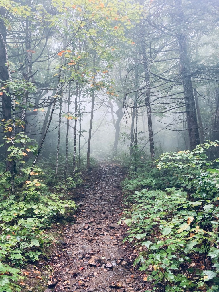
At about a mile, I finally came upon moose tracks in a low point on the trail with grasses covering a large pool of water. Shortly after this, there was an abandoned fire warden’s cabin with no doors or windows to the right in a small clearing, followed by the sound of rushing water, and a lively stream, running across the trail. The forest changed again here, more full of maple and other deciduous trees, and the fog that hung over the woods lent a haunted fairytale appearance.

The trail continued to get wetter and slicker, and there was even a rope with knots for handholds across a large steep slab of mossy, wet rock. I missed the spur to Eagle Point, which would have added .2 miles total (and no additional views on this cloudy day). I picked my way up the trail with the strong scent of pine wafting down the slope and a continuous babbling of brooks, as well as the chattering calling of robins. At a little under a mile and a half, a small wooden sign pointed right to Mount Chase Summit with a handwritten scroll underneath it, “U Got This.” Moose droppings littered the narrow, piney trail leading to the top.

The summit was mostly clear of trees, except for some brush and scrub pine, but completely socked in by clouds on this overcast morning, which wasn’t all bad. It was a wet, cool breeze, a contrast to the muggy lower trail. Just past the summit is a small locked shed with solar panels powering an antenna. I stuck around for a few minutes hoping for a break in the clouds and morning fog, but eventually pulled out my hiking poles for stability on the descent, and vowed to try to see the views another time. About a third of my way down, showers opened up with gusto, and I grabbed a rain jacket out of my pack and threw on the pack cover for the remainder of the wet walk down. I saw one more intrepid hiker on his way up, pushing through the rain with a friendly dog.

(Disclaimer: This post contains affiliate links, and as an Amazon Associate Hiking in Maine blog earns from qualifying purchases.)

If you liked this hike, please make yourself aware of the Pickett Mountain Mine being proposed by Wolfden Resources, a Canadian mining company. Their mine would be visible from the Mt Chase summit. 😦 the Maine LUPC is considering their app for re zoning (from a protected district to an industrial one!) Right now. You can still send a comment and in person comments are scheduled for later in Oct in Milinocket and Bangor.
LikeLike