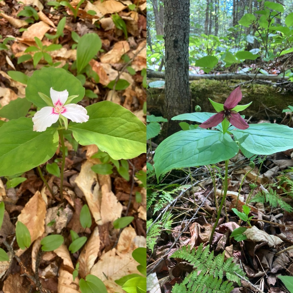
May-blooming trillium flowers on Moxie Falls Trail, The Forks, Maine
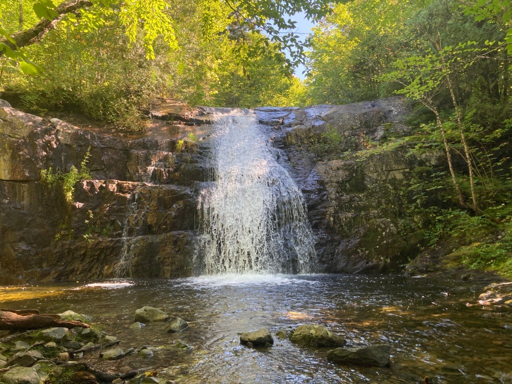
Moxie Falls, located in The Forks, Maine, has a drop of about 80 feet, making it one of the biggest in New England, and a truly impressive spectacle. The easy, well-traveled trail is about 2 miles north of Route 201, which follows the path of the Kennebec River in this area. There is a large, well-marked parking area (“Moxie Falls Scenic Area”) on the left side of Lake Moxie Road. The trail itself is about 2 miles, depending on how many diversions you take. On a sunny late May day, we followed the trail in a Y-shape to the upper falls, then the main event, Moxie Falls, totaling about 2.4 miles, and taking about an hour. Dogs under control are allowed, there is no camping or fires, and carry-in/carry-out policy is in effect. We used AllTrails to navigate (download beforehand, as very little cell service in the valley through which the falls run). A full description and map is also available in the great Hiking Waterfalls Maine book.
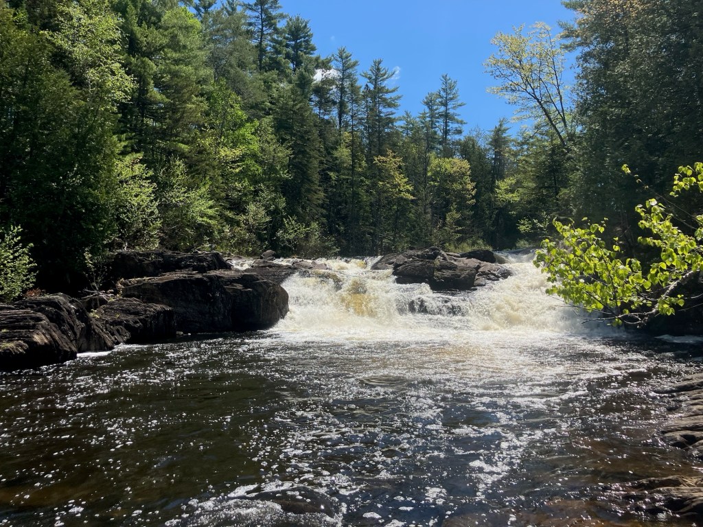
Moxie Stream Upper Falls, Moxie Falls Trail, The Forks, Maine
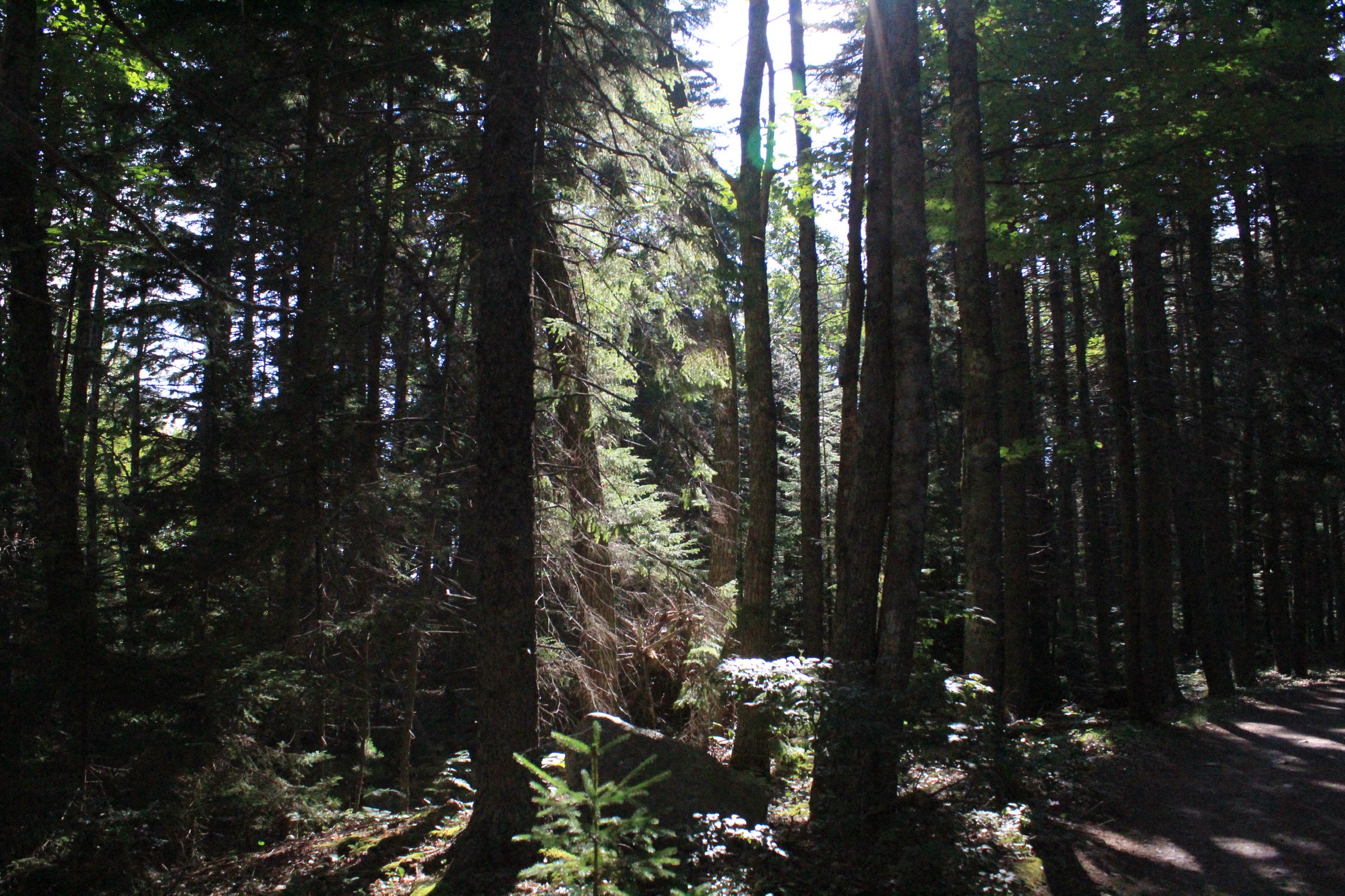
The path itself is wide and easy, starting as a gravel woods road, bounded by hobblebush, cedar, and wildflowers. An aged wooden sign documents the gift of 217 acres, the land for the scenic area, by the Coburn Lands Trust and agreement with Central Maine Power. We saw white and red trillium, lady slipper, jack-in-the-pulpit, blue-bead lilies, and many other flowering plants. Birds abounded, with the calls of robins, vireos, jays, and the least flycatcher. Bugs can be a problem here, and we saw at least one group wearing headnets, but likely due to some cold nights and a stiff breeze, the mosquitoes and black flies were not a factor.
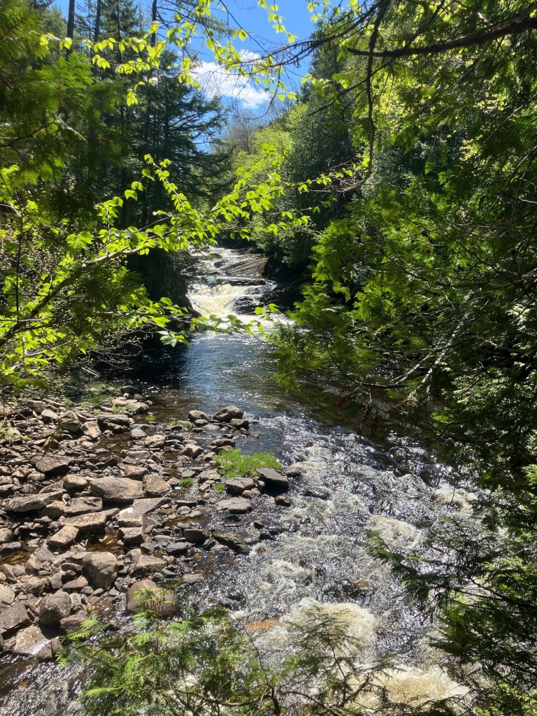
Moxie Stream, Moxie Falls Trail, The Forks, Maine
We first turned right to make our way to the Upper Falls, and the presence of spiderwebs on the trail indicated that most people bypassed it to head to Moxie Falls. These smaller falls were quietly beautiful, and we turned toward the slow downhill, with steps, that leads to Moxie Falls, and its viewing platforms. Serviceberry flowered next to Moxie Stream, with birds flying back and forth, searching for insects and small fish.
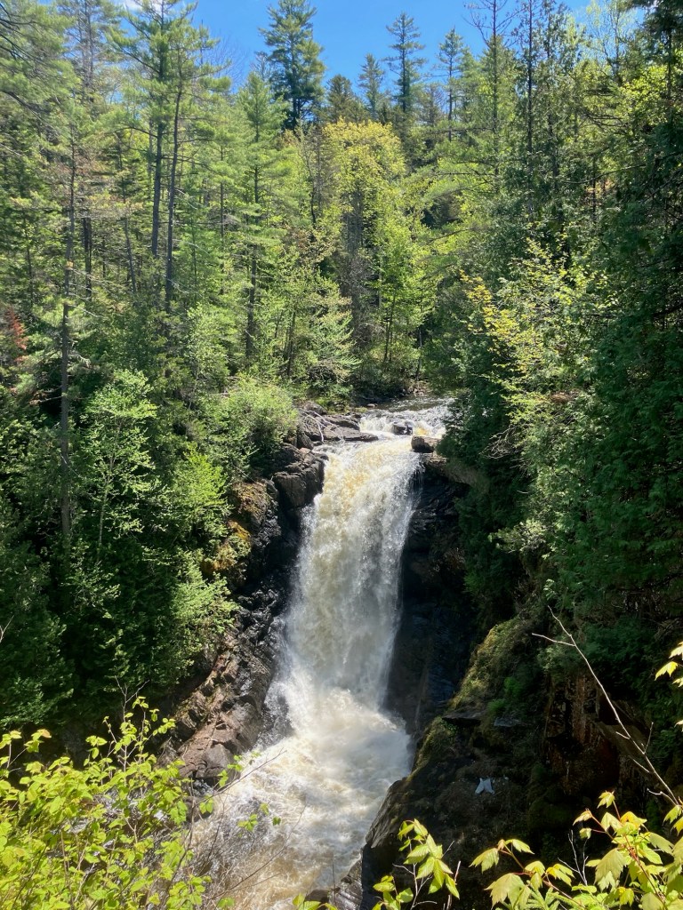
Moxie Falls, Moxie Falls Trail, The Forks, Maine
Moxie Falls are impressive, and recent rains made for a crashing spectacle, viewable from a series of platforms and breaks in the trees along the trail. We took our photos, felt the spray, and turned toward the parking lot. On this occasion, we had packed some sandwiches that we enjoyed at The Forks Rest Area, a quiet spot with picnic tables and a pit toilet at the intersection of Route 201 and Lake Moxie Road. Previously, we have eaten at The Hawk’s Nest Restaurant and Pub, which has tables overlooking the Kennebec.
(Disclaimer: This post contains affiliate links, and as an Amazon Associate Hiking in Maine blog earns from qualifying purchases.)
Stroudwater River, Stroudwater River Trail, Portland, ME
Stroudwater River Trail, part of Portland Trails’ extensive Forest City Trail network, is a 3.3 mile one-way (6.6 mile out-and-back) path beginning at Rivers’ Edge Drive, off outer Congress Street, that primarily follows the slow, muddy, meandering Stroudwater River where Portland meets Westbrook, crosses Spring Street, and ends at Smiling Hill Farm. This trail is popular with mountain bikers, trail runners and dog walkers.
Stroudwater River Trail, Portland, ME
The full trail (see Portland Trails’ page) is unavailable from November 1 to April 1, as the area west from Portland’s Blueberry Road to Westbrook’s Cardinal Street is closed in the winter as a deeryard to provide a winter habitat for these animals. Stroudwater Trail is an island of green in a fairly developed area of Maine, and the sounds and smells of industry and transit permeate much of the walk.
USMC Osprey flying over Stroudwater Trail, Portland, ME
The trail crosses underneath noisy I-95, and is flown over by thundering Jetport air traffic, but still maintains intervals of peace and quiet. On one late June day, we saw a U.S. Marine Corps Osprey vertical takeoff/landing plane doing test flights overhead.
Plank bridge, Day Ridges Preserve, Gouldsboro, Maine
Day Ridges Preserve, off Route One in Gouldsboro, is maintained by the Frenchman Bay Conservancy. Their site includes a trail map, as well as a paddling map, as the Preserve has access to West Bay Pond, as well as a suggested canoe route (and a canoe to borrow, if you plan ahead). Hunting is not allowed at Day Ridges. Dogs are allowed at Frenchman Bay Conservancy Preserves, off-leash if under voice control, unless otherwise posted.
Day Ridges Preserve, Gouldsboro, Maine
The parking area is well-marked, and just off Route One, with an information kiosk. To reach the trails or the canoe launch, use the woods road. On the sunny August day that Pig the dog and I checked out the Preserve, the road was under construction. It was hot and sandy, lined with sweet fern, and birds popping out of the tree line. At a little under a quarter mile in, a marsh lined the road, and beavers had obviously been busy fortifying their watery territory.
Cedar swamp, Day Ridges Preserve, Gouldsboro, Maine
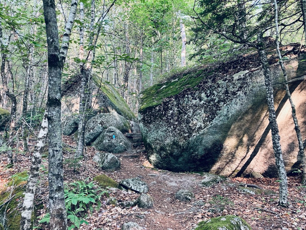
We ended up turning around at about 3.4 of a mile, due to the heavy machinery on the road, and decided to take the wooded trails instead of going all the way to West Bay Pond. We turned off onto the white trail marked with its namesake blazes. The White Trail started with a plank walkway over moss and ferns, a much more pleasant experience than the dust-choked road in progress. After winding through winterberry, blueberry, and sweet fern, we took a left on the white trail to make a somewhat longer loop. This trail had just a slight elevation to it, a climb up hills and next to big, bruising boulders. The mixed forest was full of birds, including northern flicker, chickadee, and the unmistakable call of a hermit thrush through the mixed forest. We continued on the outer loop, taking a left onto the blue trail.
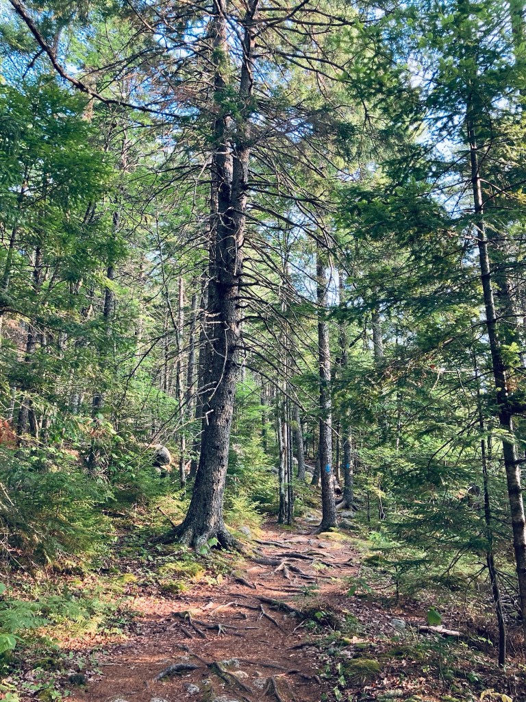
Boulders on Schoodic Mountain Trail, Donnell Pond Public Reserved Land
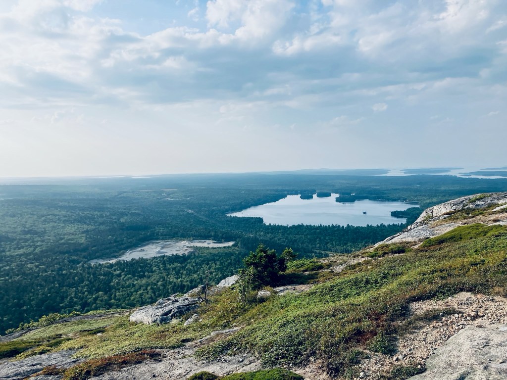
Schoodic Mountain (1,069 ft) is a relatively low mountain with excellent views due to its open summit and prime coastal location in Hancock County’s Donnell Pond Public Reserved Land, just south of the Blackwoods Scenic Byway (Rte 182). This is about a 2.8 mile loop, and it took about an hour and a half, with plenty of stops to enjoy. Consider adding more time to take a swim at Schoodic Beach. Full description and maps are available in the excellent books Dog-Friendly Hikes in Maine or the AMC Maine Mountain Guide, or free/printable from Maine’s DPPRL site. Dogs are allowed off-leash on the trails, if under strict control, but must be on-leash at beaches and campsites, and cleaned up after at all places.
Schoodic Mountain Trail, Donnell Pond Public Reserved Land
Prior to 7 AM on a Monday morning in August, the parking lot on Schoodic Beach Road was almost entirely full, mostly with people staying overnight at the camping areas. Pig (the dog) and I found a parking spot and then the trailhead for the Schoodic Mountain Trail, which is right next to the outhouse. This path starts downhill, marked by blue blazes, and crosses over a small bubbling stream. After this, the trail shifts uphill over rocks and roots.
Schoodic Mountain Trail, Donnell Pond Public Reserved Land
Up the hill there’s a field of massive boulders, with the trail weaving its way through them. Pig and I continued winding up the gentle ridges on switchbacks over rocks and roots through moss, boulders and ferns. At just under half a mile, the view to the right begins to open up as the trail climbs up the ridge, taking on a more rolling (up and down) aspect, following some obstructed views.
View from Schoodic Mountain summit, Donnell Pond Public Reserved Land
Low wild, blueberry bushes line both sides of the trail, and in this mid-August heat, the leaves were still green, but the fruit had since gone by. A few dry powder-blue berries remained. Higher up, there were a few more huckleberries. The trees were lower and scrubbier as the climb continued.
Steeper climbing, Trout Brook Mountain, Baxter State Park
At the beginning of the trail up Trout Brook Mountain, the emerald colors of hobblebush contrast with the darker forest, particularly as it transitions to evergreen. The trail winds through this forest and climbs rocky ledges dressed in soft green moss, with excellent northward views at about 3/4 of a mile up toward Trout Brook, Grand Lake Matagamon and the north woods.
View north of Grand Lake Matagamon and mountains in Aroostook from Trout Brook MountainContinue reading →
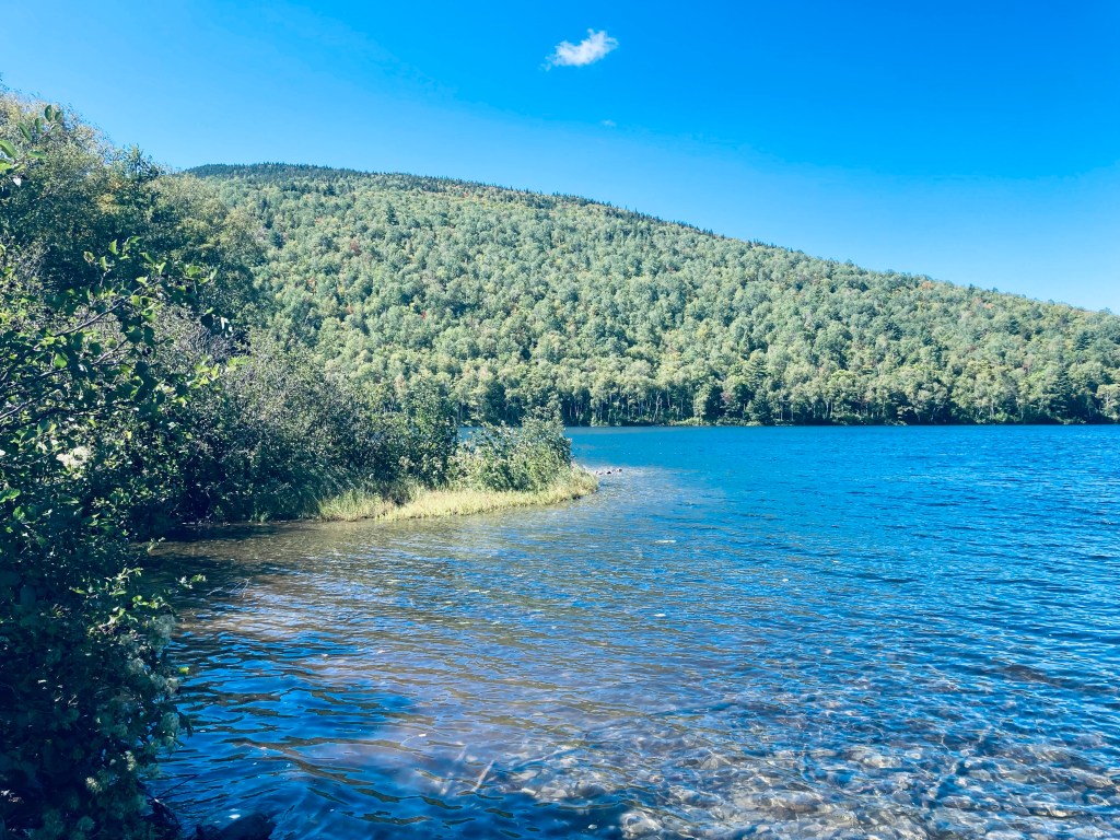
Lower South Branch Pond from Pogy Notch Trail, Baxter State Park, Maine
Howe Brook Falls is a spectacular four mile total out-and-back waterfall hike from South Branch Pond Campground in the northern half of Baxter State Park (BSP). I have tacked this hike on to a South Branch Pond Loop hike, which is covered separately in another post, but also done all or part of the Howe Brook Falls hike by itself, which can be done in three hours or less. A detailed description and map of this hike is found in the books Hiking Maine’s Baxter State Park and Hiking Waterfalls Maine, and a Baxter State Park downloadable map of South Branch Pond is available on BSP’s website.
Howe Brook Trail, Baxter State Park, Maine
The hike begins at the Pogy Notch trailhead in the southeast corner of the South Branch Pond Campground. The beginning of this trail contains the iconic “You Are Entering Maine’s Largest Wilderness” sign, which encourages caution and self-sufficiency, and turnaround times are calculated in a table at the kiosk. A straightforward, flat mile-long hike leads along the eastern shore of clear, quiet Lower South Branch Pond to a left turn onto the Howe Brook Trail.
Howe Brook Trail, Baxter State Park, Maine
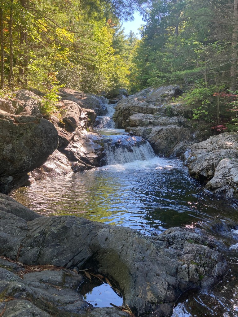
From this trail intersection, it’s only about a quarter mile to the lower falls and pools, so if you have kids who can’t make it the full two miles out and back, these lower cascades are sufficiently beautiful and entertaining for a day trip, splashing and swimming, and a picnic. After about a mile, the trail becomes a little steeper and veers farther away from the brook as the gorge narrows in the shadow of Traveler Mountain. The path to the upper falls is narrow and sometimes winding, but never overly strenuous, with views of the rushing water and moss-covered boulders of Howe Brook to the right.
Howe Brook Trail, Baxter State Park, Maine
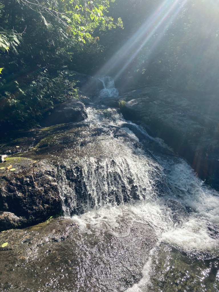
At the top of the trail is a truly impressive waterfall, dropping straight into a cold pool. This is the Upper Falls, capping this trip through the cascades. In the sunlit opening below, I have disturbed some ruffed grouse, who had been sunning themselves on the rocks, made unaware of me until the last minute by the white noise of the falls.
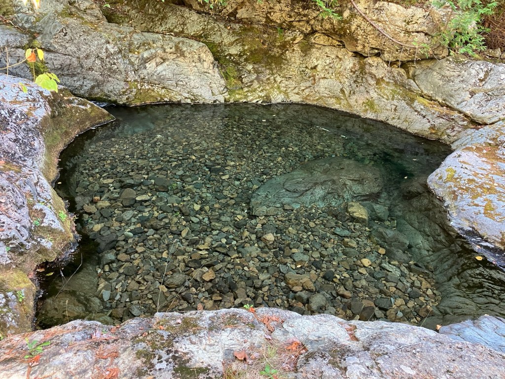
Clear pool below Howe Brook Falls, Baxter State Park, Maine
A pleasant downhill hike re-traced my steps, and allowed me to re-visit the mirrored pools and clearings of Howe Brook on the way back to South Branch Campground. This hike is amazing, even with low water flow in drier periods, and every tier of the path has amazing views and clear, cold pools.
Upper Falls, Howe Brook Trail, Baxter State Park, Maine
(Disclaimer: This post contains affiliate links, and as an Amazon Associate Hiking in Maine blog earns from qualifying purchases.)
What is a hike, really, but a long walk, preferably in the countryside? Sometimes the sense of getting away can be amplified by the journey to get to the hike’s starting point, whether it be a long drive through strange places, a bus ride, or in this case, a boat trip. While it may seem hard to escape the (relative) bustle of Maine’s largest city, a 4-mile loop with birds, flowers, and ocean vistas is only seventeen minutes away via Casco Bay Lines. Like Moosehead’s Mount Kineo, this hike begins after a short ferry ride, a trip across Portland Harbor to Peaks Island, part of the city of Portland.
Rugosa roses and view of Cushing Island from Peaks Island, Maine
The Casco Bay Lines Terminal is located at 56 Commercial Street, Portland, Maine, and the ferry schedule is posted here. As of November 2025, round-trip tickets are $7.20 for adults (14 and over), $3.60 for kids/seniors/disabled, and free for children under 5. These typically double in peak season, mid-April to mid-October. Dogs can go on the ferry, they must be leashed, and their tickets are $4.50. You can bring bikes for a small fee, or rent them on-island (golf carts can also be rented, but that’s not hiking). The voyage from Portland to Peaks allows views of Fort Gorges, the harbor, seabirds, and occasional seals.
(TheBates-Morse Mountain Conservation Area can be crowded, particularly in the summer and on weekends. They advise to plan your trip accordingly, and note that they “turn cars away once the parking lot is full.” You can check the status of the lot online at https://www.bmmparking.com/)
Your five-year old could do this, but everyone in the family will love it. It’s the Bates-Morse Mountain Conservation Area near Phippsburg, Maine, a 3.8 mile out-and-back hike over Morse Mountain (433 feet) to Seawall Beach. Wife/mother of the hiking family here again to report that I think I may have found my favorite “hike” so far! (Full disclosure: while I love the outdoors, I am not on the hard-core side of the hiking spectrum, preferring instead to walk at a steady pace for up to three hours in nice weather. Furthermore, I do not get an adrenaline rush from dangerous climbs so I avoid them.) Hike is in quotations here because this particular adventure may be more of a beautiful walk, given the minimal altitude, the terrain (mostly paved) and the distance. This hike checks all the boxes for me in all seasons. Let’s begin!
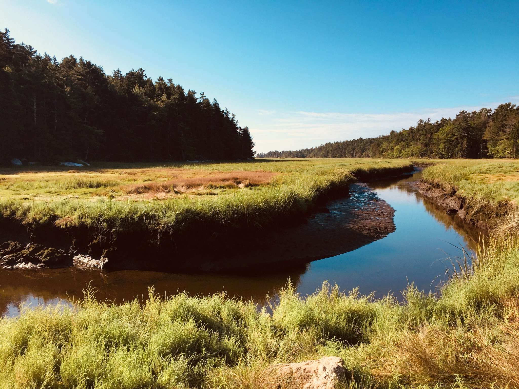
Sprague River Salt Marsh, Phippsburg, ME
This trailhead is well-marked. From Route 1 in Bath, you follow Route 209 south to Route 216 to Morse Mountain Road where there is a small parking lot on your left. Arrive early, particularly on summer weekends, because parking is limited (see note and link at beginning to check on it). We have been turned away on Father’s Day weekend. At about 8:30 am on a summer Saturday, people are trickling in, but there are usually still spots available. By half an hour to an hour later, all the spots can be full (On New Year’s Eve, the lot was mostly full by mid-morning). There is a friendly attendant there in the summer, giving maps, selling crafts and answering questions (donations accepted).
Salt Marsh trail at entrance to Bates-Morse Mountain Conservation Area, Phippsburg, Maine
If you are turned away, consider the nearby hikes at Reid State Park Loop, Hermit Island Loop (in winter only), Sprague Pond Loop, or Cooley Preserve. Additionally, there is a very short trail, the Bill Jayne Trail, accessible from the parking lot. Head back down the road away from the Morse Mountain Trail, and you will reach the trailhead, which leads to a Phippsburg Land Trust trail (marked “Salt Marsh Access Trail,” only several hundred yards long, ending at a bench overlooking the Small Point marsh.
Morning light through trees, trail over Morse Mountain to Seawall Beach
The entire trail is paved, as this is a service road, so it is wide enough for a bunch of people to walk together and chat (I doubt you will need a trail map, but if you do: Morse Mountain Map). Shortly after departing the lot, you notice the area is quite well maintained by the Bates-Morse Mountain Conservation Corporation with members from the St. John Family (who originally conserved the area), Bates College and the public. For those with four-legged friends, dogs are not allowed in any season. Additionally, radios or speakers are not permitted, so listen to the ocean and birds.
View from Morse Mountain, Phippsburg, Maine
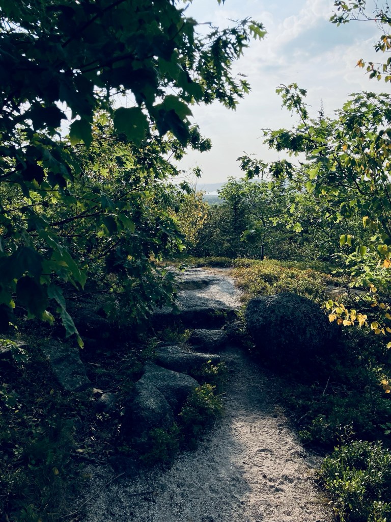
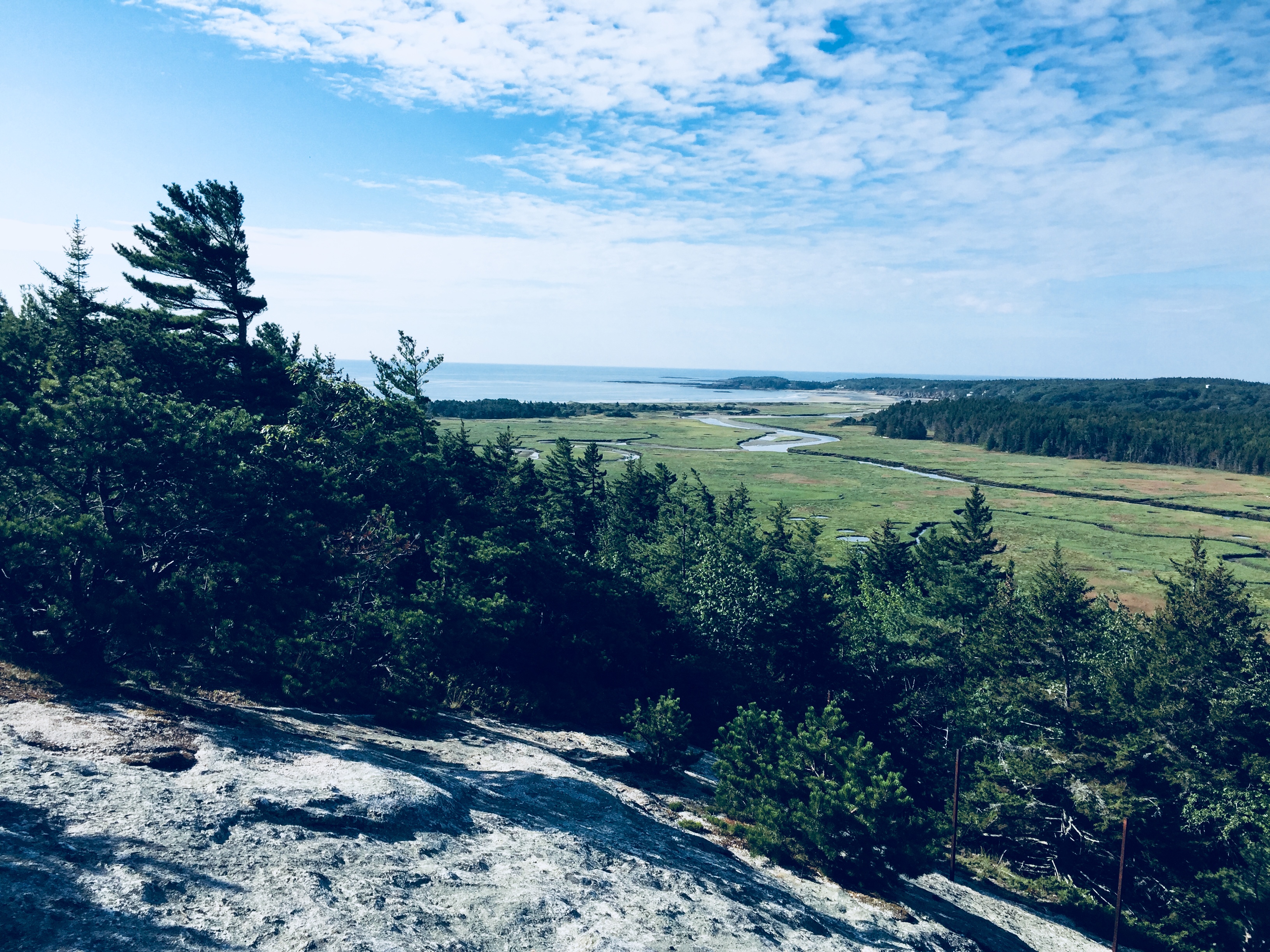
Bugs can be a big problem here. Very early or late in the season, or with enough of a breeze, they won’t bother you too much. Otherwise, bring strong (Deet-based) insect repellent, and walk fast. About halfway into the hike, you will see a fork in the road and you head right to get to the summit. “Morse Mountain” is really not much more than a hill, yet there are fantastic views at the lookout: the snaking Sprague River, the cliffs in the distance and the gorgeous…drum roll…beach and ocean!
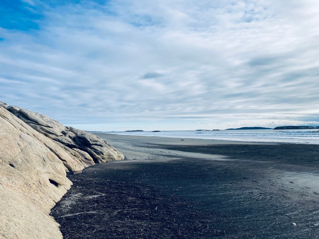
Low tide, Seawall Beach, Phippsburg, Maine
Yeah, I really can’t wait any longer to tell you that this hike ends at Seawall Beach and for those of you who thought you died and went to heaven when you saw nearby Popham Beach, you will be counting your blessings when you see this two-mile stretch of gorgeous sand that is Seawall Beach. After you leave the summit and return to the main path, you have roughly a mile to go to reach the beach. Then, kick off your shoes and enjoy this huge, uncrowded beach.
Seawall Beach in winter, Phippsburg, Maine
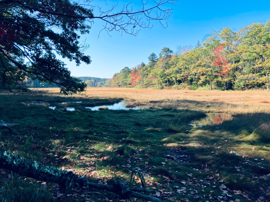
We headed right upon entering the beach area and walked for approximately a mile to the “red pole” which is marked on the map and signals the end of the conservation area. A left turn will eventually bring you to Popham Beach. Try to hit this beach at low tide if you can so you will have plenty of room to roam. Daughter loved the large clam shells, sand dollars, sea gulls, ospreys, and little plovers. The beach is constantly changing with tides, seasons, and weather. On a July trip, we saw plenty of seals, as well. In October, the changing leaves and fall grasses were reflected in the Sprague River. On a late-December trip, a storm had coughed up lobster traps and buoys, which were lined up at the high tide line like a used-car lot.
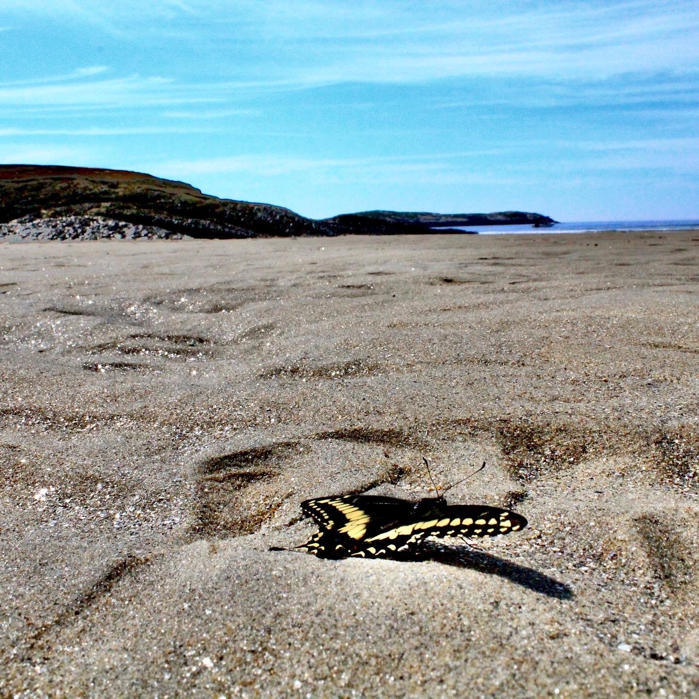
Swallowtail butterfly near end of life cycle, Seawall Beach, Phippsburg, Maine
Since access is limited, there are so few people on this beach! For three people who hate crowds and love the ocean and the sand, it was kind of hard to leave. The trail is easy and beautiful so the 33 minutes it took to walk back were very pleasant. Here is my advice for your trip to Morse Mountain:
Go to the bathroom before you get on the trail and do not plan to drink much liquid unless you are a camel. There are no restrooms and since the trail was fairly crowded, you cannot just “pop off the trail” and go behind a tree very easily without being seen. The ocean is an option, but it’s Maine-cold.
Bring bug spray.
Consider staying awhile at the beach, which means that you might need a towel, sunscreen, hat, and snacks! The beach is that good.
Go early in the day to get a parking spot. If it’s full, you can wait, go to Popham Beach State Park, or try a nearby Phippsburg hike, as described above.
Try to hit low tide.
This truly is a Maine gem and when visitors come and ask where to go, this is going to be on the top of my list as it showcases the beauty that Maine has to offer without the crowds. A little exercise, fresh air, woods, marsh, beach, snacks, family and friends – you can’t beat it.
View from trail over Morse Mountain to Seawall Beach
Birch Stream in morning light, Oak Point Trail, Sunkhaze Meadows NWR, Milford, ME
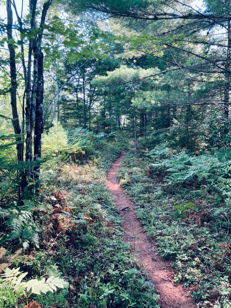
The Oak Point Trail is a 2.8 mile out-and-back trail at Sunkhaze Meadows National Wildlife Refuge (NWR) in Milford, Maine, a town on the Penobscot just north of Bangor. Sunkhaze NWR is a 11,485 acre refuge that protects the Sunkhaze Meadows peat bog, as well as a large concentration of migratory birds. I navigated using the AllTrails app, but the best description and map are hosted by the Friends of Sunkhaze Meadows. Oak Point Trail is in the middle of the three trails on the south side of the NWR, next to Johnson Brook and Carter Meadow Trails, and directly across from The Nature Conservancy’s Bradley-Sunkhaze Preserve. As with all these trails at Sunkhaze NWR, they can be oppressively buggy and wet in late spring and early summer. I enjoyed the brisk, bug-free chill of mid-September. Dogs are allowed, but must be leashed at all times. Hunting is allowed, so wear blaze orange during hunting seasons.
Oak Point Trail, Sunkhaze Meadows NWR, Milford, ME
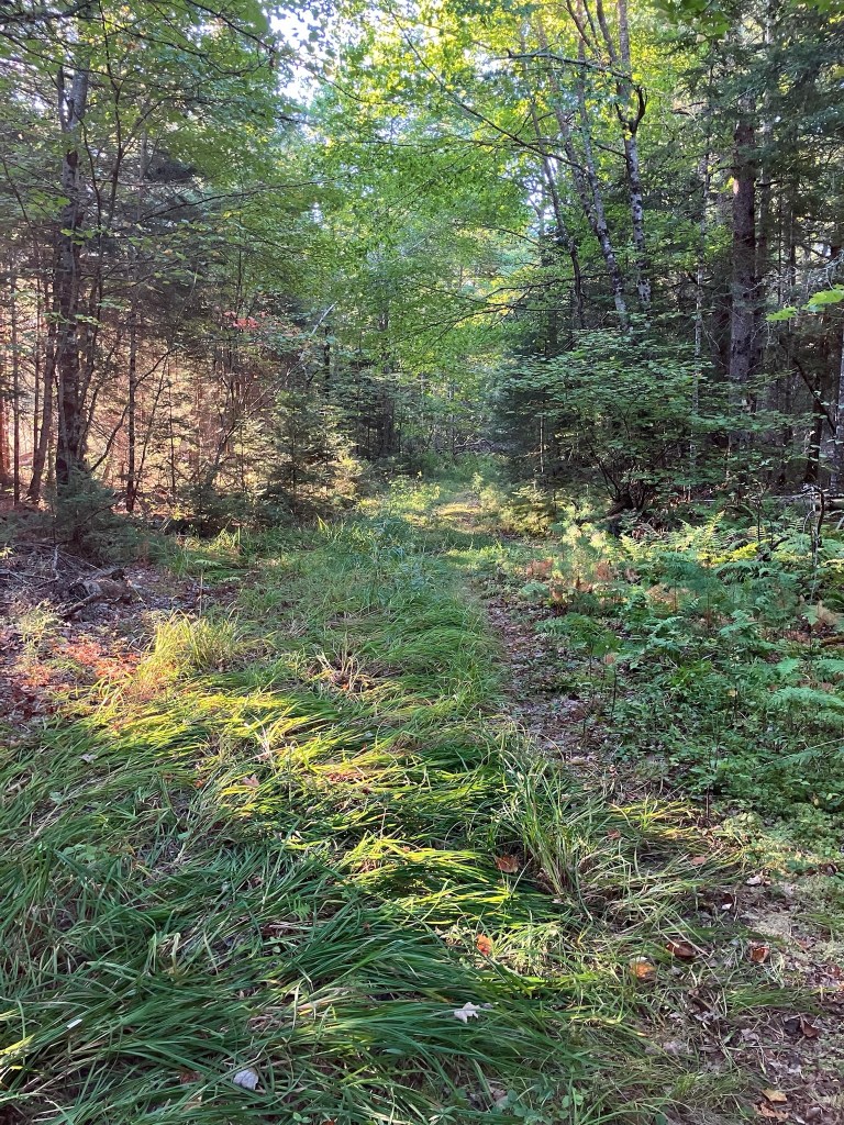
There’s a clearing between the trail and County Road that does not appear designed for parking. It’s better to park in the lot across County Road by Birch Stream. Small side trails to the right shortly after the hike’s beginning the hike have views from the banks of slow-moving Birch Stream. The surrounding forest rang with the morning calls of many large, loud jays. This trail is grassy and a bit overgrown, but easy to walk and to navigate. The light behind the forest to the right (east) slowly begins to open up to the large open marshy meadow behind it.
Viewpoint, Oak Point Trail, Sunkhaze Meadows NWR, Milford, ME
The marsh itself is visible through short spur trails to the right close to the end of the trail, and then at the end of the trail. I could see small songbirds hiding in the bushes surrounding the marsh, with many jays calling again. The tracks and flattened and trampled grass left behind by deer and moose were passive evidence of the recent presence of these larger animals. At the trail’s end there were more limited views, but several yellow-rumped warblers, hovering and moving around, waiting impatiently for me to leave. The easy, flat path was about an hour.
Morning light on Oak Point Trail, Sunkhaze Meadows NWR, Milford, ME
Johnson Brook Trail, Sunkhaze National Wildlife Refuge, Milford, Maine
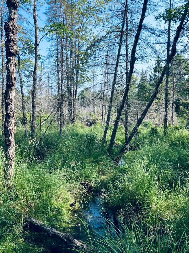
Johnson Brook Trail is a 3.3 mile loop trail at Sunkhaze Meadows National Wildlife Refuge (NWR) in Milford, Maine, a town on the Penobscot by Orono/Old Town. Sunkhaze is a 11,485 acre refuge that protects the Sunkhaze Meadows peat bog, as well as a large concentration of migratory birds. I navigated using the AllTrails app, but the best description and map are hosted by the Friends of Sunkhaze Meadows. Johnson Brook is the farthest east of the three trails on the south side of the NWR, next to Oak Point and Carter Meadow Trails. Dogs are allowed, but must be leashed at all times. Hunting is allowed, so wear blaze orange during hunting seasons. I started early (right at sunrise) on a mid-September morning from the small parking lot, with a definite chill in the air. From experience, Sunkhaze much earlier in the season can be pretty wet and buggy. I started along the flat, easy trail, with the sound of barking dogs at a nearby residence giving way to jays and chattering red squirrels.
Beaver pond spur on Johnson Brook Trail, Sunkhaze National Wildlife Refuge, Milford, Maine
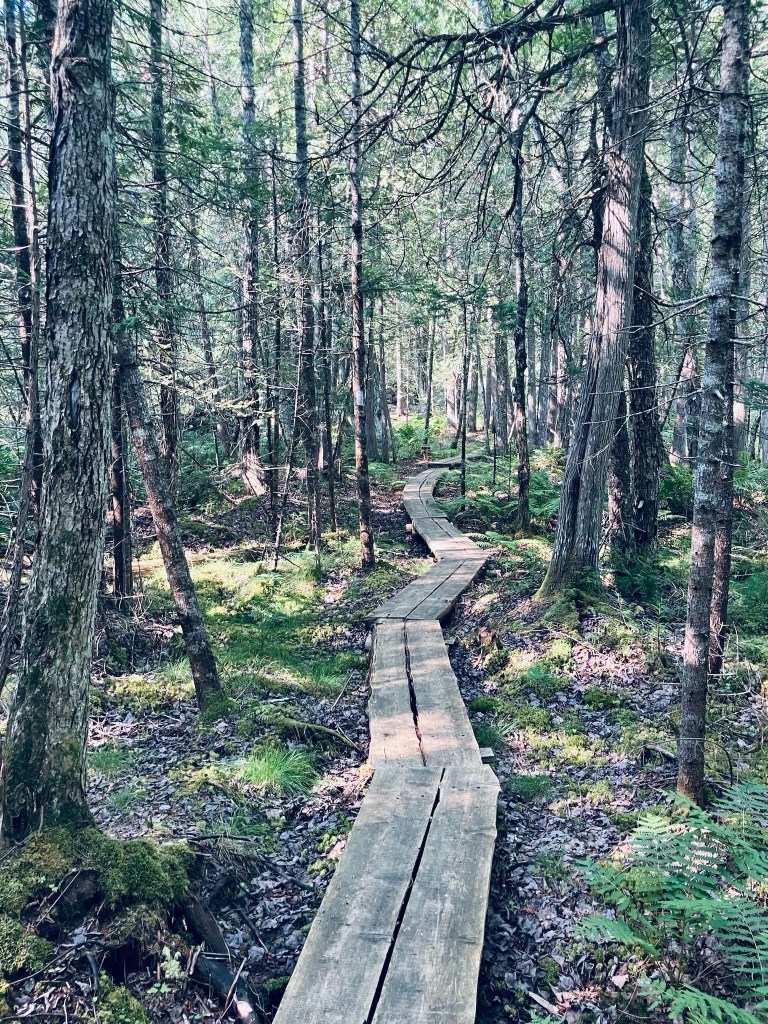
The righthand spur heads east off the loop trail at about 4/10 of a mile, and I took this to see the beaver pond. The changing colors of the ferns and the deciduous trees, as well as the mist rising from the pond in the cool morning made this trip (less than a third of a mile) well worthwhile. At a little over a mile on the loop trail, you will reach a couple of raised boardwalks over the marsh, just before the second spur trail, which goes off to the right. At the time I came through, this spur was clearly marked off by a sign with a red line through a hiker, so it’s closed for now.
Johnson Brook Trail, Sunkhaze National Wildlife Refuge, Milford, Maine
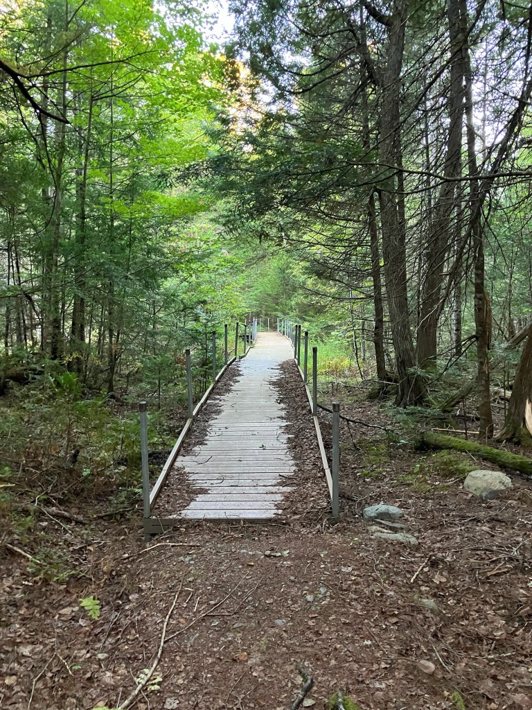
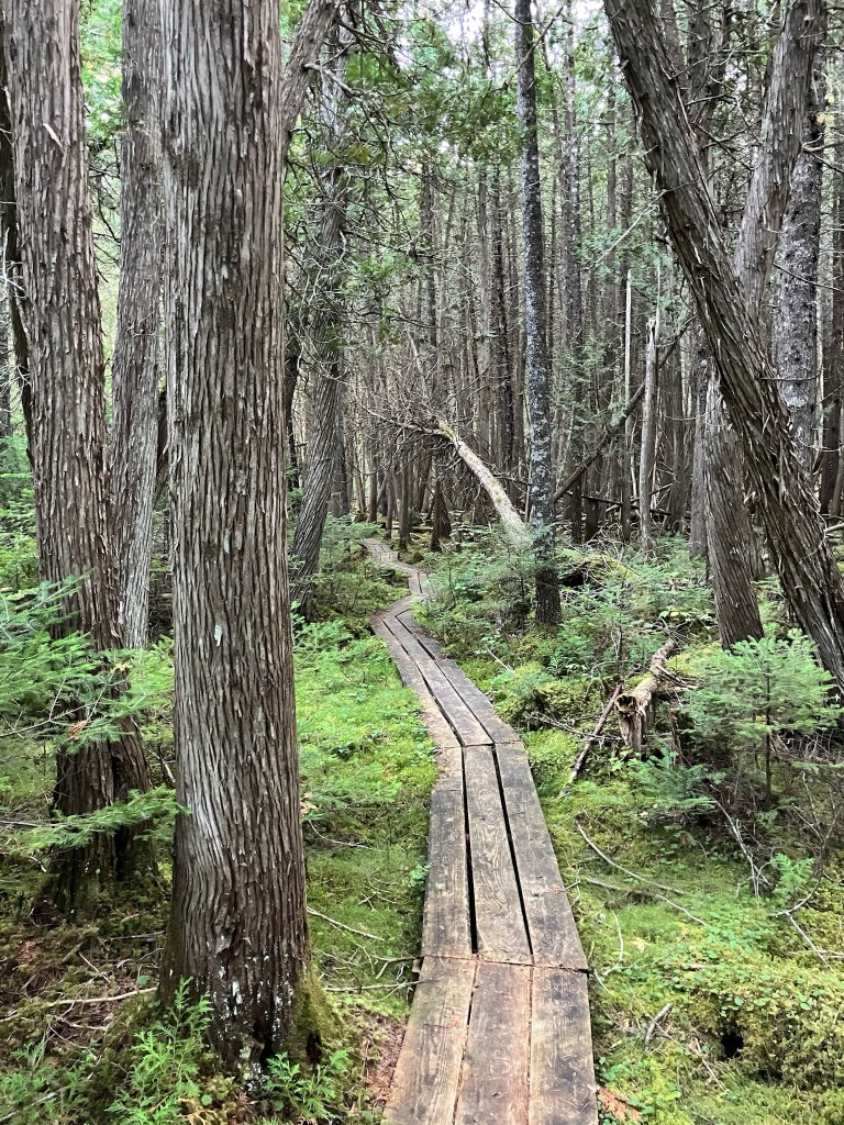
After another boardwalk, the trail turns left to return to the east side of the loop. At this turn, there is a path back to County Road and there are two interpretive displays on vernal pools and songbirds. The trail and a bench on this part of the loop are dedicated to Janice Beckett, a former president of the Friends of Sunkhaze Meadows. I visited on a dry fall day, but the many boardwalks and plank bridges, the moss, and the dense cedar speak to how marshy this area is, typically. In mid-September, this was a nice, easy loop, taking about an hour, for late summer wildflowers and wildlife sightings.
Johnson Brook Trail, Sunkhaze National Wildlife Refuge, Milford, Maine