Morning light, Abol Stream Trail, Baxter State Park, ME
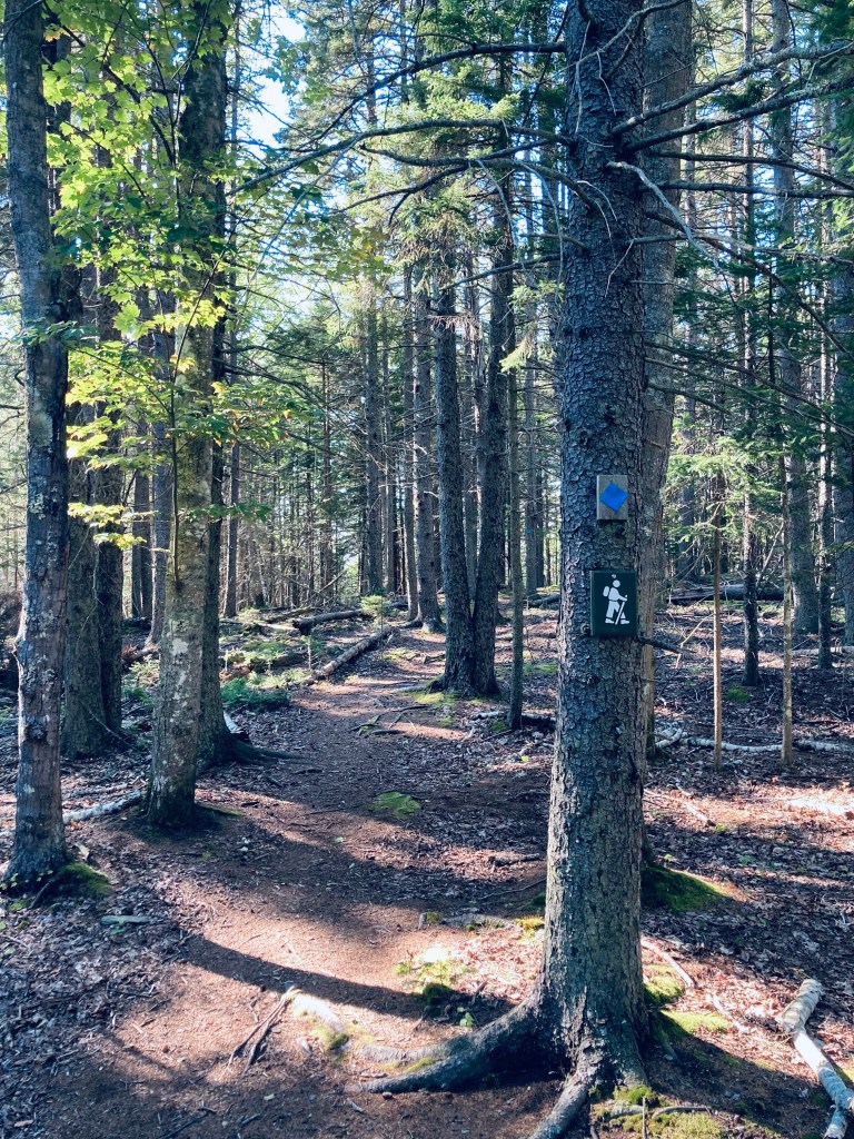
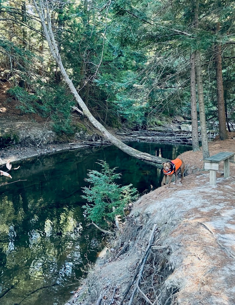
Some trails at Baxter State Park are quieter than others, and Blueberry Ledges, on the south side of the park, approximately midway between Katahdin Stream Campground and Abol Beach, is a beautiful spot you just might have all to yourself. Appalachian Trail (AT) thru-hikers this close to Katahdin are unlikely to take side trails, and day-hikers are often focused on the more robust peaks to the north and east. The lollipop loop trail to Blueberry Ledges from the trailhead at the end of Abol Beach Road is a 6.6 mile hike (if you take all the side trails like I did), using the Abol Stream Trail to briefly leave the Park, then pick up the Appalachian Trail (AT) northbound on the way out, and Abol Pond Trail on the return. I’ve done this twice, both on bright mid-September mornings, using the route recommended by the book Hiking Maine’s Baxter State Park. The Blueberry Ledges are also accessible from the north by using the AT southbound from the Park Tote Road near Katahdin Stream Campground, an out-and-back hike of about three miles each way. The trails are all on the downloadable Kidney-Daicey map from Baxter State Park, and in my pack, as usual, was the durable Map Adventures’ Katahdin Baxter State Park Waterproof Trail Map.
Mount Katahdin from Abol Stream Trail, Baxter State Park, ME
Abol Beach, which is a quiet, often-empty picnic area (with an outhouse) with a decent-sized parking lot. I began by crossing the small bridge at the outlet of Abol Pond, following the trail along a wide, wooded floor dotted with colorful late-season mushrooms. The path rises on an esker above Abol Stream. A little over a quarter mile in, there’s a short side path along the stream, which dead-ends at a robust beaver dam, and after about .4 miles, a small sign-in kiosk for hikers. At about .7 and 1.1 miles are more turnouts with excellent views of Katahdin’s bulk rising clear and crisp over multi-colored marsh grasses. The trail at this point is an old woods road bounded by sweet fern and pine, and serenaded by the chattering of red squirrels, jays, winter wrens, and white-throated sparrows.
Dad and daughter atop Pleasant Mountain summit in 2017
Pleasant Mountain (2,006 ft) is a mountain in Bridgton right next to the former Shawnee Peak, now (since 2022) Pleasant Mountain ski area, with trails mostly on land owned by the Loon Echo Land Trust (see here for info and detailed maps). Dad and daughter hiked this first with our cousin in April 2017 as part of our preparation for our 100 Mile Wilderness trek via the (moderate) Southwest Ridge Trail (also known as the MacKay Pasture Trail), 5.8 miles up/back, but have done it since in February, August, and other months. Map and description are also available in the stellar Maine Mountain Guide. The preserve is open dawn to dusk, and dogs on-leash are allowed. Blaze orange is suggested during hunting season.
Morning light on Southwest Ridge Trail, Pleasant Mountain, Maine
This hike can be busy in summer, particular up the Ledges Trail, but an early start or a winter morning can provide solitude. There are always a few hikers, especially close to the summit, but I have also seen woodpeckers, crows, turkeys, and a winter herd of deer. The deer were using the same path, and bounded away from me, big white tails flashing, every time they heard my footsteps crunching in the snow, coming no closer than about fifty yards. In the summer, the call of loons carries up the mountain from Moose Pond.
Winter morning view of Moose Pond from near Southwest Summit, Pleasant MountainContinue reading →
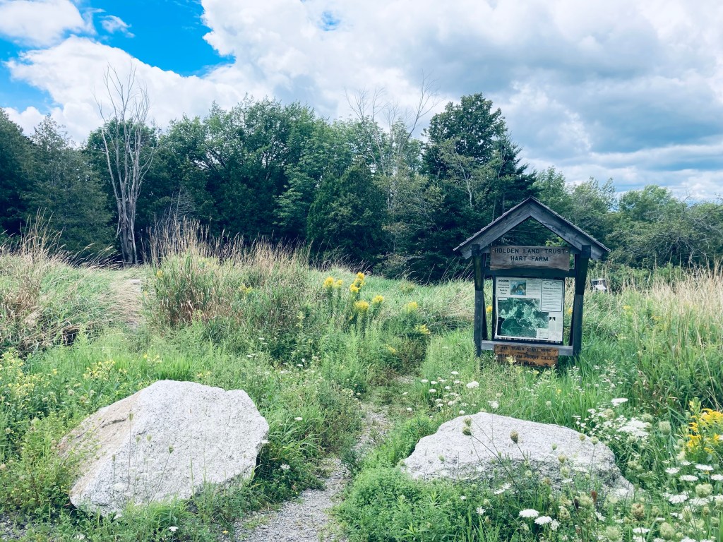
Information kiosk at trailhead, Hart Farm, Holden, ME
The trails at 157-acre Hart Farm in Holden, Maine, have been preserved by the Holden Land Trust and the Maine Farmland Trust, and are open from dawn to dusk. Dogs must be leashed (livestock is present) and cleaned up after. A trail map is available at the town of Holden website (and on kiosk at beginning). I have stopped by here several times on the way to/from Washington County/Dowmeast and Bangor, just a slight diversion off route 1A. This makes a great stop for people or a dog to stretch their legs. The outer loop hike around the Pocket Field Loop Trail is an easy 1.3 miles in about 30-40 minutes.
View of hills and mountains across cow pasture, Hart Farm, Holden, ME
The easy trail network, marked with blue diamonds, begins from a kiosk next to the small parking area, through tall grass and wildflowers, with cows lounging in the large field to the right. Here, the cleared land allows views of the hills to the northeast. It’s also an opportunity for a dumbfounded pit bull to see cows.
Pig the pit bull sees cows, Hart Farm Trails, Holden, ME
An option is available at this point to turn left (west) and connect through the Fields Pond Connector Trail with the Shelterwood Trail of the neighboring Fields Pond Audubon Nature Center trail network (dogs not allowed there). Continue straight to stay on the Hart Farm trails. Off the trail to the left are some junked vintage cars, as the trail curves around the border of the cow pasture.
Goldenrod Field, Hart Farm Trails, Holden, ME
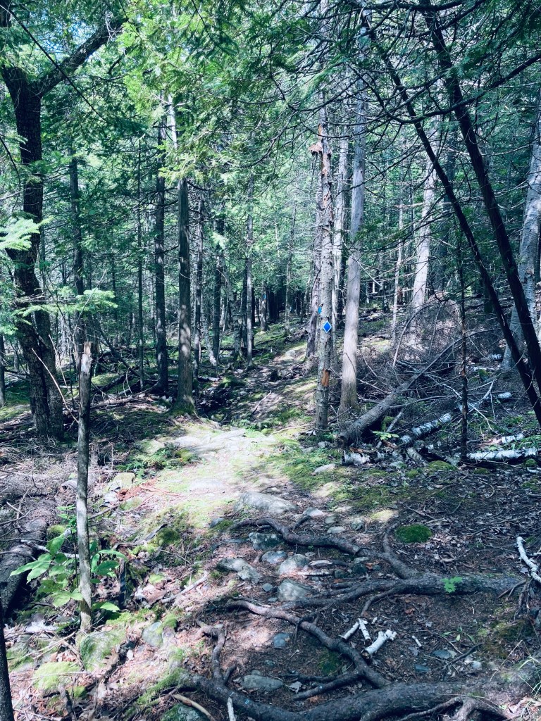
I chose to go counterclockwise, taking me past a field of goldenrod and into the woods. The trail here has trickier footing, with rocks and roots, and was full of birdsong. The sounds weren’t completely wild, as I could hear dogs barking, power equipment, and the sound of jets heading to and from the Bangor airport. The Middle Trail bisects this loop.
Hart Farm Trails, Holden, ME
As I completed the circle, close to the Bates Homestead, the path hugged the edge of a gully with a small valley, typically containing a creek, but dry in some summer months, running through it. A large sign marked the historic Isaac Bates and Ursula Jones Homestead, now consisting of only sunken foundations, which was built prior to 1807. Not long after, I returned to the parking area.
Vaughan Woods, surprisingly close to downtown Augusta and the capitol complex, is part of a 197-acre nature preserve adjacent to the historic Vaughan Homestead in Hallowell, Maine, free to the public and open from dawn to dusk. Dogs are allowed, on-leash. The Vaughan Woods website has trail maps, a historical walking guide, and a list of programs. The Woods, comprising 150 acres, are protected through a conservation easement held by the Kennebec Land Trust. Trailhead parking is available in a small roadside lot at the corner of Litchfield Road and Middle Street. If this is full, alternate parking is available (during non-school hours, weekends and holidays) at Hall-Dale High School at 97 Maple St. in Farmingdale, with trailhead access by the tennis courts. This trail, and our photo, was featured in Portland’s monthly magazine in July/August 2024’s “Micro Hikes” article (pg 55).
Driving Bridge over Vaughan Brook, Vaughan Woods, Hallowell, ME
On a hot July day, and more recently on a cooler May day, I took the Corniche Trail Loop for a lollipop loop of about two miles, taking less than 45 minutes, a good lunchbreak hike. The trail, starting from an information kiosk, starts through an overgrown open field uphill of the homestead, then moves onto a wooded ridge, with Vaughan Brook flowing at the bottom. It can be very muddy in sections, with the biting insects present that one would expect from recent rains. The positive is that the walk is mostly shaded.
Vaughan Brook, Vaughan Woods, Hallowell, ME
A series of well-built stone bridges cross the streams which feed down to the brook, running quickly underneath the trail. The Brook Trail, a short (.4 mile) wooded path, runs along Vaughan Brook. According to the guided walking tour, along this trail is a pool known as Louis Philippe Pool, as the future king of France, then the Duke of Orleans, supposedly fell in here while fishing during a visit between 1795 and 1797.
Page & Stickney Dam, Vaughan Woods, Hallowell, ME
A series of pools, waterfalls, and cascades led up to the stone Driving Bridge, from which the tall Page & Stickney dam holding back Cascade Pond is visible. Shortly after the bridge, I veered to the right to take the Corniche Trail Loop counterclockwise. The trails throughout Vaughan Woods are unmarked, so I used AllTrails to navigate (the trail map bin at the kiosk was empty). Here on the Corniche Trail, you can still hear the sounds of I-95 off to your right. Otherwise, the trail is quiet and shady, surrounded by a mixed evergreen and deciduous forest, and much less trafficked than the Driving Bridge area. I heard the calls of red-eyed vireo, ovenbird, pine warbler, and hermit thrush.
Corniche Trail Loop, Vaughan Woods, Hallowell, ME
A turn-off to the right led to the high school, but I continued left/clockwise, reaching a high point on Perkins Hill, overlooking an old granite quarry. Here, I heard Eastern Woods Pee-wee, and saw a white-breasted nuthatch, robins, and a line of six squirrels crossing the trail together. As the trail loops back to complete the lollipop, it opens up on a large pasture, covered in wildflowers, milkweed, birds and butterflies. To the left, a maple and a hemlock appeared to have grown together over the years, and their mixed canopy sheltered a series of ferns. I rejoined the original trail, and took a quick detour at the Driving Bridge to climb the stone staircase next to the dam, which led up to views of Cascade Pond.
Light through the trees, Rines Forest, Cumberland, ME
Rines Forest is a 268-acre woodland owned by the Town of Cumberland, and preserved through a conservation easement with the Chebeague & Cumberland Land Trust (CCLT). I have hiked this in icy mid-March, using the Loop, Perimeter, and Waterfall Trails in Rines Forest in Cumberland, as a part of a longer loop including Hadlock Forest (Falmouth), connected through the Rines Trail, as well as more recently in sunny late May. Rines Forest has a network of about 3 miles of trails open for hiking, cross-country skiing, snowshoeing, fishing, hunting, picnicking, horseback riding, and snowmobiling as designated (some trails are winter-only). Dogs are allowed on-leash or under voice command at all times (Hadlock is different Apr – Oct, requiring leash due to sensitive habitats, so check before you do both). As hunting is allowed, blaze orange is recommended during hunting seasons.
Rines Forest, Cumberland, ME
Parking is available on Range Road, on the south side of the Forest, about 1.2 miles from the intersection with Winn Road. Next to the parking area is a Frog Pond & Salamander Swamp. CCLT’s website includes a trail map and a printable scavenger hunt for kids. The extended loop at Rines is about 2.77 mi, easily doable in an hour and change. In winter and early spring, micro spikes are probably advisable for the duration of the hike, and in the ice and snow, you can see the frozen tracks of deer and other animals. In warmer seasons, the green canopy provides great shade.
Waterfall Trail in early spring, Rines Forest, Cumberland, Maine
The trail traverses a high esker above a stream, and I took a right onto the red-blazed Perimeter Trail, then an immediate right onto the blue-blazed Waterfall Trail. This descends to a series of waterfalls, where in early summer, Pig the dog splashed around, and we avoided a larger concentration of biting insects. For a longer spur, the Waterfall Trail extends across Saw Mill Brook all the way to Blanchard Road. The loop described continues on the Perimeter Trail around the edges of Rines Forest.
Boardwalk, Rines Forest, Cumberland, ME
In spring, the margins of the trail are punctuated by wildflowers. The interior of the Forest has the Fox, Raccoon, and Fisher Trails, which I left for another visit. After completing the Perimeter Trail, if continuing the long loop, you can cross back over Range Road toward the Rines Trail and Hadlock Forest.
Late spring wildflowers in Rines Forest, Cumberland, ME
Spruce Fir-Forest Trail, Bowdoin’s Schiller Coastal Studies Center, Harpswell, ME
Schiller Coastal Studies Center, a 118 acre preserve on Harpswell’s Orrs Island, is owned by Bowdoin College, with trails made open to the public (foot traffic only, dogs on leash) from dawn to dusk. We discovered this special place using Maine Trailfinder, and have done several hikes since, in early September, in October, and in May, a loop hike of just under 3 miles, seeing most of the peninsula in under an hour-and-a-half through a long loop using the Spruce Fir-Forest Trail, Dipper Cove Path, Pine Needle Path, Brewer Cove Trail, Long Cove Loop, and Stone Wall Walk. We planned and hiked this loop using the excellent printable map available on the Schiller Coastal Studies website, as well as at an information kiosk at the small parking area off Bayview Road (it’s hard to see, due to the map’s colors, but the Long Cove Loop does connect to the Stone Wall Walk to complete the circle).
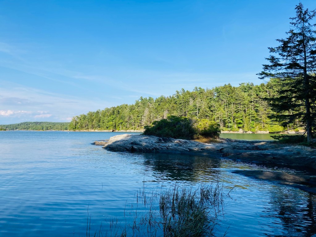
Harpswell Sound by Dipper Path, Bowdoin’s Schiller Coastal Studies Center, Harpswell, ME
We started by walking south on Bayview Road, turning right (west) onto the blue-blazed Spruce Fir-Forest Trail. This trail descended quickly through its namesake forest to Dipper Cove on Harpswell Sound, meeting the Dipper Cove Path (green blazes) to head north along the shoreline, with glimpses of the water peeking through the sunlit trees. We enjoyed broader high tide views from the rocky shore of the emerald water and Wyer Island. According to Schiller Coastal Studies’ trail guide, the footpath to access Wyer Island is open at low tide only. The descent to the shore and the return climb along the Dipper Cove Path are the only real elevation along this loop.
Terminus of Pine Needle Path, Bowdoin’s Schiller Coastal Studies Center, Harpswell, ME
We moved through the sunny campus along the road to rejoin the Pine Needle Path to the point of the peninsula, where a rocky promontory guarded the entrance to Brewer Cove. Several students can often be seen moving around the quiet campus. This amazing coastal property was deeded to Bowdoin College in 1981 by William (a Bowdoin graduate) and Irma Thalheimer, who continued to reside in the farmhouse there until their respective deaths in 1986 and 1994. The Center is named for Philip Schiller and Kim Gassett-Schiller, who more recently donated $10 million for laboratory and facility construction.
Late afternoon light, Brewer Cove Trail, Bowdoin’s Schiller Coastal Studies Center, Harpswell, ME
A chair tucked into a large bush gripping the rocks appeared to be a quiet, secret study spot, seen only by mergansers gliding by across the flat surface of Brewer Cove. We returned south, briefly retracing our steps to get onto the Brewer Cove Trail (blue blazes), which skirted the bottom of the cove, then headed north at a stone wall. The Brewer Cove Trail hugged tight to the small ridge along the way to Dog’s Head, with views down to the sheltered waters of Brewer Cove throughout, past twisted cedar trees.
Dog’s Head views, Long Cove Loop, Bowdoin’s Schiller Coastal Studies Center, Harpswell, ME
At the point of this peninsula, where the Brewer Cove Trail gives way to the Long Cove Loop (yellow blazes), a bench looks out over Dog’s Head and Harpswell Sound, where gulls, cormorants, and mergansers competed for territory. Here, we saw a small group of hikers heading back to the trailhead in the late-afternoon light. We paused briefly to enjoy the ocean views. The walk south along Long Cove seemed familiar, and looking at the map, it became apparent why – the Schiller Coastal Studies trails lie immediately across the Cove from the Devil’s Back Area Trails, which I explored previously on an unseasonably warm winter’s day. At a rocky open area in the trees, we heard, then saw, a pair of osprey wheeling overhead.
Spring wildflower – milkworts at Schiller Coastal Studies Center, Harpswell, Maine
In May, we saw a bright pink-colored fringed polygala, a species of milkwort flower, in the center of the path almost to the Stone Wall Walk. We headed uphill through evergreens and brightly colored changing ferns to pick up the Stone Wall Walk, the last leg of our loop. This trail passed a large section of blowdown trees and then moved through open fields.
Bright yellow and green ferns, Bowdoin’s Schiller Coastal Studies Center, Harpswell, ME
As we moved into the forest on the home stretch, I caught sight of a porcupine making its way out of the fields and across the trail. At our approach, it turned away from us, raising its tail toward us to telegraph its willingness to protect itself. The porcupine then lumbered through the pines, and made its way quickly up a tree, watching us from its perch as we walked back to the parking area. For food and drink after the hike, try Wild Oats Bakery and/or Flight Deck Brewing, which share a Brunswick Landing parking lot, on the way back to Route One.
Porcupine on Stone Wall Walk, Bowdoin’s Schiller Coastal Studies Center, Harpswell, ME
The Rodick Pettengill Farm in Freeport is a 140-acre property on the Harraseeket River owned and maintained by the Freeport Historical Society, and open to the public dawn to dusk, year-round. A self-guided tour and map, including trails, is available on the Freeport Historical Society website. In late October, we took a morning loop through the farm in the autumn foliage, using the Grant’s Point and Carter’s Creek Trails. Dogs are allowed (we were without Pig the dog for this hike, but saw several others with owners on the walk), a point we clarified with the Freeport Historical Society, as this policy has changed over the last several years.
Saltbox house, Pettengill Farm, Freeport, ME
Parking is available on Pettengill Road at the end of the farm’s driveway (as is a house-shaped box for donations) – just don’t park in front of the gate. Many historical placards dot the property, with vignettes from the farm’s up-and-down history, archeological findings, interactions with Native populations, and signs pointing out the sites of former buildings. The long driveway leads to the open fields around the farmhouse, built around the year 1800. We peeked in the windows (tours are available for groups of two or more with advance notice), then we walked downhill to the Harraseeket River, the site of a former shipping wharf for a brickyards.
Harraseeket River, Pettengill Farm, Freeport, ME
The sunlit October morning had a chill to it, but was invigorating, particularly since many hike reviews in warmer months listed mosquitoes and other biting insects as omnipresent. Across the field to the northeast of the house, we picked up the Grant’s Point Trail, mostly downhill through the mixed evergreen woods with a couple twists and the strong smell of pine, taking it all the way to its namesake promontory, with an excellent view of the river and beyond.
Pettengill Farm fields, Freeport, ME
There were some muddy areas, but none that were problematic or couldn’t be traversed. We took the Carter’s Creek Trail, winding in a forest full of birdsong, back up to the fields, skirting the edge until reaching the long driveway again. We bypassed the Ridge Trail and Marsh Trails, leaving them for another time.
Grant’s Point, Pettengill Farm, Freeport, ME
All told, the lollipop-type loop hike was about three miles in an easy hour and ten minutes, with time to read about history, stop in the sun, and birdwatch. While we did see other walkers and hikers, it was very quiet in the wooded portion of the trail. For those interested in more Freeport-area historical sites, the Freeport Historical Society has a Freeport Heritage Trail, with a map of sites and accompanying audio files.
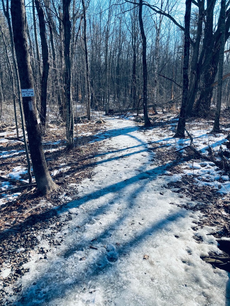
White Trail, Blackstrap Hill Preserve, Falmouth, Maine
The Blackstrap Hill Preserve, along with the Blackstrap Community Forest, is comprised of two separate properties totaling almost 600 acres and 11 miles of trails, owned by the Falmouth Land Trust (FLT) and the Town of Falmouth, and divided by north and south. We have hiked this several times, and the photos are from a mid-March day and a mid-November day, several years apart. Dogs are allowed, and must be on-leash within 300 ft of trailheads. Hunting is permitted, so blaze orange is highly suggested in-season. Parking is available at the Blackstrap Community Forest parking lot on Blackstrap Road, where there is a small lot and map kiosk (see the FLT website for a map). From there, we have completed a loop of about 4.2 miles in a little under two hours (White Trail, Waterfall Trail, Red Trail, Greenline Trail, Saw Whet Trail, and Cross-Cut Trail).
Pig in blaze orange on the River Trail, Blackstrap Hill Preserve, Falmouth, ME
The Preserve is also accessible from a trailhead further up Blackstrap Road (same as for North Falmouth Community Forest), just north of Babbidge Road, where we did a 4.8 mile hike in about 2 hours (River Trail, Hayfield Trail, River Trail, Updraft Trail, Bobcat Trail, Rocky Ridge Trail, Happy Cats Trail), as well as another small parking lot off Hurricane Road. A connector to the east (from the River Trail) extends to the Hadlock Community Forest, as well.
Waterfall Trail, Blackstrap Hill Preserve, Falmouth, Maine
In March, after a short walk across the grassy field to the White Loop Trail, I put on micro spikes to deal with the icy footing. The White Loop Trail led to the Waterfall spur trail, marked with purple blazes, which added about .7 miles out and back, with the pleasant sound of the creek leading downhill. The waterfall was not so much one massive torrent, but a pleasing series of cascades, and would be a nice, easy hike for young children in warmer months.
Piscataqua River in late fall, River Trail, Blackstrap Hill Preserve
I returned to the White Loop Trail, continuing a counter-clockwise loop to the Red Trail, which was wide and sunken, making it a sort of frozen river in the winter melt. At the Red Trail intersection with the Yellow Trail (which I bypassed), you can begin to hear the highway again. The trail network is mostly self-correcting, with maps at major intersections.
Blackstrap Hill Preserve, Falmouth, Maine
I turned left by a lazy bend in the West Branch of the Piscataqua River to take the Greenline Trail toward the Saw Whet Trail. The Saw Whet climbs a ridge next to a marshy area, and is not particularly well-marked, but I eventually re-acquired some white blazes, eventually returning to the Red Trail and then the White Trail, which widened out for the loop back to the parking lot. For the longer loop from further up Blackstrap, we used AllTrails to navigate clockwise, dodging a few mountain bikers here and there (all of whom were courteous and respectful).
Great Back Lots and Valiant Loop Trail in Litchfield, Maine
The Great Back Lots and Valiant Trail Loop is part of the Small-Burnham Conservation Area in Litchfield, Maine, managed by the Kennebec Land Trust (KLT), who has a great website and map. The area itself is on a conservation easement by the landowners. I hiked this in late August 2024, navigating the 2.3 mile loop using AllTrails, easily completed in under an hour. The trails and parking area were very buggy, even on a dry sunny day. A small parking lot and kiosk are located off Pine Tree Road, with a sign-in station shortly down the trail.
Great Back Lots and Valiant Loop Trail in Litchfield, Maine
The Small-Burnham Conservation Area is open for hiking, nature observation, cross-country skiing, and snowshoeing. Contact the landowner for hunting permission, and snowmobiles are allowed on designated trails. Dogs are allowed on a leash or under voice command, as long as you clean up after them.
Great Back Lots and Valiant Loop Trail in Litchfield, Maine
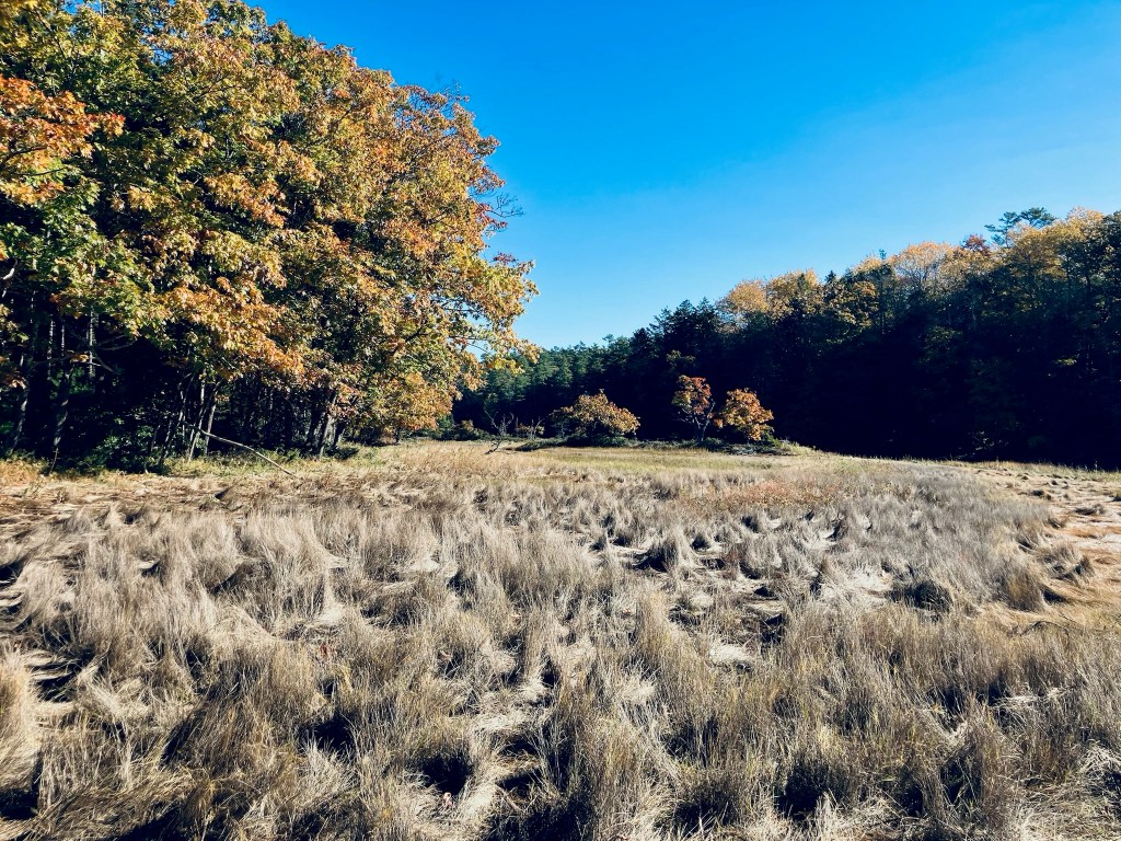
The yellow-blazed Back Lots Trail follows the edge of a small ridge through deciduous trees overlooking a small, quiet stream. The slow flowage, bounded by ferns, looked fairly exotic by Maine standards in the late summer light. At a unique, twisted evergreen with five trunks, the trail turns hard left. At 1.4 miles I turned right on the main trail to do the loop counterclockwise.
Stone Bridge, Great Back Lots and Valiant Loop Trail in Litchfield, Maine
This trail was wide, open and shaded, a winding walk past a marsh and field of ferns. At a little over a mile, it opened up onto a wide meadow full of black-capped chickadee, cardinal and crows. On the opposite side of the loop, shortly before making the turn back towards the parking lot, I saw a large brown raptor by a low-lying marshy spot, but it flew away through the trees before I could identify it.
Great Back Lots and Valiant Loop Trail in Litchfield, Maine
White Pine Loop, Central Penjajawoc Preserve, Bangor, ME
The Central Penjajawoc Preserve, a 182-acre trail network a short distance from downtown Bangor, is owned and maintained by the Bangor Land Trust, which has a helpful map and information on its website. No dogs or bicycles are allowed on the trails. The Preserve can be accessed from a small, signed parking lot on Essex Street, just south of the intersection with Burleigh Road. I hiked a loop in late September using the White Pine, Milkweed, and Penjajawoc Overlook Trails. The trail loop begins from a map kiosk as a narrow downhill path lined with ferns and wildflowers, and marked by diamond-shaped Bangor Land Trust placards on trees.
Tall White Pines, White Pine Loop, Central Penjajawoc Preserve, Bangor, ME
At the first trail junction (about a quarter-mile), I continued left on the White Pine Loop to go clockwise. The White Pine lives up to its namesake, and I enjoyed the sight and scent of the tall straight evergreens. As I moved further along the trail, there were low-lying marshy areas, mostly spanned with plank bridges, but in the early fall, it was dry enough that I had no issues with the mud. At about 2/3 of a mile, I hit the next trail intersection and continued left on the Milkweed Trail for the outer part of the loop.
Central Penjajawoc Preserve, Bangor, ME
I crossed a small stream lined with wildflowers and an open meadow, with the path now marked by flags. The footing was uneven, but the trail’s overall grade was flat and easy to follow. The trail dipped through a wooded area, back across a small stream, and then into another open meadow, with a similar density and variety of wildflowers. Just prior to the first (northernmost) Marsh Overlook, I encountered a massive tan toad with dark brown spots, who lumbered across the path, and then disappeared into the undergrowth.
Marsh Overlook on Milkweed Trail, Central Penjajawoc Preserve, Bangor, ME
I would describe the Overlook as more of a “through” look, a glimpse beyond the curtain of the trees to a large marsh, but no real elevation to look down from. I continued clockwise along the trail past the wildflowers and milkweed, following the flags, as the path is more of a game path here. Next turn was left, on the Penjajawoc Overlook Trail toward the second Marsh Overlook, which started through a small gap in a stonewall. I walked through another open meadow, this one higher and greener than the prior ones. This spur trail was a lot more overgrown, but still marked by flags and downtrodden vegetation, and fairly easy to follow. The field and its small islands of shrubs were full of chickadees, palm warblers, and eastern phoebe.
Overlook over Penjajawoc Marsh, Central Penjajawoc Preserve, Bangor, ME
I reached the second Marsh Overlook through a small stand of trees, and enjoyed the view, which was much more expansive than the first, hearing ducks in the distance. I paused and realized that I was covered in pollen from the waist down, following the walk through the meadow. The browns, gold, and yellow colors of early fall covered Penjajawoc Marsh and Penjajawoc Stream. On the return loop toward the parking area, I saw a small pile of bear scat on the pine-covered floor of the trail, as well as the signs of a small human encampment. The total loop was about 2.8 miles, taking only about an hour.
White Pine Loop, Central Penjajawoc Preserve, Bangor, ME