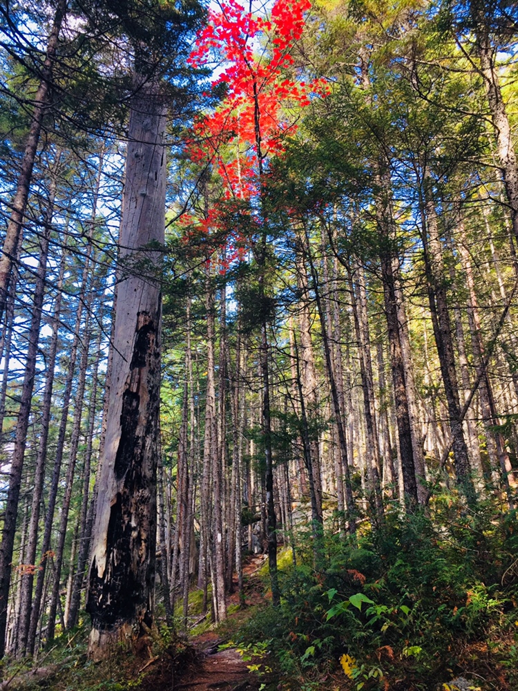
Morning light, Abol Stream Trail, Baxter State Park, ME
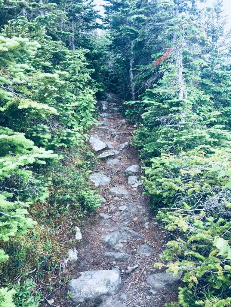
Some trails at Baxter State Park are quieter than others, and Blueberry Ledges, on the south side of the park, approximately midway between Katahdin Stream Campground and Abol Beach, is a beautiful spot you just might have all to yourself. Appalachian Trail (AT) thru-hikers this close to Katahdin are unlikely to take side trails, and day-hikers are often focused on the more robust peaks to the north and east. The lollipop loop trail to Blueberry Ledges from the trailhead at the end of Abol Beach Road is a 6.6 mile hike (if you take all the side trails like I did), using the Abol Stream Trail to briefly leave the Park, then pick up the Appalachian Trail (AT) northbound on the way out, and Abol Pond Trail on the return. I’ve done this twice, both on bright mid-September mornings, using the route recommended by the book Hiking Maine’s Baxter State Park. The Blueberry Ledges are also accessible from the north by using the AT southbound from the Park Tote Road near Katahdin Stream Campground, an out-and-back hike of about three miles each way. The trails are all on the downloadable Kidney-Daicey map from Baxter State Park, and in my pack, as usual, was the durable Map Adventures’ Katahdin Baxter State Park Waterproof Trail Map.
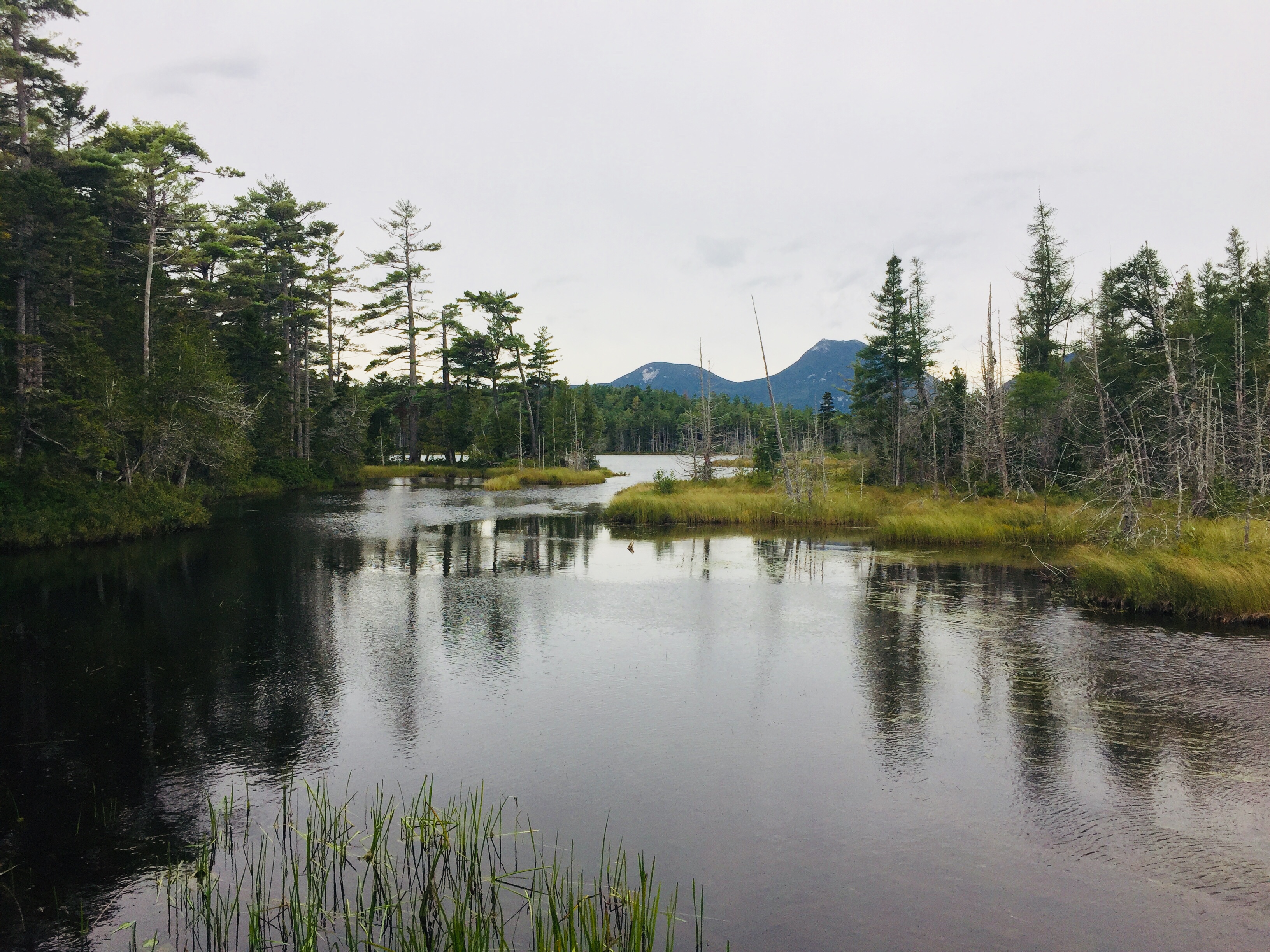
Mount Katahdin from Abol Stream Trail, Baxter State Park, ME
Abol Beach, which is a quiet, often-empty picnic area (with an outhouse) with a decent-sized parking lot. I began by crossing the small bridge at the outlet of Abol Pond, following the trail along a wide, wooded floor dotted with colorful late-season mushrooms. The path rises on an esker above Abol Stream. A little over a quarter mile in, there’s a short side path along the stream, which dead-ends at a robust beaver dam, and after about .4 miles, a small sign-in kiosk for hikers. At about .7 and 1.1 miles are more turnouts with excellent views of Katahdin’s bulk rising clear and crisp over multi-colored marsh grasses. The trail at this point is an old woods road bounded by sweet fern and pine, and serenaded by the chattering of red squirrels, jays, winter wrens, and white-throated sparrows.
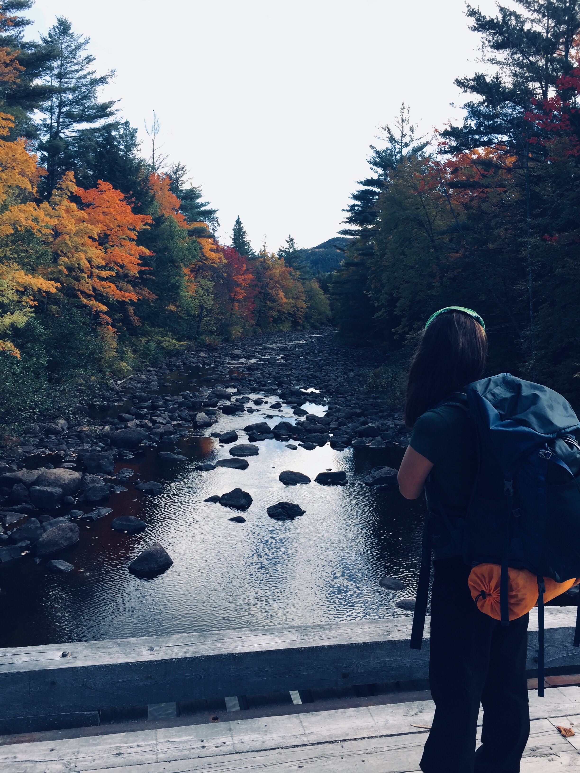
View from Barren Ledges on Barren Mountain, 100 Mile Wilderness.
Overview
With the right preparation, the 100 Mile Wilderness (100MW) can be a challenging but enjoyable eight-day hike (and for thru-hikers and experienced “speedhikers,” who can rip off 20-mile days, substantially less). Dad (then 41) and daughter (then 12) completed this in two segments in 2017 and 2018. We definitely allowed ourselves extra time to enjoy places we liked, or to recover from wet gear or injuries, so plan on ten days. Our 100 Mile Wilderness journey finally complete, we took a look back and came up with a better plan of attack. So, here is our guide, with a suggested itinerary, and a packing list.
Direction: There are arguments for going south to north (like we did), or alternately, starting at Abol Bridge, and finishing in Monson. The northern part is substantially flatter (read: faster) terrain, so starting with a heavy pack might be easier north-south, eating up food weight as you move south. But starting from the south, and climbing over the Barren-Chairback and White Cap ranges might make your tired legs want to finish with the more gently rolling terrain of the north.
Timing: When we started the 100 MW, we did so at the end of June/beginning of July. Once we got down from the higher elevations, the heat was oppressive, and the bugs were brutal. We later finished the 100 MW at the end of September, and it was cold at night, but pleasant during the day, and there were no bugs. I think a happy medium would be the beginning of September (assuming your work/school/life allows this), which would still be warm enough to enjoy dips in the lakes and streams, cool enough at night to sleep well, and at the very tail end of bug season. One caveat to this plan – AT Lean-To’s and tent sites may be fairly full, as many thru-hikers will be making their last push to Katahdin. Check out this summary from The Trek of thru-hiker tips for the 100MW, including a 5-day itinerary. Some water sources may also be dry by this time of summer, depending on the rains. Speaking of which, watch the weather forecast – water crossings can be treacherous after heavy rains further upstream.
Resupply: We didn’t do this, but it’s worth considering. Some purists believe that it’s cheating, but lightening your pack enough to enjoy your walk in the woods might help a great deal, and it’s your hike. Shaw’s Hiker Hostel (Monson), the Appalachian Trail Lodge (Millinocket), and 100 Mile Wilderness Adventures and Outfitters are reputable providers who can coordinate food drops for you along the 100MW. They can also provide advice, shuttle service, Baxter/Katahdin permits, help you stage your vehicle at either end, and provide a place to stay before and/or after.
A whodunit where the “who” turns out to be nature and decisions could be anti-climactic. The title and an Author’s Note at the beginning of the book foretell the tragic ending in When You Find My Body: The Disappearance of Geraldine Largay on the Appalachian Trail, by D. Dauphinee (DownEast Books 2019), but the story in between remains taut and meaningful. Geraldine Largay, a sixty-six year old Appalachian Trail (AT) hiker, trail name “Inchworm,” disappeared in July 2013 on a section of the AT in western Maine, and despite a wide search, her remains were found inside a sleeping bag by surveyors in October 2015, less than eight hundred yards from the AT.
As Largay cannot bear witness anymore (besides e-mails, text messages, and notes from the hike), Dauphinee largely focuses on the searchers from the Maine Warden Service and other agencies, the friends, and the fellow hikers to tell Largay’s story. The misinformation, inaccurate tips, and rumors are seen in split-screen with the actual timeline created from digital and physical artifacts of Largay. As Dauphinee concludes at the end of a chapter, “The behavior of lost people is a challenging study.”
Woven throughout the narrative on Largay’s disappearance is a broader examination of the AT’s history, its lore, terminology, and culture, and the reasons each hiker has for tackling all or part of the trail. Dauphinee also devotes a fair amount of time to the concepts of Search And Rescue and the mindset of the lost person. The irony that Largay became disoriented and eventually died on lands used for training by the U.S. Navy Survival, Evasion, Resistance, and Escape (SERE) school could have been played up for effect, and indeed, Dauphinee references sensational Bollard news articles which insinuated that this Navy “torture school” was responsible for Largay’s disappearance, and other theories about prescription drugs. But this conspiracy-type thinking is quickly neutralized by Dauphinee’s interviews and interactions, including with a retired SERE instructor who participated in the search, and who was emotionally affected by the failed effort. Dauphinee eventually returns with the SERE instructor for a somber visit to the site at which Largay’s remains were found. Dauphinee’s book ends with an epilogue in which he discusses the practical lessons that may be learned from Largay’s tragedy.
It is the mark of good writing that, even when the end is never in doubt, the reader still feels compelled to turn each page, to explore the broader story. In this case, human nature and years of evolution make it a story that sticks with us beyond the closing of the book, a survival lesson learned. And the care taken by Daupinee to be respectful, to make the kind, gregarious Largay more than a statistic, builds a character that the reader roots for, even knowing the outcome.
(Disclaimer: This post contains affiliate links, and as an Amazon Associate Hiking in Maine blog earns from qualifying purchases.)
Little Niagara Falls, Appalachian Trail in Baxter State Park
In season 1, episode 3 of the travel show “An Idiot Abroad,” comedian Karl Pilkington, sleeping in a cave across from the impressive facade of the lost city of Petra in Jordan, focuses on his vantage point, rationalizing, “I’d rather live in a cave with a view of a palace than live in a palace with a view of a cave.” When our annual father/daughter trip to climb Katahdin was detoured by injury, we used similar logic in planning a non-Katahdin hike at Baxter State Park – a flatter, less strenuous hike highlighted by the views of Katahdin and the many surrounding mountains of Baxter S.P. While Katahdin’s peaks are the undisputed centerpiece of this amazing place, this approach showed us a glimpse of the wonders available in the shadow of the mountain.
Mount Katahdin, wreathed in clouds, from Katahdin Stream Campground
We kept our lean-to reservation at Katahdin Stream Campground, and when morning dawned, we filtered the chilly waters of Katahdin Stream into our water bottles. Instead of heading up the Hunt Trail to Baxter Peak, we turned south on the Appalachian Trail, all the way around Grassy Pond, Elbow Pond, Daicey Pond, down Nesowadnehunk Stream to Little and Big Niagara Falls, then back to the start. We pieced together this hike, totaling about 7.5 miles round-trip (3 hrs 45 mins), from Falcon Guides’ Hiking Maine’s Baxter State Park by Greg Westrich, and used Map Adventures’ Katahdin Baxter State Park Waterproof Trail Map to navigate. Baxter’s great website also has downloadable/printable trail maps, and the Kidney-Daicey map covers this area.
Moose and Doubletop Mountains across Grassy Pond, Baxter State Park
Our turn away from Katahdin’s elevation seemed serendipitous, as a steady rain picked up that would have made a steep climb tricky, and we quickly donned our rain gear. An easy rolling trail and plank bridges took us over cold, clear streams tinged sepia tones by cedars, and a hard right turn took us onto the Grassy Pond (blue blazes) and Elbow Pond Trails. We skirted these ponds, trying unsuccessfully to glimpse a morning moose. We settled for birds, frogs and a variety of mushrooms in every color and shape, from small, bright cones to giant discs that looked dangerously like pancakes.
Looking across Elbow Pond to Mt O-J-I and Barren Mountain, Baxter State Park
Canoes are available to rent at Grassy, Elbow, and Daicey Ponds from the nearest Baxter S.P. ranger station, with plenty of wildlife viewing opportunities. Daicey Pond has cabins for rent, making it a great base for a week of hiking, if you can snag a reservation. At Daicey, we re-joined the Appalachian Trail, moving across the day-use parking area to the shores of Nesowadnehunk Stream (towards directional sign marked The Falls). The sides of the trail were carpeted in vibrant green mosses and ferns, creating an emerald forest by the stream.
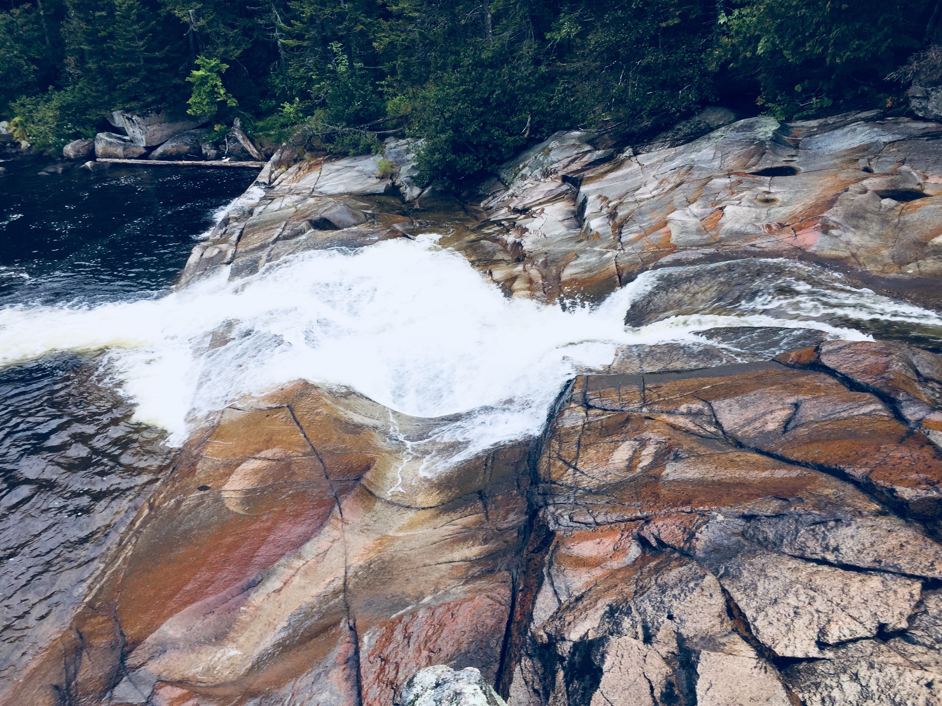
Little Niagara Falls, Baxter State Park
The remains of the Toll Dam, a vestige of Maine’s logging history, came first, then a short side trail to Little Niagara Falls. The rain and the time of day contributed to a quiet trail, with mostly thru-hikers heading in the other direction, racing the season to summit Katahdin, all friendly and moving quickly. We traveled the slight downhill, and enjoyed the spectacle of the roaring waters of both falls.
Big Niagara Falls, Baxter State Park
Heading back after a snack at Big Niagara Falls, we re-traced our steps north along the A.T., veering south (right) on the Daicey Pond Nature Trail to vary our return route. The trail around the southern side of Daicey Pond was narrow, with wet branches tight to our legs as we moved back towards the A.T. The clouds had moved in to obscure our view of the peaks across Daicey, but a clear day must be spectacular.
Cloudy view across the south side of Daicey Pond to O-J-I and Barren Mountain
The A.T. took us back to the trailhead, and our nearby vehicle. Normally, we would have enjoyed an outdoor meal on a camp stove, but the rain and cold had us in the truck with the heat on. We headed out of the park to lunch at New England Outdoors Center’s River Drivers Restaurant, overlooking Millinocket Lake (look for signs for a turn left as you head back towards Millinocket), a warm, welcoming place with great pub food and a view of Katahdin – crunchy chicken wrap and fish and chips both got high marks.
Grassy Pond Trail, Baxter State Park
The trip to Baxter State Park is always a long one, no matter where you are arriving from, as it is remote and wild, and requires you to shed creature comforts and technology. That, and the reservation system limiting access (smart and sustainable, for the park’s protection) can put a lot of pressure on a day or weekend trip with Katahdin as the goal. But this great reclaimed wilderness holds a lot more secrets for anyone willing to broaden their outlook beyond the mountain centerpiece, and this change-up hike left us wanting to plan a much longer stay to explore the rest of Baxter State Park.
(Disclaimer: This post contains affiliate links, and as an Amazon Associate Hiking in Maine blog earns from qualifying purchases.)
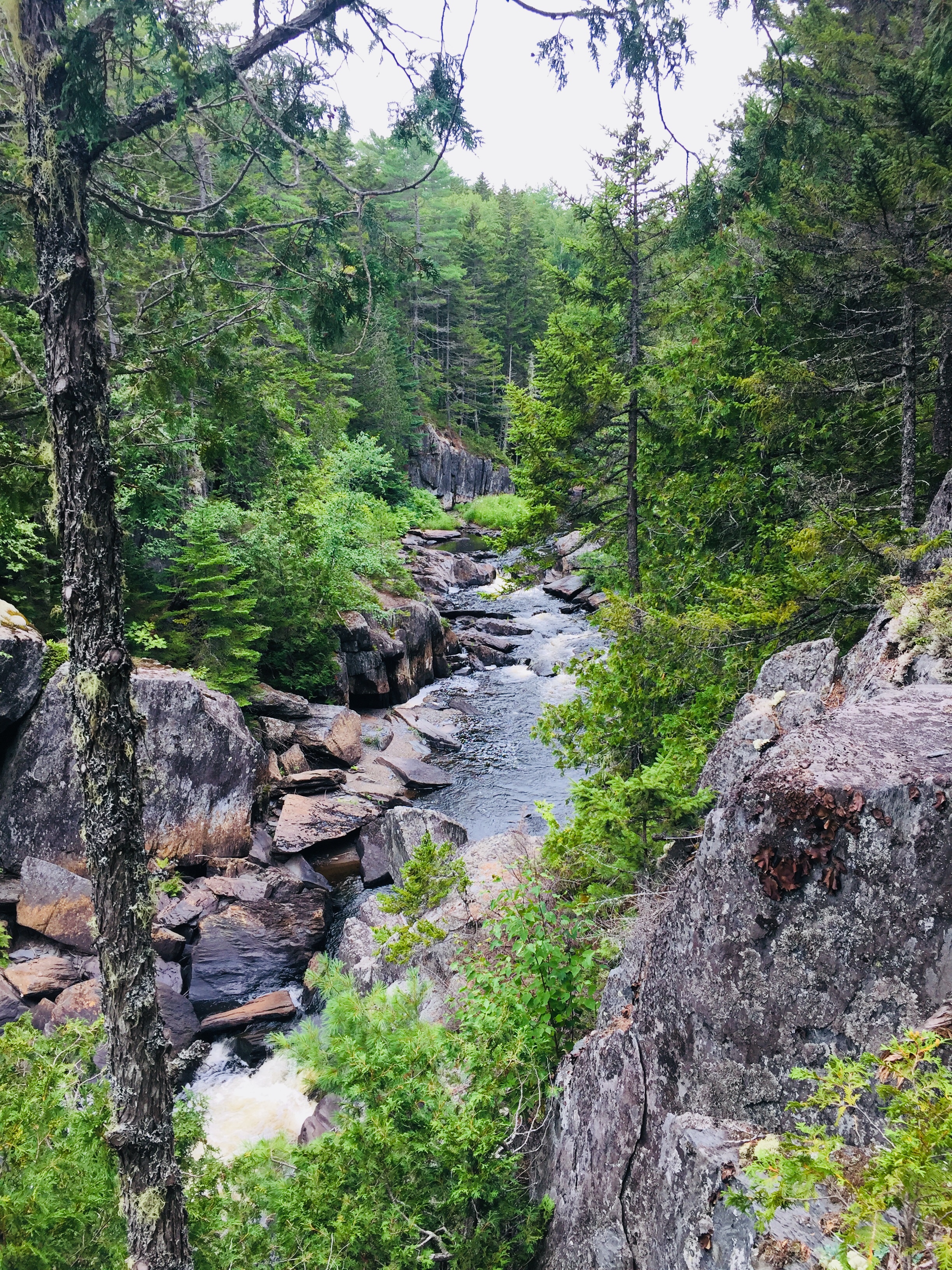
Gulf Hagas, a gem hidden in the 100 Mile Wilderness of Maine’s Appalachian Trail, has been dubbed the “Grand Canyon of the East.” Recently, this moderate (in difficulty, not grandeur) hike along the West Branch of the Pleasant River is getting more press, for better or worse, including mentions in Outside Online’s Best Hike In Every State, and in the Sep/Oct 2019 Outside Magazine print edition. Why? Waterfalls! Appalachian Trail! Beautiful rock formations! Swimming holes! Moose (well, moose droppings, anyway)! This is what you can tell any curmudgeons (I won’t name names) who come bearing excuses like, “too many bugs” or “that sounds like a lot of walking” or “I don’t have hiking boots.”
Gulf Hagas is located near the small town of Brownville, ME, about 3.3 hours from Portland and accessible through the gatehouse at Katahdin Iron Works Road (and two other checkpoints). The Katahdin Iron Works (KI) Jo-Mary Multiple Use Management Area is a region of about 175,000 acres of privately owned commercial forest, wedged conveniently between Moosehead Lake and Baxter State Park. All visitors – even those who are not camping – must stop at the gatehouse to pay the day use fee (and the camping fee if you are camping). They accept cash or check – and more cash than you might expect. On our recent camping and hiking weekend to celebrate the end of summer, four adults and one child camping for two nights and hiking for two days was $176 (under 18 is free). Information on fees can be found at North Maine Woods site. Also, pay attention while you are driving on those roads- the pot holes will get ya.
The gatekeeper at KI gate was friendly and helpful and happy to answer my questions about swimming holes and the state of the privy/outhouse at the campsite (brand new). I regret not asking him about a good spot to see a moose because I got the sense he would have known. The maps available at the gate (or print in advance here) of the area and of Gulf Hagas are particularly useful.
A small poplar grows at the top of the remaining Katahdin Iron Works furnace by the KI Gate.
I would recommend camping at the KI/Jo Mary campsites. Unless you are one of the few people that live nearby, you are going to want to relax somewhere after you hike for several hours. We lucked out and got one of those late summer weekends where the evenings require jackets, the campfire is crowded and the days warm up enough to be in shorts. Late August in Maine!
Our camping site (Pleasant River #1) was sandwiched between a clean, quiet, shallow river and a dusty road that had about 4-5 cars per hour go by during the day. It included a new outhouse which (no joke) smelled like fresh pine when we arrived. The site had enough privacy and except for a few barks from a dog at a nearby camp site, we did not hear the neighbors. The covered picnic table was perfect for providing shade.
Pleasant River Campsites managed by KI Jo-Mary, Inc., near Gulf Hagas
I was practicing the art of low-maintenance and so decided this would be the trip that I would go without a pillow. I spent the first night with my head on a hard-sided duffel bag, cursing this decision. Alas, nobody will ever say about me that “all she needed was a small patch of land to lay her weary head.” Turns out I need a blow-up mattress and a pillow. And chocolate. And delicious “camping-easy” coffee that even has some health benefits. It is a splurge, but when you are camping without a pillow, you will want that coffee.
We set up three tents in the three nooks of the large site, which had a great mix of sun and shade and was approximately 3.5 miles from the trailhead. My sole complaint was the road. Given the ruggedness of the road, the dust and the clouds of marijuana smoke billowing from passing cars, my advice would be to drive to the trailhead as opposed to walk. Save your energy for the gorgeous scenery along the Gulf Hagas Rim Trail! This is the hike with all the oohs and ahhs.
The trailhead for the Gulf Hagas Rim Trail is well-marked and on this sunny August Saturday the parking lot was overflowing. Several wooden hiking sticks rested next to the large trail map, to borrow for fording the river which comes at approximately .2 miles into the walk. Fortunately, the river was shallow and only reached mid-calf in the deepest areas. Because of the slippery rocks, I would highly recommend a walking stick or hiking poles and water shoes – my daughter crossed in bare feet but it did not look pleasant. The depth of the water varies from season to season and in dangerous conditions, there are other ways to hike the trail without crossing the river.
Crossing W. Branch of Pleasant River on AT on way to Rim Trail, Gulf Hagas
After the river crossing, you are on the Appalachian Trail. I was impressed with all those hikers who had walked perhaps since Georgia. Follow those white blazes, through The Hermitage (lots of huge, old white pine trees and hemlocks) and continue to the Rim Trail, where you say goodbye to the folks who are walking the 100-Mile Wilderness of the AT and you follow the blue blazes instead.
We took the Rim Trail along the water and then returned along the Pleasant River Tote Trail. See map here. In total, with all the small side trails to viewpoints, it is about 9 miles and there is an option to make a smaller loop, if you take the Appalachian Trail cutoff. Alternately, Gulf Hagas can be reached from a parking area for the Head of the Gulf Trail (opposite end from the AT), closer to the Greenville Road.
Many families with small children appeared to turn around at Screw Auger Falls or Buttermilk Falls. Several people were jumping into the water at Screw Auger Falls and it was the busiest spot along the walk. Everyone in our party seemed to be allergic to big groups of people (Husband mumbled something about Disneyland) and so we moved along. Certainly on a hot day this would be a great spot to cool off and I can’t imagine a more picturesque spot.
The hike does not include significant elevation and it is well marked. There are some little scrambles over rocks that a well-placed hiking pole or a tree branch would help with, but otherwise it is what I would call moderate. The AMC Maine Mountain Guide suggested allowing 4 hrs and 25 minutes for the loop, which is reasonable. We took plenty of breaks to relax and snack, and completed it in about 6 hours.
The trail has plenty of quiet, scenic areas to stop and sit and rest and stick your feet in the water while eating a peanut butter and jelly sandwich. My group had a couple of stoves and made sophisticated camping meals and hot tea. Daughter is a huge fan of Mountain House Chili Mac while the breakfast favorite was the Peak Refuel Breakfast Skillet. The JetBoil camping stove continues to impress in its efficiency.
We took the Pleasant River Tote Trail back and it was scenic in its own right – meandering woodland paths – quiet, green and easy. The walk back was much faster than the hike along the Rim Trail and the river crossing that you complete again to get back to the parking lot was refreshing on tired feet.
For post-hike refreshment, we enjoyed the cool river by the campsite, grilled hamburgers and beer and wine, and watching kingfishers and small, fast-moving ducks move by. But if you are headed back towards Portland, consider stopping at Bissell Brothers Brewing Three Rivers on Elm Street in Milo (turn right at Dot Rd just before the red train car). According to the cheery bartender, their double IPA, Preserve and Protect, is a tribute to the brothers’ father, Jensen Bissell, who was the Director of Baxter State Park for thirty years. A Katahdin benchmark is imprinted in the bar, as well. Please stop by soon, though, as an open letter on their site advises that the Bissell location, open since July 2018, will close at the end of summer 2024.
Katahdin benchmark in the bar at Bissell Brothers Three Rivers in Milo, ME
The now-famous Bissell Brothers beers are all available on tap, and delicious food is also available for purchase outside. Relax on the outdoor patio, and watch or play cornhole and ping-pong – all without the bustle at their Portland location. And continuing towards the turnpike in Dover-Foxcroft is Butterfields Ice Cream, serving up unbelievable ice cream flavors (and now, burgers, fries, and lobster rolls) since 1950.
Gulf Hagas is a memorable day-hike with friends and family, customizable to each person’s individual abilities, with memorable scenery unique to Maine’s 100-Mile Wilderness.
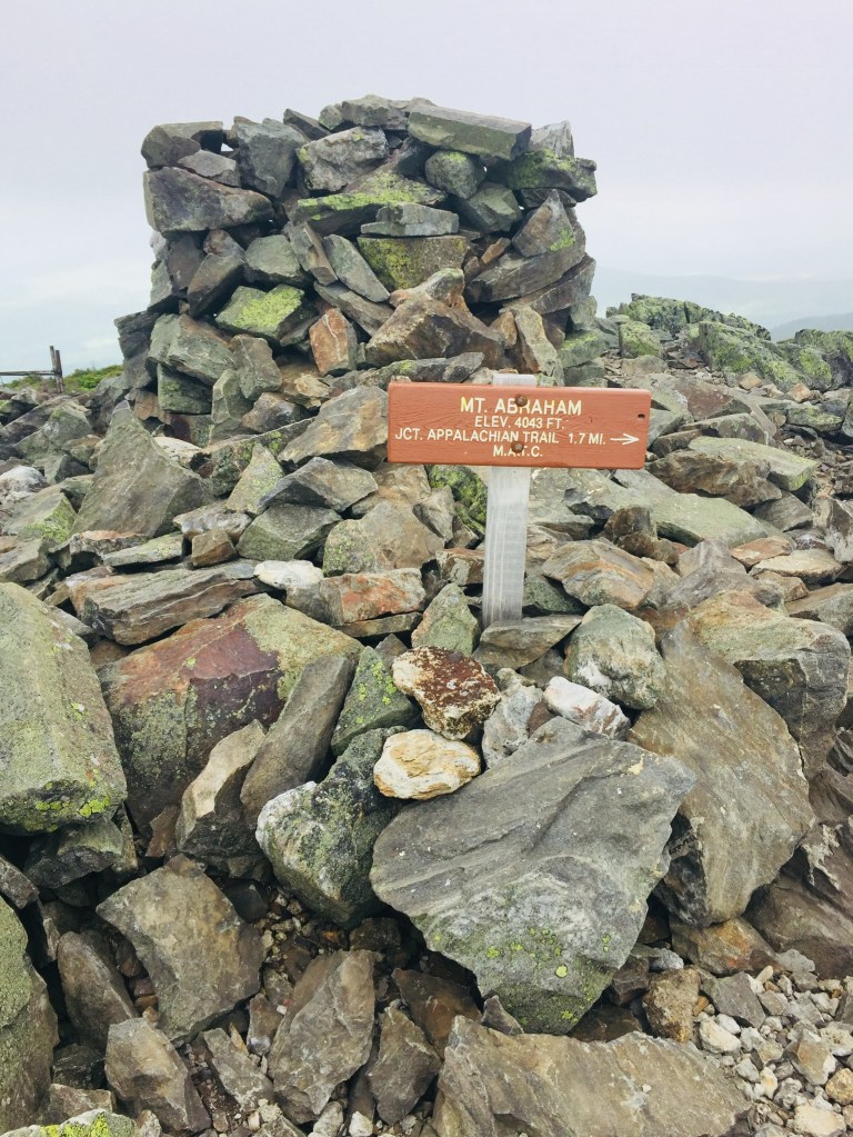
View down the Fire Warden’s Trail, Mount Abraham in Kingfield, ME
Sometimes hikes are listed as “Strenuous” simply because of their length or isolation. Often, it is because of rapid elevation gain, water crossings or the chance of inclement weather at altitude. Mount Abraham (4,049 ft) in Mt. Abram Twp., one of Maine’s fourteen 4,000 footers, combines all these factors, but still remains an attainable challenge of a day hike, approximately 8.2 miles round-trip out from trailhead to summit and back. This was about four hours total time on the recent July Saturday I hiked it (I moved quickly because of weather – allow up to six hours or so, based upon your own hiking level), and I used the Maine Mountain Guide and Maine Trailfinder to research the hike.
Fire Warden’s Trail, Mount Abraham, Kingfield, Maine
The mountain itself is in the Mt. Abraham Public Reserved Lands Unit, and contains the second-largest (to Katahdin) alpine zone in Maine. As of July 2019, the roads were passable all the way to the trailhead, which is at the T-intersection at approximately latitude 44.96817, longitude -70.26049.
From Kingfield, head north from “downtown,” and take a left on West Kingfield Road from Route 27. Continue straight about six miles (road turns to dirt, and becomes Rapid Stream Road enroute), and take a left at the fork. After crossing two bridges, take the right fork for about a mile. At the T-intersection, the trail will be slightly to your right (trailhead sign is set slightly back in the woods), and parking will be by a sign to your left.
Mountain stream, Mount Abraham, Kingfield, Maine
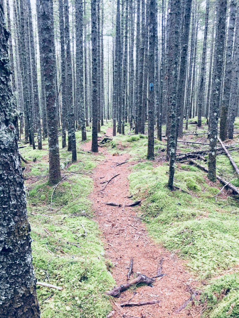
The path, marked with blue blazes, showed signs of recent trail work (thanks, trail crew), and had been re-routed out of lower-lying areas. Recent moose tracks and droppings were frequent, but I did not see the elusive animal on this day.
The Fire Warden’s Trail is pleasantly rugged, a steady, grinding uphill climb across a number of mountain streams, requiring a quick dance across wet, mossy rocks in some spots. The deciduous forest was thick and humid, an almost jungle-like green tunnel, dense with mosquitoes. The forest thinned out gradually with elevation, and evergreens substituted in for leafy greenery during the ascent, with a campsite and privy available at about 2.6 miles.
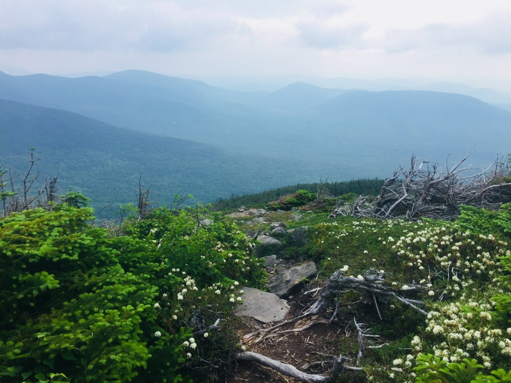
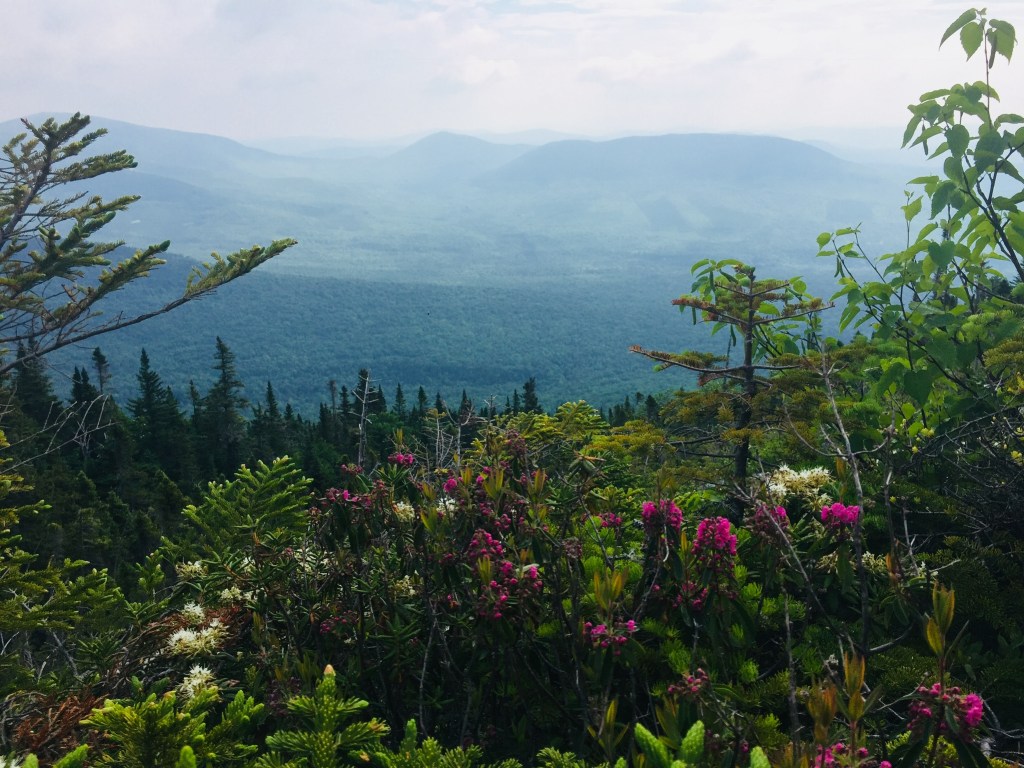
Flowers in the alpine zone, Mount Abraham, Kingfield, Maine
The breezes and open air of the alpine zone were a brief reprieve from the muggy forest before the steep, rocky climb to the top. On the summer day I hiked past the cairns lining the ascent, I was racing afternoon thunderstorms, and could see dark clouds rapidly moving, so did not waste time in the mostly unprotected half-mile between the treeline and the summit.
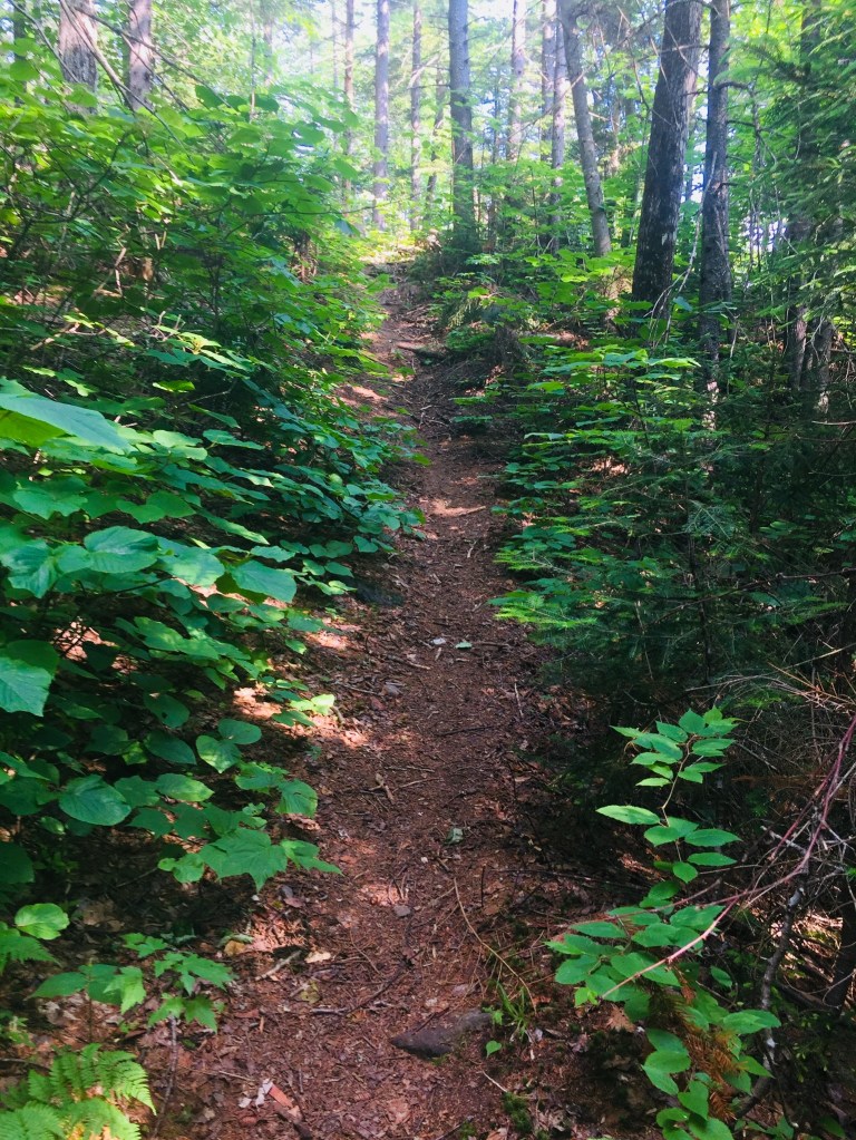
Narrow path in the alpine area of Mount Abraham.
I did, however, enjoy the smaller evergreens crowding the narrow trail, the flowering alpine plants across the ridge, and the views of the surrounding mountains and the Carrabassett Valley. The fire tower and shelter at the summit were knocked over and caved in, and a line of cairns marked the connector trail to the Appalachian Trail.
Summit cairn, Mount Abraham, Kingfield, Maine
After a quick snack and an obligatory change of socks at the windswept summit, I headed downhill, for a much easier descent back to the trailhead. The trail was lightly traveled- I saw nobody else on the way up, and only six to eight hikers headed up while I was on my way down (pleasantly light for a sunny Saturday in July).
Where to eat in Kingfield? In addition to beating the storms, my early-morning start allowed me to lunch at the incomparable Rolling Fatties. I opted for the delicious Falafel Fatty Bowl, packed with fresh greens and crispy falafel, enjoying it with a Maine Beer Company Woods and Waters IPA at an outdoor table in the sunlight.
Mount Abraham is a pleasantly demanding hike, close to the attractions of the Carrabassett Valley, and paying off with commanding views from Maine’s tenth-highest Mountain.
(Disclaimer: This post contains affiliate links, and as an Amazon Associate Hiking in Maine blog earns from qualifying purchases.)
I first heard of Jeffrey H. Ryan’s book Appalachian Odyssey: A 28-Year Hike on America’s Trail, (Down East Books, 2016) at an engaging February 2017 talk Ryan gave at Frontier Cafe Cinema and Gallery in Brunswick, Maine, complete with a slide show of photographs from his almost thirty-year journey in sections of the Appalachian Trail (AT). The timing was perfect – in the teeth of the Maine winter, I saw again the possibilities of getting on the trail.
Ryan, having thru-hiked the Pacific Coast Trail (PCT) in the early 1980’s, began his Appalachian odyssey with a hike of Mount Katahdin with eight friends, including eventual AT companion Wayne Cyr, in September 1985. Hikes on the AT in Vermont and Massachusetts followed, and Ryan realized that he was completing the AT in sections, beginning a twenty-eight year quest to finally complete the 2,181 miles of the trail.
Ryan’s book breaks up this journey with Cyr into twenty-four chapters, including photographs, maps, gear lists, and salient historical facts about the AT and its surroundings. The anecdotes and (often self-deprecating) trail stories are excellent, and my personal favorite was the saga of a hungry Vermont porcupine, and the havoc it wreaked on the underside of Ryan’s parked vehicle, punctuated by the instructive note entitled, “Why Porcupines Love Working on Cars.” Ryan concludes the chapter describing his unexpected porcupine encounter with an understanding:
Because it’s the unexpected that fills life with excitement, joy and gratitude. When you let go of your expectations and allow journeys to unfold before you, you discover they are filled with wonder – clouds screaming past the moon, climbs to summits with vistas beyond belief, hoards of black flies that send you into the tent, porcupines that eat vehicles and strangers that give you a lift to the hardware store just when you need it most, I wouldn’t trade one bit of it – not even the black flies, the forced vacation or the $900 repair bill – for a more predictable and less fulfilling walk through life.
Throughout the book, we continue to see this theme resonate, and readers of the right age can nod, and remember not being able to reach people by cell phone, or puzzling over a map, prior to the advent of GPS and Google Maps. The appeal of returning to a new section of the trail each year for Ryan seems to include this passage back to a world of limited priorities, of perspective, of strictly the essential.
While many trail journals are immersive, and discuss the alternate thru-hiker universe, Ryan’s is different, as he also explores the physical and emotional challenges of getting on and off the trail in sections over the years. The physical effects of residual stress from work and travel, the betrayals of aging and benefits of maturity, and even the changes in technology on the trail over time are currents running through this book.
In following Ryan and Cyr through the years and miles, it’s impossible not to start seeing it through their eyes and pick up the trail shorthand they use. “First flat spot” to a hiking partner is a three-word utterance that says all that needs to be said about exhaustion, and the need to pitch a tent and call it a day. Ryan’s inner “drill sergeant” is the alternately self-motivating and abusive internal voice that drives him up and down hills when his reserves of energy are gone.
A brief encounter with a solo thru-hiker at the Sawmill Overlook in Virginia who admits to having the “Virginia Blues” causes Ryan to re-evaluate the mental load being carried by himself and Cyr on the trail. The Virginia Blues are the result of a formerly ambitious thru-hiker’s realization during a 550 mile section across Virginia of the realities of the length and deprivations of the trail, a two thousand mile endeavor with a 75% dropout rate. Ryan’s thoughts on the Virginia Blues are an unmistakable metaphor for the trials of middle age, the broader trails we all walk alone and together, and the societal supports we all need.
These times of exhaustion and doubt, however, are like the low points in the rolling “sawtooth” terrain Ryan crosses in his section-hiking journey – left in shadow by peaks bathed in sunshine, unexpected kindnesses from strangers, hot meals, and special places inaccessible except by the AT. Ryan conveys tricks of the trade in breathing, arranging gear, and staying in the game mentally, and says this about continually moving forward:
But my greatest source of strength was the reason I was out here in the first place. From the beginning, I have felt that it is a privilege to walk through some of the most fascinating and inspiring places on earth. It is something that makes me feel more complete and connected to nature than any activity I can imagine. Trying to do it for as long as I can is the greatest gift I can give myself. Yes, there are tough days. There are also many more glorious ones – just like life in general. And experiencing them out here helps keep things in perspective when I return to the man-made universe of projects, deadlines and the like.
Every person who punches a clock can understand Ryan’s realization that “my greatest challenge in getting to the trail wasn’t the travel, it was carving out the two week chunk of time I would need to make the trip happen.” But Appalachian Odyssey shows a blueprint for finding a balance between the things we must do, and those we dream of doing.
(Disclaimer: This post contains affiliate links, and as an Amazon Associate Hiking in Maine blog earns from qualifying purchases.)
Fall colors on Pollywog Stream, 100 Mile Wilderness
[Note: this is the ninth and final part of a series begun in summer 2017 of an attempt at the 100 Mile Wilderness by dad, 41, and daughter, 12]
Should it take ten days to do the 100 Mile Wilderness? Probably not. Should it take eight days in 2017, and two days in 2018? Doesn’t matter- it did. As described on the 100 Mile Wilderness page, we started in 2017, had a great time together, but dad and daughter decided after 75 miles that we would continue some other time. This summer, we were dying to get back out there, and when the last weekend in September 2018 opened up for us, we jumped at the chance to complete the final 25 miles.
By definition, it’s a wilderness, so starting 25 miles south of Abol Bridge took logistical support. For that, we were helped by the friendly people at the Appalachian Trail Lodge in Millinocket, a hostel open during the hiking season until October 15th. We were greeted by Ole Man (these are trail names) upon our arrival, stayed at the Earl Shaffer Room (clean, two twin beds, shared bathroom, WiFi) for $55 the night before, got delicious breakfast sandwiches and a massive chocolate donut down the street at the Appalachian Trail Cafe the morning we left, and used the reasonably priced Appalachian Trail Lodge shuttle service to leave our truck at Abol Bridge, and get dropped off at the south end of Lake Nahmakanta. We swapped shuttles halfway, as the larger van we rode back to Millinocket from Abol Bridge was needed for the eager thru-hikers headed to Baxter State Park, and we traveled south in an SUV that had recently been repaired after a charging moose had broken off the driver’s side mirror.
We learned a lot on our shuttle ride from NoKey, a 2012 AT thru-hiker working at the Appalachian Trail Lodge, who was friendly, professional, and added all kinds of value to what otherwise would have been just a cab ride over logging roads. We had just missed a large bull moose on the Golden Road, of which NoKey showed us a picture. We got the scoop on good (most) and bad (very few) shuttle services/guides, places to stay near Millinocket, the effect of the Katahdin Woods and Waters National Monument on tourism, area wildlife and history, saw a lynx crossing the road, got an update on bear activity in the area, and even got a lesser-known trail recommendation (Turtle Ridge Trail in Nahmakanta Public Lands). We also passed a large encampment by Cooper Brook, which was the location of an L.L. Bean promotional “Trail Magic” campaign along the AT.
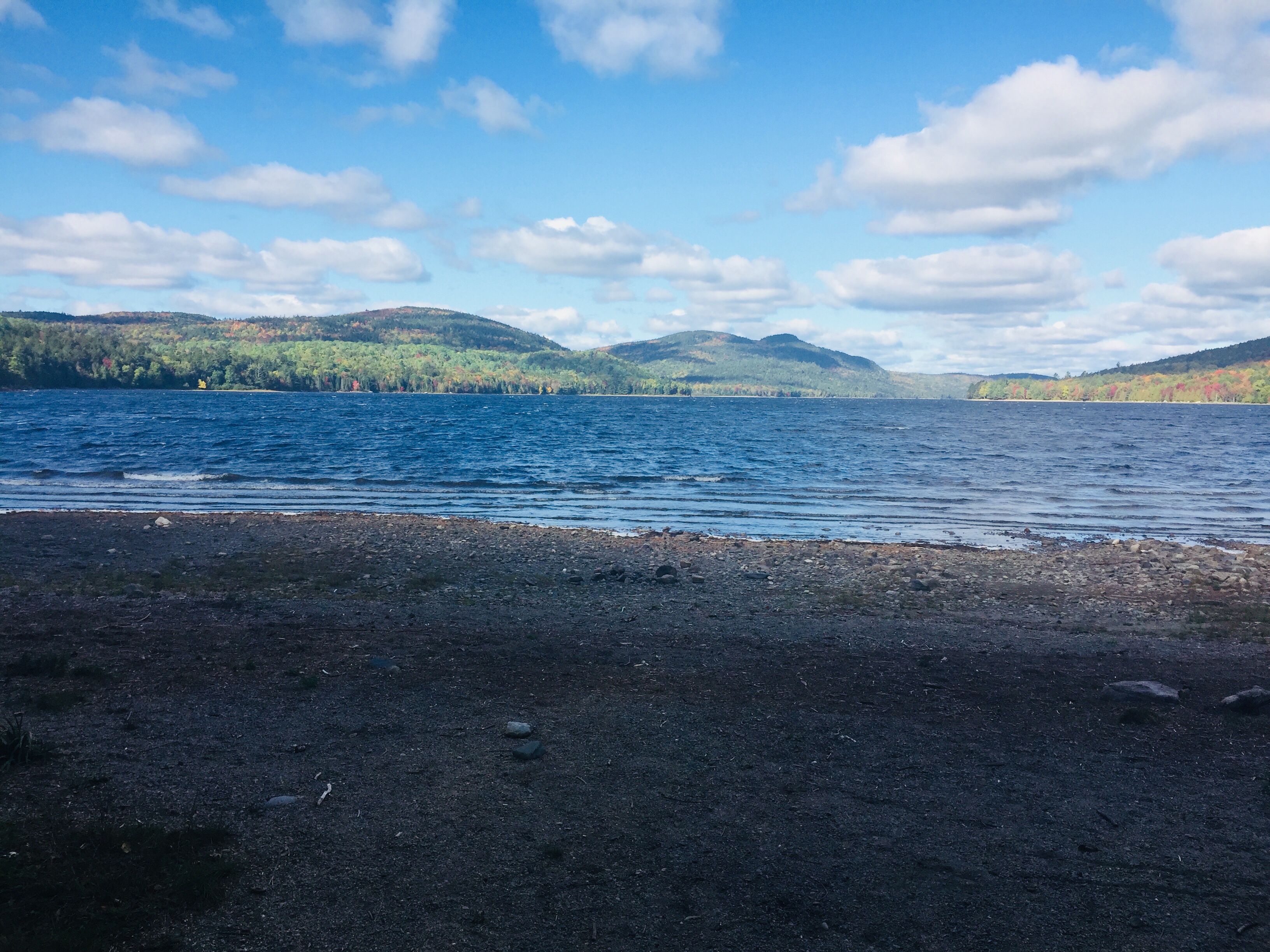
The beach at the south end of Lake Nahmakanta.
With that preamble, we got a mid-morning start at the south end of Lake Nahmakanta, and after a nostalgic moment on the windy beach, started walking north through the remote Nahmakanta Public Lands. Quickly, we saw large moose tracks and fresh droppings along the trail, and quickened our pace to try to see this animal, without success. We grudgingly adapted to having the heavy packs on our backs, and adjusted our day-hiker pace downward to accommodate the extra weight (we packed too much food). We stopped briefly at Wadleigh Stream Lean-to to crack open our Peanut Butter M&M’s, and noticed a plaque inside the lean-to honoring a hiker named Buffalo Bobby, who had passed away near this spot exactly 7 years before, 38 miles from finishing his third AT thru-hike. Wow. Rest in peace, BB.
Landscape and foliage views from north summit of Nesuntabunt Mountain.
By about 1 pm, we had reached the north summit of Nesuntabunt Mountain, and took the short side trail to view Nahmakanta Lake and far-off peaks. Then we sat down to make ourselves lunch, the same peanut butter, banana, and Nutella wraps we had used for energy on Katahdin a couple weeks before. A quick descent took us to the base of the mountain and around Crescent Pond to Pollywog Gorge.
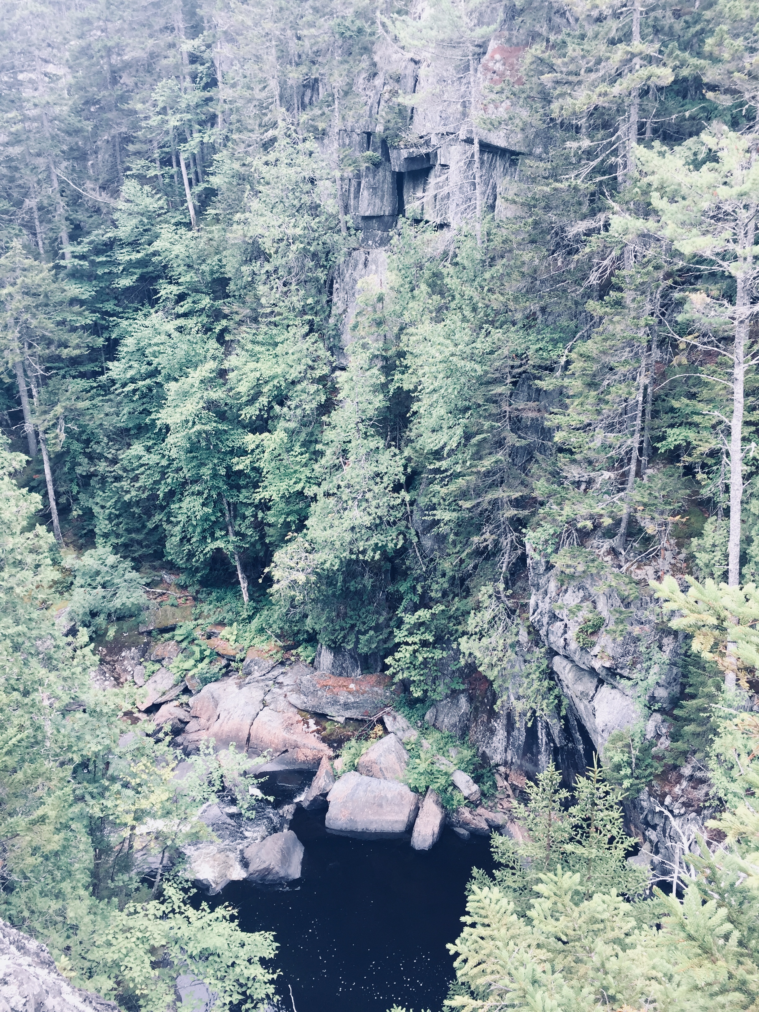
Fall colors on the AT near Pollywog Gorge
Changing leaves along Pollywog Stream.
The cliffs surrounding the gorge were impressive, but we were beginning to wear down, and didn’t linger. We crossed Pollywog Stream on a bridge, and made our way up Rainbow Stream to Rainbow Stream Lean-to a little before 5 pm, where a male thru-hiker and two female multi-day hikers we had seen earlier were getting ready for the night. This made it only a 10.7 mile day for us, but it felt like a lot more. The lean-to area quickly filled up with thru-hikers as the sun set. The thru-hikers we saw were exhausted, broken, and profane, but unfailingly friendly, polite, and focused on the last stretch of trail to Katahdin.
We set up our tent, which was complicated by a broken pole, repaired with a mostly ineffective combination of duct tape, twine, and tent stakes. We lay out our bedding, refilled our water, cooked dinner (Chicken Teriyaki Mountain House meal), hung our food in a bear bag, and were in our sleeping bags by 7 pm, fading into sleep despite the loud conversations by the lean-to campfire.
Log bridge and animal den.
It was a cold night, and we were uncomfortable, with neither of us sleeping well. Our sleeping bags and pads were up to the task, but we both agreed in the morning that we need to figure out how to pack pillows with us. Also, dad’s snoring woke up daughter, and daughter poking dad to stop his snoring woke up dad, creating the worst sort of perpetual motion machine throughout the night.
Daughter explored the campsite area in the morning, finding a precarious log bridge across Rainbow Stream to an animal den in a rock cave, possibly the former resting place of a bear. We peeked inside the den, seeing the small skull of an unfortunate prey animal. Dad made instant coffee and mixed in one of daughter’s hot chocolate packets for some more flavor in an attempt to wake up.
Morning light on the Rainbow Deadwaters.
We packed quickly and got moving around 7:30 AM, moving along the edge of the Rainbow Deadwaters. The trail was beautiful, and we marveled at spiderwebs covered in dew, and the unique morning light in the North Woods. We also heard late-season loons calling from Rainbow Lake.
Illuminated trail by Rainbow Lake.
Daughter said that the Hobbit movies could have been filmed here, a recognition of the dramatic, colorful terrain that we tend to associate with movies, and so rarely see in person. We saw a root formation overtaking a tree that looked like a giant spider. As far as mythical creatures go, the west end of Rainbow Lake was the site of what can only be described as a beaver Armageddon, with fallen trees every which way across the trail.
Beaver Armageddon
We stopped for a break by Rainbow Spring Campsite. The privy there was filled with trail graffiti, including the signature of someone whose trail name was “The Privy Destroyer.” This harkened back to irreverent trail names scrawled inside the Appalachian Trail Cafe that had amused daughter, including “Swamp Butt.”
We continued past side trails to Rainbow Mountain and Big Beaver Pond in the Debsconeag Lakes Wilderness Area, stopping to check out Rainbow Lake (the largest lake on the 100 MW) from several rocky openings along the trail. On one stop, we cooked a Mountain House chicken and rice meal for lunch, and let it cool while we walked. When we sat down about fifteen minutes later to eat, it was perfect. Daughter was already sick of the Nutella and lavash bread, so the hot lunch was a good change-up. We also used this time to air out our feet, and change into clean, dry socks.
View of Katahdin from Rainbow Ledges.
Rainbow Ledges was a steady climb, with colorful foliage and views from the high point back to the White Cap range, and forward, towards Katahdin. We remembered crossing the White Cap range a year ago on the 4th of July, and the pea soup fog that hindered our summit views that day. Sadly, we ran out of Peanut Butter M&M’s during this Rainbow Ledges ascent, which had a devastating effect on morale. From here, we descended through the ever-changing forest and down well-set rock staircases to Hurd Brook Lean-To.
Different vegetation, incline, and make-up of the trail over just a 25-mile section.
The last few miles seemed to last the longest, as they always do. There weren’t many landmarks on the home stretch to Abol Bridge. The descriptive note, “Interesting area of large boulders and large hemlock trees,” on AT Map 1 at 2.2 miles from Abol Bridge, seemed superfluous after 100 miles of interesting rocks and trees. Suddenly, we were faced with a sign warning us that we were 100 miles north of Monson, and that we should have a minimum of 10 days supplies if we were heading south. We realized we were almost done, and saw the Golden Road peeking through the trees ahead.
Katahdin and the West Branch of the Penobscot from Abol Bridge.
We trudged across Abol Bridge in the late afternoon, completing our 15 mile day. We stopped by the Abol Bridge Campground store to buy some Gatorade, then got back in our truck, and drove out the Golden Road towards Millinocket. The Millinocket House of Pizza is daughter’s restaurant of choice, and she called in an order enroute for a large Hawaiian pizza as soon as cell service returned.
The soreness in our shoulders and knees and the chafing from the packs would fade in time, but completing the 100 Mile Wilderness together had been important to both of us. The cool, bug-free fall weather and colorful foliage were unexpected bonuses. To immerse yourself into the Wilderness, to walk there, sleep there on the ground, listen to the sounds of birds, bathe in the lakes, and then bring back out everything you came in with, is to feel shared ownership of this special place, where most people never go. Even in our weary haste at the end to finish, we had talked about new challenges, and also bringing memories of this hike back with us. As we split the pizza, we talked about our hike, and planned a lazy day for tomorrow.
We had hiked Katahdin, but daughter had never taken the legendary Knife Edge Trail, the narrow 1.1 mile stretch (and Maine rite of passage) from Pamola Peak to Baxter Peak. At age 12, it was time. On September 9, 2018, we hiked together to Baxter Peak on Mt. Katahdin via the Helon Taylor Trail to cross the Knife Edge. On the way down, dad and daughter took the Saddle and Chimney Pond Trails (total R/T appx 10.2 mi). (For maps, other routes, and links to Baxter State Park’s great resources, see our September 2017 Mt. Katahdin post.)
On the way in to Millinocket the night before, we stopped at Hannaford to stock up on supplies before staying at the Parks Edge Inn. In preparation, we went with a chocolate and peanut butter theme, and for our lunches, wrapped Nutella, peanut butter, and bananas in lavash bread like some Willy Wonka burritos, and grabbed peanut butter chocolate chip Larabars and peanut butter M&M’s to snack on.
To get into line at the Baxter State Park gate the next morning, we woke up around 5 am, and signed in to start hiking at Roaring Brook at 6:47 am. The $5 Day Use parking pass for Maine residents has to be the most value Mainers can get for $5. This easy online step is essential to guarantee a spot in the park, which is kept wild in many ways, including the limitation on daily access to the park.
The climb up Helon Taylor Trail was steady and tough, but we took our time, and enjoyed the changing vegetation and ubiquitous chattering of red squirrels, often looking back to enjoy the views behind us to the east, as we slowly emerged from the forest, patches of scrub pine, and finally above the tree line, reaching Pamola Peak around 10 am.
Getting ready to descend into the beginning of the Knife Edge.
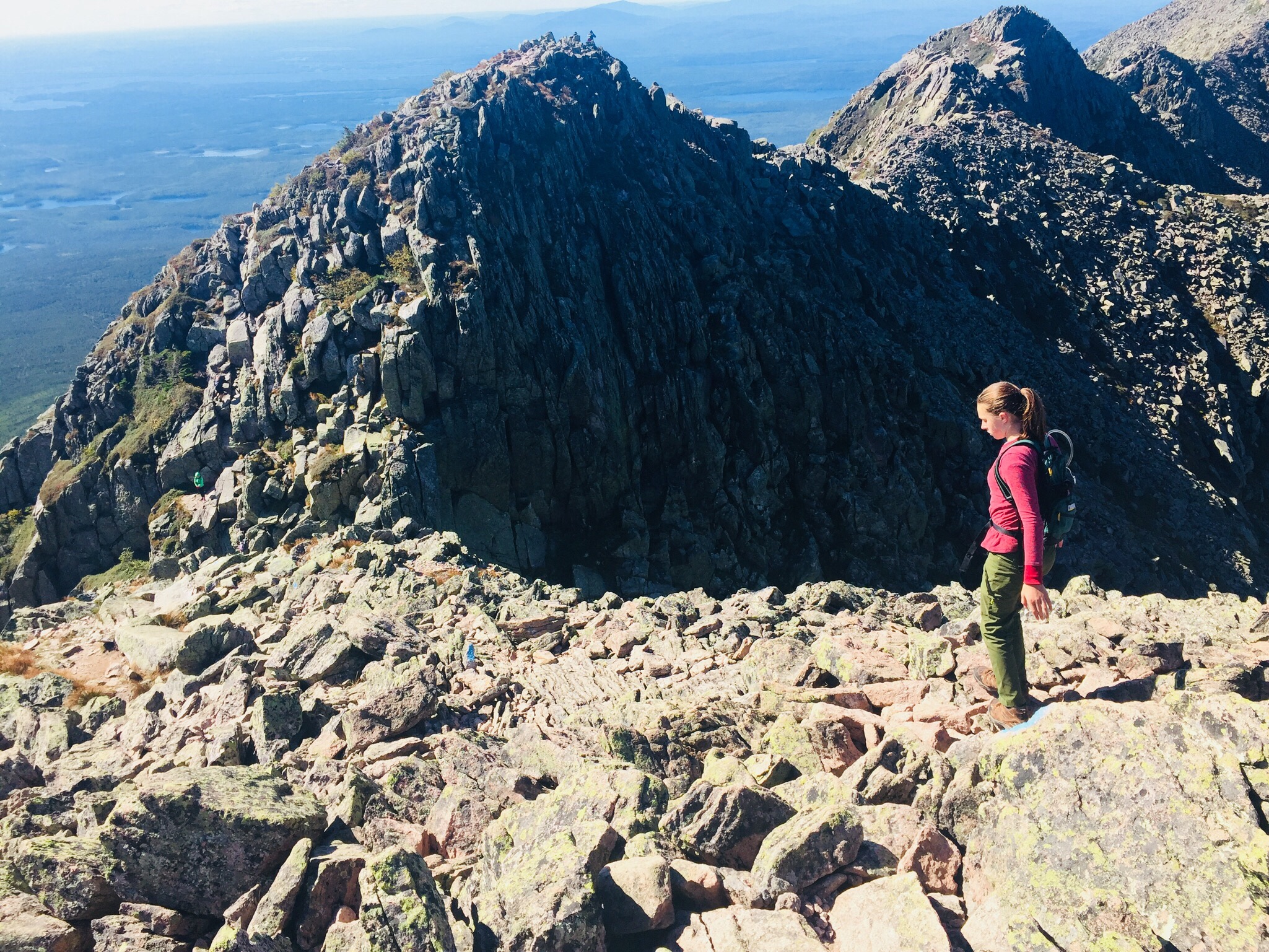
The first step of the Knife Edge was the descent into the chimney adjoining Pamola, then a quick climb back up, setting the tone for a fun traverse. We saw several other groups of people crossing the Knife Edge, including some coming from the direction of Baxter Peak, one of which contained the only other child we saw, a nimble little boy, younger than daughter, leaping from rock to rock.
The Knife Edge Trail is a dizzying series of up and down climbs.
After the climb up Helon Taylor, exposed to the wind, and steeply ascending until our legs ached, we agreed that the Knife Edge was more mentally than physically challenging, and stopped frequently to gaze down into the bowl created by the steep cliffs of Katahdin, look at rock slides down the cliffs to the south, and watch ravens wheel and glide on the air currents below us.
We did not spend long on the summit of Baxter Peak, which was crowded with thru-hikers and large groups, with a long line to take pictures at the summit sign. Millennial-types used the cell service available due to the summit’s elevation to FaceTime with friends (“You’ll never guess where I am right now”) and send Instagram pictures ad nauseam. Daughter waited for a quick break in the action and snapped a ghost summit photo.
A weather-worn sign cautions hikers on the Saddle to take care with alpine plants.
Much more interesting was our meeting on the way down to the Saddle Trail with a Baxter State Park ranger, who educated us about the fragility of alpine plants. She told us that even a small patch can take up to one hundred years to grow back, and can be killed by as few as seven footsteps on it. We asked a number of questions we had gathered during our hike, including why some slides looked different- she explained that the slides where the trees were laying downhill were caused by avalanches in the winter, but that when the mountainside was denuded of vegetation, it meant that a rockslide had occurred. This ranger, from Asheville, North Carolina, works at Baxter from May to October educating hikers, conducting rescues, and sometimes climbs Katahdin every day.
Relaxing on the descent by Chimney Pond.
Our descent of the Saddle Trail was slowed by the onerous process of passing what looked like a large school group, and we got to Chimney Pond around 1:40 PM, where we took a long break to enjoy the sunshine, air out our feet, and birdwatch.
From there, it was a downhill walk over rocks and roots to Roaring Brook and our car, getting back around 3:30, for a total of almost nine hours of hiking. During this last stretch, one of dad’s hiking poles snapped, but our hike was otherwise uneventful.
So what worked? Obviously, chocolate and peanut butter. But daughter felt good about her hiking and running in the weeks leading up to the Knife Edge, and it got her into shape for the climb.
Mentally, we had talked about the challenges, and even used technology to our advantage, watching YouTube videos of the Knife Edge (the volume was quickly muted) to dispel fears. We started hiking with the agreement that we would not stupidly try to push through bad weather, and even reserved another parking spot for the following day, just in case.
We had a ton of water, using our 3 Liter Osprey hydration systems (Dad still ran out with a mile or two left to go). Dad carried a light pack with extra clothing layers and food. Daughter stayed with a Camelbak pack that allowed her to carry water and a few energy bars, but didn’t hinder her while climbing.
We shared a great hike, and daughter enjoyed being the tallest thing in Maine, even for a few seconds. With the right attitude, preparation, and training, the Knife Edge can be an incredible, unforgettable experience for kids, as part of an exploration of Maine’s tallest mountain and the limits within themselves. Even an unsuccessful attempt, safely and properly handled, can create a goal for future conquest, and build decision-making and risk management skills.
(Note: The Katahdin Loop Road opened for the 2020 season on Saturday, May 23. U.S. National Park Service advises to drive with caution and be alert for soft spots and rough road sections. Haskell and Big Spring Brook Huts are temporarily closed, and updates will be posted to the NPS website.)
The standard route into the South Entrance is via Route 11 from E. Millinocket/Medway to the Swift Brook Road along the Katahdin Woods and Waters Scenic Byway, but we were feeling adventurous, and took the Stacyville Road north from Millinocket to where it meets the Swift Brook Road. We savored the lonely ride along this quiet logging road, occasionally startling game birds (this is not the way to take a low-clearance or non 4×4 vehicle).
The 17-mile loop of Katahdin Loop Road is punctuated by meadows, bogs, and ridges, and the south and west parts of the loop boast excellent views of Katahdin and the surrounding area. This is an opportunity to see the Monument and cover distance in a vehicle, while having the chance to get out and explore at a variety of hiking paths and overlooks. The best map of the loop we found (which I wish we had when we were there, as it is also an excellent interpretive guide) was from the Friends of Katahdin Woods and Waters, and can be found here.
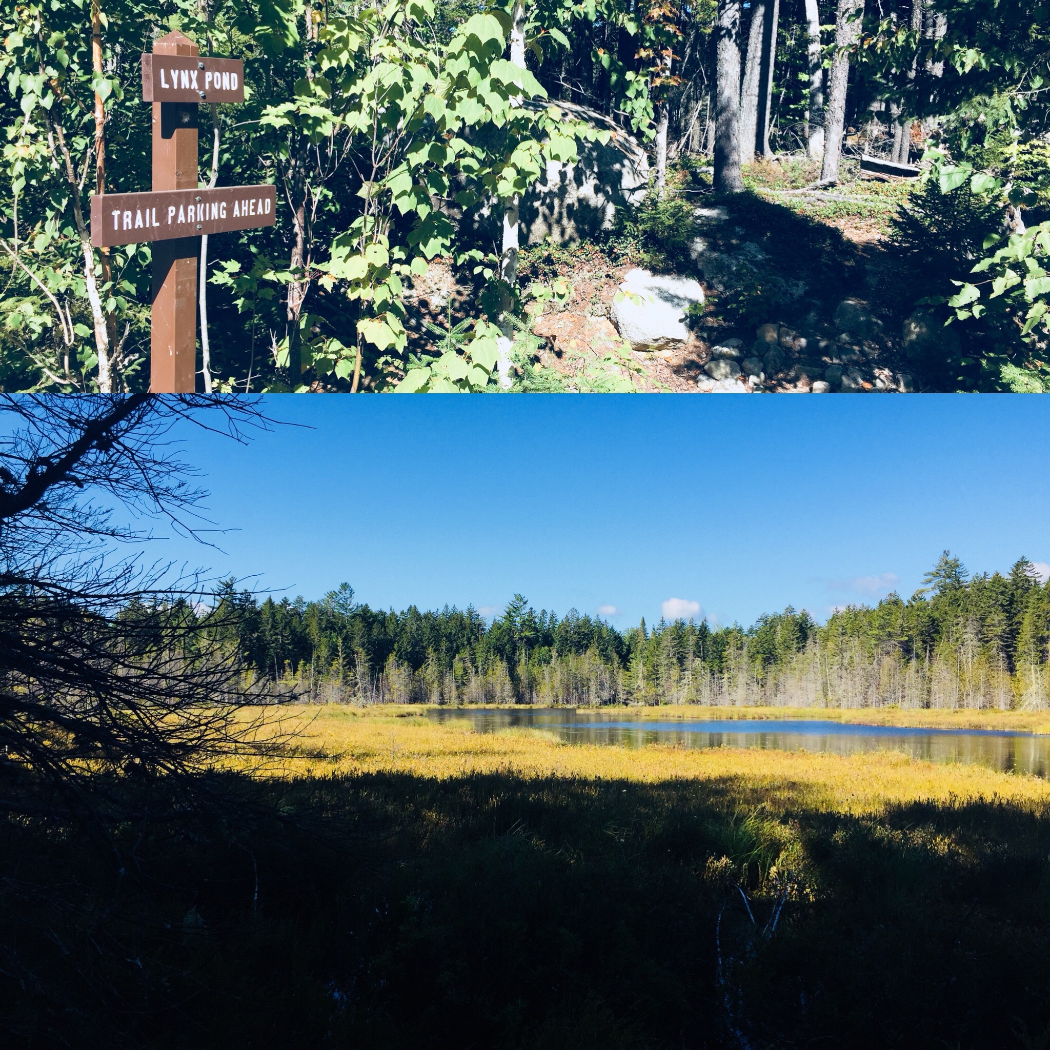
Lynx Pond
The Lynx Pond Walk is shortly past the Loop Road Gate, on the right just past the Mile 2 marker. Shortly after the trailhead is a parking area on the left of the Loop Road. This is a very short walk through the woods to a small boardwalk by the pond, and a spot for quiet reflection and wildlife viewing.
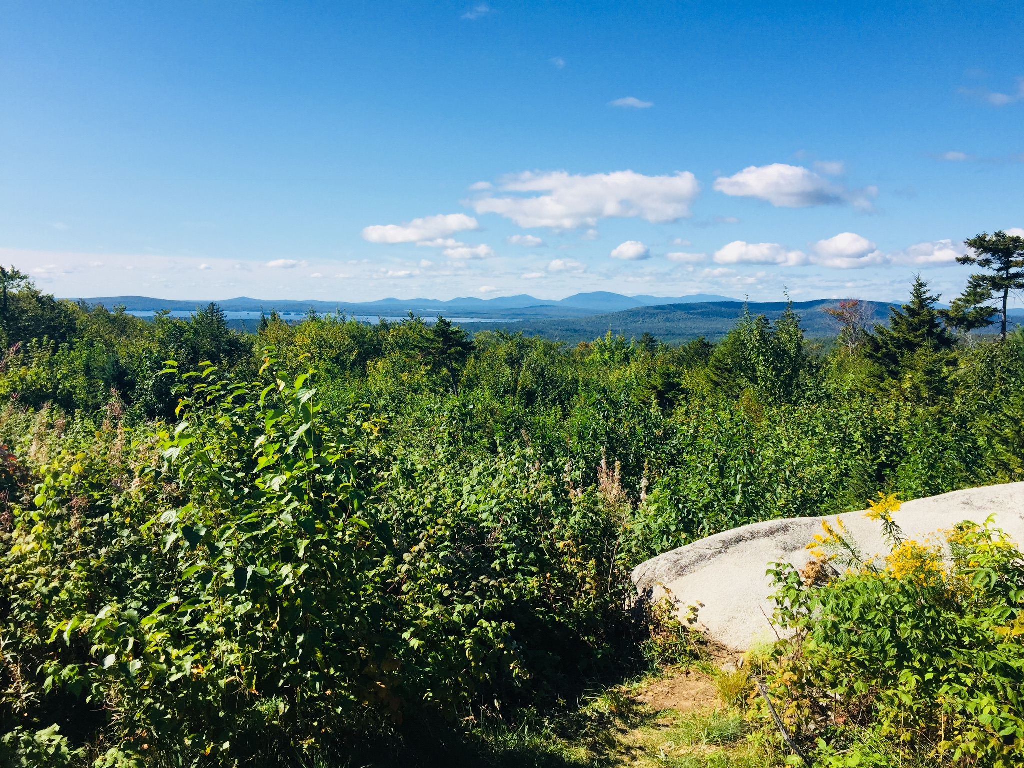
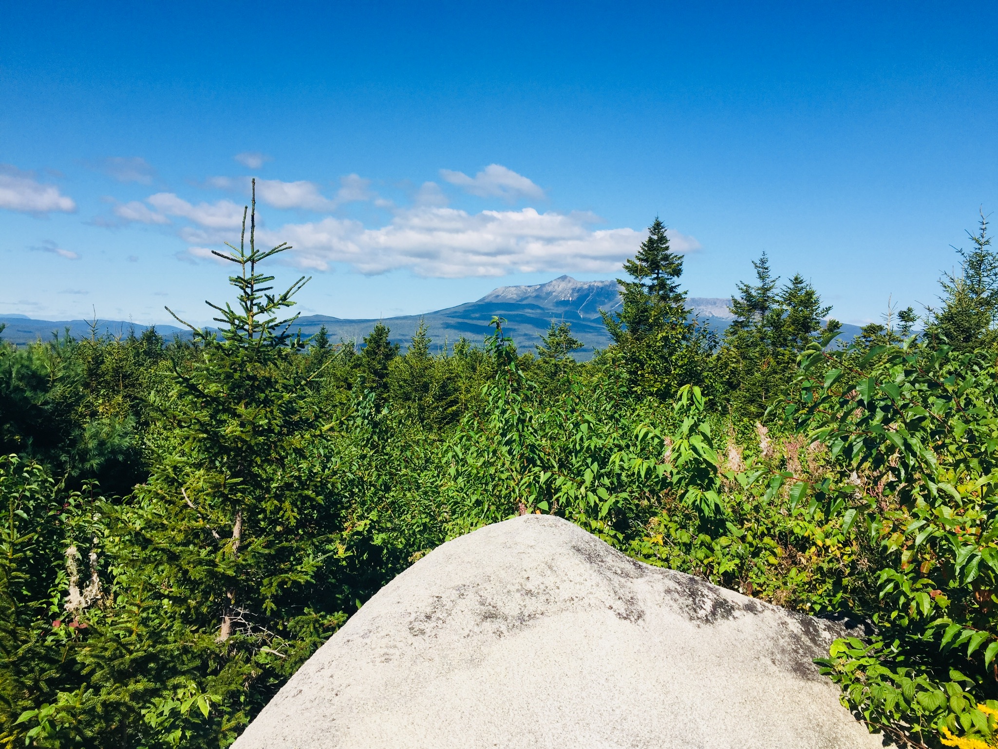
Looking south from The Overlook on Katahdin Loop Road. The large lake is Millinocket Lake.
Views of Katahdin from The Overlook on Katahdin Loop Road
Katahdin towers over the loop, and there are multiple spots around the Loop Road with views of the lakes and mountains to the west and south, particularly The Overlook, between Miles 6 and 7, which conveniently has a picnic spot and a toilet.
The IAT and trail to Barnard Mountain
IAT Lean-To (toilet is behind lean-to)
We continued around the Loop Road, and got out to stretch our legs again at the International Appalachian Trail (IAT) and trail to Barnard Mountain, passing over Katahdin Brook and by the IAT lean-to. This wide logging road made for a sunny trail, and though we did not make the turn towards the Barnard Mountain summit, we enjoyed the walk, and the familiar plants and animals that inhabit newly overgrown woodcuts, with blue jays diving across our path and into the trees. The Barnard Mountain trail itself is a moderate 4-mile round trip with summit views of Katahdin and Katahdin Lake to the west.
Late summer flowers and plants along the IAT
The IAT continues from the northern terminus of the Appalachian Trail at Baxter Peak across Maine, into Canada, across to Greenland, and Europe, to the Atlas Mountains of Morocco. For a great exploration of the concept of the IAT, see On Trails by Robert Moor, reviewed on this blog.
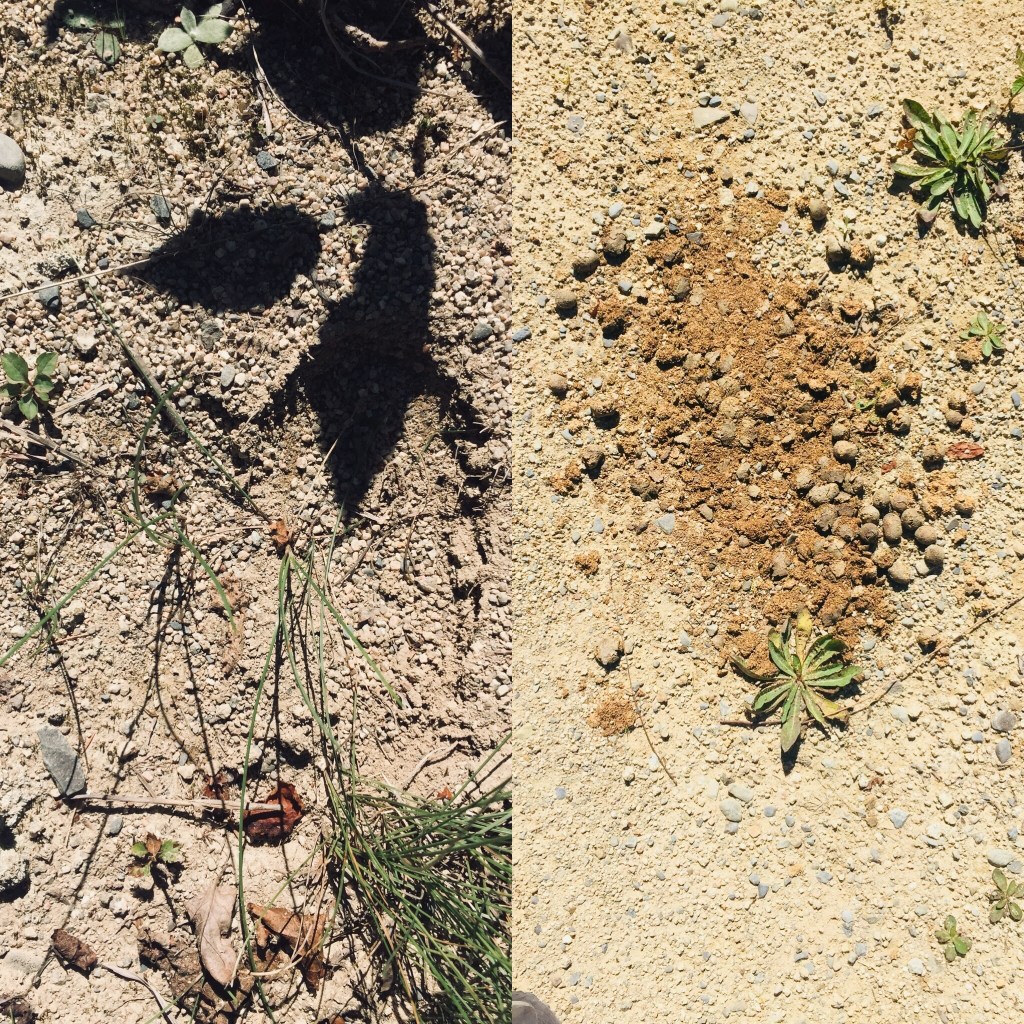
Moose tracks and droppings on the IAT
There are seven mountains in the Monument to hike, including Barnard, as well as paddling opportunities and waterfalls. The Loop Road was quiet, as were the trails, with natural sounds, and only a few others exploring the area. A bumpy drive back down Stacyville Road took us to Millinocket, where we devoured a Hawaiian pizza without remorse at the Millinocket House of Pizza.
Katahdin Woods and Waters National Monument is a special place, and we will be back there for hiking, biking, and paddling. The views during peak foliage season must be spectacular. Ensure you plan ahead, bring maps, and a cooler with water and snacks, as there are no facilities at the Monument, and cell coverage ranges from little to non-existent. But that’s probably what you’re looking for in the first place.