[Note: this is the ninth and final part of a series begun in summer 2017 of an attempt at the 100 Mile Wilderness by dad, 41, and daughter, 12]
Should it take ten days to do the 100 Mile Wilderness? Probably not. Should it take eight days in 2017, and two days in 2018? Doesn’t matter- it did. As described on the 100 Mile Wilderness page, we started in 2017, had a great time together, but dad and daughter decided after 75 miles that we would continue some other time. This summer, we were dying to get back out there, and when the last weekend in September 2018 opened up for us, we jumped at the chance to complete the final 25 miles.
By definition, it’s a wilderness, so starting 25 miles south of Abol Bridge took logistical support. For that, we were helped by the friendly people at the Appalachian Trail Lodge in Millinocket, a hostel open during the hiking season until October 15th. We were greeted by Ole Man (these are trail names) upon our arrival, stayed at the Earl Shaffer Room (clean, two twin beds, shared bathroom, WiFi) for $55 the night before, got delicious breakfast sandwiches and a massive chocolate donut down the street at the Appalachian Trail Cafe the morning we left, and used the reasonably priced Appalachian Trail Lodge shuttle service to leave our truck at Abol Bridge, and get dropped off at the south end of Lake Nahmakanta. We swapped shuttles halfway, as the larger van we rode back to Millinocket from Abol Bridge was needed for the eager thru-hikers headed to Baxter State Park, and we traveled south in an SUV that had recently been repaired after a charging moose had broken off the driver’s side mirror.
We learned a lot on our shuttle ride from NoKey, a 2012 AT thru-hiker working at the Appalachian Trail Lodge, who was friendly, professional, and added all kinds of value to what otherwise would have been just a cab ride over logging roads. We had just missed a large bull moose on the Golden Road, of which NoKey showed us a picture. We got the scoop on good (most) and bad (very few) shuttle services/guides, places to stay near Millinocket, the effect of the Katahdin Woods and Waters National Monument on tourism, area wildlife and history, saw a lynx crossing the road, got an update on bear activity in the area, and even got a lesser-known trail recommendation (Turtle Ridge Trail in Nahmakanta Public Lands). We also passed a large encampment by Cooper Brook, which was the location of an L.L. Bean promotional “Trail Magic” campaign along the AT.
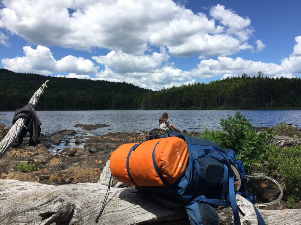
With that preamble, we got a mid-morning start at the south end of Lake Nahmakanta, and after a nostalgic moment on the windy beach, started walking north through the remote Nahmakanta Public Lands. Quickly, we saw large moose tracks and fresh droppings along the trail, and quickened our pace to try to see this animal, without success. We grudgingly adapted to having the heavy packs on our backs, and adjusted our day-hiker pace downward to accommodate the extra weight (we packed too much food). We stopped briefly at Wadleigh Stream Lean-to to crack open our Peanut Butter M&M’s, and noticed a plaque inside the lean-to honoring a hiker named Buffalo Bobby, who had passed away near this spot exactly 7 years before, 38 miles from finishing his third AT thru-hike. Wow. Rest in peace, BB.

By about 1 pm, we had reached the north summit of Nesuntabunt Mountain, and took the short side trail to view Nahmakanta Lake and far-off peaks. Then we sat down to make ourselves lunch, the same peanut butter, banana, and Nutella wraps we had used for energy on Katahdin a couple weeks before. A quick descent took us to the base of the mountain and around Crescent Pond to Pollywog Gorge.


The cliffs surrounding the gorge were impressive, but we were beginning to wear down, and didn’t linger. We crossed Pollywog Stream on a bridge, and made our way up Rainbow Stream to Rainbow Stream Lean-to a little before 5 pm, where a male thru-hiker and two female multi-day hikers we had seen earlier were getting ready for the night. This made it only a 10.7 mile day for us, but it felt like a lot more. The lean-to area quickly filled up with thru-hikers as the sun set. The thru-hikers we saw were exhausted, broken, and profane, but unfailingly friendly, polite, and focused on the last stretch of trail to Katahdin.
We set up our tent, which was complicated by a broken pole, repaired with a mostly ineffective combination of duct tape, twine, and tent stakes. We lay out our bedding, refilled our water, cooked dinner (Chicken Teriyaki Mountain House meal), hung our food in a bear bag, and were in our sleeping bags by 7 pm, fading into sleep despite the loud conversations by the lean-to campfire.
It was a cold night, and we were uncomfortable, with neither of us sleeping well. Our sleeping bags and pads were up to the task, but we both agreed in the morning that we need to figure out how to pack pillows with us. Also, dad’s snoring woke up daughter, and daughter poking dad to stop his snoring woke up dad, creating the worst sort of perpetual motion machine throughout the night.
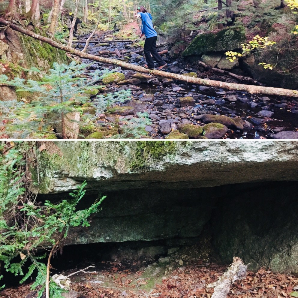
Daughter explored the campsite area in the morning, finding a precarious log bridge across Rainbow Stream to an animal den in a rock cave, possibly the former resting place of a bear. We peeked inside the den, seeing the small skull of an unfortunate prey animal. Dad made instant coffee and mixed in one of daughter’s hot chocolate packets for some more flavor in an attempt to wake up.

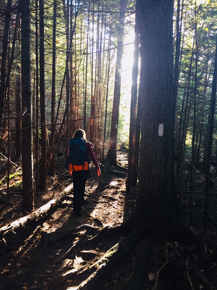
We packed quickly and got moving around 7:30 AM, moving along the edge of the Rainbow Deadwaters. The trail was beautiful, and we marveled at spiderwebs covered in dew, and the unique morning light in the North Woods. We also heard late-season loons calling from Rainbow Lake.
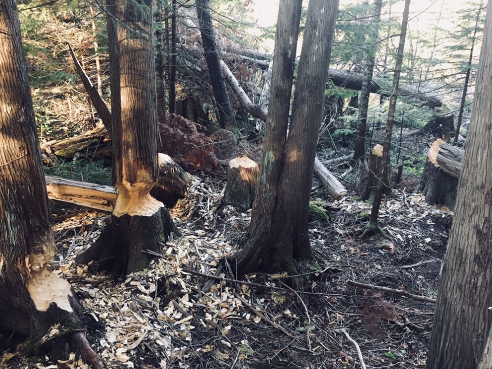
Daughter said that the Hobbit movies could have been filmed here, a recognition of the dramatic, colorful terrain that we tend to associate with movies, and so rarely see in person. We saw a root formation overtaking a tree that looked like a giant spider. As far as mythical creatures go, the west end of Rainbow Lake was the site of what can only be described as a beaver Armageddon, with fallen trees every which way across the trail.
We stopped for a break by Rainbow Spring Campsite. The privy there was filled with trail graffiti, including the signature of someone whose trail name was “The Privy Destroyer.” This harkened back to irreverent trail names scrawled inside the Appalachian Trail Cafe that had amused daughter, including “Swamp Butt.”
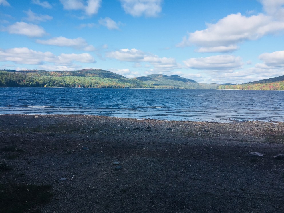
We continued past side trails to Rainbow Mountain and Big Beaver Pond in the Debsconeag Lakes Wilderness Area, stopping to check out Rainbow Lake (the largest lake on the 100 MW) from several rocky openings along the trail. On one stop, we cooked a Mountain House chicken and rice meal for lunch, and let it cool while we walked. When we sat down about fifteen minutes later to eat, it was perfect. Daughter was already sick of the Nutella and lavash bread, so the hot lunch was a good change-up. We also used this time to air out our feet, and change into clean, dry socks.
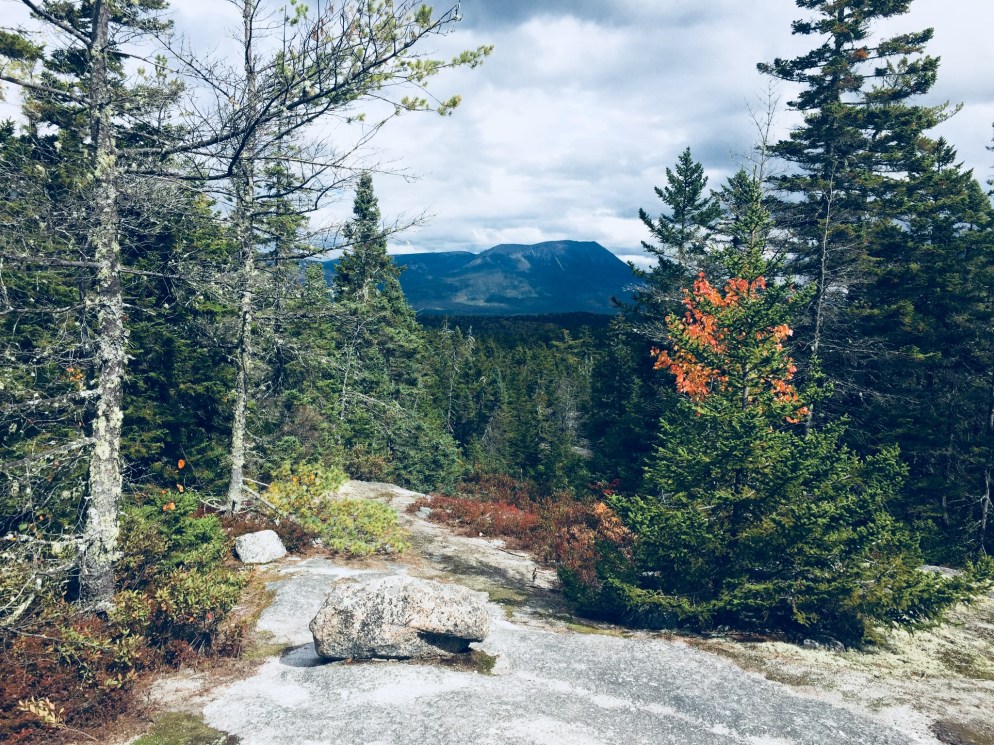
Rainbow Ledges was a steady climb, with colorful foliage and views from the high point back to the White Cap range, and forward, towards Katahdin. We remembered crossing the White Cap range a year ago on the 4th of July, and the pea soup fog that hindered our summit views that day. Sadly, we ran out of Peanut Butter M&M’s during this Rainbow Ledges ascent, which had a devastating effect on morale. From here, we descended through the ever-changing forest and down well-set rock staircases to Hurd Brook Lean-To.

The last few miles seemed to last the longest, as they always do. There weren’t many landmarks on the home stretch to Abol Bridge. The descriptive note, “Interesting area of large boulders and large hemlock trees,” on AT Map 1 at 2.2 miles from Abol Bridge, seemed superfluous after 100 miles of interesting rocks and trees. Suddenly, we were faced with a sign warning us that we were 100 miles north of Monson, and that we should have a minimum of 10 days supplies if we were heading south. We realized we were almost done, and saw the Golden Road peeking through the trees ahead.

We trudged across Abol Bridge in the late afternoon, completing our 15 mile day. We stopped by the Abol Bridge Campground store to buy some Gatorade, then got back in our truck, and drove out the Golden Road towards Millinocket. The Millinocket House of Pizza is daughter’s restaurant of choice, and she called in an order enroute for a large Hawaiian pizza as soon as cell service returned.
The soreness in our shoulders and knees and the chafing from the packs would fade in time, but completing the 100 Mile Wilderness together had been important to both of us. The cool, bug-free fall weather and colorful foliage were unexpected bonuses. To immerse yourself into the Wilderness, to walk there, sleep there on the ground, listen to the sounds of birds, bathe in the lakes, and then bring back out everything you came in with, is to feel shared ownership of this special place, where most people never go. Even in our weary haste at the end to finish, we had talked about new challenges, and also bringing memories of this hike back with us. As we split the pizza, we talked about our hike, and planned a lazy day for tomorrow.
Like this post? Go all the way through. Try: