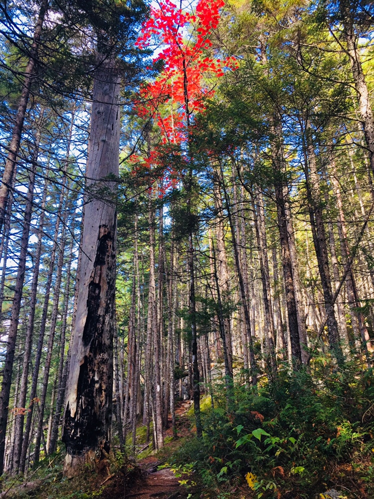
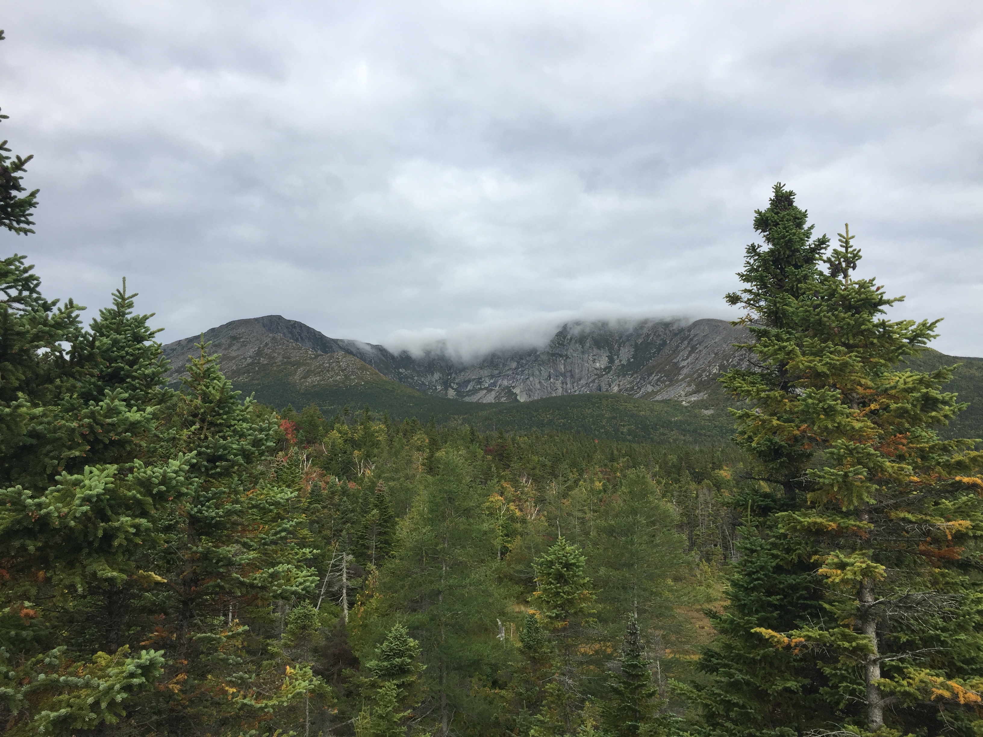
View from Barren Ledges on Barren Mountain, 100 Mile Wilderness.
Overview
With the right preparation, the 100 Mile Wilderness (100MW) can be a challenging but enjoyable eight-day hike (and for thru-hikers and experienced “speedhikers,” who can rip off 20-mile days, substantially less). Dad (then 41) and daughter (then 12) completed this in two segments in 2017 and 2018. We definitely allowed ourselves extra time to enjoy places we liked, or to recover from wet gear or injuries, so plan on ten days. Our 100 Mile Wilderness journey finally complete, we took a look back and came up with a better plan of attack. So, here is our guide, with a suggested itinerary, and a packing list.
Direction: There are arguments for going south to north (like we did), or alternately, starting at Abol Bridge, and finishing in Monson. The northern part is substantially flatter (read: faster) terrain, so starting with a heavy pack might be easier north-south, eating up food weight as you move south. But starting from the south, and climbing over the Barren-Chairback and White Cap ranges might make your tired legs want to finish with the more gently rolling terrain of the north.
Timing: When we started the 100 MW, we did so at the end of June/beginning of July. Once we got down from the higher elevations, the heat was oppressive, and the bugs were brutal. We later finished the 100 MW at the end of September, and it was cold at night, but pleasant during the day, and there were no bugs. I think a happy medium would be the beginning of September (assuming your work/school/life allows this), which would still be warm enough to enjoy dips in the lakes and streams, cool enough at night to sleep well, and at the very tail end of bug season. One caveat to this plan – AT Lean-To’s and tent sites may be fairly full, as many thru-hikers will be making their last push to Katahdin. Check out this summary from The Trek of thru-hiker tips for the 100MW, including a 5-day itinerary. Some water sources may also be dry by this time of summer, depending on the rains. Speaking of which, watch the weather forecast – water crossings can be treacherous after heavy rains further upstream.
Resupply: We didn’t do this, but it’s worth considering. Some purists believe that it’s cheating, but lightening your pack enough to enjoy your walk in the woods might help a great deal, and it’s your hike. Shaw’s Hiker Hostel (Monson), the Appalachian Trail Lodge (Millinocket), and 100 Mile Wilderness Adventures and Outfitters are reputable providers who can coordinate food drops for you along the 100MW. They can also provide advice, shuttle service, Baxter/Katahdin permits, help you stage your vehicle at either end, and provide a place to stay before and/or after.
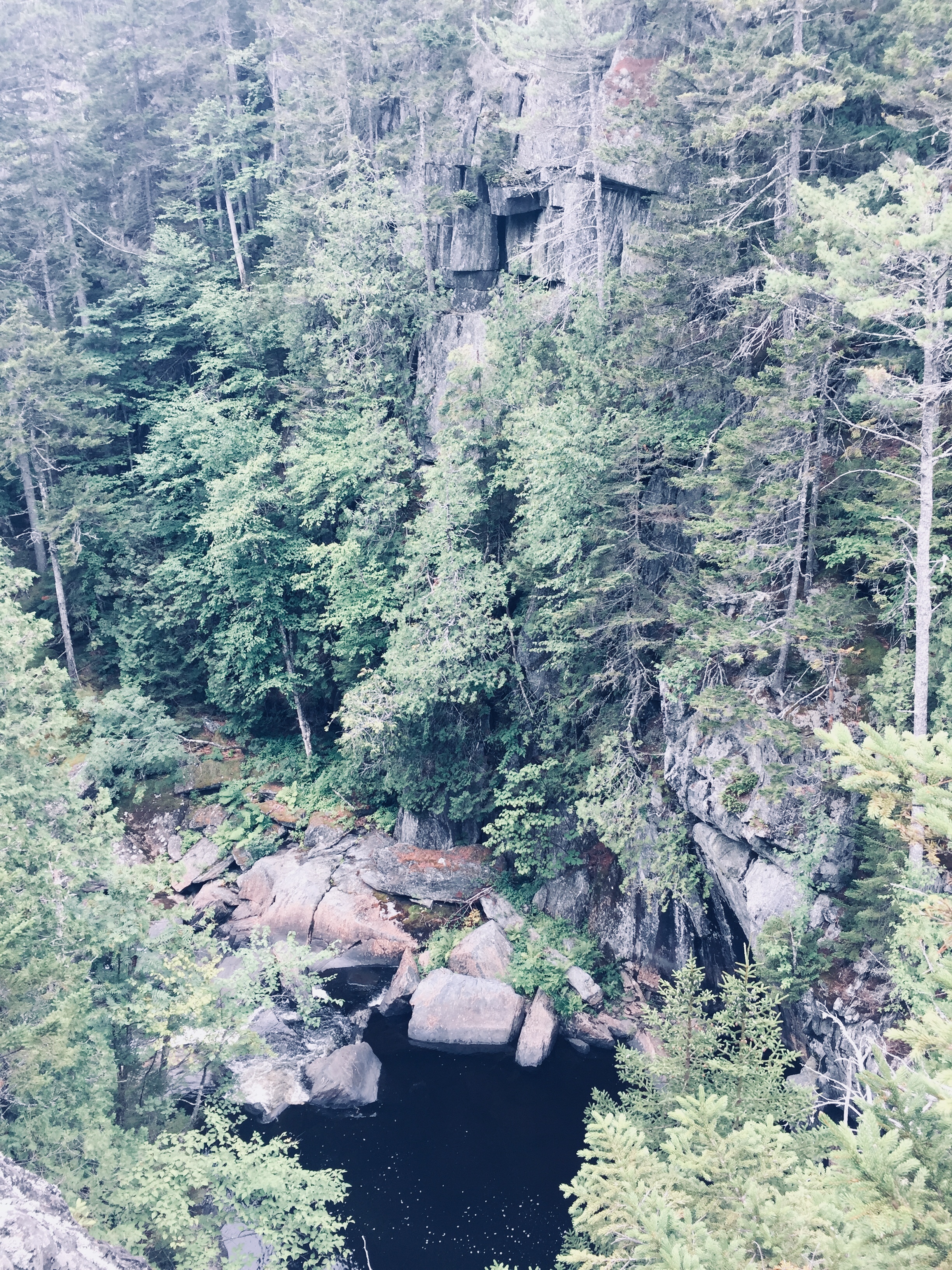
Gulf Hagas, a gem hidden in the 100 Mile Wilderness of Maine’s Appalachian Trail, has been dubbed the “Grand Canyon of the East.” Recently, this moderate (in difficulty, not grandeur) hike along the West Branch of the Pleasant River is getting more press, for better or worse, including mentions in Outside Online’s Best Hike In Every State, and in the Sep/Oct 2019 Outside Magazine print edition. Why? Waterfalls! Appalachian Trail! Beautiful rock formations! Swimming holes! Moose (well, moose droppings, anyway)! This is what you can tell any curmudgeons (I won’t name names) who come bearing excuses like, “too many bugs” or “that sounds like a lot of walking” or “I don’t have hiking boots.”
Gulf Hagas is located near the small town of Brownville, ME, about 3.3 hours from Portland and accessible through the gatehouse at Katahdin Iron Works Road (and two other checkpoints). The Katahdin Iron Works (KI) Jo-Mary Multiple Use Management Area is a region of about 175,000 acres of privately owned commercial forest, wedged conveniently between Moosehead Lake and Baxter State Park. All visitors – even those who are not camping – must stop at the gatehouse to pay the day use fee (and the camping fee if you are camping). They accept cash or check – and more cash than you might expect. On our recent camping and hiking weekend to celebrate the end of summer, four adults and one child camping for two nights and hiking for two days was $176 (under 18 is free). Information on fees can be found at North Maine Woods site. Also, pay attention while you are driving on those roads- the pot holes will get ya.
The gatekeeper at KI gate was friendly and helpful and happy to answer my questions about swimming holes and the state of the privy/outhouse at the campsite (brand new). I regret not asking him about a good spot to see a moose because I got the sense he would have known. The maps available at the gate (or print in advance here) of the area and of Gulf Hagas are particularly useful.
A small poplar grows at the top of the remaining Katahdin Iron Works furnace by the KI Gate.
I would recommend camping at the KI/Jo Mary campsites. Unless you are one of the few people that live nearby, you are going to want to relax somewhere after you hike for several hours. We lucked out and got one of those late summer weekends where the evenings require jackets, the campfire is crowded and the days warm up enough to be in shorts. Late August in Maine!
Our camping site (Pleasant River #1) was sandwiched between a clean, quiet, shallow river and a dusty road that had about 4-5 cars per hour go by during the day. It included a new outhouse which (no joke) smelled like fresh pine when we arrived. The site had enough privacy and except for a few barks from a dog at a nearby camp site, we did not hear the neighbors. The covered picnic table was perfect for providing shade.
Pleasant River Campsites managed by KI Jo-Mary, Inc., near Gulf Hagas
I was practicing the art of low-maintenance and so decided this would be the trip that I would go without a pillow. I spent the first night with my head on a hard-sided duffel bag, cursing this decision. Alas, nobody will ever say about me that “all she needed was a small patch of land to lay her weary head.” Turns out I need a blow-up mattress and a pillow. And chocolate. And delicious “camping-easy” coffee that even has some health benefits. It is a splurge, but when you are camping without a pillow, you will want that coffee.
We set up three tents in the three nooks of the large site, which had a great mix of sun and shade and was approximately 3.5 miles from the trailhead. My sole complaint was the road. Given the ruggedness of the road, the dust and the clouds of marijuana smoke billowing from passing cars, my advice would be to drive to the trailhead as opposed to walk. Save your energy for the gorgeous scenery along the Gulf Hagas Rim Trail! This is the hike with all the oohs and ahhs.
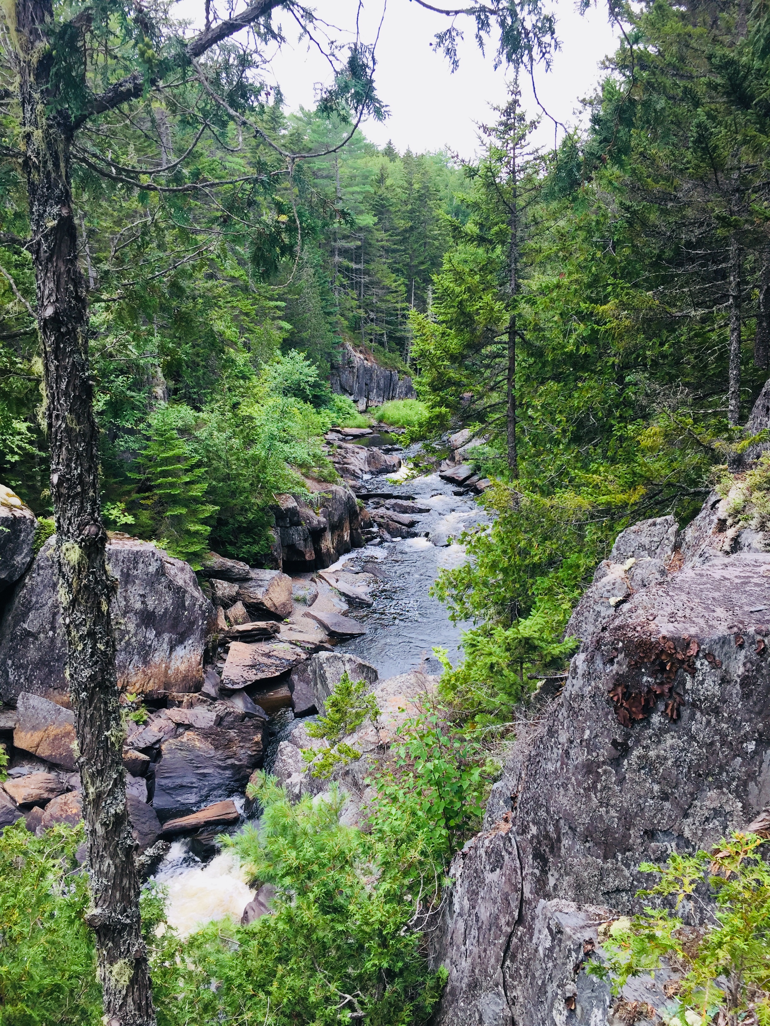
The trailhead for the Gulf Hagas Rim Trail is well-marked and on this sunny August Saturday the parking lot was overflowing. Several wooden hiking sticks rested next to the large trail map, to borrow for fording the river which comes at approximately .2 miles into the walk. Fortunately, the river was shallow and only reached mid-calf in the deepest areas. Because of the slippery rocks, I would highly recommend a walking stick or hiking poles and water shoes – my daughter crossed in bare feet but it did not look pleasant. The depth of the water varies from season to season and in dangerous conditions, there are other ways to hike the trail without crossing the river.
Crossing W. Branch of Pleasant River on AT on way to Rim Trail, Gulf Hagas
After the river crossing, you are on the Appalachian Trail. I was impressed with all those hikers who had walked perhaps since Georgia. Follow those white blazes, through The Hermitage (lots of huge, old white pine trees and hemlocks) and continue to the Rim Trail, where you say goodbye to the folks who are walking the 100-Mile Wilderness of the AT and you follow the blue blazes instead.
We took the Rim Trail along the water and then returned along the Pleasant River Tote Trail. See map here. In total, with all the small side trails to viewpoints, it is about 9 miles and there is an option to make a smaller loop, if you take the Appalachian Trail cutoff. Alternately, Gulf Hagas can be reached from a parking area for the Head of the Gulf Trail (opposite end from the AT), closer to the Greenville Road.
Many families with small children appeared to turn around at Screw Auger Falls or Buttermilk Falls. Several people were jumping into the water at Screw Auger Falls and it was the busiest spot along the walk. Everyone in our party seemed to be allergic to big groups of people (Husband mumbled something about Disneyland) and so we moved along. Certainly on a hot day this would be a great spot to cool off and I can’t imagine a more picturesque spot.
The hike does not include significant elevation and it is well marked. There are some little scrambles over rocks that a well-placed hiking pole or a tree branch would help with, but otherwise it is what I would call moderate. The AMC Maine Mountain Guide suggested allowing 4 hrs and 25 minutes for the loop, which is reasonable. We took plenty of breaks to relax and snack, and completed it in about 6 hours.
The trail has plenty of quiet, scenic areas to stop and sit and rest and stick your feet in the water while eating a peanut butter and jelly sandwich. My group had a couple of stoves and made sophisticated camping meals and hot tea. Daughter is a huge fan of Mountain House Chili Mac while the breakfast favorite was the Peak Refuel Breakfast Skillet. The JetBoil camping stove continues to impress in its efficiency.
We took the Pleasant River Tote Trail back and it was scenic in its own right – meandering woodland paths – quiet, green and easy. The walk back was much faster than the hike along the Rim Trail and the river crossing that you complete again to get back to the parking lot was refreshing on tired feet.
For post-hike refreshment, we enjoyed the cool river by the campsite, grilled hamburgers and beer and wine, and watching kingfishers and small, fast-moving ducks move by. But if you are headed back towards Portland, consider stopping at Bissell Brothers Brewing Three Rivers on Elm Street in Milo (turn right at Dot Rd just before the red train car). According to the cheery bartender, their double IPA, Preserve and Protect, is a tribute to the brothers’ father, Jensen Bissell, who was the Director of Baxter State Park for thirty years. A Katahdin benchmark is imprinted in the bar, as well. Please stop by soon, though, as an open letter on their site advises that the Bissell location, open since July 2018, will close at the end of summer 2024.
Katahdin benchmark in the bar at Bissell Brothers Three Rivers in Milo, ME
The now-famous Bissell Brothers beers are all available on tap, and delicious food is also available for purchase outside. Relax on the outdoor patio, and watch or play cornhole and ping-pong – all without the bustle at their Portland location. And continuing towards the turnpike in Dover-Foxcroft is Butterfields Ice Cream, serving up unbelievable ice cream flavors (and now, burgers, fries, and lobster rolls) since 1950.
Gulf Hagas is a memorable day-hike with friends and family, customizable to each person’s individual abilities, with memorable scenery unique to Maine’s 100-Mile Wilderness.
Fall colors on Pollywog Stream, 100 Mile Wilderness
[Note: this is the ninth and final part of a series begun in summer 2017 of an attempt at the 100 Mile Wilderness by dad, 41, and daughter, 12]
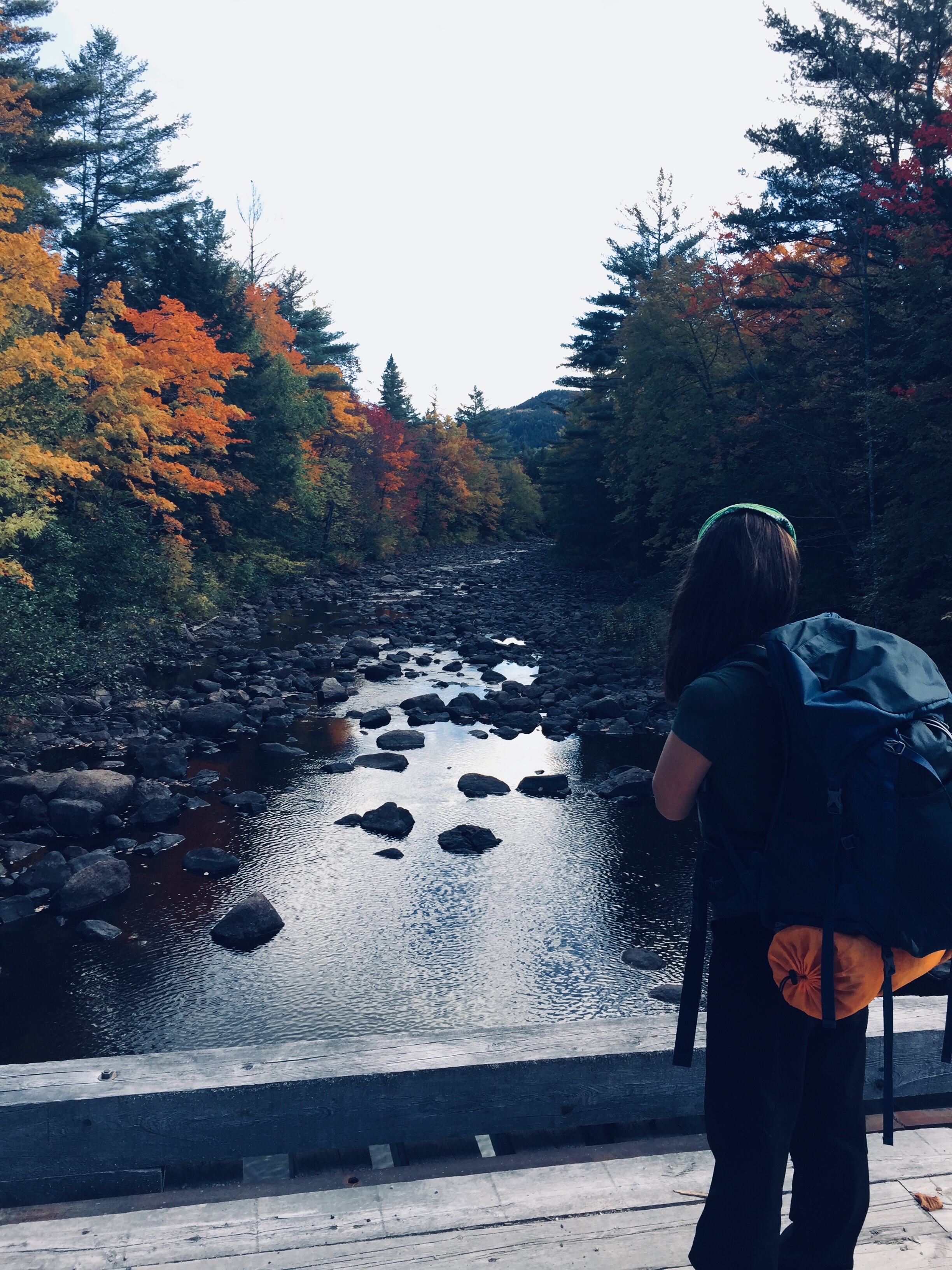
Should it take ten days to do the 100 Mile Wilderness? Probably not. Should it take eight days in 2017, and two days in 2018? Doesn’t matter- it did. As described on the 100 Mile Wilderness page, we started in 2017, had a great time together, but dad and daughter decided after 75 miles that we would continue some other time. This summer, we were dying to get back out there, and when the last weekend in September 2018 opened up for us, we jumped at the chance to complete the final 25 miles.
By definition, it’s a wilderness, so starting 25 miles south of Abol Bridge took logistical support. For that, we were helped by the friendly people at the Appalachian Trail Lodge in Millinocket, a hostel open during the hiking season until October 15th. We were greeted by Ole Man (these are trail names) upon our arrival, stayed at the Earl Shaffer Room (clean, two twin beds, shared bathroom, WiFi) for $55 the night before, got delicious breakfast sandwiches and a massive chocolate donut down the street at the Appalachian Trail Cafe the morning we left, and used the reasonably priced Appalachian Trail Lodge shuttle service to leave our truck at Abol Bridge, and get dropped off at the south end of Lake Nahmakanta. We swapped shuttles halfway, as the larger van we rode back to Millinocket from Abol Bridge was needed for the eager thru-hikers headed to Baxter State Park, and we traveled south in an SUV that had recently been repaired after a charging moose had broken off the driver’s side mirror.
We learned a lot on our shuttle ride from NoKey, a 2012 AT thru-hiker working at the Appalachian Trail Lodge, who was friendly, professional, and added all kinds of value to what otherwise would have been just a cab ride over logging roads. We had just missed a large bull moose on the Golden Road, of which NoKey showed us a picture. We got the scoop on good (most) and bad (very few) shuttle services/guides, places to stay near Millinocket, the effect of the Katahdin Woods and Waters National Monument on tourism, area wildlife and history, saw a lynx crossing the road, got an update on bear activity in the area, and even got a lesser-known trail recommendation (Turtle Ridge Trail in Nahmakanta Public Lands). We also passed a large encampment by Cooper Brook, which was the location of an L.L. Bean promotional “Trail Magic” campaign along the AT.
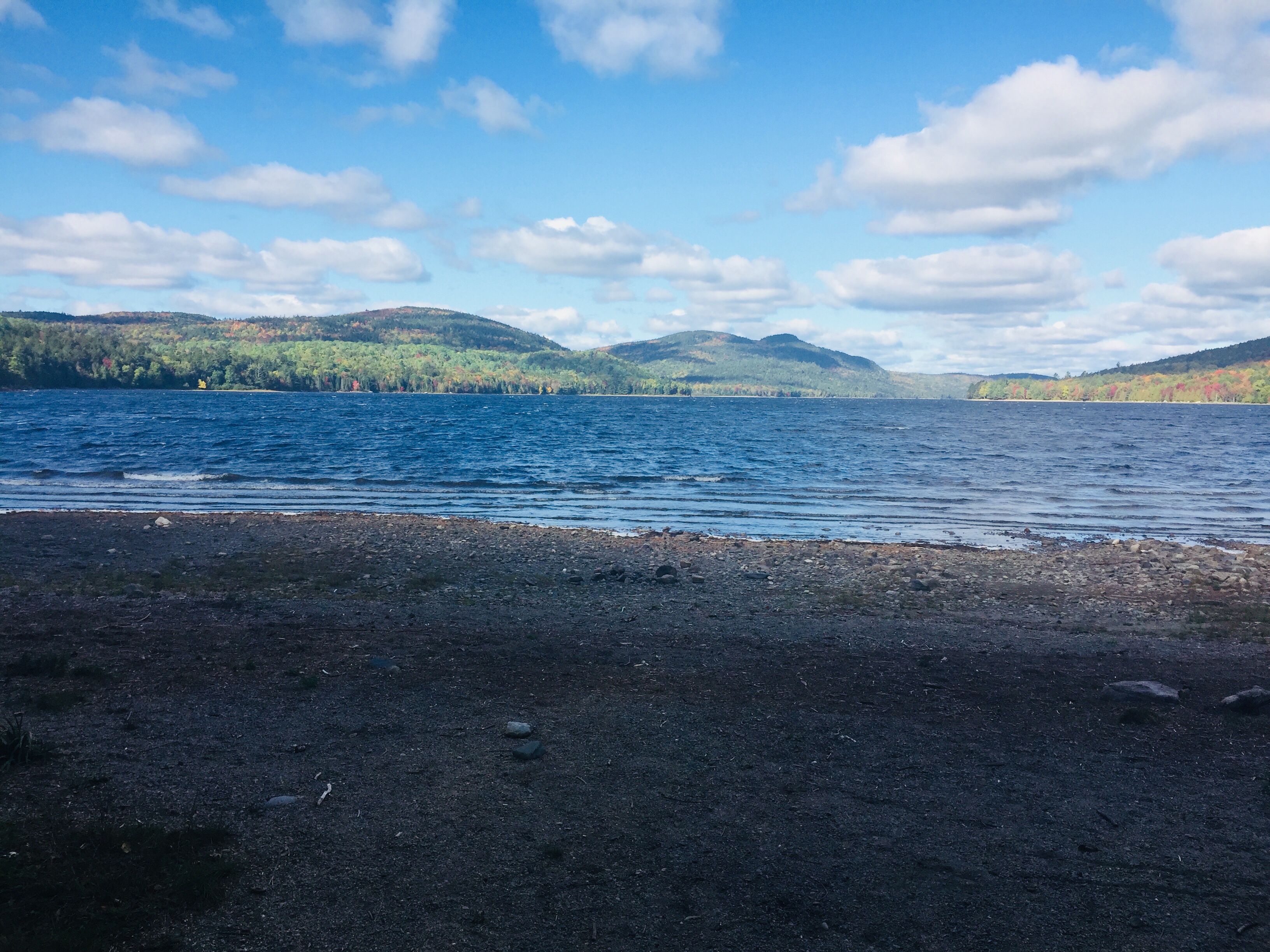
The beach at the south end of Lake Nahmakanta.
With that preamble, we got a mid-morning start at the south end of Lake Nahmakanta, and after a nostalgic moment on the windy beach, started walking north through the remote Nahmakanta Public Lands. Quickly, we saw large moose tracks and fresh droppings along the trail, and quickened our pace to try to see this animal, without success. We grudgingly adapted to having the heavy packs on our backs, and adjusted our day-hiker pace downward to accommodate the extra weight (we packed too much food). We stopped briefly at Wadleigh Stream Lean-to to crack open our Peanut Butter M&M’s, and noticed a plaque inside the lean-to honoring a hiker named Buffalo Bobby, who had passed away near this spot exactly 7 years before, 38 miles from finishing his third AT thru-hike. Wow. Rest in peace, BB.
Landscape and foliage views from north summit of Nesuntabunt Mountain.
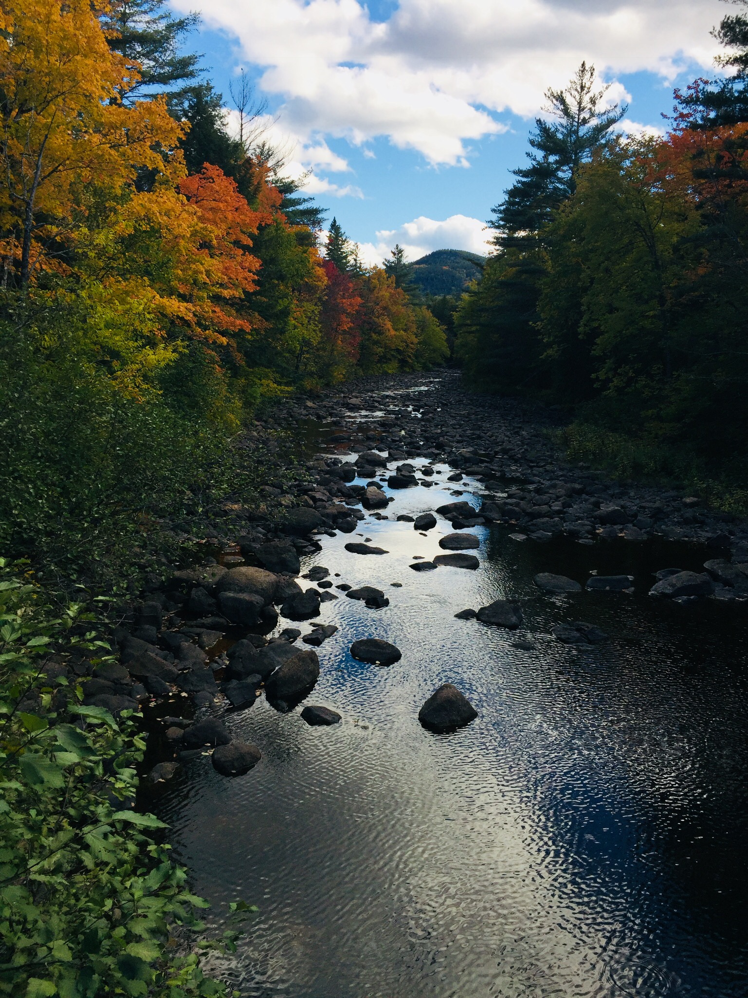
By about 1 pm, we had reached the north summit of Nesuntabunt Mountain, and took the short side trail to view Nahmakanta Lake and far-off peaks. Then we sat down to make ourselves lunch, the same peanut butter, banana, and Nutella wraps we had used for energy on Katahdin a couple weeks before. A quick descent took us to the base of the mountain and around Crescent Pond to Pollywog Gorge.
Fall colors on the AT near Pollywog Gorge
Changing leaves along Pollywog Stream.
The cliffs surrounding the gorge were impressive, but we were beginning to wear down, and didn’t linger. We crossed Pollywog Stream on a bridge, and made our way up Rainbow Stream to Rainbow Stream Lean-to a little before 5 pm, where a male thru-hiker and two female multi-day hikers we had seen earlier were getting ready for the night. This made it only a 10.7 mile day for us, but it felt like a lot more. The lean-to area quickly filled up with thru-hikers as the sun set. The thru-hikers we saw were exhausted, broken, and profane, but unfailingly friendly, polite, and focused on the last stretch of trail to Katahdin.
We set up our tent, which was complicated by a broken pole, repaired with a mostly ineffective combination of duct tape, twine, and tent stakes. We lay out our bedding, refilled our water, cooked dinner (Chicken Teriyaki Mountain House meal), hung our food in a bear bag, and were in our sleeping bags by 7 pm, fading into sleep despite the loud conversations by the lean-to campfire.
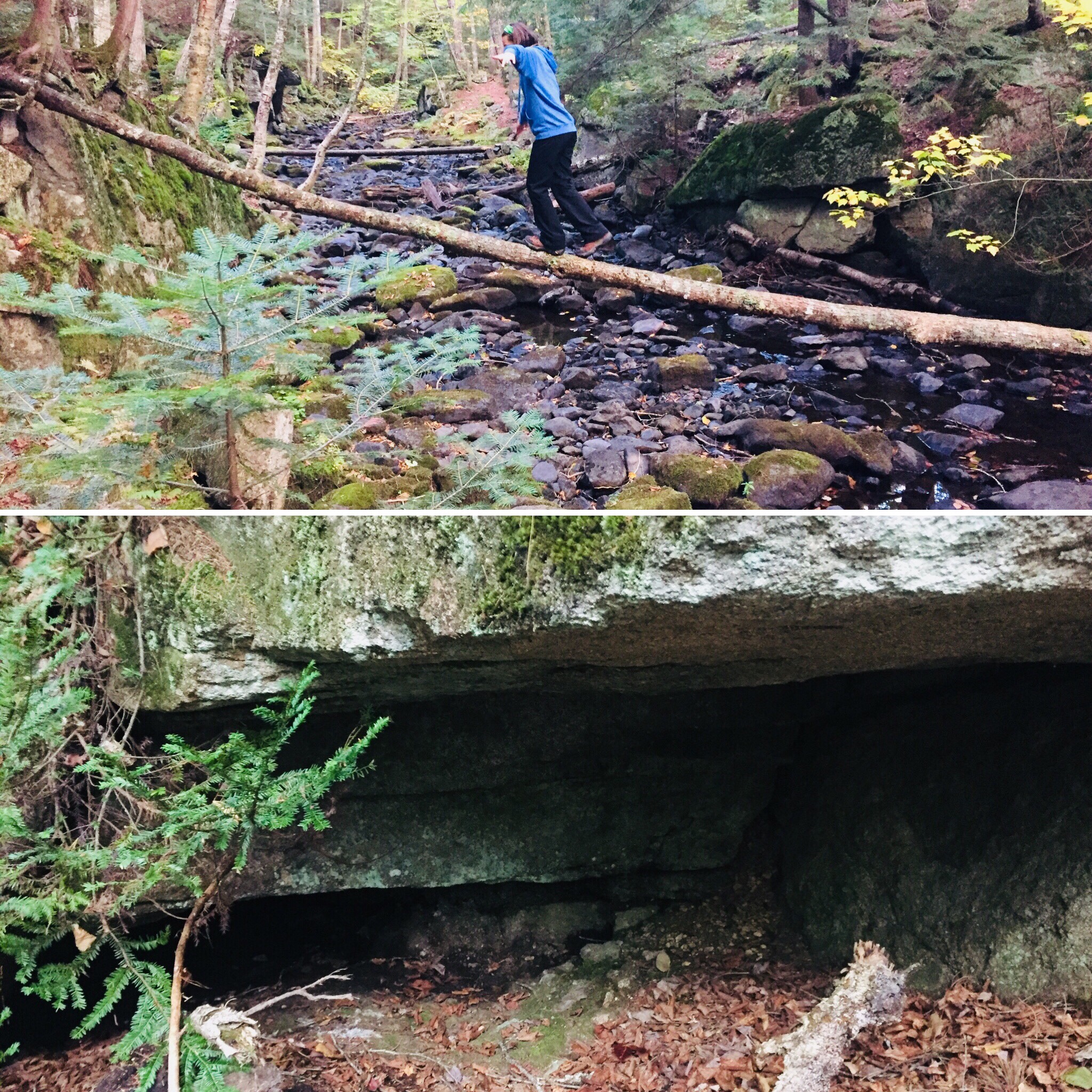
Log bridge and animal den.
It was a cold night, and we were uncomfortable, with neither of us sleeping well. Our sleeping bags and pads were up to the task, but we both agreed in the morning that we need to figure out how to pack pillows with us. Also, dad’s snoring woke up daughter, and daughter poking dad to stop his snoring woke up dad, creating the worst sort of perpetual motion machine throughout the night.
Daughter explored the campsite area in the morning, finding a precarious log bridge across Rainbow Stream to an animal den in a rock cave, possibly the former resting place of a bear. We peeked inside the den, seeing the small skull of an unfortunate prey animal. Dad made instant coffee and mixed in one of daughter’s hot chocolate packets for some more flavor in an attempt to wake up.
Morning light on the Rainbow Deadwaters.
We packed quickly and got moving around 7:30 AM, moving along the edge of the Rainbow Deadwaters. The trail was beautiful, and we marveled at spiderwebs covered in dew, and the unique morning light in the North Woods. We also heard late-season loons calling from Rainbow Lake.
Illuminated trail by Rainbow Lake.
Daughter said that the Hobbit movies could have been filmed here, a recognition of the dramatic, colorful terrain that we tend to associate with movies, and so rarely see in person. We saw a root formation overtaking a tree that looked like a giant spider. As far as mythical creatures go, the west end of Rainbow Lake was the site of what can only be described as a beaver Armageddon, with fallen trees every which way across the trail.
Beaver Armageddon
We stopped for a break by Rainbow Spring Campsite. The privy there was filled with trail graffiti, including the signature of someone whose trail name was “The Privy Destroyer.” This harkened back to irreverent trail names scrawled inside the Appalachian Trail Cafe that had amused daughter, including “Swamp Butt.”
We continued past side trails to Rainbow Mountain and Big Beaver Pond in the Debsconeag Lakes Wilderness Area, stopping to check out Rainbow Lake (the largest lake on the 100 MW) from several rocky openings along the trail. On one stop, we cooked a Mountain House chicken and rice meal for lunch, and let it cool while we walked. When we sat down about fifteen minutes later to eat, it was perfect. Daughter was already sick of the Nutella and lavash bread, so the hot lunch was a good change-up. We also used this time to air out our feet, and change into clean, dry socks.
View of Katahdin from Rainbow Ledges.
Rainbow Ledges was a steady climb, with colorful foliage and views from the high point back to the White Cap range, and forward, towards Katahdin. We remembered crossing the White Cap range a year ago on the 4th of July, and the pea soup fog that hindered our summit views that day. Sadly, we ran out of Peanut Butter M&M’s during this Rainbow Ledges ascent, which had a devastating effect on morale. From here, we descended through the ever-changing forest and down well-set rock staircases to Hurd Brook Lean-To.
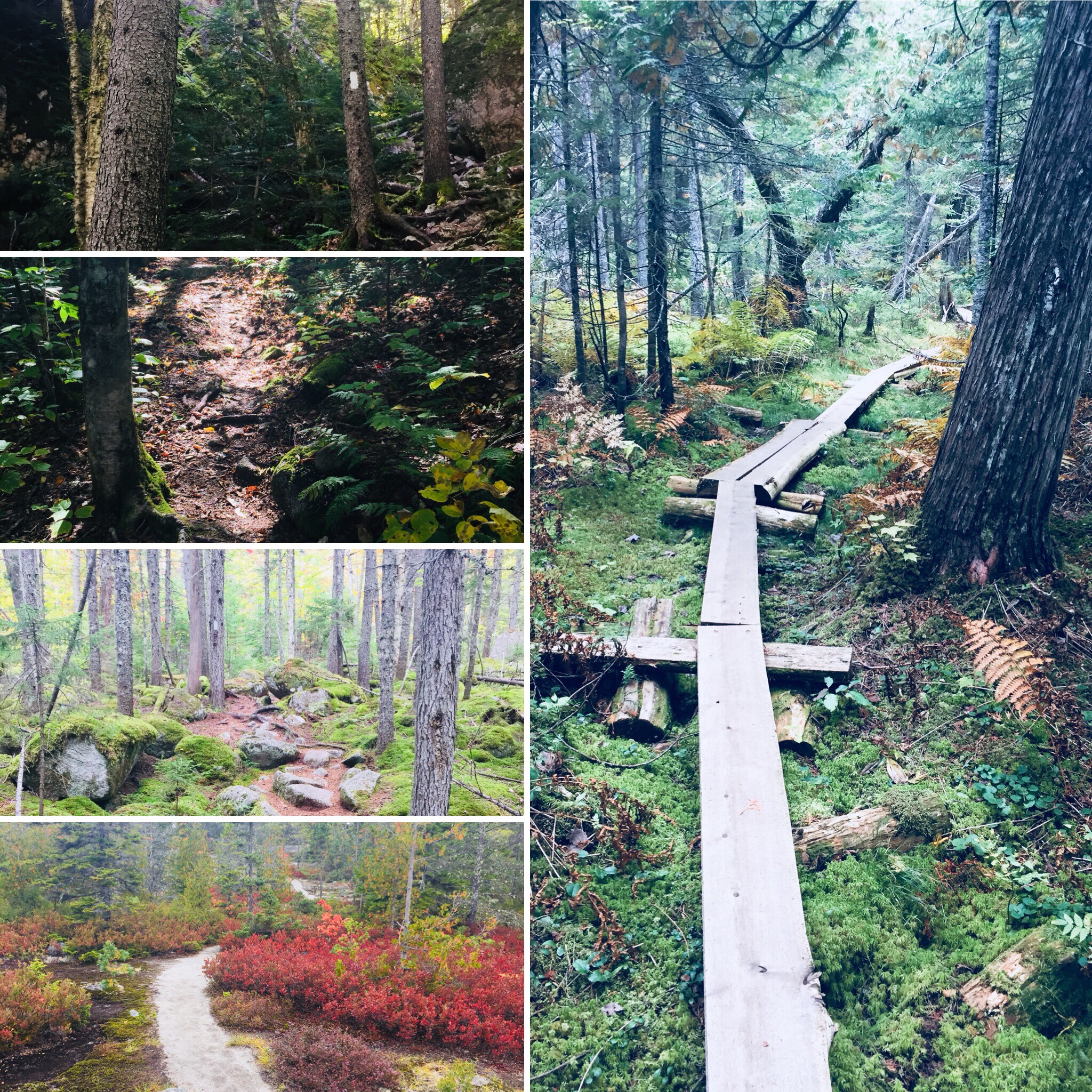
Different vegetation, incline, and make-up of the trail over just a 25-mile section.
The last few miles seemed to last the longest, as they always do. There weren’t many landmarks on the home stretch to Abol Bridge. The descriptive note, “Interesting area of large boulders and large hemlock trees,” on AT Map 1 at 2.2 miles from Abol Bridge, seemed superfluous after 100 miles of interesting rocks and trees. Suddenly, we were faced with a sign warning us that we were 100 miles north of Monson, and that we should have a minimum of 10 days supplies if we were heading south. We realized we were almost done, and saw the Golden Road peeking through the trees ahead.
Katahdin and the West Branch of the Penobscot from Abol Bridge.
We trudged across Abol Bridge in the late afternoon, completing our 15 mile day. We stopped by the Abol Bridge Campground store to buy some Gatorade, then got back in our truck, and drove out the Golden Road towards Millinocket. The Millinocket House of Pizza is daughter’s restaurant of choice, and she called in an order enroute for a large Hawaiian pizza as soon as cell service returned.
The soreness in our shoulders and knees and the chafing from the packs would fade in time, but completing the 100 Mile Wilderness together had been important to both of us. The cool, bug-free fall weather and colorful foliage were unexpected bonuses. To immerse yourself into the Wilderness, to walk there, sleep there on the ground, listen to the sounds of birds, bathe in the lakes, and then bring back out everything you came in with, is to feel shared ownership of this special place, where most people never go. Even in our weary haste at the end to finish, we had talked about new challenges, and also bringing memories of this hike back with us. As we split the pizza, we talked about our hike, and planned a lazy day for tomorrow.
Maine’s seasons are different than those of our neighbors to the south- sometimes the resolutions of the New Year are still buried under several feet of snow, even at the beginning of Daylight Savings. I believe it’s important to get outside in the winter either way, but this article will focus on planning for the traditional hiking season.
Step 1: Create a difficult, even unrealistic goal.
How we did it in 2017: In the winter of 2016-2017, we decided to attempt the 100 Mile Wilderness. The difficulty of this task forced us to create a training schedule, and to prepare our gear and bodies one piece at a time for a “capstone” hike, so that we were not fully ready for it until we stepped onto the trail. The training then became part of the journey, instead of being a series of unrelated excursions. And we also had a blast doing it.
How you can do it in 2018: Pick a goal, and plan for it. Check out this great article by Carey Kish on Ten Great Hikes You Should Do in 2018. Or this one, again from Maine Today, on 10 Brag-Worthy Hikes in New England. Pick one outside your comfort zone, something you haven’t done before. If you are a more experienced hiker or backpacker, do the same with longer, multi-day hikes. Try the Section Hiker blog for ideas. Great ideas in the area include Maine’s Bigelow Range, the Presidential Traverse in New Hampshire, and even the Long Trail in Vermont. Or maybe you are tired of explaining why you have lived in Maine for X number of years, and never been to Katahdin’s summit. Make it challenging.
Step 2: Make yourself accountable, find a partner if you can, and lock in your plans.
How we did it in 2017: Daughter and dad agreed on our training plan and final goal. Hiking together is fun. We told people (family, friends, co-workers, gear salespeople) we were going to hike the 100 Mile Wilderness together. That made it hard to back out. We also set aside vacation days for the attempt, and later, booked a Baxter State Park parking pass ahead of time for Katahdin. Planning is fun, too, and having these outdoor excursions to look forward to can be soothing, depending on your life situation and “day job.”
How you can do it in 2018: Start with the end goal in mind, and back up to the current day, making incremental additions to your training plan. For accountability, book your arrangements early (vacation days, lodging, re-supply) so you are motivated to follow up on your investment. Put everything on a calendar. In general, buying a state park season pass is a good deal, and will prompt you to get out there. Maine’s is $55 for individuals, or $105 for a vehicle pass, and free for seniors. The White Mountain National Forest offers an annual pass for $30, and an annual household pass for $40. These passes also allow you to forgo the hassle of trying to find a pen and exact change at the many self-service kiosks at trailheads, and to support our great parks.
Step 3: Let experts do the work for you.
How we did it in 2017: We devoured the books and blog posts we could find on the 100 Mile Wilderness (check this out), and purchased the Appalachian Mountain Club Guide to Maine, as well as the maps for the 100 Mile. For our training hikes, we consulted the Maine Mountain Guide and the White Mountain Guide (skip to Recommended Hikes, get in the car, and go).
How you can do it in 2018: Buy the AMC Maine Mountain Guide and White Mountain Guide. Just do it. They come with maps, they are well-researched, portable, and can serve as a journal for hikes completed. Also, follow Philip Werner’s Section Hiker blog (mentioned above) and Carey Kish’s columns on Maine Today.com. Ask at Information Centers for actual information, and engage with park rangers and volunteers. In addition, join the Appalachian Mountain Club. It’s cheap, most of the membership fee is tax deductible, it supports trails, and they sponsor a ton of group activities/hikes for all skill levels. Follow the people above on Twitter to get updates and ideas, as well as publications like Backpacker Magazine and Outside, which also has an excellent podcast series.
Step 4: If your plans are disrupted, do “something” anyway.
How we did it in 2017: We couldn’t always get out on the trail. School, work, travel, injuries, commitments came up that kept us out of the woods. But we figured out ways to work through. Daughter played basketball, and dad focused on weight room exercises (lunges, box jumps, squats) that strengthened legs for the terrain of the 100 Mile. We skied. On a couple weekends we couldn’t hike, or were out of town somewhere, we signed up for several 5K road races – try Running In The USA. The way to get better at doing hard things is to do hard things. Just do something.
How you can do it in 2018: Shorter hikes can be very rewarding when time is not on your side. Try a big-payoff one like Burnt Meadow Mountain or Pleasant Mountain, steep hikes with great views. Try trail running, which is just hiking’s skinnier cousin. There are trail running groups throughout Maine. Baxter Outdoors does a great race series, which might take you to some places you haven’t been, help you meet some like-minded people, benefit charity, and get some free beer. Here are some tips to get ready for hiking with a pack from Backpacker Magazine. Understand your limits, particularly with an injury, but focus on the things that you can do. For example, dad broke his right wrist descending Katahdin in September 2017, and this precluded a lot of activities, but still allowed him to hike, and as a result he developed more dexterity in his left hand. A caveat: all these things help, but hiking with a pack seems to be a singular exercise, and the best way to get better at hiking is to hike (see above regarding hard things).
Step 5: Let the momentum propel you to staying on the path.
How we did it in 2017: Despite our difficulties at the end of the 100 Mile attempt, we were both invigorated by the hiking we’d done, and talked about more goals. Daughter had never climbed Mt. Washington or Katahdin, and felt strong after our training. It was only mid-July, so the good times we’d had kept us hiking, and we completed both of these mountains, as well as some great hikes in between. We started taking more pictures, and talked about capturing our adventures in this blog, which we began last fall, right after our Katahdin hike.
How you can do it in 2018: Use the aforementioned accountability to keep you going, locked in to activities, and check in with people who are doing the same. You will feel stronger each time you get out there, and maybe your goals will change by the time you hit your big hike. You will see intriguing side trails and places along the way. If you are into social media, use it to catalog your progress. You won’t find any “look at me shirtless doing yoga on top of a mountain” selfies on this blog, but if that’s your thing, and helps you… Either way you will have fun and get outside.
(Disclaimer: This post contains affiliate links, and as an Amazon Associate Hiking in Maine blog earns from qualifying purchases.)