For the best foliage hikes, I often return to the White Mountain National Forest (WMNF), which has the perfect mix of pine and deciduous forest, displayed in sunny tiers, to boost the powerful colors of fall in New England. Albany Mountain (1,930 ft) in south Oxford county, near Bethel, on the eastern edge of WMNF, is a relatively easy climb for the quality of its views, which include a variety of fall colors spread across the forests, lakes, and hills leading to the White Mountains to the west. The hike is fully described in the Maine Mountain Guide, and downloadable maps are available from the site of the U.S. Forest Service, which manages the WMNF. A small parking area with a trail map and information kiosk is located off Crocker Pond Road in WMNF. From here, the yellow-blazed trail led through a yellow, green and orange October forest. Strategically placed rocks bridged small streams, and cut swaths on the margins let light into the surrounding forest.
Maine’s seasons are different than those of our neighbors to the south- sometimes the resolutions of the New Year are still buried under several feet of snow, even at the beginning of Daylight Savings. I believe it’s important to get outside in the winter either way, but this article will focus on planning for the traditional hiking season.
Step 1: Create a difficult, even unrealistic goal.
How we did it in 2017: In the winter of 2016-2017, we decided to attempt the 100 Mile Wilderness. The difficulty of this task forced us to create a training schedule, and to prepare our gear and bodies one piece at a time for a “capstone” hike, so that we were not fully ready for it until we stepped onto the trail. The training then became part of the journey, instead of being a series of unrelated excursions. And we also had a blast doing it.
How you can do it in 2018: Pick a goal, and plan for it. Check out this great article by Carey Kish on Ten Great Hikes You Should Do in 2018. Or this one, again from Maine Today, on 10 Brag-Worthy Hikes in New England. Pick one outside your comfort zone, something you haven’t done before. If you are a more experienced hiker or backpacker, do the same with longer, multi-day hikes. Try the Section Hiker blog for ideas. Great ideas in the area include Maine’s Bigelow Range, the Presidential Traverse in New Hampshire, and even the Long Trail in Vermont. Or maybe you are tired of explaining why you have lived in Maine for X number of years, and never been to Katahdin’s summit. Make it challenging.
Step 2: Make yourself accountable, find a partner if you can, and lock in your plans.
How we did it in 2017: Daughter and dad agreed on our training plan and final goal. Hiking together is fun. We told people (family, friends, co-workers, gear salespeople) we were going to hike the 100 Mile Wilderness together. That made it hard to back out. We also set aside vacation days for the attempt, and later, booked a Baxter State Park parking pass ahead of time for Katahdin. Planning is fun, too, and having these outdoor excursions to look forward to can be soothing, depending on your life situation and “day job.”
How you can do it in 2018: Start with the end goal in mind, and back up to the current day, making incremental additions to your training plan. For accountability, book your arrangements early (vacation days, lodging, re-supply) so you are motivated to follow up on your investment. Put everything on a calendar. In general, buying a state park season pass is a good deal, and will prompt you to get out there. Maine’s is $55 for individuals, or $105 for a vehicle pass, and free for seniors. The White Mountain National Forest offers an annual pass for $30, and an annual household pass for $40. These passes also allow you to forgo the hassle of trying to find a pen and exact change at the many self-service kiosks at trailheads, and to support our great parks.
Step 3: Let experts do the work for you.
How we did it in 2017: We devoured the books and blog posts we could find on the 100 Mile Wilderness (check this out), and purchased the Appalachian Mountain Club Guide to Maine, as well as the maps for the 100 Mile. For our training hikes, we consulted the Maine Mountain Guide and the White Mountain Guide (skip to Recommended Hikes, get in the car, and go).
How you can do it in 2018: Buy the AMC Maine Mountain Guide and White Mountain Guide. Just do it. They come with maps, they are well-researched, portable, and can serve as a journal for hikes completed. Also, follow Philip Werner’s Section Hiker blog (mentioned above) and Carey Kish’s columns on Maine Today.com. Ask at Information Centers for actual information, and engage with park rangers and volunteers. In addition, join the Appalachian Mountain Club. It’s cheap, most of the membership fee is tax deductible, it supports trails, and they sponsor a ton of group activities/hikes for all skill levels. Follow the people above on Twitter to get updates and ideas, as well as publications like Backpacker Magazine and Outside, which also has an excellent podcast series.
Step 4: If your plans are disrupted, do “something” anyway.
How we did it in 2017: We couldn’t always get out on the trail. School, work, travel, injuries, commitments came up that kept us out of the woods. But we figured out ways to work through. Daughter played basketball, and dad focused on weight room exercises (lunges, box jumps, squats) that strengthened legs for the terrain of the 100 Mile. We skied. On a couple weekends we couldn’t hike, or were out of town somewhere, we signed up for several 5K road races – try Running In The USA. The way to get better at doing hard things is to do hard things. Just do something.
How you can do it in 2018: Shorter hikes can be very rewarding when time is not on your side. Try a big-payoff one like Burnt Meadow Mountain or Pleasant Mountain, steep hikes with great views. Try trail running, which is just hiking’s skinnier cousin. There are trail running groups throughout Maine. Baxter Outdoors does a great race series, which might take you to some places you haven’t been, help you meet some like-minded people, benefit charity, and get some free beer. Here are some tips to get ready for hiking with a pack from Backpacker Magazine. Understand your limits, particularly with an injury, but focus on the things that you can do. For example, dad broke his right wrist descending Katahdin in September 2017, and this precluded a lot of activities, but still allowed him to hike, and as a result he developed more dexterity in his left hand. A caveat: all these things help, but hiking with a pack seems to be a singular exercise, and the best way to get better at hiking is to hike (see above regarding hard things).
Step 5: Let the momentum propel you to staying on the path.
How we did it in 2017: Despite our difficulties at the end of the 100 Mile attempt, we were both invigorated by the hiking we’d done, and talked about more goals. Daughter had never climbed Mt. Washington or Katahdin, and felt strong after our training. It was only mid-July, so the good times we’d had kept us hiking, and we completed both of these mountains, as well as some great hikes in between. We started taking more pictures, and talked about capturing our adventures in this blog, which we began last fall, right after our Katahdin hike.
How you can do it in 2018: Use the aforementioned accountability to keep you going, locked in to activities, and check in with people who are doing the same. You will feel stronger each time you get out there, and maybe your goals will change by the time you hit your big hike. You will see intriguing side trails and places along the way. If you are into social media, use it to catalog your progress. You won’t find any “look at me shirtless doing yoga on top of a mountain” selfies on this blog, but if that’s your thing, and helps you… Either way you will have fun and get outside.
(Disclaimer: This post contains affiliate links, and as an Amazon Associate Hiking in Maine blog earns from qualifying purchases.)
Dad did Chocorua solo on August 30 and then came back with daughter on September 2, 2017 to do it again. This hike was suggested by friends, and planned using the AMC White Mountain Guide, making it part of the “and beyond” part of our stated “Pine Tree state and beyond” header, as the mountain is in Albany, NH.
There are several loops up and down this beautiful mountain, and dad took the Piper, Nickerson Ledge, Carter Ledge, Middle Sister, and Piper Trails up, then descended via the Liberty, Hammond, Weetamoo, and Piper Trails (9.6 mi). This trailhead is accessed from NH 16. Dad and daughter ascended on September 2 via the less challenging but equally scenic Champney Falls and Piper Trails (7.6 mi), accessed from the Kancamagus Highway. Both parking lots can be crowded in the summer, so we got an early start. From either starting point, there is a small cash use fee to the White Mountain National Forest, payable with cash at a kiosk (and bring a pen).
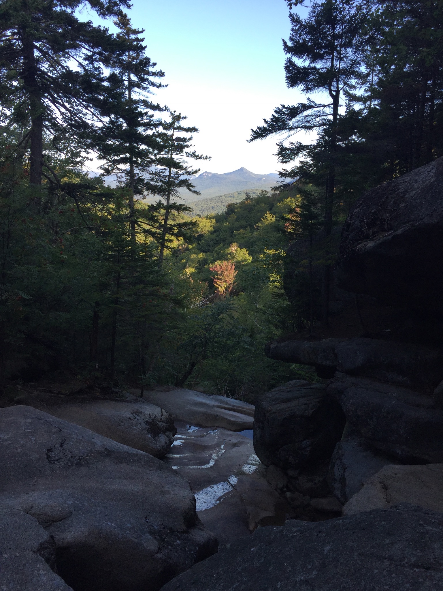
The trail climbs steadily up past Champney Falls and Pitcher Falls, which were not running with much force at this time of summer, but still worthwhile to see.
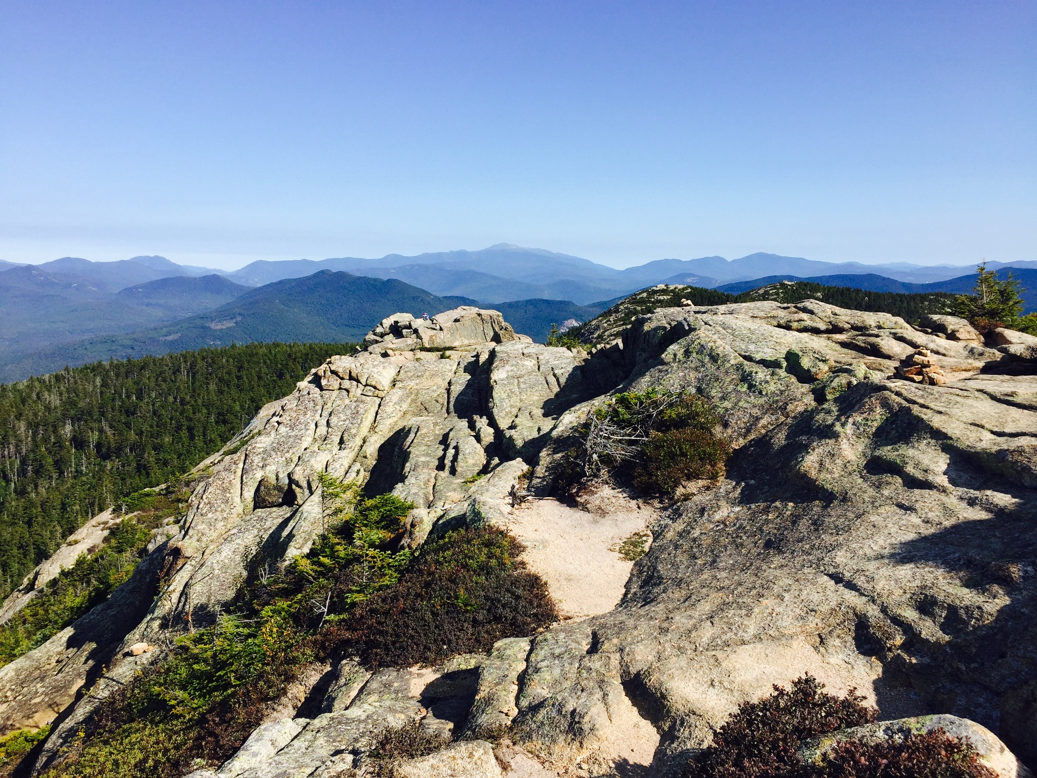
After the intersection with the Piper Trail, the vistas opened up, and we had fun making our way up to the windy summit in the morning sunlight.
The last scramble to the top involved some steeper climbing, which we enjoyed. We didn’t spend much time at the summit, as the wind was powerful. After the climb up, our descent was pleasant and uneventful. We did notice that the volume of hikers headed uphill increased dramatically as the day wore on, and felt good about getting an early start. Many people brought their dogs, and this seemed like a good hike with a pet, as long as they were careful near the top.
We enjoyed a great post-hike pizza at Brothers Original Pizza in Albany, NH, which has an outdoor deck, if you are so inclined. The air was chilly on this trip, but if you take the Champney Falls route, a short distance down the Kancamagus Highway is the Lower Falls Recreation Site, where you can cool off in the Swift River after the hike.
(Disclaimer: This post contains affiliate links, and as an Amazon Associate Hiking in Maine blog earns from qualifying purchases.)
On June 3, 2017, we tackled a challenging overnight hike to test out our tent and sleeping gear (and our leg power). We got the idea to attempt the Royce-Speckled Mountain Loop in the White Mountain National Forest (WMNF) and the Caribou-Speckled Mountain Wilderness from the awesome SectionHiker blog. This will be our first addition to our Links page, and this guy does an incredible job documenting hikes, gear, and everything else. See here for details and map of the Royce-Speckled Mountain Loop from this treasure trove of hiking and backpacking information. We loved the area, and you can check out our Caribou Mountain post for an alternate hike in the same area.
So, based upon internet research, trial and error, and sheer economics, we had settled on the Kelty Salida 2-person tent, and this was our first use of it while hiking. This is 3 lb 14 oz, comes with a very effective rain fly, and we bought a footprint for it, as well, all of which came in handy later during our 100 Mile Wilderness attempt. The Kelty Salida is easy to setup, cozy for two people (one big, one small), but enough space to sit up, and great for the elements. Our packs and boots were too big to fit inside, but we managed to wedge them comfortably under the rain fly.
For sleeping bags, on recommendation from our cousin, we both got the Marmot NanoWave 55, (dad in a long, and daughter in a regular length). These are insanely comfortable and packable, and we both enjoyed them.
Our sleeping pads were the Therm-a-Rest ProLite Mattress, again, comfortable and packable. We felt they made for a good balance of being lightweight and durable, but also thick enough to keep us warm, dry, and cushioned (mostly) from the ground.
We got a late (mid-morning) start on June 3 from the parking area at the Brickett Place on ME 113, and then walked down ME 113, turning toward the Cold River Campground to the Basin Pond area to pick up the Basin Trail. We enjoyed a break around noon at Hermit Falls.
From here, it was an extremely steep climb to the Rim Junction, where we took a sharp right and picked up the Basin Rim Trail.
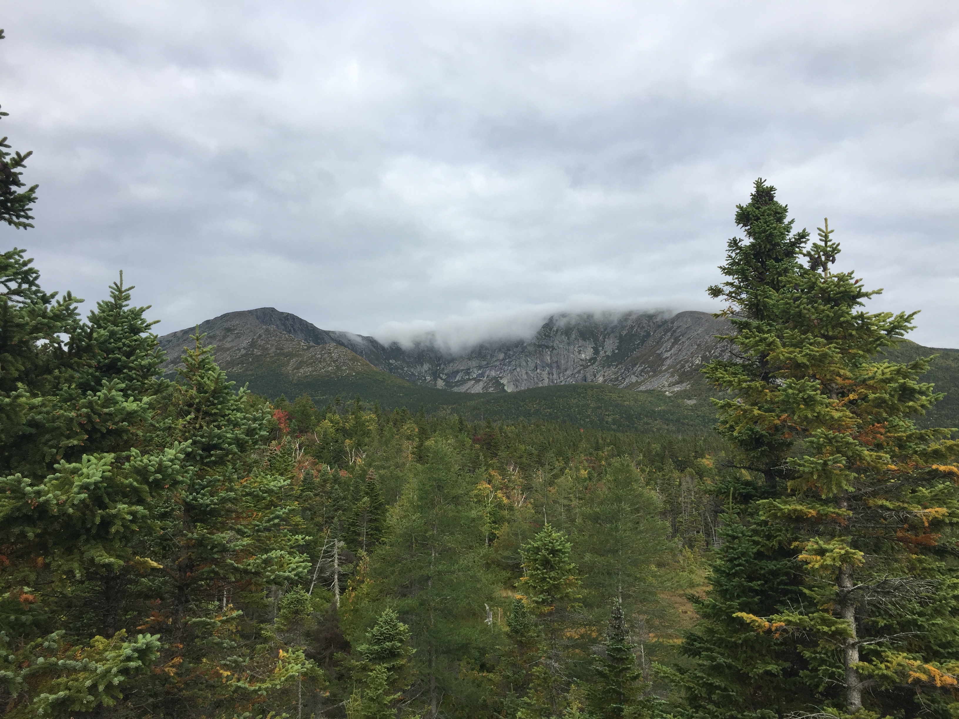
The ridge turned out to be a great spot to have lunch and look back over Basin Pond, and the progress we’d made. The weather turned cold and rainy as we ascended West Royce, and the footing became very difficult, slowing our progress.
We descended West Royce carefully, and the light started fading for us. Because we were losing daylight, we called an audible, bypassing the ascent and descent of East Royce, and continued on through Evans Notch to cross over ME 113 again, and started the gradual ascent of the Spruce Trail. We passed the no-camping boundary, and immediately began looking for a campsite off the trail, as it was closing in on 7 PM. Daughter began the set-up of the interior of the tent, while dad prepared the makeshift bear bag with Stuff Sacks and parachute cord. We enjoyed a well-earned hot dinner of Mountain House freeze-dried Italian style Pepper Steak, and fell asleep quickly.
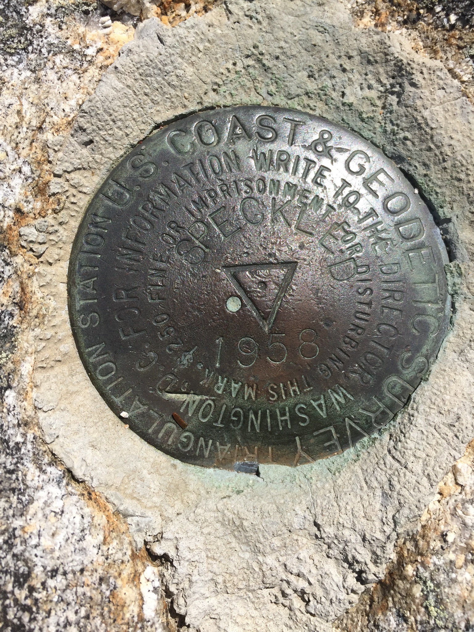
In the morning, we started early on the eastern side of our loop, enjoying the morning light and changing vegetation in the Caribou-Speckled Mountain Wilderness on the way up Spruce Hill, and hit the summit of Speckled Mountain around 9:30 in the morning, the view seen in the featured image at the top of this blog post.
The ridge hike across the Blueberry Ridge Trail yielded wonderful views, but the constant downhill and pounding over rock was difficult on daughter’s sore feet. The descent of Blueberry Mountain was slick and brutal, and hiking poles would have helped with balance and footing.
We stopped at Bickford Brook so that daughter could soak her feet in the icy brook. From there it was a short walk back to our car at the Brickett Place. We totaled about 14 miles, across some pretty rugged terrain, and enjoyed the test of our overnight equipment.
(Disclaimer: This post contains affiliate links, and as an Amazon Associate Hiking in Maine blog earns from qualifying purchases.)
The Caribou-Speckled Mountain Wilderness area inside the White Mountain National Forest (WMNF) is an accessible but vastly underrated area to hike in Maine, and we hope it stays that way. Uncrowded, beautiful and wild, but close enough to civilization, it is one of our favorite places. Another option is an overnight hike of the Royce-Speckled Mountain Loop. In October 2018, we hiked Caribou Mountain (2,850 ft) via the Caribou and Mud Brook Trails, a moderate 6.9 mile loop, which took us a bit over four hours. The idea (and map) for this hike again came from the indispensable Maine Mountain Guide’s recommended hikes (see our review of the 11th edition here), and did not disappoint. With fall foliage at its peak, the views were dazzling.
We again had wife/mom along as a guest, and we parked at the west trailhead on Rte 113 (Google Maps), from which both the Caribou Trail and Mud Brook Trail depart. The temperature hovered around 70 by late morning, definitely not an October feel, and we were all in t-shirts for most of the hike.
The Caribou trail weaves over and around Morrison Brook on the way up, and we stopped briefly at Kees Falls, which was impressive, but not running at full volume due to recent drought conditions. Shortly after the falls, we startled a comically fat raccoon, which stopped foraging, and disappeared (slowly, and with effort) up the opposite side of a tree. A steady uphill climb brought us to the Mud Brook Trail intersection, and we turned right for the final push to the summit, where we sat in the sun and enjoyed a snack.
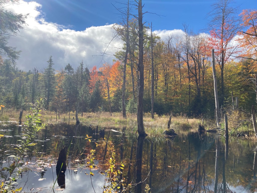
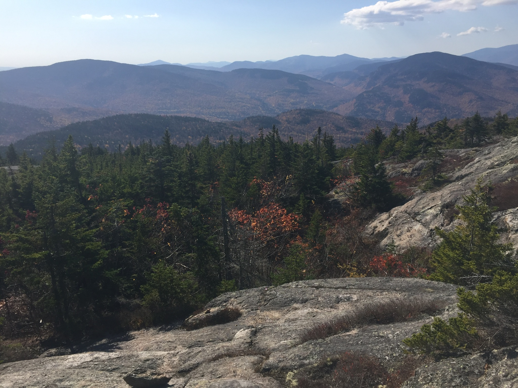
The views from the summit and the ledges below were incredible, highlighting the autumn colors.
Views from Caribou Mountain
Our descent was swift, and made us grateful that we had climbed via Caribou, rather then Mud Brook, which would have been more of a scramble, had we been moving uphill. The dry leaves made for uneasy footing, however, and we could have used some hiking poles to stabilize ourselves. The route from the summit to the treeline on Mud Brook was not well-marked, and there were some twists and turns, but we found our way.
Finished by late afternoon, we extended the outdoor day by enjoying a great meal and cold drinks at the screened-in dining area at Ebenezer’s Pub in Lovell, the perfect post-hike location.
(Disclaimer: This post contains affiliate links, and as an Amazon Associate Hiking in Maine blog earns from qualifying purchases.)