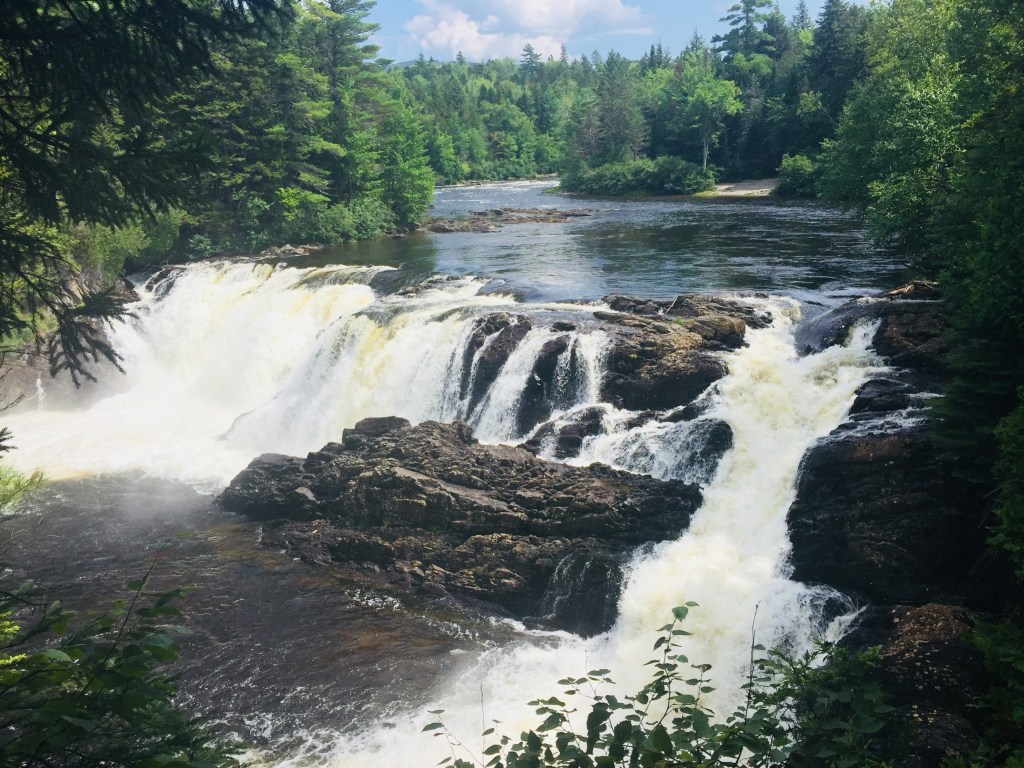
Falls at Grand Pitch of Webster Stream, Baxter State Park, ME
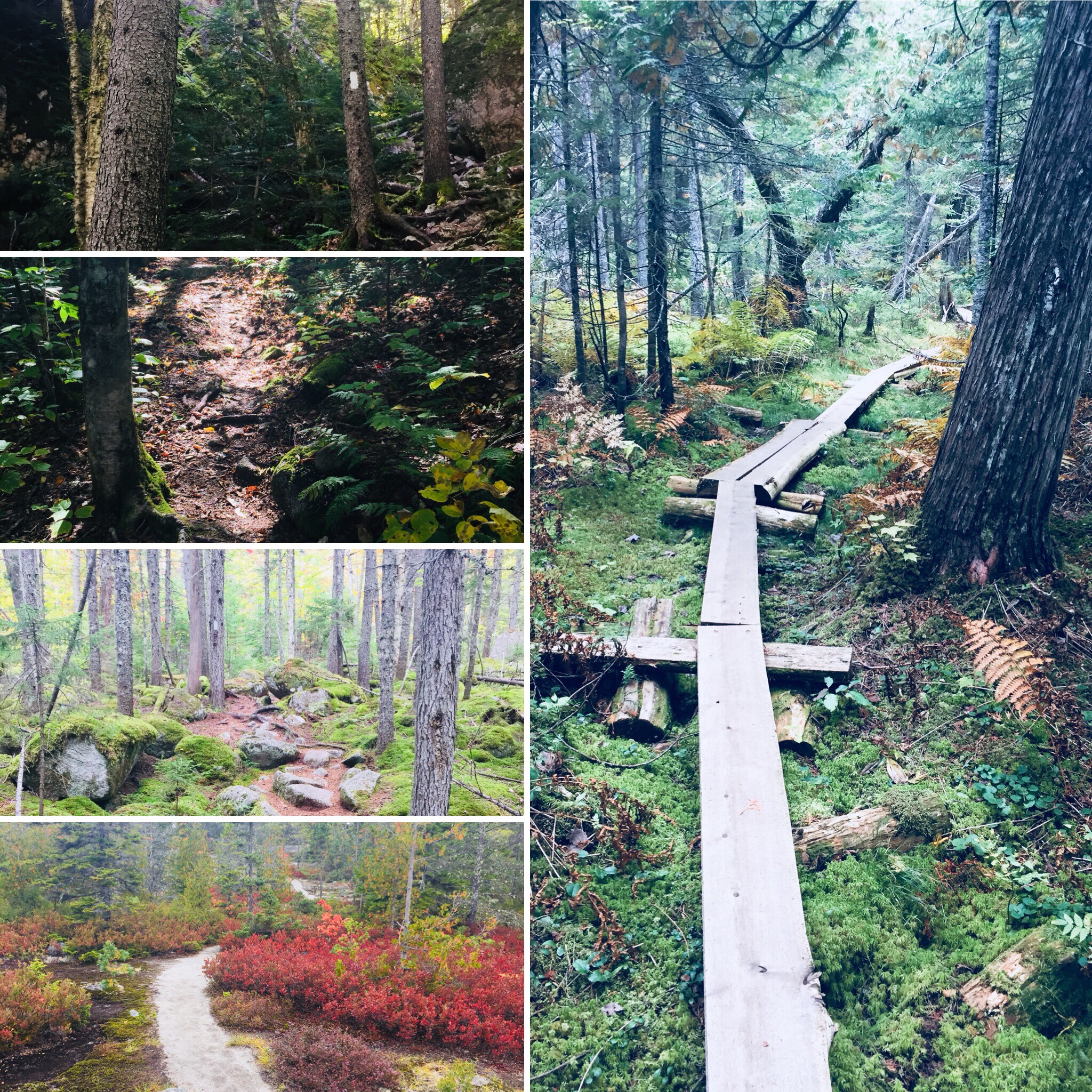
The Freezeout Trail at Baxter State Park (BSP) starts from the Day-Use Parking at Trout Brook Farm Campground, crossing a sturdy wooden bridge over the brook, which was mobbed by honking Canada geese when I hiked it in mid-September. The Freezeout Trail itself is a long one-way trail (14.4 miles) connecting Trout Brook Farm to the outlet of Webster Lake in Baxter’s Scientific Forest Management Area, and often included as a loop with the Wadleigh Brook and Frost Pond Trails, and/or as a backpacking trip utilizing the campsites along the way.
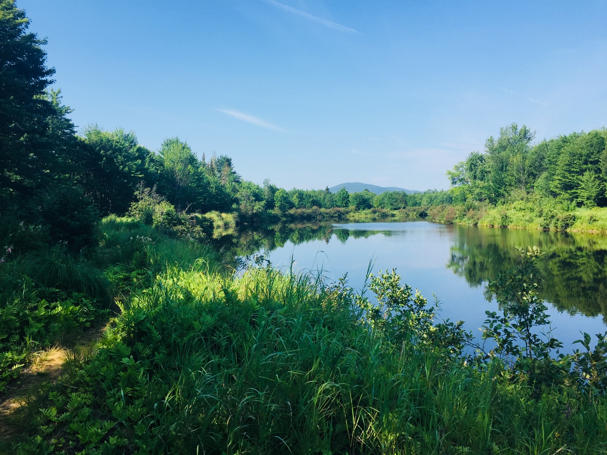
Freezeout Trail, Baxter State Park, ME
I navigated using AllTrails, on a route from Hiking Waterfalls Maine that took me to the Grand Pitch of Webster Stream, which the book accurately described as, “a long way from anywhere.” To the waterfalls and back was 12.86 miles, which I did in about four and-a-half hours, with a stop at the falls to cook a chili-mac meal on my JetBoil. The hike is usually described by guidebooks and BSP rangers as very buggy, but the chilly early fall morning made mosquitoes and flies a non-factor on this hike. After the third walk-in Trout Brook Farm tent site, there is a sign-in box for hikers.
Wildflowers on Freezeout Trail, Baxter State Park, ME
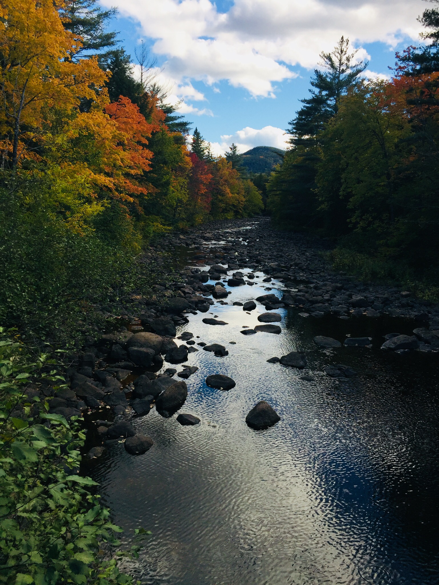
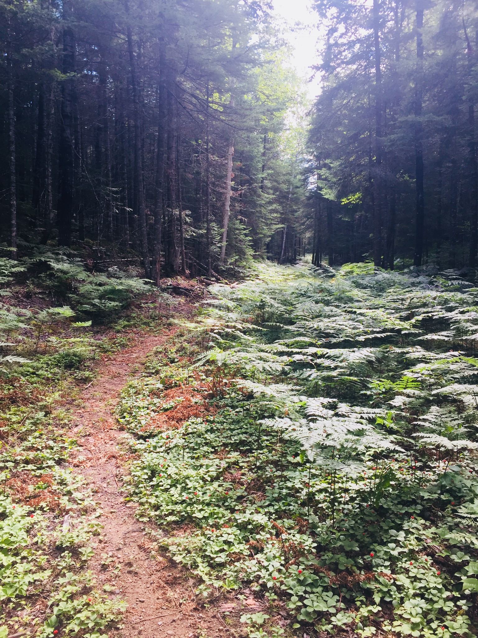
The trail was flat and fast, and a beautiful carpet of moss and princess pine lined the path. I had the trail to myself, with the pleasant chirping of birds throughout, and now and then the view of Grand Lake Matagamon to the right of me through the trees. At about one and-a-quarter miles I crossed a bridge over a small bog, passing aster and goldenrod flowers, and disturbed a small brown bird, a least flycatcher or pee-wee.
Beaver dam across large bog on Freezeout Trail, Baxter State Park, ME
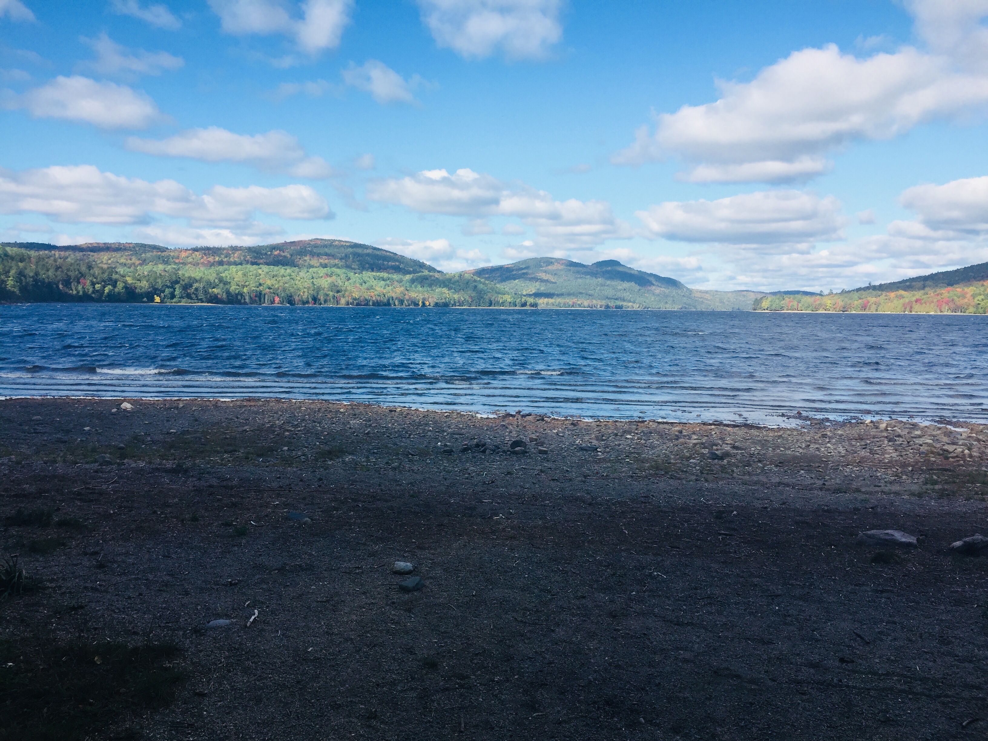
At a little under 2.5 miles I crossed another bog over a large beaver dam, and saw one of the beavers working about 100 yards away, weaving its way in a slalom between the flooded tree trunks. A side trail at 3.2 miles led to a large pile of sawdust remaining from mill operations, springy underfoot on the shores of Grand Lake Matagamon. I stopped here for a snack on jerky and looked at the waters, while a solitary belted kingfisher plied the shoreline. A drifting loon joined the chorus of bird sound, and then dove under silently.
Sawdust pile on shore of Grand Lake Matagamon, Freezeout Trail, Baxter State Park, ME
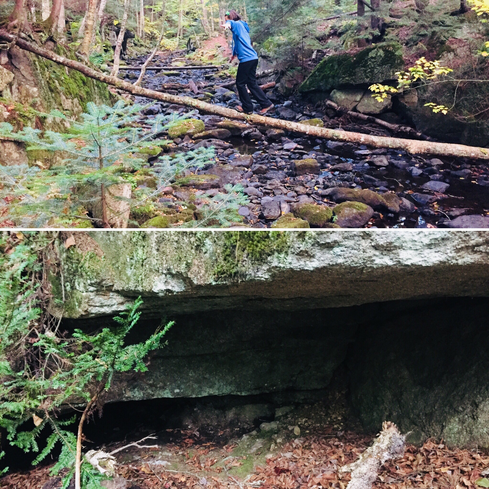
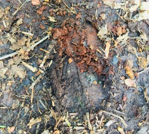
As I turned up the shore to continue north on the Freezeout Trail, I noticed fairly clear, new bear tracks in the sawdust, and bear scat on the trail. At about 4.2 miles, the Frost Pond Trail came in from the left, and I continued to see the lake through the trees. The trail here was a little wider as I continued towards Webster Stream. At about 5.2 miles I stopped at the Northwest Cove tent site to take a look at the lake where a cormorant was drying its wings on a log extending from the water, then I continued up the Freezeout Trail.
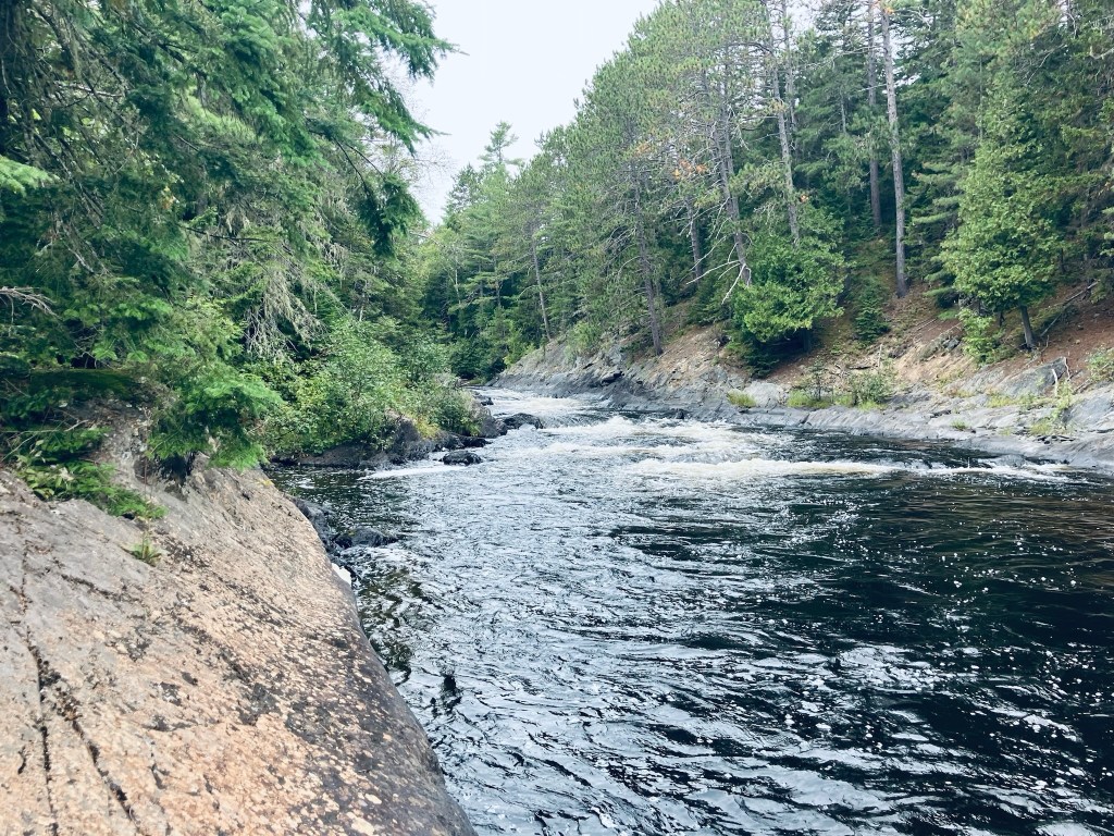
At about 5.7 miles, I turned hard left towards Grand Pitch Falls, which I could already hear through the trees. The trail followed a worn path on the bank above Webster Stream, which moved quickly below. At about 6 miles I took advantage of an overlook to the right to watch the stream flow down towards me and downstream, around an island in the middle.
Webster Stream, Baxter State Park, ME
Shortly thereafter, I veered right on a small trail which rode the rock lip over the river, emerging to the Stream crashing through the canyon with a deafening roar, which was awesome to behold. Just above the wild falls, a large crayfish waited in a quiet pocket of rock.
Crayfish in pool above falls of Webster Stream, Baxter State Park, ME
I prepared myself a freeze-dried chili mac here and sat by the falls for quite awhile, then packed up everything and turned and walked the 6.4 miles back to the trailhead. On the way back across the beaver dam, I noticed a small ramp midway across, covered with mud, and clearly used by the beaver to slide back-and-forth between his properties. This is a truly remote hike – despite covering almost 13 miles, I didn’t see a single person until I got back to the parking area.
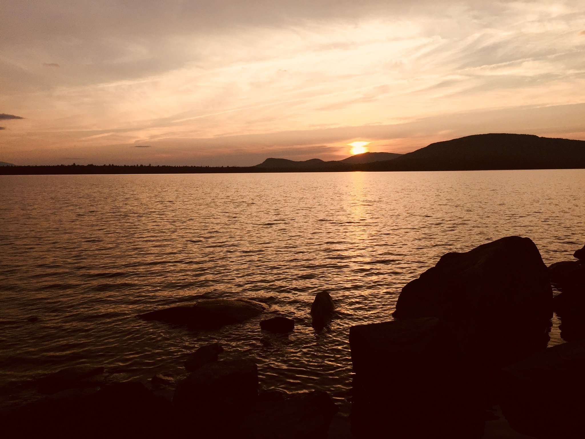
Grand Lake Matagamon from Freezeout Trail, Baxter State Park, ME
(Disclaimer: This post contains affiliate links, and as an Amazon Associate Hiking in Maine blog earns from qualifying purchases.)
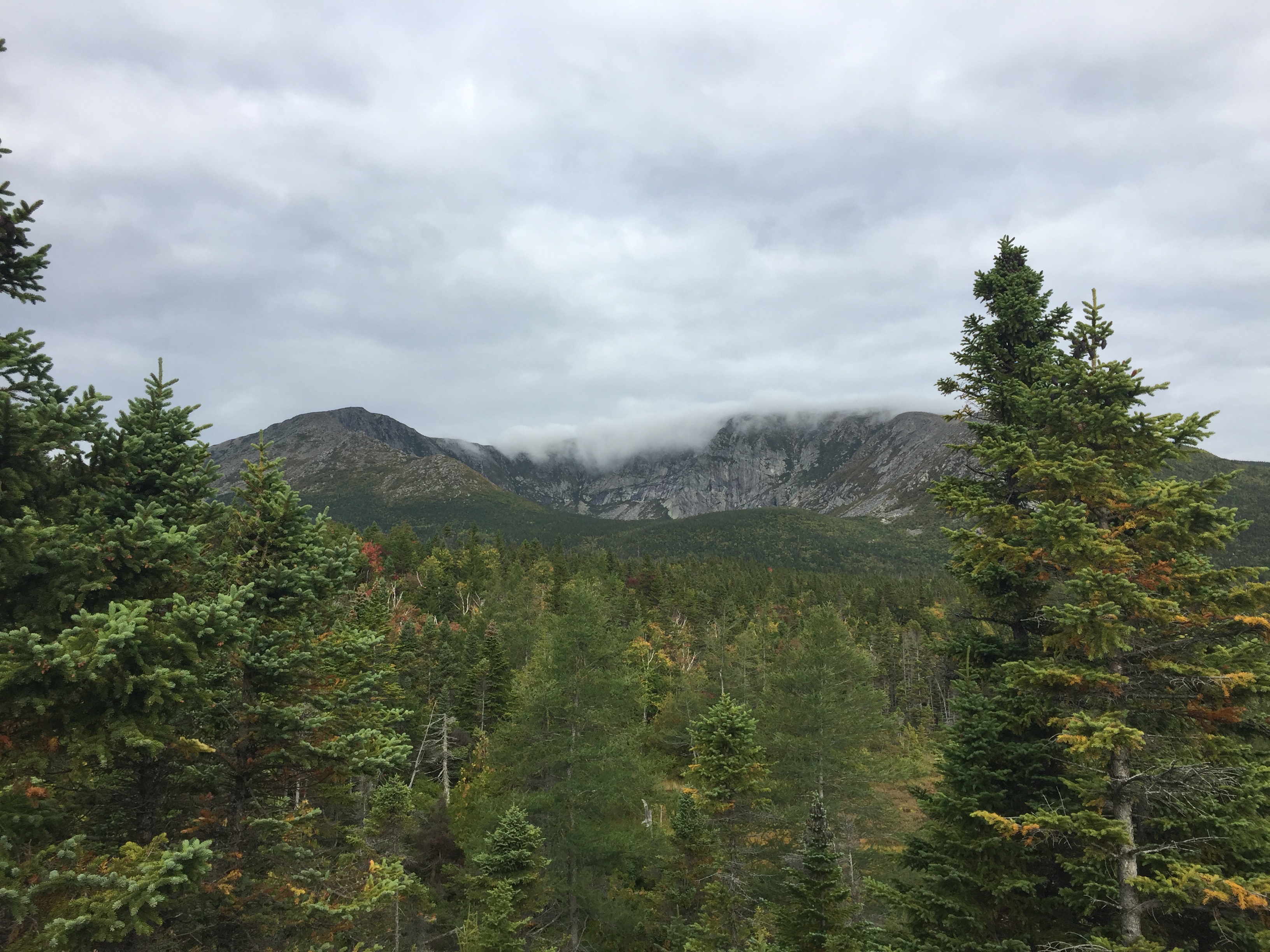
View from Barren Ledges on Barren Mountain, 100 Mile Wilderness.
Overview
With the right preparation, the 100 Mile Wilderness (100MW) can be a challenging but enjoyable eight-day hike (and for thru-hikers and experienced “speedhikers,” who can rip off 20-mile days, substantially less). Dad (then 41) and daughter (then 12) completed this in two segments in 2017 and 2018. We definitely allowed ourselves extra time to enjoy places we liked, or to recover from wet gear or injuries, so plan on ten days. Our 100 Mile Wilderness journey finally complete, we took a look back and came up with a better plan of attack. So, here is our guide, with a suggested itinerary, and a packing list.
Direction: There are arguments for going south to north (like we did), or alternately, starting at Abol Bridge, and finishing in Monson. The northern part is substantially flatter (read: faster) terrain, so starting with a heavy pack might be easier north-south, eating up food weight as you move south. But starting from the south, and climbing over the Barren-Chairback and White Cap ranges might make your tired legs want to finish with the more gently rolling terrain of the north.
Timing: When we started the 100 MW, we did so at the end of June/beginning of July. Once we got down from the higher elevations, the heat was oppressive, and the bugs were brutal. We later finished the 100 MW at the end of September, and it was cold at night, but pleasant during the day, and there were no bugs. I think a happy medium would be the beginning of September (assuming your work/school/life allows this), which would still be warm enough to enjoy dips in the lakes and streams, cool enough at night to sleep well, and at the very tail end of bug season. One caveat to this plan – AT Lean-To’s and tent sites may be fairly full, as many thru-hikers will be making their last push to Katahdin. Check out this summary from The Trek of thru-hiker tips for the 100MW, including a 5-day itinerary. Some water sources may also be dry by this time of summer, depending on the rains. Speaking of which, watch the weather forecast – water crossings can be treacherous after heavy rains further upstream.
Resupply: We didn’t do this, but it’s worth considering. Some purists believe that it’s cheating, but lightening your pack enough to enjoy your walk in the woods might help a great deal, and it’s your hike. Shaw’s Hiker Hostel (Monson), the Appalachian Trail Lodge (Millinocket), and 100 Mile Wilderness Adventures and Outfitters are reputable providers who can coordinate food drops for you along the 100MW. They can also provide advice, shuttle service, Baxter/Katahdin permits, help you stage your vehicle at either end, and provide a place to stay before and/or after.
A whodunit where the “who” turns out to be nature and decisions could be anti-climactic. The title and an Author’s Note at the beginning of the book foretell the tragic ending in When You Find My Body: The Disappearance of Geraldine Largay on the Appalachian Trail, by D. Dauphinee (DownEast Books 2019), but the story in between remains taut and meaningful. Geraldine Largay, a sixty-six year old Appalachian Trail (AT) hiker, trail name “Inchworm,” disappeared in July 2013 on a section of the AT in western Maine, and despite a wide search, her remains were found inside a sleeping bag by surveyors in October 2015, less than eight hundred yards from the AT.
As Largay cannot bear witness anymore (besides e-mails, text messages, and notes from the hike), Dauphinee largely focuses on the searchers from the Maine Warden Service and other agencies, the friends, and the fellow hikers to tell Largay’s story. The misinformation, inaccurate tips, and rumors are seen in split-screen with the actual timeline created from digital and physical artifacts of Largay. As Dauphinee concludes at the end of a chapter, “The behavior of lost people is a challenging study.”
Woven throughout the narrative on Largay’s disappearance is a broader examination of the AT’s history, its lore, terminology, and culture, and the reasons each hiker has for tackling all or part of the trail. Dauphinee also devotes a fair amount of time to the concepts of Search And Rescue and the mindset of the lost person. The irony that Largay became disoriented and eventually died on lands used for training by the U.S. Navy Survival, Evasion, Resistance, and Escape (SERE) school could have been played up for effect, and indeed, Dauphinee references sensational Bollard news articles which insinuated that this Navy “torture school” was responsible for Largay’s disappearance, and other theories about prescription drugs. But this conspiracy-type thinking is quickly neutralized by Dauphinee’s interviews and interactions, including with a retired SERE instructor who participated in the search, and who was emotionally affected by the failed effort. Dauphinee eventually returns with the SERE instructor for a somber visit to the site at which Largay’s remains were found. Dauphinee’s book ends with an epilogue in which he discusses the practical lessons that may be learned from Largay’s tragedy.
It is the mark of good writing that, even when the end is never in doubt, the reader still feels compelled to turn each page, to explore the broader story. In this case, human nature and years of evolution make it a story that sticks with us beyond the closing of the book, a survival lesson learned. And the care taken by Daupinee to be respectful, to make the kind, gregarious Largay more than a statistic, builds a character that the reader roots for, even knowing the outcome.
(Disclaimer: This post contains affiliate links, and as an Amazon Associate Hiking in Maine blog earns from qualifying purchases.)
View west on North Traveler Trail, Baxter State Park
The last couple years, dad and daughter have picked a late-summer weekend to climb Mount Katahdin together at Baxter State Park (BSP). On last year’s trip, we diverted to explore some easier trails from Katahdin Stream Campground, and this year, due to daughter’s same lingering knee injury from last year and her recovery from late August knee surgery, it was a solo trip for dad. Not wanting to climb Katahdin without my hiking buddy, I set my sights on the Traveler Loop. South Branch Pond Campground was full, so I canceled our mid-September Roaring Brook parking reservation, and found a tent site instead at Trout Brook Farm Campground.
The “Bold Coast” of Maine is the area of coastal Washington County stretching from approximately Milbridge to Calais, and accessible through a route designated as the Bold Coast Scenic Byway (see map here from Maine DOT), which largely follows U.S. 1 North. Bold Coast Maine, a collaboration by the Washington County Council of Governments and Downeast-Acadia Regional Tourism, has an extensive site dedicated to the many attractions of this region, with a great interactive map, searchable by interest (Arts and Culture, Food and Drink, Recreation, etc.). For some area context, including post-hike food and drink, see the post on this blog on Quoddy Head State Park in Lubec.
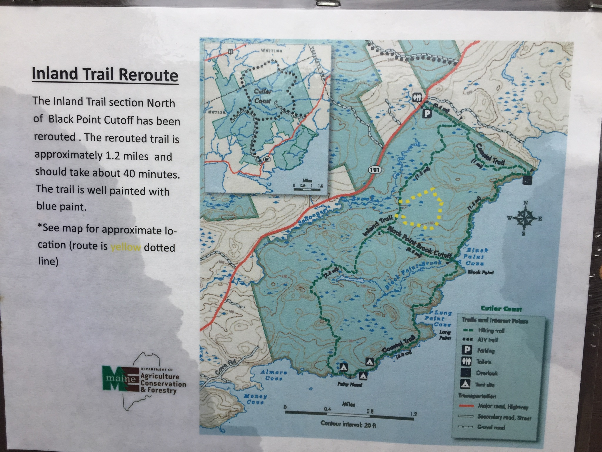
For hikers, the centerpiece of this great region has to be the Cutler Coast Public Lands, managed by the Maine Bureau of Parks and Lands, which publishes an excellent guide and map. An important update to this map, however, is a rerouting of the Inland Trail, just east of the junction with the Black Point Brook Cutoff, which adds 1.2 miles to any loop using this segment, and was still in place as of October 2018.
Inland Trail Reroute (note 1.2 mile change in yellow), Cutler Coast Public Lands
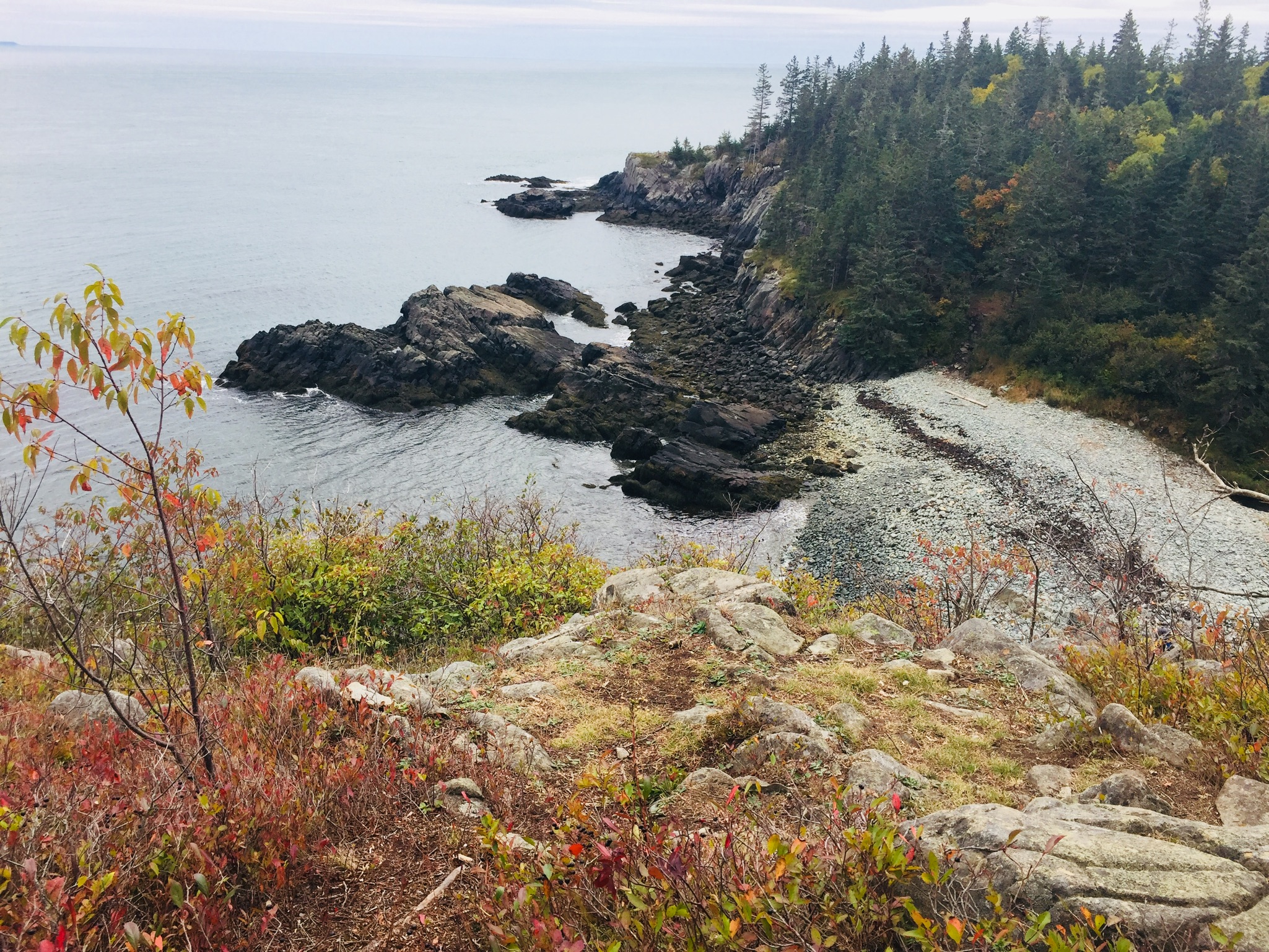
These lands, overlooking the Bay of Fundy, have 10 miles of trails and three remote tent sites (first come, first serve) for hiking and camping with unparalleled views. We started on the Coastal Trail, which is a 1.4 mile hike east from the parking area off Route 191 in Cutler to the ocean. According to the guide, this is the easiest segment, and the remainder of the trails are “moderately difficult.”
None of the trails we explored here were particularly strenuous, but the paths are winding and require some climbing up and down over the rolling terrain. Like Quoddy Head, however, there are sudden cliffs that make it a potentially dangerous place for younger children. The rocky coastal sections are steep, and footing could be treacherous in rainy periods. And given the boggy inland areas, the insects in May and June must be fairly aggressive.
Coastal Trail view to south of Cutler Coast Public Lands.
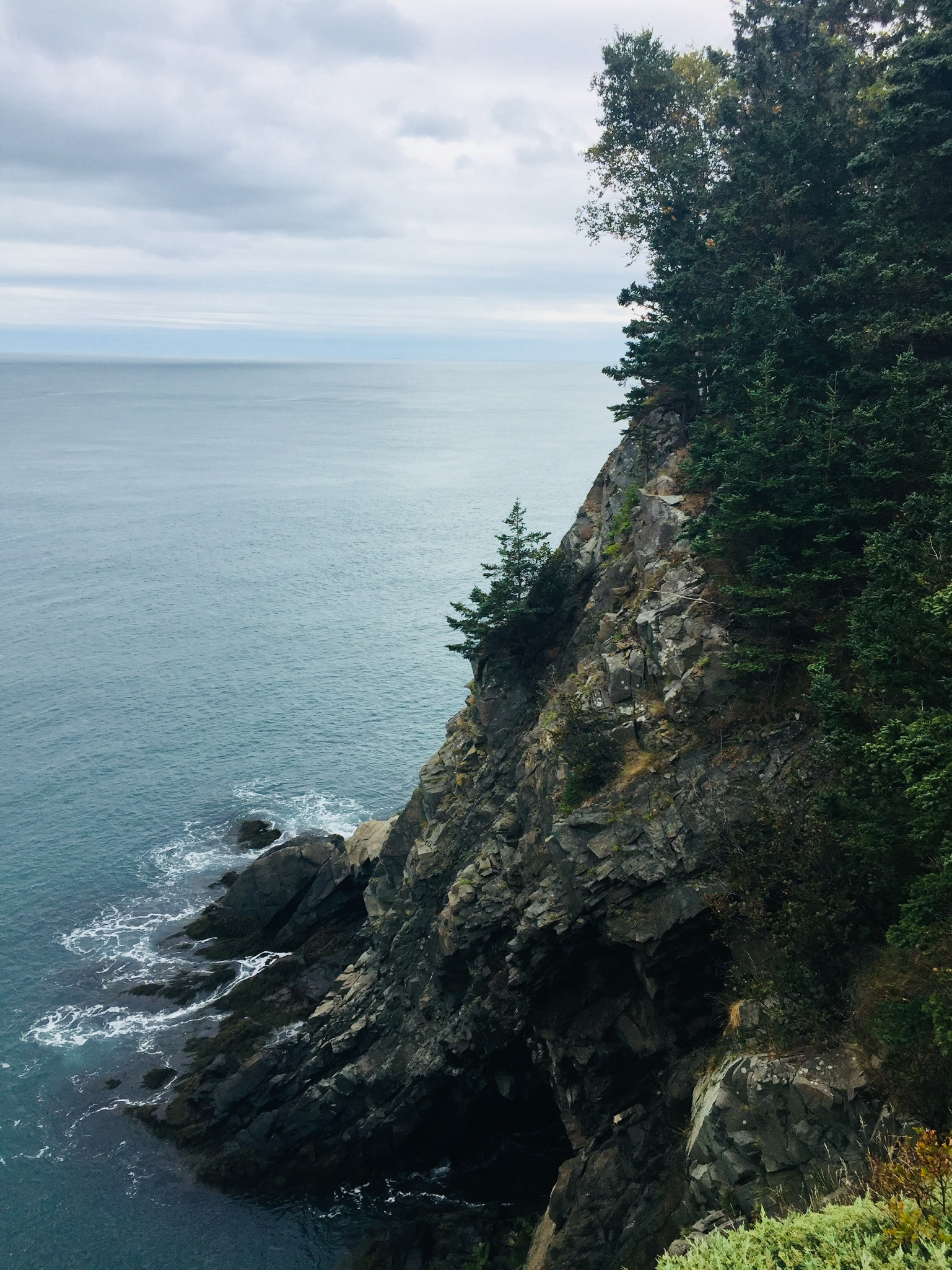
The payoff upon reaching the coast, however, is instantaneous, as the dark rocky cliffs and forested coastline meet dramatically with the ocean in a stimulation of the five senses that can only be experienced firsthand. We picked our way slowly down the Coastal Trail toward Black Point, stopping at each short side overlook trail to listen to the powerful rumble of the waves and smell the mix of sea spray and pine.
Maine’s Bold Coast, Cutler Coast Public Lands.
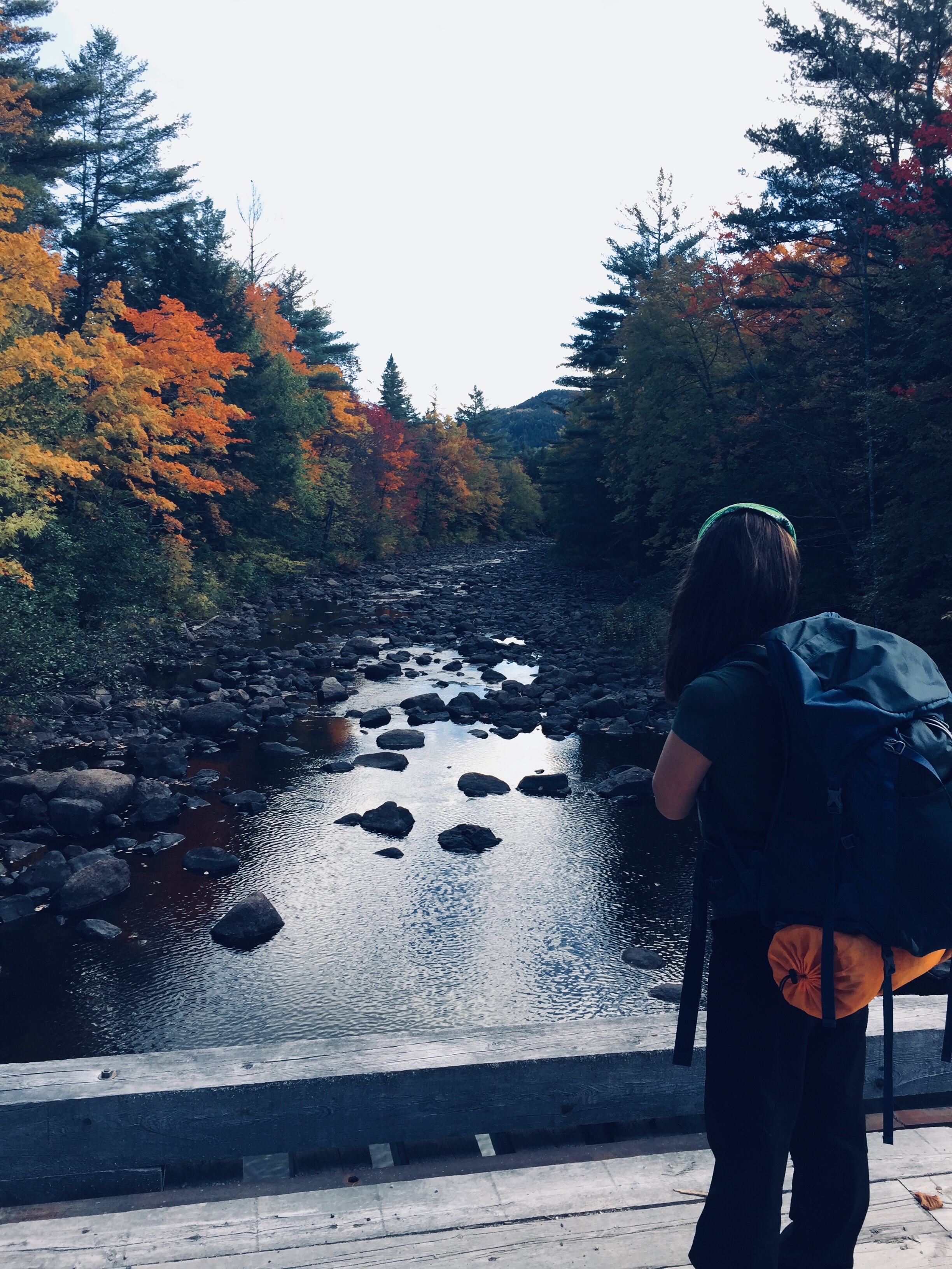
The Black Point Brook Loop, with a turnaround at the beach at Black Point Cove, is normally 5.5 miles, but with the reroute on the Inland Trail, was closer to 6.7 miles, which took us about four hours at a slow pace, with many stops.
We agreed that a better (delayed gratification) itinerary for us would have been to take the Inland Trail first to the Black Point Brook Cutoff, have lunch at Black Point Cove, then hike up the Coastal Trail, so that our route back would take us along the shore (rather than having the forested trail and circuitous reroute on the return trip).
Rocky beach at Black Point, Cutler Coast Public Lands.
The Inland Trail was impressive in its own way, however, with variety in flora and fauna, rocky sections, mossy green hummocks, and some open meadows. The fall colors were much more pronounced in this section, with many deciduous trees and colorful bushes. We also saw many birds, including a noisy pair of Canada jays near the path.
For those looking for a longer route, or an overnight trip, the Fairy Head Loop is 9.2 miles (10.4 miles with current reroute), including 3.8 miles along the shore front, and this route accesses the three permitted campsites.
This quiet section of Maine’s Bold Coast, where the woods and the ocean come together, instantly became one of our favorite hikes. Any time a hike ends at a beach (see Morse Mountain), it’s special, and the Cutler Coast rivals any scenery on the East Coast, without the crowds of Acadia.
Fall colors on Pollywog Stream, 100 Mile Wilderness
[Note: this is the ninth and final part of a series begun in summer 2017 of an attempt at the 100 Mile Wilderness by dad, 41, and daughter, 12]
Should it take ten days to do the 100 Mile Wilderness? Probably not. Should it take eight days in 2017, and two days in 2018? Doesn’t matter- it did. As described on the 100 Mile Wilderness page, we started in 2017, had a great time together, but dad and daughter decided after 75 miles that we would continue some other time. This summer, we were dying to get back out there, and when the last weekend in September 2018 opened up for us, we jumped at the chance to complete the final 25 miles.
By definition, it’s a wilderness, so starting 25 miles south of Abol Bridge took logistical support. For that, we were helped by the friendly people at the Appalachian Trail Lodge in Millinocket, a hostel open during the hiking season until October 15th. We were greeted by Ole Man (these are trail names) upon our arrival, stayed at the Earl Shaffer Room (clean, two twin beds, shared bathroom, WiFi) for $55 the night before, got delicious breakfast sandwiches and a massive chocolate donut down the street at the Appalachian Trail Cafe the morning we left, and used the reasonably priced Appalachian Trail Lodge shuttle service to leave our truck at Abol Bridge, and get dropped off at the south end of Lake Nahmakanta. We swapped shuttles halfway, as the larger van we rode back to Millinocket from Abol Bridge was needed for the eager thru-hikers headed to Baxter State Park, and we traveled south in an SUV that had recently been repaired after a charging moose had broken off the driver’s side mirror.
We learned a lot on our shuttle ride from NoKey, a 2012 AT thru-hiker working at the Appalachian Trail Lodge, who was friendly, professional, and added all kinds of value to what otherwise would have been just a cab ride over logging roads. We had just missed a large bull moose on the Golden Road, of which NoKey showed us a picture. We got the scoop on good (most) and bad (very few) shuttle services/guides, places to stay near Millinocket, the effect of the Katahdin Woods and Waters National Monument on tourism, area wildlife and history, saw a lynx crossing the road, got an update on bear activity in the area, and even got a lesser-known trail recommendation (Turtle Ridge Trail in Nahmakanta Public Lands). We also passed a large encampment by Cooper Brook, which was the location of an L.L. Bean promotional “Trail Magic” campaign along the AT.
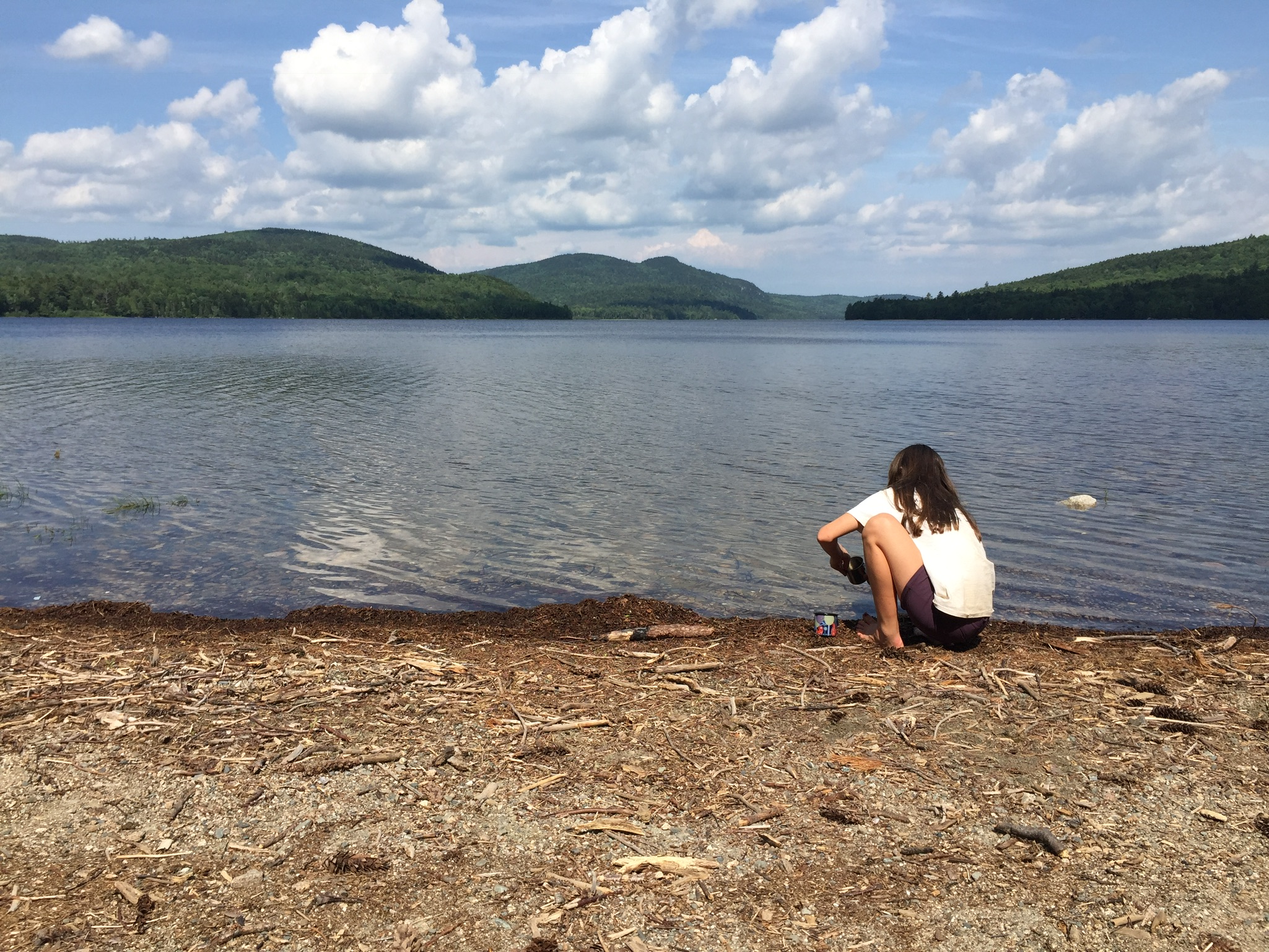
The beach at the south end of Lake Nahmakanta.
With that preamble, we got a mid-morning start at the south end of Lake Nahmakanta, and after a nostalgic moment on the windy beach, started walking north through the remote Nahmakanta Public Lands. Quickly, we saw large moose tracks and fresh droppings along the trail, and quickened our pace to try to see this animal, without success. We grudgingly adapted to having the heavy packs on our backs, and adjusted our day-hiker pace downward to accommodate the extra weight (we packed too much food). We stopped briefly at Wadleigh Stream Lean-to to crack open our Peanut Butter M&M’s, and noticed a plaque inside the lean-to honoring a hiker named Buffalo Bobby, who had passed away near this spot exactly 7 years before, 38 miles from finishing his third AT thru-hike. Wow. Rest in peace, BB.
Landscape and foliage views from north summit of Nesuntabunt Mountain.
By about 1 pm, we had reached the north summit of Nesuntabunt Mountain, and took the short side trail to view Nahmakanta Lake and far-off peaks. Then we sat down to make ourselves lunch, the same peanut butter, banana, and Nutella wraps we had used for energy on Katahdin a couple weeks before. A quick descent took us to the base of the mountain and around Crescent Pond to Pollywog Gorge.
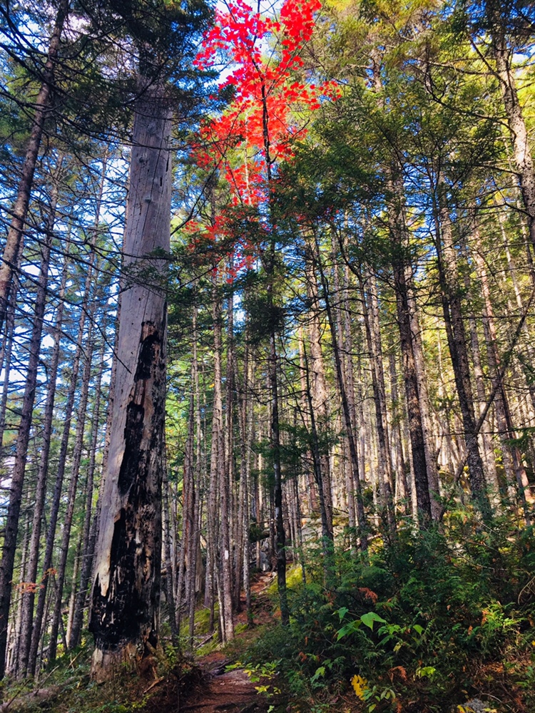
Fall colors on the AT near Pollywog Gorge
Changing leaves along Pollywog Stream.
The cliffs surrounding the gorge were impressive, but we were beginning to wear down, and didn’t linger. We crossed Pollywog Stream on a bridge, and made our way up Rainbow Stream to Rainbow Stream Lean-to a little before 5 pm, where a male thru-hiker and two female multi-day hikers we had seen earlier were getting ready for the night. This made it only a 10.7 mile day for us, but it felt like a lot more. The lean-to area quickly filled up with thru-hikers as the sun set. The thru-hikers we saw were exhausted, broken, and profane, but unfailingly friendly, polite, and focused on the last stretch of trail to Katahdin.
We set up our tent, which was complicated by a broken pole, repaired with a mostly ineffective combination of duct tape, twine, and tent stakes. We lay out our bedding, refilled our water, cooked dinner (Chicken Teriyaki Mountain House meal), hung our food in a bear bag, and were in our sleeping bags by 7 pm, fading into sleep despite the loud conversations by the lean-to campfire.
Log bridge and animal den.
It was a cold night, and we were uncomfortable, with neither of us sleeping well. Our sleeping bags and pads were up to the task, but we both agreed in the morning that we need to figure out how to pack pillows with us. Also, dad’s snoring woke up daughter, and daughter poking dad to stop his snoring woke up dad, creating the worst sort of perpetual motion machine throughout the night.
Daughter explored the campsite area in the morning, finding a precarious log bridge across Rainbow Stream to an animal den in a rock cave, possibly the former resting place of a bear. We peeked inside the den, seeing the small skull of an unfortunate prey animal. Dad made instant coffee and mixed in one of daughter’s hot chocolate packets for some more flavor in an attempt to wake up.
Morning light on the Rainbow Deadwaters.
We packed quickly and got moving around 7:30 AM, moving along the edge of the Rainbow Deadwaters. The trail was beautiful, and we marveled at spiderwebs covered in dew, and the unique morning light in the North Woods. We also heard late-season loons calling from Rainbow Lake.
Illuminated trail by Rainbow Lake.
Daughter said that the Hobbit movies could have been filmed here, a recognition of the dramatic, colorful terrain that we tend to associate with movies, and so rarely see in person. We saw a root formation overtaking a tree that looked like a giant spider. As far as mythical creatures go, the west end of Rainbow Lake was the site of what can only be described as a beaver Armageddon, with fallen trees every which way across the trail.
Beaver Armageddon
We stopped for a break by Rainbow Spring Campsite. The privy there was filled with trail graffiti, including the signature of someone whose trail name was “The Privy Destroyer.” This harkened back to irreverent trail names scrawled inside the Appalachian Trail Cafe that had amused daughter, including “Swamp Butt.”
We continued past side trails to Rainbow Mountain and Big Beaver Pond in the Debsconeag Lakes Wilderness Area, stopping to check out Rainbow Lake (the largest lake on the 100 MW) from several rocky openings along the trail. On one stop, we cooked a Mountain House chicken and rice meal for lunch, and let it cool while we walked. When we sat down about fifteen minutes later to eat, it was perfect. Daughter was already sick of the Nutella and lavash bread, so the hot lunch was a good change-up. We also used this time to air out our feet, and change into clean, dry socks.
View of Katahdin from Rainbow Ledges.
Rainbow Ledges was a steady climb, with colorful foliage and views from the high point back to the White Cap range, and forward, towards Katahdin. We remembered crossing the White Cap range a year ago on the 4th of July, and the pea soup fog that hindered our summit views that day. Sadly, we ran out of Peanut Butter M&M’s during this Rainbow Ledges ascent, which had a devastating effect on morale. From here, we descended through the ever-changing forest and down well-set rock staircases to Hurd Brook Lean-To.
Different vegetation, incline, and make-up of the trail over just a 25-mile section.
The last few miles seemed to last the longest, as they always do. There weren’t many landmarks on the home stretch to Abol Bridge. The descriptive note, “Interesting area of large boulders and large hemlock trees,” on AT Map 1 at 2.2 miles from Abol Bridge, seemed superfluous after 100 miles of interesting rocks and trees. Suddenly, we were faced with a sign warning us that we were 100 miles north of Monson, and that we should have a minimum of 10 days supplies if we were heading south. We realized we were almost done, and saw the Golden Road peeking through the trees ahead.
Katahdin and the West Branch of the Penobscot from Abol Bridge.
We trudged across Abol Bridge in the late afternoon, completing our 15 mile day. We stopped by the Abol Bridge Campground store to buy some Gatorade, then got back in our truck, and drove out the Golden Road towards Millinocket. The Millinocket House of Pizza is daughter’s restaurant of choice, and she called in an order enroute for a large Hawaiian pizza as soon as cell service returned.
The soreness in our shoulders and knees and the chafing from the packs would fade in time, but completing the 100 Mile Wilderness together had been important to both of us. The cool, bug-free fall weather and colorful foliage were unexpected bonuses. To immerse yourself into the Wilderness, to walk there, sleep there on the ground, listen to the sounds of birds, bathe in the lakes, and then bring back out everything you came in with, is to feel shared ownership of this special place, where most people never go. Even in our weary haste at the end to finish, we had talked about new challenges, and also bringing memories of this hike back with us. As we split the pizza, we talked about our hike, and planned a lazy day for tomorrow.
(Note: As of May 17, 2020, according to MH&T website, all Maine Huts and Trails “huts are closed – there is no access inside the huts for water or bathroom facilities. The bunkhouses are closed. Please know it is for your safety and the well-being of others. Be well, stay healthy.”)
Hello! I am the wife and mother of this happy hiking team in Maine. I tend to exist on the hiking periphery and I’m known mostly for cherry-picking the hikes I attend and forgetting critical supplies, like appropriate snacks and waterproof shoes.
On that note, welcome to the post on our recent 3-day hike from the Long Falls Dam trailhead in New Portland, Maine to the Flagstaff Hut (1.8 mi) to the Grand Falls Hut in West Forks, Maine (11.2 mi) and back (13.0 mi) to the trailhead (described on the Maine Huts and Trails website as the Hut-to-Hut Shoreline Trek). Maine Huts and Trails, which has four “huts” in the Carrabassett Valley region of western Maine, is a non-profit with a stated mission “to create and operate a world-class system of backcountry trails and eco-lodges for people-powered recreation to enhance the economy, communities and environment of Maine’s Western Mountain region, for the benefit of current and future generations.” You can view and download trail maps here.
Trailhead on Long Falls Dam Road
View West across Flagstaff Lake from Shore Trail
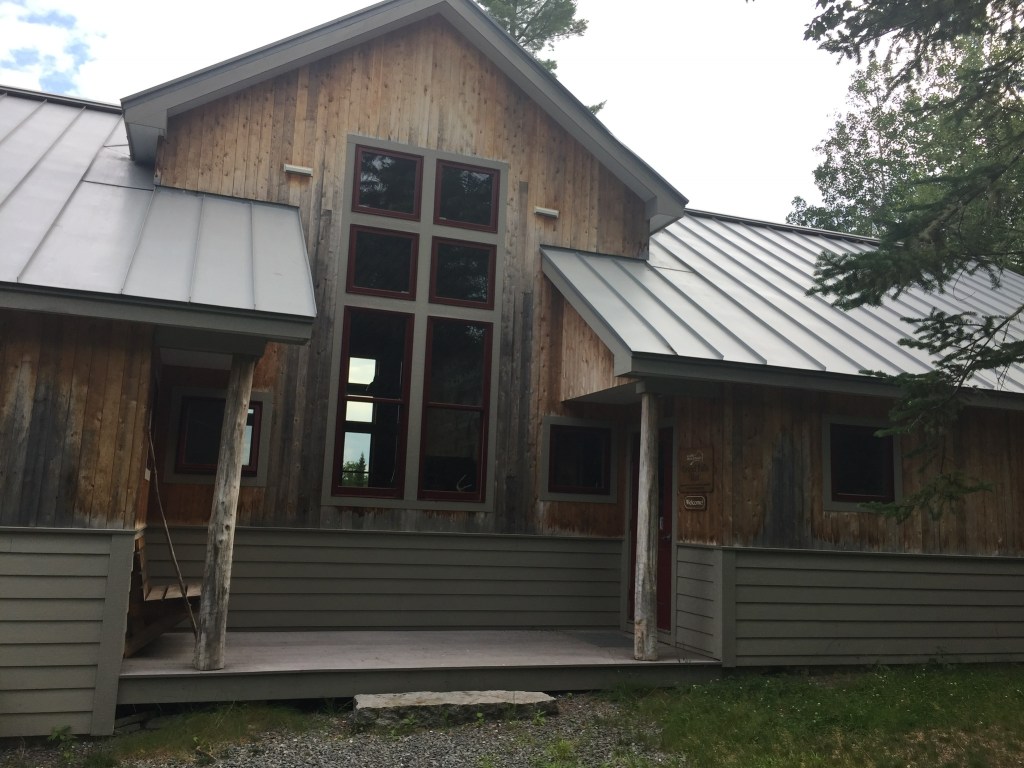
Husband and I (we were sans daughter this trip) took a route that began with a two-mile walk along the Shore Trail from the trailhead along a wooded route bordered to our left by glimpses of nearby Flagstaff Lake to the Flagstaff Hut – a beautiful, modern and welcoming property. Flagstaff Hut is the largest and most popular of the huts in the Maine Huts & Trails system and was built in 2009. I was glad to get there and take off my shoes. I know what you are thinking – she is tired after two miles? The answer is yes- it was incredibly hot. A handwritten dinner menu on a chalkboard awaited us, letting us know that at promptly 6pm we would get meatballs and pasta and blueberry pie!
A patient and friendly staff member who was turning out fresh bread in the kitchen greeted us and told us where our room was (she even switched us to a private room because one was available), answered questions about where we could swim and borrow paddleboards and explained the token system for the shower and how to operate the composting toilets. The main building houses a large community/dining area, a reading room, bathrooms, showers, and a drying room for wet gear. The dormitories are separated from the main lodge at Flagstaff Hut.
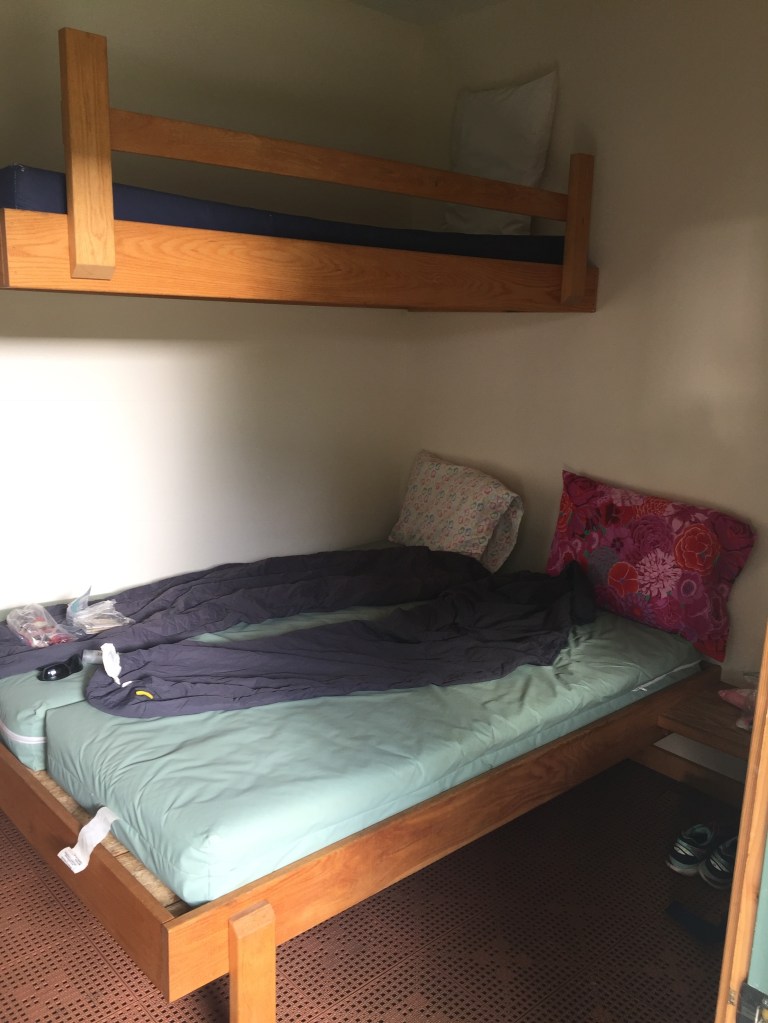
Yes, it looks like a crime scene photo, but this is what a room looks like.
The room was spartan but clean, well-lit and I won’t say “comfortable” but I am comparing that to my bed at home. It’s a thin, plastic mattress, folks. And a plastic pillow. But it sure beats the ground.
A snowshoe hare in its summer colors looks for food near Flagstaff Hut
Dinner is served family-style promptly at 6:00 pm. The food is fresh, sometimes local and healthy. On the night we were there, there were thirteen of us spread over two tables and the staff accommodated all sorts of dietary restrictions, which is no small feat these days. We also tried lobster mushrooms foraged by the staff. Guests mostly discussed their plans for the next day or tips about what they had already seen and done in the area. It is a family-friendly environment, with children of various ages reading and running around. After dinner, we took a guided tour to see how energy is used throughout the hut and then we took a .1 mile stroll along the Birch Trail to the end of the small peninsula to watch the sun set over the Bigelow Mountains.
Kids were swimming and friends were chatting. We returned to the reading room where I read about the history of Flagstaff Lake, which was man-made and a controversial project at the time it was created. Quiet time begins at 9:30. Make sure to bring earplugs because you can hear your neighbor snoring. I would also bring a fitted sheet for the mattress next time, as it can feel like sleeping on a diaper.
The shower is warm and quick and will give you an activity especially if you wake up at 6:15 ready to walk but need to wait until 7:30 when breakfast is served and the sandwich bar is put out so you can make a bag lunch. With sausages, eggs and pancakes in my belly, I was ready to go! We set out at 8:30 am to walk the Maine Hut Trail to the Grand Falls Hut. I must admit that I had some anxiety about the distance because it was 11.2 miles and I’ve never walked that far with a pack on. Let’s be honest here, I haven’t walked one mile with a pack on prior to this. Fortunately, my pack was light and husband graciously carried my water and a few other supplies.
The narrow trail runs along the Dead River for several miles
I discovered quickly that this was going to be a single-file walk. The trail is well-marked and clear but too narrow for two people to walk side by side, so conversations are nearly impossible. Also, you may not see anyone on the trail for the entire 11.2 miles, as was the case with us. The first third of the trail hugs Flagstaff Lake and then you enter the wooded Big Eddy area, and finally you follow the Dead River for the remainder of the trail. While there are numerous signs that say “Maine Huts & Trails” there are very few mileage markers or landmarks until you get close to the huts. Just after leaving the hut, the first bit of the trail was boggy and wet and not a good place for expensive, new running shoes. I’m just saying. The Big Eddy area was my favorite walking area because of the soft, pine-covered floors and the sunlight filtering through the tall trees onto the trail. Hiking poles are not necessary but we both found them helpful. There is very little elevation on this route and the only place I would say you have to be careful is the part right around the Grand Falls, which is rocky and steep for a short period. It is not so much a hike as it is a very long walk in the woods and along a river.
The peaceful morning sun hitting the trail
Yes, do bring a mosquito net and some Deet. Due to the proximity to the water and the low-lying areas, there were several stretches of trail that I did a lot of cursing and swatting and power-walking and questioning my decision to walk this trail. I came out looking like I had the chicken pox. Husband is completely unappealing to bugs.
There were brief pit-stops to pick blueberries or raspberries along the way, but we mostly just motored along. The banks are steep, and not conducive to swimming, except at a canoe and kayak launch off Dead River Road, and then a small beach right before Grand Falls.
We stopped for about twenty minutes to eat smushed, warm tuna salad sandwiches, raisins and granola bars, but there were no obvious picnic spots along the way, save for a lone picnic table about 2/3 into the trip and not marked on the map. The picnic table may actually have been placed there by mosquitoes as a trap.
Moose use the trails, too.
Although there was evidence of bear and moose, we did not see any. Shortly after crossing the Dead River on a footbridge, we startled a large predatory bird mid-meal, causing it to drop a headless squirrel Ozzy Osbourne-style right next to us. During the course of the three-day hike we saw a garter snake, a small green snake, kingfishers, a hawk, a school of trout and lots of curious red squirrels.
The big highlight is the impressive “Grand Falls.” It is certainly mesmerizing, and you can stand close enough to cool off in the mist it throws off.
We got to the Grand Falls Hut at about 2:30pm and quickly stripped off our socks and shoes (no trail shoes in the huts) and met our two new hosts who directed us to our room and said they would be available if we had questions. My first question was “can you drive me back to the trailhead tomorrow?” (no.) “How about a gear shuttle?” (we’ll check on that.) “How about a canoe?” (We’ll check on that.) “Is there a shorter way?” (no.) “Can I have a glass of wine?” (yes.)
Grand Falls Hut
The hut was quiet and peaceful and had a similar set-up as Flagstaff. The dorms were connected to the main lodge through a walkway. The showers felt deliriously good. How rewarding to walk all day, then get clean, grab a book and sit on a couch in a beautiful, sunny lodge with a glass of wine next to the man you love? It was also nice to be able to have a conversation with him after staring at his back for six hours. It was not as nice to contemplate the fact I had to walk 13 miles back to the car the following morning.
Next time, we will paddle this stretch of the trail
I would highly recommend renting a canoe in advance from Maine Huts and Trails, putting in at the Big Eddy canoe launch, and canoeing the 6 miles along the Northern Forest Canoe Trail on the Dead River to break up the walking. Everyone else staying at the lodges had canoed or kayaked that stretch. Once you are at Grand Falls Hut you will have your canoe/kayak and at least the option to paddle that stretch (I feel certain if you elected to leave the vessel there at that point and walk back, you could). I would also strongly suggest that you check in with your group and be honest about how nice it would be to have your gear shuttled back to the trailhead. By the time you get to Grand Falls Hut and your feet are tired and your shoulders are sore, you very likely might not have that option anymore, as was the case with us – no canoes left and no gear shuttle available. There may or may not have been some internal cursing when I found that out. I guess this is how I learn my physical limits!
Before dinner, we took a short walk along the Fisherman’s Trail to a swimming spot. We soaked our tired feet in the cool water and enjoyed watching the Dead River rapids. Dinner was plentiful and delicious – roasted chicken with pesto, kale salad, warm berry crisp. Guests traded stories by a big bonfire and quiet time began at 10 pm.
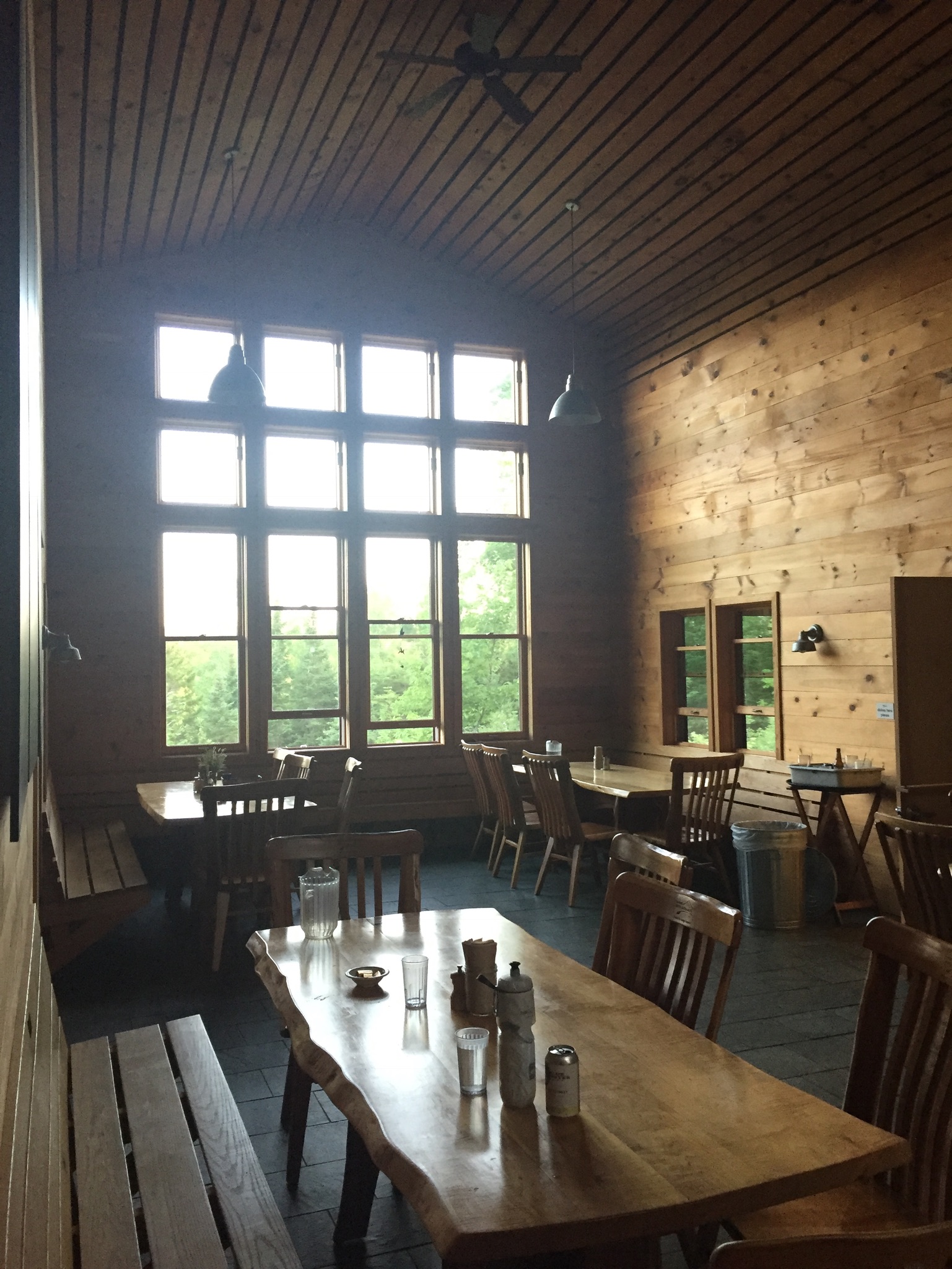
The dining area at Grand Falls Hut
The next morning we set out at 8:15 after a breakfast of eggs, sausages and fried (local) potatoes to hike all the way back along the same route to the the trailhead. You know it is a long walk when you finally see a sign letting you know that you have five miles left and you are excited. It is about 13 miles from Grand Falls Hut to the Flagstaff trailhead and it felt so nice to get my socks and shoes off, change my clothes and sit in an air conditioned car for a while. We arrived at the trailhead about 2:20 pm (yes, we were moving along!!) and a large, boisterous group of parents with teenage girls was just gearing up to hike into Flagstaff Lake. We let them know that they picked a great adventure!
Thru-hikers can have many different reasons to attempt the Appalachian Trail (AT), whether it be the fulfillment of a dream, a personal challenge, or any number of life events, and in Hike It Forward: Hiking the Appalachian Trail Strong, Safe and in the Spirit, (self-published, 2015) David Rough recounts his successful 2014 thru-hike from Georgia to Maine, as part of an “unavoidable call” and an effort to improve tuition assistance at the Christian school system in Ohio of which he was Academic Dean at the time. Rough blogged about his hike in the Hike It Forward blog.
Rough (trail name: Rowdy) details his preparations for the hike, and how these preparations stood up to the 2,186 mile test, including gear and clothing. In addition, Rough’s book includes three bonus features: Trail Preparation, Trail Journal, and a State-by-State guide. A bibliography includes everything from A Walk in The Woods to The Lord of the Rings.
Rough breaks down AT lingo, most importantly explaining the HYOH concept: Hike Your Own Hike, respecting the different goals, motivations, and methods of other hikers. Rough also converts the “trail magic” concept to “trail blessings,” which reflects Rough’s Christian faith. Most of the blessings involve food, which is central to the thoughts and well-being of thru-hikers.
The book reveals a daily life on the trail containing surprises, nasty falls, and unexpected acts of kindness. These vignettes range from uplifting conversations with other thru-hikers, most of them referenced by trail name, to lighthearted musings on moose encounters, to an incident with a peeping tom at a hostel.
These stories illustrate lessons learned by Rough, and his trail journal provides a sense of scale regarding the sheer mileage of a thru-hike, and its effect on his mood. Additionally, Rough is careful to credit his wife and sister, and the many others who supported his hike, showing that while an AT hike is inherently a solitary endeavor, the added motivation and encouragement to see it through can be the difference between success and failure.
Rough also discusses the challenges faced in adjusting to normal life again after his AT experience, and how small things like shoes, being inside, and changing his diet caused stress, and how Rough dealt with this, and how reconnecting with friends from the AT cushioned some of the loss felt upon leaving the trail. Rough concludes:
The Appalachian Trail is forever etched into my life. God allowed me to experience a path that few have walked. My hike was so uniquely mine and the spiritual journey so personally embraced me that words cannot describe its intimacy. A one hundred and fifty-two day walk incorporates 3,648 hours of experiences and people and blessing and adversity and adventure. To capture it in a book, to recall it in words, to reflect it in pictures, or even to fully understand it myself seems to evade my abilities.
Overall, Rough’s narrative effectively describes his initial romantic view of the trail being replaced by hardship, but then re-forged, one step at a time, hiking his own hike, into an appreciation of the trail as it is.
(Disclaimer: This post contains affiliate links, and as an Amazon Associate Hiking in Maine blog earns from qualifying purchases.)
Maine’s seasons are different than those of our neighbors to the south- sometimes the resolutions of the New Year are still buried under several feet of snow, even at the beginning of Daylight Savings. I believe it’s important to get outside in the winter either way, but this article will focus on planning for the traditional hiking season.
Step 1: Create a difficult, even unrealistic goal.
How we did it in 2017: In the winter of 2016-2017, we decided to attempt the 100 Mile Wilderness. The difficulty of this task forced us to create a training schedule, and to prepare our gear and bodies one piece at a time for a “capstone” hike, so that we were not fully ready for it until we stepped onto the trail. The training then became part of the journey, instead of being a series of unrelated excursions. And we also had a blast doing it.
How you can do it in 2018: Pick a goal, and plan for it. Check out this great article by Carey Kish on Ten Great Hikes You Should Do in 2018. Or this one, again from Maine Today, on 10 Brag-Worthy Hikes in New England. Pick one outside your comfort zone, something you haven’t done before. If you are a more experienced hiker or backpacker, do the same with longer, multi-day hikes. Try the Section Hiker blog for ideas. Great ideas in the area include Maine’s Bigelow Range, the Presidential Traverse in New Hampshire, and even the Long Trail in Vermont. Or maybe you are tired of explaining why you have lived in Maine for X number of years, and never been to Katahdin’s summit. Make it challenging.
Step 2: Make yourself accountable, find a partner if you can, and lock in your plans.
How we did it in 2017: Daughter and dad agreed on our training plan and final goal. Hiking together is fun. We told people (family, friends, co-workers, gear salespeople) we were going to hike the 100 Mile Wilderness together. That made it hard to back out. We also set aside vacation days for the attempt, and later, booked a Baxter State Park parking pass ahead of time for Katahdin. Planning is fun, too, and having these outdoor excursions to look forward to can be soothing, depending on your life situation and “day job.”
How you can do it in 2018: Start with the end goal in mind, and back up to the current day, making incremental additions to your training plan. For accountability, book your arrangements early (vacation days, lodging, re-supply) so you are motivated to follow up on your investment. Put everything on a calendar. In general, buying a state park season pass is a good deal, and will prompt you to get out there. Maine’s is $55 for individuals, or $105 for a vehicle pass, and free for seniors. The White Mountain National Forest offers an annual pass for $30, and an annual household pass for $40. These passes also allow you to forgo the hassle of trying to find a pen and exact change at the many self-service kiosks at trailheads, and to support our great parks.
Step 3: Let experts do the work for you.
How we did it in 2017: We devoured the books and blog posts we could find on the 100 Mile Wilderness (check this out), and purchased the Appalachian Mountain Club Guide to Maine, as well as the maps for the 100 Mile. For our training hikes, we consulted the Maine Mountain Guide and the White Mountain Guide (skip to Recommended Hikes, get in the car, and go).
How you can do it in 2018: Buy the AMC Maine Mountain Guide and White Mountain Guide. Just do it. They come with maps, they are well-researched, portable, and can serve as a journal for hikes completed. Also, follow Philip Werner’s Section Hiker blog (mentioned above) and Carey Kish’s columns on Maine Today.com. Ask at Information Centers for actual information, and engage with park rangers and volunteers. In addition, join the Appalachian Mountain Club. It’s cheap, most of the membership fee is tax deductible, it supports trails, and they sponsor a ton of group activities/hikes for all skill levels. Follow the people above on Twitter to get updates and ideas, as well as publications like Backpacker Magazine and Outside, which also has an excellent podcast series.
Step 4: If your plans are disrupted, do “something” anyway.
How we did it in 2017: We couldn’t always get out on the trail. School, work, travel, injuries, commitments came up that kept us out of the woods. But we figured out ways to work through. Daughter played basketball, and dad focused on weight room exercises (lunges, box jumps, squats) that strengthened legs for the terrain of the 100 Mile. We skied. On a couple weekends we couldn’t hike, or were out of town somewhere, we signed up for several 5K road races – try Running In The USA. The way to get better at doing hard things is to do hard things. Just do something.
How you can do it in 2018: Shorter hikes can be very rewarding when time is not on your side. Try a big-payoff one like Burnt Meadow Mountain or Pleasant Mountain, steep hikes with great views. Try trail running, which is just hiking’s skinnier cousin. There are trail running groups throughout Maine. Baxter Outdoors does a great race series, which might take you to some places you haven’t been, help you meet some like-minded people, benefit charity, and get some free beer. Here are some tips to get ready for hiking with a pack from Backpacker Magazine. Understand your limits, particularly with an injury, but focus on the things that you can do. For example, dad broke his right wrist descending Katahdin in September 2017, and this precluded a lot of activities, but still allowed him to hike, and as a result he developed more dexterity in his left hand. A caveat: all these things help, but hiking with a pack seems to be a singular exercise, and the best way to get better at hiking is to hike (see above regarding hard things).
Step 5: Let the momentum propel you to staying on the path.
How we did it in 2017: Despite our difficulties at the end of the 100 Mile attempt, we were both invigorated by the hiking we’d done, and talked about more goals. Daughter had never climbed Mt. Washington or Katahdin, and felt strong after our training. It was only mid-July, so the good times we’d had kept us hiking, and we completed both of these mountains, as well as some great hikes in between. We started taking more pictures, and talked about capturing our adventures in this blog, which we began last fall, right after our Katahdin hike.
How you can do it in 2018: Use the aforementioned accountability to keep you going, locked in to activities, and check in with people who are doing the same. You will feel stronger each time you get out there, and maybe your goals will change by the time you hit your big hike. You will see intriguing side trails and places along the way. If you are into social media, use it to catalog your progress. You won’t find any “look at me shirtless doing yoga on top of a mountain” selfies on this blog, but if that’s your thing, and helps you… Either way you will have fun and get outside.
(Disclaimer: This post contains affiliate links, and as an Amazon Associate Hiking in Maine blog earns from qualifying purchases.)
[Note: this is the eighth part of a series on the summer 2017 attempt at the 100 Mile Wilderness by dad, 40, and daughter, 11]
July 7, 2017 turned out to be our last day, and our shortest mileage: 3.2 miles. We woke up and had a hot, buggy morning hike with very few good landmarks and a few stops to discuss existential issues, and upon arrival at the south end of Nahmakanta Lake, we decided we were done with our 100 Mile Wilderness hike, after about 74 miles.
Far too many bugs, our feet were not in great condition, and we both agreed that we only wanted to keep going as long as we were having fun. The lake was beautiful, and we agreed that we could stay there for a day or three if needed, until mom or grandfather picked us up. Very few bugs, cool water for swimming, loons, sun, and a perfect tent site.
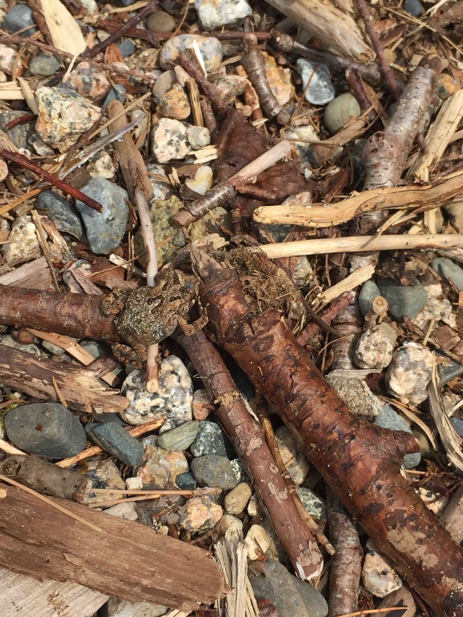
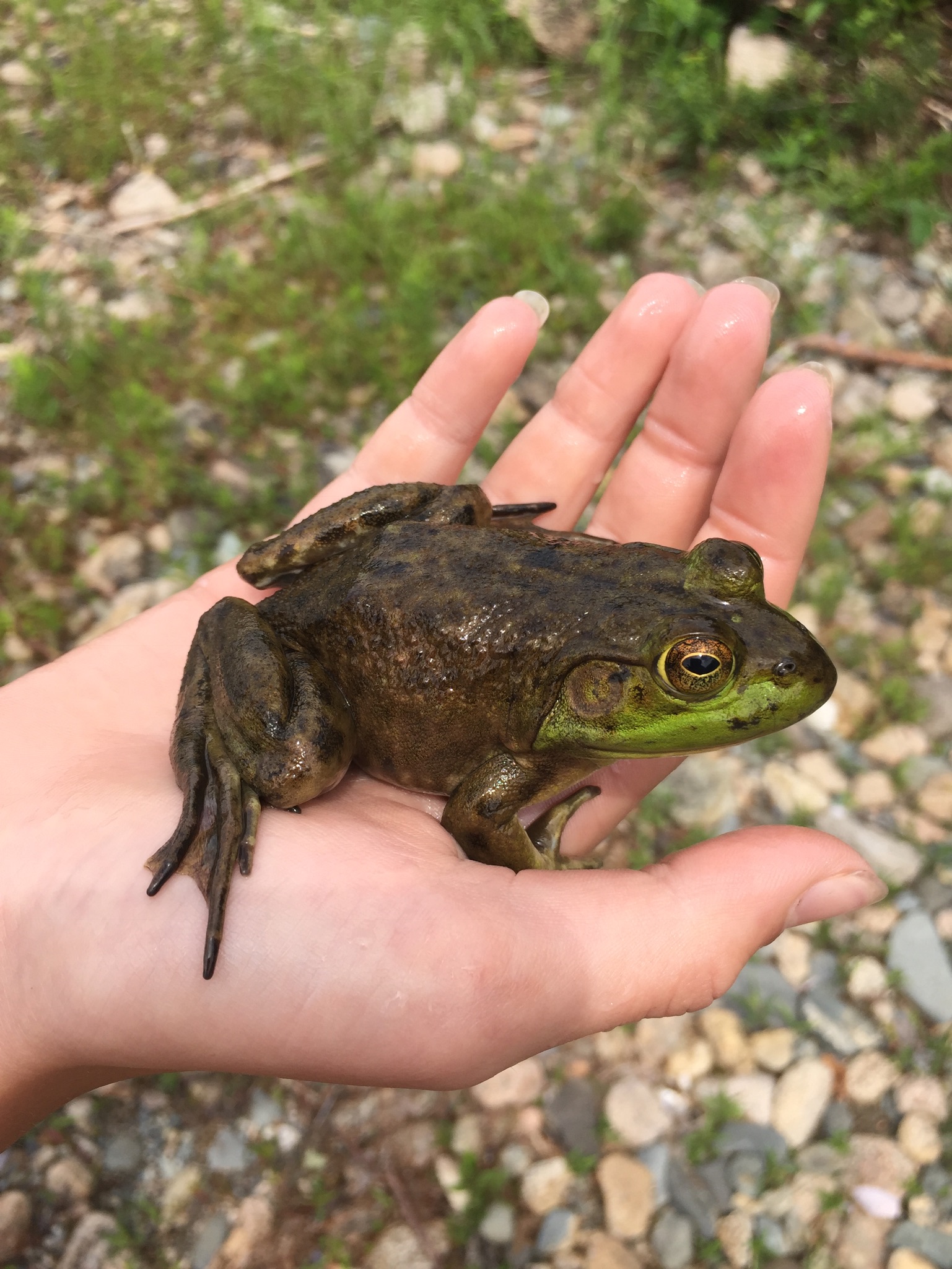
Can you find the toad in this picture?
We spent most of the day swimming, bathing, fishing, snacking, catching/watching frogs and toads, listening to music, looking at flowers and birds, reading A Walk in The Woods aloud, and looking at clouds.
Thankfully, we were able to get a bar or two of service there, and text mom at 9:10 AM – dad’s backup plan had been to leave his pack and climb nearby Mt. Nestabunt to get cell service. Mom and grandfather arrived a little before 5 PM, and had their own adventure getting there, some of which we will never know. Thankfully, they brought the truck, so we could stow all our smelly 100 Mile gear in the back.
We discussed what we wanted to eat while waiting, and daughter craved pizza and cheesecake, while dad wanted a burger and beer. We each ended up getting mostly what we wanted at the Pat’s Pizza in Dover-Foxcroft, as well as Butterfield’s Ice Cream down the street.
We will follow-up with our lessons learned on our gear and packing list, and many more hikes. This 100 Mile Wilderness hike is also unfinished business, and will be continued- after all, we have about 25 miles left to go.