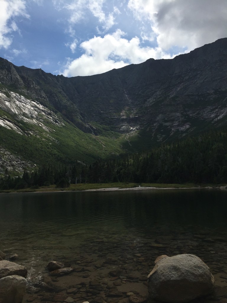
Katahdin across River Pond, River Pond Nature Trail, Millinocket, Maine
River Pond Nature Trail is the outside loop of a trail system, all with logging names, dotted with interpretive displays, off the Golden Road in Millinocket between its namesake River Pond and the West Branch of the Penobscot River, not far at all from Baxter State Park’s Togue Pond gate. I took this trail loop, owned by Katahdin Forest Management, in mid-September as the last Sunday hike on the way out of the park on a weekend trip.
River Pond Nature Trail, Millinocket, Maine
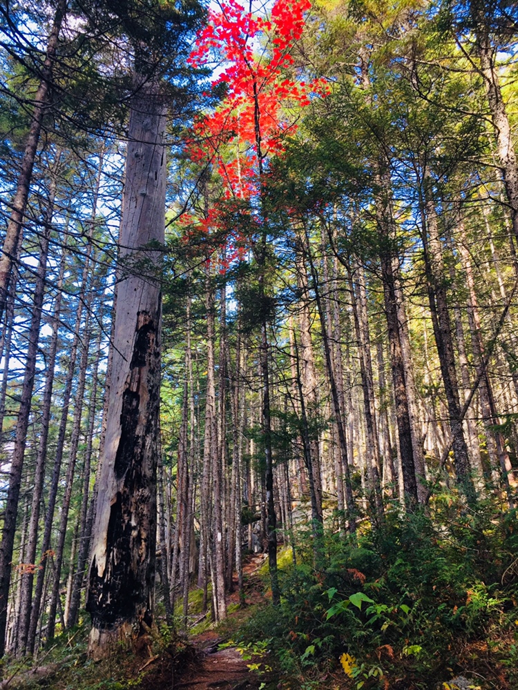
Looking at reviews, it was uniformly described as buggy, but I didn’t have any problems with flies or mosquitoes in the cooler temperatures of early fall. The narrow Tenderfoot Trail through the forest started at a small kiosk by the large parking area, where there were two other vehicles. I moved counterclockwise, and at about .4 miles, just shy of a large boulder, I got my first view of Katahdin through a side trail that led down to River Pond.
River Pond Nature Trail, Millinocket, Maine
As I continued, two people coming towards me told me there were moose in the second clearing. I saw many clearings, no moose, but it’s always exciting to know they are out there. I reached Moose Point and the Timber Cruisers Trail and enjoyed the views across the pond of Katahdin, still nestled in clouds. The south side of the trail is more forested, with an occasional view of the West Branch of the Penobscot River below in the distance.
Katahdin across River Pond, River Pond Nature Trail, Millinocket, Maine
I did not take the River Driver’s Trail, which was a detour of a spur trail that would likely have culminated in better views, as I did not have the energy. Nevertheless, the rolling hills and springy pine-needle paths of the Forester’s Trail were a pleasant change from the rocky terrain of Baxter State Park. All told, the loop was about 4 miles, taking about an hour and 24 minutes.
Fall colors on Pollywog Stream, 100 Mile Wilderness
[Note: this is the ninth and final part of a series begun in summer 2017 of an attempt at the 100 Mile Wilderness by dad, 41, and daughter, 12]
Should it take ten days to do the 100 Mile Wilderness? Probably not. Should it take eight days in 2017, and two days in 2018? Doesn’t matter- it did. As described on the 100 Mile Wilderness page, we started in 2017, had a great time together, but dad and daughter decided after 75 miles that we would continue some other time. This summer, we were dying to get back out there, and when the last weekend in September 2018 opened up for us, we jumped at the chance to complete the final 25 miles.
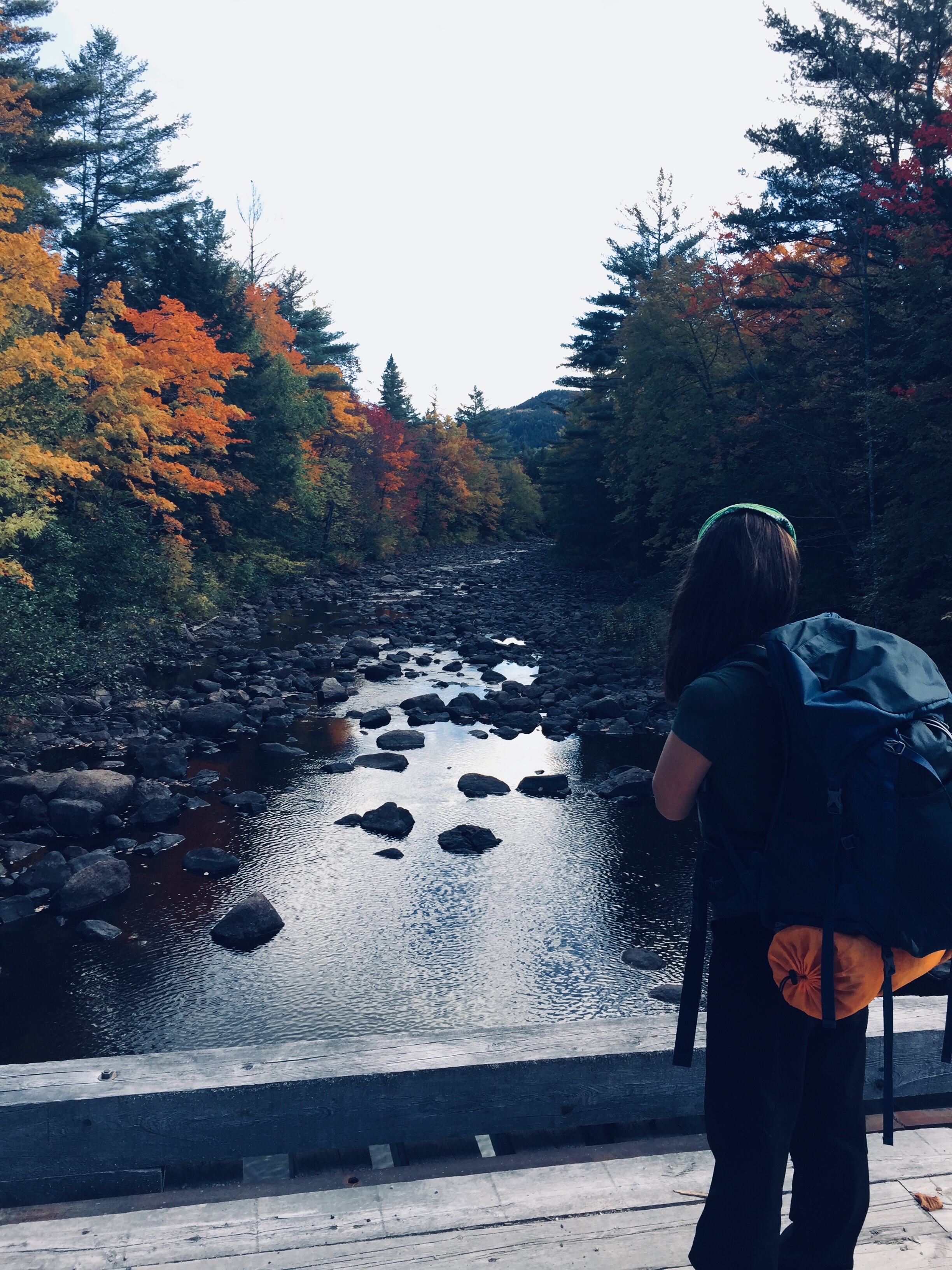
By definition, it’s a wilderness, so starting 25 miles south of Abol Bridge took logistical support. For that, we were helped by the friendly people at the Appalachian Trail Lodge in Millinocket, a hostel open during the hiking season until October 15th. We were greeted by Ole Man (these are trail names) upon our arrival, stayed at the Earl Shaffer Room (clean, two twin beds, shared bathroom, WiFi) for $55 the night before, got delicious breakfast sandwiches and a massive chocolate donut down the street at the Appalachian Trail Cafe the morning we left, and used the reasonably priced Appalachian Trail Lodge shuttle service to leave our truck at Abol Bridge, and get dropped off at the south end of Lake Nahmakanta. We swapped shuttles halfway, as the larger van we rode back to Millinocket from Abol Bridge was needed for the eager thru-hikers headed to Baxter State Park, and we traveled south in an SUV that had recently been repaired after a charging moose had broken off the driver’s side mirror.
We learned a lot on our shuttle ride from NoKey, a 2012 AT thru-hiker working at the Appalachian Trail Lodge, who was friendly, professional, and added all kinds of value to what otherwise would have been just a cab ride over logging roads. We had just missed a large bull moose on the Golden Road, of which NoKey showed us a picture. We got the scoop on good (most) and bad (very few) shuttle services/guides, places to stay near Millinocket, the effect of the Katahdin Woods and Waters National Monument on tourism, area wildlife and history, saw a lynx crossing the road, got an update on bear activity in the area, and even got a lesser-known trail recommendation (Turtle Ridge Trail in Nahmakanta Public Lands). We also passed a large encampment by Cooper Brook, which was the location of an L.L. Bean promotional “Trail Magic” campaign along the AT.
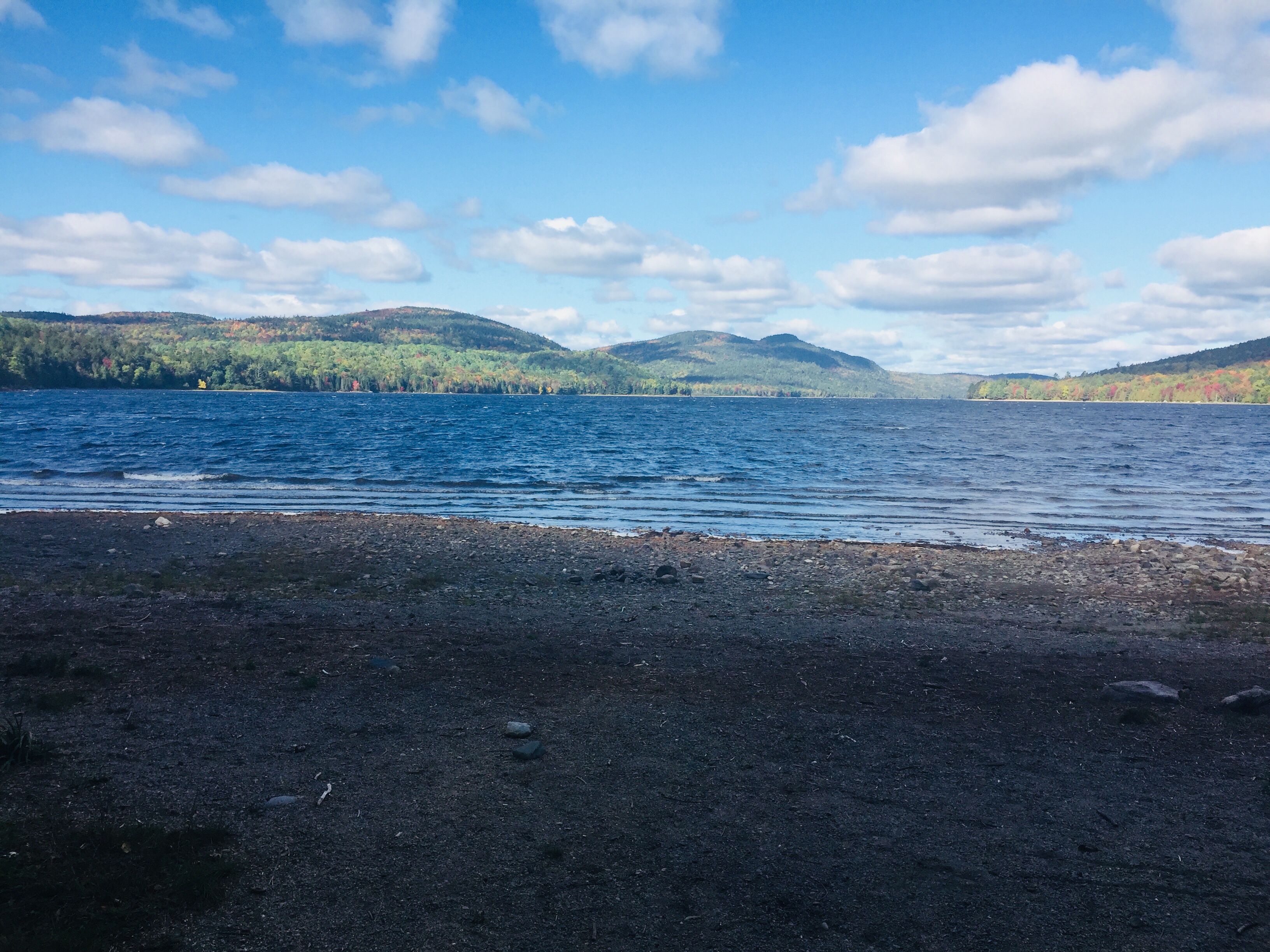
The beach at the south end of Lake Nahmakanta.
With that preamble, we got a mid-morning start at the south end of Lake Nahmakanta, and after a nostalgic moment on the windy beach, started walking north through the remote Nahmakanta Public Lands. Quickly, we saw large moose tracks and fresh droppings along the trail, and quickened our pace to try to see this animal, without success. We grudgingly adapted to having the heavy packs on our backs, and adjusted our day-hiker pace downward to accommodate the extra weight (we packed too much food). We stopped briefly at Wadleigh Stream Lean-to to crack open our Peanut Butter M&M’s, and noticed a plaque inside the lean-to honoring a hiker named Buffalo Bobby, who had passed away near this spot exactly 7 years before, 38 miles from finishing his third AT thru-hike. Wow. Rest in peace, BB.
Landscape and foliage views from north summit of Nesuntabunt Mountain.
By about 1 pm, we had reached the north summit of Nesuntabunt Mountain, and took the short side trail to view Nahmakanta Lake and far-off peaks. Then we sat down to make ourselves lunch, the same peanut butter, banana, and Nutella wraps we had used for energy on Katahdin a couple weeks before. A quick descent took us to the base of the mountain and around Crescent Pond to Pollywog Gorge.
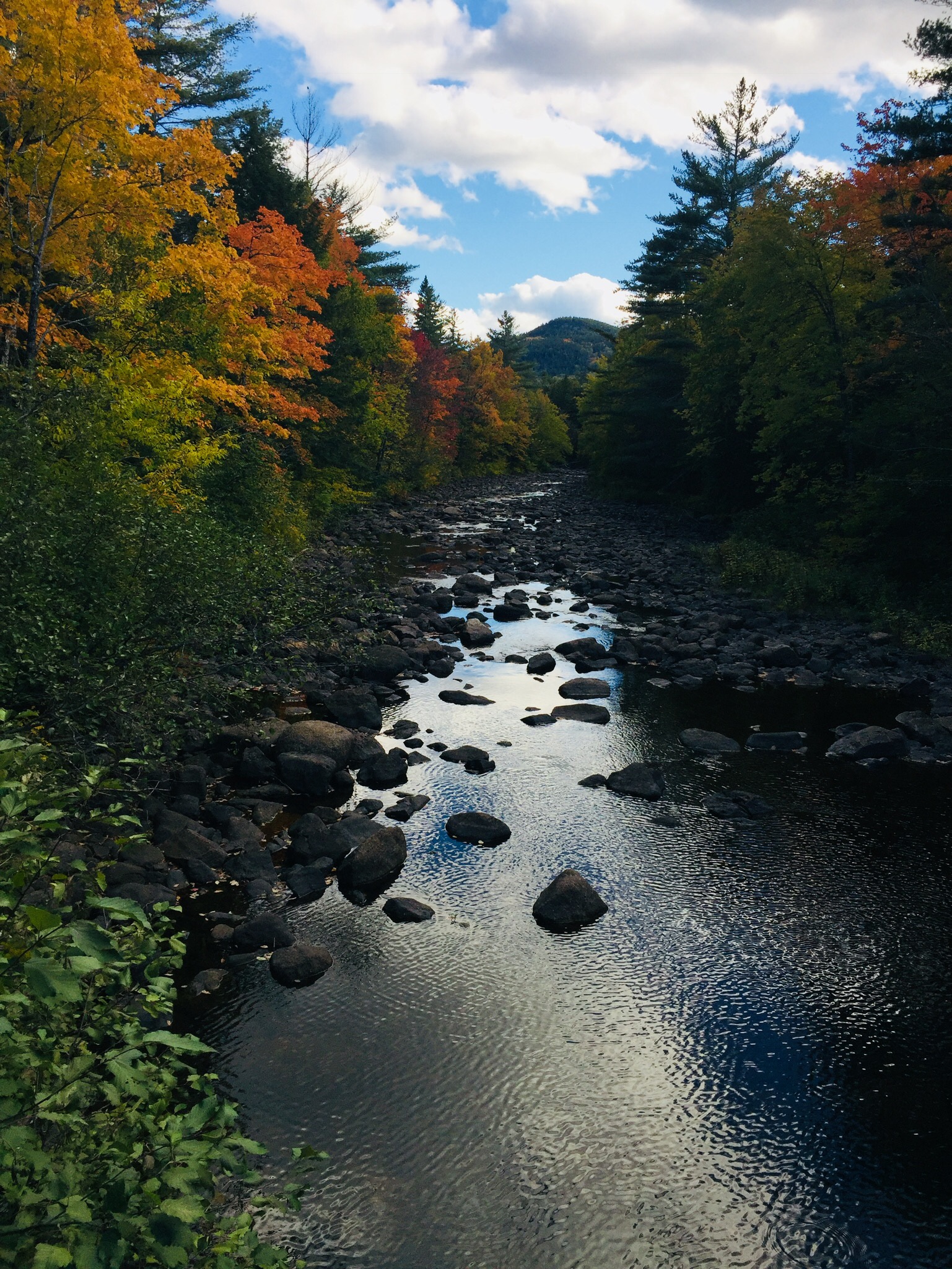
Fall colors on the AT near Pollywog Gorge
Changing leaves along Pollywog Stream.
The cliffs surrounding the gorge were impressive, but we were beginning to wear down, and didn’t linger. We crossed Pollywog Stream on a bridge, and made our way up Rainbow Stream to Rainbow Stream Lean-to a little before 5 pm, where a male thru-hiker and two female multi-day hikers we had seen earlier were getting ready for the night. This made it only a 10.7 mile day for us, but it felt like a lot more. The lean-to area quickly filled up with thru-hikers as the sun set. The thru-hikers we saw were exhausted, broken, and profane, but unfailingly friendly, polite, and focused on the last stretch of trail to Katahdin.
We set up our tent, which was complicated by a broken pole, repaired with a mostly ineffective combination of duct tape, twine, and tent stakes. We lay out our bedding, refilled our water, cooked dinner (Chicken Teriyaki Mountain House meal), hung our food in a bear bag, and were in our sleeping bags by 7 pm, fading into sleep despite the loud conversations by the lean-to campfire.
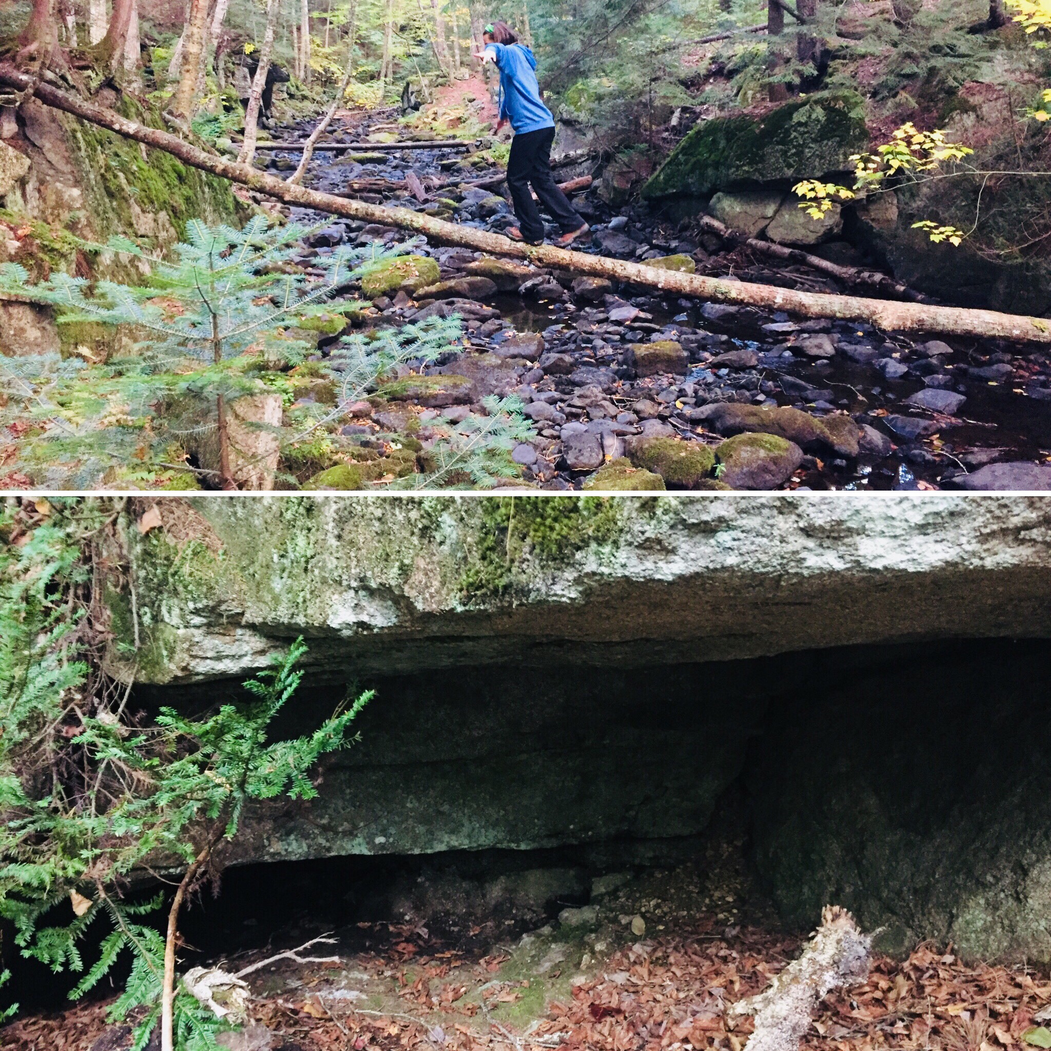
Log bridge and animal den.
It was a cold night, and we were uncomfortable, with neither of us sleeping well. Our sleeping bags and pads were up to the task, but we both agreed in the morning that we need to figure out how to pack pillows with us. Also, dad’s snoring woke up daughter, and daughter poking dad to stop his snoring woke up dad, creating the worst sort of perpetual motion machine throughout the night.
Daughter explored the campsite area in the morning, finding a precarious log bridge across Rainbow Stream to an animal den in a rock cave, possibly the former resting place of a bear. We peeked inside the den, seeing the small skull of an unfortunate prey animal. Dad made instant coffee and mixed in one of daughter’s hot chocolate packets for some more flavor in an attempt to wake up.
Morning light on the Rainbow Deadwaters.
We packed quickly and got moving around 7:30 AM, moving along the edge of the Rainbow Deadwaters. The trail was beautiful, and we marveled at spiderwebs covered in dew, and the unique morning light in the North Woods. We also heard late-season loons calling from Rainbow Lake.
Illuminated trail by Rainbow Lake.
Daughter said that the Hobbit movies could have been filmed here, a recognition of the dramatic, colorful terrain that we tend to associate with movies, and so rarely see in person. We saw a root formation overtaking a tree that looked like a giant spider. As far as mythical creatures go, the west end of Rainbow Lake was the site of what can only be described as a beaver Armageddon, with fallen trees every which way across the trail.
Beaver Armageddon
We stopped for a break by Rainbow Spring Campsite. The privy there was filled with trail graffiti, including the signature of someone whose trail name was “The Privy Destroyer.” This harkened back to irreverent trail names scrawled inside the Appalachian Trail Cafe that had amused daughter, including “Swamp Butt.”
We continued past side trails to Rainbow Mountain and Big Beaver Pond in the Debsconeag Lakes Wilderness Area, stopping to check out Rainbow Lake (the largest lake on the 100 MW) from several rocky openings along the trail. On one stop, we cooked a Mountain House chicken and rice meal for lunch, and let it cool while we walked. When we sat down about fifteen minutes later to eat, it was perfect. Daughter was already sick of the Nutella and lavash bread, so the hot lunch was a good change-up. We also used this time to air out our feet, and change into clean, dry socks.
View of Katahdin from Rainbow Ledges.
Rainbow Ledges was a steady climb, with colorful foliage and views from the high point back to the White Cap range, and forward, towards Katahdin. We remembered crossing the White Cap range a year ago on the 4th of July, and the pea soup fog that hindered our summit views that day. Sadly, we ran out of Peanut Butter M&M’s during this Rainbow Ledges ascent, which had a devastating effect on morale. From here, we descended through the ever-changing forest and down well-set rock staircases to Hurd Brook Lean-To.
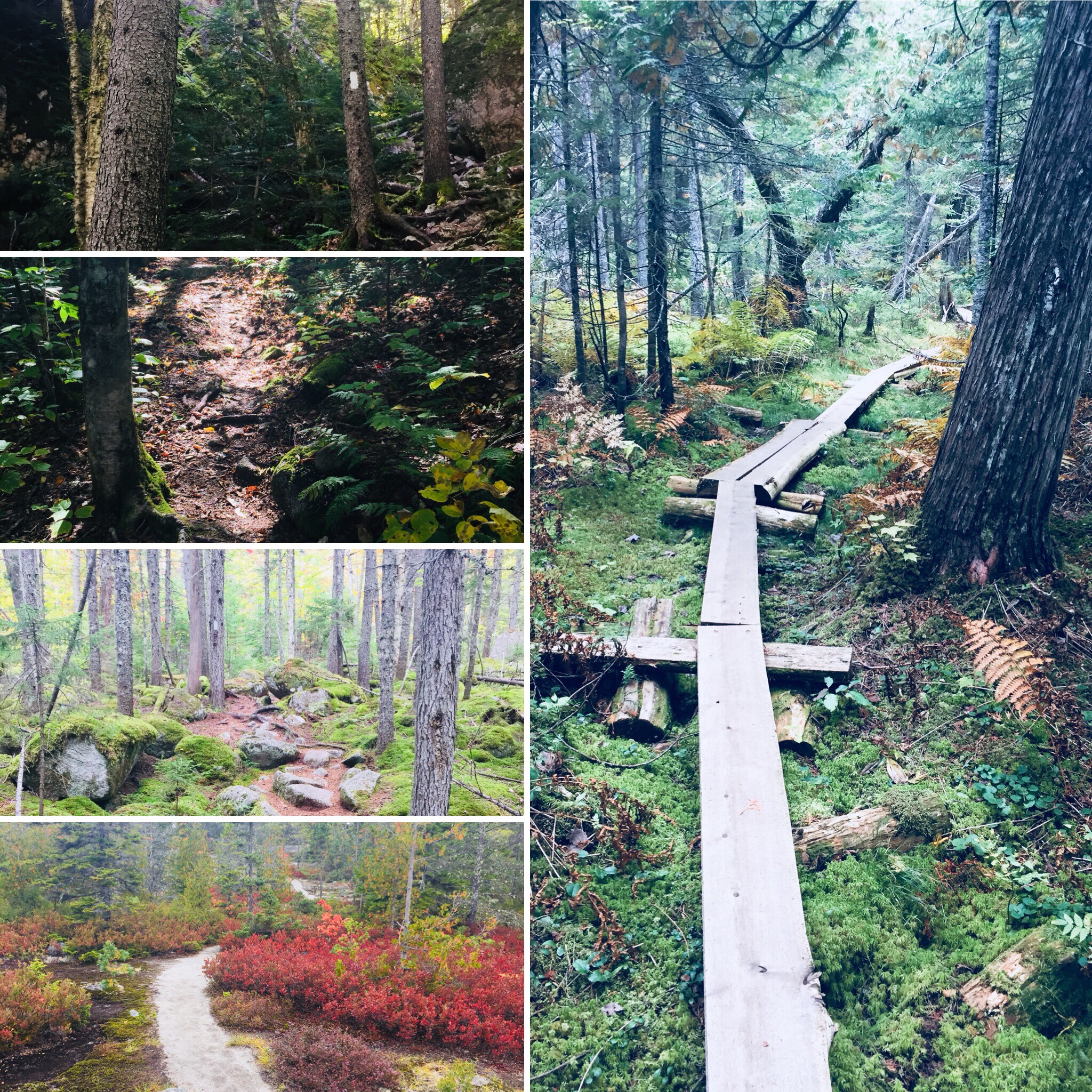
Different vegetation, incline, and make-up of the trail over just a 25-mile section.
The last few miles seemed to last the longest, as they always do. There weren’t many landmarks on the home stretch to Abol Bridge. The descriptive note, “Interesting area of large boulders and large hemlock trees,” on AT Map 1 at 2.2 miles from Abol Bridge, seemed superfluous after 100 miles of interesting rocks and trees. Suddenly, we were faced with a sign warning us that we were 100 miles north of Monson, and that we should have a minimum of 10 days supplies if we were heading south. We realized we were almost done, and saw the Golden Road peeking through the trees ahead.
Katahdin and the West Branch of the Penobscot from Abol Bridge.
We trudged across Abol Bridge in the late afternoon, completing our 15 mile day. We stopped by the Abol Bridge Campground store to buy some Gatorade, then got back in our truck, and drove out the Golden Road towards Millinocket. The Millinocket House of Pizza is daughter’s restaurant of choice, and she called in an order enroute for a large Hawaiian pizza as soon as cell service returned.
The soreness in our shoulders and knees and the chafing from the packs would fade in time, but completing the 100 Mile Wilderness together had been important to both of us. The cool, bug-free fall weather and colorful foliage were unexpected bonuses. To immerse yourself into the Wilderness, to walk there, sleep there on the ground, listen to the sounds of birds, bathe in the lakes, and then bring back out everything you came in with, is to feel shared ownership of this special place, where most people never go. Even in our weary haste at the end to finish, we had talked about new challenges, and also bringing memories of this hike back with us. As we split the pizza, we talked about our hike, and planned a lazy day for tomorrow.
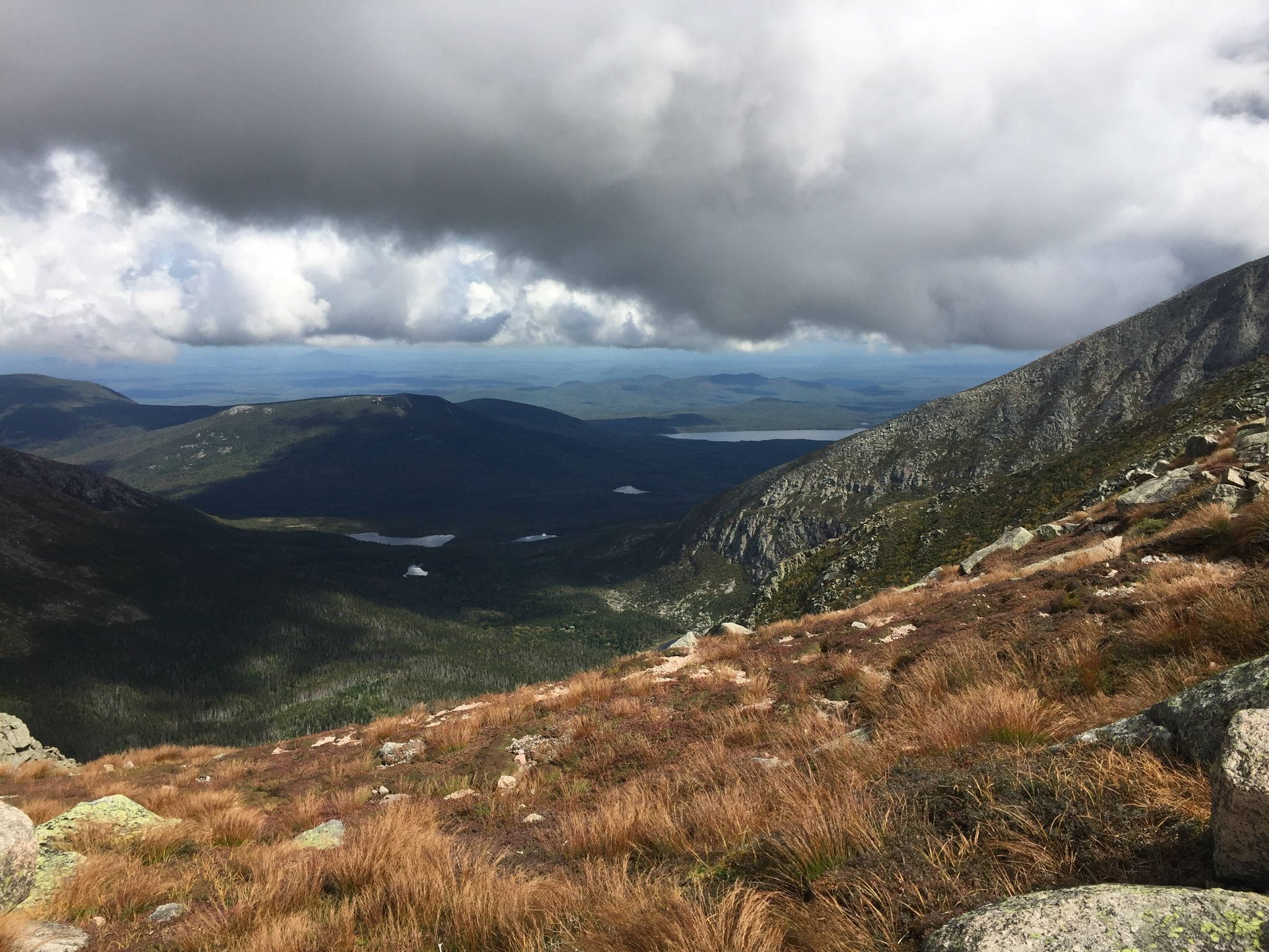
Keeping an eye on the weather on our descent down the Saddle Trail.
Katahdin is the grandfather of Maine mountains, and the northern terminus of the Appalachian Trail. It’s hard to describe the way Katahdin’s bulk dominates the landscape without actually seeing it for yourself. Dad and daughter climbed Katahdin’s Baxter Peak (5,268 ft) via the Chimney Pond, Cathedral, and Saddle Trails (total R/T appx 10.5 mi) on September 9, 2017 to cap off our spring and summer of hiking. Dad had previously hiked Katahdin via the Hunt Trail (11 mi R/T), and via the Helon Taylor, Knife Edge, Saddle, and Chimney Pond Trails (total R/T appx 10.2 mi), but this was daughter’s first ascent.
(Note: for a deeper dive on the Knife Edge Trail, check out this update in September 2018.)
Here is the Katahdin trail map from the Baxter State Park website, which wisely suggests allowing 8 to 12 hours for a Katahdin hike, and has all the info you will need for a successful hike:
Climbing Katahdin requires some prior planning, due to the remoteness of Baxter State Park. We stayed in Millinocket the night before our climb, as well as the night after, as not much was available for campsites within the park. We booked late, and due to a good deal, stayed both nights at a large suite in the Parks Edge Inn, which was more space than we needed, but it would be a perfect arrangement for a larger group of hikers, as it was cozy, friendly, there was a kitchen, and there were plenty of places to sleep.
View of Katahdin from the Chimney Pond Trail.
Our day started early, with the drive out to wait in line by the park’s gate. Luckily, dad had secured a parking pass for the Roaring Brook campground beforehand, and we weren’t turned away, as some in line were. Definitely plan ahead, and allow yourself the time to get to Baxter State Park’s gate, as well as the time for the slow drive on the Park’s dirt roads to wherever your trailhead is, as this will always take longer than you think.
The Knife Edge from Chimney Pond.
We parked at Roaring Brook, took a look at the scale model of the mountain at the ranger station there, signed the log, and began our trek beside Roaring Brook on the Chimney Pond trail.
Chimney Pond is beautiful, and a great jumping-off point for multiple hikes, as well as family-friendly ranger-led programs in the summertime. With ominous clouds moving in, we signed the trail log, got advice from the ranger at Chimney Pond to avoid descending the Cathedral Trail, and decided to make our push up Cathedral, and to return via the Saddle Trail. We decided we would forgo the Knife Edge, and take it the next time the weather allowed us to.
The Knife Edge on a previous ascent – not for the faint of heart.
Dad and daughter started the steep climb, and mom, who had accompanied us on this trip and hiked with us as far as the Chimney Pond Campground, then turned back to wait at the Roaring Brook lot for us as we climbed to the top. We felt strong, and our packs were intentionally light, focused on water, food, and light rain gear (in that order).
Dad/daughter each carried a 3 Liter Osprey water bladder (dad is one of those humans who just flat-out uses a lot of water), and we left daughter’s less full to reduce weight. Water on Katahdin is crucial, as straining leg muscles can easily dehydrate and cramp up, making for a difficult trip. In addition to water, eating bananas, and/or taking small amounts of salt and magnesium with food can help counter this cramping.
Daughter pushing up the Cathedral Trail.
We encountered several other pairs of hikers, who we spoke to briefly as we leap-frogged our way past and then behind them again during rest breaks. Cathedral was a serious climb, with a few hand-over-hand scrambles to follow the blue blazes.
We didn’t linger long at the summit of Baxter Peak, or stay for our planned lunch break. There was a large crowd that had come up the Hunt Trail, and the clouds did not look friendly. When dad did this hike the first time, it had been an icy affair, with stinging hail and ice, combined with a steady rain, and sure enough, we heard distant thunder, and started to feel a few drops.
Looking back at Pamola Peak and the Knife Edge from the Saddle Trail.
We scrambled down the Saddle Trail as the rain began to pick up, and about halfway down, dad’s feet went out from under him on a wet rock, and he took the weight on his wrist. The pain was dazzling, and we looked at the joint and the hand, but besides the discomfort, it appeared to be fine, so dad pulled it into his stomach to minimize the jostling as we descended, and we kept going.
The rain really began coming down, and we stopped in the treeline to put covers on our packs, and for daughter to don her rain jacket. The rain began to lighten while we stopped to enjoy some PB+J in a covered shelter at the Chimney Pond Campground. From there, we covered the ground quickly down the Chimney Pond Trail to the Roaring Brook lot, and our truck.
Getting back in the truck, dad realized that he couldn’t shift, steer, or turn the keys in the ignition with his right hand, and used his left to reach over the wheel for these tasks. As we wrote in our brief post on this hike to start this blog back in September 2017, it turned out, after X-rays a couple weeks later, that the wrist was broken. Bummer. Again, a great argument for the utility of hiking poles on a slippery descent, which would likely have mitigated this injury.
Daughter and dad agreed that Katahdin was the most challenging mountain of the summer, far surpassing Washington. We were happy with our route, and would suggest it to those tackling Katahdin when the Knife Edge is not a good idea due to weather. Cathedral offered us incredible views, and we used our rest breaks to turn and survey our progress and the landscape. We are looking forward to hiking Katahdin again, as well as exploring more of the newly established Katahdin Woods and Waters National Monument.
A Post Script….
We did enjoy a great mini-hike the following day on the way home, as we had a full day available to us. We stopped on the way south at the Orono Bog Walk, a 1-mile boardwalk loop that starts at the Bangor City Forest.
We really like plaid.
This was fascinating, particularly for the opportunity to see pitcher plants, which we had seen in the Barren-Chairback range during our 100 Mile hike, and for the many varieties of birds along the route.
Views from the Orono Bog boardwalk.
It was also a relatively easy loop, and an opportunity to stretch our legs after Katahdin the day before. Larger loops are well-marked and available for running and walking within the adjacent City Forest. Just get there early- parking was at a premium.