The Orono Bog Boardwalk, adjacent to the Bangor City Forest, is located off Stillwater Avenue just north of the Bangor Mall area. The easy, flat 1-mile Boardwalk, celebrating its 20th year in 2022, is a joint venture of the University of Maine, the City of Bangor, and the Orono Land Trust. Updates on conditions and opening hours are available through the Boardwalk’s Facebook page. The Boardwalk is closed during the winter, and from the designated opening day in the spring through Labor Day, open from 7 am to 6:30 pm, with hours gradually getting shorter in September and October until closing for winter the Sunday after Thanksgiving, when it is 8 am to 3:30 pm. We had visited the Boardwalk before as a stopover to stretch our legs on the way back south from Katahdin.
Orono Bog Boardwalk, Orono, ME
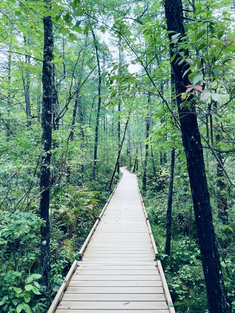
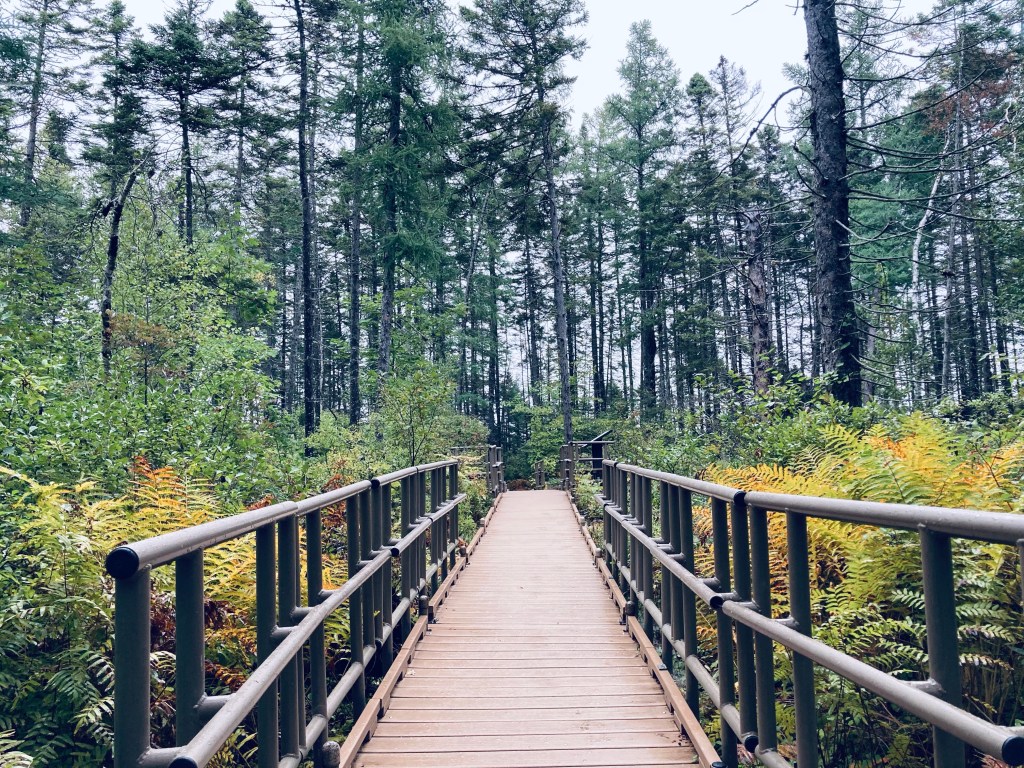
On a rainy late September morning, I parked at the Bangor City Forest parking lot on Tripp Road and turned immediately right onto the wide flat East-West Loop Trail through the trees. It was quiet, except for red squirrels, and a little over a quarter mile to the Boardwalk, the entrance situated behind an information kiosk, a picnic table, and a bike rack. There are restroom facilities available, close by and clearly marked. The Boardwalk elevates over the bog, which is filled with large, lush ferns, wide leaves of skunk cabbage, and ash and maple trees perched on hummocks, with periodic benches to sit and watch the plants and wildlife. I heard but didn’t see a white-breasted nuthatch and a hairy woodpecker.
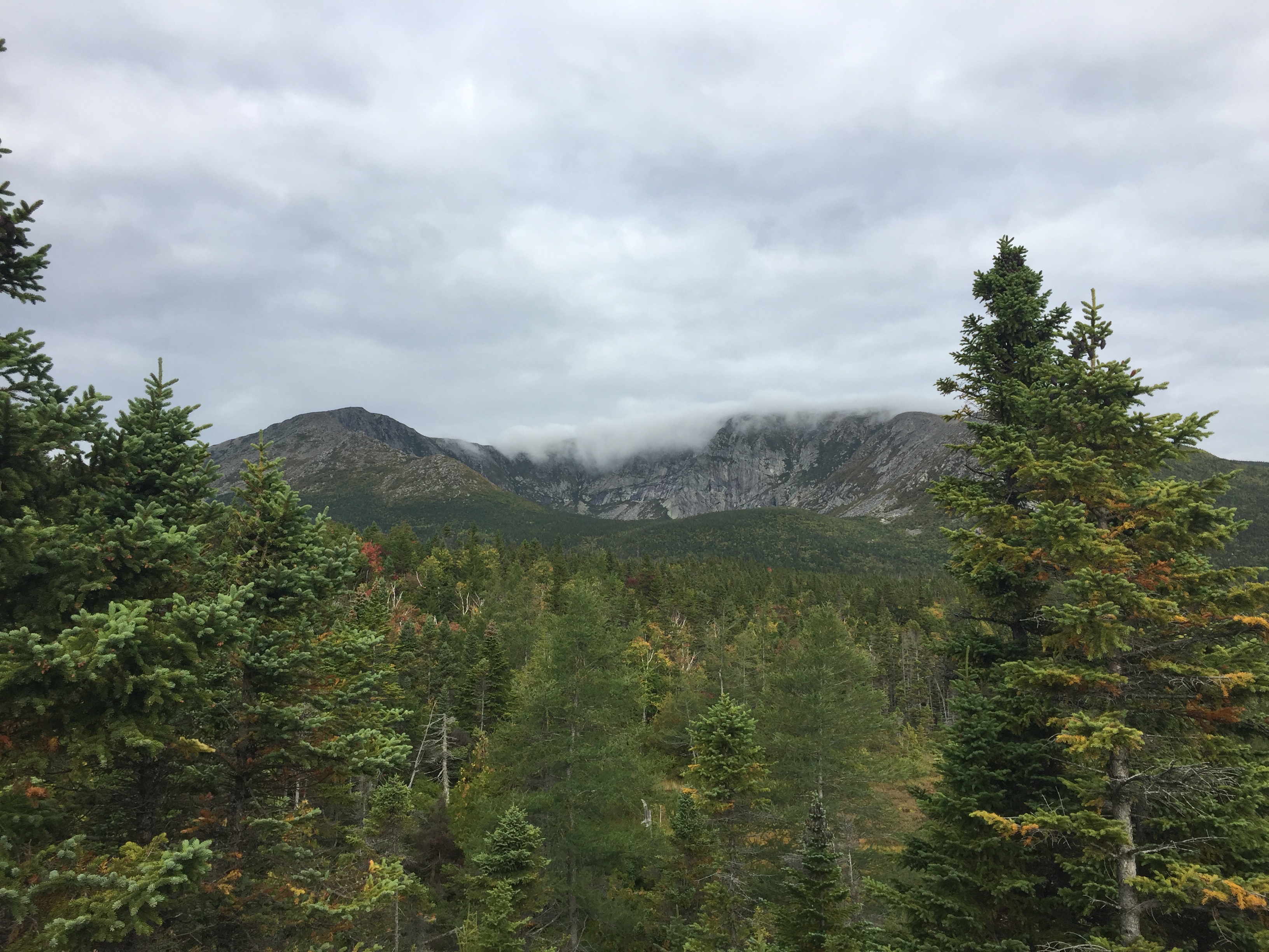
Keeping an eye on the weather on our descent down the Saddle Trail.
Katahdin is the grandfather of Maine mountains, and the northern terminus of the Appalachian Trail. It’s hard to describe the way Katahdin’s bulk dominates the landscape without actually seeing it for yourself. Dad and daughter climbed Katahdin’s Baxter Peak (5,268 ft) via the Chimney Pond, Cathedral, and Saddle Trails (total R/T appx 10.5 mi) on September 9, 2017 to cap off our spring and summer of hiking. Dad had previously hiked Katahdin via the Hunt Trail (11 mi R/T), and via the Helon Taylor, Knife Edge, Saddle, and Chimney Pond Trails (total R/T appx 10.2 mi), but this was daughter’s first ascent.
(Note: for a deeper dive on the Knife Edge Trail, check out this update in September 2018.)
Here is the Katahdin trail map from the Baxter State Park website, which wisely suggests allowing 8 to 12 hours for a Katahdin hike, and has all the info you will need for a successful hike:
Climbing Katahdin requires some prior planning, due to the remoteness of Baxter State Park. We stayed in Millinocket the night before our climb, as well as the night after, as not much was available for campsites within the park. We booked late, and due to a good deal, stayed both nights at a large suite in the Parks Edge Inn, which was more space than we needed, but it would be a perfect arrangement for a larger group of hikers, as it was cozy, friendly, there was a kitchen, and there were plenty of places to sleep.
View of Katahdin from the Chimney Pond Trail.
Our day started early, with the drive out to wait in line by the park’s gate. Luckily, dad had secured a parking pass for the Roaring Brook campground beforehand, and we weren’t turned away, as some in line were. Definitely plan ahead, and allow yourself the time to get to Baxter State Park’s gate, as well as the time for the slow drive on the Park’s dirt roads to wherever your trailhead is, as this will always take longer than you think.
The Knife Edge from Chimney Pond.
We parked at Roaring Brook, took a look at the scale model of the mountain at the ranger station there, signed the log, and began our trek beside Roaring Brook on the Chimney Pond trail.
Chimney Pond is beautiful, and a great jumping-off point for multiple hikes, as well as family-friendly ranger-led programs in the summertime. With ominous clouds moving in, we signed the trail log, got advice from the ranger at Chimney Pond to avoid descending the Cathedral Trail, and decided to make our push up Cathedral, and to return via the Saddle Trail. We decided we would forgo the Knife Edge, and take it the next time the weather allowed us to.
The Knife Edge on a previous ascent – not for the faint of heart.
Dad and daughter started the steep climb, and mom, who had accompanied us on this trip and hiked with us as far as the Chimney Pond Campground, then turned back to wait at the Roaring Brook lot for us as we climbed to the top. We felt strong, and our packs were intentionally light, focused on water, food, and light rain gear (in that order).
Dad/daughter each carried a 3 Liter Osprey water bladder (dad is one of those humans who just flat-out uses a lot of water), and we left daughter’s less full to reduce weight. Water on Katahdin is crucial, as straining leg muscles can easily dehydrate and cramp up, making for a difficult trip. In addition to water, eating bananas, and/or taking small amounts of salt and magnesium with food can help counter this cramping.
Daughter pushing up the Cathedral Trail.
We encountered several other pairs of hikers, who we spoke to briefly as we leap-frogged our way past and then behind them again during rest breaks. Cathedral was a serious climb, with a few hand-over-hand scrambles to follow the blue blazes.
We didn’t linger long at the summit of Baxter Peak, or stay for our planned lunch break. There was a large crowd that had come up the Hunt Trail, and the clouds did not look friendly. When dad did this hike the first time, it had been an icy affair, with stinging hail and ice, combined with a steady rain, and sure enough, we heard distant thunder, and started to feel a few drops.
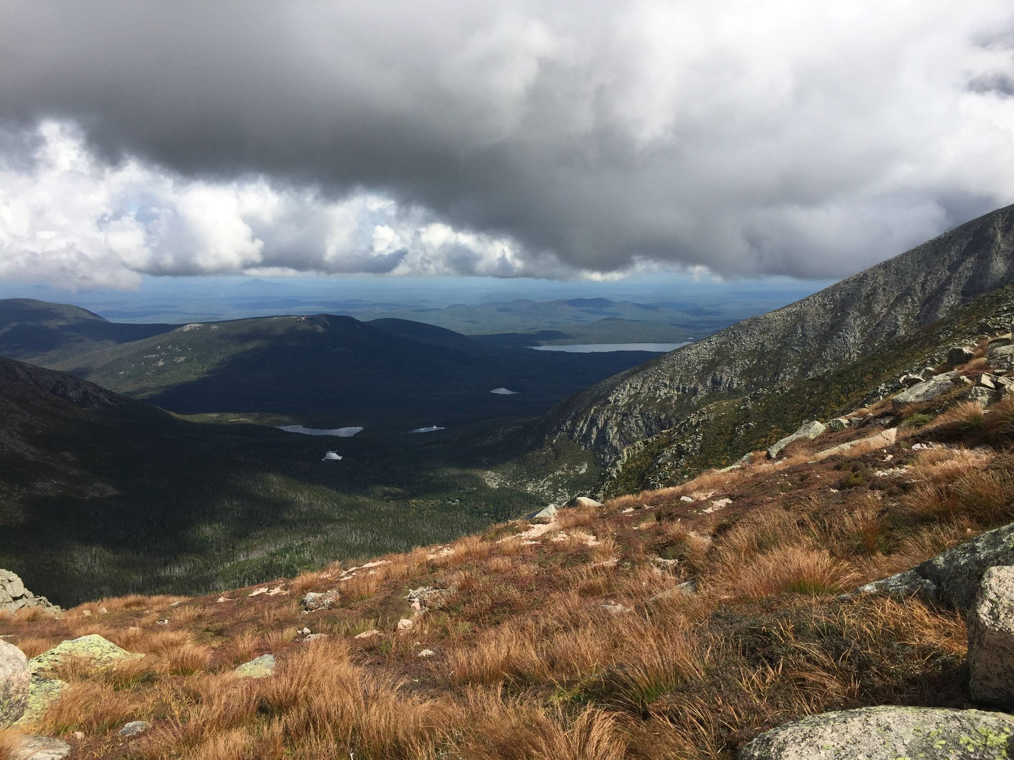
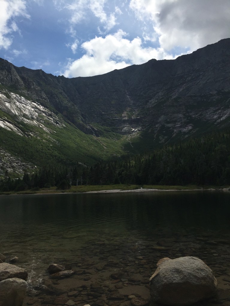
Looking back at Pamola Peak and the Knife Edge from the Saddle Trail.
We scrambled down the Saddle Trail as the rain began to pick up, and about halfway down, dad’s feet went out from under him on a wet rock, and he took the weight on his wrist. The pain was dazzling, and we looked at the joint and the hand, but besides the discomfort, it appeared to be fine, so dad pulled it into his stomach to minimize the jostling as we descended, and we kept going.
The rain really began coming down, and we stopped in the treeline to put covers on our packs, and for daughter to don her rain jacket. The rain began to lighten while we stopped to enjoy some PB+J in a covered shelter at the Chimney Pond Campground. From there, we covered the ground quickly down the Chimney Pond Trail to the Roaring Brook lot, and our truck.
Getting back in the truck, dad realized that he couldn’t shift, steer, or turn the keys in the ignition with his right hand, and used his left to reach over the wheel for these tasks. As we wrote in our brief post on this hike to start this blog back in September 2017, it turned out, after X-rays a couple weeks later, that the wrist was broken. Bummer. Again, a great argument for the utility of hiking poles on a slippery descent, which would likely have mitigated this injury.
Daughter and dad agreed that Katahdin was the most challenging mountain of the summer, far surpassing Washington. We were happy with our route, and would suggest it to those tackling Katahdin when the Knife Edge is not a good idea due to weather. Cathedral offered us incredible views, and we used our rest breaks to turn and survey our progress and the landscape. We are looking forward to hiking Katahdin again, as well as exploring more of the newly established Katahdin Woods and Waters National Monument.
A Post Script….
We did enjoy a great mini-hike the following day on the way home, as we had a full day available to us. We stopped on the way south at the Orono Bog Walk, a 1-mile boardwalk loop that starts at the Bangor City Forest.
We really like plaid.
This was fascinating, particularly for the opportunity to see pitcher plants, which we had seen in the Barren-Chairback range during our 100 Mile hike, and for the many varieties of birds along the route.
Views from the Orono Bog boardwalk.
It was also a relatively easy loop, and an opportunity to stretch our legs after Katahdin the day before. Larger loops are well-marked and available for running and walking within the adjacent City Forest. Just get there early- parking was at a premium.