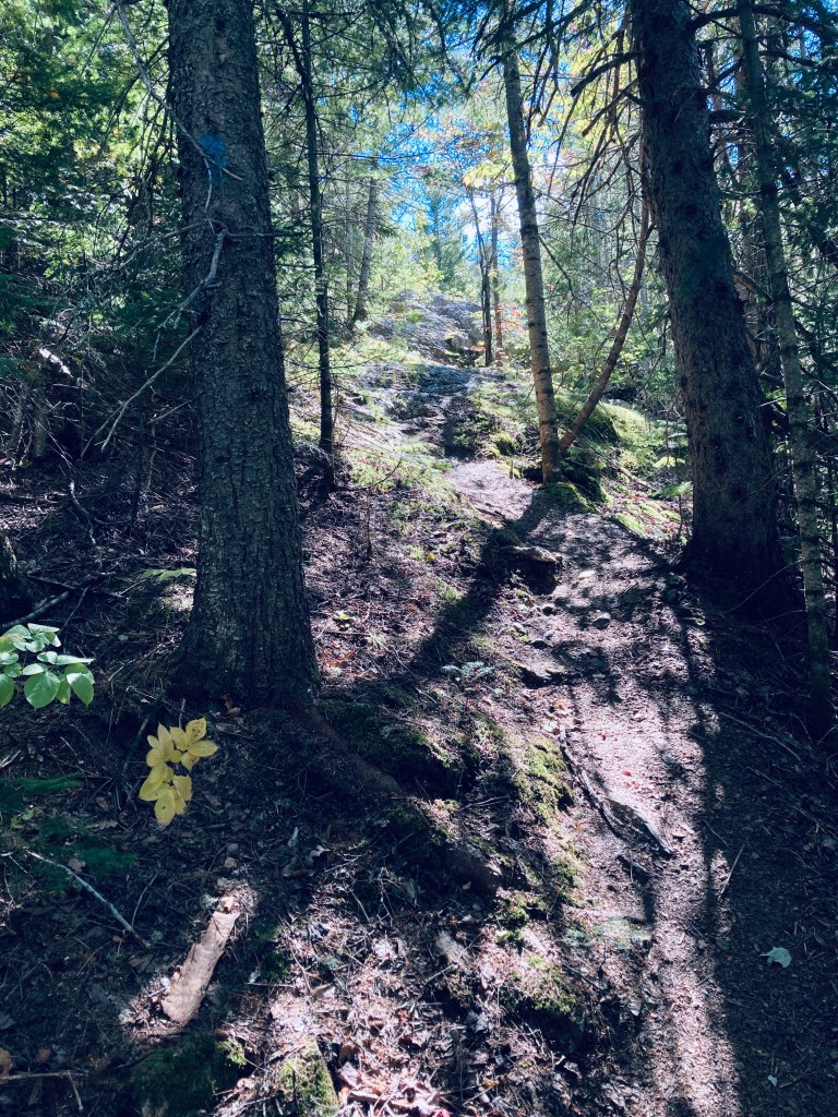
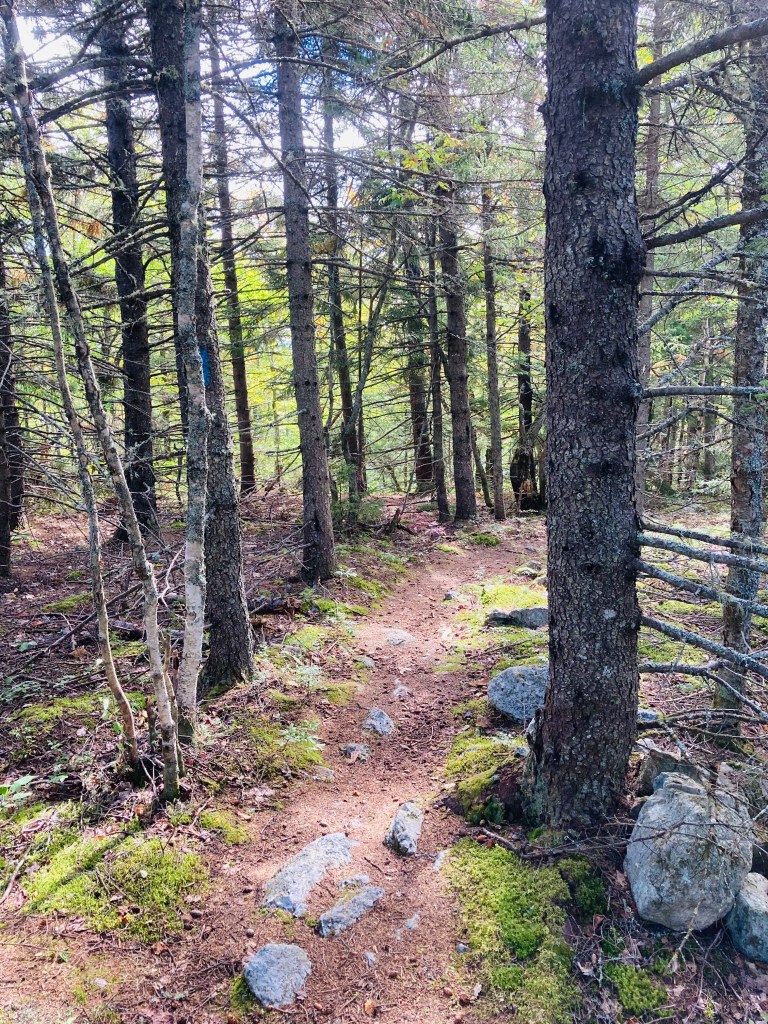
Steeper climbing, Trout Brook Mountain, Baxter State Park
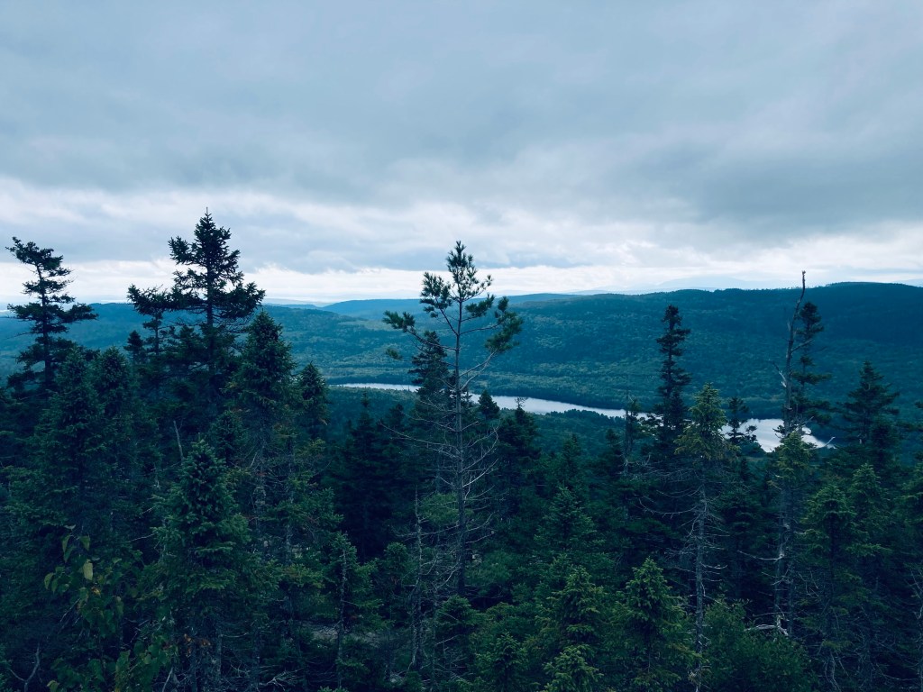
At the beginning of the trail up Trout Brook Mountain, the emerald colors of hobblebush contrast with the darker forest, particularly as it transitions to evergreen. The trail winds through this forest and climbs rocky ledges dressed in soft green moss, with excellent northward views at about 3/4 of a mile up toward Trout Brook, Grand Lake Matagamon and the north woods.
View north of Grand Lake Matagamon and mountains in Aroostook from Trout Brook MountainContinue reading →
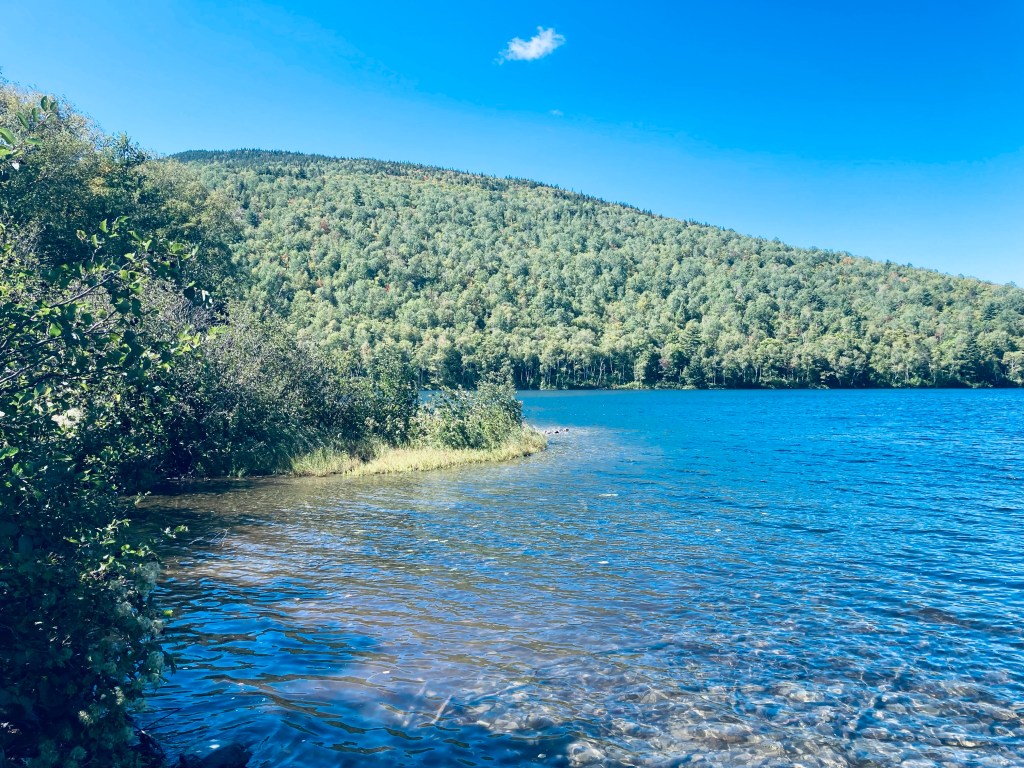
Lower South Branch Pond from Pogy Notch Trail, Baxter State Park, Maine
Howe Brook Falls is a spectacular four mile total out-and-back waterfall hike from South Branch Pond Campground in the northern half of Baxter State Park (BSP). I have tacked this hike on to a South Branch Pond Loop hike, which is covered separately in another post, but also done all or part of the Howe Brook Falls hike by itself, which can be done in three hours or less. A detailed description and map of this hike is found in the books Hiking Maine’s Baxter State Park and Hiking Waterfalls Maine, and a Baxter State Park downloadable map of South Branch Pond is available on BSP’s website.
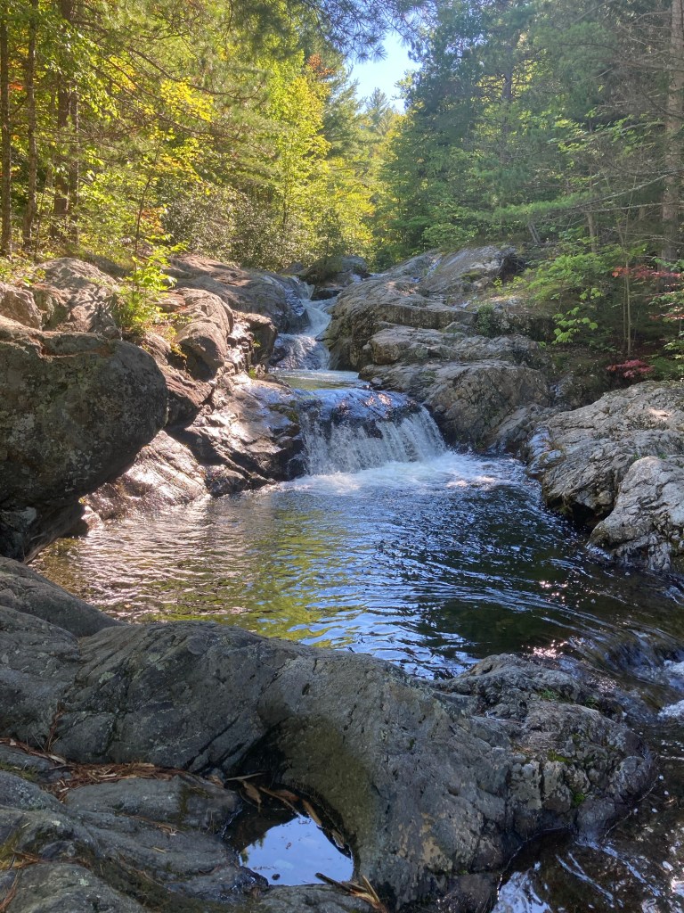
Howe Brook Trail, Baxter State Park, Maine
The hike begins at the Pogy Notch trailhead in the southeast corner of the South Branch Pond Campground. The beginning of this trail contains the iconic “You Are Entering Maine’s Largest Wilderness” sign, which encourages caution and self-sufficiency, and turnaround times are calculated in a table at the kiosk. A straightforward, flat mile-long hike leads along the eastern shore of clear, quiet Lower South Branch Pond to a left turn onto the Howe Brook Trail.
Howe Brook Trail, Baxter State Park, Maine
From this trail intersection, it’s only about a quarter mile to the lower falls and pools, so if you have kids who can’t make it the full two miles out and back, these lower cascades are sufficiently beautiful and entertaining for a day trip, splashing and swimming, and a picnic. After about a mile, the trail becomes a little steeper and veers farther away from the brook as the gorge narrows in the shadow of Traveler Mountain. The path to the upper falls is narrow and sometimes winding, but never overly strenuous, with views of the rushing water and moss-covered boulders of Howe Brook to the right.
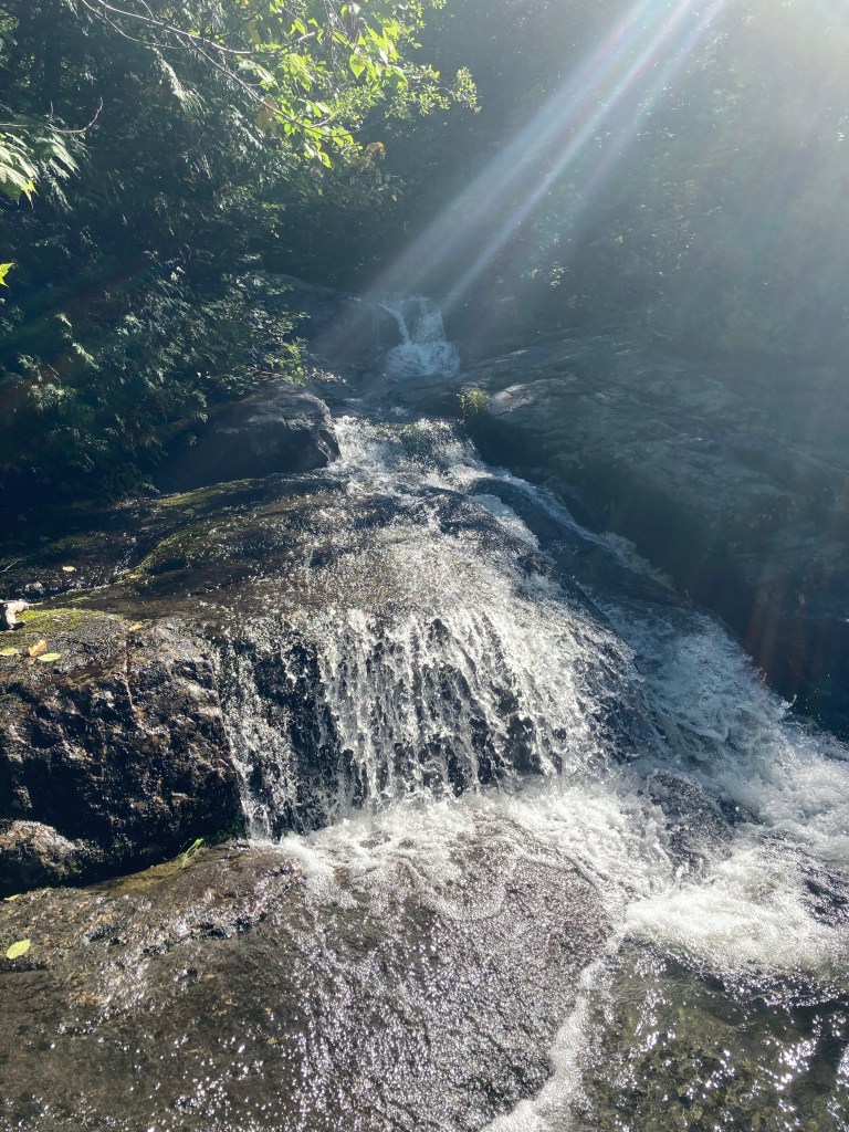
Howe Brook Trail, Baxter State Park, Maine
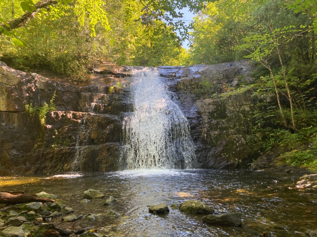
At the top of the trail is a truly impressive waterfall, dropping straight into a cold pool. This is the Upper Falls, capping this trip through the cascades. In the sunlit opening below, I have disturbed some ruffed grouse, who had been sunning themselves on the rocks, made unaware of me until the last minute by the white noise of the falls.
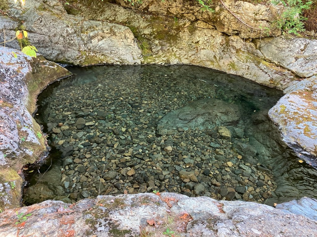
Clear pool below Howe Brook Falls, Baxter State Park, Maine
A pleasant downhill hike re-traced my steps, and allowed me to re-visit the mirrored pools and clearings of Howe Brook on the way back to South Branch Campground. This hike is amazing, even with low water flow in drier periods, and every tier of the path has amazing views and clear, cold pools.
Upper Falls, Howe Brook Trail, Baxter State Park, Maine
(Disclaimer: This post contains affiliate links, and as an Amazon Associate Hiking in Maine blog earns from qualifying purchases.)
Sun rising over Black Cat and South Branch Mountains from Traveler Loop
This loop route over Traveler’s bulk, which the AMC Maine Mountain Guide accurately describes as “starfish-shaped,” crosses Peak of the Ridges (3,254 ft), Traveler summit (3,550 ft), and North Traveler summit (3,152 ft). As it says on BSP’s website, “Preparation for a Traveler Loop hike is the same as a Katahdin hike,” due to the exposed nature of the hike, elevation gain, lack of available water, and distance. This is true, and in inclement weather, hikers should explore other options. To navigate, I used Map Adventures’ Katahdin Baxter State Park Waterproof Trail Map, but BSP’s official website also has free downloadable/printable trail maps, and the South Branch Pond map covers this area.
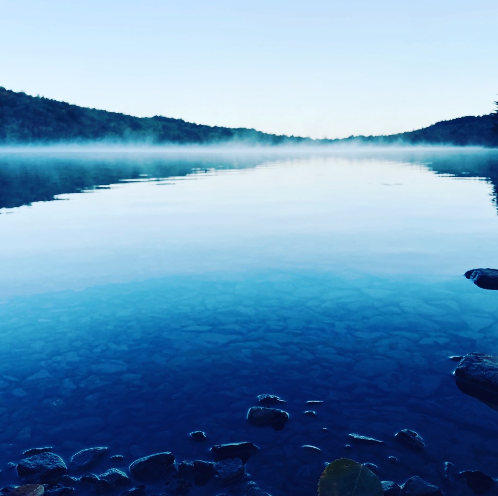
Lower South Branch Pond at dawn
The Traveler is a strenuous 10.1 mile loop hike over the rhyolite peaks of Traveler Mountain, the highest volcanic mountain in New England, with over 4,000 feet of total elevation gain. This full-day (6-10 hour) hike begins at Baxter State Park’s (BSP) South Branch Campground, and based upon advice from the AMC Maine Mountain Guide and Falcon Guides’ Hiking Maine’s Baxter State Park and BSP rangers, is best attempted counterclockwise via the Pogy Notch, Center Ridge, Traveler Mountain, and North Traveler trails. This is to avoid descending the steep, loose rock on the Center Ridge Trail.
Lower South Branch Pond from canoe launch in morning, Baxter State Park
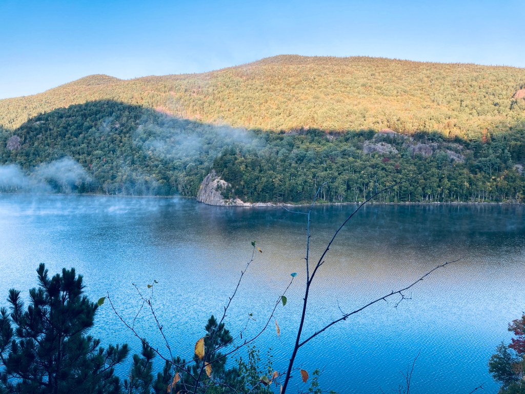
Unlike Katahdin trailheads, no additional parking reservation is typically needed for the Traveler, and the closest parking to the trailhead is the South Branch Pond Campground day-use/back country lot. On each of the cool mid-September mornings I did my hike in 2020 and 2025, an early fog hung over South Branch Pond. The trail leads over plank bridges to a winding track along the edge of the pond, usually accompanied by the stuttering sound of a belted kingfisher. About .9 miles in, there are beautiful views of the pond from the south end at the canoe landing for the Howe Brook trail.
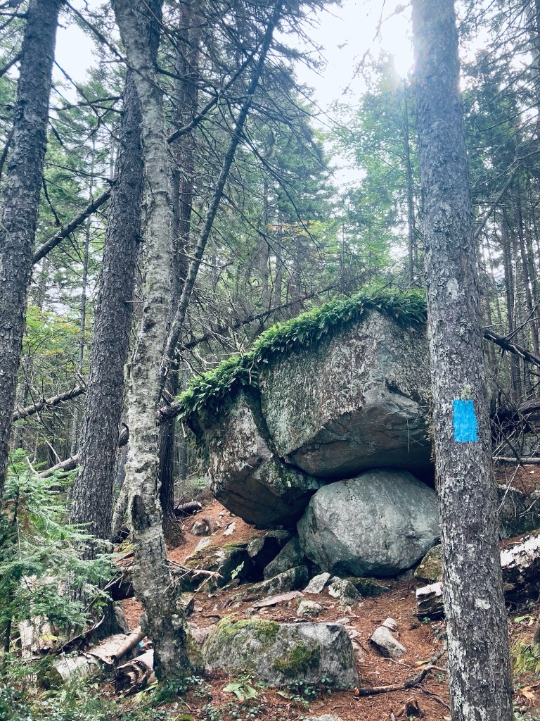
Balanced boulder, South Branch Pond, and the horizon from Center Ridge Trail, Baxter State Park’s Traveler Loop
The blue blazes lead up a steep rocky outcrop to continue up Pogy Notch Trail to its junction with the Center Notch Trail, with nice views along the pond. This is where the climbing really starts, and you’ll find yourself periodically grabbing for rocks and roots as handholds. I took a well-deserved rest after about 2 miles to make myself a coffee, let my feet air out a little, and send a proof-of-life text from elevation (South Branch Pond, like a lot of Baxter State Park, has no cell service).
Millinocket Lake from Observation Tower, Trout Mountain Preserve, T2 R9, Maine
Trout Mountain (1,409 ft) is the centerpiece of a 3,598 acre Preserve owned and managed by The Nature Conservancy (TNC), adjacent to the south side of Baxter State Park, and open from dawn to dusk (no overnight camping). Information and trail maps can be found on TNC’s Trout Mountain Preserve website. This hike is also fully described in The AMC Maine Mountain Guide. The relatively easy trail to the Trout Mountain summit, listed by TNC as 2.7 miles one-way, capped by an 80-foot observation tower, measured a total of 5.26 miles roundtrip by my AllTrails app, with only 827 feet elevation gain, the whole thing taking about an hour and 45 minutes.
Fern-covered boulders, Trout Mountain Preserve, T2 R9, Maine
The trail starts from a small kiosk accessible from the same turn as the large emergency helicopter landing area, just short of Baxter State Park’s Togue Pond Gate, where a bald eagle circled when I drove through. The trail is a well-maintained single track that is fairly rocky. After the Nature Conservancy sign welcoming you to The Trout Mountain Preserve, the trail winds through a widely spaced young forest with knee-high ferns.
Trout Mountain Preserve, T2 R9, Maine
After 2 miles, the incline increases quickly, but it’s through such a beautiful green, moss-covered forest with hobblebush and bright red berries that the strain likely won’t hit you for a little bit. I reached the tower in a little less than an hour’s time. It looked incongruent on this quiet mountain, but I was grateful for its elevation in order to see the surrounding countryside.
Observation Tower, Trout Mountain Preserve, T2 R9, Maine
The tower, which a stamp shows was erected in 2020, seemed absurdly tall while climbing it, and even taller once I was at the top. I could see the surrounding north Maine woods, Millinocket Lake, and Katahdin shrouded with clouds, looking like the cloud would move away soon. There is also an outhouse near the summit. I had the tower to myself, and enjoyed the meager remains of my trail snacks from a weekend at Baxter State Park. The hike back was almost uniformly downhill, and I passed another solo hiker, then a small family, each headed up to the top.
Katahdin from Observation Tower, Trout Mountain Preserve, T2 R9, Maine
(Disclaimer: This post contains affiliate links, and as an Amazon Associate Hiking in Maine blog earns from qualifying purchases.)
Falls at Grand Pitch of Webster Stream, Baxter State Park, ME
The Freezeout Trail at Baxter State Park (BSP) starts from the Day-Use Parking at Trout Brook Farm Campground, crossing a sturdy wooden bridge over the brook, which was mobbed by honking Canada geese when I hiked it in mid-September. The Freezeout Trail itself is a long one-way trail (14.4 miles) connecting Trout Brook Farm to the outlet of Webster Lake in Baxter’s Scientific Forest Management Area, and often included as a loop with the Wadleigh Brook and Frost Pond Trails, and/or as a backpacking trip utilizing the campsites along the way.
Freezeout Trail, Baxter State Park, ME
I navigated using AllTrails, on a route from Hiking Waterfalls Maine that took me to the Grand Pitch of Webster Stream, which the book accurately described as, “a long way from anywhere.” To the waterfalls and back was 12.86 miles, which I did in about four and-a-half hours, with a stop at the falls to cook a chili-mac meal on my JetBoil. The hike is usually described by guidebooks and BSP rangers as very buggy, but the chilly early fall morning made mosquitoes and flies a non-factor on this hike. After the third walk-in Trout Brook Farm tent site, there is a sign-in box for hikers.
Wildflowers on Freezeout Trail, Baxter State Park, ME
The trail was flat and fast, and a beautiful carpet of moss and princess pine lined the path. I had the trail to myself, with the pleasant chirping of birds throughout, and now and then the view of Grand Lake Matagamon to the right of me through the trees. At about one and-a-quarter miles I crossed a bridge over a small bog, passing aster and goldenrod flowers, and disturbed a small brown bird, a least flycatcher or pee-wee.
Beaver dam across large bog on Freezeout Trail, Baxter State Park, ME
At a little under 2.5 miles I crossed another bog over a large beaver dam, and saw one of the beavers working about 100 yards away, weaving its way in a slalom between the flooded tree trunks. A side trail at 3.2 miles led to a large pile of sawdust remaining from mill operations, springy underfoot on the shores of Grand Lake Matagamon. I stopped here for a snack on jerky and looked at the waters, while a solitary belted kingfisher plied the shoreline. A drifting loon joined the chorus of bird sound, and then dove under silently.
Sawdust pile on shore of Grand Lake Matagamon, Freezeout Trail, Baxter State Park, ME
As I turned up the shore to continue north on the Freezeout Trail, I noticed fairly clear, new bear tracks in the sawdust, and bear scat on the trail. At about 4.2 miles, the Frost Pond Trail came in from the left, and I continued to see the lake through the trees. The trail here was a little wider as I continued towards Webster Stream. At about 5.2 miles I stopped at the Northwest Cove tent site to take a look at the lake where a cormorant was drying its wings on a log extending from the water, then I continued up the Freezeout Trail.
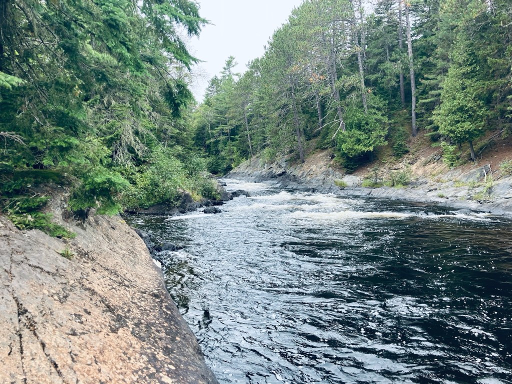
At about 5.7 miles, I turned hard left towards Grand Pitch Falls, which I could already hear through the trees. The trail followed a worn path on the bank above Webster Stream, which moved quickly below. At about 6 miles I took advantage of an overlook to the right to watch the stream flow down towards me and downstream, around an island in the middle.
Webster Stream, Baxter State Park, ME
Shortly thereafter, I veered right on a small trail which rode the rock lip over the river, emerging to the Stream crashing through the canyon with a deafening roar, which was awesome to behold. Just above the wild falls, a large crayfish waited in a quiet pocket of rock.
Crayfish in pool above falls of Webster Stream, Baxter State Park, ME
I prepared myself a freeze-dried chili mac here and sat by the falls for quite awhile, then packed up everything and turned and walked the 6.4 miles back to the trailhead. On the way back across the beaver dam, I noticed a small ramp midway across, covered with mud, and clearly used by the beaver to slide back-and-forth between his properties. This is a truly remote hike – despite covering almost 13 miles, I didn’t see a single person until I got back to the parking area.
Grand Lake Matagamon from Freezeout Trail, Baxter State Park, ME
(Disclaimer: This post contains affiliate links, and as an Amazon Associate Hiking in Maine blog earns from qualifying purchases.)
The first time I chose to take the approximately six and-a-half mile Five Ponds Loop at Baxter State Park was the day after a strenuous Traveler Mountain hike, both for its relative ease and for early morning opportunities to see wildlife. I recently explored it again in mid-September as a last, long walk before sunset, after other more difficult hikes. A detailed description of the trail can be found in the AMC Maine Mountain Guide and Falcon Guides’ Hiking Maine’s Baxter State Park.
Colorful mushroom, Five Ponds LoopFern-covered Boulder, Five Ponds Loop, Baxter State ParkRed squirrel, Five Ponds Loop
In 2020, my hike was in a clockwise direction from the trailhead at the Trout Brook Farm Campground, familiar to me from my hike of Trout Brook Mountain two days prior (park in day-use parking near the sign that reads, “Park Orderly”). The ponds, in that east to west sequence, are Littlefield Pond, Billfish Pond, Round Pond, High Pond, and Long Pond, accessed through a series of side trails spanning the shoulders of Trout Brook Mountain. Billfish and Long each have canoe rentals (through the ranger at Trout Brook Farm campsite).
East Spur Overlook, Horse Mountain, Baxter State Park
Horse Mountain (1,589 ft) is the first trail you will encounter through Baxter State Park’s Matagamon Gate, with high cliffs visible from the Grand Lake Road heading into the park. This hike, about 3.3 miles, taking about an hour and twenty minutes with the inclusion of the East Spur Overlook, starts uphill on a narrow track through a forest dominated by birch. Map and description are available from two indispensable books – the AMC Maine Mountain Guide and Falcon Guides’ Hiking Maine’s Baxter State Park by Greg Westrich. Throughout Baxter State Park, I used Map Adventures’ Katahdin Baxter State Park Waterproof Trail Map to navigate. Baxter’s great website also has downloadable/printable trail maps, and the Trout Brook Farm map covers this area.
Horse Mountain Trail near summit, Baxter State Park
The sparsely recorded trail log and spiderwebs across the trail attest to its lesser-used nature. In fact, as I was getting ready to hike it the first time in September 2020 at the tiny parking area, a man stopped his vehicle and told me that he had hiked every mountain in Baxter State Park except Horse Mountain. I don’t know why he stopped to tell me this, but it provided the proper motivation for me to do something that he had not. In September 2024, I hiked it in a steady rain, and did not see any other hikers.
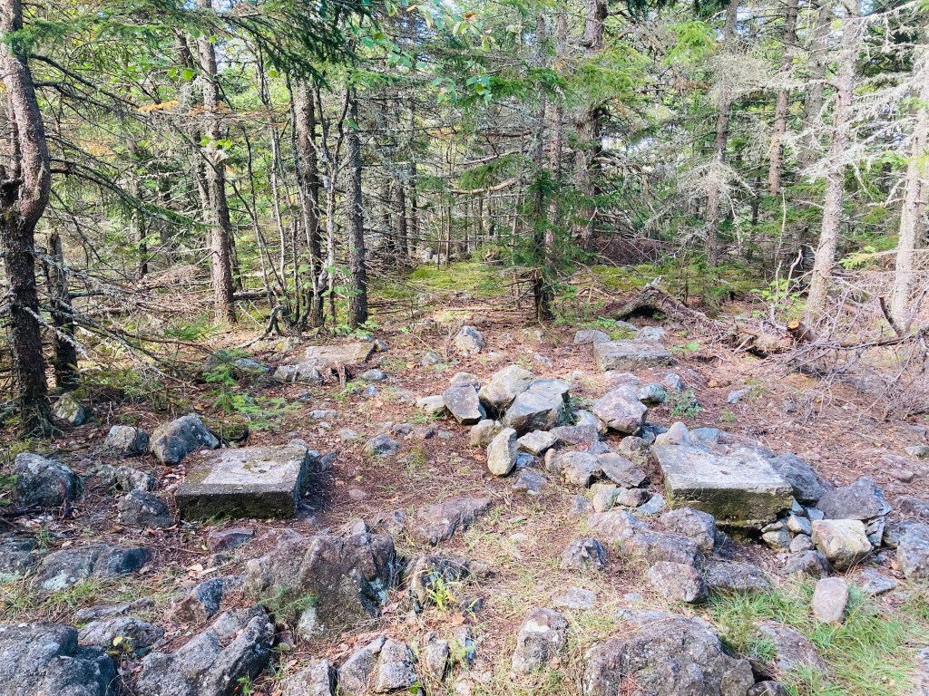
Footings of old fire tower at Horse Mountain summit, Baxter State Park
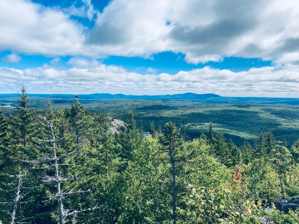
Maybe it’s too close to the Matagamon Gate, too low, no summit views (from Horse Mountain itself – views are from the East Spur), but I loved this hike. The beginning of the hike has a sort of a green tunnel aspect to it, but in the most positive way – there’s an artist’s palette of green with blueberries, princess pine, and hobblebush. This was a silver lining of the rain – I was able to notice the tones that sunlight would normally wash out. I bypassed the spur trail (1.2 miles in) on the way up, headed to the summit, planning to hit the views on the way back. At the peak, I found only the footings of what was once a fire tower, and scattered chunks of the rhyolite that comprises the volcanic mountains of the northern side of Baxter State Park.
View from East Spur Overlook, Horse Mountain, Baxter State Park
This wooded mausoleum was somber and peaceful, and I paused briefly to enjoy the silence. For those looking for a longer hike, the Horse Mountain Trail continues south to some backcountry campsites, the Billfish Pond and the Five Ponds Trail. The East Spur Overlook (.4 miles), which I took on the way back, provides an outstanding overlook of Grand Lake Matagamon and the East Branch of the Penobscot River. As an aside, this is one of the lowest mountains/easy hikes in Baxter that will give you sufficient elevation and line-of-sight to use cellular signal to send a proof-of-life text and maybe download an updated weather report.
Horse Mountain Trail, Baxter State Park
(Disclaimer: This post contains affiliate links, and as an Amazon Associate Hiking in Maine blog earns from qualifying purchases.)
Doubletop Mountain Trail enroute to Slaughter Pond, Baxter State Park, Maine
Slaughter Pond is a sufficiently remote one-way hike that when I mentioned to a Baxter State Park ranger that I was thinking of hiking there, he looked at me curiously, and then asked if I was going to get some fishing in, as that seemed to be the primary reason people make the trek. The pond itself lies slightly outside the borders of Baxter State Park, and is managed by The Nature Conservancy as part of its Debsconeag Lakes Wilderness Area (see map). I hiked there and back, a trip of just over 6 miles, that took me about two and a quarter hours on a rainy mid-September day. I used the map and trail description in Hiking Maine’s Baxter State Park, and navigated using AllTrails and the Map Adventures’ Katahdin Baxter State Park Waterproof Trail Map. The longer, more scenic route starts from the Doubletop Mountain Trail at the Kidney Pond Campground day-use parking area. A shorter route that eliminates Draper and Deer Ponds begins at a trailhead on Kidney Pond Road just west of the bridge over Nesowadnehunk Stream. The Doubletop Mountain Trail route begins as a pleasant, pine-smelling tunnel of thick evergreens, giving way after about a quarter-mile to a more broadly spaced forest.
View across Draper Pond, Baxter State Park, Maine
At about this point in the hike, a light rain began to fall, mostly absorbed by the canopy above me, that continued throughout. At a little before .4 miles. I reached the intersection with the Draper Pond Trail, and continued straight on the spur down to see Draper Pond. The trail was short and easy, and the flat surface of Draper Pond reflecting the mountains was well worth the short detour. I flipped around and headed back up the side trail to rejoin the Doubletop Mountain Trail. The trail was winding, with roots and fallen trees, but generally flat and easy, surrounded by moss, ferns and large glacial erratics. At one elevated point, I could see both peaks of Doubletop Mountain through the trees to my left, and heard a pileated woodpecker loudly calling through the forest.
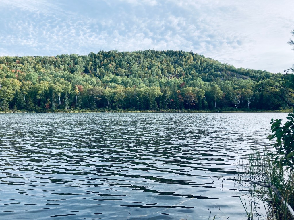
View across Deer Pond, Baxter State Park, Maine
At about 1.1 miles, I entered a boggy area which required some maneuvering around standing water and negotiating plank bridges over Slaughter Brook, at this point, a swamp overlooked by Doubletop, and held back by beaver dams. The trail was a little more difficult here, as some of the plank bridges had fallen, but I picked my way through. When I got across Slaughter Brook, it appeared that some kind of storm or microburst had taken down a large number of trees, probably accounting for the damage at the crossing I had just made. The trail continued to move in tandem with Slaughter Brook, and at about 1.4 miles, following a right turn, the larger expanse of Deer Pond was visible in front of me, with waving grasses and views of the mountains.
Deer Pond, along Slaughter Brook, Baxter State Park, Maine
I reached the junction with the Slaughter Pond Trail that comes in from the trailhead on Kidney Pond Road, and continued west towards Slaughter Pond. This flat, single-track trail was relatively overgrown, but flat, fast, infused with a pine scent, and serenaded by squawking jays. At about 2.15 miles, I passed the intersection with Doubletop Mountain Trail to the right, and continued less than a mile more, the edge of Baxter State Park marked by a white diamond. This was the beginning of The Nature Conservancy property, followed by a stream crossing. I quickly reached a large area with canoes strewn all around, the boat storage area, used by people who register with The Nature Conservancy for use on Slaughter Pond, and then walked through the trees to see the pond itself, which was beautiful in the light rain. I had hoped that, by approaching a series of backcountry ponds quietly in the rain in the morning, I would’ve maximized my chance of seeing a moose, but it was not to be this day. I only saw moose droppings on the hill overlooking Deer Pond. I had the trail entirely to myself until I passed a middle-aged couple close to the Draper Pond turn on the way back.
Slaughter Pond in the rain, The Nature Conservancy, Maine
(Disclaimer: This post contains affiliate links, and as an Amazon Associate Hiking in Maine blog earns from qualifying purchases.)
Morning view of Kidney Pond, Baxter State Park, Maine
Sentinel Mountain (1,842 ft) is not a towering monolith like Katahdin or a sinister double-horned mass lurking like Doubletop but its proximity and line of sight to those two peaks and the rest of Baxter and the North Maine Woods make it an important bucket list hike in Baxter State Park. In mid-September, I had planned for loftier heights and longer distances, but weather changed my plans, and facing impending thunderstorms, I opted out of the all-day hikes above treeline, and chose this smaller mountain. I used information from Hiking Maine’s Baxter State Park and Maine Hikes Off the Beaten Path, and navigated using Map Adventures’ Katahdin Baxter State Park Waterproof Trail Map. This moderately difficult hike of about 6.2 miles took me about three and a half hours, with plenty of time spent resting and enjoying views.
Rocky and green Sentinel Trail, Baxter State Park, Maine
The Sentinel Trail starts from the Kidney Pond Day-Use Parking Area and runs concurrent with the trails to Rocky Ponds, Celia and Jackson Ponds, and Lily Pad Pond. I quickly ran into a large bullfrog perched in the middle of the trail, who looked at me briefly, then jumped beneath a boulder, then I walked past the boulder marked, “Kidney Stone – Do Not Remove,” which is Baxter State Park’s version of a joke. The trail crossed a lively brook emptying into flat, quiet Kidney Pond on a cloudy morning.
Sentinel Trail, Baxter State Park, Maine
The trail continued to skirt the shoreline, with plank bridges and rocks used as stepping stones over moss and mud. I passed the turnoff for Celia and Jackson Ponds, continuing along the shore until I hit the hard right turn to the Sentinel Trail at about half a mile from the trailhead. The trail headed slightly uphill through a thick forest, the most compelling characteristic of which was its overpowering greenness. After a bit of a downhill, this gave way to what looked to be a much younger forest in a low-lying area. At about 1.2 miles the trail crossed Beaver Brook. Through the trees, I could see Beaver Brook feeding into a boggy area, later visible to the left of the trails.
Beaver Brook crossing, Sentinel Trail, Baxter State Park, Maine
Once I got uphill, the trail was slightly faster through pines and then along a plank bridge walkway through another boggy area. Holes through the deep moss in the bog led to mysterious pathways beneath the visible surface of the path, signs of a subterranean world invisible and unknown. The trail then passed a stream with many little rivulets and drops, in the shadow of a large mossy rock outcropping. Shortly after two stream crossings, the trail really began to climb uphill. This grade continued for awhile, and then the last real challenge before making the turn onto the summit trail was a long, steep jumble of rocks and boulders.
View of Lily Pad Pond and Katahdin shrouded in clouds, Sentinel Mountain, Baxter State Park, Maine
After a brief respite, there was another series of rocks, which were, thankfully, more widely spaced to allow for actual footsteps. After this steep climb, the summit loop path was a welcome change, walking on flat rocks, with a cool breeze and views of Baxter State Park and its surroundings. I turned to the right to take the loop counterclockwise and paused, facing east, with a view centered on Katahdin, despite the cloud cover moving in. This stone ledge was a great spot to sit down, have a snack and a drink, and drink in the air and views. Surprisingly, there was sufficient cell service to send home a quick proof-of-life text.
View from Summit Loop, Sentinel Mountain, Baxter State Park, Maine
The remaining circuit was beautiful for the rocks and mountain laurel, lichen and blueberries, interspersed with views off more ledges through scrub pine to the Debsconeag Wilderness Area. There were still a lot of ripe huckleberries on the loop back and one last broad sweeping view as I made the turn left to rejoin the trail down from the summit. I heard a lot more birds on the way back, as some of the clouds cleared but were still hovering over Katahdin, and I heard a yellow-rumped warbler and a blue jay as I passed back near the edge of Kidney Pond.
View from Summit Loop, Sentinel Mountain, Baxter State Park, Maine
(Disclaimer: This post contains affiliate links, and as an Amazon Associate Hiking in Maine blog earns from qualifying purchases.)
Sun rising on the way up Mount Coe, Baxter State Park, ME
Having explored other difficult but rewarding long hikes in Baxter State Park, I decided to finally try a challenging early fall hike of Mount Coe (3,760 ft), South Brother (3,963 ft), and North Brother (4,052 ft), a 10.1 mi loop (extendable to about 12.5 mi if you include Fort Mountain in the spur hike from North Brother). This exhilarating trek begins with its most difficult ascent first, and hits peaks (including a 4,000 footer) that allow for views on a clear day in all directions of Baxter State Park and its surroundings. I started this hike based upon a route recommended by the book Hiking Maine’s Baxter State Park, a relatively new volume which I have dog-eared, bookmarked, and annotated in pen/pencil. As recommended in that book, every other guidebook, and the Baxter State Park ranger I consulted, I took the loop counterclockwise, in order to tackle the Mount Coe slides uphill, rather than trying to descend (more on that later). To navigate, you can use the free downloadable Kidney-Daicey map from Baxter State Park, or the more durable (my choice) Map Adventures’ Katahdin Baxter State Park Waterproof Trail Map.
Clear brook along Mount Coe Trail, Baxter State Park, ME
The parking area for Mount Coe and the Brothers is on the Park Tote Road just south of Slide Dam picnic area, on the east side of the road. I took a long, quiet morning drive south from South Branch Campground, with the windows down to breathe in the foggy morning dew and listen for about an hour. No moose crossed in front of me, but I saw several ruffed grouse scurrying into the undergrowth lining the Tote Road. At the parking lot, across from Nesowadnehunk Stream, a large hiking group was meeting and beginning to pack up breakfast and coffee in preparation for a hike in smaller pairs and trios. The hike started easily enough on a relatively flat grade, with the trail going across a couple low streambeds. The temperature began to increase as I climbed up and out of the valley, ascending a narrow staircase with the pretty runoff of the stream to my left. At about 1.2 miles, I reached the intersection of the Marston and Mount Coe trails and turned right towards Mount Coe. Almost immediately, I started seeing moose droppings. The trail was flat and mossy, almost downhill at the beginning, with quiet, green Eden-like surroundings of mossy hummocks and clear, cascading brooks.
View of Doubletop and beyond from Mount Coe slides, Baxter State Park, ME
I had arrived at the trailhead about an hour after sunrise, but the sun had still not summited the peaks to the east, so when it did, at around 8 AM, it peered over like a death ray. So, when the trail crisscrossed the cool stream and moved uphill, I missed the air conditioning that the cold running water had provided. Here, I passed a friendly group of three on my way to the final ascent of Mount Coe, then another, even more amiable group of three making their way up the slick, steep slides. It’s difficult to find grumpy people at Baxter State Park. Back to the slides – they were as advertised, difficult, slick with morning dew and runoff, and sharp (I left some blood there on a handhold). I had planned to only use my hiking poles, collapsed and stowed on my pack, on the descent, but thought twice about that plan while navigating the steep, slippery surface. I can’t imagine the difficulty of climbing down this stretch on coltish, tired legs on a clockwise hike. Thankfully, the slide gave way to a thin path through thin spruce with roots and trees for handholds, leading to the Mount Coe summit, with unbelievable views in all directions.
Trail up to South Brother summit, Baxter State Park, MEContinue reading →