Howe Brook Falls (Baxter State Park)

Lower South Branch Pond from Pogy Notch Trail, Baxter State Park, Maine

Howe Brook Falls is a spectacular four mile total out-and-back waterfall hike from South Branch Pond Campground in the northern half of Baxter State Park (BSP). I have tacked this hike on to a South Branch Pond Loop hike, which is covered separately in another post, but also done all or part of the Howe Brook Falls hike by itself, which can be done in three hours or less. A detailed description and map of this hike is found in the books Hiking Maine’s Baxter State Park and Hiking Waterfalls Maine, and a Baxter State Park downloadable map of South Branch Pond is available on BSP’s website.

Howe Brook Trail, Baxter State Park, Maine

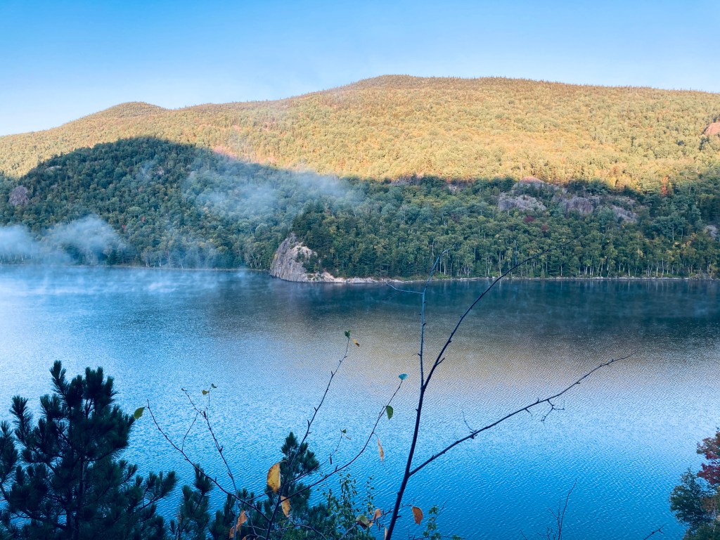
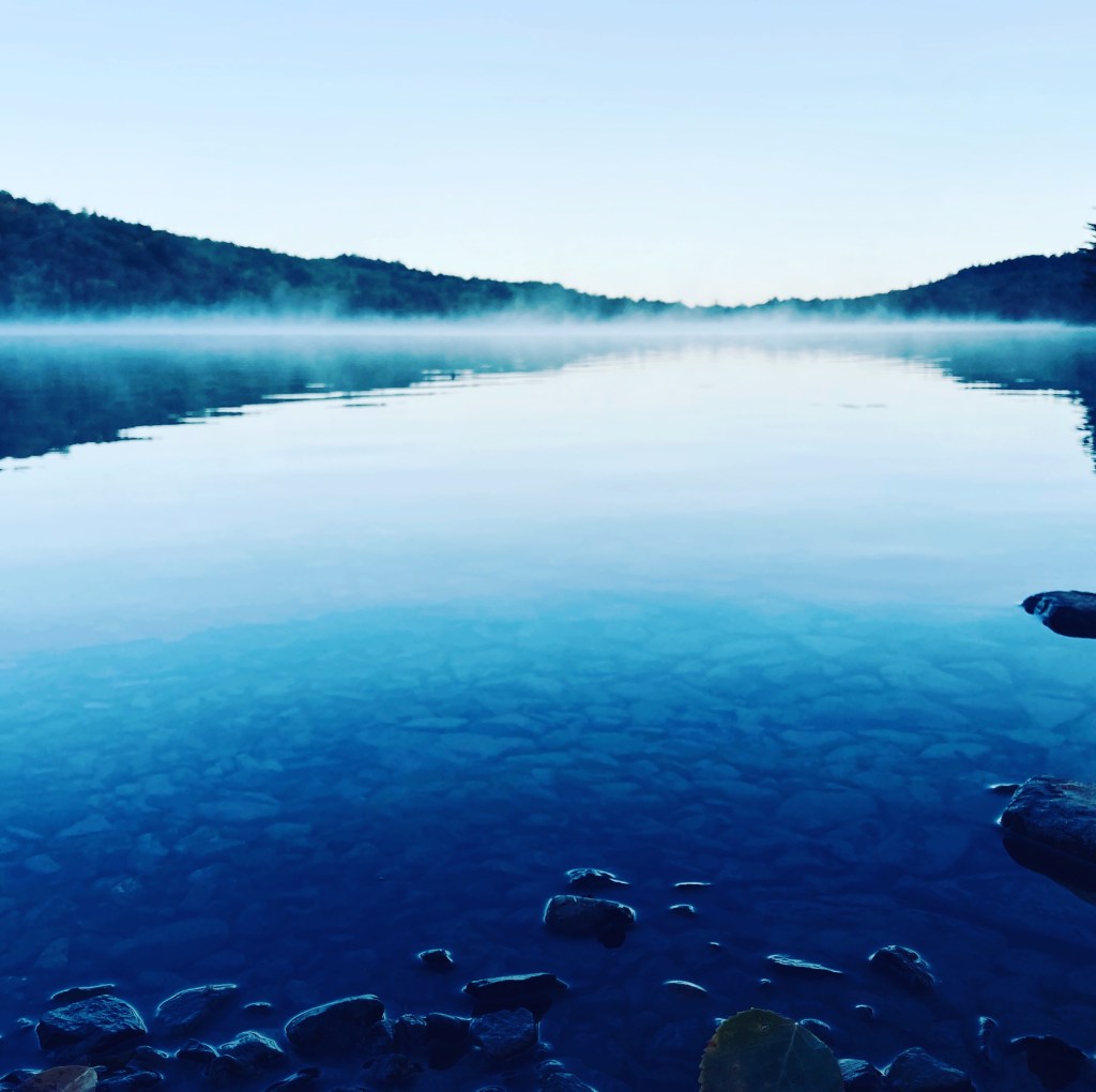
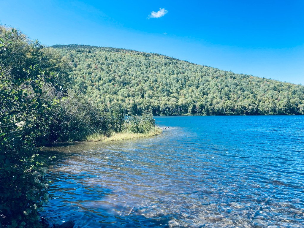
The hike begins at the Pogy Notch trailhead in the southeast corner of the South Branch Pond Campground. The beginning of this trail contains the iconic “You Are Entering Maine’s Largest Wilderness” sign, which encourages caution and self-sufficiency, and turnaround times are calculated in a table at the kiosk. A straightforward, flat mile-long hike leads along the eastern shore of clear, quiet Lower South Branch Pond to a left turn onto the Howe Brook Trail.

Howe Brook Trail, Baxter State Park, Maine

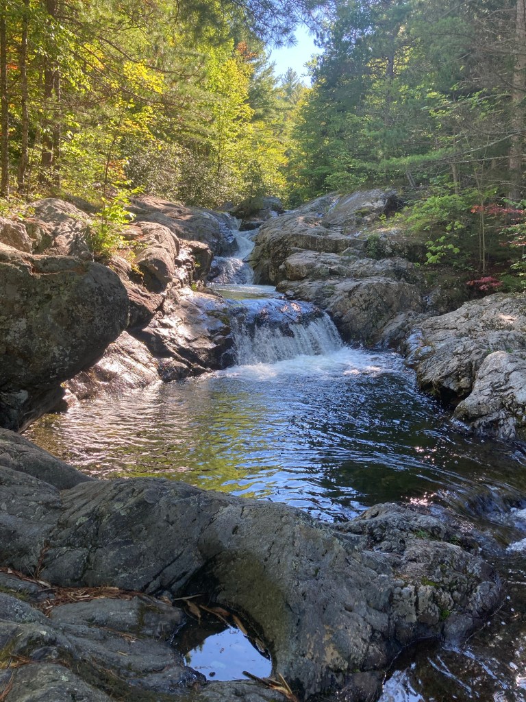
From this trail intersection, it’s only about a quarter mile to the lower falls and pools, so if you have kids who can’t make it the full two miles out and back, these lower cascades are sufficiently beautiful and entertaining for a day trip, splashing and swimming, and a picnic. After about a mile, the trail becomes a little steeper and veers farther away from the brook as the gorge narrows in the shadow of Traveler Mountain. The path to the upper falls is narrow and sometimes winding, but never overly strenuous, with views of the rushing water and moss-covered boulders of Howe Brook to the right.

Howe Brook Trail, Baxter State Park, Maine

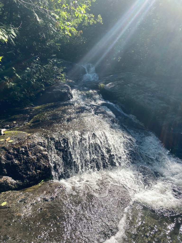
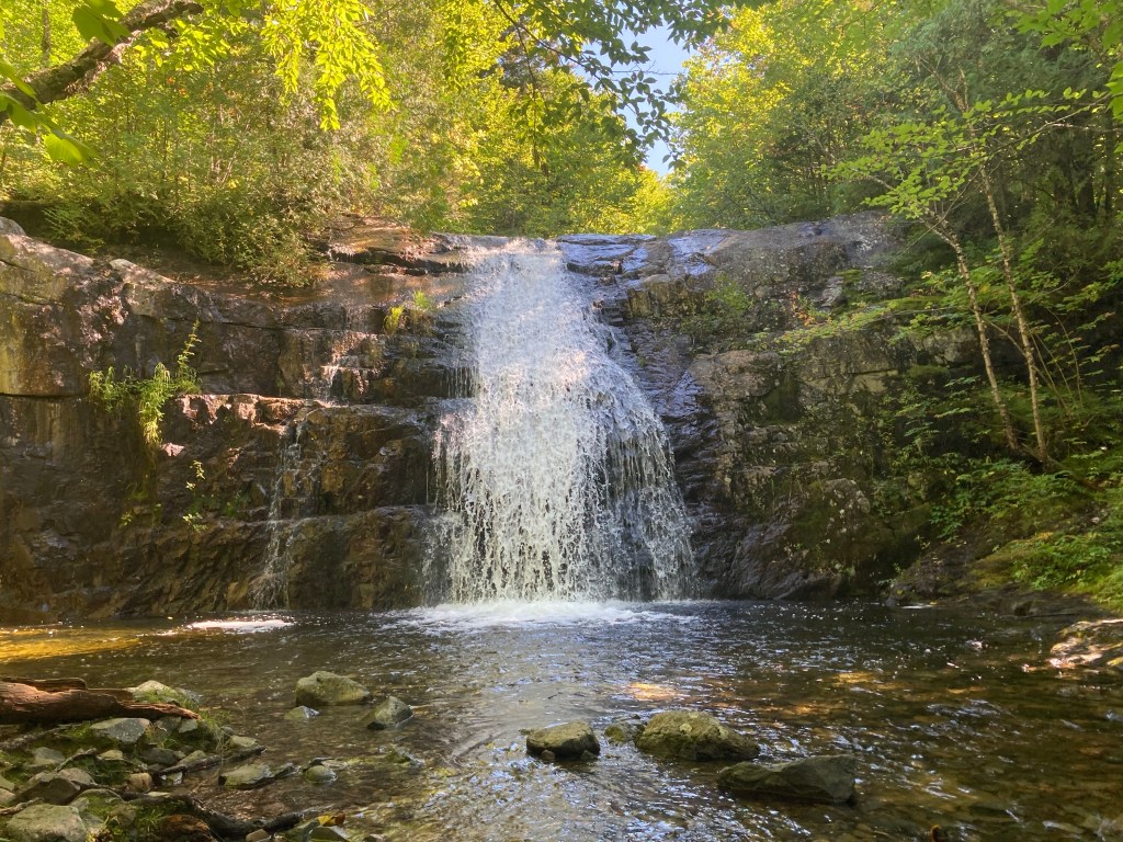
At the top of the trail is a truly impressive waterfall, dropping straight into a cold pool. This is the Upper Falls, capping this trip through the cascades. In the sunlit opening below, I have disturbed some ruffed grouse, who had been sunning themselves on the rocks, made unaware of me until the last minute by the white noise of the falls.

Clear pool below Howe Brook Falls, Baxter State Park, Maine

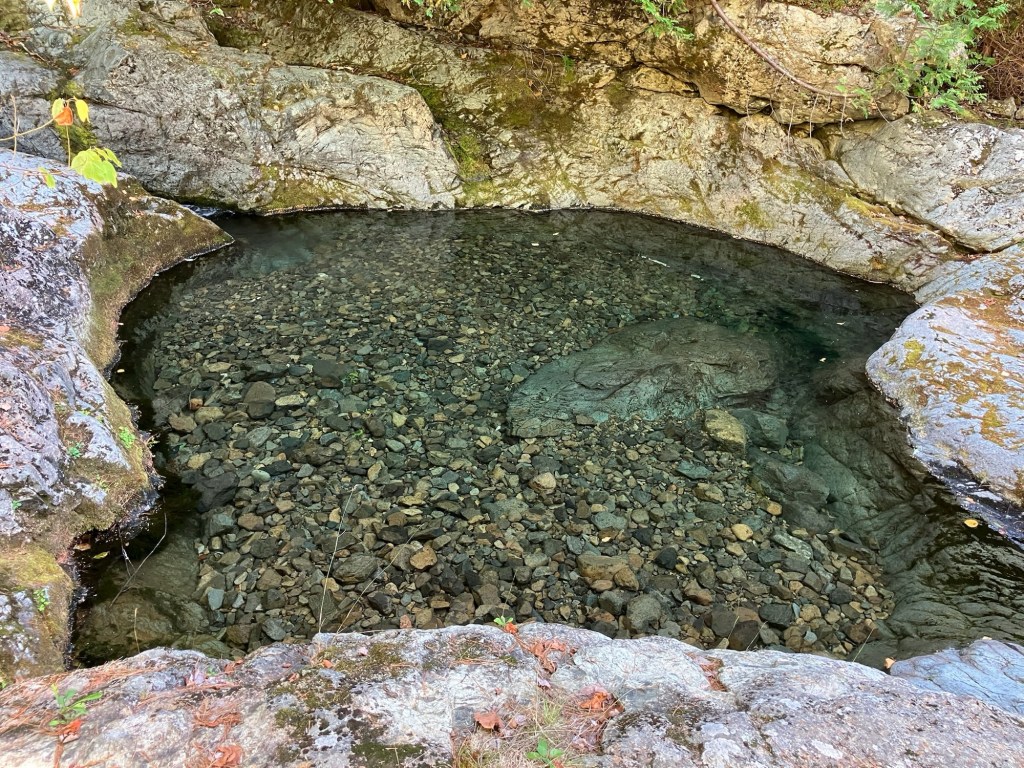
A pleasant downhill hike re-traced my steps, and allowed me to re-visit the mirrored pools and clearings of Howe Brook on the way back to South Branch Campground. This hike is amazing, even with low water flow in drier periods, and every tier of the path has amazing views and clear, cold pools.

Upper Falls, Howe Brook Trail, Baxter State Park, Maine

(Disclaimer: This post contains affiliate links, and as an Amazon Associate Hiking in Maine blog earns from qualifying purchases.)

Traveler Mountain Loop (Baxter State Park)

Sun rising over Black Cat and South Branch Mountains from Traveler Loop

This loop route over Traveler’s bulk, which the AMC Maine Mountain Guide accurately describes as “starfish-shaped,” crosses Peak of the Ridges (3,254 ft), Traveler summit (3,550 ft), and North Traveler summit (3,152 ft). As it says on BSP’s website, “Preparation for a Traveler Loop hike is the same as a Katahdin hike,” due to the exposed nature of the hike, elevation gain, lack of available water, and distance. This is true, and in inclement weather, hikers should explore other options. To navigate, I used Map Adventures’ Katahdin Baxter State Park Waterproof Trail Map, but BSP’s official website also has free downloadable/printable trail maps, and the South Branch Pond map covers this area.

Lower South Branch Pond at dawn

The Traveler is a strenuous 10.1 mile loop hike over the rhyolite peaks of Traveler Mountain, the highest volcanic mountain in New England, with over 4,000 feet of total elevation gain. This full-day (6-10 hour) hike begins at Baxter State Park’s (BSP) South Branch Campground, and based upon advice from the AMC Maine Mountain Guide and Falcon Guides’ Hiking Maine’s Baxter State Park and BSP rangers, is best attempted counterclockwise via the Pogy Notch, Center Ridge, Traveler Mountain, and North Traveler trails. This is to avoid descending the steep, loose rock on the Center Ridge Trail.

Lower South Branch Pond from canoe launch in morning, Baxter State Park

Unlike Katahdin trailheads, no additional parking reservation is typically needed for the Traveler, and the closest parking to the trailhead is the South Branch Pond Campground day-use/back country lot. On each of the cool mid-September mornings I did my hike in 2020 and 2025, an early fog hung over South Branch Pond. The trail leads over plank bridges to a winding track along the edge of the pond, usually accompanied by the stuttering sound of a belted kingfisher. About .9 miles in, there are beautiful views of the pond from the south end at the canoe landing for the Howe Brook trail.

Balanced boulder, South Branch Pond, and the horizon from Center Ridge Trail, Baxter State Park’s Traveler Loop

The blue blazes lead up a steep rocky outcrop to continue up Pogy Notch Trail to its junction with the Center Notch Trail, with nice views along the pond. This is where the climbing really starts, and you’ll find yourself periodically grabbing for rocks and roots as handholds. I took a well-deserved rest after about 2 miles to make myself a coffee, let my feet air out a little, and send a proof-of-life text from elevation (South Branch Pond, like a lot of Baxter State Park, has no cell service).

Continue reading

South Branch Pond Loop

Lower South Branch Pond in the morning from trailhead, Baxter State Park, ME

The South Branch Pond Campground in Maine’s Baxter State Park overlooks two pristine ponds in the shadow of the surrounding mountains. The South Branch Pond Loop hike is a 6.6 mile loop that leaves from the southwest corner of the campground and includes South Branch Mountain (2630 ft) and Black Cat Mountain (2611 ft) in its counterclockwise circuit of these lower and upper ponds. A full description of the hike can be found in the Maine Mountain Guide, or as an out-and-back to Black Cat Mountain in Hiking Maine’s Baxter State Park. A map of the South Branch Pond area is available for download from BSP’s website. Leaving early from behind the ranger station, I started the hike with wet shoes, as South Branch Pond Brook, the outlet from Lower South Branch Pond, stands between the trailhead kiosk and the remaining trail, and was running high after the night’s rains. The trail was marked in intervals by fresh moose droppings. Less than a mile in, the first overlook faced the wilds to the north.

View of The Traveler from near peak of South Branch Mountain, Baxter State Park, ME
Continue reading