
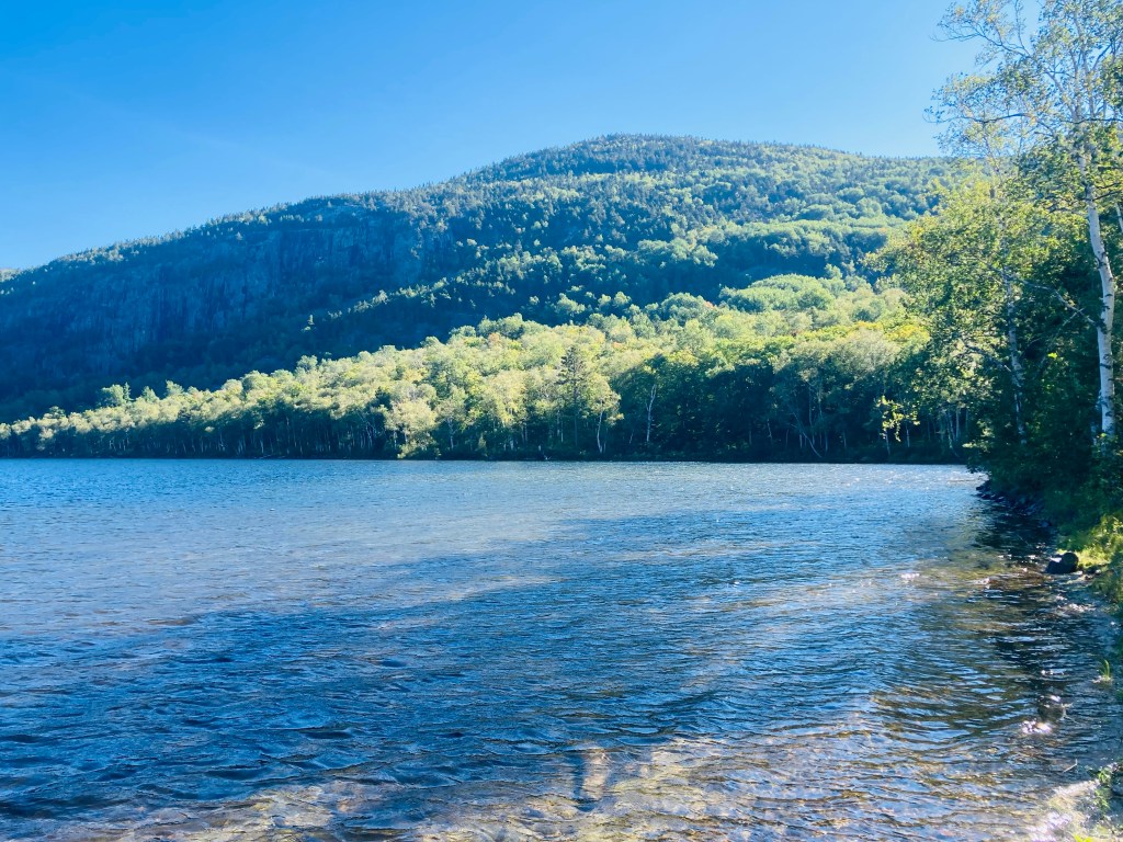
The South Branch Pond Campground in Maine’s Baxter State Park overlooks two pristine ponds in the shadow of the surrounding mountains. The South Branch Pond Loop hike is a 6.6 mile loop that leaves from the southwest corner of the campground and includes South Branch Mountain (2630 ft) and Black Cat Mountain (2611 ft) in its counterclockwise circuit of these lower and upper ponds. A full description of the hike can be found in the Maine Mountain Guide, or as an out-and-back to Black Cat Mountain in Hiking Maine’s Baxter State Park. A map of the South Branch Pond area is available for download from BSP’s website. Leaving early from behind the ranger station, I started the hike with wet shoes, as South Branch Pond Brook, the outlet from Lower South Branch Pond, stands between the trailhead kiosk and the remaining trail, and was running high after the night’s rains. The trail was marked in intervals by fresh moose droppings. Less than a mile in, the first overlook faced the wilds to the north.

The thick forest quickly gave way to evergreens, birch, and a carpet of light green moss. More views to the north were visible from South Branch Mountain’s ledges and then a brief ridge hike led to the mountain’s summit, two miles in. It was only in the half mile between South Branch summit and Black Cat Mountain’s summit that I started hearing birds, and then they were suddenly everywhere. I climbed through a sparse field of sunlit birches to the soundtrack of Canada Jays. This was just before Black Cat’s summit, where wide-ranging views of the southern half of Baxter State Park, including Katahdin, filled the crisp morning air.

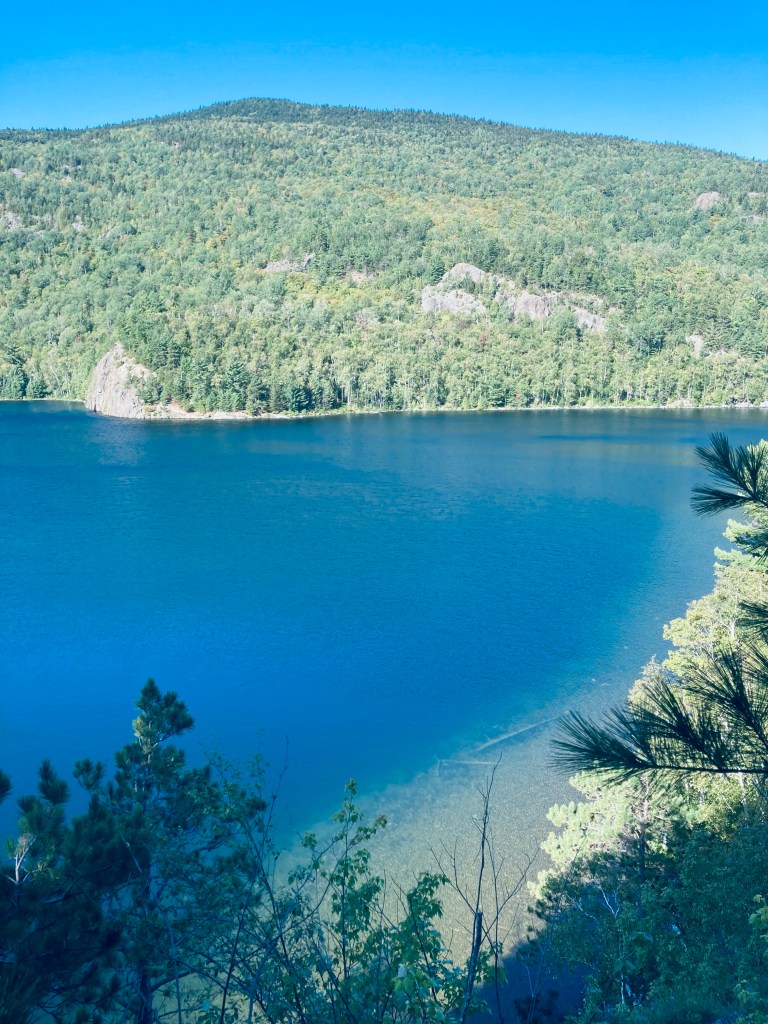
The trail wound down the south side of Black Cat through slides and other obstacles, and I was happy for my hiking poles four or five times in the slick rock and mud. I took a break on a rocky slope looking up at Peak of the Ridges, part of Traveler Mountain, to enjoy a hearty Peak Refuel Beef Chili Mac meal I had cooked at the top of Black Cat. The trail leveled out, becoming flatter and flatter past the turn to the left for the Upper South Branch Pond lean-to, and crossed over some log bridges with the reflected morning light emanating from South Branch Pond to my left. A small path led to a rocky beach at the tip of Upper South Branch Pond, just before the intersection at 4.7 miles with the Pogy Notch Trail.
A small picnic area lay just north of this intersection on the shore of South Branch Pond. The trail was a pleasant walk through leafy forest with the placid South Branch ponds to the left. This became a bit of a scramble on the rocky ledges on the east side of the pond and leveled out into pine forest and the intersection with the Center Ridge Trail. Descending ledges brought me to another deciduous forest, green like it had been tinted by a filmmaker.
Here, a little over three hours into the hike, I saw my first human being, a solo hiker headed the other way, and then more people as I reached the intersection with the Howe Brook Trail (On this particular trip, I added on the Howe Brook Trail, which tacked on another four miles, and will cover that out-and-back waterfall trail in another post). I continued north a short distance along Upper South Branch Pond, moving past the North Traveler Trail, with views through the trees of the pond, ending the loop back at the Campground in under 4 hours. This quiet, secluded loop around glassy ponds in the shadow of Traveler Mountain is a fantastic day hike, with mountain views and wildlife.
(Disclaimer: This post contains affiliate links, and as an Amazon Associate Hiking in Maine blog earns from qualifying purchases.)

Love that hike!
LikeLike