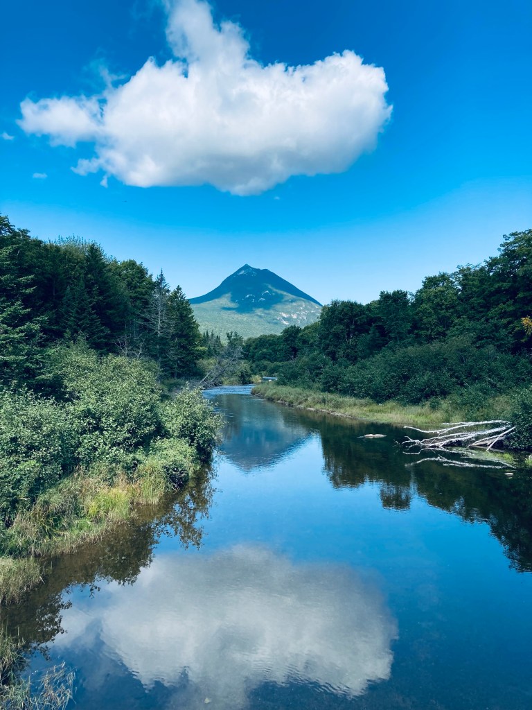
View of Doubletop Mountain from Nesowadnehunk Stream bridge to the south near Kidney Pond Campground, Baxter State Park, ME
Doubletop Mountain (north peak 3,489 feet, south peak 3,455 ft) guards the western edge of Baxter State Park (BSP), its tufted, twin summit ridge looming like the profile of a slumped, pudgy Dark Knight. The views of this signature BSP mountain are impressive, as its unique profile and steep drops make for a formidable photo over Nesowadnehunk Stream or from the rugged peaks to its east. On a sunny mid-September afternoon, I ascended it for the first time, using a challenging 7 mile out-and-back route from the parking area at Nesowadnehunk Field Campground, which took me about three hours and forty minutes.
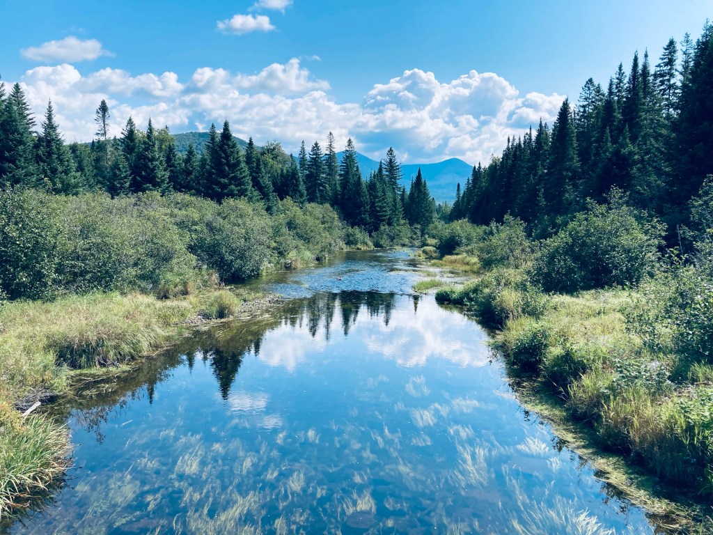
Nesowadnehunk Stream from bridge at Nesowadnehunk Field Campground by Doubletop Mountain Trail, Baxter State Park, MEContinue reading →
As humans, we can be dilettantes by nature, sifting through life by discarding difficulty and glamorizing what seems to be a simpler path. It’s not our fault – the world is too complex to completely understand, and shortcuts like this help our tiny brains operate and avoid pain. One of the ascendant thoughts that some keyboard warriors may cling to on Sunday nights (in the pre-work “scaries”) is the perceived freedom of being a park ranger. In the aptly-titled This Wild Land: Two Decades of Adventure as a Park Ranger in the Shadow of Katahdin by Andrew Vietze (AMC Books, 2021), the author, who is a former editor at Down East magazine, explores such a transition, relating stories from his time as a park ranger at Maine’s Baxter State Park.
Vietze skillfully cycles through stories over his twenty-year career involving the various and legendary animals at Baxter State Park, relating stories and history about deer (the original “Bambi”), moose, bear, beaver, the various blood-sucking insects, and their collective futures. The winter tick and habitat challenges facing the moose are particularly compelling. Baxter State Park is different in many ways from other state and national parks, due to the unique nature of its charter: as Vietze says, “Here, wildlife has dominion,” making recreation secondary to conservation. Vietze explores the essence of being the referee between human and wilderness, with the predictable ranges of experience and attitude on the human side. These are the most resonant and interesting of his stories, casting careless thru-hikers or overmatched tourists against the uncaring monolith of Maine’s North Woods. The takeaways? Be humble, carry water, and maybe go for a walk or two before you try Maine’s highest, most remote mountain. According to Vietze, fatigue is considered “causative” in 66 percent of the park’s medical calls.
The book dives into the history of park rangers, Baxter State Park, and the Appalachian Trail. The uneven relationship between the Park and the Appalachian Trail thru-hikers who view it as their finish line is the subject of several anecdotes, including a (tongue-in-cheek) “Navy SEAL” operation by rangers nabbing thru-hikers camping illegally.
My sole critique is one of expectation – not the author’s fault. When a journalist investigates a topic, it is dispassion which can make the writing true and clear. Norman Maclean’s father in A River Runs Through It encouraged him to write fiction, saying, “Only then will you understand what happened and why. It is those we live with and love and should know who elude us.” Vietze, currently a ranger, clearly loves and respects his co-workers at Baxter State Park, so the “inside scoop” about working at the park is elusive. This is forgivable, and by the end of the book, endearing. His critiques are mostly self-effacing. But there were likely very good stories and insights left on the cutting room floor due to kindness, loyalty, and discretion.
Vietze also explores the family dynamics of being a park ranger, and the inherent sacrifice of living in the wilderness in public service makes Vietze’s accounts of interactions with his sons and wife more poignant, as well as clarifying the shared bond between park rangers. In a nod to the current understanding regarding the stress on first responders, the book ties in the stories about death and near-death encounters with those of training and debriefs to help rangers cope with loss.
This Wild Land contains enough variety of experience to sustain multiple books, with each story existing as a vignette that could be otherwise examined from vectors of conservation and psychology. Written during the “Year of Covid,” this book reminds us why we cherish the wilderness, why it must be protected, and is a gift to anyone who enjoys Baxter State Park and the North Maine Woods.
(Disclaimer: This post contains affiliate links, and as an Amazon Associate Hiking in Maine blog earns from qualifying purchases.)
The Ledges Trail is accessed from the Middle Fowler Trail/Nature Trail trailhead kiosk a short walk north from the parking area of the South Branch Pond campground at Baxter State Park. This hike in the lesser-traveled northern part of the Park is fully described in the Maine Mountain Guide., and BSP’s downloadable South Branch Pond map covers the area. A left (north) turn at the Ledges Trail intersection after a third of a mile will take you up a wooded blue-blazed trail to the ledges facing west.
Ledges Trail, Baxter State Park, Maine
On the way up, I disturbed a pair of large, colorful pileated woodpeckers, who voiced their collective displeasure, and flew off to other trees. The ledges provided a series of views over South Branch Ponds and South Branch Mountain and Black Cat Mountain, with changing September leaves.
Ledges Trail, Baxter State Park, Maine
The Ledges Trail exits the woods about a half mile north of the campground, with a walk along the dirt and gravel road leading back to parking or the campground. This was a short lollipop loop from South Branch Pond campground, maybe a mile and a quarter total. I was moving quickly due to impending thunderstorms on my trip, but this hike will not take more than thirty to forty-five minutes.
Ledges Trail, Baxter State Park, Maine
(Disclaimer: This post contains affiliate links, and as an Amazon Associate Hiking in Maine blog earns from qualifying purchases.)
Katahdin shrouded in clouds across Kidney Pond, Baxter State Park, Maine. Colt Point is visible to the right.
The hike to Lily Pad Pond, a short, relatively flat out-and-back from Kidney Pond Campground at Baxter State Park, is an easy walk that skirts Kidney Pond with some big-time views of Katahdin and Mt. O-J-I. I used it as a “last day at Baxter” hike, dehydrated, sore, but wanting to see more of this special place on the way out the Park Tote Road. Baxter State Park’s site has a downloadable map of the Kidney-Daicey Pond trails, but for a real full-day six-mile-plus amphibious adventure, including a canoe exploration of Lily Pad Pond, and a follow-on hike of Little and Big Niagara Falls, check out the hike description in the book Hiking Maine’s Baxter State Park.
Plank bridges toward Lily Pad Pond Trail, Baxter State Park, Maine
From Kidney Pond Campground day-use parking, head towards the Sentinel Link Trail, where you will quickly find views across Kidney Pond. This portion of the trail, hugging the shore of Kidney Pond, is the only part with tricky footing, as it is full of boulders and cedar roots. Shortly after the Celia and Jackson Ponds Trail departs to the right, there are more views of Kidney Pond Campground on the opposite shore, followed by the Sentinel Mountain Trail intersection, where you continue straight towards Lily Pad Pond. The .2 mile Colt’s Point spur trail leads to a Kidney Pond peninsula, accessible when I visited via a flooded area crossed by a ramshackle log bridge. This tenuous span was ultimately unsuccessful in keeping me above water, but the views from Colt’s Point were worth the wet socks.
View from Colt’s Point of Mt. O-J-I and Barren Mountain across Kidney Pond, Baxter State Park, Maine
Shortly after returning from Colt’s Point, turn off to the right onto Lily Pad Pond Trail, about .4 miles long, a moss-lined pathway with a slight downhill grade. A long section of plank bridging through a bog takes you to Beaver Brook, where there are three rental canoes ($1/hr or $8/day) available to take you to Lily Pad Pond, and keys can be secured from a ranger at Kidney Pond or Daicey Pond Campgrounds, as well as the Togue Pond Gate. Across Lily Pad Pond, at the east end, you can take the Windy Pitch Pond Trail to the Falls, walking parallel to the Appalachian Trail, on the opposite side of Nesowadnehunk Stream. I will definitely be using this trail-canoe-trail option on my next visit. The Lily Pad Pond out-and-back itself (including the Colt’s Point spur) was about 2.8 miles, which took me a little over an hour.
Canoe put-in on Beaver Brook towards Lily Pad Pond, Lily Pad Pond Trail, Baxter State Park, Maine
(Disclaimer: This post contains affiliate links, and as an Amazon Associate Hiking in Maine blog earns from qualifying purchases.)
A rainy final day in Baxter State Park, tired legs, and a desire to see wildlife led me to a morning exploring remote Dwelley Pond. For me, this was a 7.6 mile out-and-back, taking a little under two and a half hours in full rain gear. In good weather, allow more time to relax and enjoy the solitude, and rent the canoe at Dwelley Pond for a quiet exploration. It is also possible to spot a bike or a car at either end of the trail, turning this into a 4.6 mile point-to-point hike between the northern and southern Dwelley Pond parking areas. A description and map are available in the book Hiking Maine’s Baxter State Park.
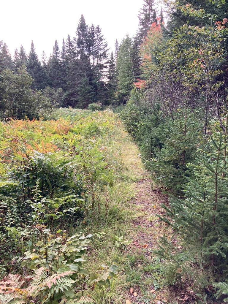
McCarty Field, Dwelley Pond Trail, Baxter State Park, ME
I began from the north trailhead, which is about a mile south from the Burnt Mountain Picnic area on the Park Tote Road. The trail, skirting Morse and McCarty Mountains in a half-circle, starts from here as a flat walk in the ruts of a former woods road, with juvenile maple saplings sprouting in the middle. A disturbingly large pile of bear scat lay in the path like a warning sign. After a stream crossing, the trail median, along with the vegetation on the periphery, changed abruptly to evergreens, hemming in the trail. At a larger stream crossing I disturbed a moose or a deer, which galloped off loudly, through woods too thick to see through. The meadow at McCarty Field, reached after less than a mile and a half, was busy with black-capped chickadees, white-throated sparrows, and golden-crowned kinglets. This unexpectedly flat, cleared area is the site of a former farm and logging depot called McCarty.
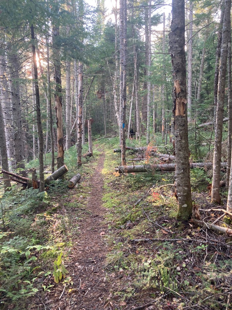
Dwelley Pond Trail, Baxter State Park, ME
After McCarty Field, the slight downhill of the previous trail switched to a light but steady uphill. The trail overlooks the south branch of Trout Brook to the east down a steep embankment, with the pleasant sound of rushing water. Closer to Dwelley Pond, a series of bogs brackets the trail, and then earthen breastworks retain shallow ponds, the logs and sticks bearing the trademark conical cut of beavers.
Dwelley Pond, Baxter State Park, ME
At Dwelley Pond, there’s a canoe, a toilet, and a picnic structure. Keys to the canoe are available for rental at either BSP gate and South Branch Pond and Nesowadnehunk Field Campgrounds ($1/hr or $8/day). Views of the pond, criss-crossed with ducks on my visit, are available via the short northward spur leading to the canoe launch. The return journey didn’t yield any moose, deer, or bear sightings, but the lighter rain and easy hike made for a relatively quick and pleasurable walk back to the north parking area.
Dwelley Pond from canoe launch, Baxter State Park, ME
(Disclaimer: This post contains affiliate links, and as an Amazon Associate Hiking in Maine blog earns from qualifying purchases.)
Fading light on Wadleigh Brook Trail, Baxter State Park, Maine
Wadleigh Mountain (1,259 ft) is a short hike just inside the Scientific Forest Management Area (SFMA) in the north of Maine’s Baxter State Park. The hike, described in the Maine Mountain Guide, begins at the trailhead for Wadleigh Brook (parking in a small area across the Park Tote Road) just west of the SFMA kiosk. Baxter State Park’s downloadable trail map of the SFMA covers this area. This flat, fast trail moves initially through a pine forest above Wadleigh Brook. Moose and bear scat were frequently visible, but the only animals I saw were squirrels and birds.
View west on North Traveler Trail, Baxter State Park
The last couple years, dad and daughter have picked a late-summer weekend to climb Mount Katahdin together at Baxter State Park (BSP). On last year’s trip, we diverted to explore some easier trails from Katahdin Stream Campground, and this year, due to daughter’s same lingering knee injury from last year and her recovery from late August knee surgery, it was a solo trip for dad. Not wanting to climb Katahdin without my hiking buddy, I set my sights on the Traveler Loop. South Branch Pond Campground was full, so I canceled our mid-September Roaring Brook parking reservation, and found a tent site instead at Trout Brook Farm Campground.
Having completed two strenuous hiking days in the northern part of Baxter State Park, I wanted to explore an easier path on my long, scenic way out through the Togue Pond Gate. Celia and Jackson Ponds, reached in that order, are accessed from the Kidney Pond campground day-use trailhead via a 3.2 mile (1.5 to 2 hours) out-and-back hike using the Sentinel Connector Trail, and Celia and Jackson Ponds Trail. I found this hike using Falcon Guides’ Hiking Maine’s Baxter State Park.
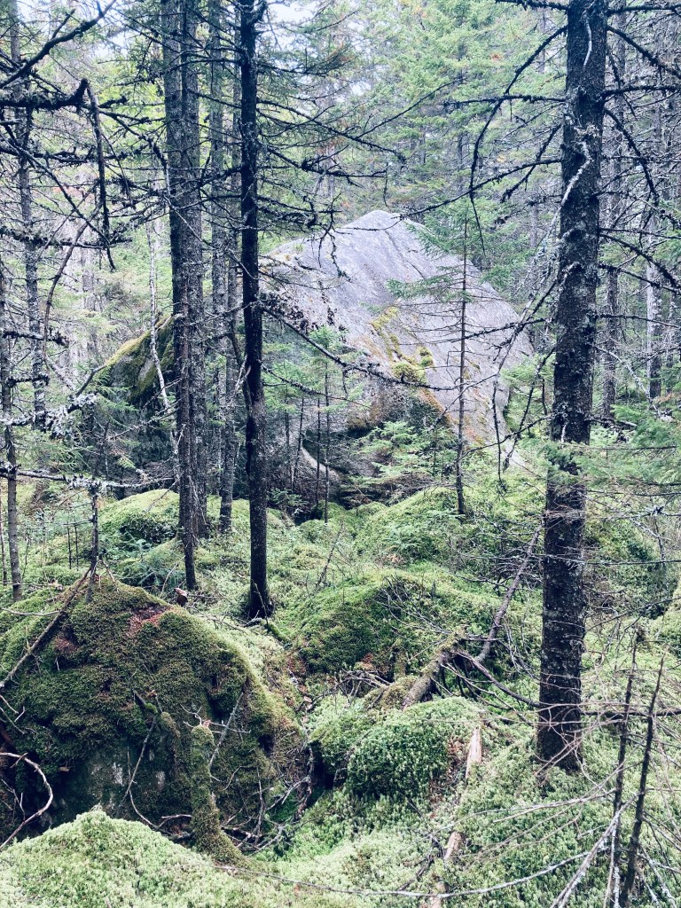
The pleasant smell of woodsmoke from the campground quickly gave way to that of pine, and the path has a definite enchanted woods feel, with soft, greenish light cast on the moss surrounding the trail. Shortly after the trail’s beginning, a large boulder on the left is whimsically marked “Kidney Stone – do not remove.” Kidney Pond can be seen through the trees, and then a small side trail to the shore provides excellent views of Katahdin to the west.
Giant boulder, Celia and Jackson Ponds Trail, Baxter State ParkContinue reading →
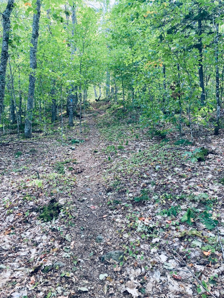
Trail to Burnt Mountain summit, Baxter State Park, Maine
You will not find many mountain hikes in Baxter State Park marked as anything other than “difficult” or “strenuous,” but Burnt Mountain (1,810 ft) is a pleasant, gradual woods walk of about 2.6 miles that took me under an hour, with fewer roots and rocks than most other hikes nearby. The best description and map I found was in Hiking Maine’s Baxter State Park. Burnt Mountain Trail’s out-and-back hike begins at the Burnt Mountain Picnic Site. This remote trailhead, which has a picnic table and a toilet, is along the park’s Tote Road, in the northwest corner of the park, close to the Scientific Forest Management Area.
Changing leaves in the light of the opening after the summit, Burnt Mountain, Baxter State ParkContinue reading →
South Branch Falls is a short (about one mile out/back, less than an hour) waterfall hike, close to Baxter State Park’s South Branch Campground, in the northern part of the park, accessible from the Matagamon Gate. This family-friendly hike explores a fast-running section of the South Branch Ponds Brook. Full description, map and photos can be found in Falcon Guides’ Hiking Maine’s Baxter State Park.