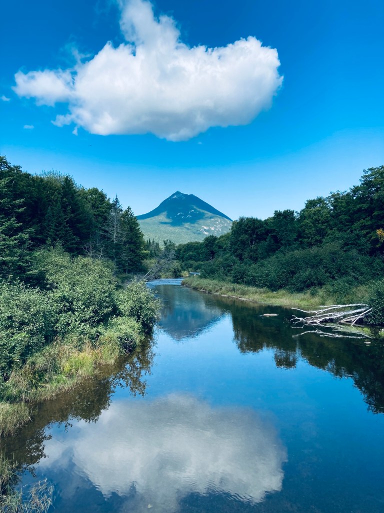
View of Doubletop Mountain from Nesowadnehunk Stream bridge to the south near Kidney Pond Campground, Baxter State Park, ME
Doubletop Mountain (north peak 3,489 feet, south peak 3,455 ft) guards the western edge of Baxter State Park (BSP), its tufted, twin summit ridge looming like the profile of a slumped, pudgy Dark Knight. The views of this signature BSP mountain are impressive, as its unique profile and steep drops make for a formidable photo over Nesowadnehunk Stream or from the rugged peaks to its east. On a sunny mid-September afternoon, I ascended it for the first time, using a challenging 7 mile out-and-back route from the parking area at Nesowadnehunk Field Campground, which took me about three hours and forty minutes.
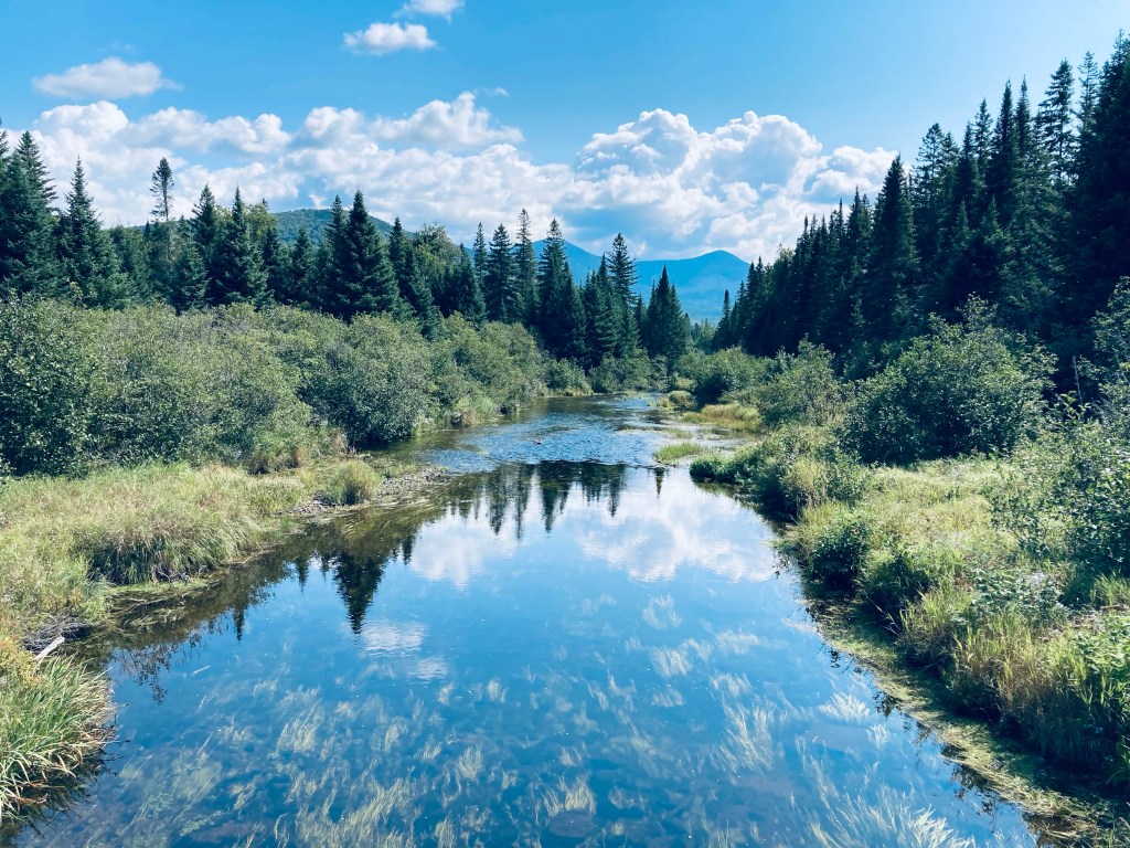
Nesowadnehunk Stream from bridge at Nesowadnehunk Field Campground by Doubletop Mountain Trail, Baxter State Park, MEContinue reading →
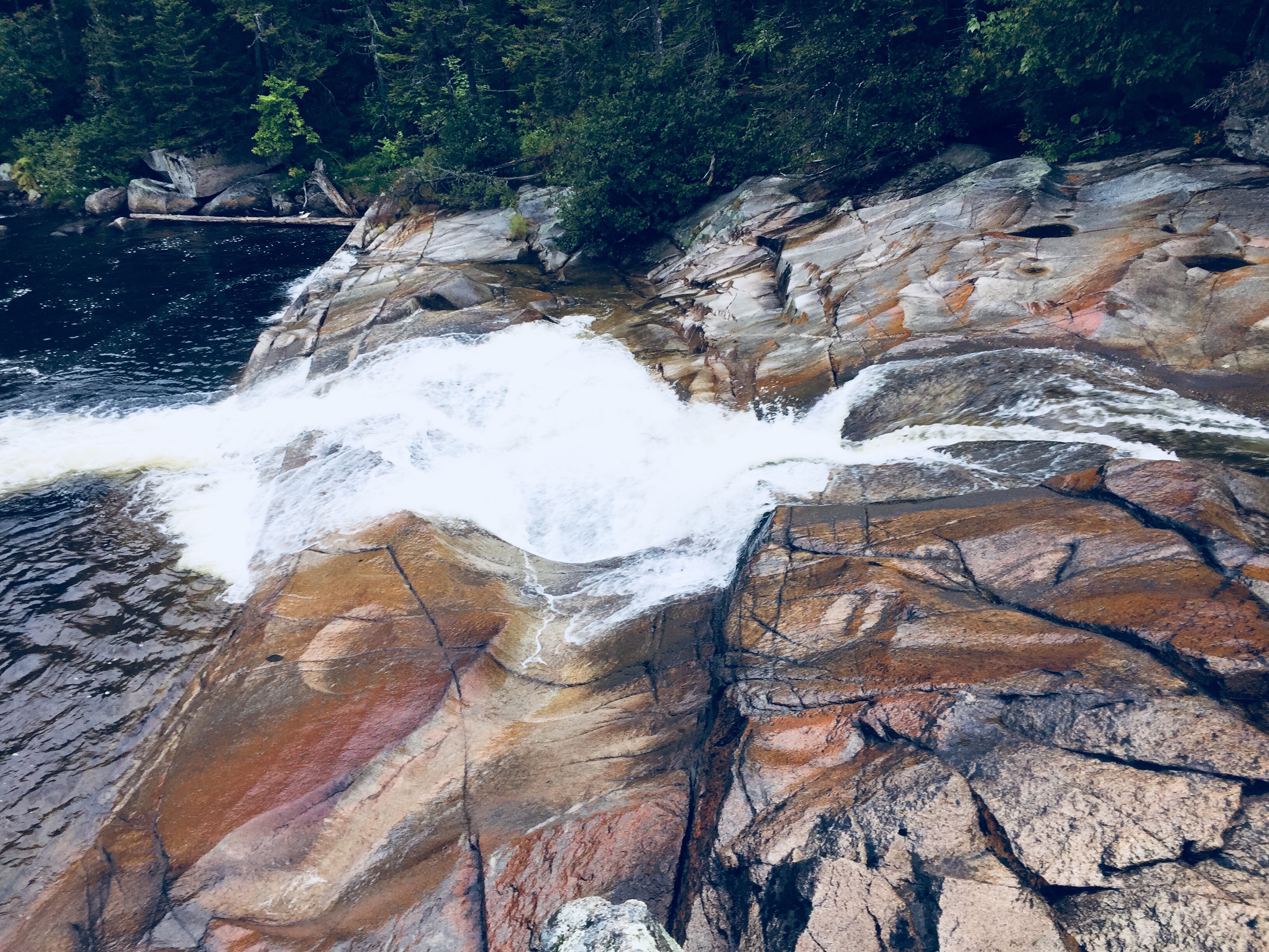
Little Niagara Falls, Appalachian Trail in Baxter State Park
In season 1, episode 3 of the travel show “An Idiot Abroad,” comedian Karl Pilkington, sleeping in a cave across from the impressive facade of the lost city of Petra in Jordan, focuses on his vantage point, rationalizing, “I’d rather live in a cave with a view of a palace than live in a palace with a view of a cave.” When our annual father/daughter trip to climb Katahdin was detoured by injury, we used similar logic in planning a non-Katahdin hike at Baxter State Park – a flatter, less strenuous hike highlighted by the views of Katahdin and the many surrounding mountains of Baxter S.P. While Katahdin’s peaks are the undisputed centerpiece of this amazing place, this approach showed us a glimpse of the wonders available in the shadow of the mountain.
Mount Katahdin, wreathed in clouds, from Katahdin Stream Campground
We kept our lean-to reservation at Katahdin Stream Campground, and when morning dawned, we filtered the chilly waters of Katahdin Stream into our water bottles. Instead of heading up the Hunt Trail to Baxter Peak, we turned south on the Appalachian Trail, all the way around Grassy Pond, Elbow Pond, Daicey Pond, down Nesowadnehunk Stream to Little and Big Niagara Falls, then back to the start. We pieced together this hike, totaling about 7.5 miles round-trip (3 hrs 45 mins), from Falcon Guides’ Hiking Maine’s Baxter State Park by Greg Westrich, and used Map Adventures’ Katahdin Baxter State Park Waterproof Trail Map to navigate. Baxter’s great website also has downloadable/printable trail maps, and the Kidney-Daicey map covers this area.
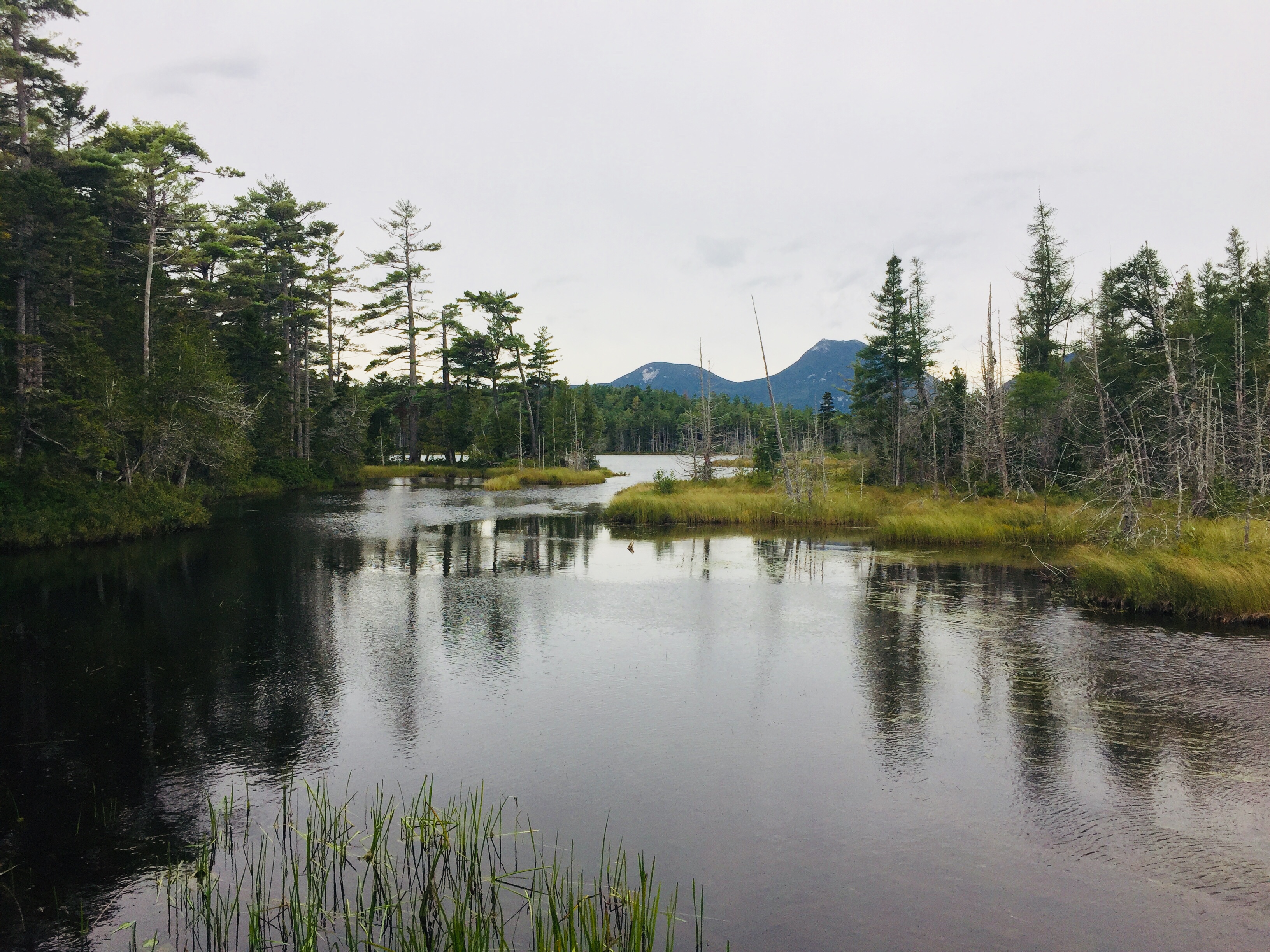
Moose and Doubletop Mountains across Grassy Pond, Baxter State Park
Our turn away from Katahdin’s elevation seemed serendipitous, as a steady rain picked up that would have made a steep climb tricky, and we quickly donned our rain gear. An easy rolling trail and plank bridges took us over cold, clear streams tinged sepia tones by cedars, and a hard right turn took us onto the Grassy Pond (blue blazes) and Elbow Pond Trails. We skirted these ponds, trying unsuccessfully to glimpse a morning moose. We settled for birds, frogs and a variety of mushrooms in every color and shape, from small, bright cones to giant discs that looked dangerously like pancakes.
Looking across Elbow Pond to Mt O-J-I and Barren Mountain, Baxter State Park
Canoes are available to rent at Grassy, Elbow, and Daicey Ponds from the nearest Baxter S.P. ranger station, with plenty of wildlife viewing opportunities. Daicey Pond has cabins for rent, making it a great base for a week of hiking, if you can snag a reservation. At Daicey, we re-joined the Appalachian Trail, moving across the day-use parking area to the shores of Nesowadnehunk Stream (towards directional sign marked The Falls). The sides of the trail were carpeted in vibrant green mosses and ferns, creating an emerald forest by the stream.
Little Niagara Falls, Baxter State Park
The remains of the Toll Dam, a vestige of Maine’s logging history, came first, then a short side trail to Little Niagara Falls. The rain and the time of day contributed to a quiet trail, with mostly thru-hikers heading in the other direction, racing the season to summit Katahdin, all friendly and moving quickly. We traveled the slight downhill, and enjoyed the spectacle of the roaring waters of both falls.
Big Niagara Falls, Baxter State Park
Heading back after a snack at Big Niagara Falls, we re-traced our steps north along the A.T., veering south (right) on the Daicey Pond Nature Trail to vary our return route. The trail around the southern side of Daicey Pond was narrow, with wet branches tight to our legs as we moved back towards the A.T. The clouds had moved in to obscure our view of the peaks across Daicey, but a clear day must be spectacular.
Cloudy view across the south side of Daicey Pond to O-J-I and Barren Mountain
The A.T. took us back to the trailhead, and our nearby vehicle. Normally, we would have enjoyed an outdoor meal on a camp stove, but the rain and cold had us in the truck with the heat on. We headed out of the park to lunch at New England Outdoors Center’s River Drivers Restaurant, overlooking Millinocket Lake (look for signs for a turn left as you head back towards Millinocket), a warm, welcoming place with great pub food and a view of Katahdin – crunchy chicken wrap and fish and chips both got high marks.
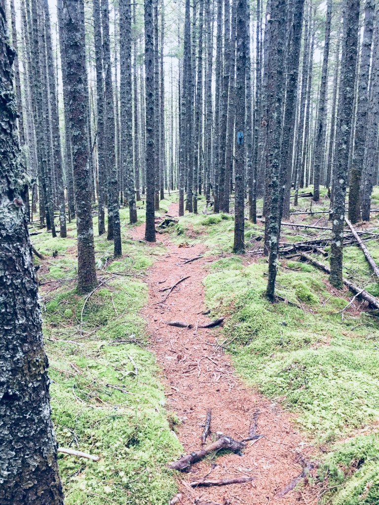
Grassy Pond Trail, Baxter State Park
The trip to Baxter State Park is always a long one, no matter where you are arriving from, as it is remote and wild, and requires you to shed creature comforts and technology. That, and the reservation system limiting access (smart and sustainable, for the park’s protection) can put a lot of pressure on a day or weekend trip with Katahdin as the goal. But this great reclaimed wilderness holds a lot more secrets for anyone willing to broaden their outlook beyond the mountain centerpiece, and this change-up hike left us wanting to plan a much longer stay to explore the rest of Baxter State Park.
(Disclaimer: This post contains affiliate links, and as an Amazon Associate Hiking in Maine blog earns from qualifying purchases.)