Dad and daughter atop Pleasant Mountain summit in 2017
Pleasant Mountain (2,006 ft) is a mountain in Bridgton right next to the former Shawnee Peak, now (since 2022) Pleasant Mountain ski area, with trails mostly on land owned by the Loon Echo Land Trust (see here for info and detailed maps). Dad and daughter hiked this first with our cousin in April 2017 as part of our preparation for our 100 Mile Wilderness trek via the (moderate) Southwest Ridge Trail (also known as the MacKay Pasture Trail), 5.8 miles up/back, but have done it since in February, August, and other months. Map and description are also available in the stellar Maine Mountain Guide. The preserve is open dawn to dusk, and dogs on-leash are allowed. Blaze orange is suggested during hunting season.
Morning light on Southwest Ridge Trail, Pleasant Mountain, Maine
This hike can be busy in summer, particular up the Ledges Trail, but an early start or a winter morning can provide solitude. There are always a few hikers, especially close to the summit, but I have also seen woodpeckers, crows, turkeys, and a winter herd of deer. The deer were using the same path, and bounded away from me, big white tails flashing, every time they heard my footsteps crunching in the snow, coming no closer than about fifty yards. In the summer, the call of loons carries up the mountain from Moose Pond.
Winter morning view of Moose Pond from near Southwest Summit, Pleasant MountainContinue reading →
Map kiosk and trailhead for Crooked River Forest, Harrison, Maine
The Crooked River Forest in Harrison is comprised of two forest parcels protected and maintained by the Loon Echo Land Trust (LELT). On a mild December day, I explored the 334 acre Intervale Preserve section, which is open year-round, with the parking area off Scribners Mills Road plowed in the winter. As of November 2023, it is only accessible from the Harrison side of the river (Maple Ridge Road), as the state of Maine permanently closed the Scribners Mill bridge over the Crooked River in Otisfield (“structurally unsound and unsafe for use”). The river and streams were still running high from the large winter storm a little over a week prior. I had the parking lot to myself, where there was a kiosk with a large trail map, and pamphlets with trail maps and info to carry along the hike. Maps and info are also available from LELT here.
Intervale Trail, Crooked River Forest, Harrison, Maine
I started on the Intervale Trail (.62 mile total length), and almost immediately heard the loud honking call of a great blue heron, with identity confirmed when it lumbered out of a tree into flight at my approach. Then along the short straightaway through the forest to an open area, I heard the chirping of a Red Crossbill. At this opening, the Evergreen Trail (1.1 mile total length) splits off to the right, and I continued left towards the Crooked River on the Intervale Trail. The trail is wide and flat, marked by red diamond-shaped placards with a black center, and moves slowly downhill toward the river. I passed over a brook flowing underneath the trail through a culvert ,with the banks covered in a recent overflow of mud and clay, yielding to a straight path through very evenly planted evergreens.
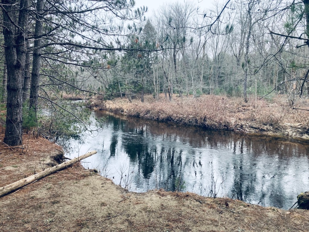
Crooked River from Intervale Trail, Harrison, Maine
Here, I disturbed some deer close to a pleasant curve in the Crooked River, which quickly became visible through a break in the trees. There were little, bubbling rapids and rocks, and trees spaced widely enough to allow for a good place for a picnic. After a short walk of about twenty minutes from the trailhead, the Intervale Trail dead-ends here, unless there’s snow. In the winter, the Winter Snowshoe Trail (.6 miles) would make a loop back to the Evergreen Trail, but without the snow, it’s too overgrown. I doubled back to the trail intersection at the open area, and then took the Evergreen Trail separately. On both trails, I saw ample signs of wildlife, with sounds in the woods, deer hoofprints in the mud, and scat and grey fur along the trail from animal usage, or some life or death struggles. Black-capped Chickadee and Dark-eyed Junco flitted across the path, and I heard Red-breasted Nuthatch and Northern Cardinal in the surrounding forest.
Crooked River from Intervale Trail, Harrison, Maine
The conifer-lined Evergreen Trail is true to its name, and crosses over several peaceful streams. In the wintertime, the trail is groomed for snowmobiles, so it might be a bit more difficult to share the road, depending on traffic. I reached the intersection with the Winter Snowshoe Trail and continued another .4 miles to where the Evergreen Trail ends abruptly in a clearing, with a wooden sign for notice. I turned around and heading back up this long, straight easy trail. My route was pleasant, a Y-shaped retracing of my steps totaling about 3.9 miles, and completed in a leisurely hour and 15 minutes or so. A more efficient snowshoe loop using the Evergreen, Intervale, and Winter Snowshoe Trails would be about 2 miles. In addition, a trail not listed on the map, marked with blue diamonds, is visible bisecting the Evergreen and Intervale Trails. According to the LELT land manager, this is another snowshoe/cross-country ski loop totaling about eight/tenths of a mile, and will be groomed (if there’s snow) by the snowmobile club. After the hike, the nearby Fluvial Brewing off Maple Ridge Road is a great place to grab a beer and snacks (check the hours first). Or, if heading towards Portland, The Good Life Market in Raymond is a perennial go-to for us.
Evergreen Trail, Crooked River Forest, Harrison, Maine
The Raymond Community Forest is a network of four trails over 356 acres between Crescent Lake and Pismire Mountain (833 ft), protected by the Loon Echo Land Trust (LELT). I decided to combine all four into a modified loop (approximately 4 miles/1.5 hrs) to try and see as much of the Forest as possible. The lower trails (Spiller Homestead and Grape Expectations) are open to pedestrians and mountain bikes, while the trails to the east of Conesca Road (Pismire Bluff and Highlands Loop) are pedestrian-only. Leashed dogs are welcome.
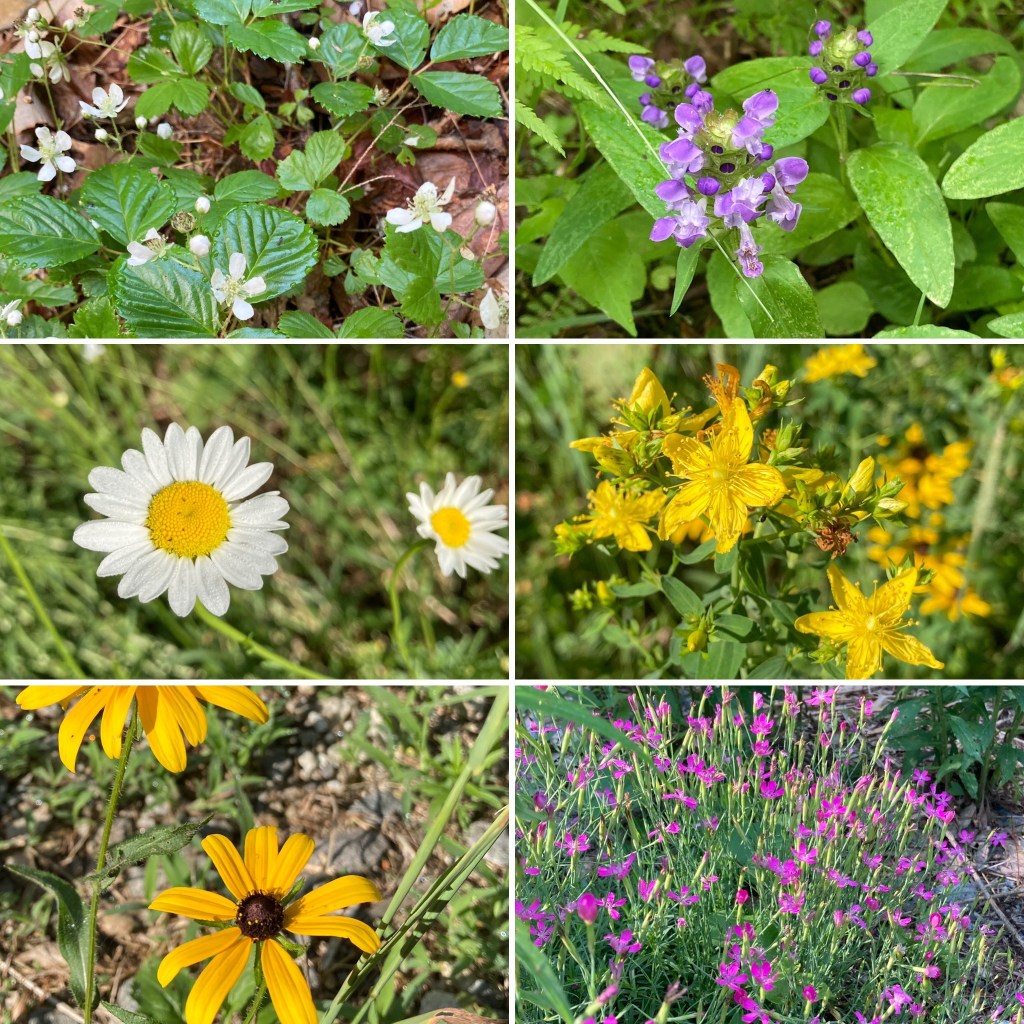
Wildflowers, Raymond Community Forest
The clearly marked trailhead, with parking, is located off Conesca Road in Raymond, and has a large kiosk with a map of the Forest and Raymond Community Forest trail maps available. On the warm July morning I visited, the field by the kiosk was bright with wildflowers.
The Lakes Region of Maine surrounding Sebago is a fantastic area for hiking, with many hikes in striking distance of lakefront idylls and other recreation. Bald Pate Mountain (1,150 ft) is an easy to moderate hike in Bridgton, Maine, with many trail options, comprising 6.7 miles of trails.
On this June morning, I took the Bob Chase Scenic Loop to the summit, then the South Face Loop Trail, returning the same way to the parking lot, for an approximately 3 mile hike (about an hour and fifteen minutes at a relaxed pace). Bald Pate trails are well-chronicled in the AMC Maine Mountain Guide, and the trail map and descriptions are available online from the Loon Echo Land Trust, which owns and manages the 486 acre Bald Pate Preserve.
Bob Chase Trailhead at the parking lot/kiosk.
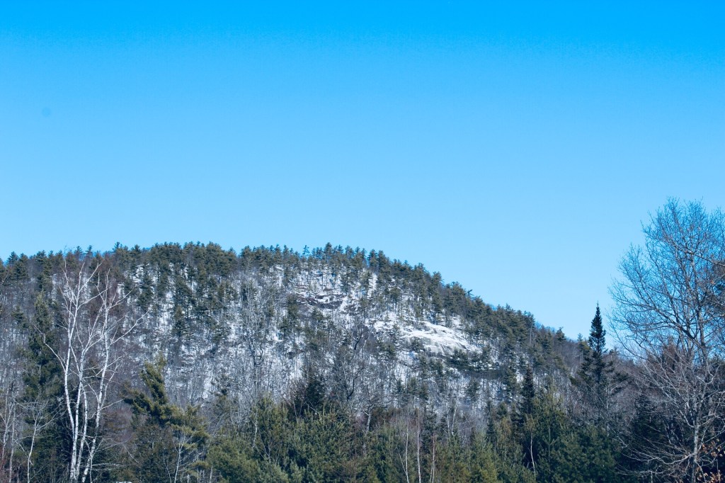
Approaching Bald Pate from the south on Route 107, you can see the exposed rock that is the mountain’s namesake. The parking lot is located on the east side of 107, just south of Five Fields Farm and XC Ski Center, at the top of a large hill. The climb up 107 allowed the car to do a lot of the work of getting to the summit before I even started hiking.
Face of Bald Pate Mountain in winter, Bridgton, Maine
When I arrived, the lot was empty, and a small circle of depressed grass and milkweed next to my car looked like a place where a deer had slept the night before. I started up the Bob Chase Scenic Loop, with birch trees, lady slippers, wild blueberries, and ferns on either side, and red squirrels chattering loudly.
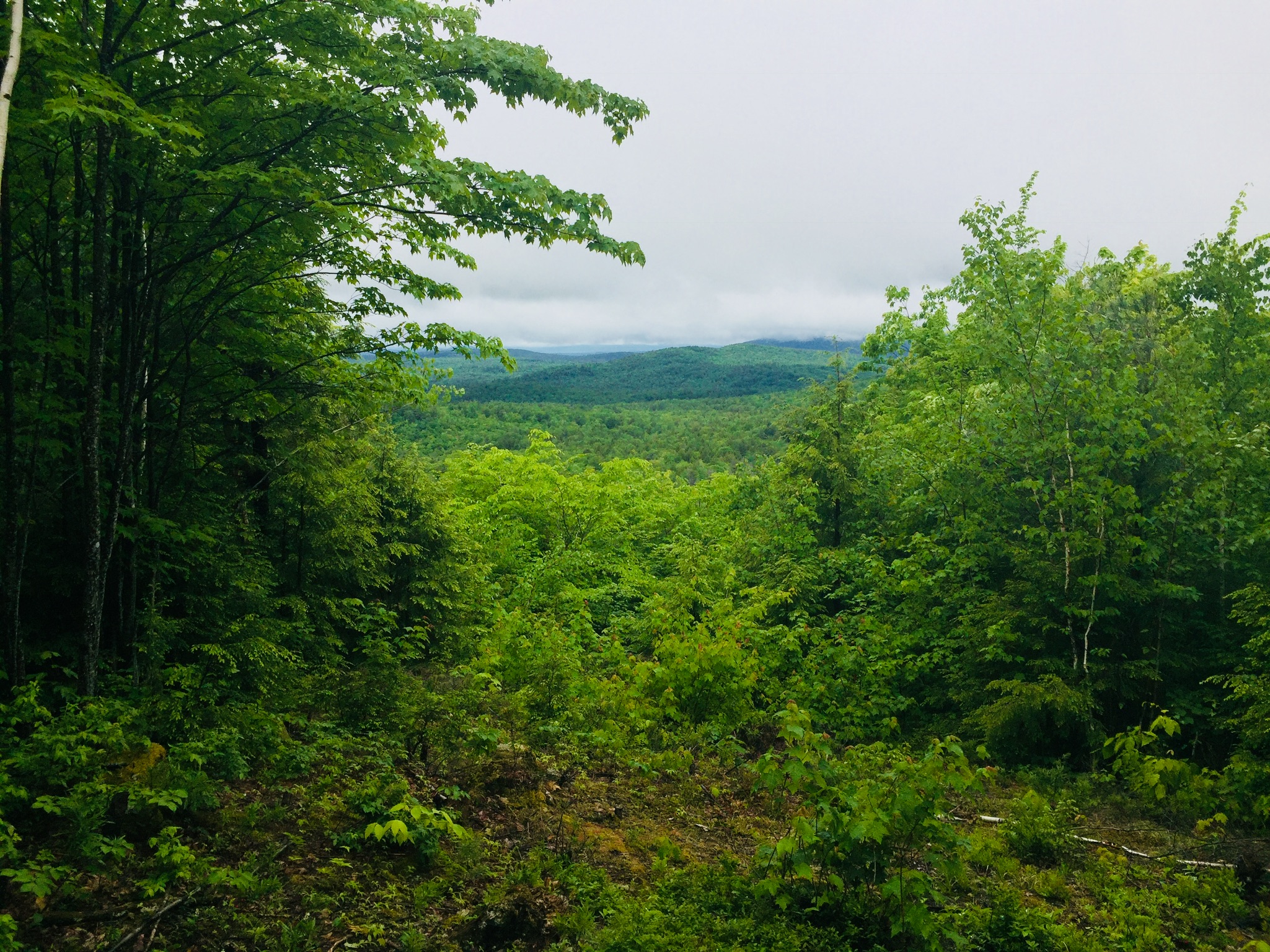
Views west from the Bob Chase Trail.
A wrong turn took me around a pleasant diversion/backtrack to the other side of the Bob Chase Scenic Loop, and I wound my way back to the summit. This was not the fault of the trail maintainers, as the Bob Chase Loop is clearly marked in blue, and the South Face Loop is clearly marked in orange.
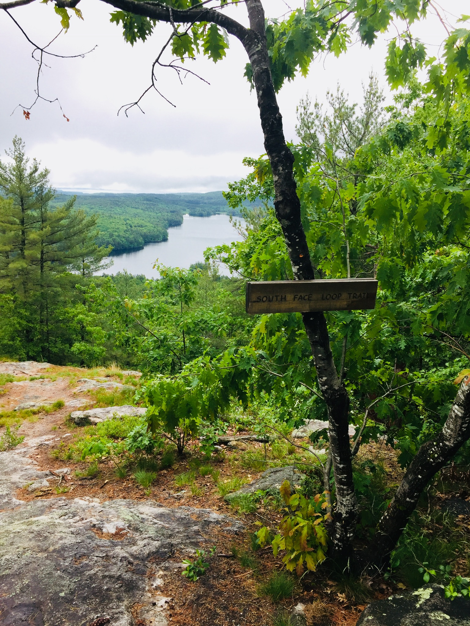
View from the South Face Loop toward Peabody Pond.
The summit is easy to reach in 25 minutes or less, with excellent views, and it looks like a riot of wild blueberries awaits those who hike it later in the summer. The South Face Loop was much more challenging than the Bob Chase Trail, descending steeply, skirting the face of the mountain, and then ascending quickly to rejoin the summit (I thought several times, I already climbed this, didn’t I?).
The Pate Trail is a short, steep (.1 mi with 360 ft of elevation gain) trail connecting the summit to the South Face Loop, and I will have to try this one next time, as well as the Moose Trail, which can create a different loop back to the parking lot.
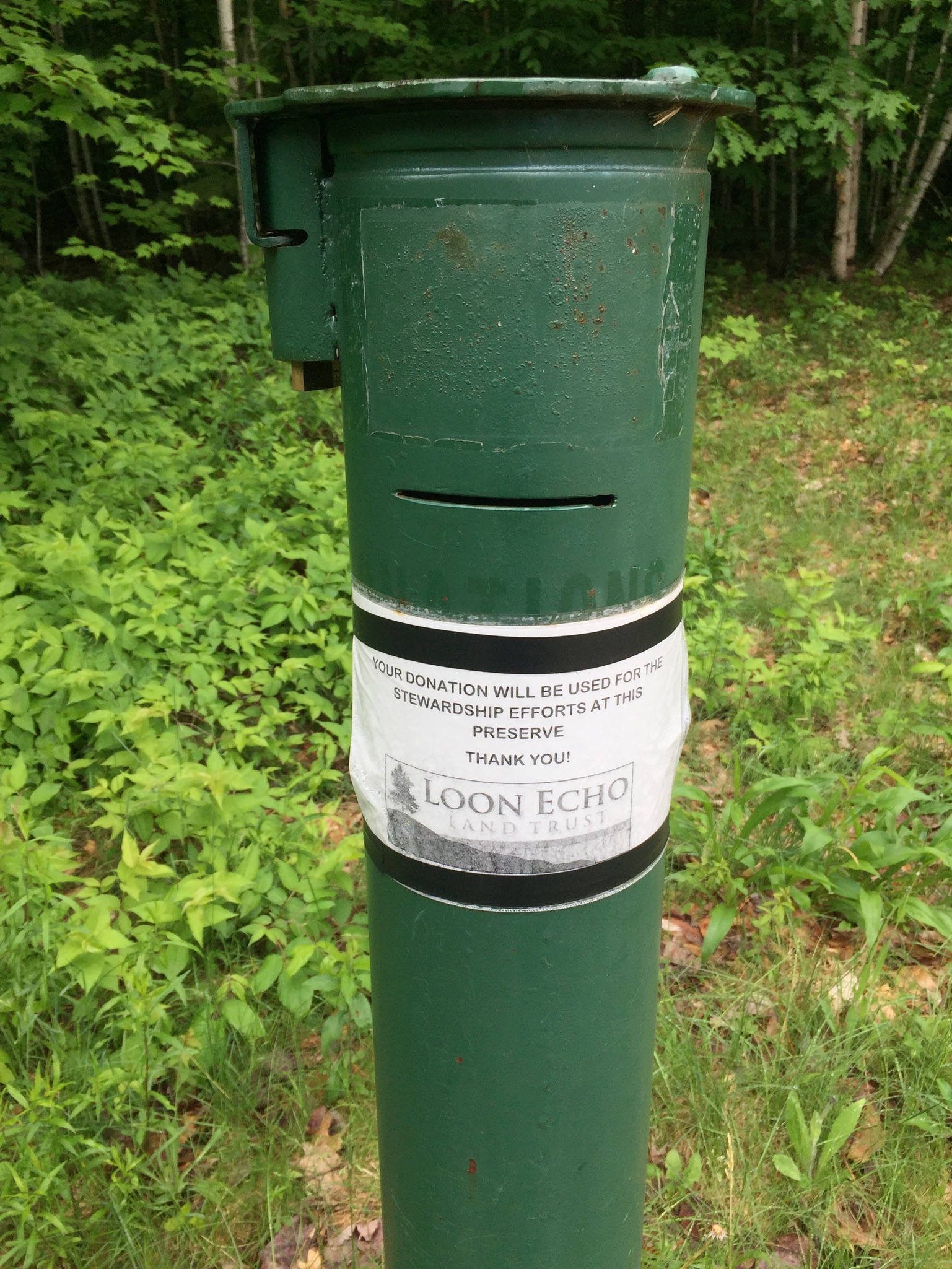
Don’t forget to “tip your bartender.” Conservation takes time and money.
This trail network is connected to the Holt Pond Preserve via the Town Farm Brook Trail, which descends northeast to the Holt Pond Trail, a link which could create a much longer hike in a very different environment (bog walkway). The Bald Pate summit is a nice, short hike, suitable for most age and skill levels, with great vistas along the way.
(Disclaimer: This post contains affiliate links, and as an Amazon Associate Hiking in Maine blog earns from qualifying purchases.)