
The Amherst Mountains Community Forest are a Public Land reserve of almost 5,000 acres, located east of Bangor in rural Hancock County on the way to more famous Downeast destinations. On a quiet mid-August day after rains, I took Pig the dog for the Partridge Pond and Ducktail Pond Loop, which I clocked at about 3.4 miles, taking about an hour and a half. It is an out-and-back on Partridge Pond Trail to the Ducktail Pond Trail, and then back on the logging road. On a recent mid-October 2024 day, I also encountered a full lot at the Partridge Pond parking area, and just reversed the hike (as an out-and-back) from the Ducktail Pond parking area, which was just a little under 3 miles. Each time, I used AllTrails to navigate, and there is also a great description and map in Dog-Friendly Hikes in Maine (pets under control are allowed).
The state of Maine has a comprehensive map and guide to the Amherst Mountains Community Forest, including campsites and the Bald Bluff Mountain hike, here. The turn off Route 9 onto Ducktail Pond Road (22-00-0 road), marked by a blue Amherst Public Lands sign, is a tricky hairpin off a busy road from either direction. The road is a typical logging road, dirt and gravel with some washouts and protruding rocks, but much better on the October 2024 visit than the previous one.

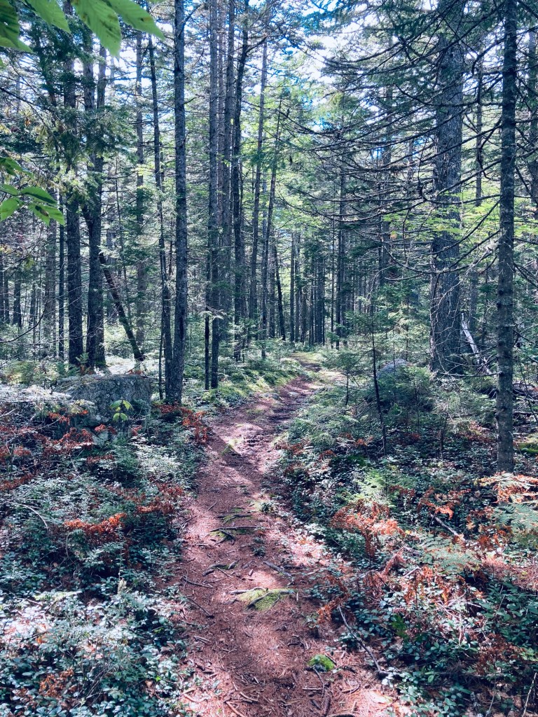
We went to the Partridge Pond Trailhead first, where the loud buzzing of mosquitoes and various assorted flies was ominous, but never quite materialized into a problem (and obviously not in October, either). The trail, well-marked with blue blazes, started with a section of slippery plank bridges, and a slight uphill into woods that were rocky and dark. The trail crossed a series of small brooks and wound over rolling terrain with low, wet spots mostly traversed by plank bridges. About 3/4 of a mile in, just before the trail split to the right towards Ducktail Pond, the forest opened up to a series of sunny, moss-filled glades. We continued straight to go to to Partridge Pond first.
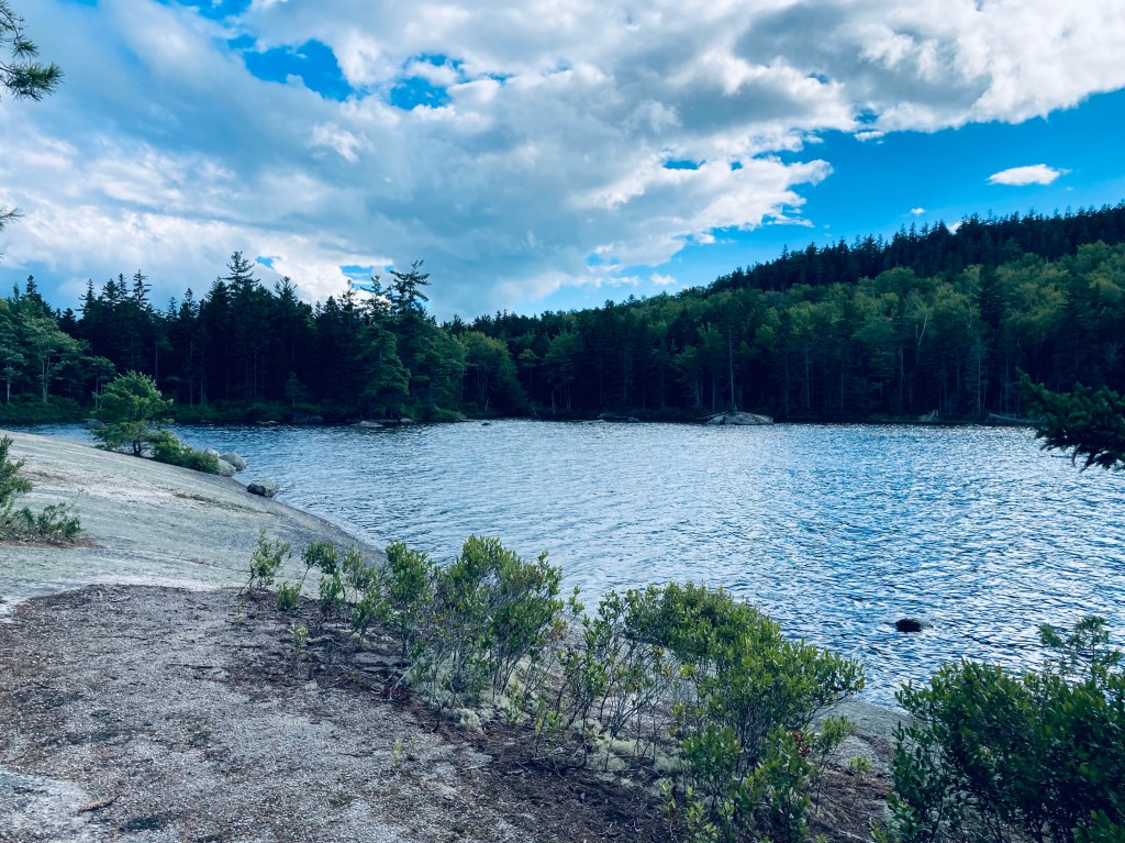
Pig briefly chased a red squirrel and we saw a small frog in a luxurious bed of moss next to the trail as we started to walk over blueberry-covered ledges leading toward Partridge Pond and bypassed a campsite along the way. We accidentally took a small deer trail that veered off, but got back on the blue blaze path, which shortly led us to a beautiful stream lined with bright green moss. A last ridge lay between us and Partridge Pond, beautiful, lined with huckleberries, and cascading into its rocky outlet in an unexpected waterfall. At the pond, there is a campsite with a pit toilet, and there were signs of fires and cooking along the shore.

On the return, we picked our way down a small, unmarked trail to the base of the waterfall, which was even more impressive from that angle. We retraced our steps and turned left onto the trail to Ducktail Pond (named Wilson Pond on some maps, including AllTrails), which was generally more level, and covered with pine needles. We wound our way down a rockier path, over more moss-covered ledges, with the sun-reflected surface of Ducktail Pond shining brightly through the trees.
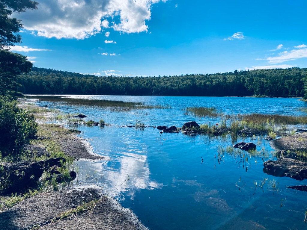
Like Partridge Pond, Ducktail’s outlet is a waterfall, this time a series of cascades, crossed by the trail, which required a small but impressive leap by six month-old Pig. The trail then followed the stream down on a winding rocky path lined by birches. The downhill path is quick and curving, and it’s a fairly fast-paced walk to reach Ducktail Pond Road, where you turn right to walk back to the Partridge Pond parking area to complete the loop. There is a picnic table at the parking area if you need a pause at this point. Alternately, if you parked at the Ducktail Pond area, there is a small, quiet day-use area about .1 miles downhill along Indian Stream.

Don’t forget to take a small unmarked trail just next to a wide culvert to see the waterfalls (third set on this hike) before they go under the road. The walk back is pleasant in and of itself, as the road is quiet, lined with wildflowers and birds (I heard a warbling vireo next to the road). If you are hungry or thirsty after the hike and time it right (Thurs -Sun, check the hours), Airline Brewing Company, marked by a sign with a saw blade, is just east on Route 9, with seating and outdoor picnic tables.

(Disclaimer: This post contains affiliate links, and as an Amazon Associate Hiking in Maine blog earns from qualifying purchases.)

2 thoughts on “Partridge Pond and Ducktail Pond Loop (Amherst, ME)”