Partridge Pond and Ducktail Pond Loop (Amherst, ME)

Pig wearing her blaze orange Carhartt, Partridge Pond in fall, Amherst Mountains Community Forest

The Amherst Mountains Community Forest are a Public Land reserve of almost 5,000 acres, located east of Bangor in rural Hancock County on the way to more famous Downeast destinations. On a quiet mid-August day after rains, I took Pig the dog for the Partridge Pond and Ducktail Pond Loop, which I clocked at about 3.4 miles, taking about an hour and a half. It is an out-and-back on Partridge Pond Trail to the Ducktail Pond Trail, and then back on the logging road. On a recent mid-October 2024 day, I also encountered a full lot at the Partridge Pond parking area, and just reversed the hike (as an out-and-back) from the Ducktail Pond parking area, which was just a little under 3 miles. Each time, I used AllTrails to navigate, and there is also a great description and map in Dog-Friendly Hikes in Maine (pets under control are allowed).

Partridge Pond Trail, Amherst, ME

The state of Maine has a comprehensive map and guide to the Amherst Mountains Community Forest, including campsites and the Bald Bluff Mountain hike, here. The turn off Route 9 onto Ducktail Pond Road (22-00-0 road), marked by a blue Amherst Public Lands sign, is a tricky hairpin off a busy road from either direction. The road is a typical logging road, dirt and gravel with some washouts and protruding rocks, but much better on the October 2024 visit than the previous one.

Pig exploring a stream next to plank bridge on Partridge Pond Trail, Amherst, ME

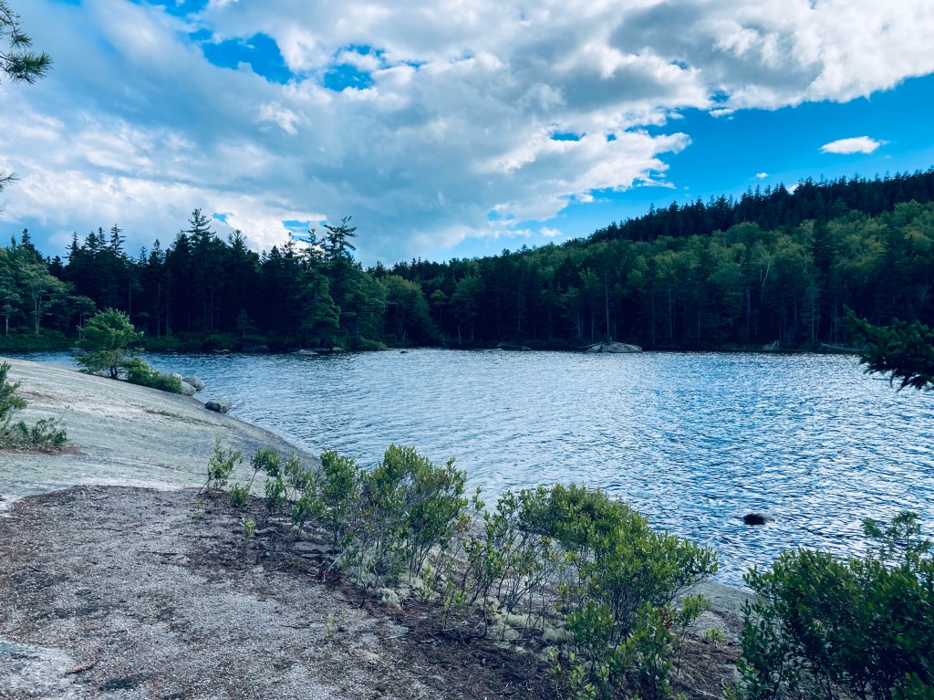
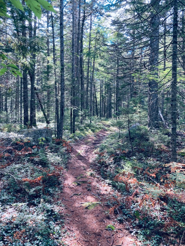
We went to the Partridge Pond Trailhead first, where the loud buzzing of mosquitoes and various assorted flies was ominous, but never quite materialized into a problem (and obviously not in October, either). The trail, well-marked with blue blazes, started with a section of slippery plank bridges, and a slight uphill into woods that were rocky and dark. The trail crossed a series of small brooks and wound over rolling terrain with low, wet spots mostly traversed by plank bridges. About 3/4 of a mile in, just before the trail split to the right towards Ducktail Pond, the forest opened up to a series of sunny, moss-filled glades. We continued straight to go to to Partridge Pond first.

Ledges on shore of Partridge Pond, Amherst, ME
Continue reading

Bald Bluff Mountain (Amherst, ME)

Overlook to the south on Bald Bluff Mountain, Amherst, ME

Bald Bluff Mountain (1,011 ft) is located within the beautiful Amherst Mountains Community Forest, a Public Land reserve of almost 5,000 acres, located east of Bangor in rural Hancock County off Route 9 (the Airline) on the way to better-known Downeast destinations. The day after hiking the Partridge Pond and Ducktail Pond Loop in mid-August, I again took Pig the dog up Bald Bluff Mountain, a lollipop loop of about 2.25 miles which we did in about an hour and fifteen minutes. As usual, I used AllTrails to navigate, and there is a thorough description and map in Dog-Friendly Hikes in Maine (pets under control are allowed). The state of Maine has a comprehensive map and guide to the Amherst Mountains Community Forest, including campsites and the Partridge and Ducktail Ponds hike, here. Again, the turn off Route 9 onto Ducktail Pond Road (22-00-0 road), marked by a blue Amherst Public Lands sign, is a tricky hairpin off a busy road from either direction.

Pig inspecting moose droppings, Bald Bluff Mountain Trail, Amherst, ME

The road is a typical logging road, dirt and gravel with some washouts and protruding rocks, and when I used the road this day, there was someone using heavy equipment to grade it, which made the ungraded portion a bit like the surface of the moon. It would be slow going in a low-clearance vehicle. The Bald Bluff parking area is about 6 miles from Route 9 – Google Maps will likely take you in from the north (from the direction of Sunkhaze Meadows NWR in Milford and/or Stud Mill Road) on the 22-00-0 road, which is another access point. I made some errors at the beginning of our hike, by following a grassy, overgrown woods road/biting insect nursery north of the parking area. The actual trail is just south (downhill) of the parking area, marked by a small brown “Trail Head” sign on a tree. This required me to do some bushwhacking to get back on track, and is reflected in the mileage. We were not the only ones to use this route, as evidenced by some of the comments on the Maine Trailfinder site, and generous piles of moose droppings on the disused road.

View just shy of summit, Bald Bluff Mountain, Amherst, ME
Continue reading