
Baxter State Park’s northern half is quiet, filled with remote ponds. The trail south from the park’s Tote Road to Lower and Middle Fowler Ponds was the perfect late afternoon hike on a mid-September day. I followed the description and map from Hiking Maine’s Baxter State Park, and navigated using AllTrails and the Map Adventures’ Katahdin Baxter State Park Waterproof Trail Map. I completed the approximately 5.4 miles in about two hours and 15 minutes as an out-and-back of the Fowler Brook and Middle Fowler Trails, but a shuttle loop is possible, using the Middle Fowler Pond Trail all the way to the trailhead at South Branch Pond Campground, and spotting a bike or a vehicle there.

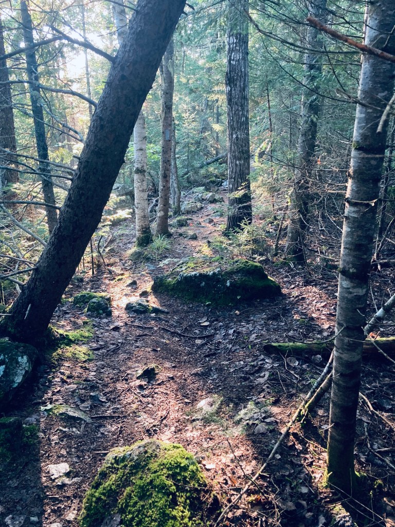
From the parking area on the Tote Road, the Fowler Trail glowed in the late afternoon sunlight, with a pine path carved through bright green moss. The forest held a surplus of red squirrels, busy with late summer gathering activities and chattering at me as I continued to cross plank bridges over a swampy area. A larger bridge crossed a wide brook with long green grass swaying in its current. I could see recent trail work, as storms must have felled a large pine and some other trees further along the way.
By about the half-mile mark, I was traversing an elevated portion of land, looking down at a deep gully to my right that continued for a while, while the sounds of the rushing water of Fowler Brook drifted uphill. At about 3/4 of a mile I crossed a small, rocky creek and finally saw Fowler Brook to my right. In the valley by the brook I saw and then heard a northern flicker, which are always larger up close than they seem as they fly away. I also saw a series of puffball mushrooms, stacked like eggs on a mossy log.

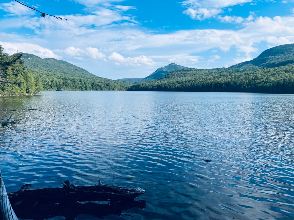
Emerging from the forest, I had a beautiful view of Lower Fowler Pond from the launch spot for the Baxter State Park rental canoes, looking across to Barrell Ridge, Bald Mountain, and the Traveler range. Working my way around the shore of Lower Fowler Pond, I spooked some large waterfowl, who took off for the opposite side of the pond. The trail continued past the Middle Fowler Pond Trail intersection through a campsite with a nice view of the water and its own outhouse. I continued through, on a long quiet walk through the woods to Middle Fowler Pond. The sound of rushing water off to the right signaled the outlet of the pond as I got closer, and I finally saw the outflow, with the water moving over and under large slabs of rock, as it trickled down to the pond I had just departed.

Middle Fowler Pond itself was magnificent, clear and cradled by lonely peaks and surrounded by trees and flowers. The names lower and middle suggest a third Fowler Pond, and it exists just to the east, named Little Fowler Pond, with no trail leading to it. Should you want to continue onward, the trail continues across the outlet and on the south side of Middle Fowler Pond, moving south of Barrell Ridge and between Little and Big Peaked Mountains, before reaching the road to South Branch Pond. Instead, I paused to take in the pond and its surroundings, have a snack and a drink, then I turned to head back the way I came in the fading light.
(Disclaimer: This post contains affiliate links, and as an Amazon Associate Hiking in Maine blog earns from qualifying purchases.)
