Sugarloaf Mountain (Mount Chase, ME)

View from Sugarloaf Mountain summit, Mount Chase, Maine

Sugarloaf Mountain (the smaller one, not the ski resort), is located in town T5 R7 WELS, near Mount Chase, Maine. From northbound ME-159, turn left onto Grondin Road, and stay on Grondin Road until you reach the trailhead (a little over 7 miles). I used the directions from AMC’s Maine Mountain Guide, and climbed this mountain in mid-September on the way into the north entrance of Baxter State Park. You will (and should) second-guess yourself on this drive, as the road is more of an ATV trail.

Sugarloaf Mountain Trail, Mount Chase, Maine

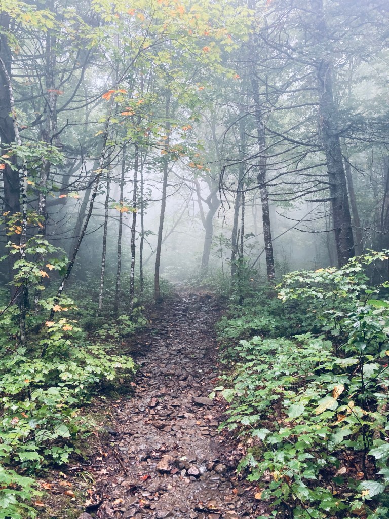
It’s probably best to park at the last four-way intersection and then walk down to the trailhead. The trail itself enters a beautiful deciduous forest dappled with light on a slightly inclined but manageable grade. At some point, the leafy green gave way to mostly evergreen, and the trail continued to become more steep, as I started to catch views through the trees of the surrounding mountains.

View from Sugarloaf Mountain Trail, Mount Chase, Maine

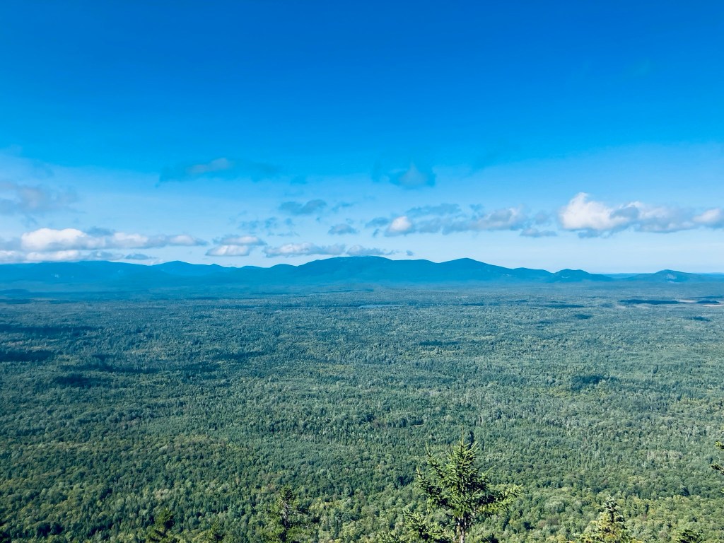
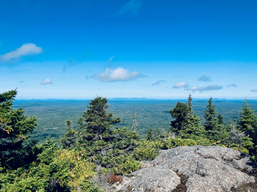
Shortly before the summit a series of rock ledges and boulders faced west with great views of Katahdin and its attendant mountains. From here, it’s a pretty short scramble over some steep rock to the summit.

View from Sugarloaf Mountain Trail, Mount Chase, Maine

I enjoyed the breeze at the top and the views of the marshes, lakes, ponds, mountains, and forest all around. Then a quick drink of water, and back down, about 1.92 total miles in 42 minutes. There are very few switchbacks – this is basically a mile up and a mile down for a beautiful view.

View from Sugarloaf Mountain Trail, Mount Chase, Maine

(Disclaimer: This post contains affiliate links, and as an Amazon Associate Hiking in Maine blog earns from qualifying purchases.)

Mount Chase

Beginning of Mount Chase Trail on Mountain Road, Mt. Chase, Maine

Mount Chase (2,440 ft) commands views of northern Penobscot County, including the peaks of Baxter State Park to the west, and the Shin Ponds. The mountain, and subsequently the town in its shadow, were apparently named after a man who came as an agent for the state to prevent timber thieves. To get to Mount Chase, head north from Patten, and make a difficult hidden turn onto unpaved Mountain Road off Route 11. You will pass some structures, logging roads, a whimsical wooden carving of a Sasquatch, and turns for ATV trails, as well as some vistas to the right. The road gets rockier the further in that you go, and the parking area is at a small clearing with a picnic table, a little over 2 miles in. I navigated using AllTrails, and it took me just shy of two hours to make the 3.4 mile out-and-back on a cloudy mid-September morning. Maps and description are available in Hiking Maine and  Maine Hikes Off the Beaten Path.

Mount Chase Trail, Mt. Chase, Maine

The trail doesn’t start in that clearing next to the picnic table, it starts at a small wooden handwritten sign just a little farther down the road. The blue-blazed trail began slightly uphill, rocky and wet, resembling a stream bed, with some ATV tracks in muddy spots. At about a quarter mile, the grade flattened out some, which had the effect of drying it, as well. The incline then grew a bit steeper, and crossed another overgrown road. At about four-tenths of a mile, the foot trail split off to the right, with a slope steeper and rockier than most ATV’s would be comfortable handling, then quickly resumed its confluence with the ATV trail.

Mount Chase Trail, Mt. Chase, Maine
Continue reading