
The Lakes Region of Maine continues to be a great place to hike. I hiked Holt Pond Preserve in Bridgton, what turned out to be a 4.5 mile loop (approximately an hour and forty-five minutes), on a June morning after heavy rains. Holt Pond Preserve is a preserve of over 400 acres, maintained by the Lakes Environmental Association (LEA), who have a site with interpretive guides and maps.
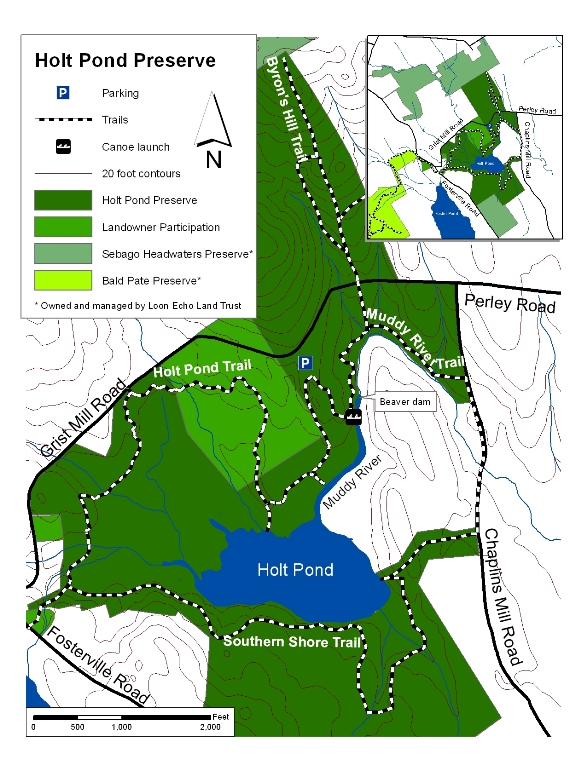
No dogs, bicycles, or ATVs are allowed at Holt Pond. There is, however, a canoe launch, which looks like a great way to see Muddy River and Holt Pond.

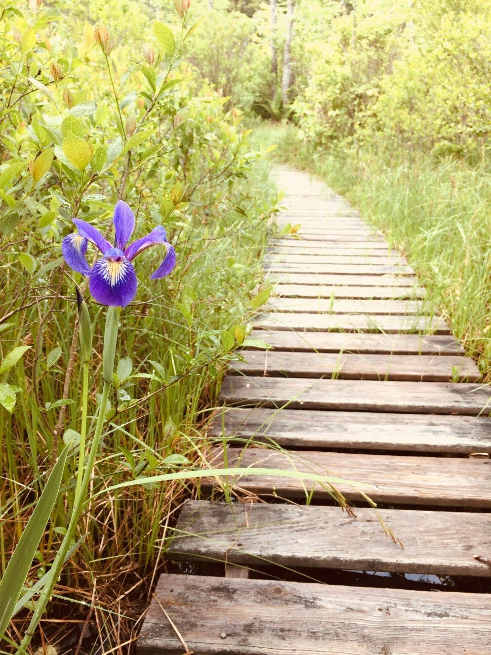
The preserve was alive with the sounds of waterfowl, including ducks and geese, and the distinctive calls of red-winged blackbirds and frogs. The boardwalk allows for fascinating views of plants that you would normally need hip waders or a kayak to see, particularly pitcher plants.

These carnivorous plants had flowers above them when I visited, something I had not yet seen. The bog breathed fetid air through the gaps in the boardwalk, a contrast to the cool breezes above. Animals use the boardwalk pathways, too, and I tagged along at times behind a chipmunk and a small fledgling bird, both of whom were unable to yield the path until they reached solid ground.
The trail’s path changed from bog to pine forest toward Grist Mill Road, and following it became more difficult, as it was overgrown, with a fair amount of upheaval to bridges and boardwalks from spring rains.

This moisture also brought with it plenty of mosquitoes. For those attempting the Southern Shore trail on the far side of Holt Pond, I would highly suggest pants and long sleeves, as well as insect repellent and a weather eye for poison ivy.

The trail skirts private property by moving onto Chaplins Mill Road briefly to the east of the preserve. I clearly missed the turn back to the trail, so I took Grist Mill Road east (left) to make a loop back to the parking area.
While the full perimeter of Holt Pond might be a bit much for most kids, the boardwalk near the parking lot is a perfect excursion for young ones, particularly using the interpretive guide on LEA’s site.
And, as mentioned in the Bald Pate post, this trail network is connected to the Bald Pate Preserve via the Town Farm Brook Trail, which ascends Southwest to the Bob Chase Scenic Loop.
