
Mount Will (1,726 ft), which spans across the town lines of Newry and Bethel, Maine is a lesser-traveled peak, accessed through a loop trail, with a small parking area across the road from the Town of Bethel transfer station. This trail, marked with bright blue blazes, was developed by the Bethel Conservation Commission, and is maintained by the Town of Bethel. Detailed description can be found in Maine Hikes Off The Beaten Path or the AMC Maine Mountain Guide.

On a cold January day, I took the loop counter-clockwise, for a total of about 3.2 miles, taking about an hour and forty minutes. The snow was recent and shallow, and I had good traction throughout the hike with microspikes and hiking poles. Later in the season, or with more snowfall, this would be a snowshoe trail. The Nature Trail section, which runs through the Bethel Town Forest, has placards throughout with facts about flora and fauna. The water from recent rains had frozen in serrated rows on rocky outcroppings, giving the mountain icy fangs.

The trail winds up the east side of Mount Will, reaching a viewpoint at the North Ledges, overlooking the Androscoggin River valley. Between the North Ledges and South Cliffs are signs for the Gray Memorial, accessible by an old woods road. This memorial commemorates a 1992 plane crash on Mount Will, which took the lives of Maine State Police Trooper Leroy Gray and his wife Brenda.
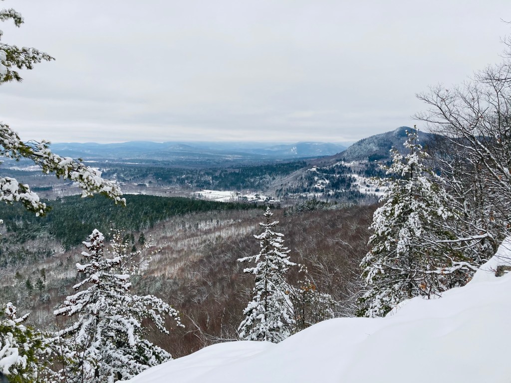
The South Cliffs have open views of the Androscoggin Valley and surrounding ski areas, before the trail descends back into the forest. On this January day, the dead leaves stood out in a rusty orange color against the snow and birch trees. The trail is separated from the other loop section by a brook, and winds along it through an area where active logging is going on, until rejoining the original trail close to the parking area.

(Disclaimer: This post contains affiliate links, and as an Amazon Associate Hiking in Maine blog earns from qualifying purchases.)

The snow is beautiful!
LikeLike
This iis a great post
LikeLike