We first visited Camden Hills State Park in the spring of 2017, an unintentional winter hike of the Megunticook Loop. Better prepared, equipped, and with a full windy, cold March day to burn, I chose a longer, meandering route through the park. This ambitious path up Mount Battie (780 feet), over to the Maiden Cliff (800 feet), and up to the summit of Mount Megunticook (1385 feet) was close to 11 miles, and a little under five hours. You can find detailed descriptions of the trails in the AMC Maine Mountain Guide. As I arrived before the road to Mount Battie opened, I used the parking lot to the left of the main entrance, paid the $4 Maine resident fee, and walked the quarter mile or so from the gate to the parking lot for the trails (toilets are available in both places).
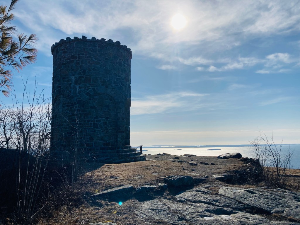
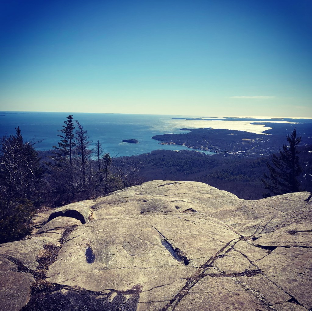
The blue-blazed trail Megunticook Trail headed up to the left, turning into the Nature Trail towards Mount Battie to begin the loop. I started to gain elevation at approximately a half-mile in, with views of the West Penobscot Bay through the bare winter trees. The Nature Trail parallels the road to Mount Battie before turning inland over ice-covered rocks. At a little over a mile, I turned left onto the Tablelands Trail, crossing the road towards Mount Battie. Near the summit, I saw a solo mourning dove and another small, puffy sparrow. The parking loop and area by the World War I memorial stone tower feature expansive views of the bay and Camden below.
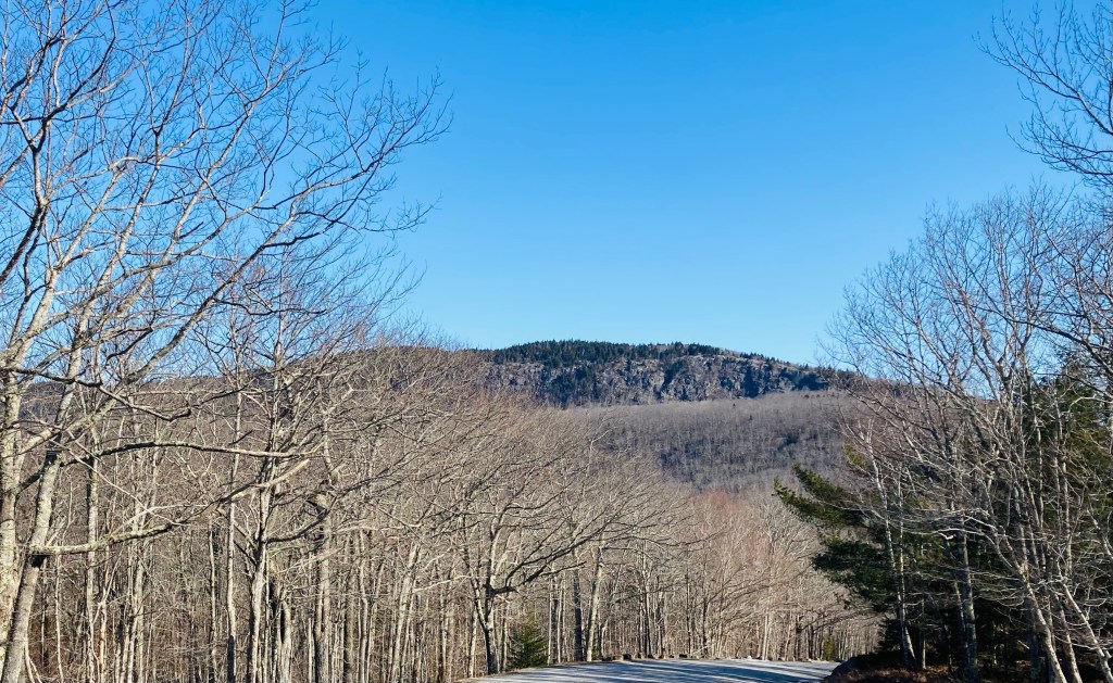
To continue the loop, I walked the short distance down the road to the Carriage Road Trail, pausing to enjoy the view of the mass of Megunticook. Here, I added microspikes, as the Carriage Road Trail was a thick, downward luge of ice. A hard left on the Carriage Trail took me on a short climb back to the Tablelands Trail. All told, the Mount Battie diversion added about two and a half miles. Here, a series of switchbacks ascended to Adam’s Lookout, and views to the south of Mount Battie, Camden, and the bay. The Jack Williams Trail moved northwest, under the large southern cliffs of Megunticook.

I took a quick break at a rocky outcropping overlooking the Snow Bowl to switch to microspikes and take out my hiking poles, as the Ridge Trail toward Maiden Cliff was incredibly slick. Lower and shaded areas sported large glacier-like coatings of ice. As I moved over the ridge to the cliffs, a large, lumbering eagle near a rock cairn took flight as I rounded the corner, a flash of long brown wings.

A large cross at the Cliff marks the spot where, in 1864, a 12 year-old girl fell to her death. On this windy day, I could see whitecaps in the bluish, chilly waters of Megunticook Lake below. I turned back toward the climb up to Megunticook’s summit, passing a plump robin on the open ledges on the way back.

The footing on the icy slog up to the glacial Ridge Trail was difficult, and only got worse near the peak of Megunticook. I managed to keep my feet, except for a cartoonish digger almost at the summit cairn itself. The trail back down after Ocean Lookout could only be described as impassable (at least to me), with a steeper ice luge than the Carriage Road Trail.

I picked my way gingerly down the crusty snow in the margins of the Megunticook Trail, narrowly avoiding more mishaps in the ice chute. Once the trail flattened out, the ice disappeared, and to the left again was West Penobscot Bay. A mixed group of adults and children made their way up Adam’s Lookout Trail, and I hope it was clearer than the route I took. An easy downhill walk on the Tablelands Trail and Nature Trail led back to the road, and to the parking area.
(Disclaimer: This post contains affiliate links, and as an Amazon Associate Hiking in Maine blog earns from qualifying purchases.)

Enjoyed your hike report & excellent photos!
LikeLike
Such a great park and now I’m inspired to check those other trails on the next visit. Those icy trails, though… sometimes the only way down is on your backside! Glad you made it down safe.
LikeLike
Nice post with great photography. Nice to see the icy tails too.
LikeLike