We first visited Camden Hills State Park in the spring of 2017, an unintentional winter hike of the Megunticook Loop. Better prepared, equipped, and with a full windy, cold March day to burn, I chose a longer, meandering route through the park. This ambitious path up Mount Battie (780 feet), over to the Maiden Cliff (800 feet), and up to the summit of Mount Megunticook (1385 feet) was close to 11 miles, and a little under five hours. You can find detailed descriptions of the trails in the AMC Maine Mountain Guide. As I arrived before the road to Mount Battie opened, I used the parking lot to the left of the main entrance, paid the $4 Maine resident fee, and walked the quarter mile or so from the gate to the parking lot for the trails (toilets are available in both places).
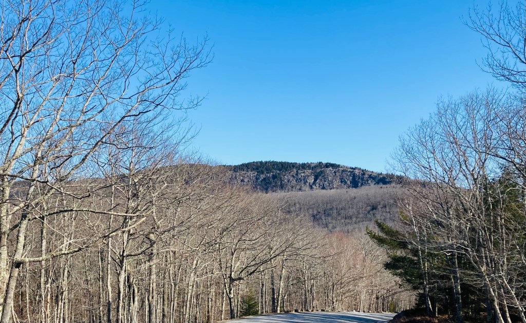
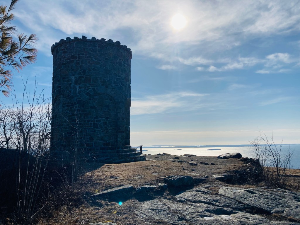
The blue-blazed trail Megunticook Trail headed up to the left, turning into the Nature Trail towards Mount Battie to begin the loop. I started to gain elevation at approximately a half-mile in, with views of the West Penobscot Bay through the bare winter trees. The Nature Trail parallels the road to Mount Battie before turning inland over ice-covered rocks. At a little over a mile, I turned left onto the Tablelands Trail, crossing the road towards Mount Battie. Near the summit, I saw a solo mourning dove and another small, puffy sparrow. The parking loop and area by the World War I memorial stone tower feature expansive views of the bay and Camden below.