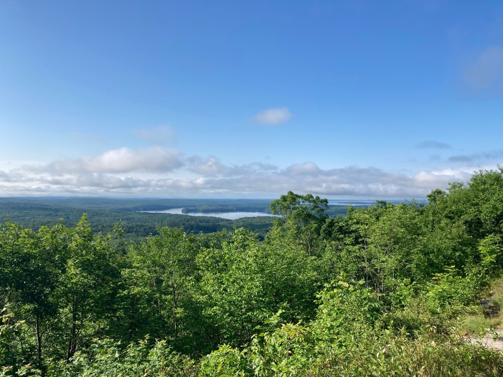
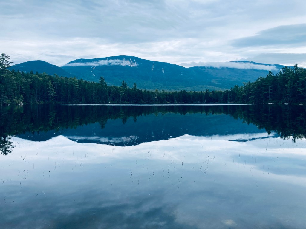
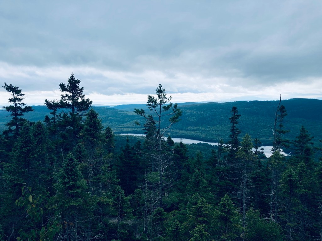
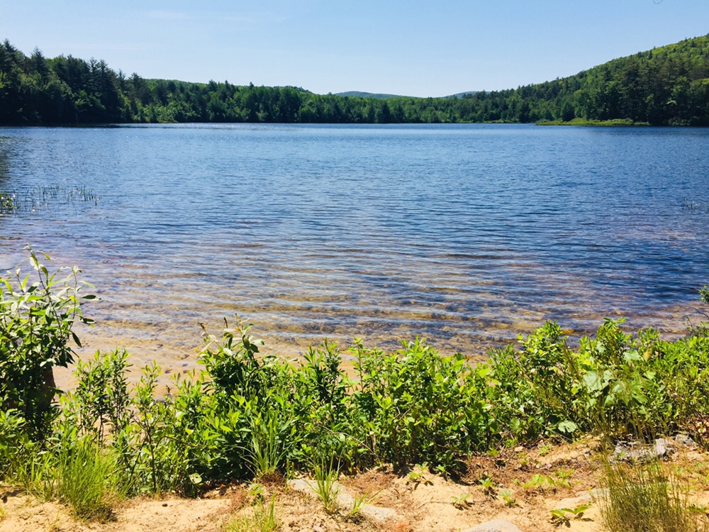
Viewpoint in summer, Bri-Mar Trail, Rattlesnake Mountain
Rattlesnake Mountain (1,035 ft) is an approximately 2.6 mile moderately difficult (but family-friendly) out-and-back hike in Raymond, Maine, with two good viewpoints overlooking the Lakes Region on the way to the summit. Allow about an hour or two for this adventure, depending upon the abilities of those in your group. The small, well-marked parking area for the Bri-Mar trailhead is off Webbs Mills Road (ME-85), and open from sunrise to sunset. No dogs are allowed on this trail. The trail is also closed during the month of April.
Wildflowers on Bri-Mar Trail, Rattlesnake Mountain, Raymond, Maine
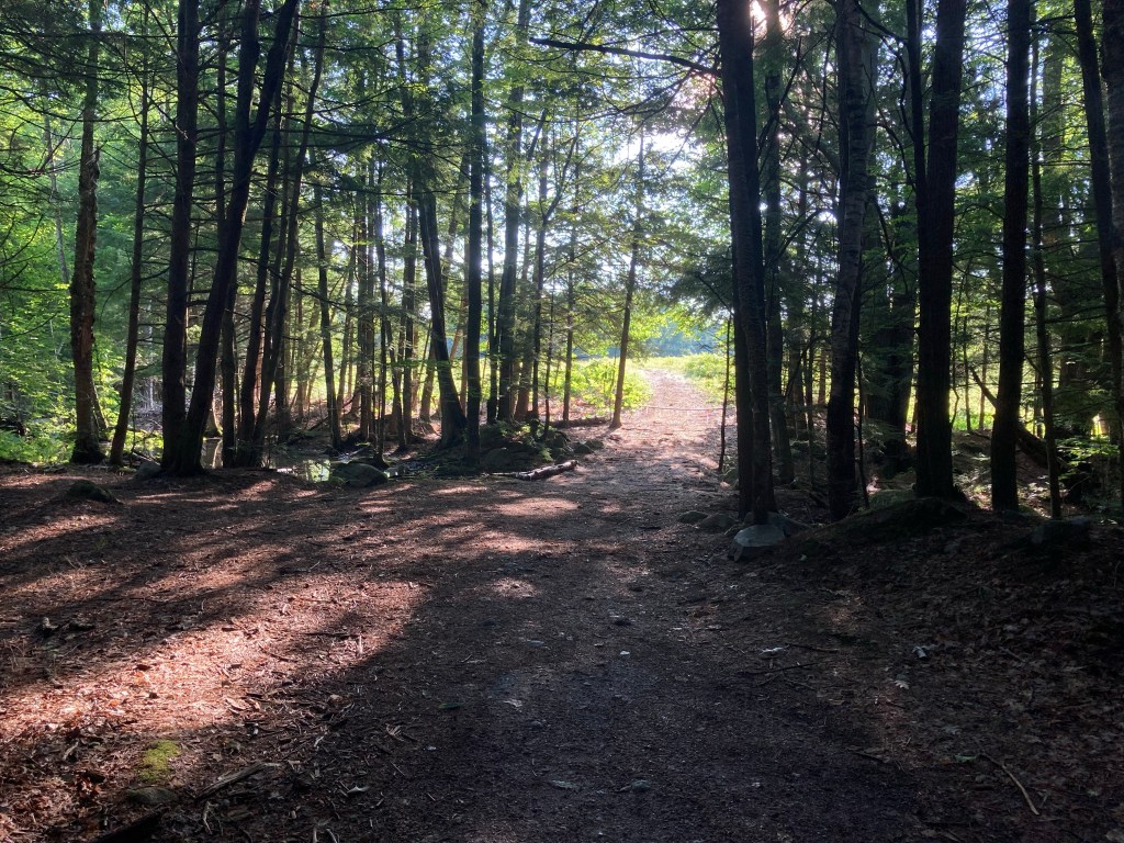
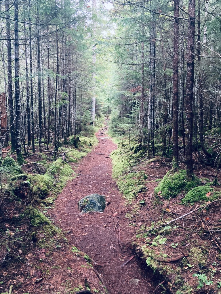
We completed this hike several times, including as a family during the fall, a warm, early July solo hike, with the field at the beginning of the hike full of wildflowers and bees, and the most recent, a late-December trip about a week after a large storm, with the path mucky, and the field a blend of yellow, orange, and brown. The footpath across the field from the parking lot gives way to a wide, pine-covered road through a swampy area, then progresses upward on a more narrow path.
Bri-Mar Trail, Rattlesnake Mountain, Raymond, ME
The forest itself is typically alive with birdsong, from chickadees, woodpeckers, and mourning doves, as well as the chattering and rustling of squirrels and chipmunks. Deerflies were a problem at the beginning of the July hike, but thinned as I climbed. The trail was mostly empty in the morning, as in July I only saw two other trail users, both trail runners, but can be fairly busy on summer afternoons. Even on the winter weekday trip, the small lot was full, and hikers were spread across the trail in various phases.
Bri-Mar Trail, Rattlesnake Mountain
The Bri-Mar trail, named in memory of Brian and Marlene Huntress, is maintained by the Huntress family. This trail is easily followed in spring, summer, and fall, with red arrows spray-painted on rocks and trees in areas of uncertainty. On the recent December trip following the storm, this proved more difficult due to storm damage and leaves, and I found myself tracing a streambed away from the trail, before correcting myself. The trail is steep in places, but becomes more of a ridge hike at the two viewpoints and summit. Logs over the trail provide fun obstacles for kids to climb over, and several wild blueberry bushes cover the margins of the trail towards the summit.
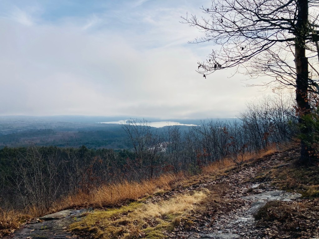
Viewpoint in winter from Bri-Mar Trail on Rattlesnake Mountain, Raymond, Maine
Rattlesnake Mountain is a great Lakes Region hike for families. Enjoy the southern vistas provided by the two viewpoints on ledges, as the summit itself is wooded, and leads to other trails sloping downward. As a general rule, as you move toward the summit, veer left at trail intersections. The top is marked by a small wooden sign to the right of the trail, which is the turnaround point. After the hike, a great place to stop for lunch or a snack in Raymond is The Good Life Market, at the corner of ME-85 and 302, with all kinds of fresh options for every diet. In the fall, we have also picked apples down the road at Meadow Brook Farm.
Lakes Region in winter from 2nd viewpoint, Bri-Mar Trail, Rattlesnake Mountain, Raymond, Maine
Head Beach from Hermit Island Campground, Phippsburg, Maine
From mid-May to mid-October, Hermit Island is accessible only to registered campers using Hermit Island Campground, and pets are not allowed. In the winter months, however, the trails and beaches on this beautiful island are open for day-use to respectful visitors who clean up after themselves and their dogs (no winter facilities are available). An added winter bonus appears to be the absence of mosquitoes and flies, which appear to be fairly aggressive in the summertime, based upon comments. We explored this quiet space on a chilly but sunny Black Friday, navigating using the AllTrails app, and a printed version of the campsite map on the Hermit Island Campground site.
Sand Dune Beach, Hermit Island Campground, Phippsburg, Maine
We hiked using the campground roads and trails for a moderate clockwise loop that was about 3.8 miles, taking about an hour and a half. Parking is available at the Kelp Shed at Hermit Island Campground, reached by crossing the rutted sand causeway behind Head Beach, effectively at the end of Route 216 in Phippsburg. A quick duck under a gate, and head uphill past a massive anchor at the campground entrance. Almost immediately, a walkway leads to the left, opening upon Head Beach. The camp roads are wide and flat, easy for walking, and bounded by grasses and ornamental berries, with fresh deer prints crossing at intervals.
Worumbo, Hermit Island Loop, Hermit Island Campground, Phippsburg, MaineContinue reading →
Shore Trail, Dodge Point Public Land, Newcastle, Maine
Dodge Point Public Land in Newcastle is a 548 acre preserve on the western shore of the Damariscotta River. A map and description is available at Coastal Rivers Conservation Trust, which co-manages the preserve with the state of Maine and maintains the public dock. An additional Dodge Point Natural Heritage Hike brochure, illuminating the history, flora and fauna of this special place, is available on the Dodge Point page at the Maine Agriculture, Conservation, and Forestry website. I found this hike by reading Dog-Friendly Hikes in Maine, and there were certainly other dogs (besides Pig) along our route. Dodge Point Preserve is at the terminus of the River-Link Trail, so can be combined with other longer area hikes.
Shore Trail, Dodge Point Public Land, Newcastle, Maine
In mid-October, we completed an easy clockwise loop of the Preserve using the Old Farm Road and Shore Trails, totaling about 3.33 miles, about an hour and 45 minutes. We started from the parking area on River Road, passed a series of small bridges and waterfalls, and headed mostly downhill to the shore, past Ice Pond. The first in a series of beaches we encountered was Brickyard Beach, then Sand Beach and Pebble Beach in succession. The trail maps are at most major trail intersections, and allow for self-correction (“You are Here”), and the trails are mostly wide and flat.
Pig looks out from the Public Dock onto the Damariscotta River, Dodge Point Public Land, Newcastle, Maine
Pig sprinted around the beach, chasing sticks and driftwood, and waded into the cold water. The trail moves south along the Damariscotta, with plenty of outlets to the water, ending in the public dock. We saw many gulls and waterfowl along here, as well as a great blue heron. From the public dock, it is an uphill walk through the forest to return to the parking lot, including vernal pools and a beautiful stretch of tall red pines lining the old farm road. Following the trip, we enjoyed the open air tasting room of Sasanoa Brewing (May – Oct, weather-dependent), located on Westport Island.
Tall Trees lining the Old Farm Road, Dodge Point Public Land, Newcastle, Maine
Wooden bridge on east side of Mill Cove, Bonyun Preserve, Westport Island, ME
Bonyun Preserve in Westport Island, Maine, is owned and maintained by the Kennebec Estuary Land Trust (KELT), which has a printable map and description of Bonyun Preserve on its website, as well as in a container at the trailhead kiosk. The Preserve, free to the public, and open daily from dawn to dusk, is named for the landowners who donated the 74 acres of land to KELT in 2002. Dogs are not allowed (eight other KELT properties allow leashed dogs). In mid-September, we used the Thomas Point, Mill Cove, Junction, and Junction Loop trails to make a double lollipop loop of about 4.5 miles, which took us about two and a quarter hours. I navigated using the AllTrails app and the description received from Falcon Guides’ Hiking Maine.
View from Thomas Point, Bonyun Preserve, Westport Island, ME
A small parking area is located off lower West Shore Road in Westport Island. The trail begins with a wide, flat pine-needle surface, heading downhill to the intersection of the Junction Trail and the Mill Cove and Thomas Cove trails, then splits north, moving around the shore of slow, muddy Mill Cove. The trail then divides into a loop heading south to Mill Cove, and the other side of the loop heading west, then south as it traces Thomas Cove enroute to Thomas Point and the wide Sasanoa River. We took the trail outward in this counterclockwise direction, crossing the narrow peninsula through tall hemlock trees.
Bonyun Preserve, Westport Island, ME
Birds were everywhere, and we heard the scratchy whoosh of winged flight nearby, made by a massive bald eagle leaving a nearby tree and heading across the bay. We saw great blue herons, downy woodpeckers, belted kingfisher, hermit thrush, dark-eyed junco, gulls, and cormorants, and heard blue-headed vireo, red squirrels, and chipmunks. The views along this stretch of the trail were incredible, with sun piercing between tall, straight evergreens, brightly-colored seaweed, twisted cedar trees, and light reflected off the tidal blue-green Sasanoa River as it moves toward the Sheepscot River and the sea.
Sasanoa River from end of Mill Cove, Bonyun Preserve, Westport Island, ME
We stopped to recline on the warm rocks at the point at the end of Mill Cove before moving back up the loop. The remains of Heal’s Mill and its mill pond are here, with placards on the trail detailing their history and purpose, primarily turning logs into boards and grinding corn into meal. You can walk across the narrow spit of land dividing the mill pond from the river, and gaze through grasses and wildflowers at fallen stones and old machine parts and wheels, now covered in barnacles and mud.
Heal’s Mill remnants, Bonyun Preserve, Westport Island, ME
Continuing back towards the start, we then turned onto the Junction Trail, where a brief climb leads to an overlook of the mill on the east side of Mill Cove, before crossing Junction Road, and heading through stone walls, past Jewett Cemetery to a hilly forest loop, before returning to the parking area. On this trip, we stopped for lunch aways south, freshly crafted sandwiches at the Winnegance Restaurant and Bakery in Bath. On a later trip, we have since enjoyed the open air tasting room of Sasanoa Brewing (May – Oct, weather-dependent), which is just down West Shore Road from Bonyun Preserve.
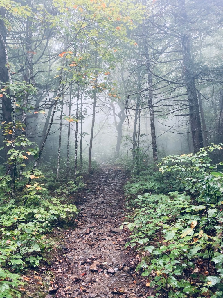
Doubletop Mountain Trail enroute to Slaughter Pond, Baxter State Park, Maine
Slaughter Pond is a sufficiently remote one-way hike that when I mentioned to a Baxter State Park ranger that I was thinking of hiking there, he looked at me curiously, and then asked if I was going to get some fishing in, as that seemed to be the primary reason people make the trek. The pond itself lies slightly outside the borders of Baxter State Park, and is managed by The Nature Conservancy as part of its Debsconeag Lakes Wilderness Area (see map). I hiked there and back, a trip of just over 6 miles, that took me about two and a quarter hours on a rainy mid-September day. I used the map and trail description in Hiking Maine’s Baxter State Park, and navigated using AllTrails and the Map Adventures’ Katahdin Baxter State Park Waterproof Trail Map. The longer, more scenic route starts from the Doubletop Mountain Trail at the Kidney Pond Campground day-use parking area. A shorter route that eliminates Draper and Deer Ponds begins at a trailhead on Kidney Pond Road just west of the bridge over Nesowadnehunk Stream. The Doubletop Mountain Trail route begins as a pleasant, pine-smelling tunnel of thick evergreens, giving way after about a quarter-mile to a more broadly spaced forest.
View across Draper Pond, Baxter State Park, Maine
At about this point in the hike, a light rain began to fall, mostly absorbed by the canopy above me, that continued throughout. At a little before .4 miles. I reached the intersection with the Draper Pond Trail, and continued straight on the spur down to see Draper Pond. The trail was short and easy, and the flat surface of Draper Pond reflecting the mountains was well worth the short detour. I flipped around and headed back up the side trail to rejoin the Doubletop Mountain Trail. The trail was winding, with roots and fallen trees, but generally flat and easy, surrounded by moss, ferns and large glacial erratics. At one elevated point, I could see both peaks of Doubletop Mountain through the trees to my left, and heard a pileated woodpecker loudly calling through the forest.
View across Deer Pond, Baxter State Park, Maine
At about 1.1 miles, I entered a boggy area which required some maneuvering around standing water and negotiating plank bridges over Slaughter Brook, at this point, a swamp overlooked by Doubletop, and held back by beaver dams. The trail was a little more difficult here, as some of the plank bridges had fallen, but I picked my way through. When I got across Slaughter Brook, it appeared that some kind of storm or microburst had taken down a large number of trees, probably accounting for the damage at the crossing I had just made. The trail continued to move in tandem with Slaughter Brook, and at about 1.4 miles, following a right turn, the larger expanse of Deer Pond was visible in front of me, with waving grasses and views of the mountains.
Deer Pond, along Slaughter Brook, Baxter State Park, Maine
I reached the junction with the Slaughter Pond Trail that comes in from the trailhead on Kidney Pond Road, and continued west towards Slaughter Pond. This flat, single-track trail was relatively overgrown, but flat, fast, infused with a pine scent, and serenaded by squawking jays. At about 2.15 miles, I passed the intersection with Doubletop Mountain Trail to the right, and continued less than a mile more, the edge of Baxter State Park marked by a white diamond. This was the beginning of The Nature Conservancy property, followed by a stream crossing. I quickly reached a large area with canoes strewn all around, the boat storage area, used by people who register with The Nature Conservancy for use on Slaughter Pond, and then walked through the trees to see the pond itself, which was beautiful in the light rain. I had hoped that, by approaching a series of backcountry ponds quietly in the rain in the morning, I would’ve maximized my chance of seeing a moose, but it was not to be this day. I only saw moose droppings on the hill overlooking Deer Pond. I had the trail entirely to myself until I passed a middle-aged couple close to the Draper Pond turn on the way back.
Slaughter Pond in the rain, The Nature Conservancy, Maine
(Disclaimer: This post contains affiliate links, and as an Amazon Associate Hiking in Maine blog earns from qualifying purchases.)
Morning view of Kidney Pond, Baxter State Park, Maine
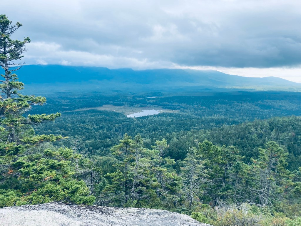
Sentinel Mountain (1,842 ft) is not a towering monolith like Katahdin or a sinister double-horned mass lurking like Doubletop but its proximity and line of sight to those two peaks and the rest of Baxter and the North Maine Woods make it an important bucket list hike in Baxter State Park. In mid-September, I had planned for loftier heights and longer distances, but weather changed my plans, and facing impending thunderstorms, I opted out of the all-day hikes above treeline, and chose this smaller mountain. I used information from Hiking Maine’s Baxter State Park and Maine Hikes Off the Beaten Path, and navigated using Map Adventures’ Katahdin Baxter State Park Waterproof Trail Map. This moderately difficult hike of about 6.2 miles took me about three and a half hours, with plenty of time spent resting and enjoying views.
Rocky and green Sentinel Trail, Baxter State Park, Maine
The Sentinel Trail starts from the Kidney Pond Day-Use Parking Area and runs concurrent with the trails to Rocky Ponds, Celia and Jackson Ponds, and Lily Pad Pond. I quickly ran into a large bullfrog perched in the middle of the trail, who looked at me briefly, then jumped beneath a boulder, then I walked past the boulder marked, “Kidney Stone – Do Not Remove,” which is Baxter State Park’s version of a joke. The trail crossed a lively brook emptying into flat, quiet Kidney Pond on a cloudy morning.
Sentinel Trail, Baxter State Park, Maine
The trail continued to skirt the shoreline, with plank bridges and rocks used as stepping stones over moss and mud. I passed the turnoff for Celia and Jackson Ponds, continuing along the shore until I hit the hard right turn to the Sentinel Trail at about half a mile from the trailhead. The trail headed slightly uphill through a thick forest, the most compelling characteristic of which was its overpowering greenness. After a bit of a downhill, this gave way to what looked to be a much younger forest in a low-lying area. At about 1.2 miles the trail crossed Beaver Brook. Through the trees, I could see Beaver Brook feeding into a boggy area, later visible to the left of the trails.
Beaver Brook crossing, Sentinel Trail, Baxter State Park, Maine
Once I got uphill, the trail was slightly faster through pines and then along a plank bridge walkway through another boggy area. Holes through the deep moss in the bog led to mysterious pathways beneath the visible surface of the path, signs of a subterranean world invisible and unknown. The trail then passed a stream with many little rivulets and drops, in the shadow of a large mossy rock outcropping. Shortly after two stream crossings, the trail really began to climb uphill. This grade continued for awhile, and then the last real challenge before making the turn onto the summit trail was a long, steep jumble of rocks and boulders.
View of Lily Pad Pond and Katahdin shrouded in clouds, Sentinel Mountain, Baxter State Park, Maine
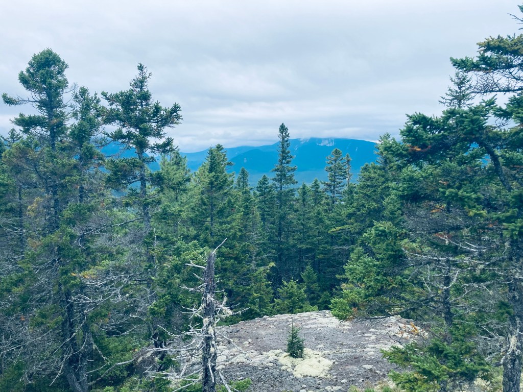
After a brief respite, there was another series of rocks, which were, thankfully, more widely spaced to allow for actual footsteps. After this steep climb, the summit loop path was a welcome change, walking on flat rocks, with a cool breeze and views of Baxter State Park and its surroundings. I turned to the right to take the loop counterclockwise and paused, facing east, with a view centered on Katahdin, despite the cloud cover moving in. This stone ledge was a great spot to sit down, have a snack and a drink, and drink in the air and views. Surprisingly, there was sufficient cell service to send home a quick proof-of-life text.
View from Summit Loop, Sentinel Mountain, Baxter State Park, Maine
The remaining circuit was beautiful for the rocks and mountain laurel, lichen and blueberries, interspersed with views off more ledges through scrub pine to the Debsconeag Wilderness Area. There were still a lot of ripe huckleberries on the loop back and one last broad sweeping view as I made the turn left to rejoin the trail down from the summit. I heard a lot more birds on the way back, as some of the clouds cleared but were still hovering over Katahdin, and I heard a yellow-rumped warbler and a blue jay as I passed back near the edge of Kidney Pond.
View from Summit Loop, Sentinel Mountain, Baxter State Park, Maine
(Disclaimer: This post contains affiliate links, and as an Amazon Associate Hiking in Maine blog earns from qualifying purchases.)
Baxter State Park’s northern half is quiet, filled with remote ponds. The trail south from the park’s Tote Road to Lower and Middle Fowler Ponds was the perfect late afternoon hike on a mid-September day. I followed the description and map from Hiking Maine’s Baxter State Park, and navigated using AllTrails and the Map Adventures’ Katahdin Baxter State Park Waterproof Trail Map. I completed the approximately 5.4 miles in about two hours and 15 minutes as an out-and-back of the Fowler Brook and Middle Fowler Trails, but a shuttle loop is possible, using the Middle Fowler Pond Trail all the way to the trailhead at South Branch Pond Campground, and spotting a bike or a vehicle there.
Egg-like mushrooms on Fowler Brook Trail, Baxter State Park, Maine
From the parking area on the Tote Road, the Fowler Trail glowed in the late afternoon sunlight, with a pine path carved through bright green moss. The forest held a surplus of red squirrels, busy with late summer gathering activities and chattering at me as I continued to cross plank bridges over a swampy area. A larger bridge crossed a wide brook with long green grass swaying in its current. I could see recent trail work, as storms must have felled a large pine and some other trees further along the way.
View across Lower Fowler Pond to Billfish Mountain, Bald Mountain, and Barrell Ridge, Baxter State Park, ME
By about the half-mile mark, I was traversing an elevated portion of land, looking down at a deep gully to my right that continued for a while, while the sounds of the rushing water of Fowler Brook drifted uphill. At about 3/4 of a mile I crossed a small, rocky creek and finally saw Fowler Brook to my right. In the valley by the brook I saw and then heard a northern flicker, which are always larger up close than they seem as they fly away. I also saw a series of puffball mushrooms, stacked like eggs on a mossy log.
View across Middle Fowler Pond to Bald Mountain, Baxter State Park, Maine
Emerging from the forest, I had a beautiful view of Lower Fowler Pond from the launch spot for the Baxter State Park rental canoes, looking across to Barrell Ridge, Bald Mountain, and the Traveler range. Working my way around the shore of Lower Fowler Pond, I spooked some large waterfowl, who took off for the opposite side of the pond. The trail continued past the Middle Fowler Pond Trail intersection through a campsite with a nice view of the water and its own outhouse. I continued through, on a long quiet walk through the woods to Middle Fowler Pond. The sound of rushing water off to the right signaled the outlet of the pond as I got closer, and I finally saw the outflow, with the water moving over and under large slabs of rock, as it trickled down to the pond I had just departed.
Outlet of Middle Fowler Pond, Baxter State Park, Maine
Middle Fowler Pond itself was magnificent, clear and cradled by lonely peaks and surrounded by trees and flowers. The names lower and middle suggest a third Fowler Pond, and it exists just to the east, named Little Fowler Pond, with no trail leading to it. Should you want to continue onward, the trail continues across the outlet and on the south side of Middle Fowler Pond, moving south of Barrell Ridge and between Little and Big Peaked Mountains, before reaching the road to South Branch Pond. Instead, I paused to take in the pond and its surroundings, have a snack and a drink, then I turned to head back the way I came in the fading light.
Afternoon light on Fowler Brook Trail, Baxter State Park, Maine
(Disclaimer: This post contains affiliate links, and as an Amazon Associate Hiking in Maine blog earns from qualifying purchases.)
Descending from North Peak via the Twin Brook Trail, Burnt Meadow Mountain, Brownfield, Maine
Burnt Meadow Mountain (1,570 ft) in Brownfield, Maine, is a favorite hike of ours in all seasons, including when daughter was much younger. Brownfield, close to Fryeburg and the New Hampshire border, is still less than an hour from Portland, and during mid-late summer, the wild blueberries all the way to the summit make for a pleasant distraction and motivator for younger children, as this can be a challenging hike for little ones. In fall, the surrounding hills are alive with color, and in winter, the moderate climb through vanished deciduous foliage yields great views of the White Mountains, as well as the winding track of the Saco River.
Daughter watching three hawks (a pair and a loner) hunt in the valley below the Burnt Meadow Mountain Trail in summer.
Our preferred route is counterclockwise via the Burnt Meadow Mountain Trail (blue blazes) and Twin Brook Trail (yellow blazes), an approximately 3.7 mile lollipop loop, which took us about 2.5 hours at a relaxed pace in summer, and 2 hrs 10 mins in winter. The spur trail up to Stone Mountain (blue blazes) from the Twin Brook Trail adds about another 1.4 miles round-trip, which was about an hour added to the loop hike in the winter time. A map is available on an information sign at the parking area. These trails are usually well-marked and maintained by the Appalachian Mountain Club (AMC) and the Friends of Burnt Meadow Mountain. In October 2023, the sign in the parking lot had been knocked over, and the switchbacks on the way up had been modified with blue marking tape guiding a new path, and were a bit confusing. Additionally, the yellow blazes of the Twin Brook Trail can be hard to pick up in the fall amidst the reds, oranges, and yellows of the surrounding forest.
Lady slippers, Burnt Meadow Mountain, Brownfield, METoad on Burnt Meadow Mountain, Brownfield, ME
As usual, the best description of this hike is in the AMC Maine Mountain Guide. In the new 12th edition of this guide, Burnt Meadow again has its own map. In winter, the parking lot on Route 160 is small and icy, and hikers may have to find a parking spot at the town boat launch down the road. In the summer as well, it may help to have a backup plan for this popular hike. (try nearby Peary Mountain) For updated winter trail conditions, check the Burnt Meadow Mountain Trail page on All Trails. On winter days, the snow on the trail is usually hard-packed, and micro-spikes help with some of the resulting ice on rocks. The only deeper snow can lie on the lesser-used Stone Mountain trail.
Sunlit clearing on ascent of Burnt Meadow Mountain, Brownfield, ME
The Burnt Meadow Mountain Trail passes through shaded woods and over exposed rock faces up a relatively short, steep climb to the North Peak. On clear days, you will see hawks wheeling below, and the green, serrated sharks’ teeth rows of the surrounding hills and ridges. In winter, the climb has the effect of being a pleasantly continuous ridge hike without the leaves to obscure views. While the blueberries were still a bright, electric green in June, we have seen vultures, crows, many lady slippers in peak color, and also ran across a few toads. We used plenty of bug spray, but didn’t hit large clouds of black flies or mosquitoes, except in low-lying areas along the Twin Brook Trail (obviously, no bugs in the fall or wintertime). In fall, I’ve startled grouse along this path.
Winter ascent up to the North Peak, Burnt Meadow Mountain
The broad, open summit of Burnt Meadow is a great place for a picnic, and a rest after the last scramble upwards. We didn’t linger too long in summer, though, just enjoyed some jerky and proceeded across to the Twin Brook Trail. A large cairn marked the point to start our descent. The Twin Brook Trail sets a rolling course downward, with its own view of the White Mountains, then a wooded junction with the Stone Mountain Trail.
View from Burnt Meadow summit, Brownfield, ME
The Stone Mountain Trail is better in winter, as the surrounding area from the summit is easier to see without the leaves. This trail is substantially less traveled than the North Peak or Twin Brook Trails, and may require some travel through deeper snow, with snowshoes being possibly necessary. Following the Stone Mountain intersection, the Twin Brook Trail moves underneath the rock slides on the side of Burnt Meadow, and along the pleasant, cascading brooks for which the trail is named, back to its junction with the Burnt Meadow Mountain Trail, and from there back to the parking lot.
Follow blue blazes through a birch forest to the Stone Mountain summit.
Along the way in June, I saw two red-shouldered hawks patrolling the area recently harvested for lumber, looking for small mammals. These open cuts allowed for the growth of fragrant sweet fern, and blossoms promised blackberries later in the season. Shortly before returning to the trail junction, I spooked a herd of small deer, who disappeared into the thick forest. In October, a lone hermit thrush perched near the trail and listened skeptically to thrush calls played to it from my phone.
Fall foliage on Twin Brook Trail, Burnt Meadow Mountain, Brownfield, ME
One of the reasons we love this hike in the summertime is its proximity to the Brownfield Town Beach, which is a great place to cool off (Note: While dogs are plentiful on Burnt Meadow Mountain trails, they are not allowed at the beach after June 1st). Another interesting development is the effort to re-open the Burnt Meadow ski area, defunct since the early 1980’s, with initial plans to open the lodge as a winter warming hut in 2023/2024. The Whistle Stop General Store in Baldwin is a good place to grab food – open all winter for snowmobilers and other travelers. Alternately, according to a recent Press Herald article, Gneiss Brewing in Limerick has food truck options on summer days.
Brownfield Town Beach
(Disclaimer: This post contains affiliate links, and as an Amazon Associate Hiking in Maine blog earns from qualifying purchases.)
The Owl’s Head Trail is in the Scraggly Lake Public Reserved Land, comprised of about 9,000 acres just short of the Matagamon Gate of Baxter State Park’s north entrance. After a long bumpy drive up Scraggly Lake Road in northern Penobscot County (be sure to check out Sawtelle Brook and Deadwater feeding into Sawtelle Falls on the way), the Owl’s Head Trail trailhead is clearly marked on a curve just before the outlet of Scraggly Lake to Scraggly Brook, with a map and kiosk, as well as bathroom facilities further down the road. Maine Parks and Lands has a map here. Remember to download or print out the map before you go, as you won’t find cell service here.
Owl’s Head Trail, Scraggly Lake Public Land, Maine
I hiked this trail, listed by Maine Trailfinder as 4 miles round-trip, in about an hour and-a-half, just after some hard rains on a mid-September afternoon. I did eschew the terminal lollipop loop for a simple out-and-back to the top of Owl’s Head, so mileage may vary. The trail starts out as a soft, easy blue-blazed trail through mossy woods. The forest was very quiet and full of stately cedar trees, wild mushrooms, ferns and bright green moss. Soon, the lake was visible through the trees to my left.
View of Scraggly Lake from Owl’s Head Trail, Scraggly Lake Public Land, Maine
The viewpoint at about 6/10 of a mile has an expansive view of the lake with a bench upon which to reflect. The squawking of jays dominated the sounds on the trail. A second viewpoint at about a mile was much the same, with a wooden bench overlooking the lake, mostly empty of boat traffic. The lake, with a maximum depth of 70 feet, is popular for salmon and brook trout, and is no longer stocked, as the wild population of landlocked salmon is sufficiently healthy. Its unique name is said to draw from the irregular shape of its shoreline. The terrain of the path rolls a bit more after this second viewpoint, but it’s still an easy trail, hugging the lakeshore in the shadow of massive hemlock trees, and the openings in the shoreline continued.
View toward Baxter State Park from Owl’s Head, Scraggly Lake Public Land, Maine
I enjoyed the placid lake, serenaded by the sounds of belted kingfisher and loons. Shortly before 1.4 miles, a trail came up from the shoreline marked Owl’s Head Trail. This is the access to the Owl’s Head from the water, which used to be the sole route. Stone steps lead upward, where the trail is a bit more overgrown and blocked by a few deadfalls, but the blue blazes make it easy to pick your way through to the top of the Owl’s Head (930 ft).
View north from Owl’s Head, Scraggly Lake Public Land, Maine
From the elevation of the Owl’s Head, I could see the entire lake, as well as the Traveler and its acolytes in the northern part of Baxter State Park, and Katahdin through the fog to the southwest. Ireland Pond and the hills and lakes of Aroostook County lie to the north. The trail continued its loop, but I turned and headed back downhill. Along the trail back, I saw a northern flicker with its trademark white tuft in the back flashing as it departed. The sun was coming out as I reached my vehicle, and I stepped back in, having had the trail to myself the whole time in this remote, beautiful place.
Forest by Owl’s Head Trail, Scraggly Lake Public Land, Maine
Beginning of Mount Chase Trail on Mountain Road, Mt. Chase, Maine
Mount Chase (2,440 ft) commands views of northern Penobscot County, including the peaks of Baxter State Park to the west, and the Shin Ponds. The mountain, and subsequently the town in its shadow, were apparently named after a man who came as an agent for the state to prevent timber thieves. To get to Mount Chase, head north from Patten, and make a difficult hidden turn onto unpaved Mountain Road off Route 11. You will pass some structures, logging roads, a whimsical wooden carving of a Sasquatch, and turns for ATV trails, as well as some vistas to the right. The road gets rockier the further in that you go, and the parking area is at a small clearing with a picnic table, a little over 2 miles in. I navigated using AllTrails, and it took me just shy of two hours to make the 3.4 mile out-and-back on a cloudy mid-September morning. Maps and description are available in Hiking Maine and Maine Hikes Off the Beaten Path.
Mount Chase Trail, Mt. Chase, Maine
The trail doesn’t start in that clearing next to the picnic table, it starts at a small wooden handwritten sign just a little farther down the road. The blue-blazed trail began slightly uphill, rocky and wet, resembling a stream bed, with some ATV tracks in muddy spots. At about a quarter mile, the grade flattened out some, which had the effect of drying it, as well. The incline then grew a bit steeper, and crossed another overgrown road. At about four-tenths of a mile, the foot trail split off to the right, with a slope steeper and rockier than most ATV’s would be comfortable handling, then quickly resumed its confluence with the ATV trail.