Light through the trees, Rines Forest, Cumberland, ME
Rines Forest is a 268-acre woodland owned by the Town of Cumberland, and preserved through a conservation easement with the Chebeague & Cumberland Land Trust (CCLT). I have hiked this in icy mid-March, using the Loop, Perimeter, and Waterfall Trails in Rines Forest in Cumberland, as a part of a longer loop including Hadlock Forest (Falmouth), connected through the Rines Trail, as well as more recently in sunny late May. Rines Forest has a network of about 3 miles of trails open for hiking, cross-country skiing, snowshoeing, fishing, hunting, picnicking, horseback riding, and snowmobiling as designated (some trails are winter-only). Dogs are allowed on-leash or under voice command at all times (Hadlock is different Apr – Oct, requiring leash due to sensitive habitats, so check before you do both). As hunting is allowed, blaze orange is recommended during hunting seasons.
Rines Forest, Cumberland, ME
Parking is available on Range Road, on the south side of the Forest, about 1.2 miles from the intersection with Winn Road. Next to the parking area is a Frog Pond & Salamander Swamp. CCLT’s website includes a trail map and a printable scavenger hunt for kids. The extended loop at Rines is about 2.77 mi, easily doable in an hour and change. In winter and early spring, micro spikes are probably advisable for the duration of the hike, and in the ice and snow, you can see the frozen tracks of deer and other animals. In warmer seasons, the green canopy provides great shade.
Waterfall Trail in early spring, Rines Forest, Cumberland, Maine
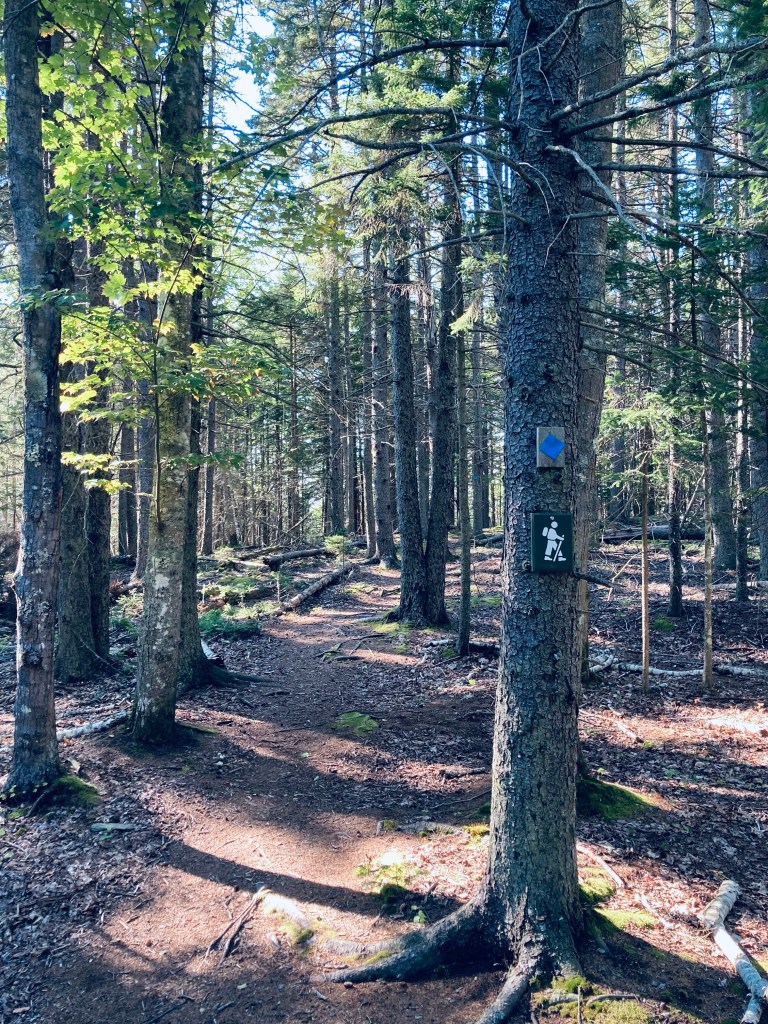
The trail traverses a high esker above a stream, and I took a right onto the red-blazed Perimeter Trail, then an immediate right onto the blue-blazed Waterfall Trail. This descends to a series of waterfalls, where in early summer, Pig the dog splashed around, and we avoided a larger concentration of biting insects. For a longer spur, the Waterfall Trail extends across Saw Mill Brook all the way to Blanchard Road. The loop described continues on the Perimeter Trail around the edges of Rines Forest.
Boardwalk, Rines Forest, Cumberland, ME
In spring, the margins of the trail are punctuated by wildflowers. The interior of the Forest has the Fox, Raccoon, and Fisher Trails, which I left for another visit. After completing the Perimeter Trail, if continuing the long loop, you can cross back over Range Road toward the Rines Trail and Hadlock Forest.
Late spring wildflowers in Rines Forest, Cumberland, ME
Spruce Fir-Forest Trail, Bowdoin’s Schiller Coastal Studies Center, Harpswell, ME
Schiller Coastal Studies Center, a 118 acre preserve on Harpswell’s Orrs Island, is owned by Bowdoin College, with trails made open to the public (foot traffic only, dogs on leash) from dawn to dusk. We discovered this special place using Maine Trailfinder, and have done several hikes since, in early September, in October, and in May, a loop hike of just under 3 miles, seeing most of the peninsula in under an hour-and-a-half through a long loop using the Spruce Fir-Forest Trail, Dipper Cove Path, Pine Needle Path, Brewer Cove Trail, Long Cove Loop, and Stone Wall Walk. We planned and hiked this loop using the excellent printable map available on the Schiller Coastal Studies website, as well as at an information kiosk at the small parking area off Bayview Road (it’s hard to see, due to the map’s colors, but the Long Cove Loop does connect to the Stone Wall Walk to complete the circle).
Harpswell Sound by Dipper Path, Bowdoin’s Schiller Coastal Studies Center, Harpswell, ME
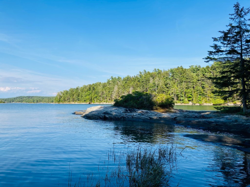
We started by walking south on Bayview Road, turning right (west) onto the blue-blazed Spruce Fir-Forest Trail. This trail descended quickly through its namesake forest to Dipper Cove on Harpswell Sound, meeting the Dipper Cove Path (green blazes) to head north along the shoreline, with glimpses of the water peeking through the sunlit trees. We enjoyed broader high tide views from the rocky shore of the emerald water and Wyer Island. According to Schiller Coastal Studies’ trail guide, the footpath to access Wyer Island is open at low tide only. The descent to the shore and the return climb along the Dipper Cove Path are the only real elevation along this loop.
Terminus of Pine Needle Path, Bowdoin’s Schiller Coastal Studies Center, Harpswell, ME
We moved through the sunny campus along the road to rejoin the Pine Needle Path to the point of the peninsula, where a rocky promontory guarded the entrance to Brewer Cove. Several students can often be seen moving around the quiet campus. This amazing coastal property was deeded to Bowdoin College in 1981 by William (a Bowdoin graduate) and Irma Thalheimer, who continued to reside in the farmhouse there until their respective deaths in 1986 and 1994. The Center is named for Philip Schiller and Kim Gassett-Schiller, who more recently donated $10 million for laboratory and facility construction.
Late afternoon light, Brewer Cove Trail, Bowdoin’s Schiller Coastal Studies Center, Harpswell, ME
A chair tucked into a large bush gripping the rocks appeared to be a quiet, secret study spot, seen only by mergansers gliding by across the flat surface of Brewer Cove. We returned south, briefly retracing our steps to get onto the Brewer Cove Trail (blue blazes), which skirted the bottom of the cove, then headed north at a stone wall. The Brewer Cove Trail hugged tight to the small ridge along the way to Dog’s Head, with views down to the sheltered waters of Brewer Cove throughout, past twisted cedar trees.
Dog’s Head views, Long Cove Loop, Bowdoin’s Schiller Coastal Studies Center, Harpswell, ME
At the point of this peninsula, where the Brewer Cove Trail gives way to the Long Cove Loop (yellow blazes), a bench looks out over Dog’s Head and Harpswell Sound, where gulls, cormorants, and mergansers competed for territory. Here, we saw a small group of hikers heading back to the trailhead in the late-afternoon light. We paused briefly to enjoy the ocean views. The walk south along Long Cove seemed familiar, and looking at the map, it became apparent why – the Schiller Coastal Studies trails lie immediately across the Cove from the Devil’s Back Area Trails, which I explored previously on an unseasonably warm winter’s day. At a rocky open area in the trees, we heard, then saw, a pair of osprey wheeling overhead.
Spring wildflower – milkworts at Schiller Coastal Studies Center, Harpswell, Maine
In May, we saw a bright pink-colored fringed polygala, a species of milkwort flower, in the center of the path almost to the Stone Wall Walk. We headed uphill through evergreens and brightly colored changing ferns to pick up the Stone Wall Walk, the last leg of our loop. This trail passed a large section of blowdown trees and then moved through open fields.
Bright yellow and green ferns, Bowdoin’s Schiller Coastal Studies Center, Harpswell, ME
As we moved into the forest on the home stretch, I caught sight of a porcupine making its way out of the fields and across the trail. At our approach, it turned away from us, raising its tail toward us to telegraph its willingness to protect itself. The porcupine then lumbered through the pines, and made its way quickly up a tree, watching us from its perch as we walked back to the parking area. For food and drink after the hike, try Wild Oats Bakery and/or Flight Deck Brewing, which share a Brunswick Landing parking lot, on the way back to Route One.
Porcupine on Stone Wall Walk, Bowdoin’s Schiller Coastal Studies Center, Harpswell, ME
The Rodick Pettengill Farm in Freeport is a 140-acre property on the Harraseeket River owned and maintained by the Freeport Historical Society, and open to the public dawn to dusk, year-round. A self-guided tour and map, including trails, is available on the Freeport Historical Society website. In late October, we took a morning loop through the farm in the autumn foliage, using the Grant’s Point and Carter’s Creek Trails. Dogs are allowed (we were without Pig the dog for this hike, but saw several others with owners on the walk), a point we clarified with the Freeport Historical Society, as this policy has changed over the last several years.
Saltbox house, Pettengill Farm, Freeport, ME
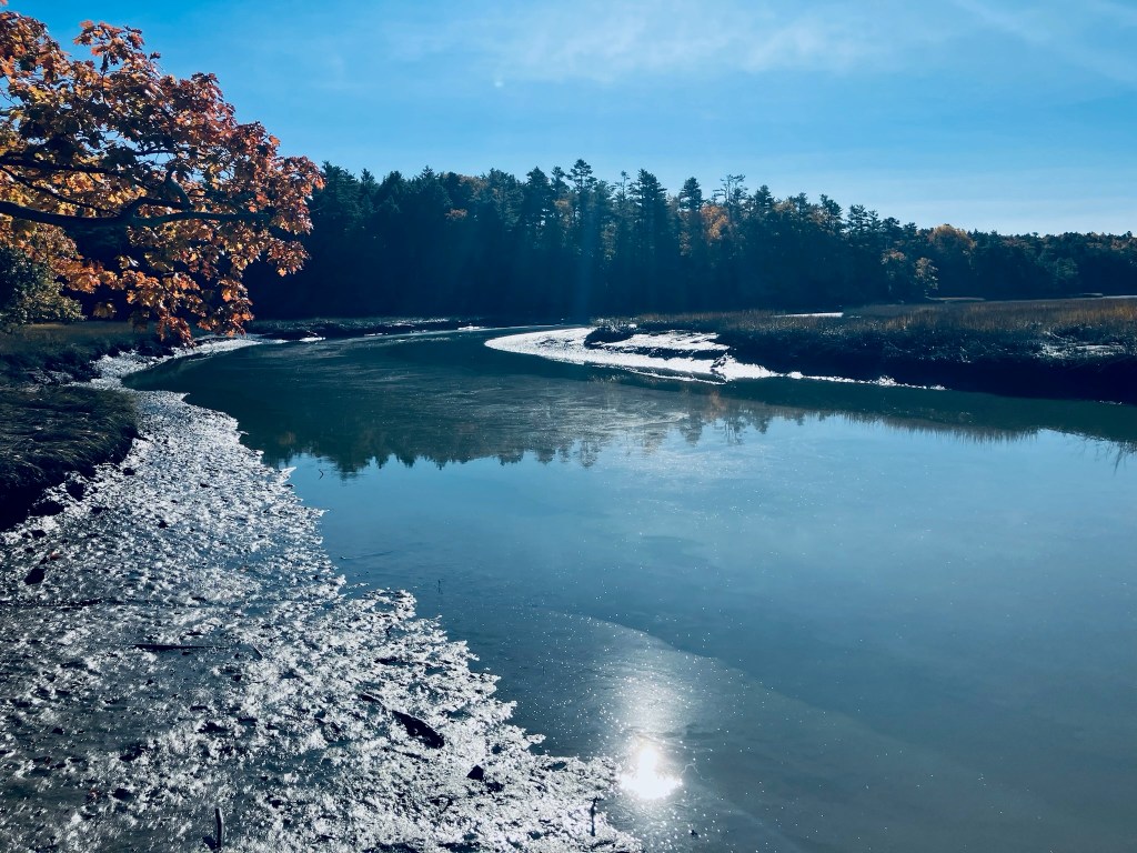
Parking is available on Pettengill Road at the end of the farm’s driveway (as is a house-shaped box for donations) – just don’t park in front of the gate. Many historical placards dot the property, with vignettes from the farm’s up-and-down history, archeological findings, interactions with Native populations, and signs pointing out the sites of former buildings. The long driveway leads to the open fields around the farmhouse, built around the year 1800. We peeked in the windows (tours are available for groups of two or more with advance notice), then we walked downhill to the Harraseeket River, the site of a former shipping wharf for a brickyards.
Harraseeket River, Pettengill Farm, Freeport, ME
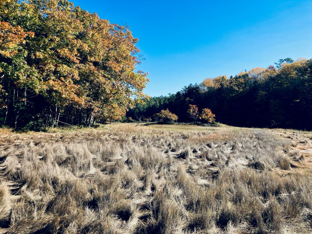
The sunlit October morning had a chill to it, but was invigorating, particularly since many hike reviews in warmer months listed mosquitoes and other biting insects as omnipresent. Across the field to the northeast of the house, we picked up the Grant’s Point Trail, mostly downhill through the mixed evergreen woods with a couple twists and the strong smell of pine, taking it all the way to its namesake promontory, with an excellent view of the river and beyond.
Pettengill Farm fields, Freeport, ME
There were some muddy areas, but none that were problematic or couldn’t be traversed. We took the Carter’s Creek Trail, winding in a forest full of birdsong, back up to the fields, skirting the edge until reaching the long driveway again. We bypassed the Ridge Trail and Marsh Trails, leaving them for another time.
Grant’s Point, Pettengill Farm, Freeport, ME
All told, the lollipop-type loop hike was about three miles in an easy hour and ten minutes, with time to read about history, stop in the sun, and birdwatch. While we did see other walkers and hikers, it was very quiet in the wooded portion of the trail. For those interested in more Freeport-area historical sites, the Freeport Historical Society has a Freeport Heritage Trail, with a map of sites and accompanying audio files.