
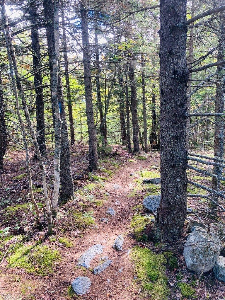
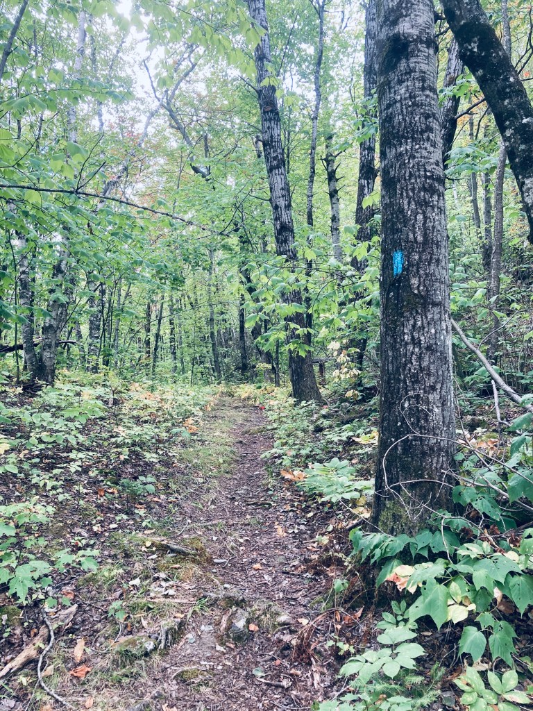
Horse Mountain (1,589 ft) is the first trail you will encounter through Baxter State Park’s Matagamon Gate, with high cliffs visible from the Grand Lake Road heading into the park. This hike, about 3.3 miles, taking about an hour and twenty minutes with the inclusion of the East Spur Overlook, starts uphill on a narrow track through a forest dominated by birch. Map and description are available from two indispensable books – the AMC Maine Mountain Guide and Falcon Guides’ Hiking Maine’s Baxter State Park by Greg Westrich. Throughout Baxter State Park, I used Map Adventures’ Katahdin Baxter State Park Waterproof Trail Map to navigate. Baxter’s great website also has downloadable/printable trail maps, and the Trout Brook Farm map covers this area.
The sparsely recorded trail log and spiderwebs across the trail attest to its lesser-used nature. In fact, as I was getting ready to hike it the first time in September 2020 at the tiny parking area, a man stopped his vehicle and told me that he had hiked every mountain in Baxter State Park except Horse Mountain. I don’t know why he stopped to tell me this, but it provided the proper motivation for me to do something that he had not. In September 2024, I hiked it in a steady rain, and did not see any other hikers.
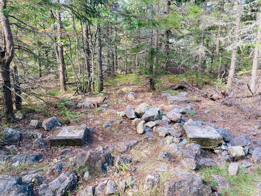
Maybe it’s too close to the Matagamon Gate, too low, no summit views (from Horse Mountain itself – views are from the East Spur), but I loved this hike. The beginning of the hike has a sort of a green tunnel aspect to it, but in the most positive way – there’s an artist’s palette of green with blueberries, princess pine, and hobblebush. This was a silver lining of the rain – I was able to notice the tones that sunlight would normally wash out. I bypassed the spur trail (1.2 miles in) on the way up, headed to the summit, planning to hit the views on the way back. At the peak, I found only the footings of what was once a fire tower, and scattered chunks of the rhyolite that comprises the volcanic mountains of the northern side of Baxter State Park.
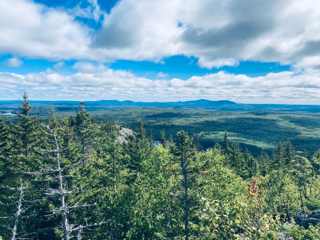
This wooded mausoleum was somber and peaceful, and I paused briefly to enjoy the silence. For those looking for a longer hike, the Horse Mountain Trail continues south to some backcountry campsites, the Billfish Pond and the Five Ponds Trail. The East Spur Overlook (.4 miles), which I took on the way back, provides an outstanding overlook of Grand Lake Matagamon and the East Branch of the Penobscot River. As an aside, this is one of the lowest mountains/easy hikes in Baxter that will give you sufficient elevation and line-of-sight to use cellular signal to send a proof-of-life text and maybe download an updated weather report.
(Disclaimer: This post contains affiliate links, and as an Amazon Associate Hiking in Maine blog earns from qualifying purchases.)
