Puzzle Mountain

Map kiosk, Puzzle Mountain parking area, Newry, Maine

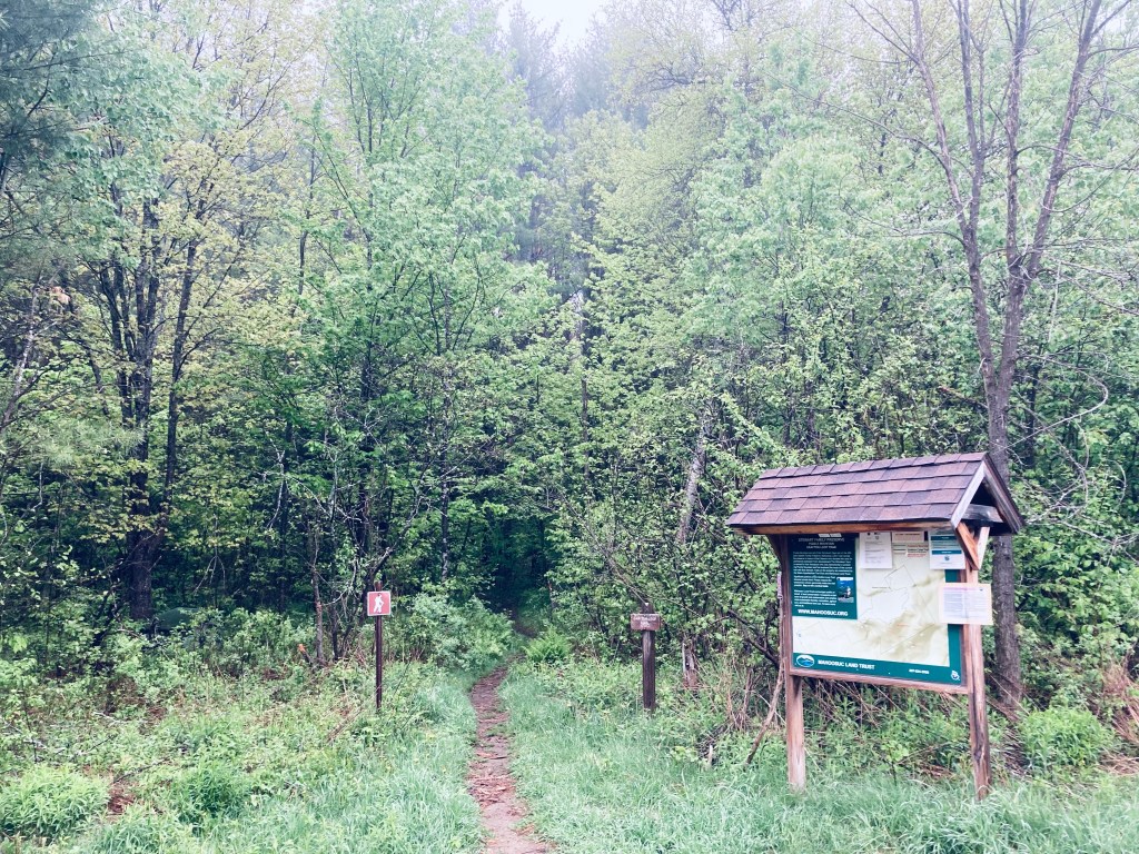
Puzzle Mountain (3,133 ft) in Newry, Maine, is a lollipop-style loop hike incorporating the Grafton Loop Trail and the Woodsum Trail, for an approximately 7.7 mile hike with expansive western Maine views, including Sunday River. The mountain is supposedly named after the discovery of a soft vein of rock on the mountain that was subsequently lost, making it a puzzle. Parking is available at a medium-sized parking area off Route 26, with a map kiosk. A map is available from the Mahoosuc Land Trust, which manages the 485 acres of Stewart Family Preserve land on which Puzzle Mountain sits. A detailed description is also available in the venerable Maine Mountain Guide.

Morning sun, Grafton Loop Trail, Puzzle Mountain

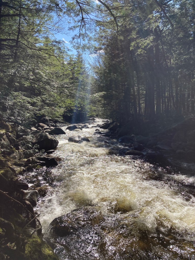
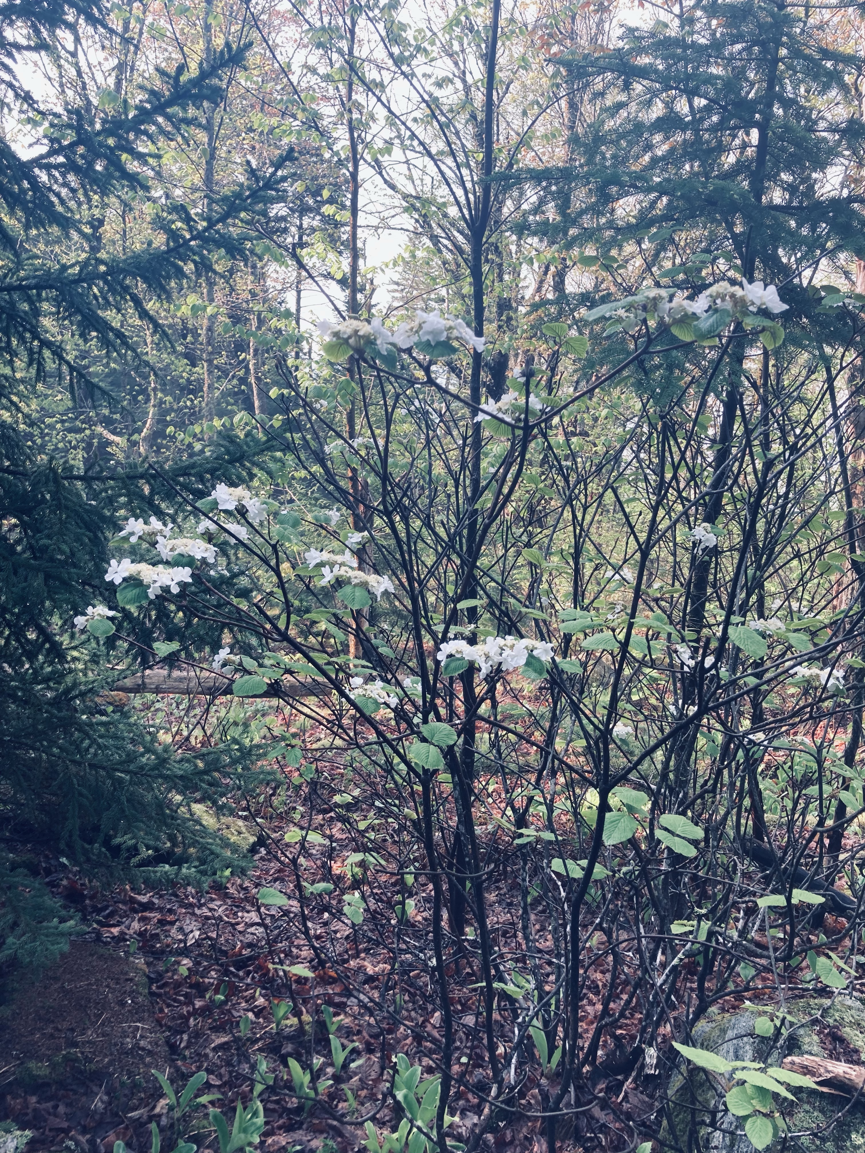
The blue-blazed trail crosses an ATV trail and then after about a quarter mile, a logging road, until beginning to climb by a small stream cascading down. Due to recent late May rains, the trail was slippery and the streams in the surrounding woods seemed to multiply. I knew this presaged a slippery trail with lots of bugs, and the clouds of mosquitoes were unrelenting. Clear spring streams criss-crossed the trail, which was a spooky green tunnel in the morning fog of beech leaves, birch, and hobblebush, with toads hopping out of the way.

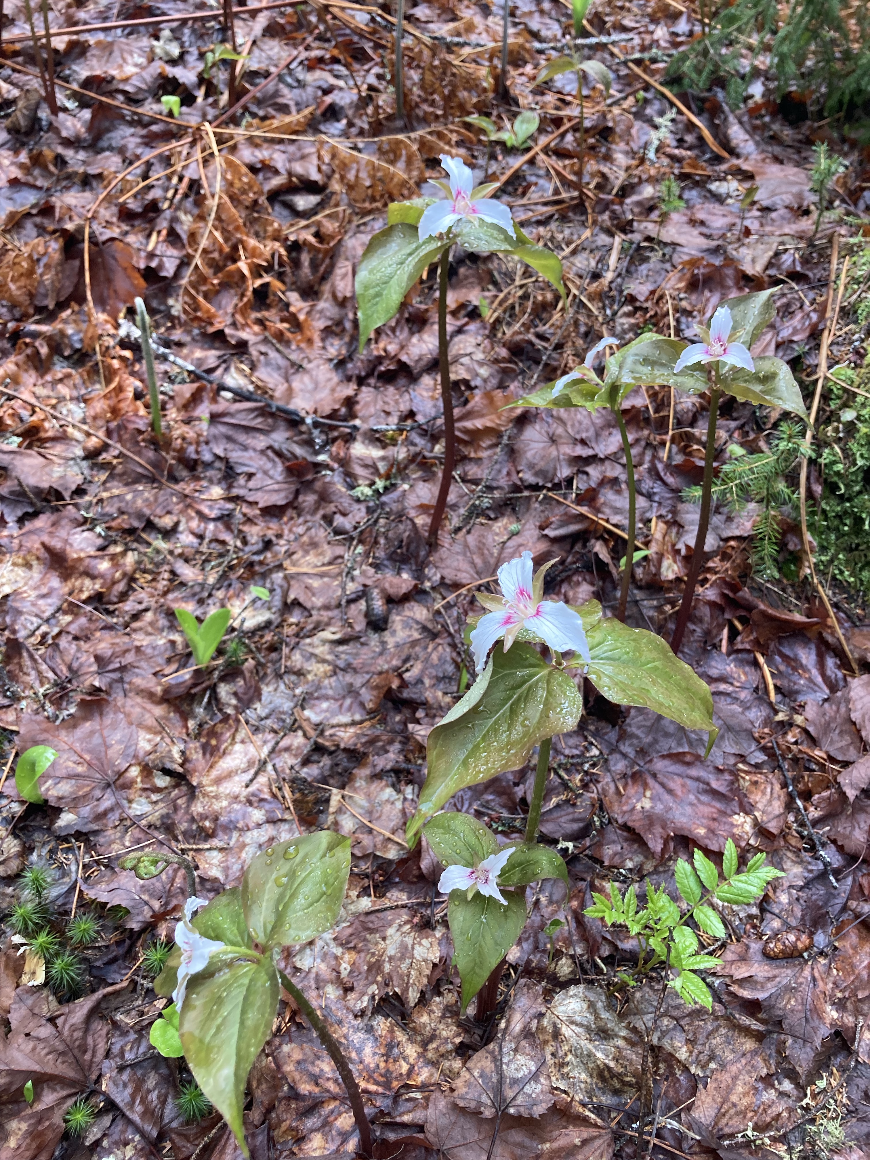
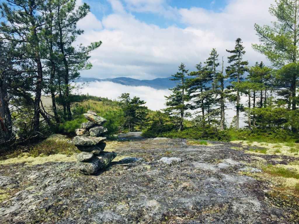
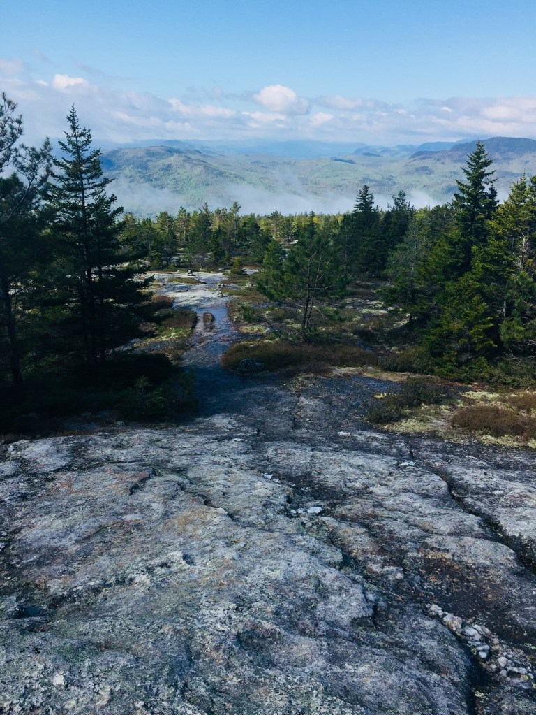
A Maine Appalachian Trail Club (MATC) register box was there to log the hike a little over 3/4 of a mile in. The sun began to light the way and changed the tunnel to an emerald forest, with trillium and other wildflowers dotting the sides of the trail, awaiting full bloom. This green deciduous forest ended abruptly as the trail circled a ridge with viewpoints over the valley surrounding the Bear River, switching to rocks, moss, and pine.

Viewpoint, Grafton Loop Trail, Puzzle Mountain
Continue reading

Step Falls Preserve (Newry, ME)

Afternoon sunlight on Wight Brook, Step Falls Preserve, Newry, Maine

Step Falls Preserve is a twenty-four acre parcel hugging the banks of Wight Brook in Newry, Maine. We visited at the beginning of May, during a road trip to see waterfalls during the spring melt. In the summer months, the shallow pools and falls are refreshing places to cool off with a dip, wade, or swim. Parking is available in a lot off Bear River Road/Route 26. The 3/4 mile trail to the top of the falls is fairly easy, with some roots and steep spots towards the end. Due to the popularity of this spot, it often fills up quickly on weekends and nice summer days.

Continue reading

Rumford Whitecap (Rumford, ME)

View west from the Starr Trail, Rumford Whitecap

Rumford Whitecap Mountain (2,214 ft) in Rumford is accessible through trails maintained by the Mahoosuc Land Trust (MLT), for a 5.4 mile out/back to the summit on the Orange Trail (or slightly longer using the Starr and Orange Trails), or a longer traverse over Black Mountain via the Black/White Trail (requires spotting a car).  MLT’s website advertises Rumford Whitecap as a four-season destination for hiking, snowshoeing, and back country skiing, with blueberries in the summer.

019f7a3415111ec83cd816c59b0b76606da7c51b23
Forest “gateway” descending the Orange Trail, Rumford Whitecap Mountain, Maine.

I have ascended via the Connector to the Starr Trail (marked with yellow blazes and flagging tape), and returned via the Orange Trail, and would suggest this route (or its reverse) for the views, rather than just the Orange Trail.  I used the guidebooks Maine Mountain Guide and Maine Hikes Off the Beaten Path for detailed trail maps and descriptions.  You can also find a map on the AllTrails app or Maine Trailfinder (link at the MLT website above).

(COVID-19 note: the Mahoousuc Land Trust advises on its website: “Our trails and preserves remain open, and are a great way to get fresh air and exercise. . . Please carefully adhere to these State restrictions and guidelines, and note that parking lot and trail closures will result if crowding occurs or the required distancing is not maintained.)

Spring waterfalls on the Connector between the Starr and Red/Orange Trails, Rumford Whitecap

Both trails, divided by a pleasantly running brook in a valley between them, were muddy, but well-maintained.  The Connector crossed the brook, with spring runoff created small waterfalls along the way.  Rains can create a morning fog, but also spur the growth of a variety of May wildflowers from the trailhead to the summit.

Spring wildflowers, Rumford Whitecap, Rumford, Maine

The Starr Trail transitions from a grassy woods road to a winding climb, becoming more strenuous as the deciduous forest changes to a more sparse, rocky pine forest, and opens up on ledges with spectacular views of the Mahoosucs and White Mountains.

Descent out of the woods into the clouds on the Starr Trail, Rumford Whitecap

After the junction with the Orange Trail, the summit is only about another .5 miles, hopping over small cool rivulets of water running down the exposed rock face.  Close to the summit last May, there was what appeared to be a large deposit of bear poop, but a quick look around didn’t disclose any prints.  The summit itself is open in all directions, and a great spot for a picnic.

The long summit ridge of Rumford Whitecap

After a brief rest at the summit to enjoy the view and chew on some jerky, I headed back down the Orange Trail.  The trail ran like a creek in places, with the spring rains, and remains diverted for a section.  The hike can take about two to two and-a-half hours, with plenty of stops to listen to birdsong, inspect wildflowers, watch bumblebees at work, and pick up and inspect pieces of quartz.

(Disclaimer: This post contains affiliate links, and as an Amazon Associate Hiking in Maine blog earns from qualifying purchases.)