The Meduxnekeag River Trail, a lollipop loop in Houlton, is a stone’s throw from Maine’s border with Canada and starts from a variety of places. According to the brochure available at the trail kiosk, Meduxnekeag is Maliseet (one of the five tribes of the Wabanaki confederacy) for “rocky at its mouth.” On this first December day, I chose Riverfront Park, which has ample parking, and restroom facilities (May through October only) for a starting point. At about .6 miles on, the trail wound up the riverbank to the edge of an open field.

At this time of year, about four or five inches of snow covered the path, and I could read a mix of cross country ski tracks and footprints on the trail. In another week or two, I would need some traction devices or snowshoes, but for now, my body weight and good winter boots gave me the needed traction. I passed a double Adirondack chair, with views across the field, including a giraffe-like Irving sign on the horizon, which was less-than-scenic. The trail moved back into the woods about a mile in. This trail system has a couple loops built-in to make your own version of a hike, and even in December snow, I saw a couple people of various ages, including those with small kids, enjoying different levels of the trail.
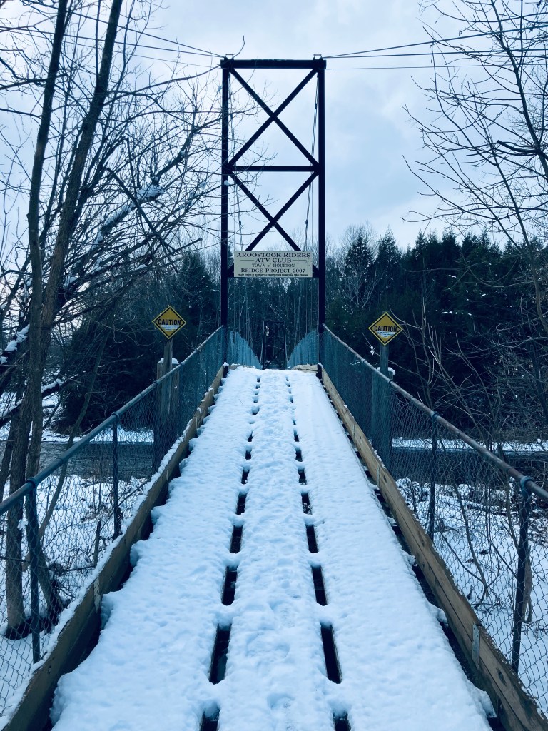
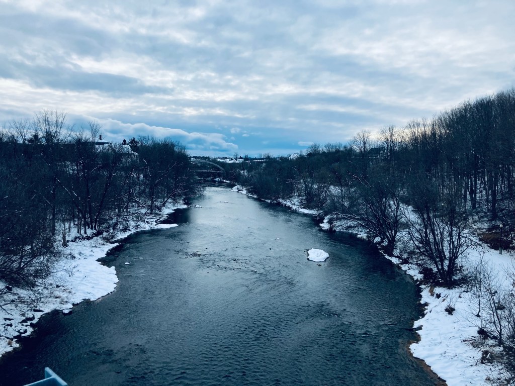
1.5 miles, the trail had a marker splitting “Easy” to the left, and “Moderate” to the right. I stuck to Moderate and started heading downhill towards a series of bridges. The trail crossed under the separate I-95 bridges- northbound (about to end) and southbound (just beginning) and reached the footbridge across at about 1.75 miles, a bridge shared by ATVs and people. This bridge definitely swayed with footfalls, and I trod down the snow and enjoyed the slow movement of the river. Across, the trail follows the bank under the two I-95 bridges and then goes back uphill along Cook Brook, which feeds the river, before tracing the brook briefly above some pleasant cascades and waterfalls and crossing back over it on a small wooden footbridge.

It was a quiet rolling walk along the riverbank until two small foot bridges across the creek led to a series of squiggles on the map at about 2.75 miles, which turned out to be switchbacks leading uphill. At about 3 miles, I passed the John H. Millar Civic Center, where the Community Park entrance of the trail comes in. Close to 3.5 miles, I emerged from the treeline, and saw the Highland Avenue bridge. Crossing the bridge was a little challenging, as the snow was piled high, and felt like walking across a series of Bosu Balls, but there was a great view at mid-span back along the slow river and then I took the long staircase back down to the riverside path and the parking lot. All told, about 4 miles in an hour and twenty minutes.