Located between the blueberry fields of Cherryfield and the Downeast coast, Tunk Mountain (1,157 feet) is part of the Donnell Pond Public Lands, managed by Maine’s Bureau of Parks and Lands (BPL), with the upper summit area on land owned by The Nature Conservancy (trail map). Parking for this moderate hike (about 3.9 miles out and back) is on the north side of the Blackwoods Scenic Byway (ME-182) between Sullivan and Cherryfield, consisting of a large lot, a pit toilet, and an information kiosk. This lot does fill up quickly, however, on weekends.

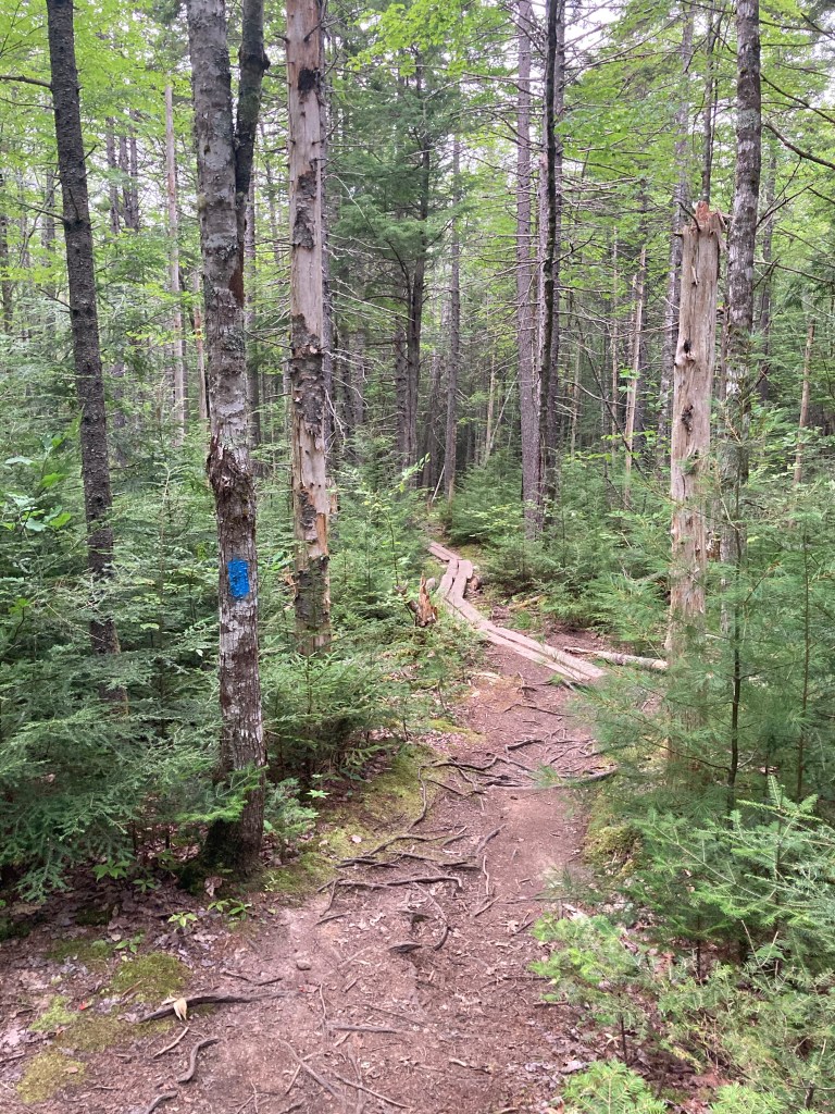
The Tunk Mountain Trail is marked by blue blazes, and starts with a downward pitch, towards plank bridges, tree roots, chattering red squirrels and chipmunks, and the sound of birds, including mourning doves and hermit thrushes. The geologic past is clearly visible in the mixed forest along the trail, with boulders haphazardly strewn among the trees. About 1/3 of a mile along the trail, some of these boulders hold small caves accessed through short side trails.

The Hidden Ponds Trail intersects with the Tunk Mountain Trail about .6 miles along, and can be taken on a one mile loop around Salmon Pond that rejoins Tunk Mountain Trail. The edges of Salmon Pond and Mud Pond were strewn with huckleberry bushes on the mid-August day I visited, heavy with full, teardrop-shaped berries.
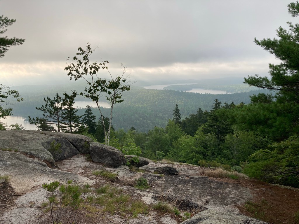
After Salmon Pond, there is a short rock scramble upward, with limited views through the trees, and low-slung blueberries along the rocky path. Another series of switchbacks takes you to open ledges, where even shrouded in fog, the vista was impressive.
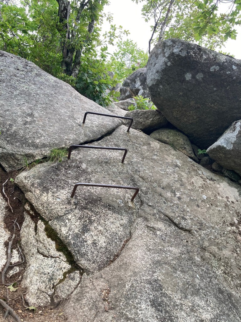
Another steep, winding ascent over roots and some well-crafted rock steps leads to iron rungs and the summit ledges, bursting with huckleberries. I usually try to hike early, and this can have mixed results on coastal mountains (see our Ragged Mountain hike), where the fog seems to linger well past sunrise. The views I enjoyed from the lower ledges turned out to be the only ones I would see, as the many summit ledges were socked in with fog. We will have to return on a clear afternoon. A plaque on one of these ledges commemorates the 1994 public gift of the land surrounding Tunk Mountain by the family of Maine native Harold Pierce.

Plan for about an hour or so one-way up to the top, where a clear day can give you views in many different directions. A much quicker descent took me back to the parking area, and a busier parking lot than the one I had left behind. Tunk Mountain is a pleasantly challenging Downeast coastal hike, without the crowds of Acadia.
