Note from Town of Harpswell website: from May 1, 2021 to October 1, 2021, the first 1/2 mile of Cliff Trail will be closed to hikers due to a Maine Conservation Corps construction project to make it ADA accessible. The remainder of the trail is open. Park at the Town Office (263 Mountain Road) and walk up the path behind the building to access the trail entrance/exit on Community Drive. There will be temporary signs and maps installed to help hikers with the changes while the work is being completed.
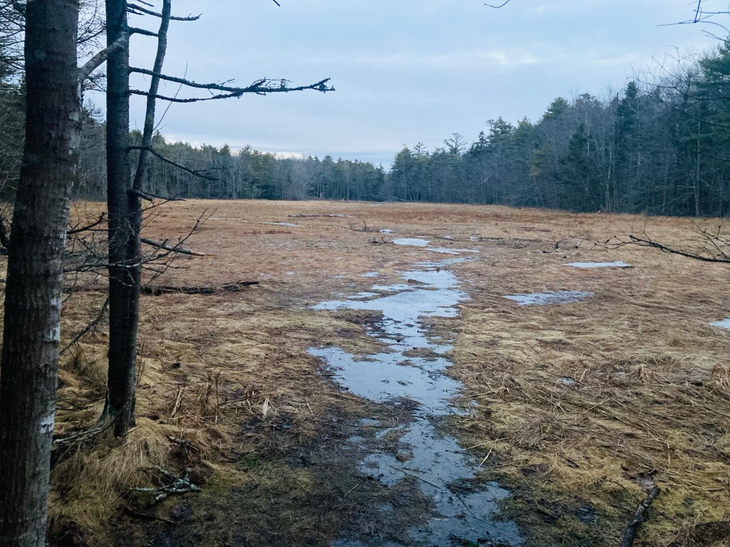
The Cliff Trail in Harpswell is an approximately 2.3 mile loop, with expansive views of the Long Reach, a long finger of a bay extending from Casco Bay inland. The popular trail, with parking at the Harpswell Town Office on Mountain Road, is well-marked and maintained by the town of Harpswell (see printable map and description here at town website). I started the white-blazed trail clockwise at sunrise on a mid-January morning. It was dark and a little muddy, with plenty of roots to trip over, but no snow had accumulated, and no traction devices were necessary. Strawberry Creek, to the west of the trail, narrows to a quiet, scenic cascade, and the trail turns inland.

Low pines and white birch bark lend an enchanted forest feel, with periodic fairy house “zones” adding to the effect on the way to the Henry Creek lookout. After this viewpoint, the incline of the trail begins, a series of switchbacks through rocks and mossy hummocks that takes you up and down the ridge of the eponymous cliff.
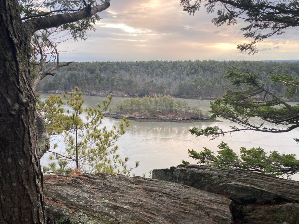
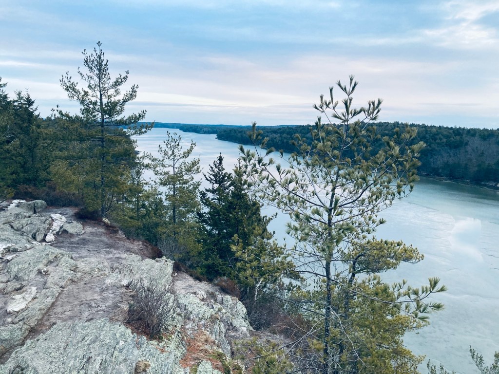
Here, the smells and sounds of humanity are still present, through whiffs of woodsmoke and the sounds of cars. These quickly gave way, however, to extended views of the Long Reach from the cliff tops and the sounds of morning birds. I would normally have lingered, but could hear the sound of voices behind me, other early morning hikers, and wanted to preserve that solitary feeling, so I kept going.
The trail skirts the Long Reach (and another “fairy house zone”) before turning west and descending through the Harpswell transfer station back to the parking lot (follow the paw prints on the ground). The town’s map lists the trail as challenging, but daughter and I did this trail together back when she was five or six, and the only real challenge was an unexpected nest of yellow jackets along our route that tagged her a few times.
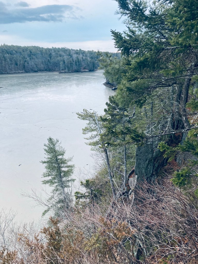
Exercise caution, however, on or near the cliff faces of the Long Reach side, as there are sheer drops that could be very treacherous for unsupervised young children. I finished this loop in about an hour, with plenty of energy to tackle other seaside hikes in the Midcoast area.

Excellent post with beautiful photos.
The sunrise at Long Reach, also looks stunning! Thanks for sharing
LikeLiked by 1 person
Sunrise at Long Reach, Cliff Trail, Harpswell, ME Beautiful photo! I imagine you’ve got some good snow by now… enjoy!
LikeLiked by 1 person
These views are fantastic!
LikeLike
Parking at town hall on Mountain Road.
LikeLike
I live a 4 minute walk to Cascade overlook which is beautiful! The Cliff trail is very near. My one complaint is Google maps sends people down Doughty Pt. Road. And onto Navigators Ln. Both are private roads. And Navigators is maintained by the few houses on it. This is not the trails entrance. It’s at the Town Office. I’m constantly redirecting traffic back to Town Hall. We’ve put up a no access sign and cones in the summer and yet the car’s still come down. Please redirect traffic back to the Town Office! Help!
LikeLike
Hi Beth! Sorry to hear this! I am on the opposite side and some on line maps are showing our driveway as part of Upland Lane, a private way, and we have had hikers park in our front yard across from our house. Ugh!
LikeLike
Thank you for the comments. I had the Town Hall listed as the parking address in the first paragraph, but I just updated to clarify Mountain Road. Hopefully this helps.
LikeLike
Thank you for that update!
LikeLike
Hi Beth – Gina here. Wish you would have called me when it first started. We can’t help fix something if we don’t know it’s broken. 🙂
I’ve requested changes in Google Maps and on Open Street Maps…now we wait. Unfortunately these are all “open software” and anyone can request changes and someone approves them without knowing the area.
Some changes have already been approved as of 4/21/21. Just waiting for the rest. Hopefully it makes things much better for the upcoming spring/summer season.
LikeLike