Mount Chocorua

016826b763b9bb48dd29303074186723d61976eb0b

Dad did Chocorua solo on August 30 and then came back with daughter on September 2, 2017 to do it again.  This hike was suggested by friends, and planned using the AMC White Mountain Guide, making it part of the “and beyond” part of our stated “Pine Tree state and beyond” header, as the mountain is in Albany, NH.

There are several loops up and down this beautiful mountain, and dad took the Piper, Nickerson Ledge, Carter Ledge, Middle Sister, and Piper Trails up, then descended via the Liberty, Hammond, Weetamoo, and Piper Trails (9.6 mi).  This trailhead is accessed from NH 16.  Dad and daughter ascended on September 2 via the less challenging but equally scenic Champney Falls and Piper Trails (7.6 mi), accessed from the Kancamagus Highway.  Both parking lots can be crowded in the summer, so we got an early start.  From either starting point, there is a small cash use fee to the White Mountain National Forest, payable with cash at a kiosk (and bring a pen).

0196c946aa227721ea76908cd2062924657a6c5887

The trail climbs steadily up past Champney Falls and Pitcher Falls, which were not running with much force at this time of summer, but still worthwhile to see.

01d185b04bb975e012f57f3798eacff99578ad84ef

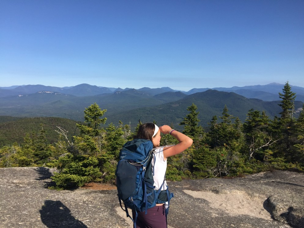
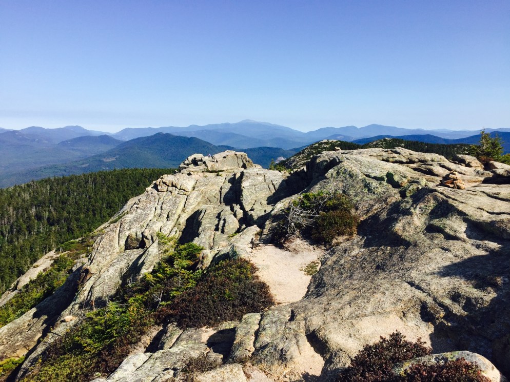
After the intersection with the Piper Trail, the vistas opened up, and we had fun making our way up to the windy summit in the morning sunlight.

010c2f3d1e431b67e46eacae0827cffcb06969aa1b

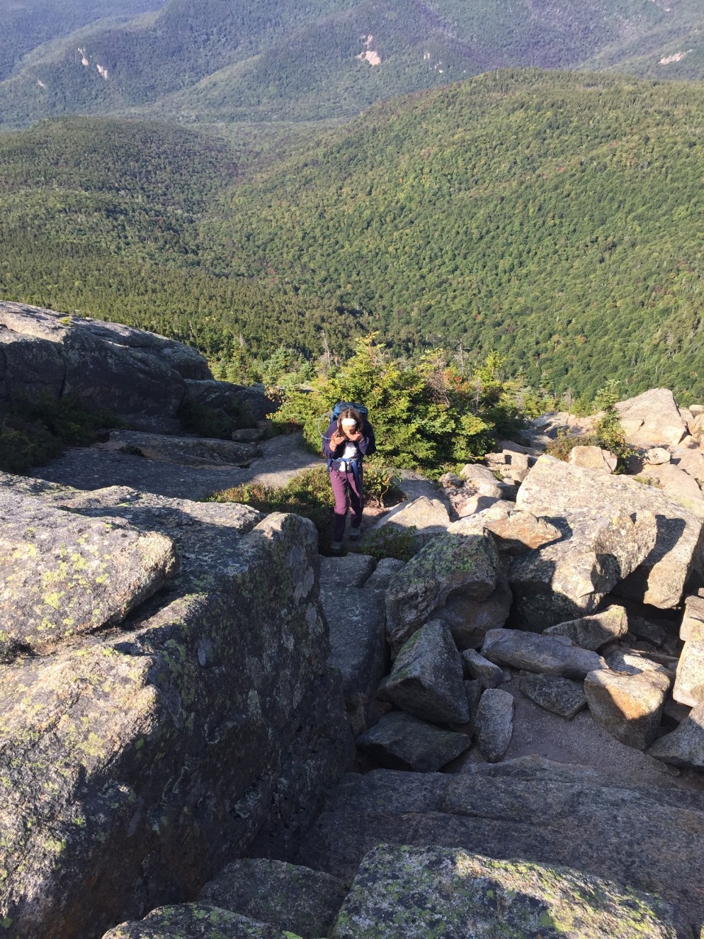
The last scramble to the top involved some steeper climbing, which we enjoyed.  We didn’t spend much time at the summit, as the wind was powerful.  After the climb up, our descent was pleasant and uneventful.  We did notice that the volume of hikers headed uphill increased dramatically as the day wore on, and felt good about getting an early start.  Many people brought their dogs, and this seemed like a good hike with a pet, as long as they were careful near the top.

We enjoyed a great post-hike pizza at Brothers Original Pizza in Albany, NH, which has an outdoor deck, if you are so inclined.  The air was chilly on this trip, but if you take the Champney Falls route, a short distance down the Kancamagus Highway is the Lower Falls Recreation Site, where you can cool off in the Swift River after the hike.

(Disclaimer: This post contains affiliate links, and as an Amazon Associate Hiking in Maine blog earns from qualifying purchases.)

Megunticook Loop at Camden Hills State Park

Camden Harbor and West Penobscot Bay from Mount Megunticook

Midcoast hiking means dramatic ocean views.  We first explored Camden Hills State Park in April 2017, when we started our 100 Mile Wilderness Training with a relatively short (5.4 mi) and moderate 3 hour hike- the Megunticook Loop at Camden Hills State Park, via the Mt. Megunticook (10 on map), Ridge (3 on map), Slope (9 on map), and Multi-Use (11 on map) Trails.  The idea for this hike (and many others) came from the indispensable 10th edition of the Maine Mountain Guide , which we have dog-eared and highlighted, as it is an incredible wealth of knowledge (Amazon link is to the new and improved 11th edition, and you can read about all the updates here).  Parking is easy, and a small fee is charged for entrance.

Camden Hills State Park map for Mount Megunticook

It was a good opportunity to test out some of our new equipment, in unexpectedly snowy conditions – the bulk of the hike was done through deep, crusty snow and sheets of ice.

Icy stream, Mount Megunticook

In addition, we had our cousin, an experienced hiker, with us, as well as our wife/mom, a um, not-so-experienced hiker (her meal for the trail was a Ziploc bag of peapods, which she accidentally stepped on in the parking lot).

This loop had some great views along the way, particularly from Ocean Lookout, but not much to see at the top. It was a fairly easy climb, but we would recommend doing it in the late spring, summer, or fall. The trails were well-maintained and this loop had a gravel path for parts of the way. With an elevation of 1385 feet, it was a steady climb for most of the way up.

Camden Harbor and West Penobscot Bay from Mount Megunticook

This was the first time we tried our packs. For dad, an Osprey Xenith 75L pack, with an Osprey UltraLight Raincover, XL. For daughter, an Osprey Ace 50 Night Youth 50L pack (it has a built-in raincover).  We equipped each with an Osprey Hydraulics 3L reservoir, for hydration.  Obviously, we didn’t need packs or a hydration bladder of that size for this hike, but they are so well made, we chose to just fill them with less water.

We also got to try out our JetBoil stove- a freeze-dried meal of Chili Mac at the top required heating.  Due to dad’s disdain for instruction manuals, the stove spewed gas noisily for several minutes before we figured it out (dad’s fault, not the stove, which we found to be excellent).

A brief cautionary tale- we have probably undersold the difficulty of hiking in the snow present on Megunticook.  Wife/mom had issues with wet shoes/socks, and our mountaintop dining was cut short by a speedy descent.  Dad/daughter agreed that the extra time heating/mixing made the Chili Mac better.

Either way, cheap food and good beer at Marshall Wharf Brewing Company made for a great after-hike stop on the Belfast waterfront.

(Disclaimer: This post contains affiliate links, and as an Amazon Associate Hiking in Maine blog earns from qualifying purchases.)