
Pleasant Mountain (2,006 ft) is a mountain in Bridgton right next to the former Shawnee Peak, now (since 2022) Pleasant Mountain ski area, with trails mostly on land owned by the Loon Echo Land Trust (see here for info and detailed maps). Dad and daughter hiked this first with our cousin in April 2017 as part of our preparation for our 100 Mile Wilderness trek via the (moderate) Southwest Ridge Trail (also known as the MacKay Pasture Trail), 5.8 miles up/back, but have done it since in February, August, and other months. Map and description are also available in the stellar Maine Mountain Guide. The preserve is open dawn to dusk, and dogs on-leash are allowed. Blaze orange is suggested during hunting season.

This hike can be busy in summer, particular up the Ledges Trail, but an early start or a winter morning can provide solitude. There are always a few hikers, especially close to the summit, but I have also seen woodpeckers, crows, turkeys, and a winter herd of deer. The deer were using the same path, and bounded away from me, big white tails flashing, every time they heard my footsteps crunching in the snow, coming no closer than about fifty yards. In the summer, the call of loons carries up the mountain from Moose Pond.

We have also hiked this mountain via the Ledges Trail from the east, and enjoy the western approach more, as the ridge hike provides wonderful views on the way up, including at the Southwest Summit (1,900 ft). The parking area on Denmark Road is well-maintained, plowed in winter, and easy to find (for directions, use AllTrails app or Google Maps to search “Pleasant Mountain Southwest Ridge Trail“), and it is a fairly steady climb to the top, with a steeper climb after the junction with the Ledges Trail, for the last .2 miles to the top.
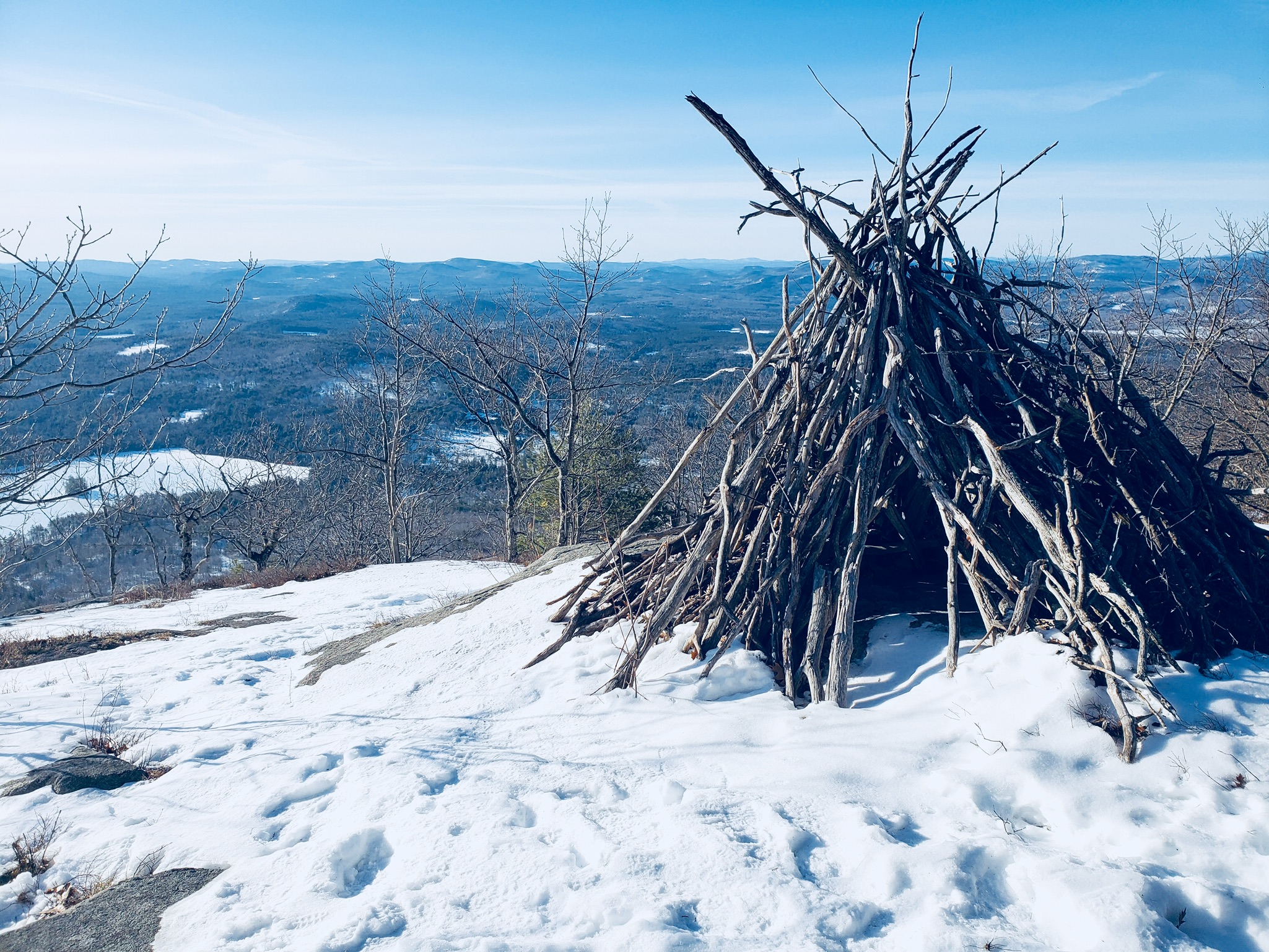
A wood teepee structure near the Southwest Summit makes for a good point to take a break along the way. The intervening woods are full of birdsong, including our favorite, the hermit thrush, as well as dark-eyed junco. Large clusters of wild blueberry bushes line the rocky trail.
A mix of sun, shade, and elevation provide different challenges throughout the hike in spring and summer, as the ridge northeast of the Southwest Summit blocks the sun during most of the morning. In mid-winter, the trail is usually well-packed, and it’s wise to use micro-spikes from the trailhead to the summit, with no need for snowshoes. Steps to the right or left of the packed snow, particularly in the valley between the Southwest Summit and the Main Summit, will put you post-holed into deep drifts. There are usually cross-country ski tracks parallel to the trail, providing more options.

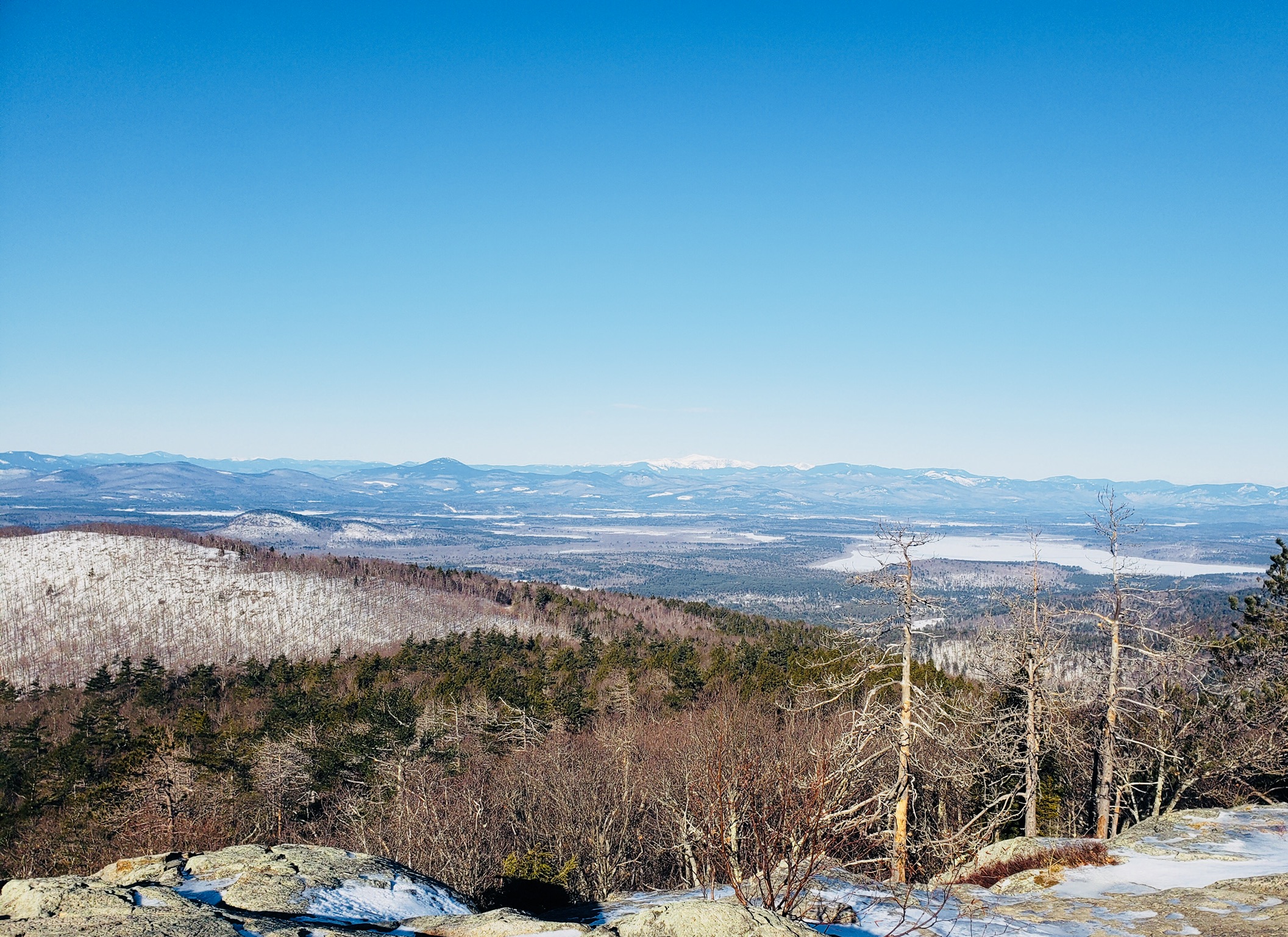
A depressed area in the section between the Southwest Summit and Pleasant Mountain Summit is a vernal pool in spring, with incredibly loud peepers, a heavy covering of snow, and probably the first ticks of the year in April. The pool gave us our first chance to use our water filtration system, the MSR Sweetwater, in April 2017. A couple of pumps produced clear, cold water. The views of the White Mountains to the west, particularly Mount Washington, are wonderful on clear days. An old fire tower still stands on the summit.

The descent requires a slight uphill climb in the valley between the main summit and the Southwest Summit, but it’s a quick downhill (careful of footing) after that, back to the trailhead, about a 1.5 to 3.5 hour out-and-back hike, depending on conditions and how long you stop to rest. If you can time it right, stop by Standard Gastropub in Bridgton after the hike to enjoy craft beer and unbelievable food.

beautiful winter scenery
LikeLike