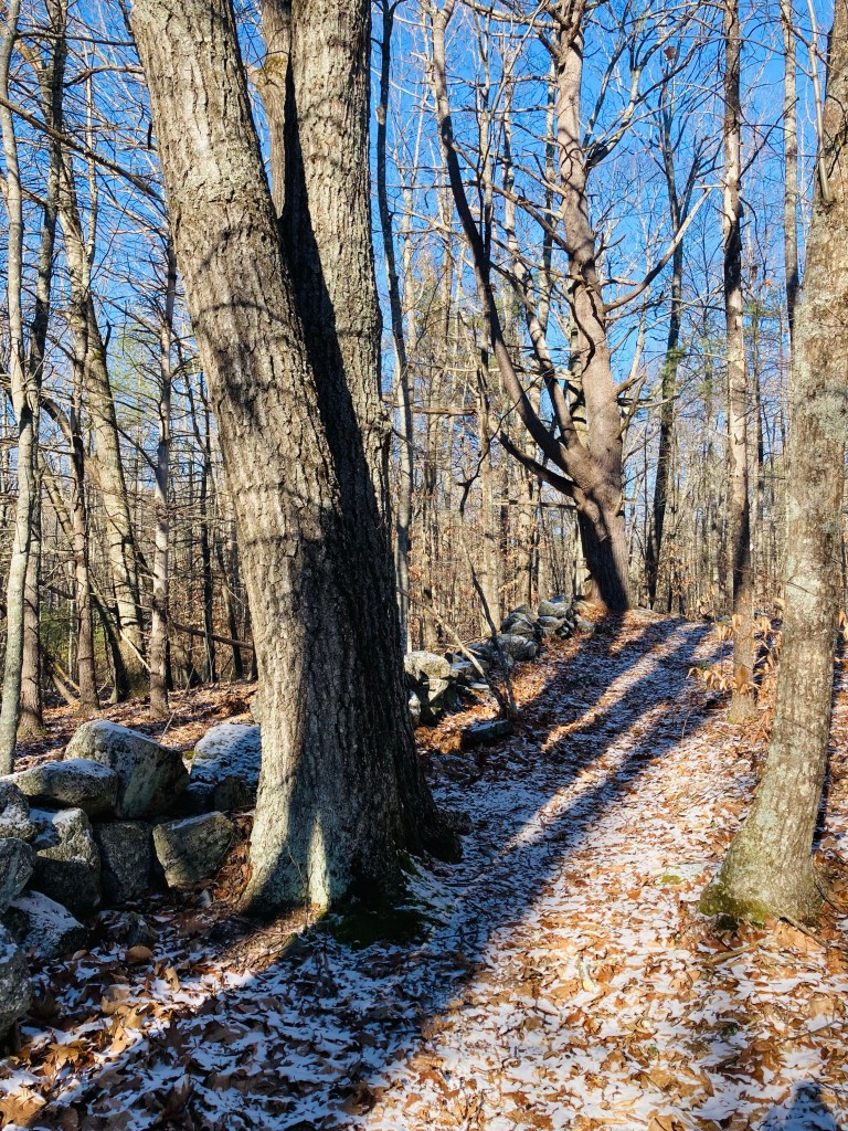
Peltoma Woods is located in Pittsfield, on the Town Farm Property along the banks of the Sebasticook River. On a mid-May morning, I took the easy Outside Loop Trail counterclockwise from the trailhead kiosk, located at the DriftBusters Snowmobile Club on Peltoma Avenue. A sign on the kiosk (which has a trail map and other info) warned of vernal pools and wet areas, which proved quickly true, with much rerouting needed around dark pools, their surfaces cloudy with pollen and amphibian eggs. For a much deeper dive, including other nearby hikes and refreshments, check out this Press Herald article regarding Pittsfield.
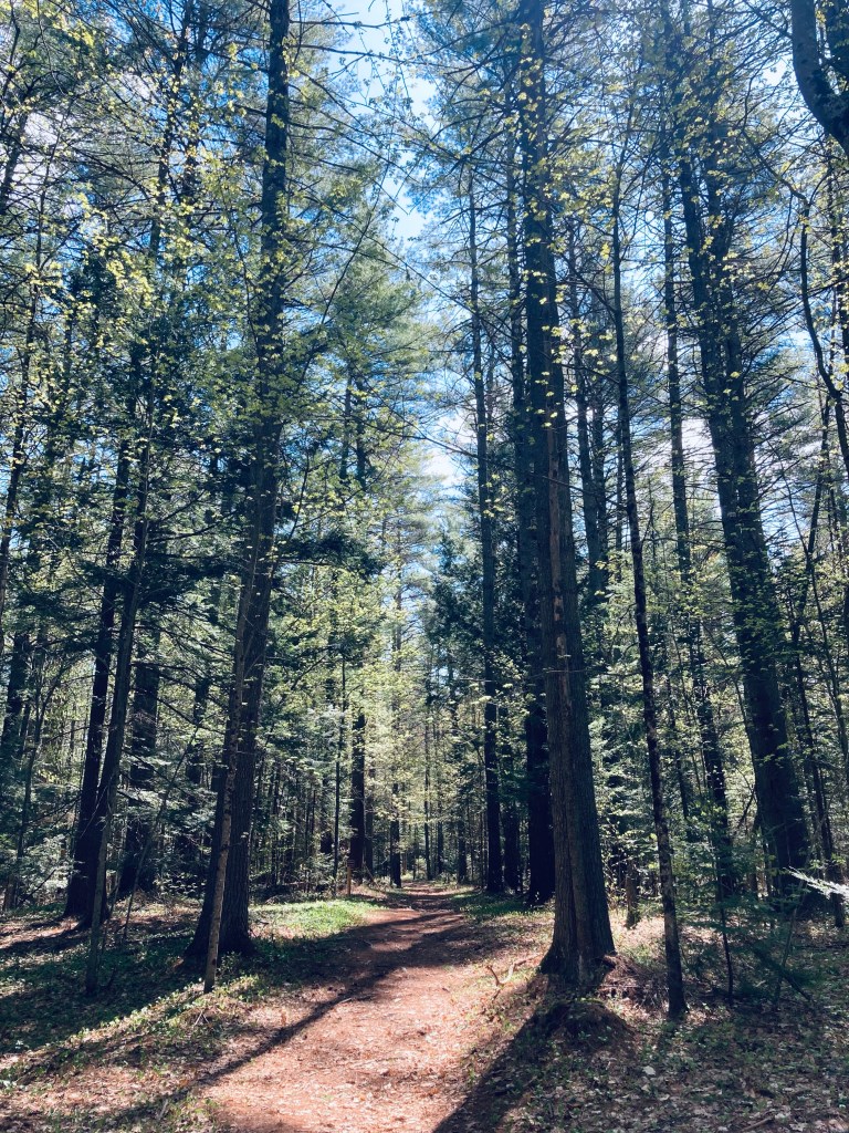
Sun through the treetops, Messalonskee Stream Trail, Oakland, ME
The Messalonskee Stream Trail is listed alternately as a 3.2, 4 mile, or 6 mile total out-and-back trail along its namesake in Oakland, Maine, open from sunup to sundown. Description and maps are available at the site of Kennebec Messalonskee Trails. I completed this trail in mid-November, and again in early May. On both occasions, they were lightly trafficked, with an emphasis on dog walkers. In November, a notice was posted for hikers to wear orange, due to archery season. In May, there was more mud, more birds, and the streams were running much faster.
Wooden bridge and fall leaves, Messalonskee Stream Trail, Oakland, ME
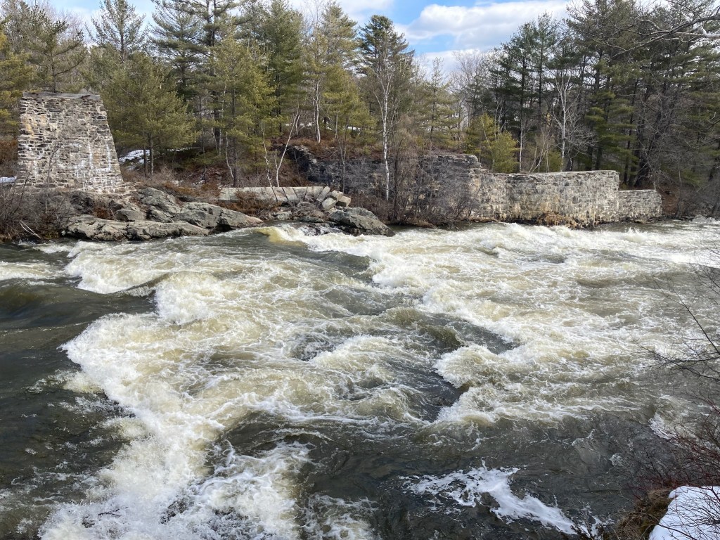
Parking is available in a small fenced-in lot off Kennedy Memorial Drive, just before the bridge next to the Oakland Town Office. An alternate start point is at the north end, off Rice Rips Road. This is a very quiet, accessible trail for being relatively close to I-95. The trail, constructed by the Maine Conservation Corps, emerges from a gap in the fenced area, and climbs to a ridge overlooking the river. On the opposite side of the stream are the castle-like ruins of the Cascade Woolen Mill, with graffiti and tumbling walls, reminiscent of a Stephen King story.
Yarmouth’s Royal River Park, located just outside the small town center, has a short out-and-back trail running alongside the falls of the Royal River. A detailed description is contained in Hiking Waterfalls Maine, including the downstream First Falls, which are separated by Bridge Street from the prior three along the trail. The water “trail” can be explored via canoe, and maps are available from the Royal River Conservation Trust. We walked the easy land route, about 1.4 miles total, in mid-March, taking us less than half an hour. The park itself, used for community concerts, is wide near the parking area, and includes picnic tables, to make a longer trip. A parking area is located across the street from the Yarmouth History Center.
View east from North Peak of Quaggy Jo, Aroostook State Park
Quaggy Jo Mountain (1,213 ft) is located within Aroostook State Park, about 5 miles south of Presque Isle, and a detailed description of the hike is available in the Maine Mountain Guide. Aroostook State Park charges a $3 entry fee for Maine residents, payable via a drop box next to the gate on the May afternoon I came through. Online maps are always hard to come by for Maine state parks, so I’ve included a photo of the physical trail map placard.
Parking is available at a large lot next to Echo Lake, at the base of the Quaquajo Nature Trail. (The popular belief is that Quaggy Jo is the shortened from of “Qua Qua Jo” a native American phrase for “twin peaked”). Not having done enough research, I started the Quaggy Jo hike counterclockwise, starting with the Nature Trail, marked with blue blazes, and proceeding via the North Peak and Ridge Trails. Guides and maps recommend completing this loop in the opposite direction, due to the steep ledges on the South Peak Trail, which make descent difficult. I opted instead to double back on the Ridge Trail, then take the Notch Trail back to avoid the issue. This made for a loop of about 2.6 miles in an hour and 15 minutes, which I finished via the Nature and Novice Trails. On the Quaquajo Nature Trail, steps led up an incline and low spots were covered with wooden walkways. The spring trees were still sparse enough to see through, with small green buds indicating the greenery to come.
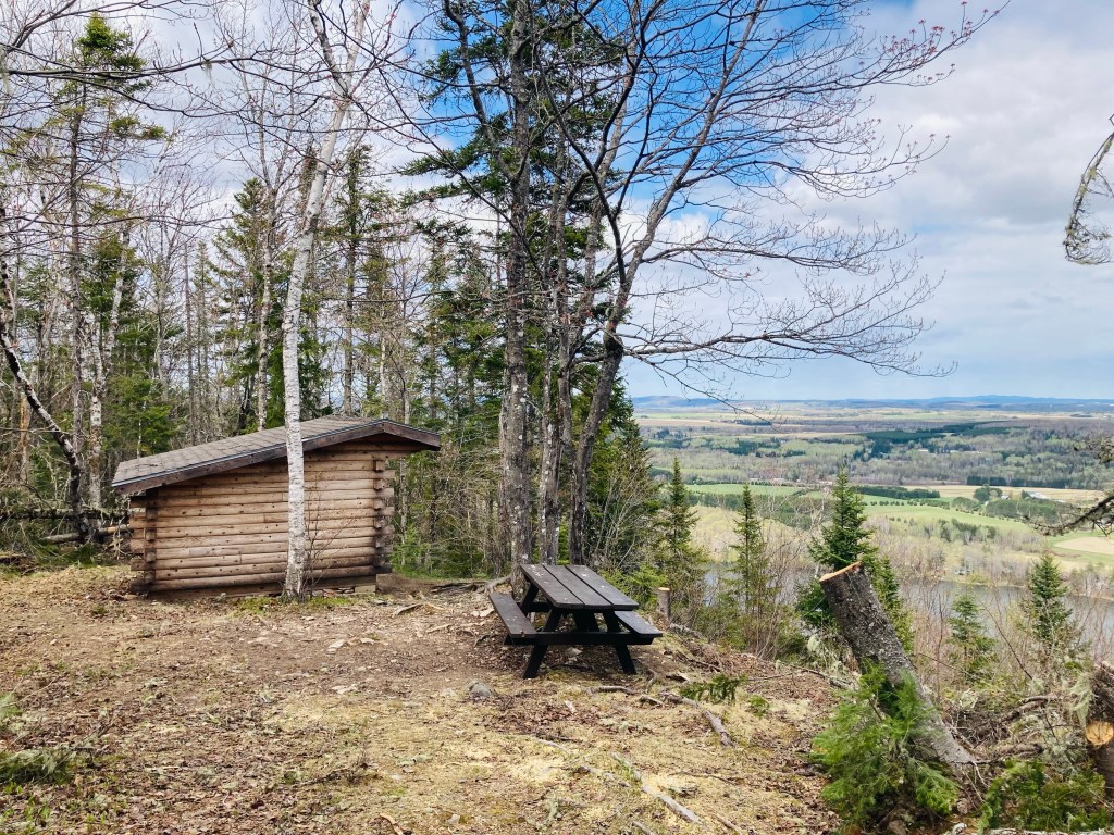
Lean-to on Ridge Trail, Aroostook State Park
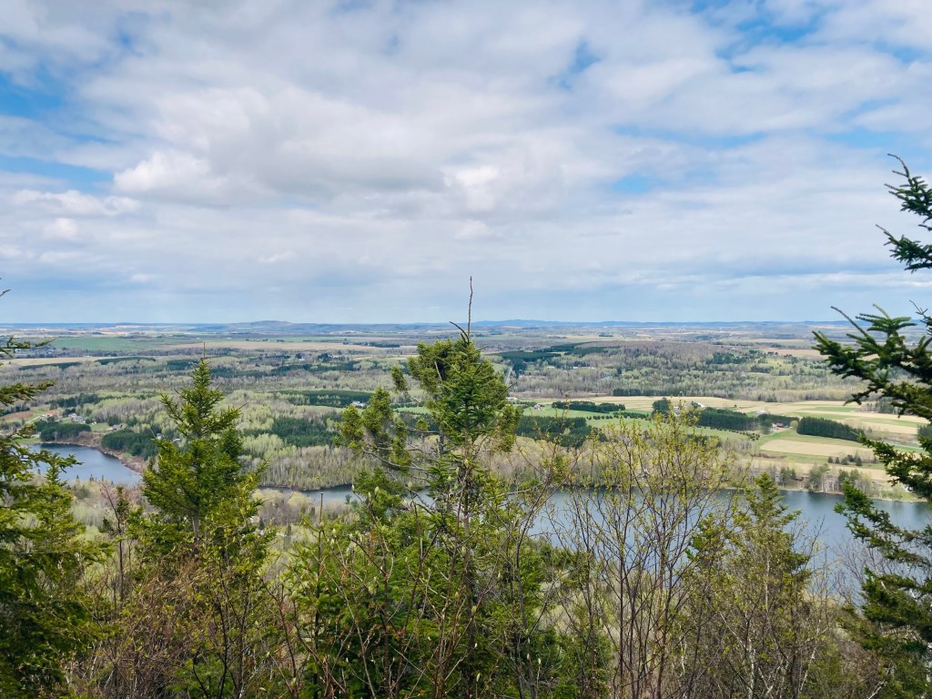
The North Peak Trail crossed over the cross-country ski trail, then quickly turned to a steep series of switchbacks facing Echo Lake, reaching the North Peak summit (1,141 ft). The North Peak had several viewpoints, including a glimpse of snowy Katahdin through the trees. On the rocky Ridge Trail heading across the road from North Peak to South Peak (or vice versa, for those who follow instructions), there is a wooden lean-to with an expansive view of Aroostook County, and Canada beyond. As the Ridge trail dipped between the two peaks, the traverse required a series of hops over fallen trees, blowdowns after recent storms. Loose volcanic rock on portions of this climb show pieces of the rhyolite bedrock that created Quaggy Jo.
View from South Peak of Quaggy Jo, Aroostook State ParkContinue reading →
Bench by beaver dam and pond, Suckfish Brook Conservation Area, Falmouth, ME
Suckfish Brook Conservation Area is a two-part preserve in Falmouth and Westbrook to the east of Highland Lake, a total of about 132 acres in size. On a mid-December day, I explored the 94-acre preserve in Falmouth by the Falmouth Land Trust, with a trail system maintained by the Town of Falmouth that begins in the Conservation Area and connects to trails made possible by neighboring landowners. The Conservation Area is named for the white sucker fish, which spawns in the eponymous brook. The small parking area is at the end of Upland Road, off Mast Road close to the Falmouth/Westbrook line. Navigation through Suckfish Brook Conservation Area can be difficult, as the maps are good, but some of the trails, particularly those through the Christmas tree farm owned by Skillins, are unsigned. I typically use the AllTrails application to navigate and track hikes, but in this case, the best way I found to navigate was using the QR code on the trail sign to access the Google Maps version of the trail map, showing my position relative to my anticipated route. In addition, the AllTrails trailhead directions tried to send me towards the wrong side of Falmouth.
Stone wall, Suckfish Brook Conservation Area, Falmouth, ME
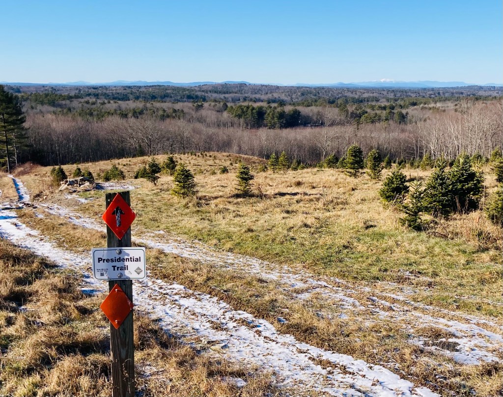
I made a loop by taking the Huston Trail clockwise to the Stone Ridge Trail, the Presidential Trail, the Red Tail Trail, and back north on the Presidential Trail to the Huston Trail, with a quick stop at the Beaver Trail. This route along the edges of the Conservation Area was about 2.6 miles, and easily completed in an hour. A sign and map kiosk mark the beginning of the trails, which are open sunrise to sunset. Shortly after the parking lot, a series of plank bridges led to the right, with a view over a small pond, a bench, and a beaver dam at the pond’s outlet. Returning to the main trail, white-blazed Huston Trail splits to the north and south, and I went left/north. Leaves rattled on the trees and crunched underfoot, frozen under a thin carpet of snow. There are periodic placards along the trail with notices and QR codes regarding the history of the area. The Huston Trail is named for William Huston and his family, the historical landowners. Huston was a forester working for the King of England’s mast agent for Maine, and white pines were harvested for Royal Navy masts here, hence the name of Mast Road, as well.
View of White Mountains from Presidential Trail, Suckfish Brook Conservation Area, Falmouth, MEContinue reading →
Tree overlooking Center Pond, Cooley Preserve at Center Pond, Phippsburg, ME
Cooley Preserve at Center Pond, also known as Center Pond Preserve, is located in Phippsburg and maintained by the Phippsburg Land Trust. Cooley Preserve, known for its bird habitat and wildflowers, contains 253 acres of woods, ledges, a beaver pond turned into a marsh, and the shoreline of Center Pond. A friend and I explored the trails on a cold but sunny late November day. The trailhead off Parker House Road is just south of a narrow neck between Center Pond and the Kennebec River, directly across the river from Squirrel Point light. The parking area has a sign-in notebook, with space for trail brochures (none when we visited), and a sign lists access to McKay Farm Preserve via the South Perimeter Trail. Online, the brochure notes that the Preserve is named for Mrs. Eleanor Cooley, from whom Phippsburg Land Trust acquired this, its first property, in 1995.
Trail map at Cooley Center Pond Preserve, Phippsburg, ME
Atop the trail guide box was a laminated version of the only map of the Preserve’s trails that I’ve seen, which is incomplete (no link to McKay Farm can be found off the South Perimeter Trail, and other new trails are not listed), and not aligned with north at the top like a traditional map. A sign encouraged hikers to wear blaze orange, which we took to heart on this late November day, the last day of deer hunting season. We navigated using the guide box map, as well as the AllTrails application and dead reckoning. Combining the Drummond Loop, Andy’s Way (signed, but not on the map), Schoolhouse Trail, Elbow Hill Trail, Perimeter Trail South, and Perimeter Trail North, we cobbled together a loop around the perimeter of the Preserve totaling about 5.5 miles.
AllTrails map of route taken through Center Pond Preserve, Phippsburg, ME
This easy hike took us a little over two hours, with plenty of time to stop and enjoy the various viewpoints. Near the trailhead, there are petroglyphs, or rock carvings, which you can find for yourself by following purple blazes or read about on Phippsburg Land Trust’s site (we are more aligned with a Leave No Trace philosophy, and these definitely aren’t our thing). The Drummond Loop led uphill from the parking area, then downhill to a left turn to pick up the loop. Shortly thereafter, we encountered a new sign for Andy’s Way, a blazed trail leading southeast, and followed this path over mixed forest, past tall ledges, until it reached the Schoolhouse Trail. There were vestiges of the farmland this used to be, with stone walls, and old barbed wire growing slowly back into the landscape.
View from Elbow Hill, Cooley Center Pond Preserve, Phippsburg, MEContinue reading →
North Loop, Pineland Public Reserved Lands, New Gloucester, ME
The Pineland Public Reserved Lands trailhead is located in New Gloucester, Maine, just south of the Pineland Farms complex on Depot Road, with year-round trails on either side of the road making a figure-eight loop, with Depot Road as the fulcrum at the center. The Lands themselves consist of over 600 acres of undeveloped forest in New Gloucester, Gray, and North Yarmouth. The best maps and descriptions can be found on Maine Trail Finder or Maine By Foot. The southern end of the trails connects to a much longer network of Pineland Corridor mixed use trails leading to Bradbury Mountain State Park, used primarily in the summer by mountain bikers.
Fall colors on North Loop, Pineland Public Reserved Lands, New Gloucester, ME
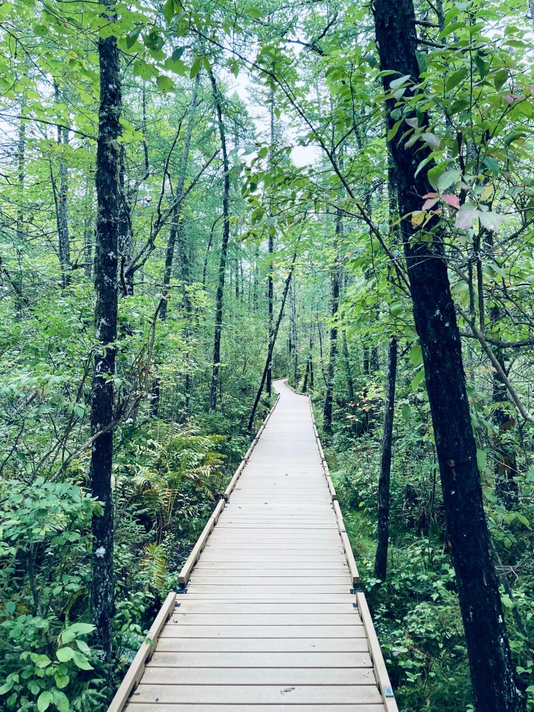
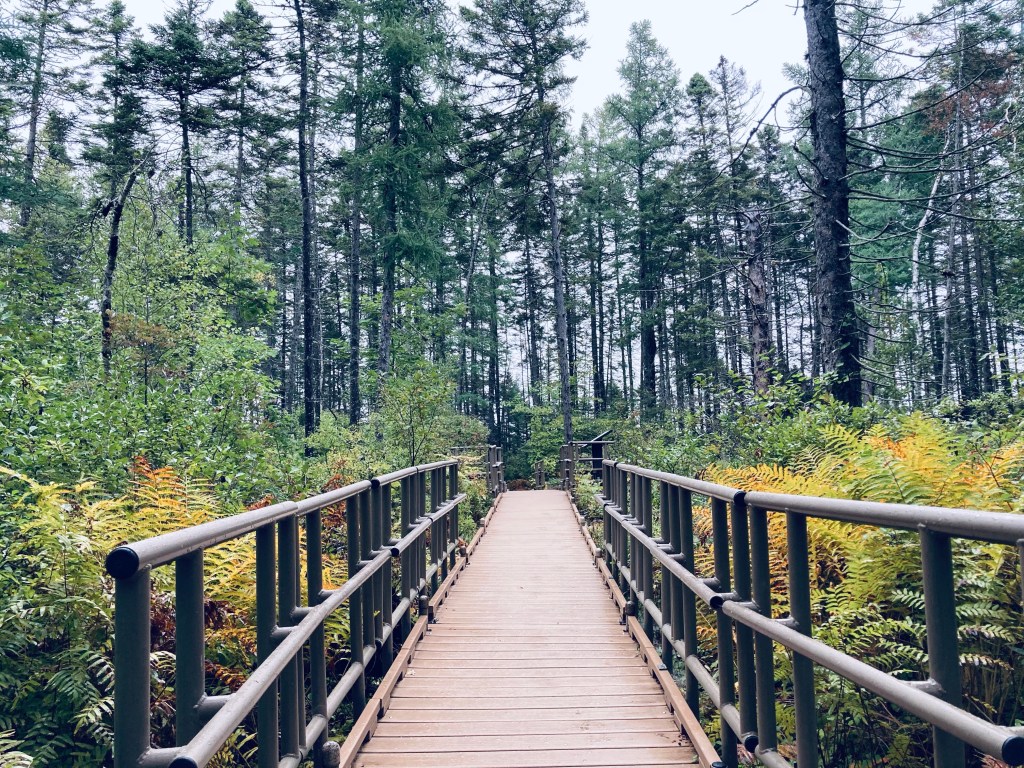
We completed this leisurely 3.2-mile loop in about an hour and twenty minutes in early October’s peak foliage, taking the northern (1.7 mi) and then southern (1.5 mi) loops each in a clockwise direction before returning to the trailhead. The trailhead is marked by a prominent brown sign on Depot Road with a pine tree on it, with a wide dirt/gravel parking area. A picnic area is adjacent to the trailhead. Plank walkways cover low or wet areas in the North Loop path, as the trail winds mostly downhill through mixed forest, with abundant ferns. Crows, black-capped chickadees, and blue jays called loudly through the widely-spaced trees.
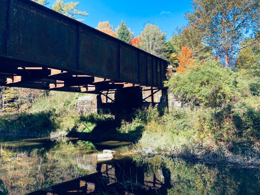
Royal River rail bridge, North Loop, Pineland Public Reserved Lands, New Gloucester, MEContinue reading →
The Orono Bog Boardwalk, adjacent to the Bangor City Forest, is located off Stillwater Avenue just north of the Bangor Mall area. The easy, flat 1-mile Boardwalk, celebrating its 20th year in 2022, is a joint venture of the University of Maine, the City of Bangor, and the Orono Land Trust. Updates on conditions and opening hours are available through the Boardwalk’s Facebook page. The Boardwalk is closed during the winter, and from the designated opening day in the spring through Labor Day, open from 7 am to 6:30 pm, with hours gradually getting shorter in September and October until closing for winter the Sunday after Thanksgiving, when it is 8 am to 3:30 pm. We had visited the Boardwalk before as a stopover to stretch our legs on the way back south from Katahdin.
Orono Bog Boardwalk, Orono, ME
On a rainy late September morning, I parked at the Bangor City Forest parking lot on Tripp Road and turned immediately right onto the wide flat East-West Loop Trail through the trees. It was quiet, except for red squirrels, and a little over a quarter mile to the Boardwalk, the entrance situated behind an information kiosk, a picnic table, and a bike rack. There are restroom facilities available, close by and clearly marked. The Boardwalk elevates over the bog, which is filled with large, lush ferns, wide leaves of skunk cabbage, and ash and maple trees perched on hummocks, with periodic benches to sit and watch the plants and wildlife. I heard but didn’t see a white-breasted nuthatch and a hairy woodpecker.
View of North Traveler from Barrell Ridge Trail, Baxter State Park, ME
On the last day of a mid-September weekend hiking trip to Baxter State Park, I snuck in a morning hike before I packed up my South Branch Pond campsite, heading to Barrell Ridge (2085 ft) via Middle Fowler Pond Trail. I got the route for this moderate six mile out-and-back hike from Hiking Maine’s Baxter State Park and the suggestion of the South Branch Pond ranger. You can navigate using the South Branch Pond printable map from Baxter State Park. The trailhead is shared with the Ledges Trail and South Branch Nature Trail, a short walk north from South Branch Pond Campground, and branches off toward Middle Fowler Pond after about a third of a mile.
View northwest from ledges on Middle Fowler Pond Trail, Baxter State Park, MEContinue reading →
Railroad Trestle Bridge, Machias River Preserve, ME
Machias River Preserve, located on the banks of its namesake, is a 917-acre area protected by the Downeast Coastal Conservancy (DCC), part of the Two Rivers Conservation Area (see description and map here). On a late September day, I used the parking area on 1A in Whitneyville to walk a lollipop-type loop using the Money Island, Homestead, and Hemlock Trails of about 3.3 miles, taking about an hour and twenty minutes. The Machias River Preserve can also be accessed from a small parking lot off 1A in the town of Machias. According to DCC’s site, “Machias” comes from a Passamaquoddy word meaning “bad little falls,” and I had taken this loop on before as part of the Bad Little Trail run sponsored by DCC and Bold Coast Runners.
Abandoned car on Money Island Trail, Machias River Preserve, Whitneyville, ME
Shortly after the entrance from the small parking area to the blue-blazed Money Island Trail, I saw the telltale signs of bushwhacking and circles in the grass indicating deer had slept here last night. I was almost immediately hit with the pleasant scent of wet pine and sweet fern. The trail narrowed, leading into a root-covered path along a healthy rust colored stream. At about a third of a mile in, just after the hulk of an old, abandoned car, a small side trail leads to the left to a series of pleasant moss-covered cascades where black-capped chickadees serenaded from the surrounding trees. Shortly after returning to the main trail, a small wooden bridge leads back over the stream, and a small spur trail can be taken to the right, for views of the Machias, flowing around Money Island in the middle of the river. The familiar clicking call of a belted kingfisher filled the cool river air.
Waterfall on Money Island Trail, Machias River Preserve, MEContinue reading →