Cliff Trail (Harpswell, ME)

Henry Creek lookout, Cliff Trail, Harpswell, ME

Note from Town of Harpswell website: from May 1, 2021 to October 1, 2021, the first 1/2 mile of Cliff Trail will be closed to hikers due to a Maine Conservation Corps construction project to make it ADA accessible. The remainder of the trail is open. Park at the Town Office (263 Mountain Road) and walk up the path behind the building to access the trail entrance/exit on Community Drive. There will be temporary signs and maps installed to help hikers with the changes while the work is being completed.

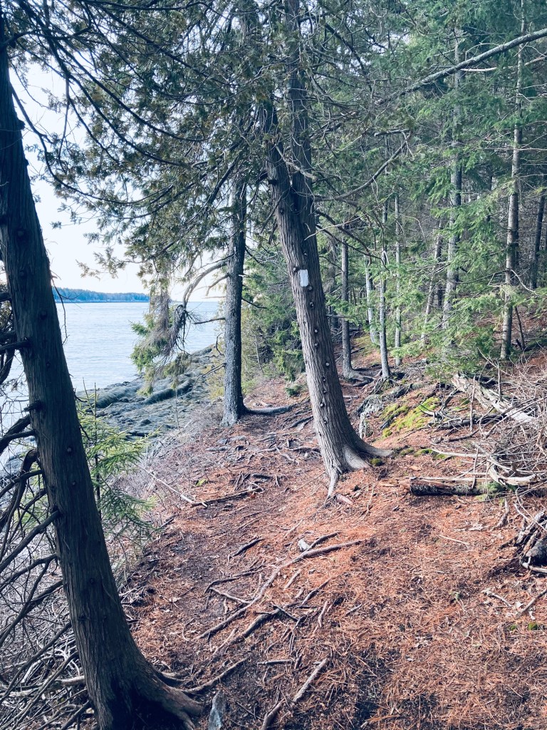
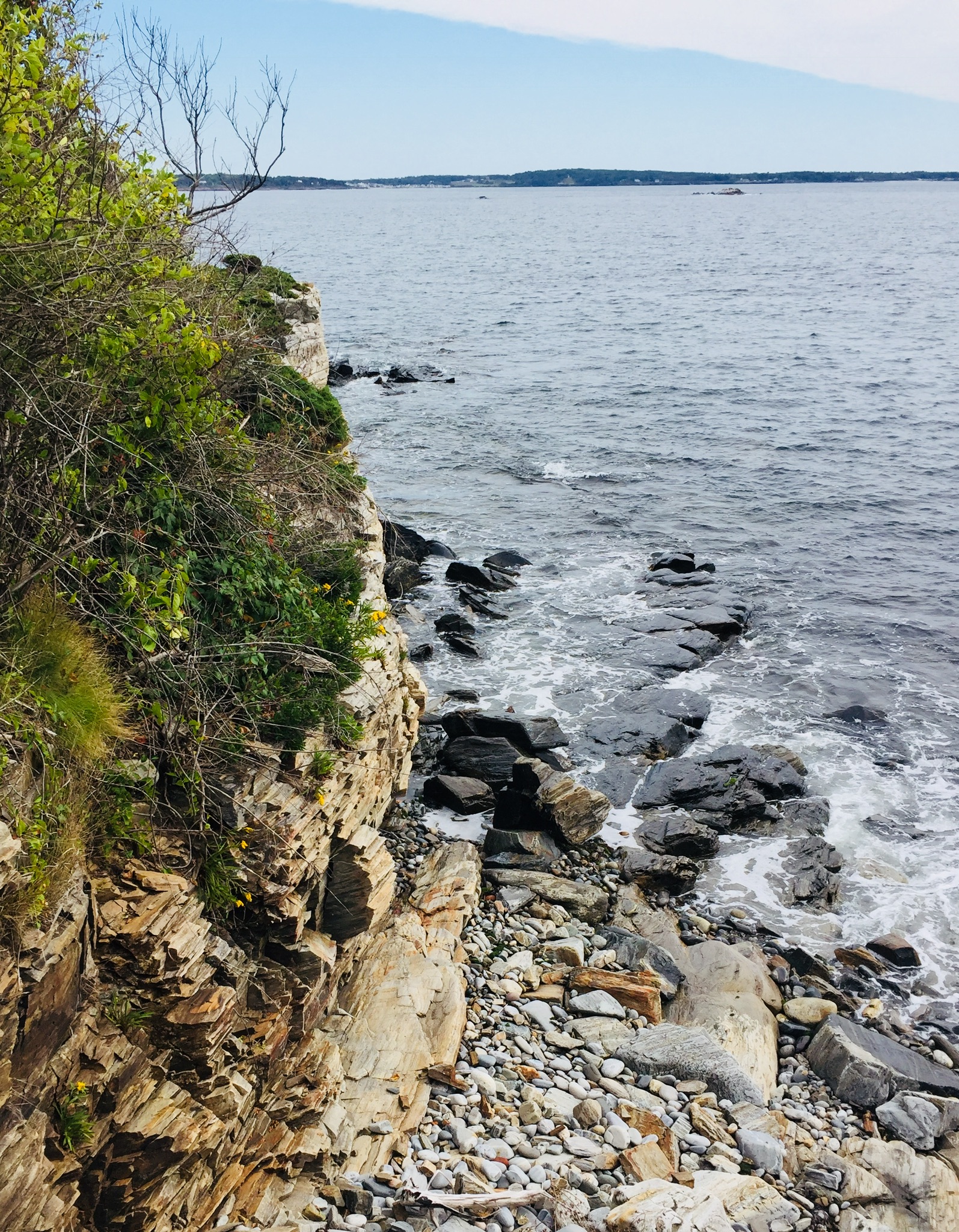
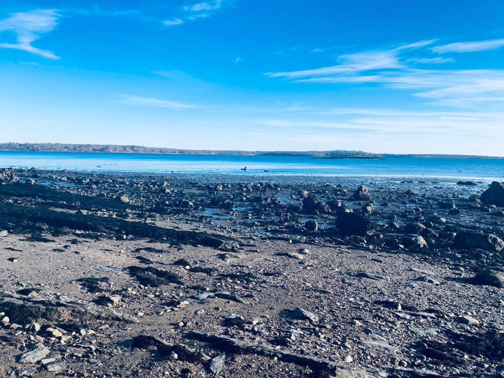
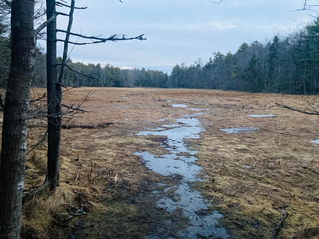
The Cliff Trail in Harpswell is an approximately 2.3 mile loop, with expansive views of the Long Reach, a long finger of a bay extending from Casco Bay inland. The popular trail, with parking at the Harpswell Town Office on Mountain Road, is well-marked and maintained by the town of Harpswell (see printable map and description here at town website). I started the white-blazed trail clockwise at sunrise on a mid-January morning. It was dark and a little muddy, with plenty of roots to trip over, but no snow had accumulated, and no traction devices were necessary. Strawberry Creek, to the west of the trail, narrows to a quiet, scenic cascade, and the trail turns inland.

Cliff Trail, Harpswell, ME
Continue reading

Hadlock Community Forest

Hobb’s Brook Trail, Hadlock Community Forest, Falmouth, Maine

The Hadlock Community Forest in Falmouth, Maine, is accessible primarily from a small parking area near the end of Hadlock Road with a map and kiosk. Information regarding the almost 300 acre property, with a loop trail of about 2.9 miles, can be found on the Town of Falmouth’s website for the forest. Many activities are allowed in the Hadlock Community Forest, including hunting in-season, so wear blaze orange during those times. I visited on a mid-March day, needing microspikes for the entire trail. For me, this was part of a longer 6.7 mile loop through a connector to the Rines Forest.

Highland Trail, Hadlock Community Forest, Falmouth, Maine
Continue reading

North Falmouth Community Forest

North Falmouth Community Forest at Blackstrap Road trailhead, Falmouth, ME

The North Falmouth Community Forest is over 400 acres of woodland reclaimed from pasture, with multi-purpose trails accessible from a small roadside parking area on Blackstrap Road (just south of the Happy Cats sign). Close to five miles of lightly-trafficked trails connect (across Blackstrap Road) with the Blackstrap Hill Preserve to the east and with Lowell Preserve in Windham to the west. This being Falmouth, the trails are well-marked, with map kiosks and QR codes (open your camera on your smartphone and scan the barcode to get maps/info). Downloadable or printable maps are harder to come by – try Maine by Foot’s post or the All Trails app. For true map nerds, you can explore using Falmouth’s ARCGIS map site.

Hurricane Valley Overlook, Poplar Ridge Trail, North Falmouth Community Forest
Continue reading

Hamilton Audobon Sanctuary (West Bath, ME)

Mud flats of Back Cove from Red Trail, Hamilton Audobon Sanctuary, West Bath, Maine

The Hamilton Audobon Sanctuary, located near Foster Point in West Bath, Maine, contains about 93 acres of forest, marshes, and mud flats, with miles of looping trails surrounded by wide views of the New Meadows River and its Back Cove. Parking is located at 681 Fosters Point Road in West Bath, where there is a lot, map kiosk and composting toilet, open each day from dawn to dusk. Check out the map and guide at Audobon’s website (Note: dogs are not allowed at Hamilton Audobon). These trails are level, well-marked, and easy.

Light through the forest, Hamilton Audobon Sanctuary, West Bath, Maine
Continue reading

Devil’s Back Trail (Harpswell, ME)

Gun Point Cove from Devil’s Back Area trails, Harpswell, ME

The Devil’s Back Trail area in Harpswell, Maine, is another jewel managed by the Town of Harpswell. This rugged but narrow area straddles Route 24 on the way to Orr’s Island, with the east side overlooking Gun Point Cove, and the west on Long Cove. The Town of Harpswell has descriptions and a trail map here, and there is an excellent treatment of this hike in Maine Hikes off the Beaten Path.

Devil’s Back Area, Harpswell, ME
Continue reading

Cliff Walk at Prouts Neck (Scarborough, Maine)

Cliff Walk at Prouts Neck, Scarborough, Maine

(Check the website of the Prouts Neck Association for updates, as the Cliff Walk is currently closed. January 2024 storm damage resulting in pending repairs of up to $4 million, which won’t be complete until possibly 2025, according to a May 2024 Portland Press Herald article.)

If you like dramatic cliffs, ocean views, rocky beaches and stunning homes, this may be your walk! The residents at Prouts Neck in Scarborough, Maine harbor a secret gem in their gated community – but fret not – while the entrances are hidden and parking is complicated, it is still possible (and legal) to walk variations of the same 1-mile route that Winslow Homer did, even if you are not an “insider.”

This is definitely categorized as a Sunday stroll-type of walk, a walk with a good friend that you haven’t seen in a while or a lone walk with a camera or sketch book. The uneven terrain and sometimes narrow path demand a leisurely pace. The smell of rugosa roses, the salty ocean breeze and the lobster boats are center stage and require frequent pauses. The views are unbeatable. The only problem is logistics. Below we will describe how to safely and lawfully enjoy a hike in summer, or even winter, from the Black Point Inn (45 minutes to an hour) or a longer “lollipop” loop from Ferry Beach (3.7 miles, about an hour and a half).

Western Cove from Black Point Road, Prouts Neck, Scarborough, Maine
Continue reading

Mackworth Island (Falmouth, ME)

Halfway Rock and Great Diamond Island from Mackworth Island, Falmouth, ME

Mackworth Island, connected to the Falmouth mainland by a causeway off Andrews Avenue, is a State Park donated to the State of Maine in 1946 by Governor Percival Baxter for state public purposes and “as a sanctuary for wild beasts and birds.” The island, which also contains the Baxter School for the Deaf, is open daily 9 am to sunset. Parking is limited, so have a backup plan (the nearby Gilsland Farm Audobon is nice), or be prepared to wait. The visitor fee is currently $3 for Maine residents, $4 for non-Maine residents, and $1 for non-resident seniors and children 5-11 (Maine residents over 65 and children under 5 are free). An outhouse is available by the parking lot.

Mackworth Island, Falmouth, ME
Continue reading

Mount Will (Bethel, ME)

Icicles on the Nature Trail section of Mt. Will Trail, Bethel, ME

Mount Will (1,726 ft), which spans across the town lines of Newry and Bethel, Maine is a lesser-traveled peak, accessed through a loop trail, with a small parking area across the road from the Town of Bethel transfer station. This trail, marked with bright blue blazes, was developed by the Bethel Conservation Commission, and is maintained by the Town of Bethel. Detailed description can be found in Maine Hikes Off The Beaten Path or the AMC Maine Mountain Guide.

Androscoggin River Valley from North Ledges, Mt. Will Trail
Continue reading

Pleasant Hill Preserve (Scarborough, ME)

Eleanor’s Trail, Pleasant Hill Preserve, Scarborough, ME

Tucked between the Pleasant Hill neighborhood and the Rachel Carson National Wildlife Refuge, Scarborough’s Pleasant Hill Preserve is 135 acres of land, with over 1.5 miles of trails, held and maintained by the Scarborough Land Trust (SLT). No hunting or bicycles are allowed on the trails, dogs must be leashed, and the .25 mile Eleanor’s Trail is ADA accessible. The trailhead, at 270 Pleasant Hill Road in Scarborough, has year-round parking and a map kiosk.

Swallow Barn, and intersection with Monty’s Trail, Pleasant Hill Preserve, Scarborough, ME
Continue reading

Black Cat Mountain (Poland, ME)

Access road to the summit of Black Cat Mountain, Poland, Maine.

This easy mountain hike, actually more of a road walk to a hilltop where is a cell tower, made for a simple First Day 2021 winter stroll. Black Cat Mountain (820 ft) in Poland, Maine (not to be confused with the larger Black Cat Mountain in Baxter State Park), is accessible from North Raymond Road, where a small gated road marked with yellow cell tower signs and the number 72 has limited parking (with overflow on the road’s shoulder).

Afternoon light through the trees, road to Black Cat Mountain, Poland, ME.
Continue reading