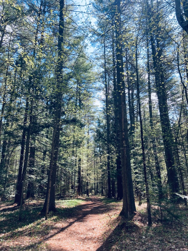
Beginning of Mount Chase Trail on Mountain Road, Mt. Chase, Maine
Mount Chase (2,440 ft) commands views of northern Penobscot County, including the peaks of Baxter State Park to the west, and the Shin Ponds. The mountain, and subsequently the town in its shadow, were apparently named after a man who came as an agent for the state to prevent timber thieves. To get to Mount Chase, head north from Patten, and make a difficult hidden turn onto unpaved Mountain Road off Route 11. You will pass some structures, logging roads, a whimsical wooden carving of a Sasquatch, and turns for ATV trails, as well as some vistas to the right. The road gets rockier the further in that you go, and the parking area is at a small clearing with a picnic table, a little over 2 miles in. I navigated using AllTrails, and it took me just shy of two hours to make the 3.4 mile out-and-back on a cloudy mid-September morning. Maps and description are available in Hiking Maine and Maine Hikes Off the Beaten Path.
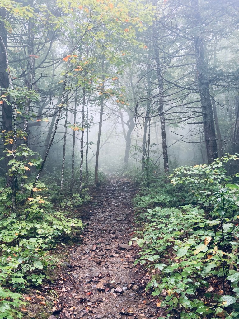
Mount Chase Trail, Mt. Chase, Maine
The trail doesn’t start in that clearing next to the picnic table, it starts at a small wooden handwritten sign just a little farther down the road. The blue-blazed trail began slightly uphill, rocky and wet, resembling a stream bed, with some ATV tracks in muddy spots. At about a quarter mile, the grade flattened out some, which had the effect of drying it, as well. The incline then grew a bit steeper, and crossed another overgrown road. At about four-tenths of a mile, the foot trail split off to the right, with a slope steeper and rockier than most ATV’s would be comfortable handling, then quickly resumed its confluence with the ATV trail.
I first discovered Grand Lake Stream and the Little Mayberry Cove Trail years ago through an August trail run sponsored by Baxter Brewing and Downeast Lakes Land Trust. As young kids, my siblings and I had splashed, played and been ravaged by horseflies in the shallow, rocky waters of the Machias River, and never knew a small town was just up the road a few miles. The Machias River Public Lands off Route 9, full of wildlife, fishing spots, campsites, blueberries, and blackberries, give way to bumpy logging roads leading north to Grand Lake Stream, which is a little under 2 hours east of Bangor, and also more commonly accessible from turning west off U.S. Route One near Indian Township. In mid-August, I came back to this area of Washington County to check out the Little Mayberry Cove trail at a hiking, rather than a running pace.
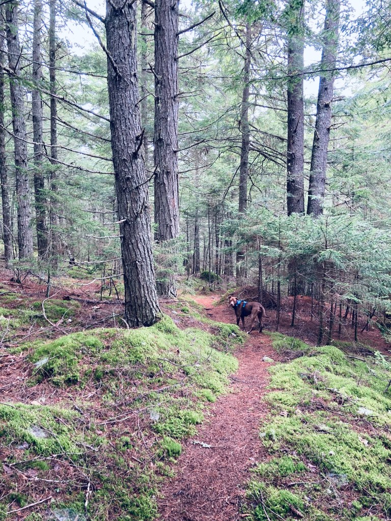
Little Mayberry Cove Trail, Grand Lake Stream, ME
Over the years, the Downeast Lakes Land Trust (DLLT) has preserved large amounts of land and water, and now manages the giant 57,703-acre Downeast Lakes Community Forest, which includes Wabassus Mountain. Their excellent website has hiking maps and descriptions here, and you can also read a detailed description of the Little Mayberry Cove hike in Maine Hikes Off the Beaten Path. The important part is to do your research and downloads before you arrive, as you won’t find much in the way of cell service in Grand Lake Stream.
Little Mayberry Cove Trail, Grand Lake Stream, ME
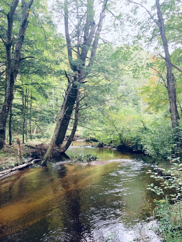
The Little Mayberry Cove Trail runs along the southeast shore of West Grand Lake, and parking, trail maps, and a toilet are available at the town boat launch, right next to the dam. The trail itself is 2.5 miles out and back, but navigating via AllTrails, we (husband/wife and Pig the dog) completed a loop using Daugherty Ridge Road of about 6 miles, which took us just under two and a half hours. To get to the trailhead, follow signs leading along Shaw Street, the road next to the lake, then uphill and right (about 1/3 mile) onto the trail, which is attractively marked along the way by individual medallions with silver pines in a blue circle. The trail winds over rolling terrain, with plenty of roots and rocks to hop over, small brooks, spur/side trails and openings in the trees to view the lake.
View of Munson Island on West Grand Lake from Little Mayberry Cove Trail, Grand Lake Stream, ME
We saw brightly colored and oddly-shaped mushrooms and lichen, but no other people on the trail, maybe because we were moving slightly ahead of an impending thunderstorm. At one point, a large bird took off and moved loudly through the thick forest, but we never saw it well enough to identify it. The final overlook of the lake had a nice bench to sit on and watch the wide, flat water. We emerged from the trail onto a logging road, and curved back around Daugherty Ridge Road, mostly uphill, to the trail connecting back to our start point. A good place to cool off, as well, with a swim at the town beach (no dogs, though). Not much in the way of amenities in Grand Lake Stream, but its Pine Tree Store has good food served from a lunch counter, cold drinks, ice cream and more.
West Grand Lake from Little Mayberry Cove Trail, Grand Lake Stream, ME
(Disclaimer: This post contains affiliate links, and as an Amazon Associate Hiking in Maine blog earns from qualifying purchases.)
Westbrook, with its proximity to Portland and its gritty mill background, does not instantly come to mind when thinking about hiking in Maine. But Mill Brook Preserve is a 130-acre section of delightfully unlikely green space in Westbrook along Mill Brook, bounded by Route 302 and Methodist Road. The six miles of trails in the preserve, suitable for hiking, mountain biking, and snowshoeing, can be accessed from four different trailheads. Leashed dogs are welcome, as long as owners pick up after them. The best information and trail map can be found at the website of the Presumpscot Regional Land Trust, which holds this land and coordinates the 28-mile Sebago to the Sea Trail.
Mill Brook Preserve, Westbrook, Maine
I recently re-visited this Preserve in late September, taking a leisurely north to south lollipop loop from the north trailhead at 302 and Methodist Road down to the Southern Loop, with Pig the dog, making for a 6.45 mile hike taking a little under three hours. I’m sure that you could extend this mileage by adding on a side trail or two, but this route stuck to the main attraction, which is Mill Brook. It’s truly impressive that you can find a path through the woods this long in the greater Portland area.
Mill Brook Preserve, Westbrook, ME
In late May and early June, alewives migrate from Casco Bay upstream in the Presumpscot River, then to Highland Lake through this narrow brook, drawing visitors to the flashing, silvery spectacle. Due to the variation in the flow, breadth, and depth of the Brook, two viewing areas (one north, one south) are identified on the trail map for maximum observation of the alewives’ run.
Mill Brook Preserve, Westbrook, Maine
The Northern Fish Viewing Pool is closest to the MAGAN/Willow Dr trailhead, and the Southern Fish Viewing Pool is by the Methodist trailhead. A new bridge connects the southern end of the east side trail to the Perry Court trailhead, avoiding a previously muddy crossing, and this Southern Loop also includes posted Scavenger Hunt signs for kids – you can find the educational flyer and scavenger hunt at the Explore Mill Brook page.
Flora and fauna, Mill Brook Preserve, Westbrook, ME
Alewives are not the only wildlife to be found in the forest valley of Mill Brook Preserve. The Preserve abounds with life, from beautiful and unique insects to small mammals and birds, to wildflowers and vines hanging with Concord grapes. These birds and wildflowers are particularly abundant in the open spaces created by power lines and ATV trails that briefly interrupt the forest. One one trip in the early fall, I saw a handful of garter snakes sunning themselves on the sandy trail near the Perry Court trailhead. On my recent mid-September trip, I saw and heard cardinals, northern flicker, a phoebe, dark-eyed junco, blue jay, sparrows, and chickadees.
Mill Brook Preserve, Westbrook, ME
The mosquitoes and biting flies can be intense in the early summer, especially in the evenings. The trails are quiet and mostly bug-free in the fall, and the spacing of the trees in the young forest creates a patchwork of light and foliage. The Presumpscot Regional Land Trust also opened (in October 2019) a new 1.5 mile loop trail through 32 acres of forest in Mill Brook Preserve South, accessible from a parking area at Millbrook Estates off East Bridge Street in Westbrook. This southernmost trail of the Preserve does not currently connect with the northern side.
Afternoon light, Mill Brook Preserve, Westbrook, ME
The trails are not difficult, overall, but the narrow, winding path up and down ridges in the middle section between the MAGAN and Methodist trailheads might challenge some hikers. Thankfully, the trails provide enough variety that this should not preclude hikers of any ability from enjoying this suburban forest oasis. One suggestion is to pick a theme – for example, the sheer number of fern types is incredible, and counting the different kinds could sustain an entire hike. Navigation along the trails is also forgiving and self-correcting, with maps posted at critical intersections throughout the Preserve. Mill Brook Preserve in Westbrook, ME, is an unexpected swath of forest, water, and wildlife in the Portland metro area, with six miles of trails and activities for everyone.
Pig explores a bend in the river, Mill Brook Preserve, Westbrook, Maine
Mowed Path, Fields Pond Audubon Center, Holden, ME
The Fields Pond Audubon center is a 229-acre sanctuary in Holden on the shores of Fields Pond. Trails are free and open to the public year round, dawn to dusk, and dogs are not allowed. In mid-August, I took a loop of the outside perimeter of Fields Pond by using the Mowed Path behind the Visitors Center, crossing the 300 foot bog bridge to the Lake Shore Trail, to the Beechwood Trail, then back on the Ravine Trail. This relatively easy loop of about 2 miles took about 47 minutes. I navigated using AllTrails, and trail maps are available on the website of the Fields Pond Audubon Center The trails are also well-marked and self-correcting, as prominent intersections are marked alphabetically.
Lake Shore Trail, Fields Pond Audubon Center, Holden, ME
I heard catbirds almost immediately, calling through the wide open fields covered with goldenrod, thistle, Queen Anne’s lace, and other wildflowers, attended by Monarch butterflies and many other insects. I continued left over the bog bridge to the Lake Shore Trail, stopping to let pass a sizable group of young day campers. The forest of the Lake Shore Trail quickly opened up to the shore of Fields Pond, where people were enjoying recreation opportunities like fishing and sailing. Maine Department of Inland Fisheries and Wildlife lists Fields Pond as a popular place to catch pickerel and perch.
View of Fields Pond from Lake Shore Trail, Fields Pond Audubon Center, Holden, ME
At the letter “E” on the trail, I turned up and left to follow the blue blazes of the Beechwood Trail. The slope of this trail was slightly more challenging than the level grade of the Mowed Path and Lake Shore Trail, and wound uphill through a relatively open forest with many signs of recent trail work. Crows called throughout the piney trees, which gave way to the trail’s tree namesake, as well as numerous oak and birch. This deciduous forest quickly turned to marsh and swamp, and an American Goldfinch sang me through this portion, where there were ample deer tracks splashed through the mud.
Bright purple fungus, Beechwood Trail, Fields Pond Audubon Center, Holden, ME
The chattering of gray and red squirrels took over for the Goldfinch, and I picked my way through a host of ferns, and more swampy, low-lying areas, before I reached the intersection with the connector trail to Hart Farm Trails (conveniently marked with an “H”). I turned left to head back on the Ravine Trail toward the Nature Center. This portion of the trail was wide and covered with soft pine needles. At the intersection marked “G,” I turned left again to stay on the Ravine Trail as it worked its way downhill towards the Nature Center. At “C,” I turned right, and took rough stone steps down at the intersection of the Brook Trail to stay on the Ravine Trail, continuing the downward walk back to the parking area.
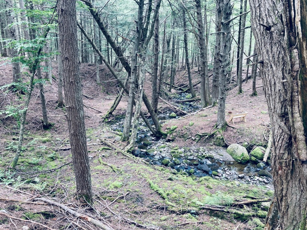
Stream running alongside Ravine Trail, Fields Pond Audubon Center, Holden, ME
Overlook to the south on Bald Bluff Mountain, Amherst, ME
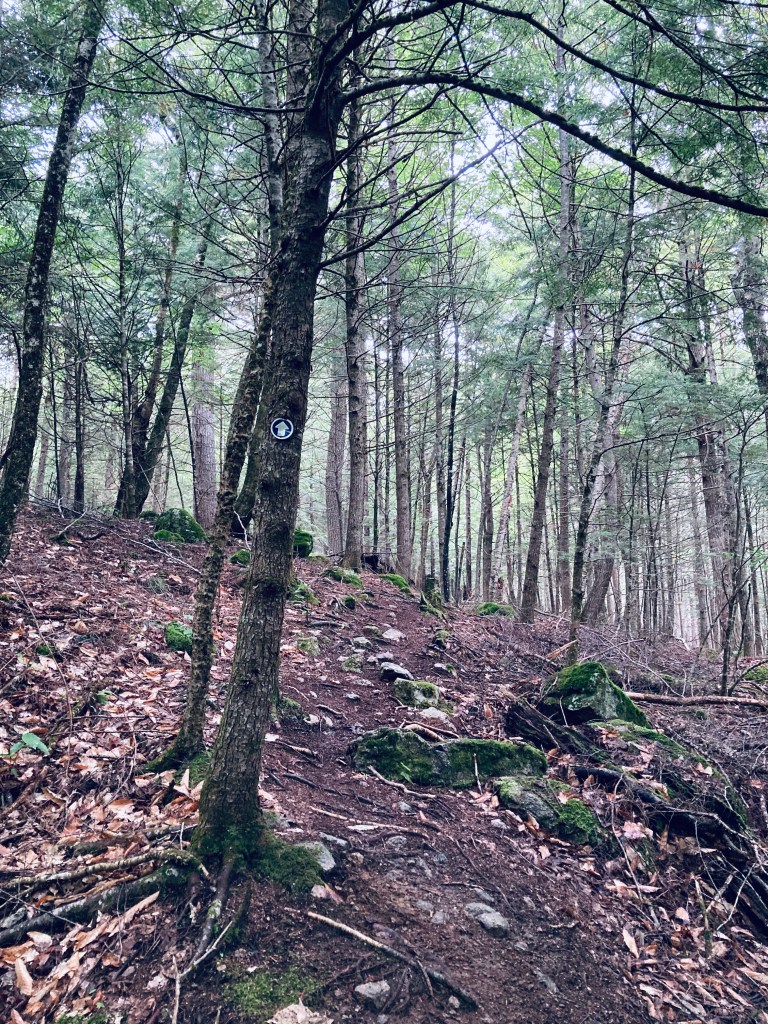
Bald Bluff Mountain (1,011 ft) is located within the beautiful Amherst Mountains Community Forest, a Public Land reserve of almost 5,000 acres, located east of Bangor in rural Hancock County off Route 9 (the Airline) on the way to better-known Downeast destinations. The day after hiking the Partridge Pond and Ducktail Pond Loop in mid-August, I again took Pig the dog up Bald Bluff Mountain, a lollipop loop of about 2.25 miles which we did in about an hour and fifteen minutes. As usual, I used AllTrails to navigate, and there is a thorough description and map in Dog-Friendly Hikes in Maine (pets under control are allowed). The state of Maine has a comprehensive map and guide to the Amherst Mountains Community Forest, including campsites and the Partridge and Ducktail Ponds hike, here. Again, the turn off Route 9 onto Ducktail Pond Road (22-00-0 road), marked by a blue Amherst Public Lands sign, is a tricky hairpin off a busy road from either direction.
Pig inspecting moose droppings, Bald Bluff Mountain Trail, Amherst, ME
The road is a typical logging road, dirt and gravel with some washouts and protruding rocks, and when I used the road this day, there was someone using heavy equipment to grade it, which made the ungraded portion a bit like the surface of the moon. It would be slow going in a low-clearance vehicle. The Bald Bluff parking area is about 6 miles from Route 9 – Google Maps will likely take you in from the north (from the direction of Sunkhaze Meadows NWR in Milford and/or Stud Mill Road) on the 22-00-0 road, which is another access point. I made some errors at the beginning of our hike, by following a grassy, overgrown woods road/biting insect nursery north of the parking area. The actual trail is just south (downhill) of the parking area, marked by a small brown “Trail Head” sign on a tree. This required me to do some bushwhacking to get back on track, and is reflected in the mileage. We were not the only ones to use this route, as evidenced by some of the comments on the Maine Trailfinder site, and generous piles of moose droppings on the disused road.
View just shy of summit, Bald Bluff Mountain, Amherst, MEContinue reading →
Casco Bay from North Loop Trail, Wolfe’s Neck Woods State Park
(Note: as of July 2025, ongoing construction affects accessibility and capacity at Wolfe’s Neck. You can receive park Park & Trail Conditions by sending a Text WOLF to 888-514-7527.)
For good reason, Wolfe’s Neck Woods State Park is a popular year-round destination for both Mainers and visitors. Close to the shopping mecca of Freeport and L.L. Bean’s adventure excursion launchpads, the state park can sometimes become crowded with people seeking an accessible outdoors spot (it’s listed as #1 of 21 things to do in Freeport by TripAdvisor). There are, however, quiet parts of this over 200-acre coastal sanctuary. A detailed map and description can be found in the worthwhile Falcon Guides’ Hiking Maine, or free, along with a calendar of activities, on the Wolfe’s Neck Woods State Park website. Entry to the park, which is open for day use, is $4 for Maine residents (free for veterans). Dogs must be leashed, and owners must pick up after their pets. No bicycles are allowed on the Wolfe’s Neck hiking trails. Restrooms are located near the parking area, and picnic areas are interspersed through the park nearby.
Googins Island from shore by Casco Bay Trail, Wolfe’s Neck Woods State Park
On a busy weekend at the beginning of July, we used the White Pines Trail, North Loop Trail, Casco Bay Trail, and Harraseeket Trail to make an easy 3 mile perimeter loop, taking about an hour and a half to enjoy, and as usual, navigating using the AllTrails app. As soon as we left the parking area via the White Pines Trail, we began to hear a variety of birds, including red-eyed vireo, dark-eyed junco, black-throated green warbler, and inland, a broad-winged hawk. On the shoreline, we heard and saw osprey, including one returning to the treeline with a large fish. Further along, on the Harraseeket Trail, we heard the distinctive song of a hermit thrush, chipping sparrows, blackburnian warbler, and a blue-headed vireo.
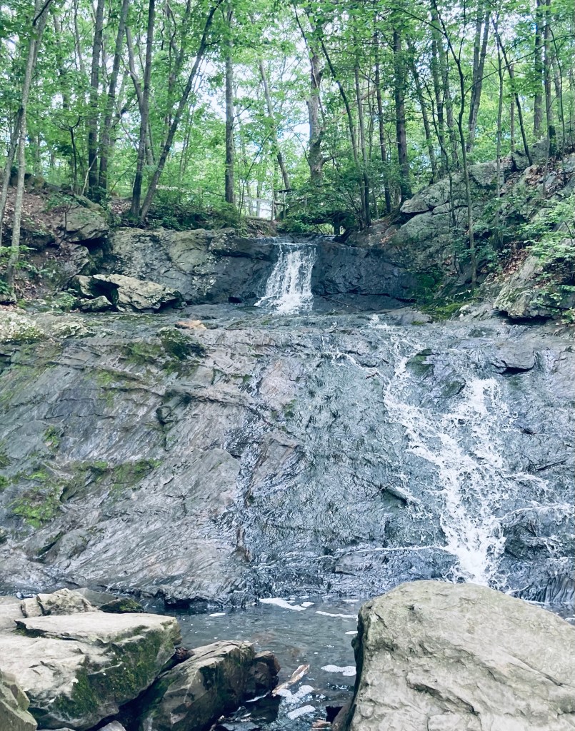
We’ve explored Portland’s Fore River Sanctuary many times in different seasons and conditions. This preserve, open from dawn to dusk and maintained by Portland Trails, is 85 acres of nature inside Maine’s largest city. Fore River Sanctuary contains a waterfall, as well as a lowland marsh area popular with bird watchers, and is a favorite with dog walkers. It is in fact, featured in the book Dog-Friendly Hikes in Maine, and dogs under control (voice or leash – we saw both) are welcome in the Sanctuary, as long as owners pick up after them. Regarding birds, we encountered a hardy birdwatcher braving morning bugs on a June day on the Forest City Trail (FCT) Canal Path, listening to red-winged blackbirds, song sparrows, and mockingbirds, and we saw many mallard ducks, crows, and a snowy egret.
Snowy egret and mallard ducks, Fore River Sanctuary, Portland, ME
The FCT Canal Path, covered in wildflowers and serenaded by birds, leads past a salt marsh to the alternate parking area on Frost Street at Maine Orthopaedic Center’s lot (parking available only in five marked spaces closest to Frost), and destinations beyond. Parking is also available at the end of Rowe Avenue, on Hillcrest Avenue (as of June 2023, this trailhead is closed due to city sewer work), across the street from the Westbrook Street trailhead, and in designated spaces on Starbird Lane. We’ve enjoyed an out-and-back lollipop loop to Jewell Falls from the Frost Street trailhead, mainly using the FCT, of about 3.2 miles.
Dog/crow encounter, Fore River Sanctuary, Portland, MEContinue reading →
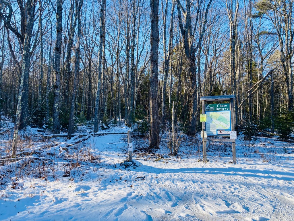
Chase Reserve is a 194 acre easement on Bunganuc Road in Brunswick, Maine, next to the Freeport line, managed by the Brunswick-Topsham Land Trust. This Reserve, known as a birding hotspot, is a part of the largest remaining unfragmented coastal forest block in Cumberland County, named for former owner and Revolutionary War soldier Benjamin Chase (buried in a cemetery on the property). Due to the season and the time of day, we only heard jays and chickadees, but this coastal spot hosts over seventy migratory and resident bird species.
Peltoma Woods is located in Pittsfield, on the Town Farm Property along the banks of the Sebasticook River. On a mid-May morning, I took the easy Outside Loop Trail counterclockwise from the trailhead kiosk, located at the DriftBusters Snowmobile Club on Peltoma Avenue. A sign on the kiosk (which has a trail map and other info) warned of vernal pools and wet areas, which proved quickly true, with much rerouting needed around dark pools, their surfaces cloudy with pollen and amphibian eggs. For a much deeper dive, including other nearby hikes and refreshments, check out this Press Herald article regarding Pittsfield.
Sun through the treetops, Messalonskee Stream Trail, Oakland, ME
The Messalonskee Stream Trail is listed alternately as a 3.2, 4 mile, or 6 mile total out-and-back trail along its namesake in Oakland, Maine, open from sunup to sundown. Description and maps are available at the site of Kennebec Messalonskee Trails. I completed this trail in mid-November, and again in early May. On both occasions, they were lightly trafficked, with an emphasis on dog walkers. In November, a notice was posted for hikers to wear orange, due to archery season. In May, there was more mud, more birds, and the streams were running much faster.
Wooden bridge and fall leaves, Messalonskee Stream Trail, Oakland, ME
Parking is available in a small fenced-in lot off Kennedy Memorial Drive, just before the bridge next to the Oakland Town Office. An alternate start point is at the north end, off Rice Rips Road. This is a very quiet, accessible trail for being relatively close to I-95. The trail, constructed by the Maine Conservation Corps, emerges from a gap in the fenced area, and climbs to a ridge overlooking the river. On the opposite side of the stream are the castle-like ruins of the Cascade Woolen Mill, with graffiti and tumbling walls, reminiscent of a Stephen King story.