Stroudwater River, Stroudwater River Trail, Portland, ME
Stroudwater River Trail, part of Portland Trails’ extensive Forest City Trail network, is a 3.3 mile one-way (6.6 mile out-and-back) path beginning at Rivers’ Edge Drive, off outer Congress Street, that primarily follows the slow, muddy, meandering Stroudwater River where Portland meets Westbrook, crosses Spring Street, and ends at Smiling Hill Farm. This trail is popular with mountain bikers, trail runners and dog walkers.
Stroudwater River Trail, Portland, ME
The full trail (see Portland Trails’ page) is unavailable from November 1 to April 1, as the area west from Portland’s Blueberry Road to Westbrook’s Cardinal Street is closed in the winter as a deeryard to provide a winter habitat for these animals. Stroudwater Trail is an island of green in a fairly developed area of Maine, and the sounds and smells of industry and transit permeate much of the walk.
USMC Osprey flying over Stroudwater Trail, Portland, ME
The trail crosses underneath noisy I-95, and is flown over by thundering Jetport air traffic, but still maintains intervals of peace and quiet. On one late June day, we saw a U.S. Marine Corps Osprey vertical takeoff/landing plane doing test flights overhead.
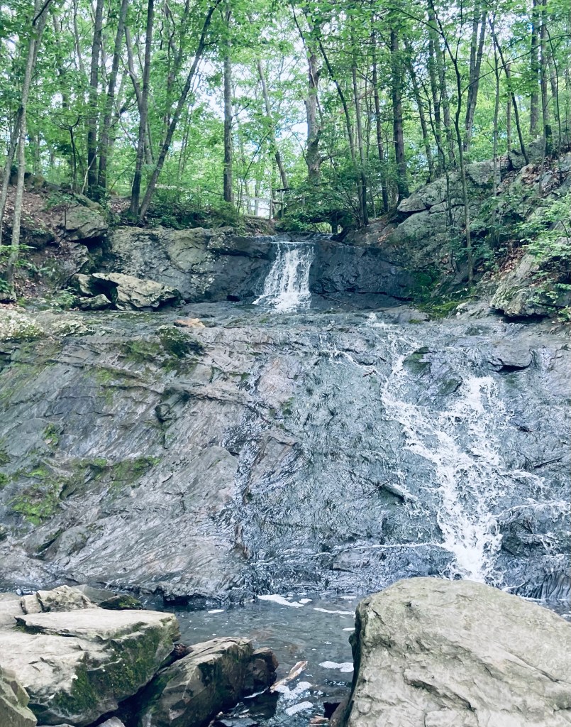
We’ve explored Portland’s Fore River Sanctuary many times in different seasons and conditions. This preserve, open from dawn to dusk and maintained by Portland Trails, is 85 acres of nature inside Maine’s largest city. Fore River Sanctuary contains a waterfall, as well as a lowland marsh area popular with bird watchers, and is a favorite with dog walkers. It is in fact, featured in the book Dog-Friendly Hikes in Maine, and dogs under control (voice or leash – we saw both) are welcome in the Sanctuary, as long as owners pick up after them. Regarding birds, we encountered a hardy birdwatcher braving morning bugs on a June day on the Forest City Trail (FCT) Canal Path, listening to red-winged blackbirds, song sparrows, and mockingbirds, and we saw many mallard ducks, crows, and a snowy egret.
Snowy egret and mallard ducks, Fore River Sanctuary, Portland, ME
The FCT Canal Path, covered in wildflowers and serenaded by birds, leads past a salt marsh to the alternate parking area on Frost Street at Maine Orthopaedic Center’s lot (parking available only in five marked spaces closest to Frost), and destinations beyond. Parking is also available at the end of Rowe Avenue, on Hillcrest Avenue (as of June 2023, this trailhead is closed due to city sewer work), across the street from the Westbrook Street trailhead, and in designated spaces on Starbird Lane. We’ve enjoyed an out-and-back lollipop loop to Jewell Falls from the Frost Street trailhead, mainly using the FCT, of about 3.2 miles.
Dog/crow encounter, Fore River Sanctuary, Portland, MEContinue reading →
Evergreen Loop Trail, Evergreen Cemetery, Portland, Maine
Evergreen Cemetery in Portland is Maine’s second largest, checking in at 239 acres. The combination of green space habitat and (relative) solitude make it a popular birdwatching and walking area, located directly behind the University of New England (UNE) Portland Campus. The small ponds at the northwest edge of Evergreen are places to observe tadpoles, frogs, newts, turtles, snakes, large snapping turtles, and waterfowl throughout the warmer seasons. In addition to the paved, gravel, and dirt roads of the cemetery itself, Evergreen is traversed by Portland Trails’ extensive network, including the 10-mile Forest City Trail, which runs from the Presumpscot River to the Stroudwater.
Ledges in Evergreen Woods, Evergreen Cemetery, Portland, MaineContinue reading →
With the temporary closure of schools and businesses, the uncertainty in the air, and the moratorium on group activities in many places, the universal mood seems to be a somber one, at best. But, with care, resolve, and education (try this article on social distancing), a more sanguine view can prevail. What is a healthy thing to do that requires relative isolation – six feet of separation with non-family members, and no direct contact with surfaces that might contain lingering viruses?
Six feet of separation is easy to maintain on a trail.
Hiking, in its many forms, needs no more cheerleading for its holistic wellness benefits. But getting outside for mental health has never been more important. Here in Portland, Maine, schools will be closed until at least the end of April, a stay-at-home order has been issued, and non-essential businesses are temporarily closing. These actions, and others, can all have degenerative ripple effects on time, and on physical and mental health, if we let them.
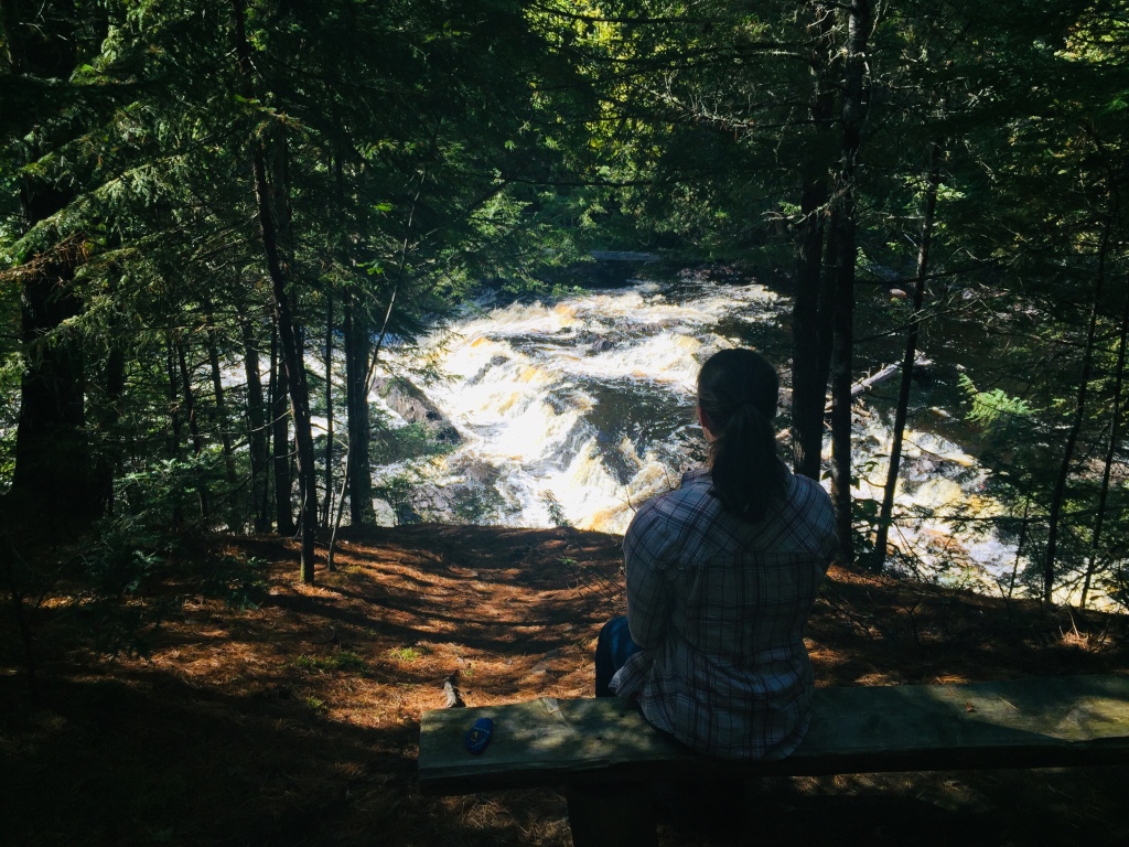
Observation bench, Mariaville Falls Preserve, ME
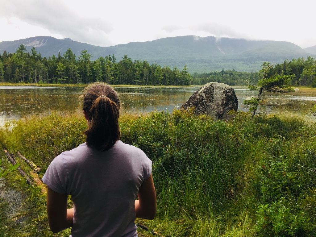
First, breathe. We were fortunate to be born in a country with the infrastructure and prosperity to get through this. Here in Maine, we are less-densely populated than most other places, surrounded by an embarrassment of natural riches in the form of the coast, lakes, and mountains.
Remember- these are close, and popular, and may be crowded. The Portland Press Herald also just published a list of wild lands for exploration during this strange time.
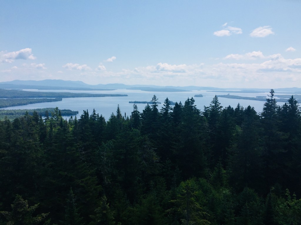
Looking across Elbow Pond to Mt O-J-I and Barren Mountain, Baxter State Park
Again, check state and local guidelines on the trails or parks you are using. Some may be closed due to COVID-19, some may just be closed to protect trails during mud season. The best source of information is the maintainer of the trails, whether that be a government agency, a municipality, a land trust, or a non-profit.
The point is not some Instagram-worthy photo opportunity, it’s fresh air and time in nature, so don’t sweat the surroundings. Baxter Woods or Evergreen Cemetery are great places to walk. If you can’t make it way out onto remote trails, there are other outdoor options. Last weekend, dad and daughter took advantage of the sunny weather, using Portland Trails and the East Coast Greenway to safely walk ten-plus miles to Wainwright Fields in South Portland.
This is not meant to be a flippant article, but suggestions specific to getting outdoors in the Portland area. People are deeply affected by this pandemic. Post-hike, consider getting takeout or delivery from a local restaurant – Portland’s Old Port has an updated list of businesses where this is available, as does Portland Food Map. The best place to look for where to help is at your friends and neighbors, but donations of money or time to places like Preble Street or national charities like the Salvation Army or Meals on Wheels can help those less fortunate.