Long Mountain (1,828 ft), located in Greenwood Maine, partially within the 12,000-acre Crooked River Headwaters conservation land, is accessed by a relatively recently completed lollipop-type loop trail, opened in the fall of 2021. We hiked this loop, listed as 5.5 miles, in early July. Given the many spur trails to overlooks, my recorded mileage was a bit longer, about 5.8 miles, for a little over two and a half hours. The Long Mountain Trail is accessed from a trailhead with a relatively large parking area off Vernon Street in Bethel (GPS is 1268 Vernon Street, Bethel, ME) and diverges to the left from Bacon Hill single-track biking trails. The size of the parking lot owes to its former role as a log yard.
Board walkway, Long Mountain Trail, Greenwood, ME
A trail map is posted to the kiosk at the parking area, but difficult to find online. The trail itself is very well-marked and maintained, and I used the AllTrails app to navigate. As much of the summer of 2022 has been, it was a hot day, and the forested trail offered shade through much of the hike. The first part of the trail moves over a series of boardwalks through some marshy areas, then crosses a logging road by Mill Brook. Here at the edge of the road, we saw a large, tattered Luna moth near the end of its lifecycle.
Mill Brook, Long Mountain Trail, Greenwood, ME
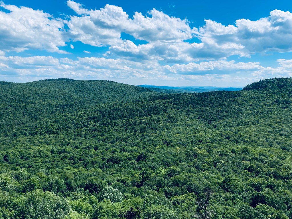
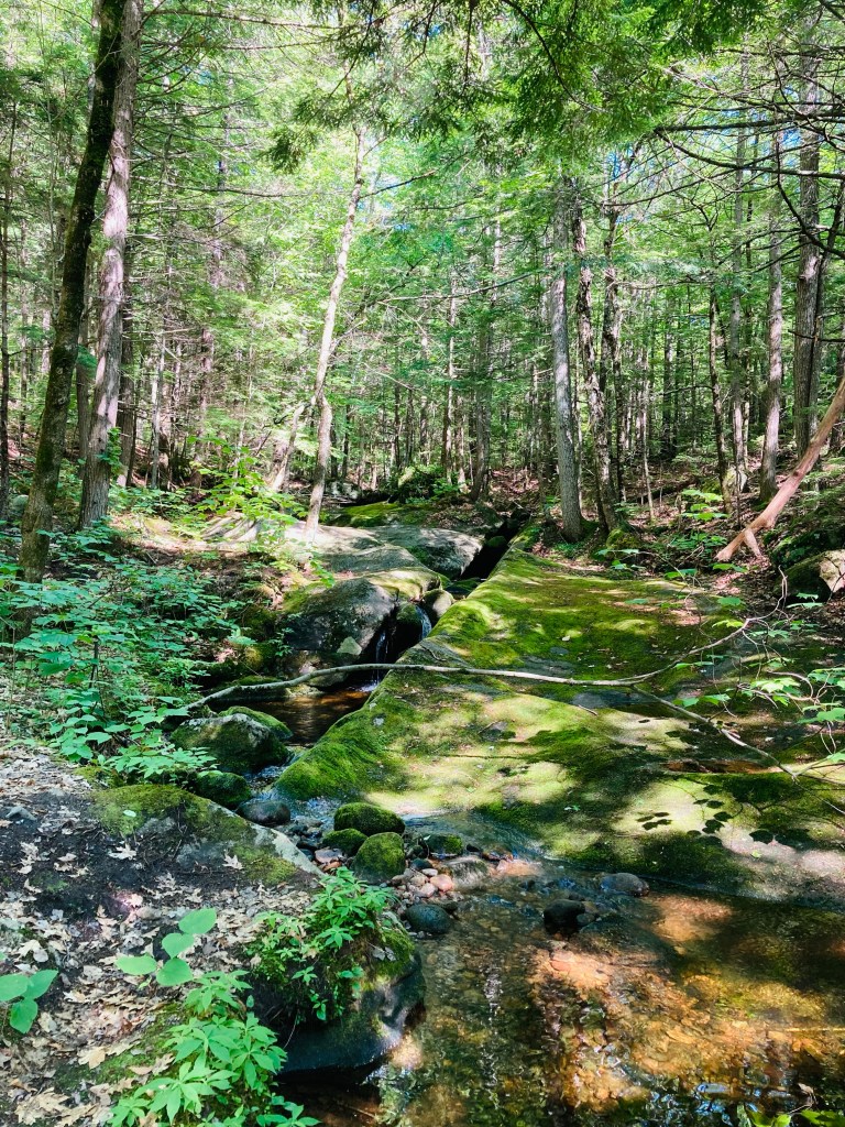
The trail then moves upstream past clear, cool Mill Brook, which is covered in moss and flows through large rock slabs. At about .9 miles, the trail splits into a lollipop loop, which we took clockwise, heading up first to the North Ledge. This is a challenging hike, heading steadily uphill until levelling out a bit, and becoming a ridge hike between the North and South Ledges. Long Mountain does not have a cleared summit with views, but the viewpoints from the ledges are outstanding.
McGaffey Mountain (1,288 ft), named for 19th century Mount Vernon resident Charles McGaffey, is the highest point in Kennebec County, and the trail to its wooded summit shares a Kennebec Highlands parking area in Rome with the trail to Round Top Mountain. The “A” Trail, a multi-use trail, diverges from the trail to Round Top a little less than a quarter mile in, in an unsigned left turn (Round Top Trail, however, is marked). It was quiet on the early July morning I visited, and I only saw two others, who were riding mountain bikes.
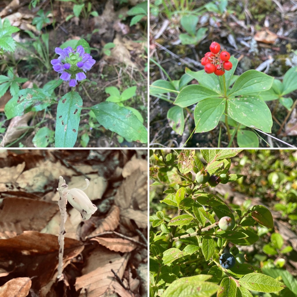
Flora along the A Trail, McGaffey Mountain, Rome, ME
I navigated using AllTrails, but a printable trail map is available from the 7 Lakes Alliance, which maintains the trails. A map is also inside the Maine Mountain Guide. AllTrails listed this hike as “Hard,” which relates to the distance (9.6 miles) and time, rather than the elevation. The A Trail is mostly unmarked, but provides a clear path, shared by mountain bikes. Like any mixed-used trail, it is graded relatively flat, and made to move quickly. At just under a mile, the trail crosses a logging road or ATV trail, and at about 1.3 miles, another old logging road, and passes over a moss-covered brook.
Viewpoint from A Trail, McGaffey Mountain, Rome, ME
The series of switchbacks heading up the mountain coincided with the beginning of hermit thrush songs. At about 3.3 miles, there is an open overlook looking east over Long Pond. The trail proceeds over rolling terrain, including sunlit boulders and blueberries, until reaching the summit, marked by the wooden handle of a tool protruding from a rock cairn.
Map kiosk, Puzzle Mountain parking area, Newry, Maine
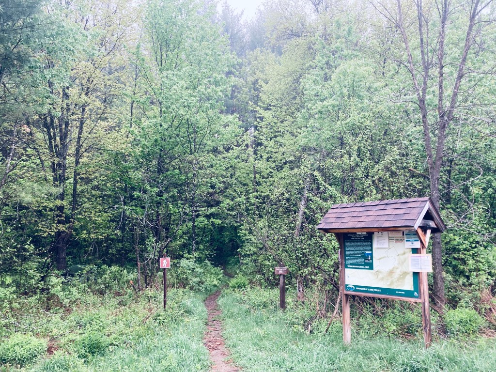
Puzzle Mountain (3,133 ft) in Newry, Maine, is a lollipop-style loop hike incorporating the Grafton Loop Trail and the Woodsum Trail, for an approximately 7.7 mile hike with expansive western Maine views, including Sunday River. The mountain is supposedly named after the discovery of a soft vein of rock on the mountain that was subsequently lost, making it a puzzle. Parking is available at a medium-sized parking area off Route 26, with a map kiosk. A map is available from the Mahoosuc Land Trust, which manages the 485 acres of Stewart Family Preserve land on which Puzzle Mountain sits. A detailed description is also available in the venerable Maine Mountain Guide.
Morning sun, Grafton Loop Trail, Puzzle Mountain
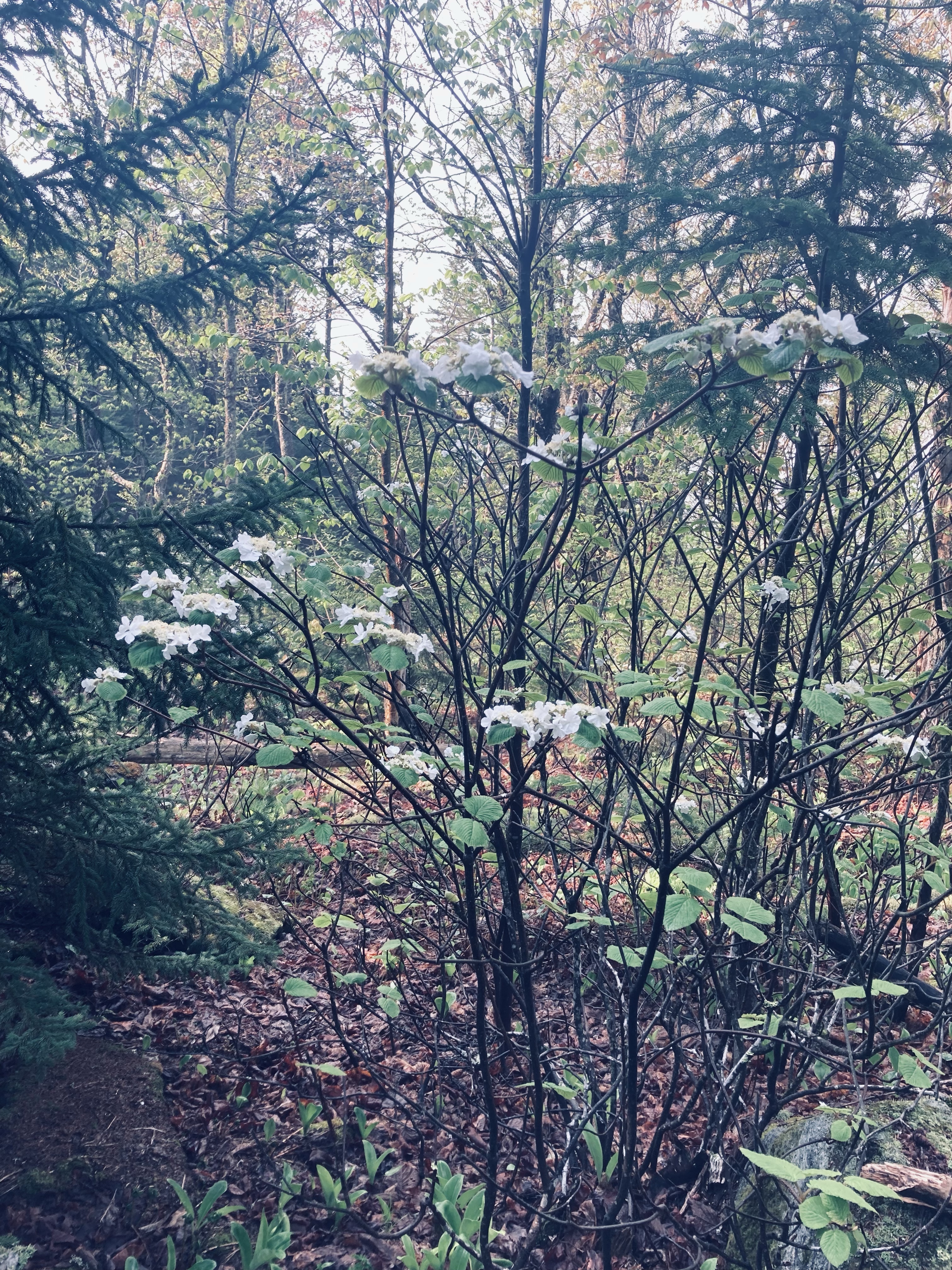
The blue-blazed trail crosses an ATV trail and then after about a quarter mile, a logging road, until beginning to climb by a small stream cascading down. Due to recent late May rains, the trail was slippery and the streams in the surrounding woods seemed to multiply. I knew this presaged a slippery trail with lots of bugs, and the clouds of mosquitoes were unrelenting. Clear spring streams criss-crossed the trail, which was a spooky green tunnel in the morning fog of beech leaves, birch, and hobblebush, with toads hopping out of the way.
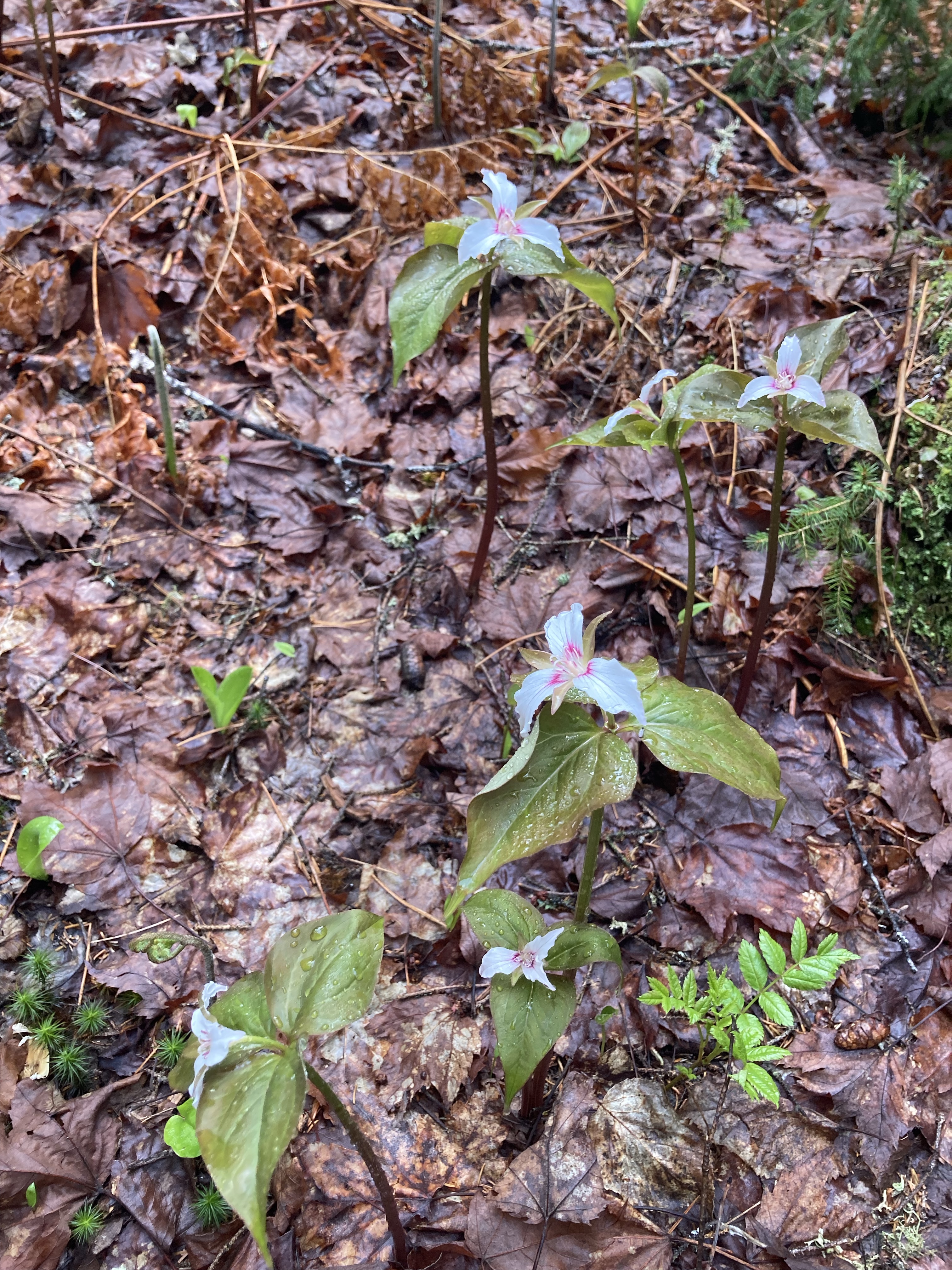
Spring Wildflowers, Puzzle Mountain, Newry, Maine
A Maine Appalachian Trail Club (MATC) register box was there to log the hike a little over 3/4 of a mile in. The sun began to light the way and changed the tunnel to an emerald forest, with trillium and other wildflowers dotting the sides of the trail, awaiting full bloom. This green deciduous forest ended abruptly as the trail circled a ridge with viewpoints over the valley surrounding the Bear River, switching to rocks, moss, and pine.
Reid State Park in Georgetown, Maine is at the southeast corner of the long coastal peninsula formed by the Kennebec River to the west and the Sheepscot River to the east. In 2015, Reid’s popular beaches were named #1 in New England for surfing by the Boston Globe. The fee for day use of Reid State Park, payable at the entry gate, is $6 for Maine residents, $8 for non-residents, and $2 for non-resident seniors. We visited at the tail-end of the winter season, enjoying the peace and quiet. As the parking lot at Todd’s Point was not yet open, we parked by the East Beach, and began our hike there, moving in an easy 4.8 mile clockwise loop covering Reid State Park’s best features in about two hours. The park does have a map, accessible from a link on the state park website. This map, though no doubt made available by a dedicated public servant, is terrible for hiking. First, know that the official map is upside-down, meaning north is at the bottom. Additionally, no trails are listed. Below is a screenshot of the correctly-oriented All Trails route we took, with helpful labels added by daughter.
The East Beach has a group picnic site overlooking the ocean, with a large shelter from the sun or inclement weather. Paths connect picnic sites, but to start our hike, we walked south along Griffith’s Head Road, crossing a small tidal inlet of the Sheepscot, where a red-breasted merganser rode the current foraging for food. We quickly arrived at Griffith Head, with the buildings shuttered for the winter (note: a pit toilet here was the only open winter bathroom). We walked down a stone staircase to Mile Beach, and the sun, sea air, and the sound of the waves filled the next mile of our walk along the sand.
Mile Beach from Griffith Head, Reid State Park, Georgetown, ME
The rocky promentory of Todd’s Point rises above the water, with a short climb yielding great views in all directions. Here, the bathing facilities were shuttered, as well, with the empty parking lots between Mile Beach and Half Mile Beach roped off until the summer season. We looked briefly at Half Mile Beach, then walked behind the dunes on a spur trail between the beach and the Little River, emerging with a long view towards Popham Beach.
Bridge across railroad tracks at Oak Grove Cemetery on Whiskeag Trail, Bath, ME
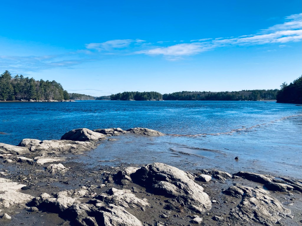
Thorne Head, the northern portion of Bath extending into the confluence of Whiskeag Creek and the Kennebec River, can be reached by foot from downtown Bath, over a Bath Trails and Kennebec Estuary Land Trust (KELT) network that is surprisingly wild for Midcoast Maine. On the first day of May, I created a 9.4 mile lollipop loop hike incorporating the Whiskeag Trail (see map here), Thorne Head Preserve’s Narrows Trail, Trail Connector, Overlook Trail, Ravine Trail (see map here), and an unmarked, unmaintained path leading back to the Whiskeag Trail, for a little over three hours of forest and water views and birds. All portions of the trails described are open from dawn to dusk, and leashed dogs are allowed. While the word sounds similar to “whiskey,” according to Bath Trails the trail takes its name from an Abenaki word meaning “a creek that runs nearly dry at low tides.” The Whiskeag Trail can be accessed from multiple points, including KELT’s Thorne Head Preserve, Sewall Woods, Oak Grove Cemetery, and McMann Athletic Fields. I chose to depart from the southern terminus, at the Bath YMCA, 305 Centre Street, where there is plenty of parking. The flat, wide pine-covered trail marked with blue blazes starts behind the YMCA and moves over a small ridge, where I heard the welcome morning call of a hermit thrush.
Beaver dam, Whiskeag Creek, on Whiskeag Trail, Bath, ME
Shortly after a marshy area, the Whiskeag Trail emerges at Congress Street at a pedestrian crosswalk by the Edward J McMann outdoor recreation area. The trail skirts the east side of the baseball diamond, then passes back into the woods. Across Old Brunswick Road, the trail curves left through Oak Grove Cemetery, crossing the railroad tracks over an attractive bridge dedicated to John C. “Jack” Hart, Jr. A short distance after the bridge, follow a small blue sign on the left marking the Whiskeag Trail, which winds down to Whiskeag Creek through a series of switchbacks. Bikes are allowed on this trail, and their frequent use can be seen through tracks in the spring mud. Here, the quiet creek was regulated by a sturdy beaver dam, and wider portions gave way to a marsh, where red-winged blackbirds called, and Canada geese sailed lazily away from my footfalls on shore.
Whiskeag Creek, Bath, ME
A mossy cliff and rock face marked the crossing of power lines, and in this gap sat a bench overlooking the creek. The spring return of birds made the Whiskeag marsh an improbably tableau, reminiscent of a children’s picture book, where geese, cormorants, herons, and ducks assembled in groups for identification. As the Whiskeag Creek got closer to mixing with the Kennebec, it grew flatter and wider. By overhanging rocks I noticed a safety feature of the trail, brightly marked alphanumeric emergency cards spaced out along the trail to tell someone in a medical emergency where they are, and how to communicate that quickly to emergency services.
Whiskeag Creek, Bath, ME
The trail then moves back inland through a pine and oak forest, winding across small plank bridges and over and around streams and vernal pools. A brief climb up and across a ridge by power lines takes the trail behind the Bath Public Works, then down and across Oak Grove Avenue. The Whiskeag Trail narrows and moves through a right-of-way next to residential properties, and then along the edge of a large horse farm, before crossing and briefly joining Whiskeag Road. On Whiskeag Road, walk east (right), until reaching the trail again on the left. Here, a large, boisterous pileated woodpecker was at the top of the telephone pole marking the re-entry to the Whiskeag Trail. Shortly after this point is a turn-off to the Sewall Woods parking lot, which you could use to break up this hike into chunks or start from a spot farther north.
Spring flowers on Whiskeag Trail near Sewall Woods, Bath, ME
A series of KELT digital scan signs marked Sewall Woods (see map here), each with facts about the natural surroundings from the Digital Trail Project and natural forestry methods. As I climbed through the more open forest, I saw purple spring flowers, and started hearing the sounds of gulls, signaling the approach to the Kennebec River area. The trail finds Whiskeag Creek again, skirting the water’s edge and muddy flats until a narrow point where you can see the confluence with the Kennebec. I began to hear people and dogs again, as well, as I approached the more-trafficked Thorne Head Preserve.
Whiskeag Creek and Kennebec River confluence from Whiskeag Trail, Bath, MEContinue reading →
Winslow Memorial Park and Campground, owned by the town of Freeport, Maine, is a 100-campsite campground, beach, and park on a narrow peninsula between the Harraseeket River and Casco Bay. During 2022, Winslow Park will be open for camping from May 26th through October 1st. A map of the property, including trails, can be found here. According to the Town’s website, the 90-acre park was a 1953 gift from Adelaide Winslow Harb in memory of her mother, Delia B. Powers Winslow with the understanding that the land and its buildings, “… shall be used as a public park and for public recreational purposes…” A day-use fee is charged during the summer months (Freeport Residents: $2.00 per person; Non-Residents: $3.00 per person). Day use hours are from 8 a.m. to 30 minutes after sunset for use of all facilities, including trails.
Reflection bench, Winslow Park, Freeport, ME
The trails at Winslow Park are named in a simple fashion, and we made a loop of the Scenic Trail and Self-Guided Nature Trail, using Winslow Park Way to connect these short loops, for a 2.5 mile hike lasting about an hour. The footing was a bit mucky on the late April day we visited, but it was a small price to pay to avoid crowds and fees and see the stunning coastal views. We started with the Scenic Trail, accessed from the parking lot to the immediate left of the entrance gate. A wide, flat trail encircles the small wooded peninsula jutting out into the Harraseeket River. We continued on Winslow Park Way, then veered left past a picnic area towards a sign marked “Trails” to rejoin the Scenic Trail, which then became the Self-Guided Nature Trail.
View of Harraseeket River and Staples Cove from Winslow Park, Freeport, MEContinue reading →
Tree swallows feeding by nesting boxes, Florida Lake, Freeport, Maine
Florida Lake Loop is part of a 167-acre property owned by the Town of Freeport since 2002, with trail maps available from the Freeport Conservation Trust. This 2.9 mile loop, using the orange Lake Loop and blue-blazed North Loop trails, skirts the edge of shallow Florida Lake, passing through wetlands and forest. The trails are accessible from a well-marked turnoff (blue sign for Florida Lake parking) off Route 125/Wardtown Road in north Freeport, leading to a small (six cars or so) parking lot. A map kiosk is located a short walk down the gravel trail towards Florida Lake (this map is faded, so the orange trail appears as yellow). This lake gets its name from the resemblance of its meandering finger-like shape to the familiar southern U.S. state.
Small pond off spur trail, Lake Loop Trail, Florida Lake, Freeport, ME
On the Easter Sunday we visited, mud season was very much in effect, necessitating waterproof boots and a certain agility in negotiating logs over standing water. The turtles sunning themselves on the small outlet of the lake gazed at us with exasperation, then slowly slide into the cold water, no doubt gurgling mild turtle swears as they dove. Nesting boxes line the lake itself, and tree swallows wheeled past our heads in blurs of blue-green and white, feeding and diving inside the small shelters.
Orange-blazed Lake Loop Trail, Florida Lake, Freeport, ME
Heading counter-clockwise around the orange trail, a small spur led to a secluded pond, and we doubled back through the muck to continue around Florida Lake. Princess pine lined the trail, and soon we encountered exotic-looking bright green and reddish skunk cabbage plants emerging in the wetlands to each side of the log bridges leading around the south side of the loop.
Skunk cabbage ascending, Lake Loop Trail, Florida Lake, Freeport, MEContinue reading →
The Ledges Trail is accessed from the Middle Fowler Trail/Nature Trail trailhead kiosk a short walk north from the parking area of the South Branch Pond campground at Baxter State Park. This hike in the lesser-traveled northern part of the Park is fully described in the Maine Mountain Guide., and BSP’s downloadable South Branch Pond map covers the area. A left (north) turn at the Ledges Trail intersection after a third of a mile will take you up a wooded blue-blazed trail to the ledges facing west.
Ledges Trail, Baxter State Park, Maine
On the way up, I disturbed a pair of large, colorful pileated woodpeckers, who voiced their collective displeasure, and flew off to other trees. The ledges provided a series of views over South Branch Ponds and South Branch Mountain and Black Cat Mountain, with changing September leaves.
Ledges Trail, Baxter State Park, Maine
The Ledges Trail exits the woods about a half mile north of the campground, with a walk along the dirt and gravel road leading back to parking or the campground. This was a short lollipop loop from South Branch Pond campground, maybe a mile and a quarter total. I was moving quickly due to impending thunderstorms on my trip, but this hike will not take more than thirty to forty-five minutes.
Ledges Trail, Baxter State Park, Maine
(Disclaimer: This post contains affiliate links, and as an Amazon Associate Hiking in Maine blog earns from qualifying purchases.)
I’m hard-pressed to think of anything that is as simultaneously calming and awe-inspiring as a waterfall. Maine’s rugged terrain, many wilderness areas, and large rivers make it a prime spot for waterfalls. There are many websites and apps that aggregate and “rate” waterfall hikes in Maine, New England, and beyond. We even added a Category to this blog for waterfall hikes, even though I still believe that the best waterfall views should come as a surprise. But our favorite travels, particular in the north Maine woods, Downeast, and western Maine, exist outside data service, and I have always enjoyed “analog” guidebooks, particularly those with maps and photos. Enter Falcon Guides’ Hiking Waterfalls Maine: A Guide to the State’s Best Waterfall Hikes, by Greg Westrich (Rowman & Littlefield, 2020).
We have used this guide for the last six months to enjoy waterfall hikes, from roadside stops to short hikes, to waterfalls embedded in longer multi-day hikes. The book lists sixty-seven distinct hikes with over one hundred waterfalls, with a map at the beginning to show the geographic distribution in Maine, as well as a trail finder listing waterfall themes (solitude, swimming, hikes for kids, etc.). Recently, on a trip to Baxter State Park’s northern half, I used the guide to hit four waterfalls (Howe Brook, Sawtelle Falls, Grand Pitch Seboeis River, and Shin Falls) inside and outside the park. Each hike has its own map, as well as any relevant details about the hike and important info like access to dogs and/or hunting.
Throughout the hike descriptions, Westrich describes the geology of the waterfalls, as well as river terminology – horsetails, pitches, plunges, and cascades are all covered, along with historical notes, primarily around Maine’s logging past. These details and the guide format allow visitors to appreciate, rather than compare, waterfall hikes, making this guidebook a must-have for navigating Maine’s waterfalls.
(Disclaimer: This post contains affiliate links, and as an Amazon Associate Hiking in Maine blog earns from qualifying purchases.)
Katahdin shrouded in clouds across Kidney Pond, Baxter State Park, Maine. Colt Point is visible to the right.
The hike to Lily Pad Pond, a short, relatively flat out-and-back from Kidney Pond Campground at Baxter State Park, is an easy walk that skirts Kidney Pond with some big-time views of Katahdin and Mt. O-J-I. I used it as a “last day at Baxter” hike, dehydrated, sore, but wanting to see more of this special place on the way out the Park Tote Road. Baxter State Park’s site has a downloadable map of the Kidney-Daicey Pond trails, but for a real full-day six-mile-plus amphibious adventure, including a canoe exploration of Lily Pad Pond, and a follow-on hike of Little and Big Niagara Falls, check out the hike description in the book Hiking Maine’s Baxter State Park.
Plank bridges toward Lily Pad Pond Trail, Baxter State Park, Maine
From Kidney Pond Campground day-use parking, head towards the Sentinel Link Trail, where you will quickly find views across Kidney Pond. This portion of the trail, hugging the shore of Kidney Pond, is the only part with tricky footing, as it is full of boulders and cedar roots. Shortly after the Celia and Jackson Ponds Trail departs to the right, there are more views of Kidney Pond Campground on the opposite shore, followed by the Sentinel Mountain Trail intersection, where you continue straight towards Lily Pad Pond. The .2 mile Colt’s Point spur trail leads to a Kidney Pond peninsula, accessible when I visited via a flooded area crossed by a ramshackle log bridge. This tenuous span was ultimately unsuccessful in keeping me above water, but the views from Colt’s Point were worth the wet socks.
View from Colt’s Point of Mt. O-J-I and Barren Mountain across Kidney Pond, Baxter State Park, Maine
Shortly after returning from Colt’s Point, turn off to the right onto Lily Pad Pond Trail, about .4 miles long, a moss-lined pathway with a slight downhill grade. A long section of plank bridging through a bog takes you to Beaver Brook, where there are three rental canoes ($1/hr or $8/day) available to take you to Lily Pad Pond, and keys can be secured from a ranger at Kidney Pond or Daicey Pond Campgrounds, as well as the Togue Pond Gate. Across Lily Pad Pond, at the east end, you can take the Windy Pitch Pond Trail to the Falls, walking parallel to the Appalachian Trail, on the opposite side of Nesowadnehunk Stream. I will definitely be using this trail-canoe-trail option on my next visit. The Lily Pad Pond out-and-back itself (including the Colt’s Point spur) was about 2.8 miles, which took me a little over an hour.
Canoe put-in on Beaver Brook towards Lily Pad Pond, Lily Pad Pond Trail, Baxter State Park, Maine
(Disclaimer: This post contains affiliate links, and as an Amazon Associate Hiking in Maine blog earns from qualifying purchases.)