Mowry Beach Trail from the Pleasant Street trailhead.
A short distance from downtown Lubec, the easternmost town in the U.S., Mowry Beach is a quiet 48-acre conservation area overlooking Deep Cove, Lubec Channel and Canada’s Campobello Island. This area, managed by the Downeast Coastal Conservancy (DCC), offers a .4 mile trail from Lubec’s Consolidated School on South Street to a parking area at the end of Pleasant Street, including a 1,700 foot boardwalk. The DCC publishes a map and brochure, available on their website.
View of Lubec village and the international bridge to Campobello from Mowry Beach.
We learned of this beach through a great Cobscook Trails Map and Guide published by Cobscook Trails, with hikes throughout the Cobscook Bay region, a free and widely available (at local businesses) pamphlet which I would recommend for anyone exploring the area. At the Pleasant Street end of the trail, which we accessed via a short walk from downtown, is 1,800 feet of shorefront along a sand beach. According to guides, ancient tree stumps can be seen along the lower portions of the beach at low tide, a forest that was present during an era with lower water levels.
On the October day we visited, seals were active, using the rapidly outgoing tide to move swiftly east at waterskiing speeds in the Lubec Channel in search of food. For sea-glass collectors, this working waterfront has a variety of shiny objects along the shore. During our walk, we also encountered two people helpfully picking up any garbage left on the beach.
Boardwalk on Mowry Beach Trail.
We turned into the trail, passing bright beach rose bushes. The trail and boardwalk are alive with birds, and we startled a large bird of prey that had been resting in a tree next to the boardwalk, which took off almost straight up, like a rocket (which, in turn, startled us). DCC’s guide lists rough-legged hawks, northern harriers, and northern shrikes as frequent visitors to the conservation area.
Mowry Beach conservation area from the playground of Lubec Consolidated School.
We continued through the coastal bog and an area lined with cattails and small trees, emerging behind the Lubec Consolidated School. For those with mobility issues, intimidated by longer hikes, or entertaining smaller children, this relatively short walk on wide paths and boardwalk is a great side excursion from the village of Lubec.
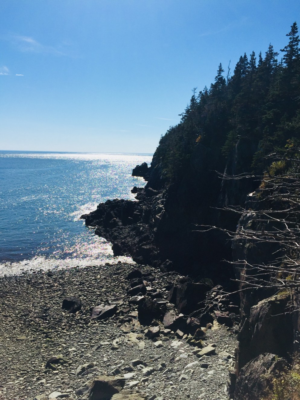
Rocky beach off the Coastal Trail, Quoddy Head State Park.
The word “Easternmost” is prominently advertised in many places across Lubec, including Quoddy Head State Park, which comprises 541 acres at the tip of the U.S.’s eastern reach. By the time you reach Quoddy Head State Park, off South Lubec Road, you will likely have seen many advertisements for all things “easternmost” (campgrounds, gift shops, etc). But beyond the quick tour stop and lighthouse “selfies,” this park offers an array of trails for all abilities with impressive ocean views and a variety of coastal vegetation. The best guide to the park’s trails is the map provided by the state of Maine: Quoddy Head State Park Guide & Map.
We started with the Coast Guard Trail, a 1-mile trail north of the entrance, which includes an overlook of the Lubec Channel, as well as a view of the town of Lubec back to the west, after a short climb up a wooden staircase. According to the Quoddy Head Guide, the first .5 miles of the western part of this trail is accessible by motorized wheelchair. After the lookout, the Coast Guard Trail then descends through the thick coastal woods to the lighthouse, passing several viewpoints along the volcanic rocks. The path was full of birds and squirrels gathering food on this warm, sunny October day.
West Quoddy Head Lighthouse, Lubec, ME
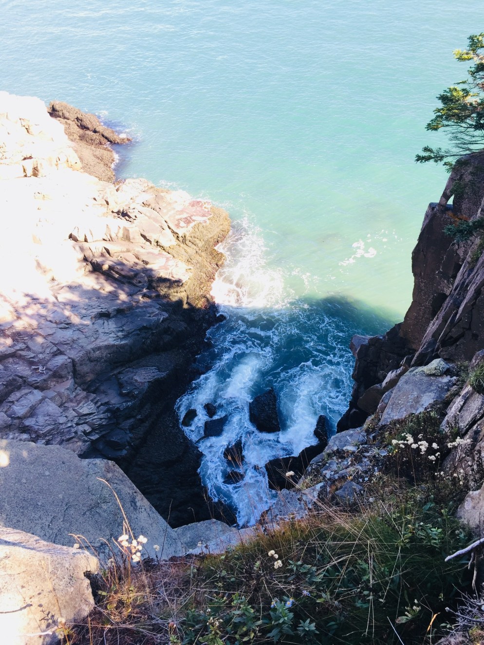
The small lighthouse museum (free, but donations always help) includes displays featuring the history of the lighthouse, flora and fauna of the area, and a guide to whales, commonly sighted off the coast. The area around the lighthouse contains a large number of picnic tables with excellent views, and the only restrooms in the park (easternmost privies in the U.S.? Probably). From the lighthouse area and most of the coastal trails, the cliffs of the Canadian island of Grand Manan are visible across the Quoddy Channel.
The terrain was impressive, and those with small children need to keep them close, as there are plenty of dizzying cliffs on the U.S. side, as well. The beaches are rocky, but make a far more interesting sound than sand beaches, combining the tidal roar with a rattling, suction sound as the rocks move together when the waves recede.
Coastal Trail at Quoddy Head State Park, Lubec, ME.
The Coastal Trail travels west along the shore past incredible views and scenic points like Gulliver’s Hole, High Ledge, and Green Point, with frequent stops in between to take in the powerful ocean. We did not linger at Green Point, a ledge with paths down to a beach, as we may have interrupted two hikers in some sort of extracurricular activity there (The trails became more and more empty the farther we got from the lighthouse).
At Carrying Place Cove, Thompson Trail heads back east, inland towards the parking area, with the short .2 mile spur of Bog Trail along the way. This side of the trail, in particular the sand beach at Carrying Place Cove, is also accessible from South Lubec Road. The Bog Trail includes a boardwalk and interpretive signs explaining the coastal plateau bog, also called a heath, according to the Quoddy Head Guide.
Thompson Trail is, for the most part, an easier walk than the coastal trail, with a few brief climbs. The best feature of this trail was the scent of pine, which created a perfumed evergreen tunnel in the narrower sections, redolent with notes of citrus and vanilla.
We completed most of the trails in the park, and stopped plenty of times to relax and take photos, making this about a three-hour visit. The difficulty level is described in the park guide as moderate, which seems about right. There are no strenuous climbs, but consistent steps over rocks and roots could make this more difficult for some hikers. There weren’t any bugs during this Columbus Day weekend, but the boggy areas guarantee mosquitoes and black flies in late spring and summer, and repellent would be a must. I would also suggest waterproof shoes, or at least wearing something on your feet that you don’t mind getting wet or muddy. Depending on your roaming plan, you may want to put your phone in airplane mode, as it will likely be using Canadian towers along this shore.
Lubec fishing fleet at dusk
Lubec, across a narrow channel from Canada’s Campobello Island, is the closest town nearby, but Machias is not that far away, and many smaller towns in Downeast Maine and the Cobscook Bay region are worth a visit. After the hike, if you can catch them open during fall hours, try the craft beer and pizza at Lubec Brewing Company or upscale pub cuisine at Cohill’s Inn on Water Street in Lubec. If you are headed south, go to Skywalker’s Bar and Grille in Machias (try the fish tacos) for a great menu and Machias River Brewing Company beers.
Quoddy Head, though remote, is hardly a secret anymore- we joked that AirBnB renters and vacationers from New York outnumbered locals in Lubec. But steps beyond the famous lighthouse is a surprisingly wild Maine coast to explore.