Johnson Brook Trail (Sunkhaze NWR)

Johnson Brook Trail, Sunkhaze National Wildlife Refuge, Milford, Maine

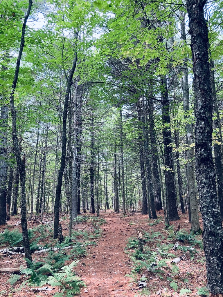
Johnson Brook Trail is a 3.3 mile loop trail at Sunkhaze Meadows National Wildlife Refuge (NWR) in Milford, Maine, a town on the Penobscot by Orono/Old Town. Sunkhaze is a 11,485 acre refuge that protects the Sunkhaze Meadows peat bog, as well as a large concentration of migratory birds. I navigated using the AllTrails app, but the best description and map are hosted by the Friends of Sunkhaze Meadows. Johnson Brook is the farthest east of the three trails on the south side of the NWR, next to Oak Point and Carter Meadow Trails. Dogs are allowed, but must be leashed at all times. Hunting is allowed, so wear blaze orange during hunting seasons. I started early (right at sunrise) on a mid-September morning from the small parking lot, with a definite chill in the air. From experience, Sunkhaze much earlier in the season can be pretty wet and buggy. I started along the flat, easy trail, with the sound of barking dogs at a nearby residence giving way to jays and chattering red squirrels.

Beaver pond spur on Johnson Brook Trail, Sunkhaze National Wildlife Refuge, Milford, Maine

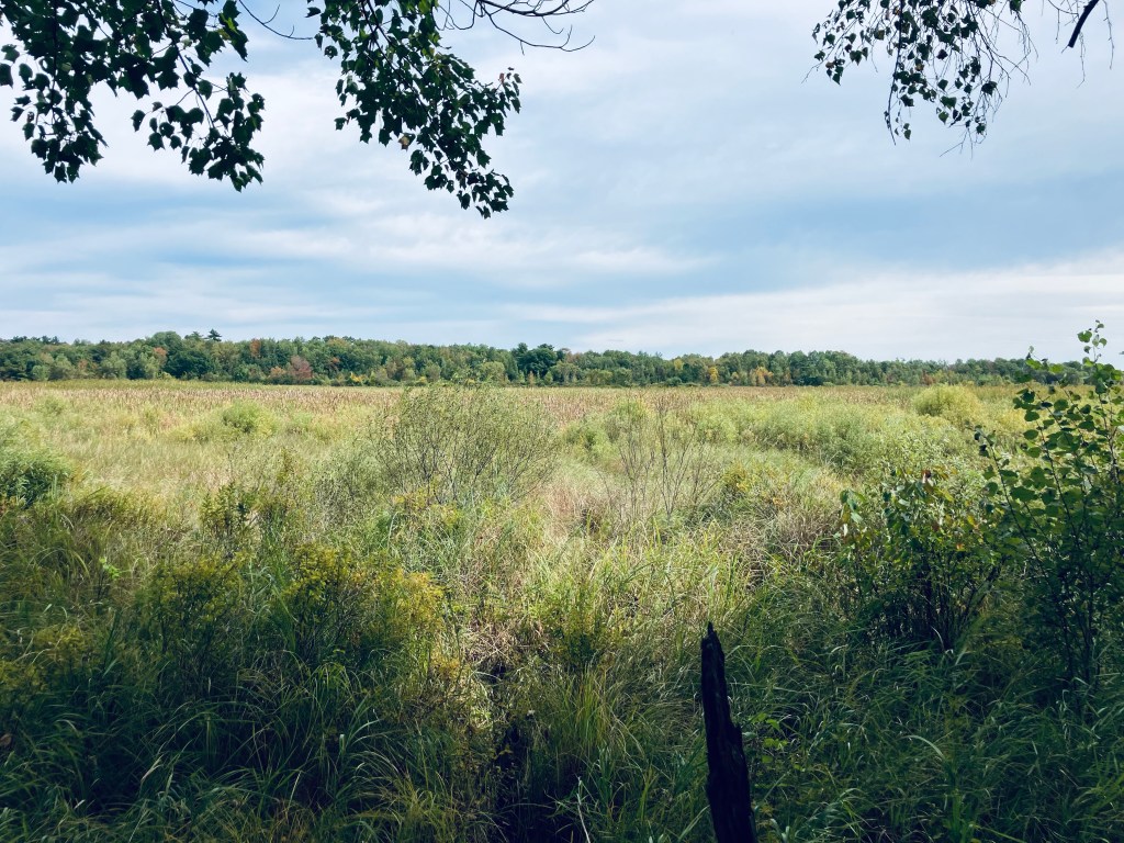
The righthand spur heads east off the loop trail at about 4/10 of a mile, and I took this to see the beaver pond. The changing colors of the ferns and the deciduous trees, as well as the mist rising from the pond in the cool morning made this trip (less than a third of a mile) well worthwhile. At a little over a mile on the loop trail, you will reach a couple of raised boardwalks over the marsh, just before the second spur trail, which goes off to the right. At the time I came through, this spur was clearly marked off by a sign with a red line through a hiker, so it’s closed for now.

Johnson Brook Trail, Sunkhaze National Wildlife Refuge, Milford, Maine

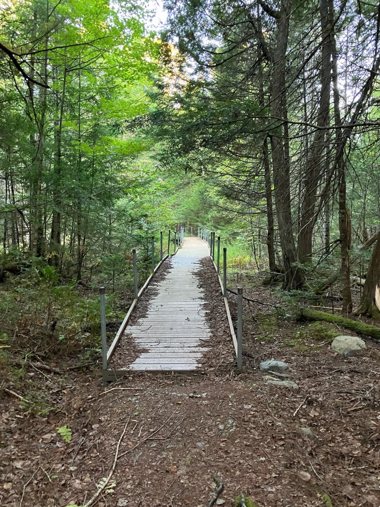
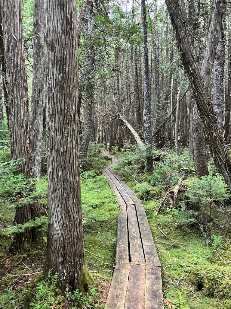
After another boardwalk, the trail turns left to return to the east side of the loop. At this turn, there is a path back to County Road and there are two interpretive displays on vernal pools and songbirds. The trail and a bench on this part of the loop are dedicated to Janice Beckett, a former president of the Friends of Sunkhaze Meadows. I visited on a dry fall day, but the many boardwalks and plank bridges, the moss, and the dense cedar speak to how marshy this area is, typically. In mid-September, this was a nice, easy loop, taking about an hour, for late summer wildflowers and wildlife sightings.

Johnson Brook Trail, Sunkhaze National Wildlife Refuge, Milford, Maine

Central Penjajawoc Preserve

White Pine Loop, Central Penjajawoc Preserve, Bangor, ME

The Central Penjajawoc Preserve, a 182-acre trail network a short distance from downtown Bangor, is owned and maintained by the Bangor Land Trust, which has a helpful map and information on its website. No dogs or bicycles are allowed on the trails. The Preserve can be accessed from a small, signed parking lot on Essex Street, just south of the intersection with Burleigh Road. I hiked a loop in late September using the White Pine, Milkweed, and Penjajawoc Overlook Trails. The trail loop begins from a map kiosk as a narrow downhill path lined with ferns and wildflowers, and marked by diamond-shaped Bangor Land Trust placards on trees.

Tall White Pines, White Pine Loop, Central Penjajawoc Preserve, Bangor, ME

At the first trail junction (about a quarter-mile), I continued left on the White Pine Loop to go clockwise. The White Pine lives up to its namesake, and I enjoyed the sight and scent of the tall straight evergreens. As I moved further along the trail, there were low-lying marshy areas, mostly spanned with plank bridges, but in the early fall, it was dry enough that I had no issues with the mud. At about 2/3 of a mile, I hit the next trail intersection and continued left on the Milkweed Trail for the outer part of the loop.

Central Penjajawoc Preserve, Bangor, ME

I crossed a small stream lined with wildflowers and an open meadow, with the path now marked by flags. The footing was uneven, but the trail’s overall grade was flat and easy to follow. The trail dipped through a wooded area, back across a small stream, and then into another open meadow, with a similar density and variety of wildflowers. Just prior to the first (northernmost) Marsh Overlook, I encountered a massive tan toad with dark brown spots, who lumbered across the path, and then disappeared into the undergrowth.

Marsh Overlook on Milkweed Trail, Central Penjajawoc Preserve, Bangor, ME

I would describe the Overlook as more of a “through” look, a glimpse beyond the curtain of the trees to a large marsh, but no real elevation to look down from. I continued clockwise along the trail past the wildflowers and milkweed, following the flags, as the path is more of a game path here. Next turn was left, on the Penjajawoc Overlook Trail toward the second Marsh Overlook, which started through a small gap in a stonewall. I walked through another open meadow, this one higher and greener than the prior ones. This spur trail was a lot more overgrown, but still marked by flags and downtrodden vegetation, and fairly easy to follow. The field and its small islands of shrubs were full of chickadees, palm warblers, and eastern phoebe.

Overlook over Penjajawoc Marsh, Central Penjajawoc Preserve, Bangor, ME

I reached the second Marsh Overlook through a small stand of trees, and enjoyed the view, which was much more expansive than the first, hearing ducks in the distance. I paused and realized that I was covered in pollen from the waist down, following the walk through the meadow. The browns, gold, and yellow colors of early fall covered Penjajawoc Marsh and Penjajawoc Stream. On the return loop toward the parking area, I saw a small pile of bear scat on the pine-covered floor of the trail, as well as the signs of a small human encampment. The total loop was about 2.8 miles, taking only about an hour.

White Pine Loop, Central Penjajawoc Preserve, Bangor, ME

Kenduskeag Stream Parkway

Kenduskeag Stream from Kenduskeag Stream Parkway, Bangor, ME

The Kenduskeag Stream Parkway traces its namesake waterway upstream from downtown Bangor, and is an easy out-and-back lunchtime hike totaling about two miles. You can start the hike from Coe Park (as recommended in AllTrails) or from various entries on Harlow or Franklin Streets, all of which give you about a mile to the trail’s end by the Maxfield Mill Dam. The path, maintained by the City of Bangor, is featured on their website, including a printable map.

Kenduskeag Stream from Kenduskeag Stream Parkway, Bangor, ME

I have completed this hike from Coe Park in spring and from downtown in the early fall, and each time it took about 40-45 minutes. From Coe Park, cross Court Street, passing the playground, and going downhill, veer left. In the winter time, with the foliage bare, you can see down from the hillside to the other side of the river.

Morse Bridge from Kenduskeag Stream Parkway, Bangor, ME

The trail winds down, doubling back to Morse Bridge across the Kenduskeag. This steel footbridge was installed in 1985 after a wooden version was burned by an arsonist. A word of warning – this trail is a bit dodgy, emblematic of the less-savory substance use and economic underbelly of Bangor. It’s more reminiscent of Stephen King‘s “Derry” than the Bangor tourism brochures would have you believe. A needle receptacle is typically not a point of interest on a hike. But no interactions made me nervous or feel unsafe. I have politely declined an offer from a man to buy my shirt, and exchanged pleasantries with a few people passing the time on benches.

Downtown Bangor from Kenduskeag Stream Parkway, Bangor, ME

Prior to Morse Bridge and to the right, the parkway will take you along the west bank back towards downtown Bangor, where the Kenduskeag eventually meets the Penobscot. I haven’t seen much wildlife here, but there are fish and ducks, and I heard the calls of song sparrow, American goldfinch, and chickadee. When heading upstream, be careful crossing Harlow Street, as the trail crosses a busy section of road where the crosswalk has been exfoliated by sand and grit, and cars coming down the hill from 95 or heading out of downtown will be unlikely to stop.

Kenduskeag Stream and dam remains from Kenduskeag Stream Parkway, Bangor, ME

At Gateway Park, there is a covered picnic area and an interpretive panel listing Gateway Park as the halfway point, and describing the history of the Kenduskeag. Uphill, trails lead down to the Kenduskeag rapids, for views and fishing. The remains of an old dam also rest on the banks, and in the watercourse. The trail ends at Maxfield Mill Dam, with signs across Valley Avenue indicating the area is closed.

Kenduskeag Stream in early fall from Kenduskeag Stream Parkway, Bangor, ME

River Pond Nature Trail

Katahdin across River Pond, River Pond Nature Trail, Millinocket, Maine

River Pond Nature Trail is the outside loop of a trail system, all with logging names, dotted with interpretive displays, off the Golden Road in Millinocket between its namesake River Pond and the West Branch of the Penobscot River, not far at all from Baxter State Park’s Togue Pond gate. I took this trail loop, owned by Katahdin Forest Management, in mid-September as the last Sunday hike on the way out of the park on a weekend trip.

River Pond Nature Trail, Millinocket, Maine

Looking at reviews, it was uniformly described as buggy, but I didn’t have any problems with flies or mosquitoes in the cooler temperatures of early fall. The narrow Tenderfoot Trail through the forest started at a small kiosk by the large parking area, where there were two other vehicles. I moved counterclockwise, and at about .4 miles, just shy of a large boulder, I got my first view of Katahdin through a side trail that led down to River Pond.

River Pond Nature Trail, Millinocket, Maine

As I continued, two people coming towards me told me there were moose in the second clearing. I saw many clearings, no moose, but it’s always exciting to know they are out there. I reached Moose Point and the Timber Cruisers Trail and enjoyed the views across the pond of Katahdin, still nestled in clouds. The south side of the trail is more forested, with an occasional view of the West Branch of the Penobscot River below in the distance.

Katahdin across River Pond, River Pond Nature Trail, Millinocket, Maine

I did not take the River Driver’s Trail, which was a detour of a spur trail that would likely have culminated in better views, as I did not have the energy. Nevertheless, the rolling hills and springy pine-needle paths of the Forester’s Trail were a pleasant change from the rocky terrain of Baxter State Park. All told, the loop was about 4 miles, taking about an hour and 24 minutes.

River Pond Nature Trail, Millinocket, Maine