This loop route over Traveler’s bulk, which the AMC Maine Mountain Guide accurately describes as “starfish-shaped,” crosses Peak of the Ridges (3,254 ft), Traveler summit (3,550 ft), and North Traveler summit (3,152 ft). As it says on BSP’s website, “Preparation for a Traveler Loop hike is the same as a Katahdin hike,” due to the exposed nature of the hike, elevation gain, lack of available water, and distance. This is true, and in inclement weather, hikers should explore other options. To navigate, I used Map Adventures’ Katahdin Baxter State Park Waterproof Trail Map, but BSP’s official website also has free downloadable/printable trail maps, and the South Branch Pond map covers this area.

The Traveler is a strenuous 10.1 mile loop hike over the rhyolite peaks of Traveler Mountain, the highest volcanic mountain in New England, with over 4,000 feet of total elevation gain. This full-day (6-10 hour) hike begins at Baxter State Park’s (BSP) South Branch Campground, and based upon advice from the AMC Maine Mountain Guide and Falcon Guides’ Hiking Maine’s Baxter State Park and BSP rangers, is best attempted counterclockwise via the Pogy Notch, Center Ridge, Traveler Mountain, and North Traveler trails. This is to avoid descending the steep, loose rock on the Center Ridge Trail.
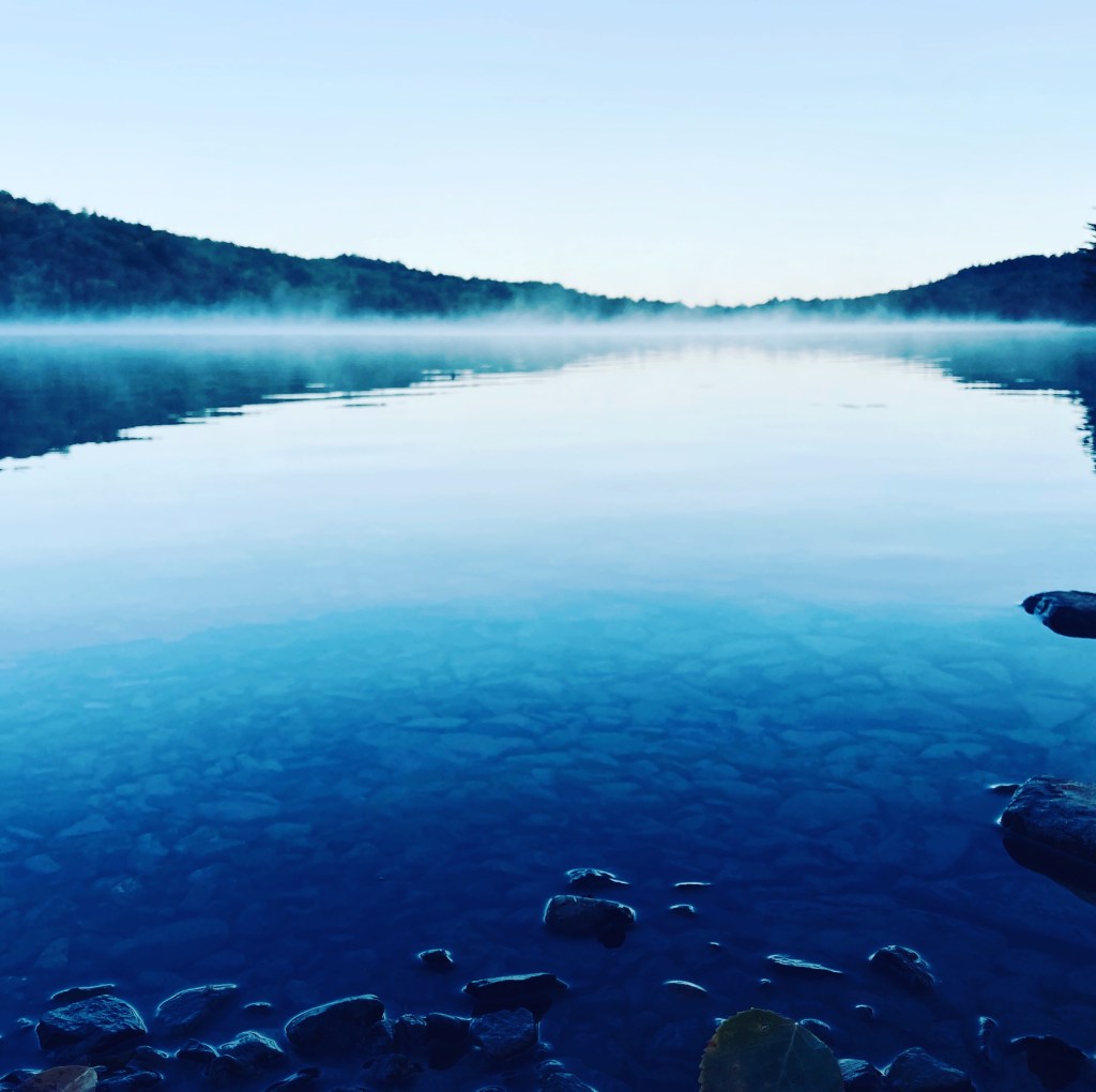
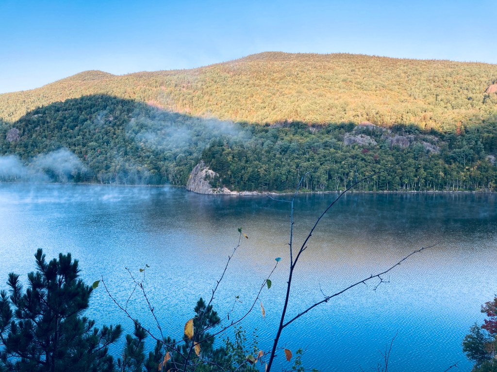
Unlike Katahdin trailheads, no additional parking reservation is typically needed for the Traveler, and the closest parking to the trailhead is the South Branch Pond Campground day-use/back country lot. On each of the cool mid-September mornings I did my hike in 2020 and 2025, an early fog hung over South Branch Pond. The trail leads over plank bridges to a winding track along the edge of the pond, usually accompanied by the stuttering sound of a belted kingfisher. About .9 miles in, there are beautiful views of the pond from the south end at the canoe landing for the Howe Brook trail.

The blue blazes lead up a steep rocky outcrop to continue up Pogy Notch Trail to its junction with the Center Notch Trail, with nice views along the pond. This is where the climbing really starts, and you’ll find yourself periodically grabbing for rocks and roots as handholds. I took a well-deserved rest after about 2 miles to make myself a coffee, let my feet air out a little, and send a proof-of-life text from elevation (South Branch Pond, like a lot of Baxter State Park, has no cell service).
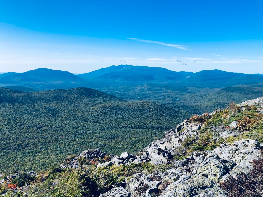
The payoff for the climb was a ledge hike beginning with views of both ponds, the valley surrounding Howe Brook enclosed by Traveler, and to the south, an unobstructed view of the iconic serrated ridge of Katahdin’s Knife Edge. There were some late-season blueberries and cranberries still hanging on. Above the tree line, I heard the familiar sound of hermit thrushes amid the September’s reddening sumac and scrub pine.
Shifting and unstable rocks clamping on my ankles made me glad I went with the higher boots instead of yesterday’s trail runners for this hike. Hiking poles were also a good knee-saver and insurance against injury, particularly while descending. Additionally, I would recommend sunglasses or a brimmed hat if you’re getting an early morning start as I did – you’ll be heading into the sun for a lot of the hike.
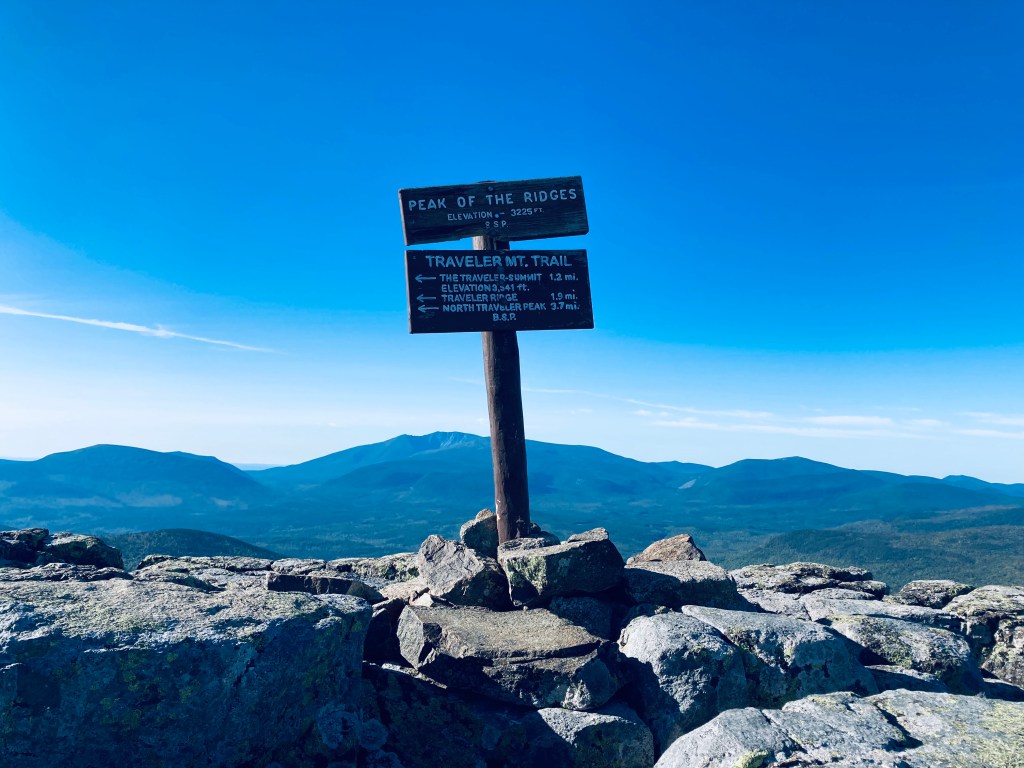
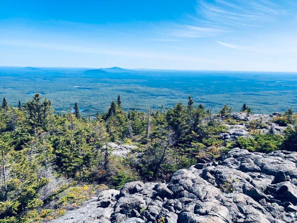
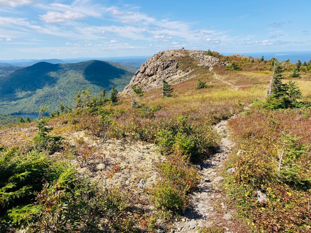
Watch for distant cairns and blazes, as the route can be hard to see if your head is down to watch your footing. I paused at Peak of the Ridges to enjoy views of Katahdin (and basically everything else). Throughout the hike, I enjoyed observing berries, flowers, and grasses enriched by the sunlight of a higher altitude.
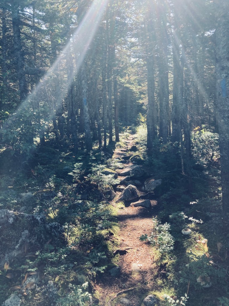
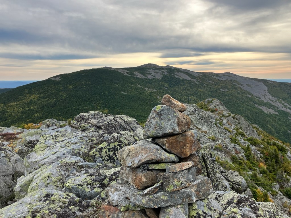
After Peak of the Ridges, a section dubbed Little Knife Edge offers a challenging ridge hike with great views, then a nice break from the climbing with a mossy walk through some pines. Emerge from the woods to find a field of loose rock on the climb to Traveler’s main summit, with excellent views continuing of Katahdin and surrounding mountains to the south.
I paused at Traveler Summit, about three hours into the hike, to fire up the JetBoil and heat and enjoy a freeze-dried beef chili mac meal while I took a break from my boots, socks, and shirt, and enjoyed the sun piercing the cold air. As I geared back up and moved across Traveler Ridge, a large hawk wheeled over the summit where I had been, and cried out, with a hermit thrush call nearby seeming to answer it.
On Traveler Ridge, I started to see other hikers, mostly fit, well-equipped, and determined-looking, all moving in the opposite direction, but not many. Before this point, I had not seen another human being, which is not unusual for the Traveler Loop. More people, looking to be of all abilities, appeared after the peak of North Traveler, taking the shorter, but very challenging, out-and-back hike from South Branch Pond to North Traveler’s summit, with some of the best views in Maine.

A rapid descent down North Traveler’s steep trail led back to South Branch Pond (my preferred campsite), and two massive bison burgers on the portable grill. My hike was about six hours, but I was solo, enjoying great weather, and moving fast, with a 3-Liter water reservoir that I pretty much drained. The Traveler Loop is a wild, beautiful hike, a challenge to those willing to explore Baxter State Park’s northern half, with sustained vistas from its ridges.
(Disclaimer: This post contains affiliate links, and as an Amazon Associate Hiking in Maine blog earns from qualifying purchases.)

Beautiful photos, fine report!
LikeLike
Loved this hike when I did it in spring a few years back.
LikeLike
Can’t wait to hike this traverse!
LikeLike
When I go to Maine, I was planning on traveling the coast, but I might have to make a detour to see the park.
LikeLike
Me and my brother in law were the first to do this hike in the summer of 2004. We heard the helicopter taking the workers from the top, and smelled the sap from the heat recently cut trees. A hike I will never forget.
LikeLike