Orin Falls Trail (Katahdin Woods and Waters)

Orin Falls in Katahdin Woods and Waters National Monument, Maine.

(Note: The Katahdin Loop Road opened for the 2020 season on Saturday, May 23. U.S. National Park Service advises to drive with caution and be alert for soft spots and rough road sections. Haskell and Big Spring Brook Huts are temporarily closed, and updates will be posted to the NPS website.)

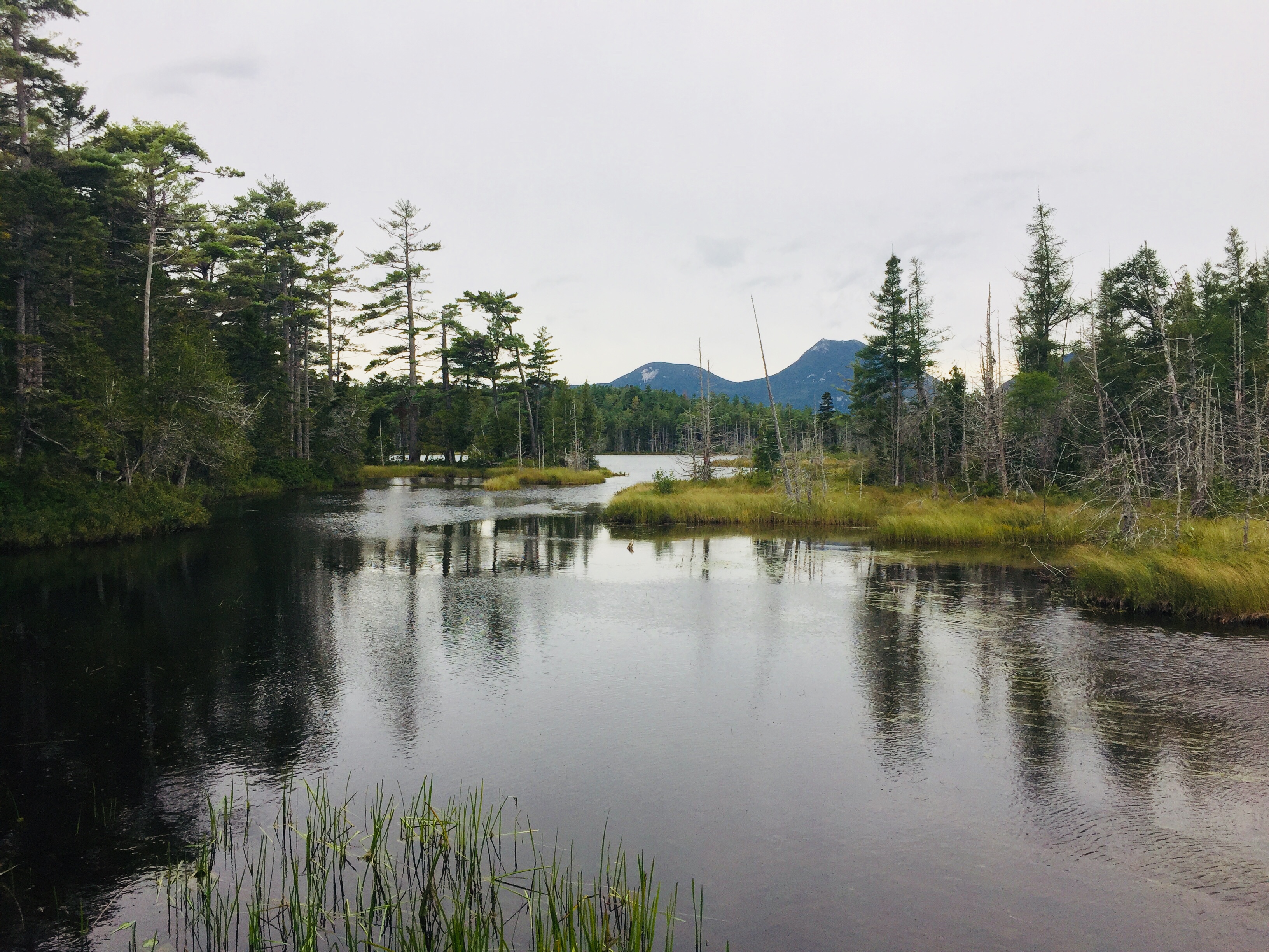
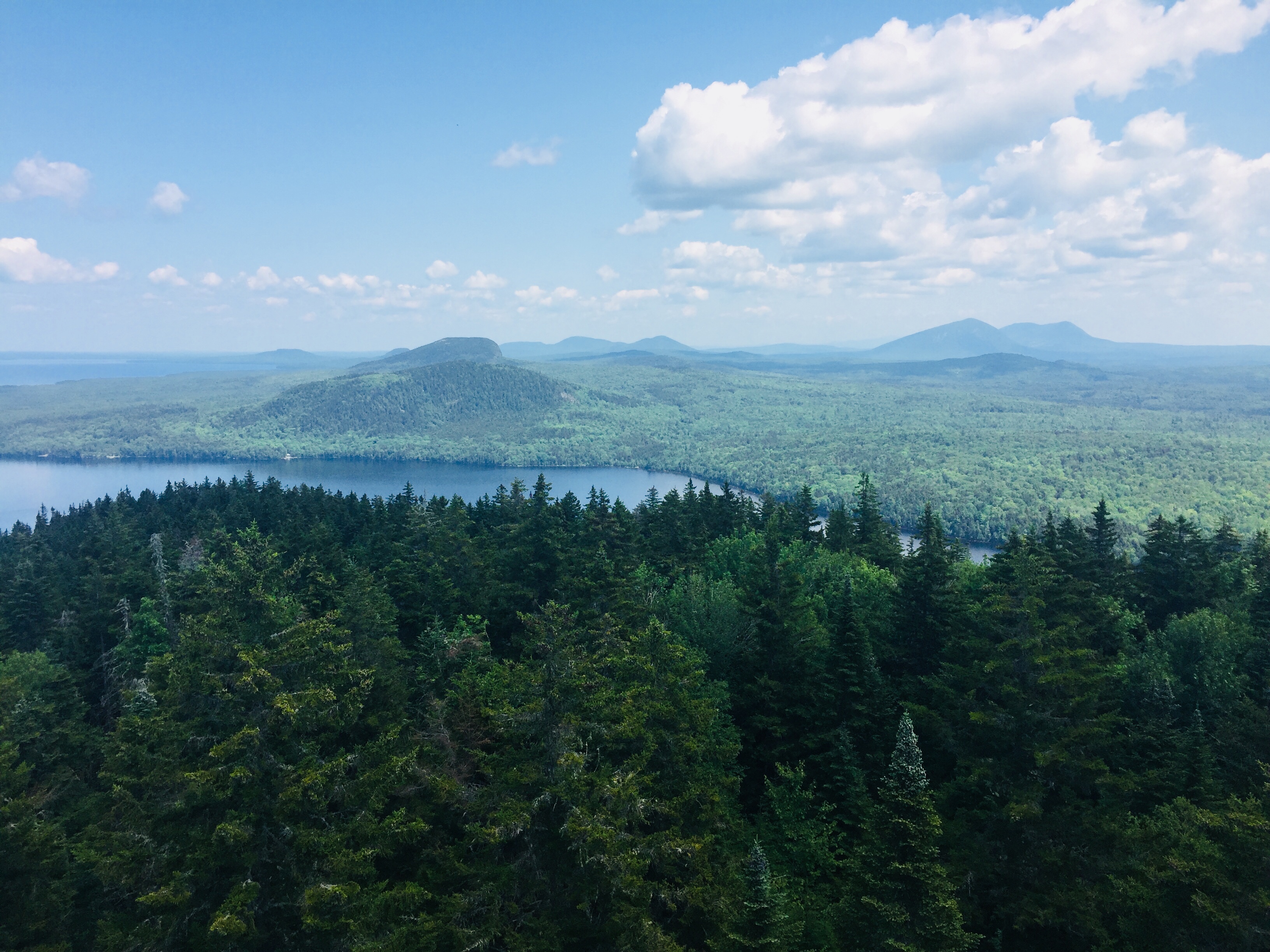
Our trip around the Loop Road at the end of last summer to Katahdin Woods and Waters National Monument left us wanting more, and after a rainy but pleasant day at Baxter State Park on Saturday, we set out the next morning for the Monument to hike to Orin Falls.  This 6-mile hike, out and back on old logging roads along Wassataquoik Stream, is a perfect fall walk.  The AMC Maine Mountain Guide has a description of the hike, and Maine Hikes Off the Beaten Path by Aislinn Sarnacki has a longer treatment, as well as a helpful map.  We used the Map Adventures Katahdin Woods & Waters Waterproof Trail Map to navigate this hike and the rest of the Monument, and the trip to the falls took a little over an hour each way.  With the sun shining, biting insects largely gone or simply sluggish, late summer flowers and berries still blooming, and the calls of birds echoing throughout the woods, we took our time getting to the end of the trail, pausing frequently to examine animal tracks and sign, and to simply listen.

img_7060
Orin Falls Trailhead, Katahdin Woods and Waters National Monument, Maine

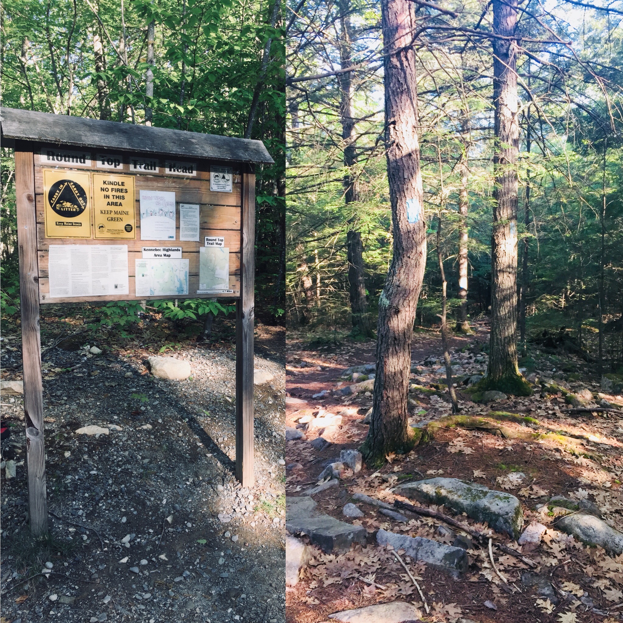
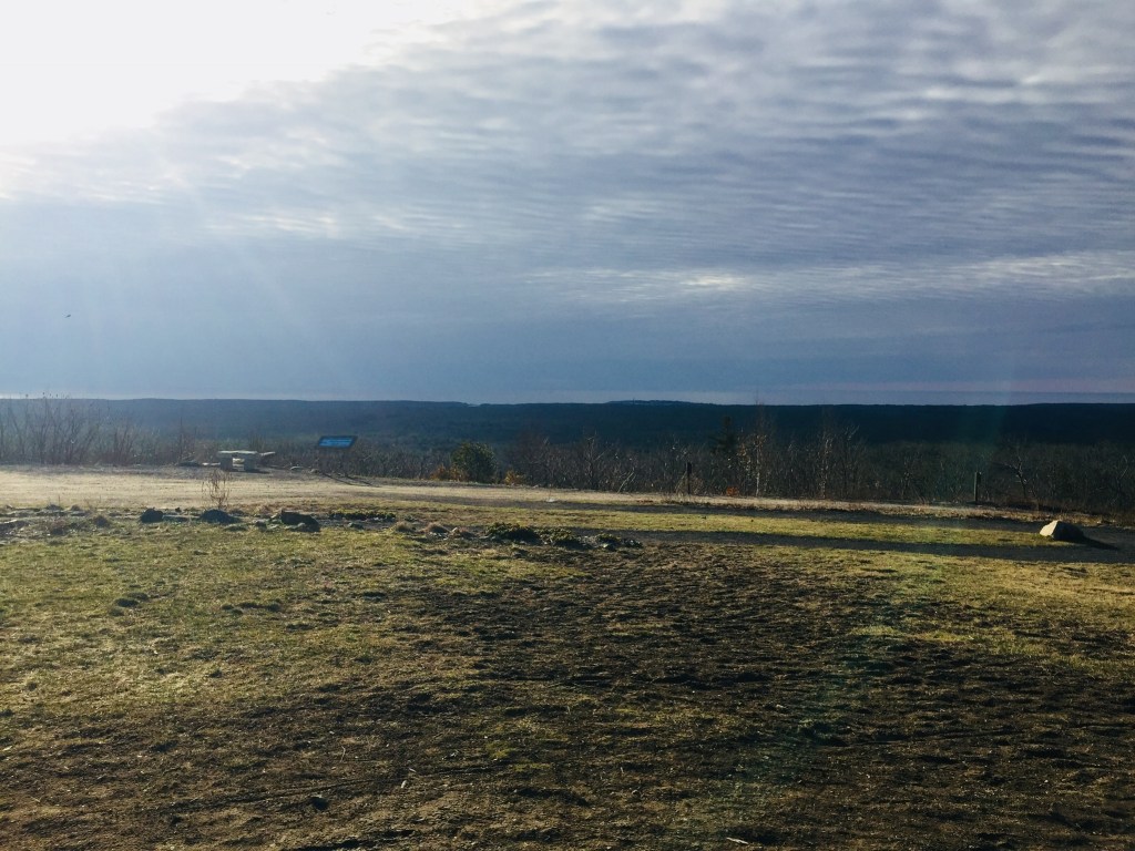
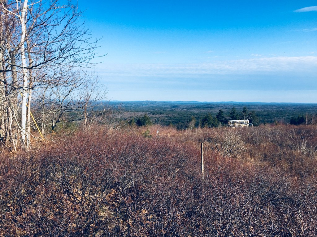
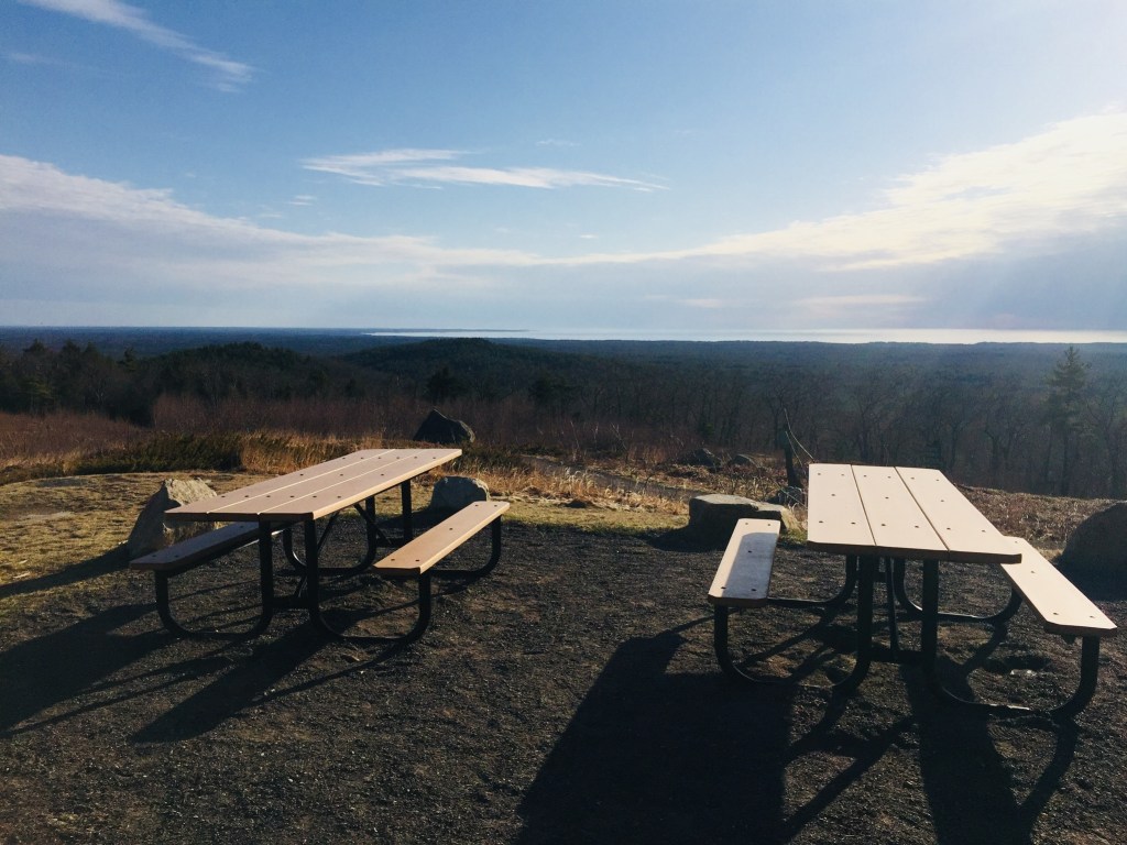
The trailhead and parking area are located at the end (for motorized vehicles) of Orin Falls Road, a spur off the Katahdin Loop Road in Katahdin Woods and Waters National Monument.  Like last year, we got to the Monument from Millinocket using the Stacyville Road.  In large stretches, particularly closer to the Monument, this is a road in name only, as its surface ranges from the consistency of an ATV trail to that of a World War I battlefield.  We cannot discourage highly enough the use of this road unless you have four-wheel drive, high clearance, and a general disdain for your car’s exterior.  The traditional route into the Monument on Swift Brook Road from Route 11 is far safer, and was the route we took departing at the end of the day.  However you get there, to reach the trailhead from Swift Brook Road, turn right (north) on the Katahdin Loop Road (sign for Barnard Mountain), then follow the sign for Orin Falls.

Orin Falls Trail, Katahdin Woods and Waters National Monument, Maine

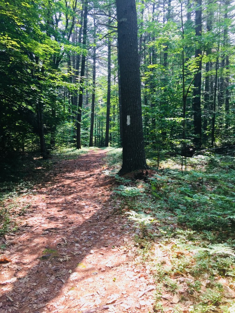
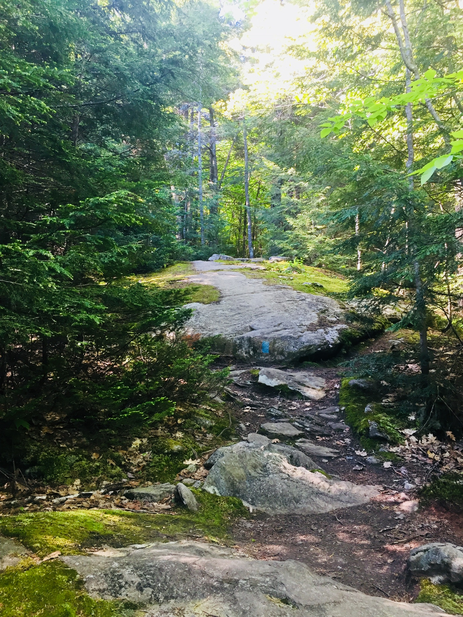
At the bottom of the hill below the trailhead is a brand new handicap-accessible toilet.  We quickly saw recent moose tracks and droppings along the trail, but had no luck seeing moose throughout our hike.  The Esker Trail comes in from the right, and then the International Appalachian Trail (IAT) veers off to the right towards a ford across Wassataquoik Stream (and a trail up Deasey Mountain).  We continued straight, and reached a relatively new foot/ATV bridge across Katahdin Brook, startling a large heron that took off upstream in the direction of Katahdin Lake.  This crossing directly precedes the Wassataquoik Shelter, a newer lean-to.  Like everything else on this hike, we had the place to ourselves.

Wildlife on Orin Falls Trail, Katahdin Woods and Waters

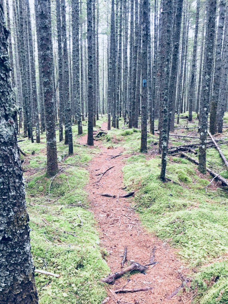
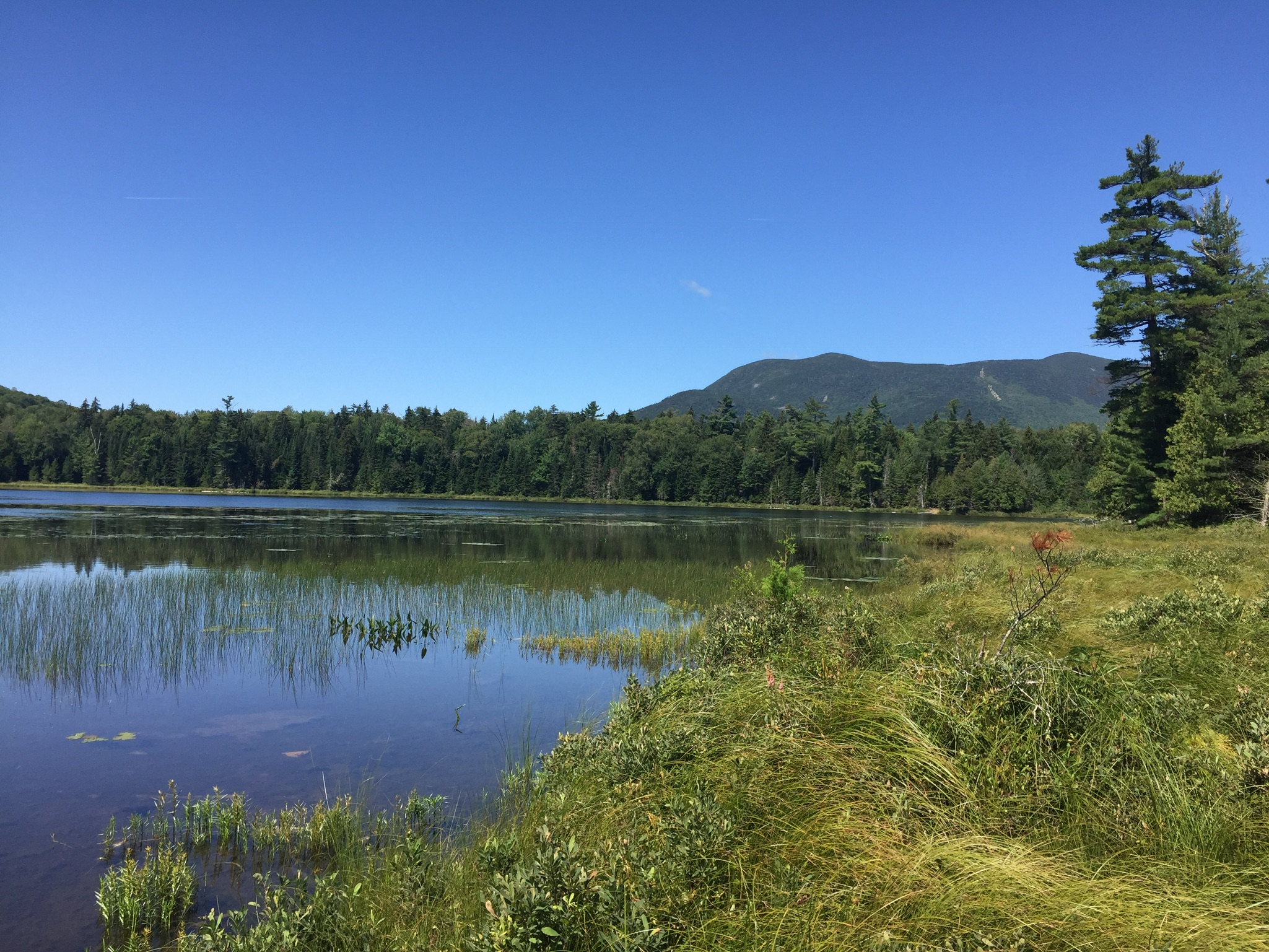
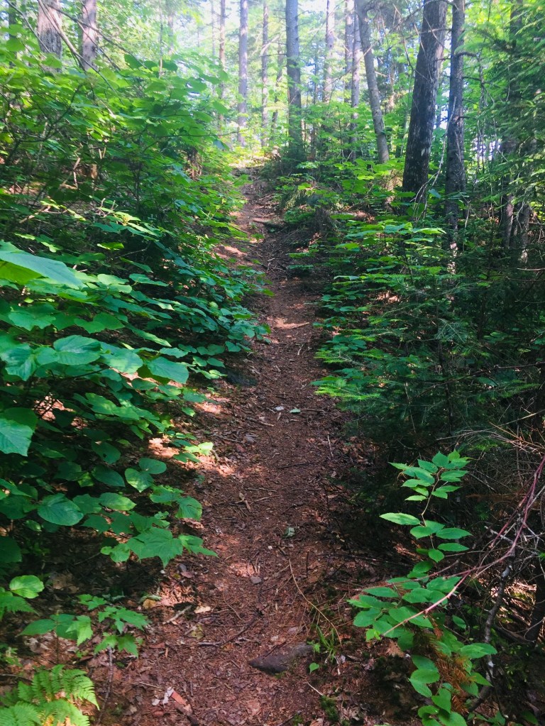
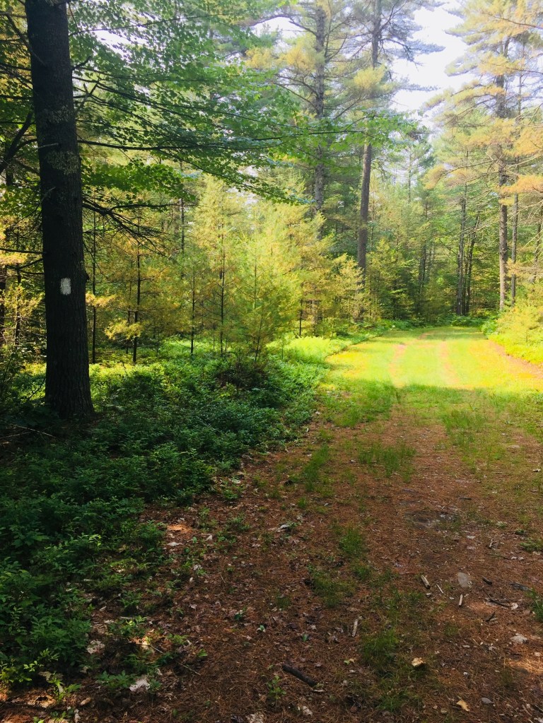
Although looking at the map may make it seem like the trail is right on the banks, you don’t see Wassataquoik Stream much along the hike until the end, but the portion between the ford and the shelter rides an elevated overlook, and you can look down to the slow, wide Stream through the trees.  There is, however, plenty to observe.  In most places, the trail was wide enough for us to walk side by side, in the wheel ruts of the former road, making for a companionable stroll.

In addition to the heron and the moose tracks, we saw deer tracks, grouse, hawks, kingfishers, jays, mice, caterpillars, many frogs and toads, garter snakes sunning themselves on the trail, massive, skittering fishing spiders, and the large track of a bear.  Raspberries, blackberries, and blueberries were out in force, but were hit-or-miss, seeming to mostly have the bitter taste associated with the end of the season, and a lack of recent rain.

img_7084
Orin Falls, Katahdin Woods and Waters

The mosquitoes and biting flies were minimal, but one could see how they could be pervasive during the summer months in the low-lying areas around water, so late summer or fall is a great time for this hike.  Shortly after passing the lean-to, we left the IAT, which veers off to the left (west) towards Barnard Mountain, and Katahdin Loop Road.  We continued straight, past the marker for the Monument line, and finally reached the trail downhill towards Orin Falls.

Orin Falls, Katahdin Woods and Waters

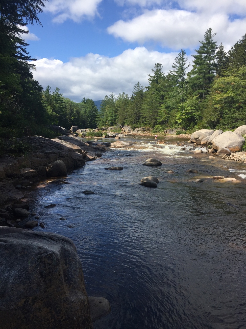
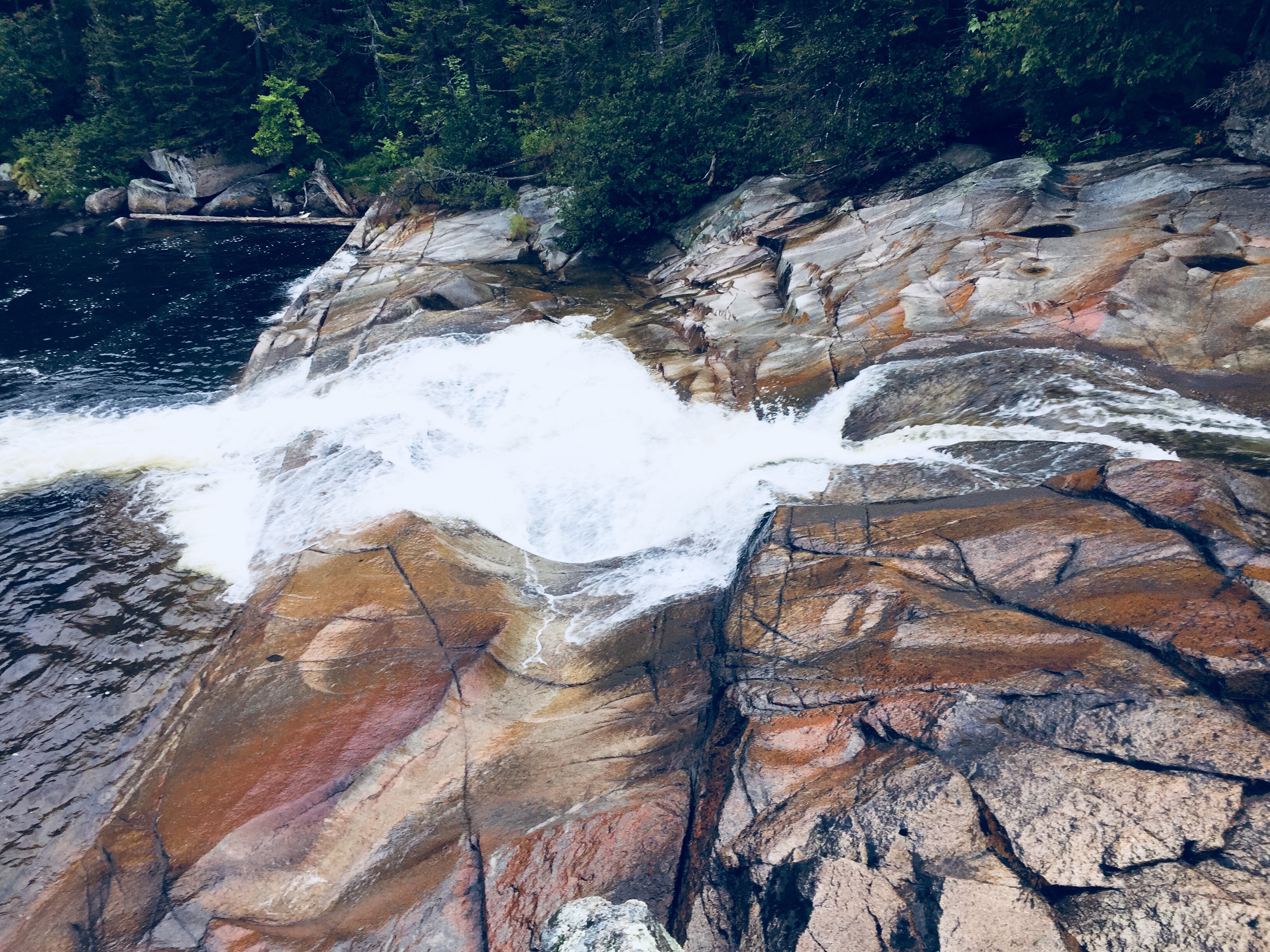
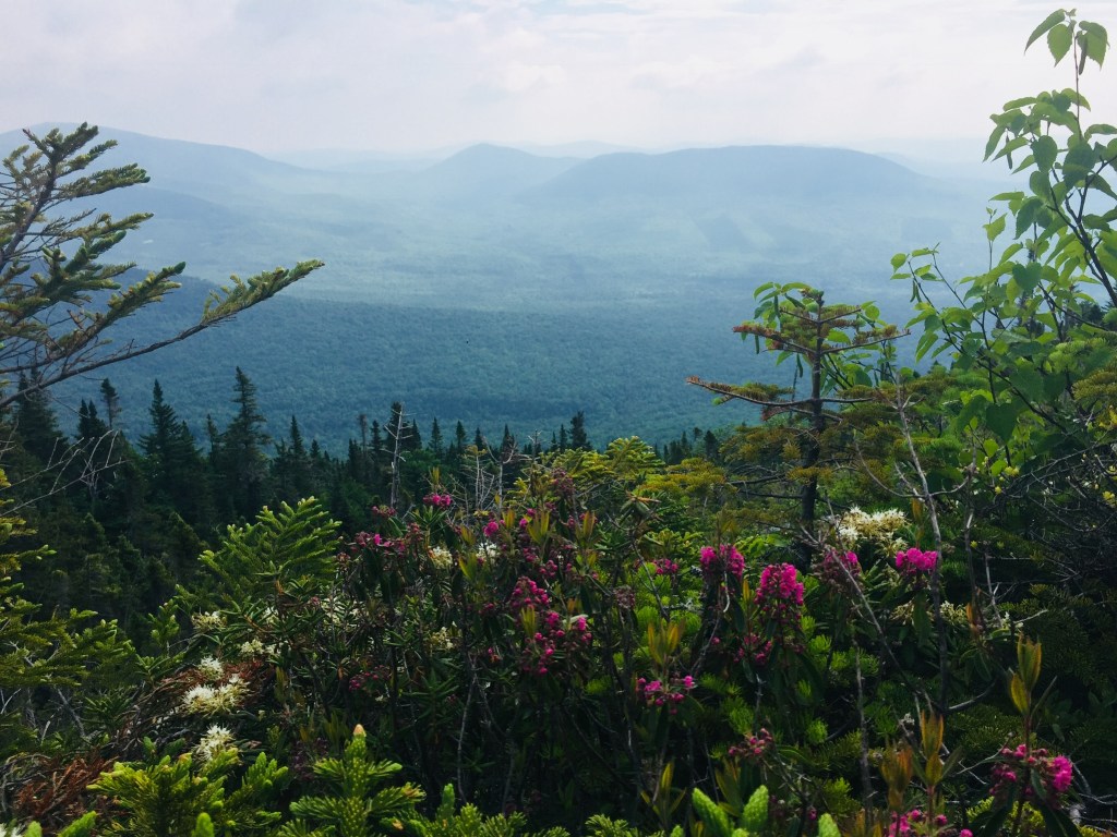
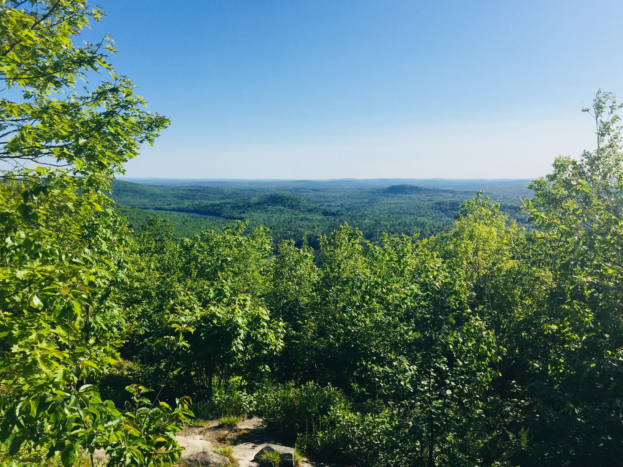
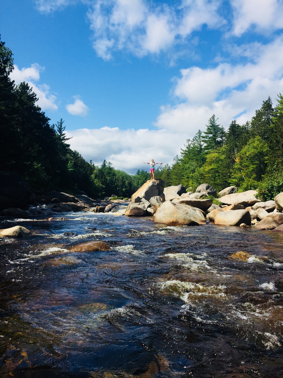
We could hear the rush of Wassataquoik Stream from the top of the trail, and emerged from the woodline to a beautiful scene of trees, boulders, flowers, and water, overlooked by the surrounding ridges and peaks of the Monument.  This was a good place to spend an hour building up memories of summer.  We sunned ourselves on boulders, filtered some clean, cold water, explored, rock-hopped, and ate a prepared meal warmed on a camp stove.  Then we packed up everything (leave no trace), and headed back the same way we had arrived, talking about our summer, and future hikes.  The first people we saw were at the trailhead, preparing to hike as we got back to our vehicle.

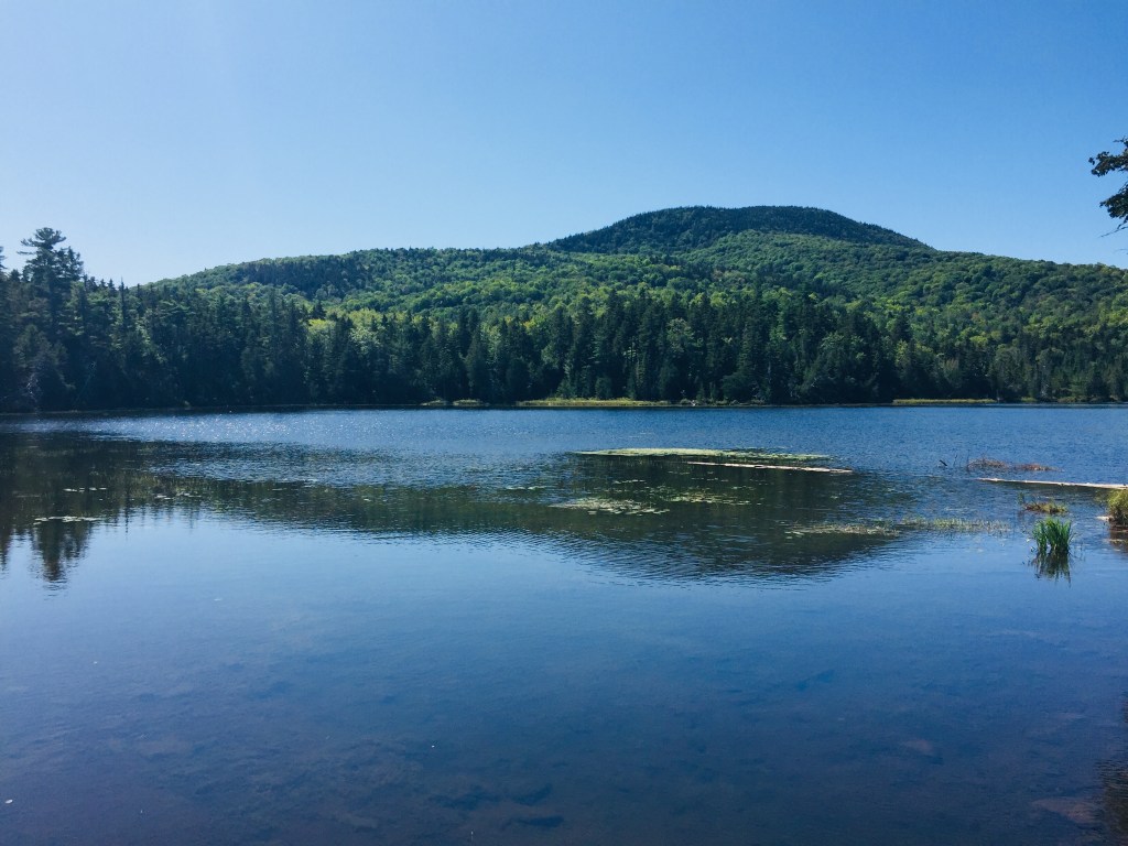
Katahdin Woods and Waters National Monument is a place we will continue to explore, a reclaimed wilderness with endless potential to surprise and excite.  The Orin Falls Trail is an easy walk, but its intersection of mountains, forest, and water provides a satisfying taste of the wild beauty of Maine’s north woods.

(Disclaimer: This post contains affiliate links, and as an Amazon Associate Hiking in Maine blog earns from qualifying purchases.)

Grassy Pond, Daicey Pond Loop and Niagara Falls (Baxter State Park)

Little Niagara Falls, Appalachian Trail in Baxter State Park

In season 1, episode 3 of the travel show “An Idiot Abroad,comedian Karl Pilkington, sleeping in a cave across from the impressive facade of the lost city of Petra in Jordan, focuses on his vantage point, rationalizing, “I’d rather live in a cave with a view of a palace than live in a palace with a view of a cave.” When our annual father/daughter trip to climb Katahdin was detoured by injury, we used similar logic in planning a non-Katahdin hike at Baxter State Park – a flatter, less strenuous hike highlighted by the views of Katahdin and the many surrounding mountains of Baxter S.P.  While Katahdin’s peaks are the undisputed centerpiece of this amazing place, this approach showed us a glimpse of the wonders available in the shadow of the mountain.

Mount Katahdin, wreathed in clouds, from Katahdin Stream Campground

We kept our lean-to reservation at Katahdin Stream Campground, and when morning dawned, we filtered the chilly waters of Katahdin Stream into our water bottles. Instead of heading up the Hunt Trail to Baxter Peak, we turned south on the Appalachian Trail, all the way around Grassy Pond, Elbow Pond, Daicey Pond, down Nesowadnehunk Stream to Little and Big Niagara Falls, then back to the start. We pieced together this hike, totaling about 7.5 miles round-trip (3 hrs 45 mins), from Falcon Guides’ Hiking Maine’s Baxter State Park by Greg Westrich, and used Map Adventures’ Katahdin Baxter State Park Waterproof Trail Map to navigate.  Baxter’s great website also has downloadable/printable trail maps, and the Kidney-Daicey map covers this area.

Moose and Doubletop Mountains across Grassy Pond
Moose and Doubletop Mountains across Grassy Pond, Baxter State Park

Our turn away from Katahdin’s elevation seemed serendipitous, as a steady rain picked up that would have made a steep climb tricky, and we quickly donned our rain gear. An easy rolling trail and plank bridges took us over cold, clear streams tinged sepia tones by cedars, and a hard right turn took us onto the Grassy Pond (blue blazes) and Elbow Pond Trails. We skirted these ponds, trying unsuccessfully to glimpse a morning moose. We settled for birds, frogs and a variety of mushrooms in every color and shape, from small, bright cones to giant discs that looked dangerously like pancakes.

Looking across Elbow Pond to Mt O-J-I and Barren Mountain, Baxter State Park

Canoes are available to rent at Grassy, Elbow, and Daicey Ponds from the nearest Baxter S.P. ranger station, with plenty of wildlife viewing opportunities.  Daicey Pond has cabins for rent, making it a great base for a week of hiking, if you can snag a reservation.  At Daicey, we re-joined the Appalachian Trail, moving across the day-use parking area to the shores of Nesowadnehunk Stream (towards directional sign marked The Falls). The sides of the trail were carpeted in vibrant green mosses and ferns, creating an emerald forest by the stream.

Little Niagara Falls, Baxter State Park

The remains of the Toll Dam, a vestige of Maine’s logging history, came first, then a short side trail to Little Niagara Falls. The rain and the time of day contributed to a quiet trail, with mostly thru-hikers heading in the other direction, racing the season to summit Katahdin, all friendly and moving quickly. We traveled the slight downhill, and enjoyed the spectacle of the roaring waters of both falls.

Big Niagara Falls, Baxter State Park

Heading back after a snack at Big Niagara Falls, we re-traced our steps north along the A.T., veering south (right) on the Daicey Pond Nature Trail to vary our return route. The trail around the southern side of Daicey Pond was narrow, with wet branches tight to our legs as we moved back towards the A.T. The clouds had moved in to obscure our view of the peaks across Daicey, but a clear day must be spectacular.

View across the south side of Daicey Pond to O-J-I and Barren Mountain
Cloudy view across the south side of Daicey Pond to O-J-I and Barren Mountain

The A.T. took us back to the trailhead, and our nearby vehicle. Normally, we would have enjoyed an outdoor meal on a camp stove, but the rain and cold had us in the truck with the heat on. We headed out of the park to lunch at New England Outdoors Center’s River Drivers Restaurant, overlooking Millinocket Lake (look for signs for a turn left as you head back towards Millinocket), a warm, welcoming place with great pub food and a view of Katahdin – crunchy chicken wrap and fish and chips both got high marks.

Grassy Pond Trail, Baxter State Park

The trip to Baxter State Park is always a long one, no matter where you are arriving from, as it is remote and wild, and requires you to shed creature comforts and technology.  That, and the reservation system limiting access (smart and sustainable, for the park’s protection) can put a lot of pressure on a day or weekend trip with Katahdin as the goal.  But this great reclaimed wilderness holds a lot more secrets for anyone willing to broaden their outlook beyond the mountain centerpiece, and this change-up hike left us wanting to plan a much longer stay to explore the rest of Baxter State Park.

(Disclaimer: This post contains affiliate links, and as an Amazon Associate Hiking in Maine blog earns from qualifying purchases.)

Pond Loop (Little Lyford Ponds, KI/Jo-Mary)

Little Lyford Upper Pond from the Pond Loop Trail

The Pond Loop Trail, a 1.9 mile hike around Little Lyford Ponds near the Appalachian Mountain Club’s (AMC) Little Lyford Lodge & Cabins, is a pleasant, easy walk with abundant wildlife.  The ponds straddle the townships of Bowdoin College Grant West and Bowdoin College Grant East, close to Moosehead Lake.  For detailed description, check out the AMC Maine Mountain Guide or the online maps available from AMC.  We hiked this short loop the morning after a longer Gulf Hagas hike.  We had camped overnight at a KI/Jo-Mary campsite on the Pleasant River, but a closer stay would be at the AMC Little Lyford Lodge & Cabins, with access to many nearby trails.  As with the rest of the KI/Jo-Mary Multiple Use Management Forest, there is a use fee ($10 per adult Maine Resident per day, $15 non-resident, under 18/over 70 free), payable at one of three checkpoints, the closest of which is the Hedgehog Gate on Greenville Road.  If approaching from the south on Upper Valley Road, the parking area for the Pond Loop Trail is past the sign for the AMC lodge and cabins, on the left-hand side, just before the spur trail marked, “Little Lyford Pond #2 Boat Launch.”

Pond Loop Trail, marked with blue signs

On this sunny Sunday morning in August, we saw no other hikers for the entirety of the loop.  The Pond Loop is known as a good place to see moose, but we were likely up too late in the morning to have a great chance.  Nevertheless, the woods and ponds were alive with smaller animals birds, and butterflies, and the tracks and droppings of moose were evident throughout the hike.  The trail is aptly named, skirting the edges of upper and lower Little Lyford Ponds.

Gerry's Gazebo, Pond Loop Trail
Gerry’s Gazebo, Pond Loop Trail

As suggested by the Maine Mountain Guide, we walked the loop counter-clockwise.  Our circuit took a fortuitous detour (we missed the hard left to go back on the east side of the upper pond), bringing us onto the Pleasant River Trail all the way to the AMC Little Lyford Lodge & Cabins.  Fun fact for dog-lovers: this is the only AMC Lodge that is dog-friendly.

View to the southeast of the Barren-Chairback Range from Little Lyford Lower Pond, along Pleasant River Trail

This added about 0.4 miles each way, but allowed us to view the cabins, the swimming hole, a beaver dam, and a viewpoint on the lower pond towards the Barren-Chairback Range.  For those staying at the lodge and cabins, this would be a part of the Pond Loop.

Upper Pond outlet, Little Lyford Ponds, from Kendall's Crossing
Upper Pond outlet, Little Lyford Ponds, from Kendall’s Crossing

From the viewpoint at Kendall’s Crossing, we saw loons, ducks, and a heron plying the waters of the upper pond for food.  After a brief walk through a blueberry-lined path through the pines, across log bridges, and a short climb back to Upper Valley Road, we were back at the parking area.

The Pond Loop is a great morning nature hike, a mostly shaded hour on relatively flat terrain, suitable for most ages and abilities.  Be quiet on the trail, listen, and slow down near the viewpoints on the Little Lyford Ponds to take a long look.  You never know what you might see.

Mount Kineo (near Rockwood, ME)

View of Mt. Kineo from the dock in Rockwood, Maine
View across Moosehead Lake of Mount Kineo from the dock in Rockwood, Maine

The woods and waters of Maine’s Moosehead Lake region feature a dizzying array of outdoor activities. For those with limited time (say, a weekend) in this area, sorting through the hiking, biking, boating, fishing, and ATV options can be overwhelming. A journey to the summit of Mount Kineo (1,800 ft), with its 700-plus foot rhyolite cliffs, presents a multi-faceted day trip, combining many of the factors that make Moosehead so special.

This trek starts with a 10 minute boat ride to Kineo from the dock in Rockwood (about a half hour drive from downtown Greenville). In peak summer season, the ferry, run by the Mount Kineo Golf Course, leaves from Rockwood every hour on the hour from 8 am to 6 pm ($13 cash for adults, don’t miss the last shuttle back from Kineo, leaving at 6:45 pm).

View of the Carriage Trail, Mt. Kineo, from above
View of the Carriage Trail, Mount Kineo, from above

The friendly, knowledgeable shuttle captain can give you enough information to complete your hike, but to preview the trail map, check out the Moosehead Lake Chamber of Commerce Moosehead Pinnacle Pursuit. Once ashore at Kineo, the Carriage Road Trail will start to your left. For restrooms, food, water, and free trail maps, go right (watching for golfers teeing off) to the golf clubhouse.

Overlook from the Indian Trail, Mt. Kineo, Moosehead Lake
Overlook from the Indian Trail, Mount Kineo, Moosehead Lake

On this day, I was with two friends, and at the shuttle captain’s suggestion, we hiked up the Indian Trail, then took the Bridle Trail on the descent. This created an approximately 3.2 mile loop hike, which took us a little over two hours, with many breaks to savor the scenery. The Indian Trail is steep, direct, and strenuous, but rewards the hiker with rapidly expanding views of Moosehead Lake and its surroundings.

The Indian Trail then intersects with the more gradual Bridle Trail, which continues to the summit and the fire tower.

View from summit fire tower, Mount Kineo

View from summit fire tower, Mt. Kineo
View from summit fire tower, Mount Kineo

The climb up (and down) the fire tower can be challenging for those with vertigo or any fear of heights, but the commanding views on a clear day are incredible. On this day, a sunny Friday in July, there were several other groups of hikers, including a vacationing pair who, after a brief conversation, surprisingly turned out to be readers of this blog. Dogs are allowed (on leash) on the ferry and the trails.

After slowly descending the fire tower steps, a winding downhill walk on the Bridle Trail leads back to the Carriage Trail and the ferry dock. For those looking for a longer day, the easy, flat Carriage Trail extends to the North Trail, which climbs up to the fire tower from the east, encircling the island. According to the shuttle captain, hikers should allow about four and a half hours to complete this longer loop.

Where to go afterwards? Obviously a swim in Moosehead to cool off. Food? Depending on timing, you can grab a beer and/or sandwich at the Mount Kineo golf clubhouse before going back to Rockwood. In Rockwood, the Rockwood Bar and Grill, from which Mount Kineo is visible, has great food and beer, and is a local favorite (the “RBG” stickers you see on cars and ATV’s refer to Rockwood Bar and Grill, not the Supreme Court Justice).

In Greenville, the aptly named Stress Free Moose Pub and Cafe has a friendly waitstaff, a rotating menu of craft beer and pub food, outdoor seating, and frequent live music.

The trek by boat and foot from Rockwood to the fire tower atop Mount Kineo is a special journey, paying off with 360 views of Moosehead Lake and the surrounding Maine woods.

Mount Abraham (Mt. Abram Township, ME)

View down the Fire Warden's Trail, Mount Abram in Kingfield, Maine
View down the Fire Warden’s Trail, Mount Abraham in Kingfield, ME

Sometimes hikes are listed as “Strenuous” simply because of their length or isolation.  Often, it is because of rapid elevation gain, water crossings or the chance of inclement weather at altitude.  Mount Abraham (4,049 ft) in Mt. Abram Twp., one of Maine’s fourteen 4,000 footers, combines all these factors, but still remains an attainable challenge of a day hike, approximately 8.2 miles round-trip out from trailhead to summit and back.  This was about four hours total time on the recent July Saturday I hiked it (I moved quickly because of weather – allow up to six hours or so, based upon your own hiking level), and I used the Maine Mountain Guide and Maine Trailfinder to research the hike.

Fire Warden's Trail, Mount Abram, Kingfield, ME
Fire Warden’s Trail, Mount Abraham, Kingfield, Maine

The mountain itself is in the Mt. Abraham Public Reserved Lands Unit, and contains the second-largest (to Katahdin) alpine zone in Maine.  As of July 2019, the roads were passable all the way to the trailhead, which is at the T-intersection at approximately latitude 44.96817, longitude -70.26049.

From Kingfield, head north from “downtown,” and take a left on West Kingfield Road from Route 27.  Continue straight about six miles (road turns to dirt, and becomes Rapid Stream Road enroute), and take a left at the fork.  After crossing two bridges, take the right fork for about a mile.  At the T-intersection, the trail will be slightly to your right (trailhead sign is set slightly back in the woods), and parking will be by a sign to your left.

Mountain stream, Mount Abram, Kingfield, ME
Mountain stream, Mount Abraham, Kingfield, Maine

The path, marked with blue blazes, showed signs of recent trail work (thanks, trail crew), and had been re-routed out of lower-lying areas.  Recent moose tracks and droppings were frequent, but I did not see the elusive animal on this day.

The Fire Warden’s Trail is pleasantly rugged, a steady, grinding uphill climb across a number of mountain streams, requiring a quick dance across wet, mossy rocks in some spots.  The deciduous forest was thick and humid, an almost jungle-like green tunnel, dense with mosquitoes.  The forest thinned out gradually with elevation, and evergreens substituted in for leafy greenery during the ascent, with a campsite and privy available at about 2.6 miles.

Flowers in the alpine zone, Mount Abram, Kingfield, ME
Flowers in the alpine zone, Mount Abraham, Kingfield, Maine

The breezes and open air of the alpine zone were a brief reprieve from the muggy forest before the steep, rocky climb to the top.  On the summer day I hiked past the cairns lining the ascent, I was racing afternoon thunderstorms, and could see dark clouds rapidly moving, so did not waste time in the mostly unprotected half-mile between the treeline and the summit.

Narrow path in the alpine area of Mount Abram.
Narrow path in the alpine area of Mount Abraham.

I did, however, enjoy the smaller evergreens crowding the narrow trail, the flowering alpine plants across the ridge, and the views of the surrounding mountains and the Carrabassett Valley. The fire tower and shelter at the summit were knocked over and caved in, and a line of cairns marked the connector trail to the Appalachian Trail.

Summit cairn, Mount Abram, Kingfield, ME
Summit cairn, Mount Abraham, Kingfield, Maine

After a quick snack and an obligatory change of socks at the windswept summit, I headed downhill, for a much easier descent back to the trailhead.  The trail was lightly traveled- I saw nobody else on the way up, and only six to eight hikers headed up while I was on my way down (pleasantly light for a sunny Saturday in July).

Where to eat in Kingfield?  In addition to beating the storms, my early-morning start allowed me to lunch at the incomparable Rolling Fatties.  I opted for the delicious Falafel Fatty Bowl, packed with fresh greens and crispy falafel, enjoying it with a Maine Beer Company Woods and Waters IPA at an outdoor table in the sunlight.

Mount Abraham is a pleasantly demanding hike, close to the attractions of the Carrabassett Valley, and paying off with commanding views from Maine’s tenth-highest Mountain.

(Disclaimer: This post contains affiliate links, and as an Amazon Associate Hiking in Maine blog earns from qualifying purchases.)

Libby Hill Forest Trails (Gray, ME)

Libby Hill Trails Trailhead in Gray, ME
Libby Hill Trails Trailhead in Gray, Maine

The Libby Hill Forest in Gray, Maine, maintained by the Friends of Libby Hill, contains nine miles of multi-use trails, spanning properties owned by the Town of Gray, Mathew Morrill Trust, SAD 15, and the Gray Community Endowment (GCE).  The parking area is not far off the Maine Turnpike and Route 26, located at 50 Libby Hill Road in Gray, and the trailhead is behind Gray-New Gloucester Middle School (see trail maps here).  These trails are open year-round, and are designated differently based on width, terrain, and season for hikers, bikers, cross-country skiers, and snowshoe travel.

Moose Odyssey Trail, Libby Hill Forest, Gray, Maine

On the July day we visited, we took the 3.1 mile Moose Odyssey Trail (white blazes), which loops through the center of the trail complex.  This broad, winding path is carpeted by grass and pine needles, and wide enough in most places for two people to walk abreast, making it more of a social trail.  The margins of the gently rolling trail are covered with wild blueberry and sweet fern.

Moose Odyssey Trail, Libby Hill Forest, Gray, Maine

The Libby Hill website contains a variety of maps on its Trail Maps page, including a digital smart phone map, Longest Day 5K race course map, individual trail descriptions and history, orienteering tour, Libby Farmstead tour, and a Tree ID Sign map, perfect for a 17-point scavenger hunt from American Beech (#3, #7) to Yellow Birch (#8).  The forest abounds with birds, and we saw an Eastern Towhee close to the trail.

Harold Libbey Memorial, Libby Hill Forest, Gray, Maine

Once you are on the trail network, navigation is self-correcting, with laminated maps at each intersection.  To the south, the Harold Libbey and Outback trails, accessible from the Moose Odyssey Trail near the Harold Libbey Memorial, continue over wetlands, and contain areas to look for wildlife, including beaver activity (according to the Libby Hill website, Harold’s father changed the spelling from Libby to Libbey to avoid being confused with two others with the same initials and last name).  A note of caution – ticks can abound in the grassy areas, so be sure to take the appropriate precautions, and check yourself after the hike.

For pre- and post-hike snacks, there is a Hannaford at the end of Libby Hill Road, which according to the Libby Hill website, is the former site of William Libby’s Revolutionary War-era farm.  For more outdoor activities, Libby Hill Forest is also in close proximity to the Maine Wildlife Park and Gillespie Farm (Pick Your Own).

Round Top Mountain (Rome, ME)

0149c614d5f2d08bc0a5887b1bb7b1ffedf1723068
View from the Kennebec Highlands Trail, Round Top Mountain, Rome, Maine

Round Top Mountain (1,133 ft) in Rome overlooks Belgrade Lakes and the Kennebec Highlands Public Reserved Lands. The route I chose on a sunny June day was an easy to moderate 4.7 mile counterclockwise loop using the Round Top Trail to the Kennebec Highlands Trail, the Round Top Spur, and then back down the Round Top Trail. I used the great guidebooks Maine Mountain Guide and Maine Hikes Off the Beaten Path for trail maps and hike descriptions. Visit the 7 Lakes Alliance website for a downloadable pdf map. This trailhead also allows access through the A Trail to McGaffey Mountain.

014eef3c5a05673b1822c74c628bc4ae82a45db41c
Trailhead and Round Top Trail in Rome, Maine

From the trailhead parking lot, this is a pleasant rolling path over a bristling cushion of oak and beech leaves and pine needles to the junction with the Kennebec Highlands Trail. On the early summer day I was there, the air was filled with aggressive mosquitoes, but a combination of Deet and constant movement neutralized their effect.

015c8ad862458ad510b6146f627b98a23d77963830
Morning light on the Round Top Trail, Rome, Maine

01026d319bcc85e3ca122be89080f5eaf7c639c395
Wildflowers on Round Top Mountain in Rome, Maine

Thanks to recent rains, the open areas to the margins of the Round Top Trail and of the wider woods road of the Kennebec Highlands were full of a variety of Maine wildflowers, with lady slippers dotting the sides of the more wooded areas.

0197cdfb5e329691896a4f02553c5a4dbbf3bde316
Rolling terrain on the Round Top Trail, Rome, Maine

From the left turn off the Kennebec Highlands Path, the ascent to the spur trail to the summit is a climb around switchbacks past blueberries and boulders, with views over the surrounding land.

010e26c909678ff72451211cec698195db7b8fd3f4
View from summit spur trail, Round Top Mountain, Rome, Maine

The (counterclockwise loop) descent down the Round Top Trail is more gradual than that of the Kennebec Highlands Trail, with fewer overlooks. The wooded path winds through the mixed forest, with large boulders lining the hillside like the spine of a dinosaur. The total loop took me about an hour and fifty minutes at a steady but leisurely pace.

This well-maintained trail network creates a unique family-friendly climb in an area of central Maine that is rich in lakes, but lacks the higher elevations of the highlands to the west. This does, however, create many options for a post-hike swim to cool off. For insight regarding things to do and places to stay in the Belgrade Lakes area, check out this great Downeast magazine article.

(Disclaimer: This post contains affiliate links, and as an Amazon Associate Hiking in Maine blog earns from qualifying purchases.)

Sawyer Mountain (Limerick, ME)

Town of Limington Scenic Overlook, Sawyer Mountain, Maine

Sawyer Mountain (1,213 feet) is part of the Sawyer Mountain Highlands, 1400 acres of which is owned by the Francis Small Heritage Trust (see map here), which describes the Highlands as the single largest block of undeveloped land in York and Cumberland Counties.  This summit can be reached from trailheads in Limerick or Limington.  On the spring day we hiked it, we chose the Sawyer Mountain Trail from the Route 117 trailhead in Limington.  The trail is well-marked, with signs and red turtle blazes, and maps were available at a kiosk at the trailhead.

Sawyer Mountain Summit, Maine

The Sawyer Mountain Road sections were rocky and covered in mud and running water, particular on the long uphill stretch preceding the last .3 mile push to the summit.  Black flies increased in number as we moved, but were never more than a minor nuisance.  Points of interest including the bright green spring vegetation surrounding streams and several cemeteries and burying grounds along the trail.

Cemeteries and burying grounds along the Sawyer Mountain Road Trail

The summit offers views facing south, and another town of Limington scenic viewpoint is not far away along the trail, offering a more open view of southern York County.  The lollipop-shaped route (about 3.6 miles, an hour and forty-five minutes at an easy pace) we took was easier on the return, as the trail descending along the New Skidway Road was less muddy than Sawyer Mountain Road.  As previously mentioned, the summit can also be accessed from the west trailhead via a shorter route on the Smith Trail.

Mt. Cutler (Hiram, ME)

The Whites from Ridge Walk
The Whites from Ridge Walk.

Mt. Cutler (1,232 ft.), part of a newly established Mt. Cutler Park and Conservation Area, is a relatively short hike in Hiram, Maine, with impressive views along the way, and multiple options for shorter and longer walks along five miles of trails (here is a detailed  map and guide).  Additionally, in the new 11th edition of the Maine Mountain Guide, Mt. Cutler gets its own map.

View of Saco River Valley from Mt. Cutler, Hiram, Maine

The direct route is the Barnes Trail, marked with red blazes, which ascends from a parking area by the former railroad depot off Mountain View Road, up through overgrown Merrill Park, where a (shallow) abandoned gold mine can be accessed from a side trail to the left.   The trail quickly ascends up rocky ledges to points overlooking Hiram and the Saco River below.

Looking down towards Hiram from Mt. Cutler
Looking down towards Hiram from the front ledges of Mt. Cutler

The ridge walk contains great views and blueberries in the summer.  The Barnes Trail does not extend to the actual summit of Mt. Cutler, which is on private land (there is currently no marked trail to the summit, but respectful bushwhacking to it is apparently ok), and instead turns hard left at the notch below the summit, where it meets the Saco Ridge Trail, completing the loop down to the parking area.

In addition to the parking area by the Barnes Trail, a second parking area is planned to be constructed by July 2019, with capacity for twenty vehicles, at the trailhead for the North Trail (blue-paint blazes) on Hiram Hill Road.  This trail connects with the Moraine Trail, which climbs a glacial moraine, consisting of rock and other debris pushed into a ridge by a glacier (for those familiar with the Maine Ice Age Trail Downeast, check out this post on sites for western Maine’s Ice Age Trail).  North Trail also connects with the White Flag Trail, which joins the Barnes Trail near the front ledges.

(Disclaimer: This post contains affiliate links, and as an Amazon Associate Hiking in Maine blog earns from qualifying purchases.)

Mount Agamenticus – First, Second, and Third Hill Loop (York, ME)

Mount Agamenticus summit
View of the Atlantic from the summit of First Hill, Mount Agamenticus

Mount Agamenticus, overlooking the southern Maine coast, apparently derives its name from an Algonquin coastal place name also used in Gloucester and Charlestown, Massachusetts.  It’s not a giant, only 691 feet tall, but is part of the Mount Agamenticus Conservation Region, which covers over 10,000 acres, including over 40 miles of trails, with a trail map here.  Its location in York makes it readily accessible from the Maine Turnpike and Route One.  I had never climbed Mount Agamenticus, and figured that a looping walk over rolling hills would be a perfect spring tune-up hike.

View towards Mount Washington from First Hill, Mount Agamenticus

These trails allow for a variety of hikes by length and ability.  On this spring day, I traversed the First, Second, and Third Hills, using the Ring, Fisher, Big A, Sweet Fern, Chestnut Oak, Ridge, Wheel, Third Hill, and Great Marsh Trails, along with Old Mountain Road, Porcupine, Rocky Road, and, again, Ring Trails to complete a loop of around 7 miles.  Much shorter loops are available (the complete Ring Trail loop is only 1.9 miles), and the Ring (west) and Witch Hazel Trails contain a “Story Walk” that might keep younger hikers moving from storyboard to storyboard, up the hill.

Observation Deck, First Hill, Mount Agamenticus

It’s not a long hike from the Mountain Road trailhead to the top of First Hill via the Ring (west) and Fisher Trails – I covered it in fifteen to twenty minutes at a moderate pace.  For those with mobility issues, there are also parking lots closer to the top.  The open summit has observation decks to orient you to the sights in all directions, from the Atlantic to Mount Washington, and a Learning Lodge is open weekends from 11 am to 3 pm from Memorial Day to Columbus Day.

Picnic Tables, First Hill, Mount Agamenticus

There are picnic tables with views of the ocean, and restroom facilities.  Songbirds abound, and I spotted an American Goldfinch near the old ski lift structures.  Descending toward Second Hill, the trail still held some ice in shaded places, the only sign of winter’s clutches.  The low points around Second and Third Hills were dotted with vernal pools, which were already riotous with the sounds of peepers.

Tree on Second Hill, Mount Agamenticus

While First Hill is well-trafficked, with trail runners and dog walkers, the only other human being I saw on Second and Third Hills was a mountain biker.  The trails here are not as well-marked as those on First Hill, and I had to double back several times to find the trail, particularly on the Ridge Trail, and Third Hill Trail.  In addition, the summits are wooded, with less spectacular views than that of First Hill.  But the hiking is not strenuous, and the scenery contains peaceful brooks and ample wildlife viewing opportunities.  I saw turkeys, deer, and innumerable songbirds, as well as sizable ant mounds on the way down Third Hill.

Mount Agamenticus is an easily accessible, family-friendly trail network which allows the user to build his/her own itinerary based on activity, ability, and time, and provides boundless opportunities for observing fauna and flora.

Seal on observation deck, First Hill, Mount Agamenticus