Douglas Mountain (Sebago, ME)

014edff1bcbccafeed461575b700a6380ffb444827
View from the stone tower at the summit

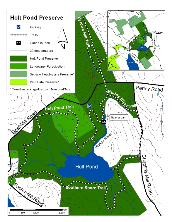
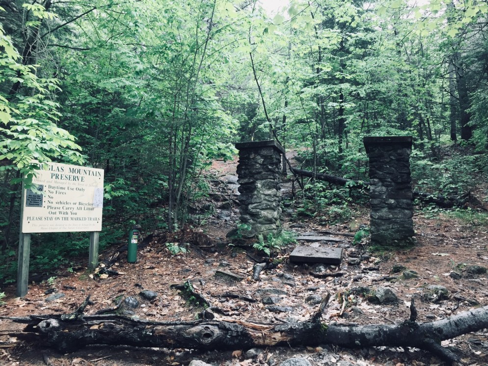
Douglas Mountain, the highest of the Saddleback hills near Sebago, is the third in a recent trio of Lakes Region hikes, preceded by Bald Pate Mountain and Holt Pond Preserve, all of which are in close proximity (I did the three hikes in a single day, so they are eminently achievable day hikes).  I hiked Douglas Mountain (1,416 ft) in Sebago in June 2018, via the Eagle Scout, Nature Loop, and Ledges Trails (2.3 miles, approximately one hour).  This is a hike we’ve done several times as a family.  These trails, part of the 169 acre Douglas Mountain Preserve, are maintained by the town of Sebago, which has a trail map and guide on its site. As usual, the AMC Maine Mountain Guide has a great description.  A fee of $3 is payable at a kiosk in the parking area.

013343dc41b0f27607365927d0a68563fa1a67dd4b
A mossy brook along the Eagle Scout Trail

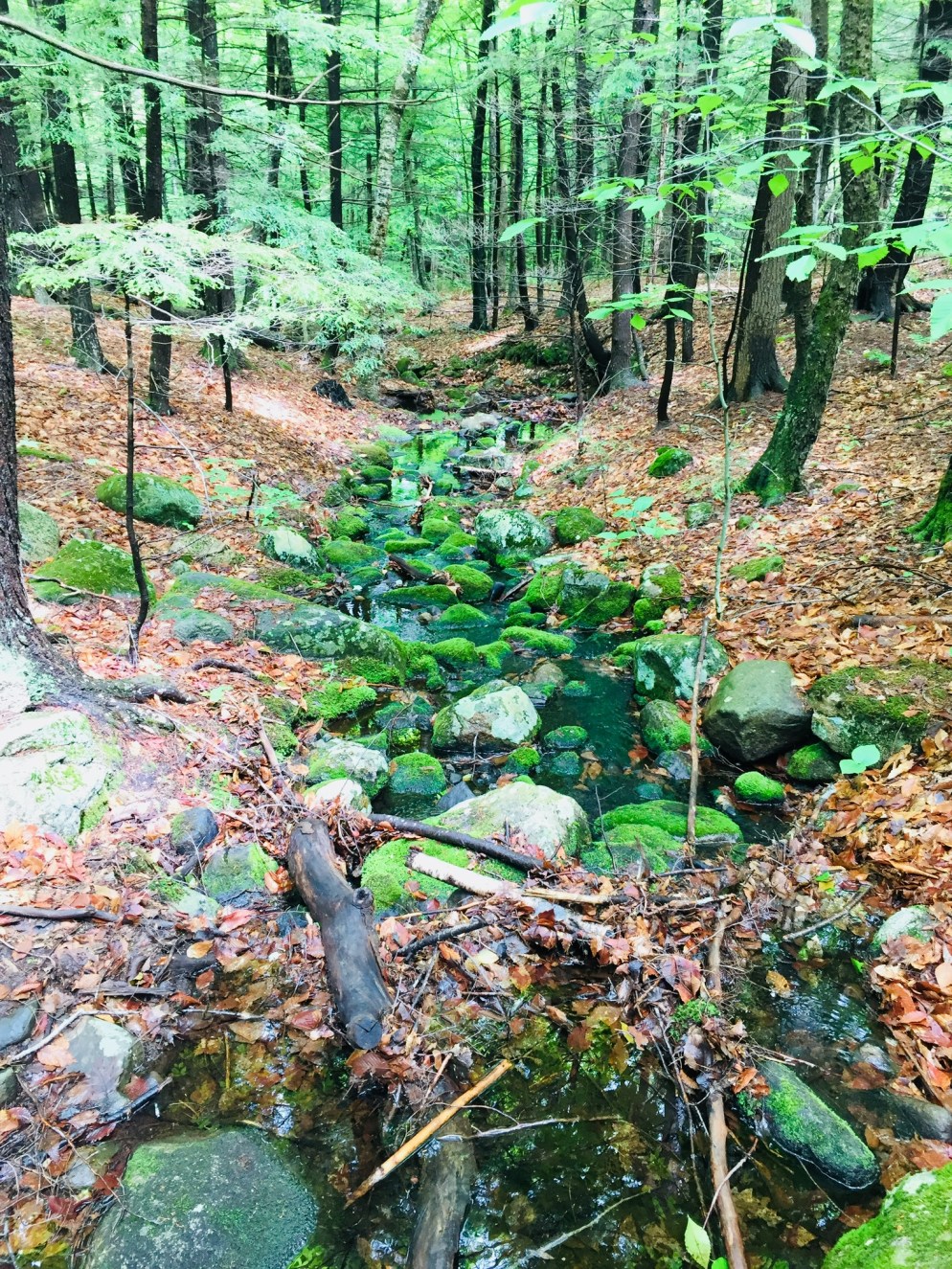
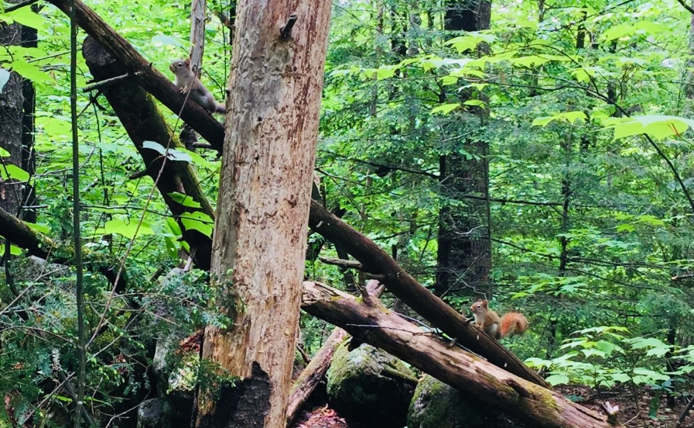
The climb is a pleasant walk through the woods on a well-traveled path, with streams and beautiful trees.  On the Nature Loop, you can start to get a sense of height from the ledges, but for the most part, the foliage hides the horizon and longer views until you reach the summit.  As for Nature on the Loop, there were many mourning doves, plenty of wild blueberry plants, and innumerable chipmunks and red squirrels, who seemed suspiciously acclimated to humans.

014ed0a9e2cb4e29e6582805bc6efa5e0c9757ac4b
Two red squirrels hope for a handout along the Eagle Scout Trail

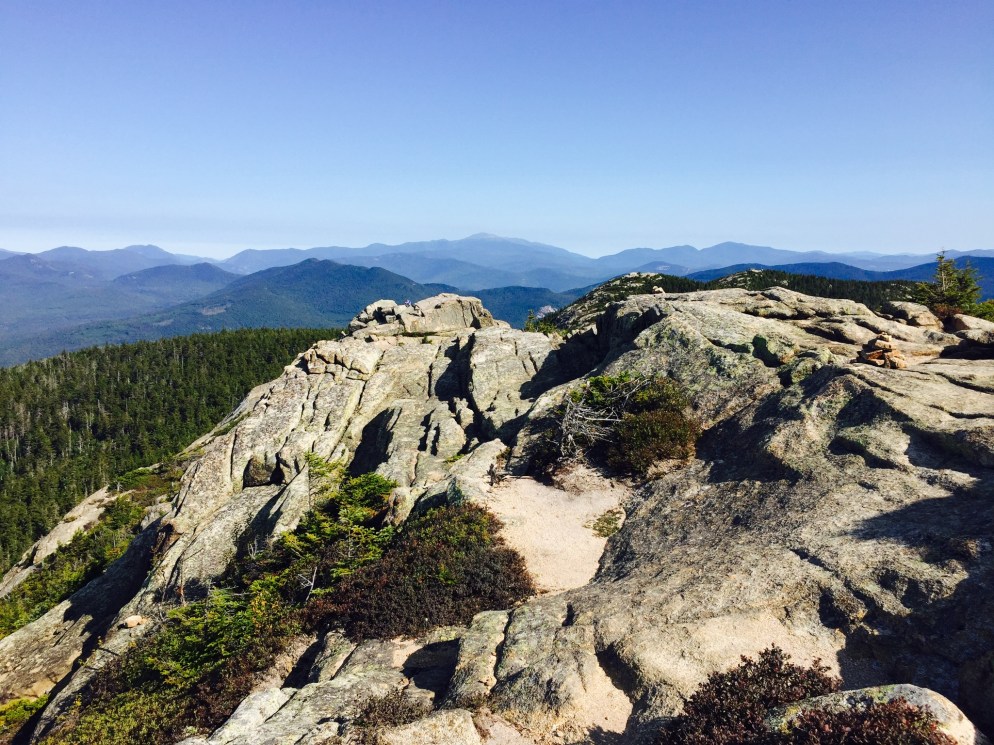
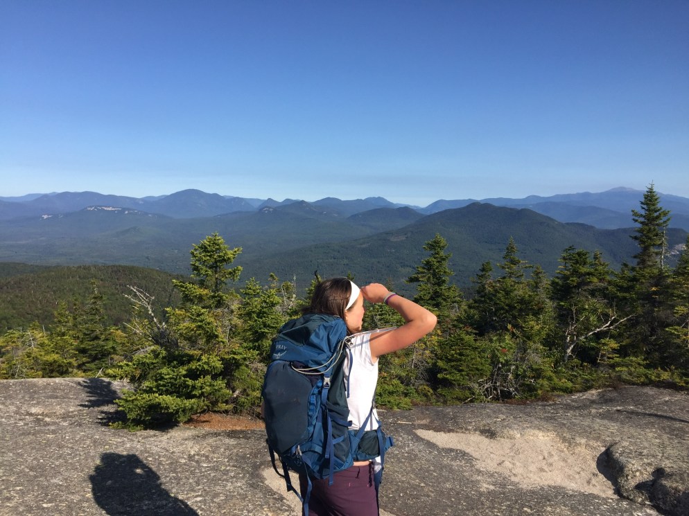
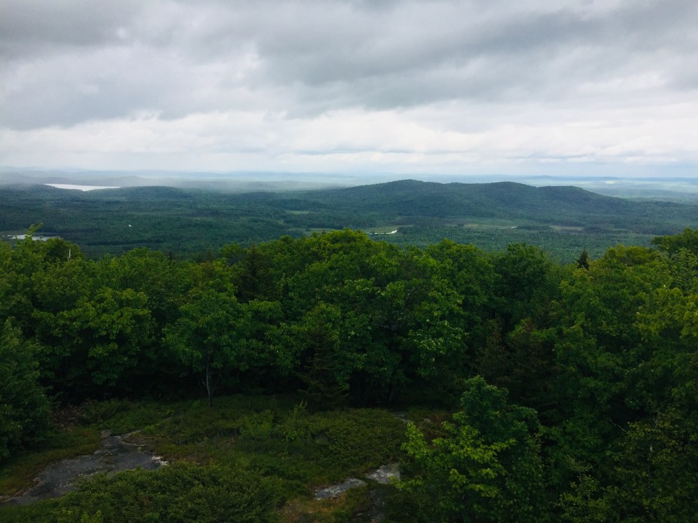
The summit’s stone tower allows for panoramic views, and a pictorial display helps to identify which peaks, lakes, and points of terrain you are able to see on a clear day.

011805f148184b09c0767ecf4a0c898c77b0a6e9fe
Entrance to the climb of the Ledges Trail, or the end of the trail, depending on your direction of travel

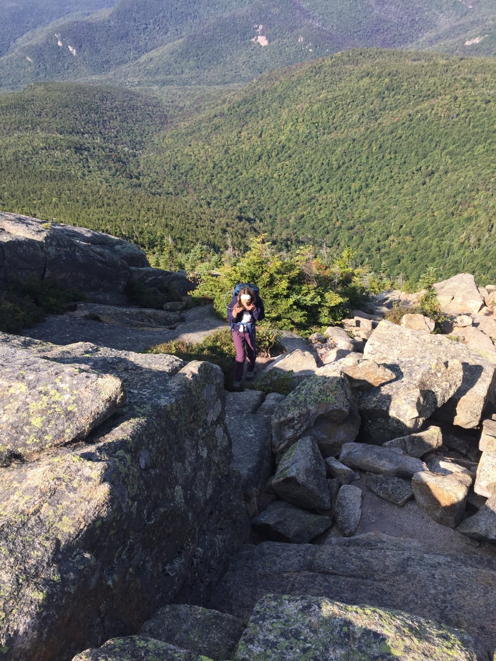
A steep descent down the Ledges Trail can be slippery in wet weather, so use caution in selecting your route.  The last .4 miles or so back to the parking lot is reached by walking along Douglas Mountain and Ledges Roads, past beautiful houses.  This route to the summit is substantially shorter than the Eagle Scout Trail, and would be a short, challenging scramble for younger hikers.

(Disclaimer: This post contains affiliate links, and as an Amazon Associate Hiking in Maine blog earns from qualifying purchases.)

Holt Pond Preserve (Bridgton, ME)

0139fae195aab23b10cf1a713859803ec9d827a8d6
Boardwalk leading to Holt Pond

The Lakes Region of Maine continues to be a great place to hike.  I hiked Holt Pond Preserve in Bridgton, what turned out to be a 4.5 mile loop (approximately an hour and forty-five minutes), on a June morning after heavy rains.  Holt Pond Preserve is a preserve of over 400 acres, maintained by the Lakes Environmental Association (LEA), who have a site with interpretive guides and maps.

Holt_Pond_Preserve_FinalMap-Feb_2012_for-web
LEA Map from website

No dogs, bicycles, or ATVs are allowed at Holt Pond. There is, however, a canoe launch, which looks like a great way to see Muddy River and Holt Pond.

01126a70c7d000d416b3fcb5f3c77894eb836f220b

The preserve was alive with the sounds of waterfowl, including ducks and geese, and the distinctive calls of red-winged blackbirds and frogs.  The boardwalk allows for fascinating views of plants that you would normally need hip waders or a kayak to see, particularly pitcher plants.

01a09a08e4798525450fd1683fec1370a7cdd526b9
Pitcher plants next to the boardwalk

These carnivorous plants had flowers above them when I visited, something I had not yet seen. The bog breathed fetid air through the gaps in the boardwalk, a contrast to the cool breezes above.  Animals use the boardwalk pathways, too, and I tagged along at times behind a chipmunk and a small fledgling bird, both of whom were unable to yield the path until they reached solid ground.

01b7ed9e323741bd7d294051e147b8b540d7f45739

The trail’s path changed from bog to pine forest toward Grist Mill Road, and following it became more difficult, as it was overgrown, with a fair amount of upheaval to bridges and boardwalks from spring rains.

01f4ba935a1c166f97c0b6efb2289310fb60b8ed73
The trail was a bit overgrown in places

This moisture also brought with it plenty of mosquitoes.  For those attempting the Southern Shore trail on the far side of Holt Pond, I would highly suggest pants and long sleeves, as well as insect repellent and a weather eye for poison ivy.

This stone wall on the trail bears the telltale sign of chipmunk dens – piles of pine cone scales

The trail skirts private property by moving onto Chaplins Mill Road briefly to the east of the preserve.  I clearly missed the turn back to the trail, so I took Grist Mill Road east (left) to make a loop back to the parking area.

While the full perimeter of Holt Pond might be a bit much for most kids, the boardwalk near the parking lot is a perfect excursion for young ones, particularly using the interpretive guide on LEA’s site.

And, as mentioned in the Bald Pate post, this trail network is connected to the Bald Pate Preserve via the Town Farm Brook Trail, which ascends Southwest to the Bob Chase Scenic Loop.

Bald Pate Mountain (Bridgton, ME)

The Lakes Region of Maine surrounding Sebago is a fantastic area for hiking, with many hikes in striking distance of lakefront idylls and other recreation.  Bald Pate Mountain (1,150 ft) is an easy to moderate hike in Bridgton, Maine, with many trail options, comprising 6.7 miles of trails.

On this June morning, I took the Bob Chase Scenic Loop to the summit, then the South Face Loop Trail, returning the same way to the parking lot, for an approximately 3 mile hike (about an hour and fifteen minutes at a relaxed pace).  Bald Pate trails are well-chronicled in the AMC Maine Mountain Guide, and the trail map and descriptions are available online from the Loon Echo Land Trust, which owns and manages the 486 acre Bald Pate Preserve.

Bob Chase Trailhead at the parking lot/kiosk
Bob Chase Trailhead at the parking lot/kiosk.

Approaching Bald Pate from the south on Route 107, you can see the exposed rock that is the mountain’s namesake.  The parking lot is located on the east side of 107, just south of Five Fields Farm and XC Ski Center, at the top of a large hill.  The climb up 107 allowed the car to do a lot of the work of getting to the summit before I even started hiking.

img_0622
Face of Bald Pate Mountain in winter, Bridgton, Maine

When I arrived, the lot was empty, and a small circle of depressed grass and milkweed next to my car looked like a place where a deer had slept the night before.  I started up the Bob Chase Scenic Loop, with birch trees, lady slippers, wild blueberries, and ferns on either side, and red squirrels chattering loudly.

Views west from the Bob Chase Trail
Views west from the Bob Chase Trail.

A wrong turn took me around a pleasant diversion/backtrack to the other side of the Bob Chase Scenic Loop, and I wound my way back to the summit.  This was not the fault of the trail maintainers, as the Bob Chase Loop is clearly marked in blue, and the South Face Loop is clearly marked in orange.

View from the South Face Loop toward Peabody Pond
View from the South Face Loop toward Peabody Pond.

The summit is easy to reach in 25 minutes or less, with excellent views, and it looks like a riot of wild blueberries awaits those who hike it later in the summer.  The South Face Loop was much more challenging than the Bob Chase Trail, descending steeply, skirting the face of the mountain, and then ascending quickly to rejoin the summit (I thought several times, I already climbed this, didn’t I?).

The Pate Trail is a short, steep (.1 mi with 360 ft of elevation gain) trail connecting the summit to the South Face Loop, and I will have to try this one next time, as well as the Moose Trail, which can create a different loop back to the parking lot.

Don't forget to
Don’t forget to “tip your bartender.”  Conservation takes time and money.

This trail network is connected to the Holt Pond Preserve via the Town Farm Brook Trail, which descends northeast to the Holt Pond Trail, a link which could create a much longer hike in a very different environment (bog walkway). The Bald Pate summit is a nice, short hike, suitable for most age and skill levels, with great vistas along the way.

(Disclaimer: This post contains affiliate links, and as an Amazon Associate Hiking in Maine blog earns from qualifying purchases.)

Mount Chocorua

016826b763b9bb48dd29303074186723d61976eb0b

Dad did Chocorua solo on August 30 and then came back with daughter on September 2, 2017 to do it again.  This hike was suggested by friends, and planned using the AMC White Mountain Guide, making it part of the “and beyond” part of our stated “Pine Tree state and beyond” header, as the mountain is in Albany, NH.

There are several loops up and down this beautiful mountain, and dad took the Piper, Nickerson Ledge, Carter Ledge, Middle Sister, and Piper Trails up, then descended via the Liberty, Hammond, Weetamoo, and Piper Trails (9.6 mi).  This trailhead is accessed from NH 16.  Dad and daughter ascended on September 2 via the less challenging but equally scenic Champney Falls and Piper Trails (7.6 mi), accessed from the Kancamagus Highway.  Both parking lots can be crowded in the summer, so we got an early start.  From either starting point, there is a small cash use fee to the White Mountain National Forest, payable with cash at a kiosk (and bring a pen).

0196c946aa227721ea76908cd2062924657a6c5887

The trail climbs steadily up past Champney Falls and Pitcher Falls, which were not running with much force at this time of summer, but still worthwhile to see.

01d185b04bb975e012f57f3798eacff99578ad84ef

After the intersection with the Piper Trail, the vistas opened up, and we had fun making our way up to the windy summit in the morning sunlight.

010c2f3d1e431b67e46eacae0827cffcb06969aa1b

The last scramble to the top involved some steeper climbing, which we enjoyed.  We didn’t spend much time at the summit, as the wind was powerful.  After the climb up, our descent was pleasant and uneventful.  We did notice that the volume of hikers headed uphill increased dramatically as the day wore on, and felt good about getting an early start.  Many people brought their dogs, and this seemed like a good hike with a pet, as long as they were careful near the top.

We enjoyed a great post-hike pizza at Brothers Original Pizza in Albany, NH, which has an outdoor deck, if you are so inclined.  The air was chilly on this trip, but if you take the Champney Falls route, a short distance down the Kancamagus Highway is the Lower Falls Recreation Site, where you can cool off in the Swift River after the hike.

(Disclaimer: This post contains affiliate links, and as an Amazon Associate Hiking in Maine blog earns from qualifying purchases.)

Megunticook Loop at Camden Hills State Park

Camden Harbor and West Penobscot Bay from Mount Megunticook

Midcoast hiking means dramatic ocean views.  We first explored Camden Hills State Park in April 2017, when we started our 100 Mile Wilderness Training with a relatively short (5.4 mi) and moderate 3 hour hike- the Megunticook Loop at Camden Hills State Park, via the Mt. Megunticook (10 on map), Ridge (3 on map), Slope (9 on map), and Multi-Use (11 on map) Trails.  The idea for this hike (and many others) came from the indispensable 10th edition of the Maine Mountain Guide , which we have dog-eared and highlighted, as it is an incredible wealth of knowledge (Amazon link is to the new and improved 11th edition, and you can read about all the updates here).  Parking is easy, and a small fee is charged for entrance.

Camden Hills State Park map for Mount Megunticook

It was a good opportunity to test out some of our new equipment, in unexpectedly snowy conditions – the bulk of the hike was done through deep, crusty snow and sheets of ice.

Icy stream, Mount Megunticook

In addition, we had our cousin, an experienced hiker, with us, as well as our wife/mom, a um, not-so-experienced hiker (her meal for the trail was a Ziploc bag of peapods, which she accidentally stepped on in the parking lot).

This loop had some great views along the way, particularly from Ocean Lookout, but not much to see at the top. It was a fairly easy climb, but we would recommend doing it in the late spring, summer, or fall. The trails were well-maintained and this loop had a gravel path for parts of the way. With an elevation of 1385 feet, it was a steady climb for most of the way up.

Camden Harbor and West Penobscot Bay from Mount Megunticook

This was the first time we tried our packs. For dad, an Osprey Xenith 75L pack, with an Osprey UltraLight Raincover, XL. For daughter, an Osprey Ace 50 Night Youth 50L pack (it has a built-in raincover).  We equipped each with an Osprey Hydraulics 3L reservoir, for hydration.  Obviously, we didn’t need packs or a hydration bladder of that size for this hike, but they are so well made, we chose to just fill them with less water.

We also got to try out our JetBoil stove- a freeze-dried meal of Chili Mac at the top required heating.  Due to dad’s disdain for instruction manuals, the stove spewed gas noisily for several minutes before we figured it out (dad’s fault, not the stove, which we found to be excellent).

A brief cautionary tale- we have probably undersold the difficulty of hiking in the snow present on Megunticook.  Wife/mom had issues with wet shoes/socks, and our mountaintop dining was cut short by a speedy descent.  Dad/daughter agreed that the extra time heating/mixing made the Chili Mac better.

Either way, cheap food and good beer at Marshall Wharf Brewing Company made for a great after-hike stop on the Belfast waterfront.

(Disclaimer: This post contains affiliate links, and as an Amazon Associate Hiking in Maine blog earns from qualifying purchases.)