Peaks Island Loop

Casco Bay Lines Ferry Terminal, Portland, Maine

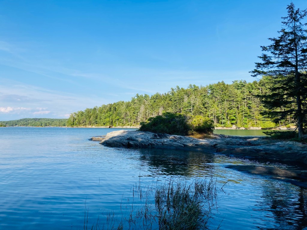
What is a hike, really, but a long walk, preferably in the countryside? Sometimes the sense of getting away can be amplified by the journey to get to the hike’s starting point, whether it be a long drive through strange places, a bus ride, or in this case, a boat trip. While it may seem hard to escape the (relative) bustle of Maine’s largest city, a 4-mile loop with birds, flowers, and ocean vistas is only seventeen minutes away via Casco Bay Lines. Like Moosehead’s Mount Kineo, this hike begins after a short ferry ride, a trip across Portland Harbor to Peaks Island, part of the city of Portland.

Rugosa roses and view of Cushing Island from Peaks Island, Maine

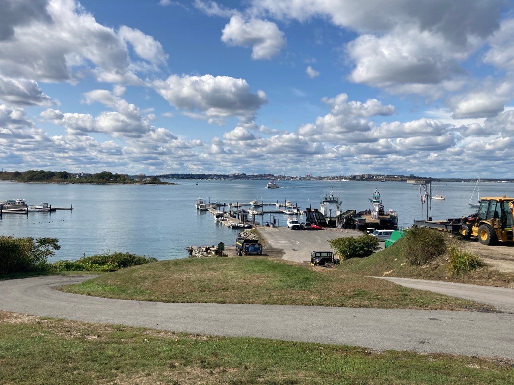
The Casco Bay Lines Terminal is located at 56 Commercial Street, Portland, Maine, and the ferry schedule is posted here. As of November 2025, round-trip tickets are $7.20 for adults (14 and over), $3.60 for kids/seniors/disabled, and free for children under 5. These typically double in peak season, mid-April to mid-October. Dogs can go on the ferry, they must be leashed, and their tickets are $4.50. You can bring bikes for a small fee, or rent them on-island (golf carts can also be rented, but that’s not hiking). The voyage from Portland to Peaks allows views of Fort Gorges, the harbor, seabirds, and occasional seals.

View from Peaks Island in October

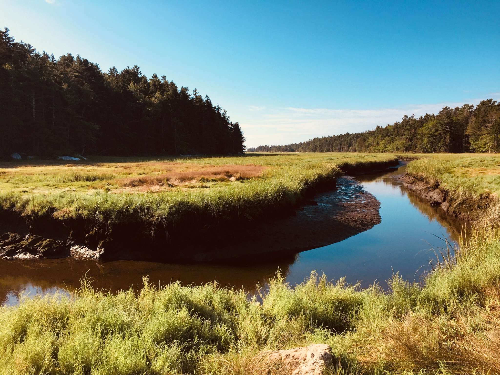
Portland Trails has a map on their site of the approximately 4-mile Peaks Island Loop. For more detail, check out the Peaks Island Land Preserve, which maintains the small, wild and/or historical places along the way. On a place like Peaks, time for visitors and businesses is measured by the ferry schedule, so allow a couple hours to fully explore the island before catching a ferry back. Simply turn right or left upon walking up the hill from the ferry, and follow the shoreline. If you get off-track, respect private property, and signs will typically get you back on the route which traces the perimeter of the island, predominantly along Island Ave and Seashore Ave.

East side of Peaks Island, with view of Ram Island Ledge Light Station in the distance

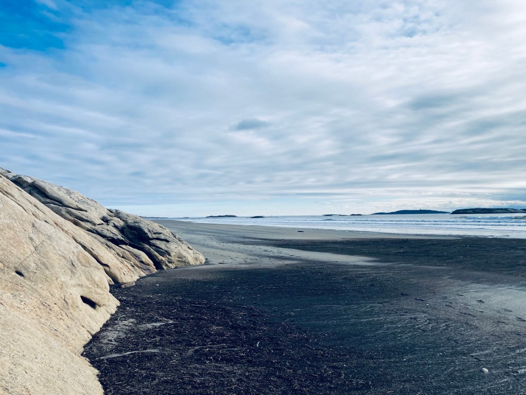
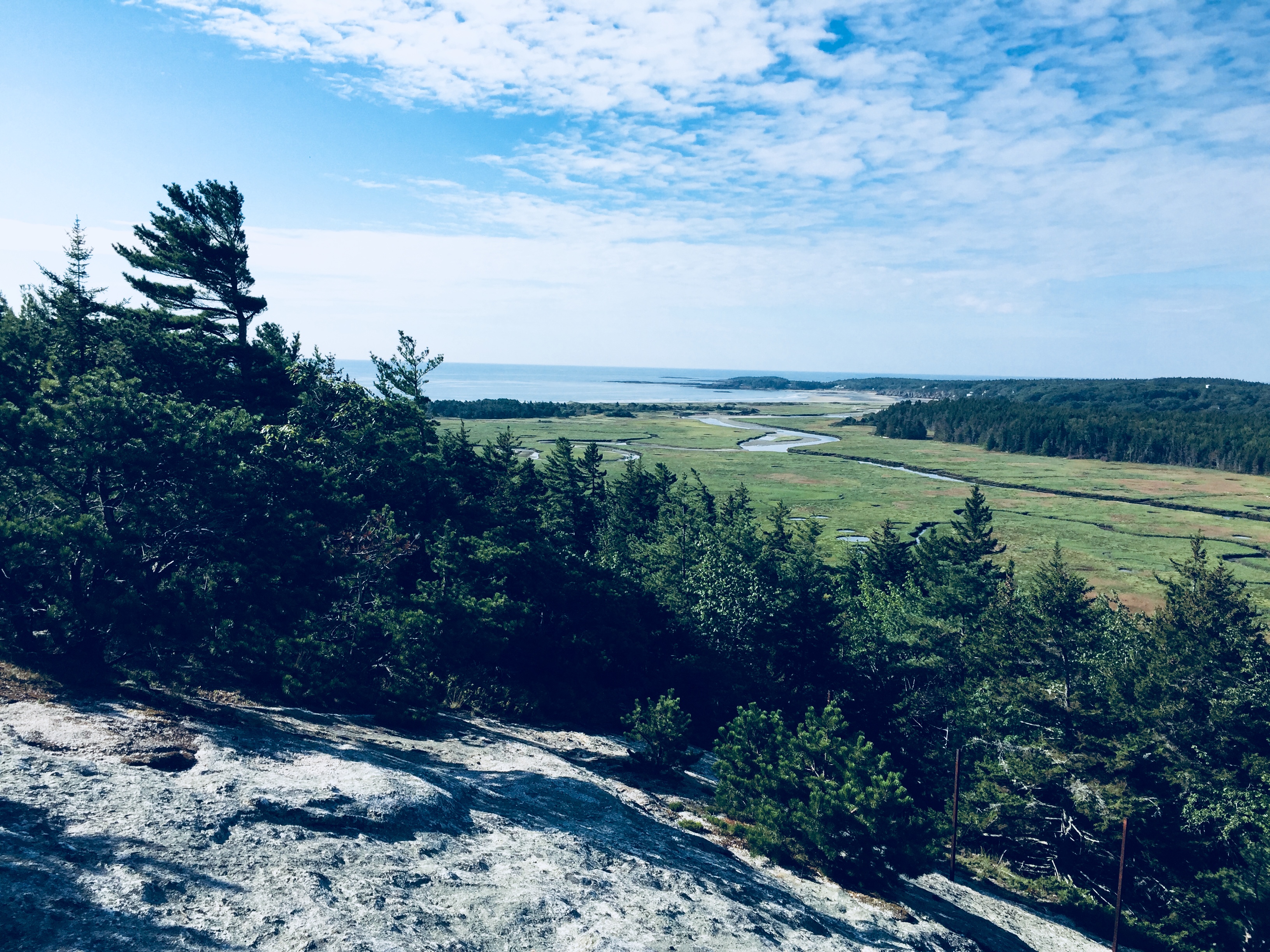
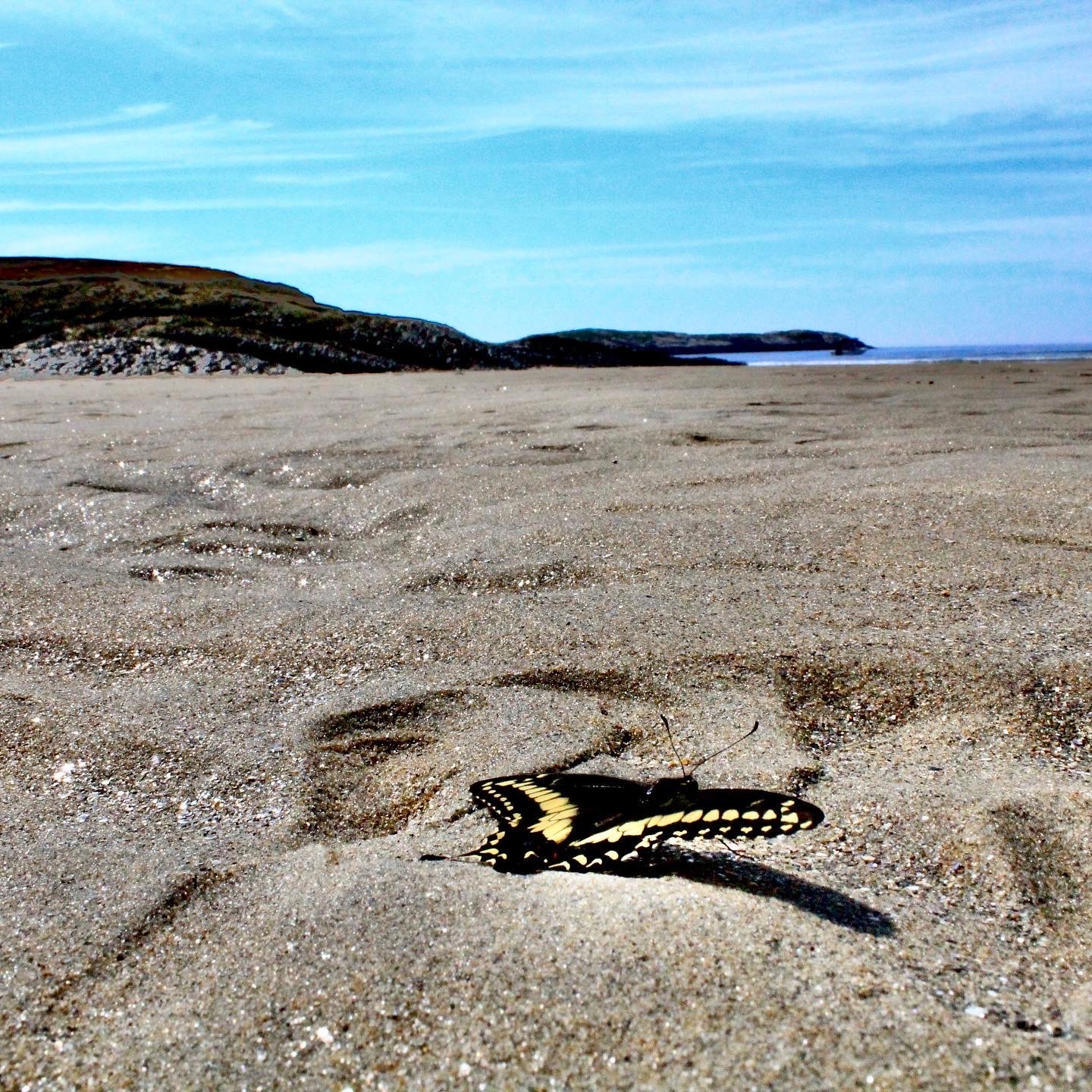
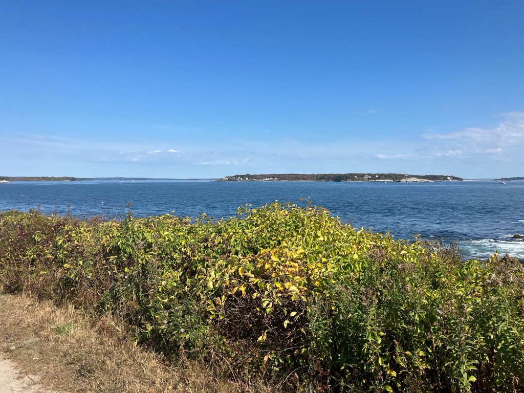
Bring a small bag or backpack with you, with water and sunscreen, as most of the places to get those items lie within a stone’s throw of the ferry terminal. Hannigan’s Island Market has everything you need for an ad hoc picnic. For those with younger children who don’t think a long, sunny walk would be the best option, follow Island Ave to the left to City Point Road and the boat ramp. The beaches there are full of barnacle-covered rocks, sea glass, and skittering crabs. This part of the walk is somewhat of a home and garden tour. The shore of the island’s eastern side is more dramatic, with large waves crashing on rocks.

Entrance to Battery Steele Conservation Area, Peaks Island, Maine

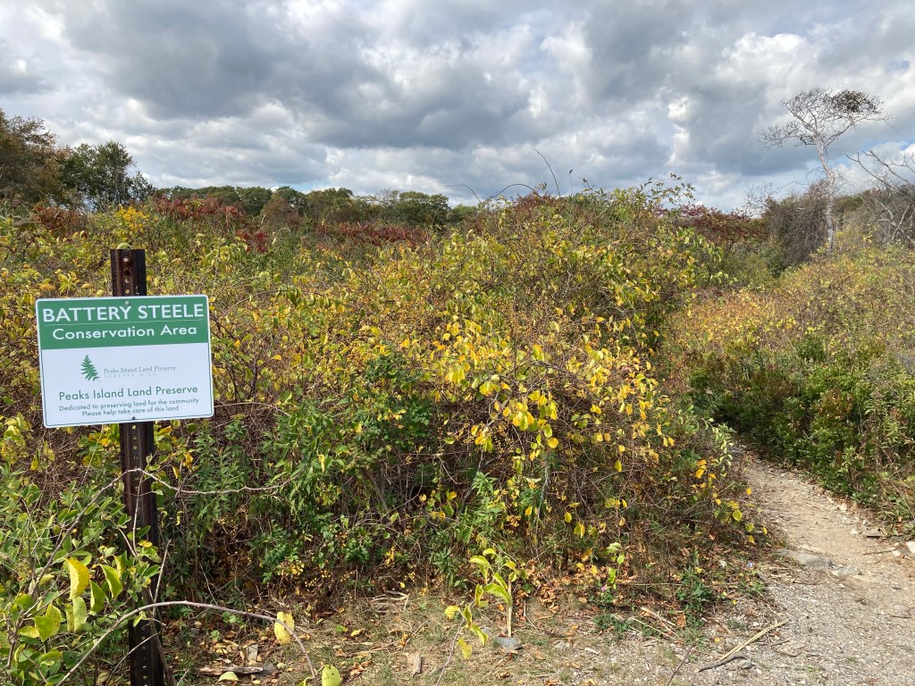
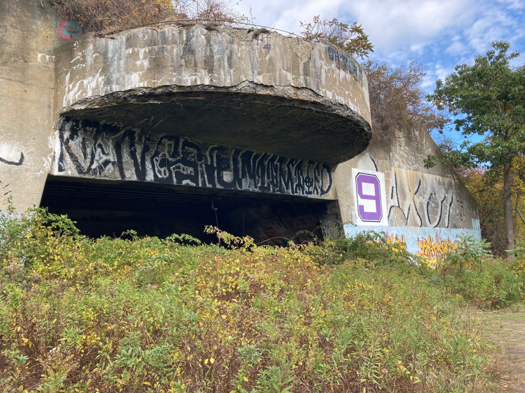
Battery Steele, about halfway around the island on the eastern side, is a World War II-era gun emplacement, part of the former Peaks Island Military Reservation (PIMR). The PIMR used to cover a quarter of the island’s land area, and served to guard Portland Harbor and Casco Bay against the threat of enemy ships and submarines. Now overgrown by vines and shrubs, these recessed turrets and tunnels can be explored by flashlight. Daughter used to challenge herself to see how far she could walk down these dark, spooky walkways without using a flashlight.

Battery Steele, Peaks Island, Maine

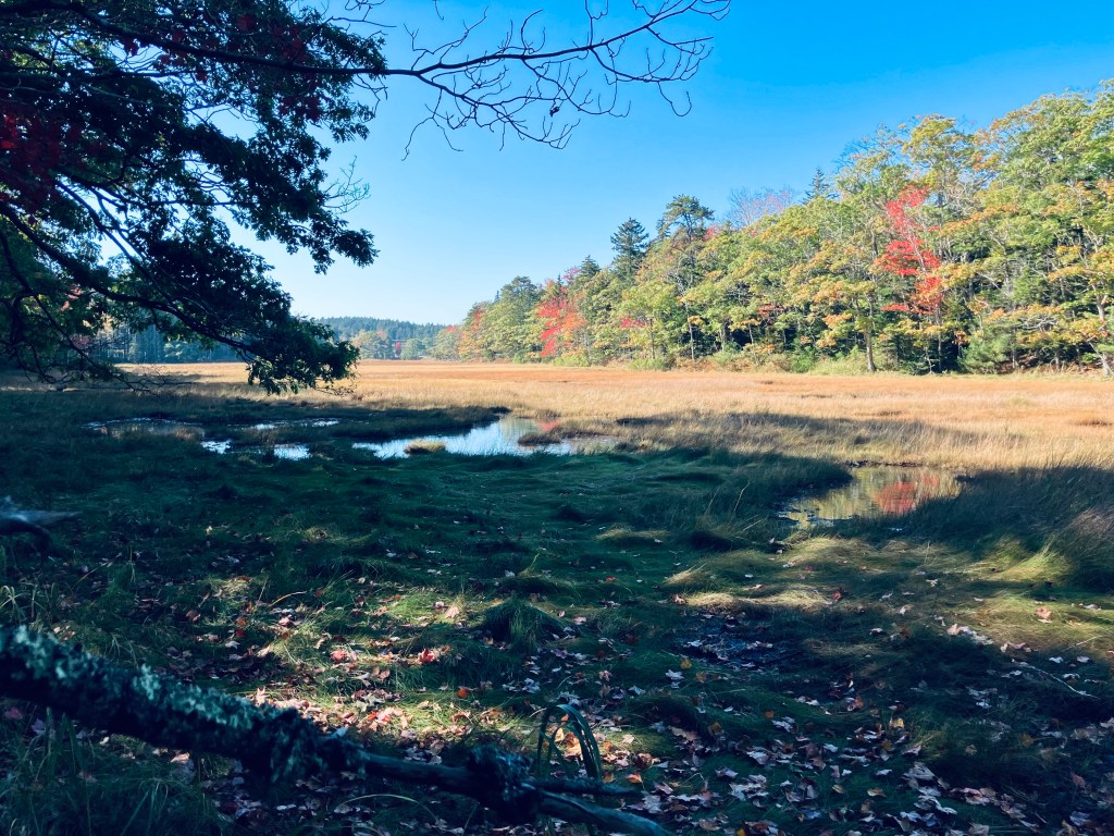
Central Avenue can be used as a mid-island cutoff, if trying to make it to a ferry, and leads to some quiet trails in the Hundred Acre Wood. While waiting for the ferry ride back, hopefully you’ve left yourself time for lunch or a drink, maybe even an ice cream. Our favorite is the friendly Island Lobster Company, on Island Ave just south of Peaks’ main intersection by the ferry. The beach adjoining the ferry pier will give up sea glass if you search for it, which makes a good distraction for kids. A trip to Peaks Island is a day well-spent, a unique ocean walk.

View across Portland Harbor from Peaks Island, Maine

Morse Mountain to Seawall Beach (Phippsburg, ME)

Winter chill at Seawall Beach, Phippsburg, Maine

(The Bates-Morse Mountain Conservation Area can be crowded, particularly in the summer and on weekends. They advise to plan your trip accordingly, and note that they “turn cars away once the parking lot is full.” You can check the status of the lot online at https://www.bmmparking.com/)

Your five-year old could do this, but everyone in the family will love it. It’s the Bates-Morse Mountain Conservation Area near Phippsburg, Maine, a 3.8 mile out-and-back hike over Morse Mountain (433 feet) to Seawall Beach.  Wife/mother of the hiking family here again to report that I think I may have found my favorite “hike” so far! (Full disclosure: while I love the outdoors, I am not on the hard-core side of the hiking spectrum, preferring instead to walk at a steady pace for up to three hours in nice weather. Furthermore, I do not get an adrenaline rush from dangerous climbs so I avoid them.) Hike is in quotations here because this particular adventure may be more of a beautiful walk, given the minimal altitude, the terrain (mostly paved) and the distance. This hike checks all the boxes for me in all seasons. Let’s begin!

01e2157f1b5483a8c9e693eb3311dc18d09a34d470
Sprague River Salt Marsh, Phippsburg, ME

This trailhead is well-marked. From Route 1 in Bath, you follow Route 209 south to Route 216 to Morse Mountain Road where there is a small parking lot on your left. Arrive early, particularly on summer weekends, because parking is limited (see note and link at beginning to check on it last-minute, particularly with less parking lot capacity due to social distancing). We have been turned away on Father’s Day weekend. At about 8:30 am on a summer Saturday, people are trickling in, but there are usually still spots available. By half an hour to an hour later, all the spots can be full (On New Year’s Eve, the lot was mostly full by mid-morning). There is a friendly attendant there in the summer, giving maps, selling crafts and answering questions (donations accepted).

Salt Marsh trail at entrance to Bates-Morse Mountain Conservation Area, Phippsburg, Maine

If you are turned away, consider the nearby hikes at Reid State Park Loop, Hermit Island Loop (in winter only), Sprague Pond Loop, or Cooley Preserve. Additionally, there is a very short trail, the Bill Jayne Trail, accessible from the parking lot. Head back down the road away from the Morse Mountain Trail, and you will reach the trailhead, which leads to a Phippsburg Land Trust trail (marked “Salt Marsh Access Trail,” only several hundred yards long, ending at a bench overlooking the Small Point marsh.

Morning light through trees, trail over Morse Mountain to Seawall Beach

The entire trail is paved, as this is a service road, so it is wide enough for a bunch of people to walk together and chat (I doubt you will need a trail map, but if you do: Morse Mountain Map). Shortly after departing the lot, you notice the area is quite well maintained by the Bates-Morse Mountain Conservation Corporation with members from the St. John Family (who originally conserved the area), Bates College and the public. For those with four-legged friends, dogs are not allowed in any season. Additionally, radios or speakers are not permitted, so listen to the ocean and birds.

IMG_5484 (Edited)
View from Morse Mountain, Phippsburg, Maine

Bugs can be a big problem here. Very early or late in the season, or with enough of a breeze, they won’t bother you too much. Otherwise, bring strong (Deet-based) insect repellent, and walk fast. About halfway into the hike, you will see a fork in the road and you head right to get to the summit. “Morse Mountain” is really not much more than a hill, yet there are fantastic views at the lookout: the snaking Sprague River, the cliffs in the distance and the gorgeous…drum roll…beach and ocean!

Low tide, Seawall Beach, Phippsburg, Maine

Yeah, I really can’t wait any longer to tell you that this hike ends at Seawall Beach and for those of you who thought you died and went to heaven when you saw nearby Popham Beach, you will be counting your blessings when you see this two-mile stretch of gorgeous sand that is Seawall Beach. After you leave the summit and return to the main path, you have roughly a mile to go to reach the beach. Then, kick off your shoes and enjoy this huge, uncrowded beach.

Seawall Beach in winter, Phippsburg, Maine

We headed right upon entering the beach area and walked for approximately a mile to the “red pole” which is marked on the map and signals the end of the conservation area. A left turn will eventually bring you to Popham Beach. Try to hit this beach at low tide if you can so you will have plenty of room to roam. Daughter loved the large clam shells, sand dollars, sea gulls, ospreys, and little plovers. The beach is constantly changing with tides, seasons, and weather. On a July trip, we saw plenty of seals, as well. In October, the changing leaves and fall grasses were reflected in the Sprague River. On a late-December trip, a storm had coughed up lobster traps and buoys, which were lined up at the high tide line like a used-car lot.

Swallowtail butterfly near end of life cycle, Seawall Beach, Phippsburg, Maine

Since access is limited, there are so few people on this beach! For three people who hate crowds and love the ocean and the sand, it was kind of hard to leave. The trail is easy and beautiful so the 33 minutes it took to walk back were very pleasant. Here is my advice for your trip to Morse Mountain:

  1. Go to the bathroom before you get on the trail and do not plan to drink much liquid unless you are a camel. There are no restrooms and since the trail was fairly crowded, you cannot just “pop off the trail” and go behind a tree very easily without being seen. The ocean is an option, but it’s Maine-cold.
  2. Bring bug spray.
  3. Consider staying awhile at the beach, which means that you might need a towel, sunscreen, hat, and snacks! The beach is that good.
  4. Go early in the day to get a parking spot. If it’s full, you can wait, go to Popham Beach State Park, or try a nearby Phippsburg hike, as described above.
  5. Try to hit low tide.

This truly is a Maine gem and when visitors come and ask where to go, this is going to be on the top of my list as it showcases the beauty that Maine has to offer without the crowds. A little exercise, fresh air, woods, marsh, beach, snacks, family and friends – you can’t beat it.

View from trail over Morse Mountain to Seawall Beach

Oak Point Trail (Sunkhaze NWR)

Birch Stream in morning light, Oak Point Trail, Sunkhaze Meadows NWR, Milford, ME

The Oak Point Trail is a 2.8 mile out-and-back trail at Sunkhaze Meadows National Wildlife Refuge (NWR) in Milford, Maine, a town on the Penobscot just north of Bangor. Sunkhaze NWR is a 11,485 acre refuge that protects the Sunkhaze Meadows peat bog, as well as a large concentration of migratory birds. I navigated using the AllTrails app, but the best description and map are hosted by the Friends of Sunkhaze Meadows. Oak Point Trail is in the middle of the three trails on the south side of the NWR, next to Johnson Brook and Carter Meadow Trails, and directly across from The Nature Conservancy’s Bradley-Sunkhaze Preserve. As with all these trails at Sunkhaze NWR, they can be oppressively buggy and wet in late spring and early summer. I enjoyed the brisk, bug-free chill of mid-September. Dogs are allowed, but must be leashed at all times. Hunting is allowed, so wear blaze orange during hunting seasons.

Oak Point Trail, Sunkhaze Meadows NWR, Milford, ME

There’s a clearing between the trail and County Road that does not appear designed for parking. It’s better to park in the lot across County Road by Birch Stream. Small side trails to the right shortly after the hike’s beginning the hike have views from the banks of slow-moving Birch Stream. The surrounding forest rang with the morning calls of many large, loud jays. This trail is grassy and a bit overgrown, but easy to walk and to navigate. The light behind the forest to the right (east) slowly begins to open up to the large open marshy meadow behind it.

Viewpoint, Oak Point Trail, Sunkhaze Meadows NWR, Milford, ME

The marsh itself is visible through short spur trails to the right close to the end of the trail, and then at the end of the trail. I could see small songbirds hiding in the bushes surrounding the marsh, with many jays calling again. The tracks and flattened and trampled grass left behind by deer and moose were passive evidence of the recent presence of these larger animals. At the trail’s end there were more limited views, but several yellow-rumped warblers, hovering and moving around, waiting impatiently for me to leave. The easy, flat path was about an hour.

Morning light on Oak Point Trail, Sunkhaze Meadows NWR, Milford, ME

Johnson Brook Trail (Sunkhaze NWR)

Johnson Brook Trail, Sunkhaze National Wildlife Refuge, Milford, Maine

Johnson Brook Trail is a 3.3 mile loop trail at Sunkhaze Meadows National Wildlife Refuge (NWR) in Milford, Maine, a town on the Penobscot by Orono/Old Town. Sunkhaze is a 11,485 acre refuge that protects the Sunkhaze Meadows peat bog, as well as a large concentration of migratory birds. I navigated using the AllTrails app, but the best description and map are hosted by the Friends of Sunkhaze Meadows. Johnson Brook is the farthest east of the three trails on the south side of the NWR, next to Oak Point and Carter Meadow Trails. Dogs are allowed, but must be leashed at all times. Hunting is allowed, so wear blaze orange during hunting seasons. I started early (right at sunrise) on a mid-September morning from the small parking lot, with a definite chill in the air. From experience, Sunkhaze much earlier in the season can be pretty wet and buggy. I started along the flat, easy trail, with the sound of barking dogs at a nearby residence giving way to jays and chattering red squirrels.

Beaver pond spur on Johnson Brook Trail, Sunkhaze National Wildlife Refuge, Milford, Maine

The righthand spur heads east off the loop trail at about 4/10 of a mile, and I took this to see the beaver pond. The changing colors of the ferns and the deciduous trees, as well as the mist rising from the pond in the cool morning made this trip (less than a third of a mile) well worthwhile. At a little over a mile on the loop trail, you will reach a couple of raised boardwalks over the marsh, just before the second spur trail, which goes off to the right. At the time I came through, this spur was clearly marked off by a sign with a red line through a hiker, so it’s closed for now.

Johnson Brook Trail, Sunkhaze National Wildlife Refuge, Milford, Maine

After another boardwalk, the trail turns left to return to the east side of the loop. At this turn, there is a path back to County Road and there are two interpretive displays on vernal pools and songbirds. The trail and a bench on this part of the loop are dedicated to Janice Beckett, a former president of the Friends of Sunkhaze Meadows. I visited on a dry fall day, but the many boardwalks and plank bridges, the moss, and the dense cedar speak to how marshy this area is, typically. In mid-September, this was a nice, easy loop, taking about an hour, for late summer wildflowers and wildlife sightings.

Johnson Brook Trail, Sunkhaze National Wildlife Refuge, Milford, Maine

Blueberry Ledges

Morning light, Abol Stream Trail, Baxter State Park, ME

Some trails at Baxter State Park are quieter than others, and Blueberry Ledges, on the south side of the park, approximately midway between Katahdin Stream Campground and Abol Beach, is a beautiful spot you just might have all to yourself. Appalachian Trail (AT) thru-hikers this close to Katahdin are unlikely to take side trails, and day-hikers are often focused on the more robust peaks to the north and east. The lollipop loop trail to Blueberry Ledges from the trailhead at the end of Abol Beach Road is a 6.6 mile hike (if you take all the side trails like I did), using the Abol Stream Trail to briefly leave the Park, then pick up the Appalachian Trail (AT) northbound on the way out, and Abol Pond Trail on the return. I’ve done this twice, both on bright mid-September mornings, using the route recommended by the book Hiking Maine’s Baxter State Park. The Blueberry Ledges are also accessible from the north by using the AT southbound from the Park Tote Road near Katahdin Stream Campground, an out-and-back hike of about three miles each way. The trails are all on the downloadable Kidney-Daicey map from Baxter State Park, and in my pack, as usual, was the durable Map Adventures’ Katahdin Baxter State Park Waterproof Trail Map.

Mount Katahdin from Abol Stream Trail, Baxter State Park, ME

Abol Beach, which is a quiet, often-empty picnic area (with an outhouse) with a decent-sized parking lot. I began by crossing the small bridge at the outlet of Abol Pond, following the trail along a wide, wooded floor dotted with colorful late-season mushrooms. The path rises on an esker above Abol Stream. A little over a quarter mile in, there’s a short side path along the stream, which dead-ends at a robust beaver dam, and after about .4 miles, a small sign-in kiosk for hikers. At about .7 and 1.1 miles are more turnouts with excellent views of Katahdin’s bulk rising clear and crisp over multi-colored marsh grasses. The trail at this point is an old woods road bounded by sweet fern and pine, and serenaded by the chattering of red squirrels, jays, winter wrens, and white-throated sparrows.

Continue reading

Pleasant Mountain (Bridgton, ME)

Dad and daughter atop Pleasant Mountain summit
Dad and daughter atop Pleasant Mountain summit in 2017

Pleasant Mountain (2,006 ft) is a mountain in Bridgton right next to the former Shawnee Peak, now (since 2022) Pleasant Mountain ski area, with trails mostly on land owned by the Loon Echo Land Trust (see here for info and detailed maps).  Dad and daughter hiked this first with our cousin in April 2017 as part of our preparation for our 100 Mile Wilderness trek via the (moderate) Southwest Ridge Trail (also known as the MacKay Pasture Trail), 5.8 miles up/back, but have done it since in February, August, and other months.  Map and description are also available in the stellar Maine Mountain Guide. The preserve is open dawn to dusk, and dogs on-leash are allowed. Blaze orange is suggested during hunting season.

Morning light on Southwest Ridge Trail, Pleasant Mountain, Maine

This hike can be busy in summer, particular up the Ledges Trail, but an early start or a winter morning can provide solitude.  There are always a few hikers, especially close to the summit, but I have also seen woodpeckers, crows, turkeys, and a winter herd of deer.  The deer were using the same path, and bounded away from me, big white tails flashing, every time they heard my footsteps crunching in the snow, coming no closer than about fifty yards. In the summer, the call of loons carries up the mountain from Moose Pond.

Winter morning view of Moose Pond from near Southwest Summit, Pleasant Mountain
Continue reading

Hart Farm Trails (Holden, ME)

Information kiosk at trailhead, Hart Farm, Holden, ME

The trails at 157-acre Hart Farm in Holden, Maine, have been preserved by the Holden Land Trust and the Maine Farmland Trust, and are open from dawn to dusk. Dogs must be leashed (livestock is present) and cleaned up after. A trail map is available at the town of Holden website (and on kiosk at beginning). I have stopped by here several times on the way to/from Washington County/Dowmeast and Bangor, just a slight diversion off route 1A. This makes a great stop for people or a dog to stretch their legs. The outer loop hike around the Pocket Field Loop Trail is an easy 1.3 miles in about 30-40 minutes.

View of hills and mountains across cow pasture, Hart Farm, Holden, ME

The easy trail network, marked with blue diamonds, begins from a kiosk next to the small parking area, through tall grass and wildflowers, with cows lounging in the large field to the right. Here, the cleared land allows views of the hills to the northeast. It’s also an opportunity for a dumbfounded pit bull to see cows.

Pig the pit bull sees cows, Hart Farm Trails, Holden, ME

An option is available at this point to turn left (west) and connect through the Fields Pond Connector Trail with the Shelterwood Trail of the neighboring Fields Pond Audubon Nature Center trail network (dogs not allowed there). Continue straight to stay on the Hart Farm trails. Off the trail to the left are some junked vintage cars, as the trail curves around the border of the cow pasture.

Goldenrod Field, Hart Farm Trails, Holden, ME

I chose to go counterclockwise, taking me past a field of goldenrod and into the woods. The trail here has trickier footing, with rocks and roots, and was full of birdsong. The sounds weren’t completely wild, as I could hear dogs barking, power equipment, and the sound of jets heading to and from the Bangor airport. The Middle Trail bisects this loop.

Hart Farm Trails, Holden, ME

As I completed the circle, close to the Bates Homestead, the path hugged the edge of a gully with a small valley, typically containing a creek, but dry in some summer months, running through it. A large sign marked the historic Isaac Bates and Ursula Jones Homestead, now consisting of only sunken foundations, which was built prior to 1807. Not long after, I returned to the parking area.

Cows at Hart Farm Trails, Holden, ME

Vaughan Woods (Hallowell, ME)

Cascade Pond, Vaughan Woods, Hallowell, ME

Vaughan Woods, surprisingly close to downtown Augusta and the capitol complex, is part of a 197-acre nature preserve adjacent to the historic Vaughan Homestead in Hallowell, Maine, free to the public and open from dawn to dusk. Dogs are allowed, on-leash. The Vaughan Woods website has trail maps, a historical walking guide, and a list of programs. The Woods, comprising 150 acres, are protected through a conservation easement held by the Kennebec Land Trust. Trailhead parking is available in a small roadside lot at the corner of Litchfield Road and Middle Street. If this is full, alternate parking is available (during non-school hours, weekends and holidays) at Hall-Dale High School at 97 Maple St. in Farmingdale, with trailhead access by the tennis courts. This trail, and our photo, was featured in Portland’s monthly magazine in July/August 2024’s “Micro Hikes” article (pg 55).

Driving Bridge over Vaughan Brook, Vaughan Woods, Hallowell, ME

On a hot July day, and more recently on a cooler May day, I took the Corniche Trail Loop for a lollipop loop of about two miles, taking less than 45 minutes, a good lunchbreak hike. The trail, starting from an information kiosk, starts through an overgrown open field uphill of the homestead, then moves onto a wooded ridge, with Vaughan Brook flowing at the bottom. It can be very muddy in sections, with the biting insects present that one would expect from recent rains. The positive is that the walk is mostly shaded.

Vaughan Brook, Vaughan Woods, Hallowell, ME

A series of well-built stone bridges cross the streams which feed down to the brook, running quickly underneath the trail. The Brook Trail, a short (.4 mile) wooded path, runs along Vaughan Brook. According to the guided walking tour, along this trail is a pool known as Louis Philippe Pool, as the future king of France, then the Duke of Orleans, supposedly fell in here while fishing during a visit between 1795 and 1797.

Page & Stickney Dam, Vaughan Woods, Hallowell, ME

A series of pools, waterfalls, and cascades led up to the stone Driving Bridge, from which the tall Page & Stickney dam holding back Cascade Pond is visible. Shortly after the bridge, I veered to the right to take the Corniche Trail Loop counterclockwise. The trails throughout Vaughan Woods are unmarked, so I used AllTrails to navigate (the trail map bin at the kiosk was empty). Here on the Corniche Trail, you can still hear the sounds of I-95 off to your right. Otherwise, the trail is quiet and shady, surrounded by a mixed evergreen and deciduous forest, and much less trafficked than the Driving Bridge area. I heard the calls of red-eyed vireo, ovenbird, pine warbler, and hermit thrush.

Corniche Trail Loop, Vaughan Woods, Hallowell, ME

A turn-off to the right led to the high school, but I continued left/clockwise, reaching a high point on Perkins Hill, overlooking an old granite quarry. Here, I heard Eastern Woods Pee-wee, and saw a white-breasted nuthatch, robins, and a line of six squirrels crossing the trail together. As the trail loops back to complete the lollipop, it opens up on a large pasture, covered in wildflowers, milkweed, birds and butterflies. To the left, a maple and a hemlock appeared to have grown together over the years, and their mixed canopy sheltered a series of ferns. I rejoined the original trail, and took a quick detour at the Driving Bridge to climb the stone staircase next to the dam, which led up to views of Cascade Pond.

Heifer Fields, Vaughan Woods, Hallowell, ME

Rines Forest

Light through the trees, Rines Forest, Cumberland, ME

Rines Forest is a 268-acre woodland owned by the Town of Cumberland, and preserved through a conservation easement with the Chebeague & Cumberland Land Trust (CCLT). I have hiked this in icy mid-March, using the Loop, Perimeter, and Waterfall Trails in Rines Forest in Cumberland, as a part of a longer loop including Hadlock Forest (Falmouth), connected through the Rines Trail, as well as more recently in sunny late May. Rines Forest has a network of about 3 miles of trails open for hiking, cross-country skiing, snowshoeing, fishing, hunting, picnicking, horseback riding, and snowmobiling as designated (some trails are winter-only). Dogs are allowed on-leash or under voice command at all times (Hadlock is different Apr – Oct, requiring leash due to sensitive habitats, so check before you do both). As hunting is allowed, blaze orange is recommended during hunting seasons.

Rines Forest, Cumberland, ME

Parking is available on Range Road, on the south side of the Forest, about 1.2 miles from the intersection with Winn Road. Next to the parking area is a Frog Pond & Salamander Swamp. CCLT’s website includes a trail map and a printable scavenger hunt for kids. The extended loop at Rines is about 2.77 mi, easily doable in an hour and change. In winter and early spring, micro spikes are probably advisable for the duration of the hike, and in the ice and snow, you can see the frozen tracks of deer and other animals. In warmer seasons, the green canopy provides great shade.

Waterfall Trail in early spring, Rines Forest, Cumberland, Maine

The trail traverses a high esker above a stream, and I took a right onto the red-blazed Perimeter Trail, then an immediate right onto the blue-blazed Waterfall Trail. This descends to a series of waterfalls, where in early summer, Pig the dog splashed around, and we avoided a larger concentration of biting insects. For a longer spur, the Waterfall Trail extends across Saw Mill Brook all the way to Blanchard Road. The loop described continues on the Perimeter Trail around the edges of Rines Forest.

Boardwalk, Rines Forest, Cumberland, ME

In spring, the margins of the trail are punctuated by wildflowers. The interior of the Forest has the Fox, Raccoon, and Fisher Trails, which I left for another visit. After completing the Perimeter Trail, if continuing the long loop, you can cross back over Range Road toward the Rines Trail and Hadlock Forest.

Late spring wildflowers in Rines Forest, Cumberland, ME

Schiller Coastal Studies Center Trails (Harpswell)

Spruce Fir-Forest Trail, Bowdoin’s Schiller Coastal Studies Center, Harpswell, ME

Schiller Coastal Studies Center, a 118 acre preserve on Harpswell’s Orrs Island, is owned by Bowdoin College, with trails made open to the public (foot traffic only, dogs on leash) from dawn to dusk. We discovered this special place using Maine Trailfinder, and have done several hikes since, in early September, in October, and in May, a loop hike of just under 3 miles, seeing most of the peninsula in under an hour-and-a-half through a long loop using the Spruce Fir-Forest Trail, Dipper Cove Path, Pine Needle Path, Brewer Cove Trail, Long Cove Loop, and Stone Wall Walk. We planned and hiked this loop using the excellent printable map available on the Schiller Coastal Studies website, as well as at an information kiosk at the small parking area off Bayview Road (it’s hard to see, due to the map’s colors, but the Long Cove Loop does connect to the Stone Wall Walk to complete the circle).

Harpswell Sound by Dipper Path, Bowdoin’s Schiller Coastal Studies Center, Harpswell, ME

We started by walking south on Bayview Road, turning right (west) onto the blue-blazed Spruce Fir-Forest Trail. This trail descended quickly through its namesake forest to Dipper Cove on Harpswell Sound, meeting the Dipper Cove Path (green blazes) to head north along the shoreline, with glimpses of the water peeking through the sunlit trees. We enjoyed broader high tide views from the rocky shore of the emerald water and Wyer Island. According to Schiller Coastal Studies’ trail guide, the footpath to access Wyer Island is open at low tide only. The descent to the shore and the return climb along the Dipper Cove Path are the only real elevation along this loop.

Terminus of Pine Needle Path, Bowdoin’s Schiller Coastal Studies Center, Harpswell, ME

We moved through the sunny campus along the road to rejoin the Pine Needle Path to the point of the peninsula, where a rocky promontory guarded the entrance to Brewer Cove. Several students can often be seen moving around the quiet campus. This amazing coastal property was deeded to Bowdoin College in 1981 by William (a Bowdoin graduate) and Irma Thalheimer, who continued to reside in the farmhouse there until their respective deaths in 1986 and 1994. The Center is named for Philip Schiller and Kim Gassett-Schiller, who more recently donated $10 million for laboratory and facility construction.

Late afternoon light, Brewer Cove Trail, Bowdoin’s Schiller Coastal Studies Center, Harpswell, ME

A chair tucked into a large bush gripping the rocks appeared to be a quiet, secret study spot, seen only by mergansers gliding by across the flat surface of Brewer Cove. We returned south, briefly retracing our steps to get onto the Brewer Cove Trail (blue blazes), which skirted the bottom of the cove, then headed north at a stone wall. The Brewer Cove Trail hugged tight to the small ridge along the way to Dog’s Head, with views down to the sheltered waters of Brewer Cove throughout, past twisted cedar trees.

Dog’s Head views, Long Cove Loop, Bowdoin’s Schiller Coastal Studies Center, Harpswell, ME

At the point of this peninsula, where the Brewer Cove Trail gives way to the Long Cove Loop (yellow blazes), a bench looks out over Dog’s Head and Harpswell Sound, where gulls, cormorants, and mergansers competed for territory. Here, we saw a small group of hikers heading back to the trailhead in the late-afternoon light. We paused briefly to enjoy the ocean views. The walk south along Long Cove seemed familiar, and looking at the map, it became apparent why – the Schiller Coastal Studies trails lie immediately across the Cove from the Devil’s Back Area Trails, which I explored previously on an unseasonably warm winter’s day. At a rocky open area in the trees, we heard, then saw, a pair of osprey wheeling overhead.

Spring wildflower – milkworts at Schiller Coastal Studies Center, Harpswell, Maine

In May, we saw a bright pink-colored fringed polygala, a species of milkwort flower, in the center of the path almost to the Stone Wall Walk. We headed uphill through evergreens and brightly colored changing ferns to pick up the Stone Wall Walk, the last leg of our loop. This trail passed a large section of blowdown trees and then moved through open fields.

Bright yellow and green ferns, Bowdoin’s Schiller Coastal Studies Center, Harpswell, ME

As we moved into the forest on the home stretch, I caught sight of a porcupine making its way out of the fields and across the trail. At our approach, it turned away from us, raising its tail toward us to telegraph its willingness to protect itself. The porcupine then lumbered through the pines, and made its way quickly up a tree, watching us from its perch as we walked back to the parking area. For food and drink after the hike, try Wild Oats Bakery and/or Flight Deck Brewing, which share a Brunswick Landing parking lot, on the way back to Route One.

Porcupine on Stone Wall Walk, Bowdoin’s Schiller Coastal Studies Center, Harpswell, ME