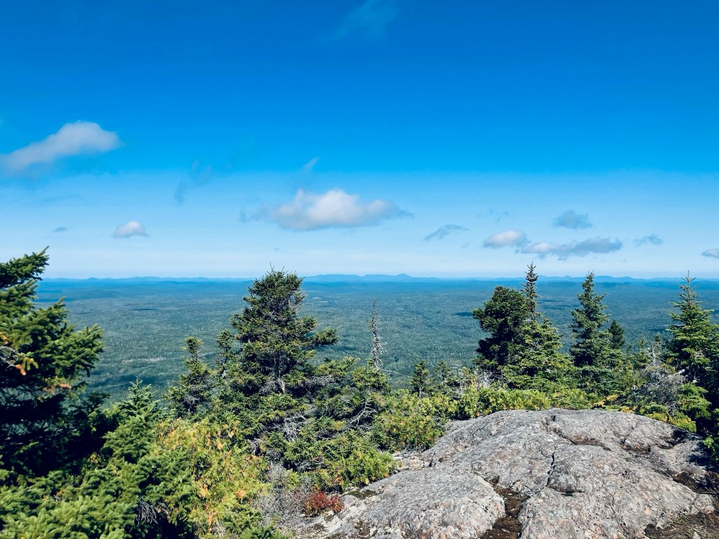
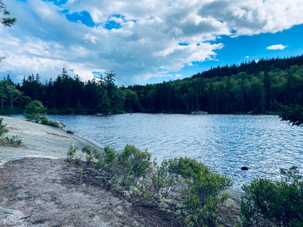
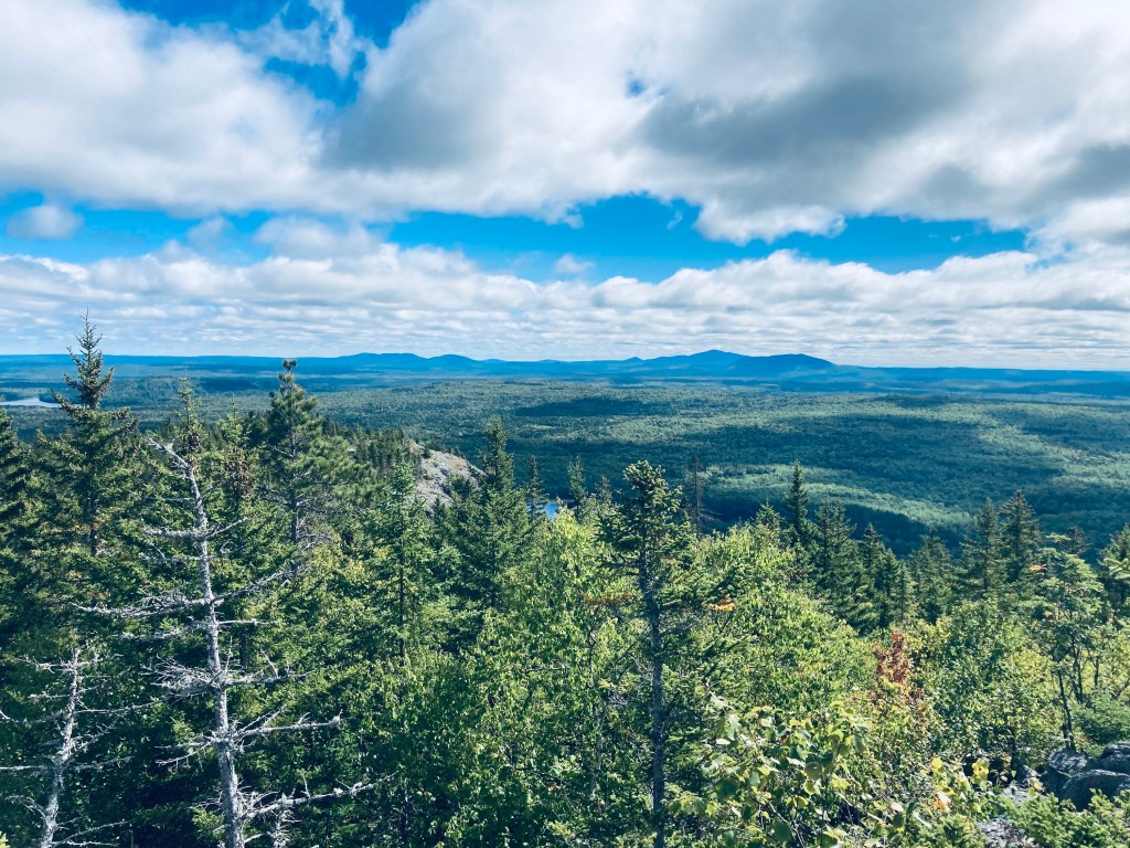
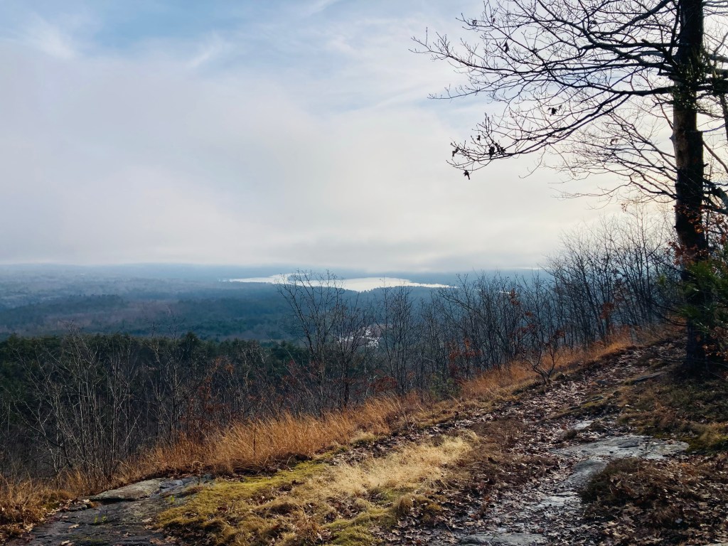
View from Sugarloaf Mountain summit, Mount Chase, Maine
Sugarloaf Mountain (the smaller one, not the ski resort), is located in town T5 R7 WELS, near Mount Chase, Maine. From northbound ME-159, turn left onto Grondin Road, and stay on Grondin Road until you reach the trailhead (a little over 7 miles). I used the directions from AMC’s Maine Mountain Guide, and climbed this mountain in mid-September on the way into the north entrance of Baxter State Park. You will (and should) second-guess yourself on this drive, as the road is more of an ATV trail.
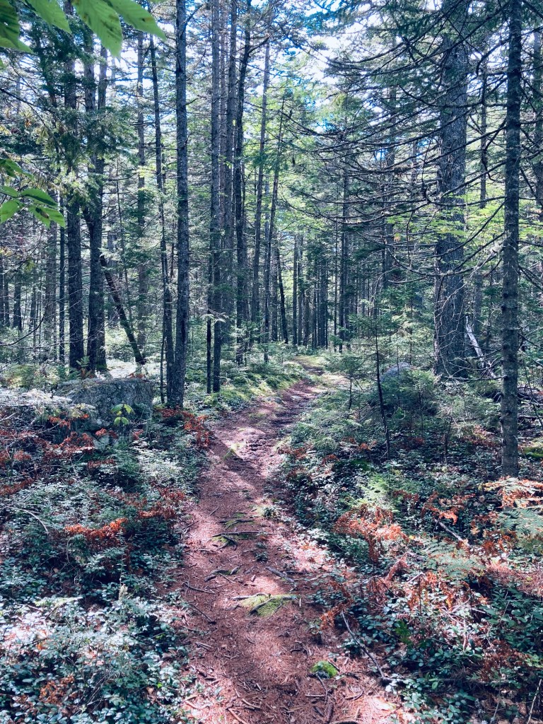
Sugarloaf Mountain Trail, Mount Chase, Maine
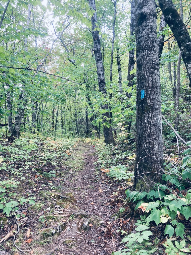
It’s probably best to park at the last four-way intersection and then walk down to the trailhead. The trail itself enters a beautiful deciduous forest dappled with light on a slightly inclined but manageable grade. At some point, the leafy green gave way to mostly evergreen, and the trail continued to become more steep, as I started to catch views through the trees of the surrounding mountains.
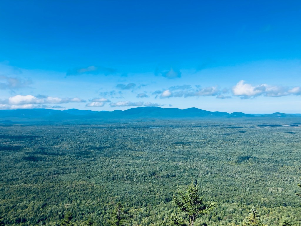
View from Sugarloaf Mountain Trail, Mount Chase, Maine
Shortly before the summit a series of rock ledges and boulders faced west with great views of Katahdin and its attendant mountains. From here, it’s a pretty short scramble over some steep rock to the summit.
View from Sugarloaf Mountain Trail, Mount Chase, Maine
I enjoyed the breeze at the top and the views of the marshes, lakes, ponds, mountains, and forest all around. Then a quick drink of water, and back down, about 1.92 total miles in 42 minutes. There are very few switchbacks – this is basically a mile up and a mile down for a beautiful view.
View from Sugarloaf Mountain Trail, Mount Chase, Maine
(Disclaimer: This post contains affiliate links, and as an Amazon Associate Hiking in Maine blog earns from qualifying purchases.)
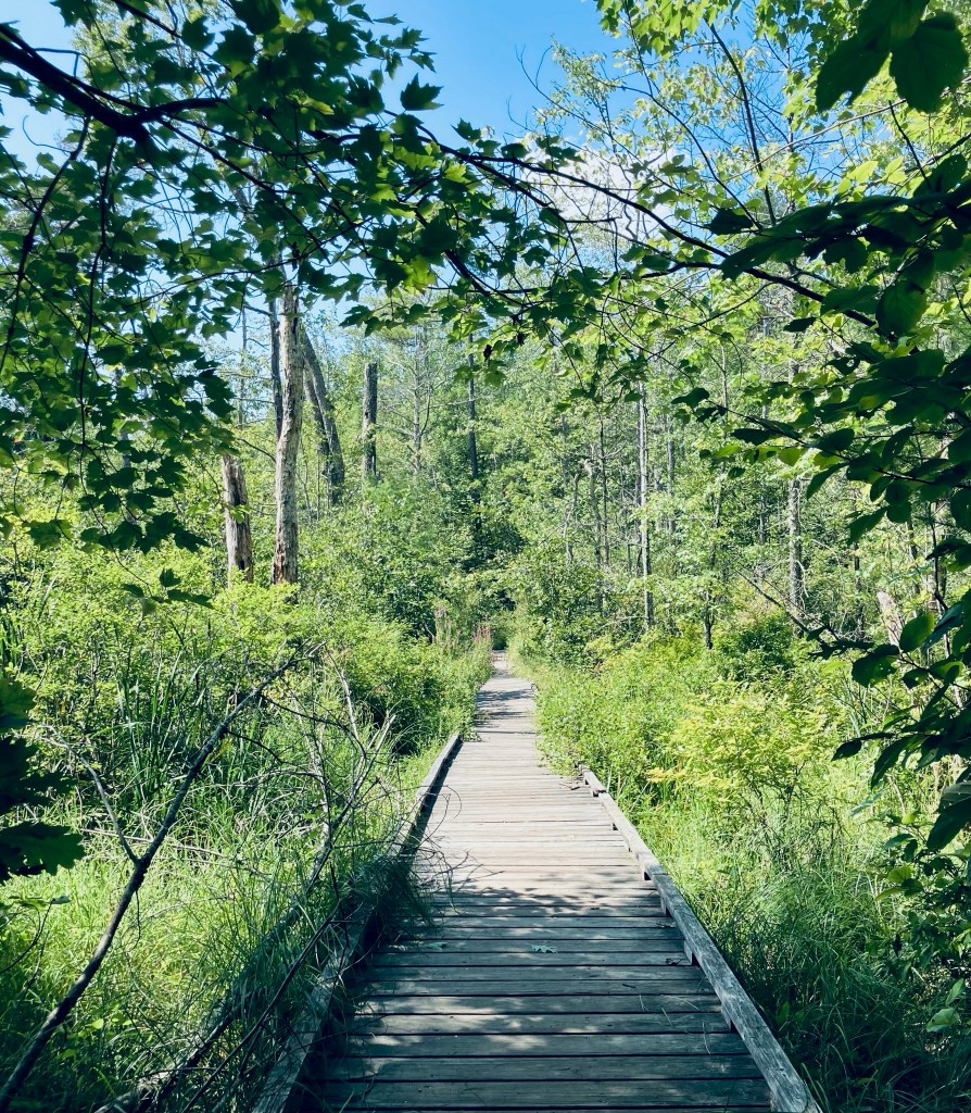
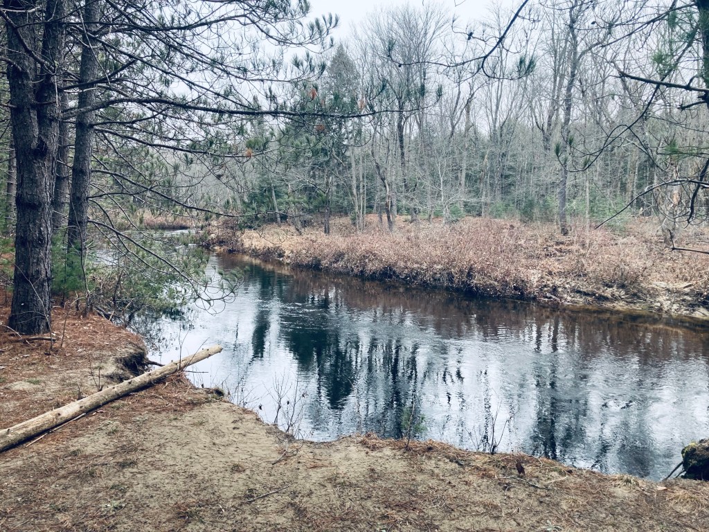
Birch Stream at County Rd, Bradley-Sunkhaze Preserve, Milford, ME
Bradley-Sunkhaze Preserve, located in Milford, Maine, is 12,710 acres owned by The Nature Conservancy (TNC), adjoining Sunkhaze Meadows National Wildlife Refuge (NWR) and Maine Parks and Lands Bradley Unit. On a cool mid-September morning, I hiked in this remote, quiet preserve, using the Birch Stream Trail. TNC’s website has a trail map, but the scale is problematic (Derek Zoolander would loudly ask if this is a map for ants), and the trails are overgrown and unmarked. I used AllTrails to navigate, and had downloaded the map well beforehand, as there is little to no cellular signal in this area.
Birch Stream Trail, Bradley-Sunkhaze Preserve, Milford, ME
There is a small parking area next to where Birch Stream crosses County Road, across from the Oak Point trailhead at Sunkhaze Meadows NWR. The Birch Stream Trail starts as an overgrown woods road with a small path in the center hemmed in by wildflowers, ferns, blackberry, and other clinging, thorny plants. A large boggy meadow lit by the sunrise opened up to the left, full of songbirds, and plenty of white birch lined the trail.
Chaffin Pond is located in Donnabeth Lippman Park, a 123 acre community park owned by the Town of Windham. A map and more information is located on this Town of Windham website. The park is tucked in on the north side of Route 302 off bumpy Chaffin Pond Road. No hunting is allowed in the park, but fishing is permitted.
Chaffin Pond from south end, Donnabeth Lippman Park, Windham, ME
In late August, Pig and I checked out the quiet, shaded trails in late August. The wide, flat Yellow Trail circumnavigates the 10 acre pond, departing a large parking area with a restroom and picnic tables. We used this loop for an easy 1.25 mile hike that took about half an hour.
Yellow Trail, Donnabeth Lippman Park, Windham, ME
Small side trails lead to the shoreline from the wooded path, and I heard a pileated woodpecker call loudly through the nearby forest, as well as many northern cardinals. A wooden boardwalk spans the swampy inlet at the north side of the pond, surrounded by wildflowers, dragonflies, and bees.
Boardwalk at inlet to Chaffin Pond, Donnabeth Lippman Park, Windham, ME
Pig managed to get into the mud on the side of this elevated walk and splash around. The west side of the pond has many good viewpoints, with plenty of water birds and long, bumpy logs full of turtles. We only saw one other hiker, but there were plenty of people at the south end of the pond.
Pig looks out over Chaffin Pond, Donnabeth Lippman Park, Windham, ME
Pig wearing her blaze orange Carhartt, Partridge Pond in fall, Amherst Mountains Community Forest
The Amherst Mountains Community Forest are a Public Land reserve of almost 5,000 acres, located east of Bangor in rural Hancock County on the way to more famous Downeast destinations. On a quiet mid-August day after rains, I took Pig the dog for the Partridge Pond and Ducktail Pond Loop, which I clocked at about 3.4 miles, taking about an hour and a half. It is an out-and-back on Partridge Pond Trail to the Ducktail Pond Trail, and then back on the logging road. On a recent mid-October 2024 day, I also encountered a full lot at the Partridge Pond parking area, and just reversed the hike (as an out-and-back) from the Ducktail Pond parking area, which was just a little under 3 miles. Each time, I used AllTrails to navigate, and there is also a great description and map in Dog-Friendly Hikes in Maine (pets under control are allowed).
Partridge Pond Trail, Amherst, ME
The state of Maine has a comprehensive map and guide to the Amherst Mountains Community Forest, including campsites and the Bald Bluff Mountain hike, here. The turn off Route 9 onto Ducktail Pond Road (22-00-0 road), marked by a blue Amherst Public Lands sign, is a tricky hairpin off a busy road from either direction. The road is a typical logging road, dirt and gravel with some washouts and protruding rocks, but much better on the October 2024 visit than the previous one.
Pig exploring a stream next to plank bridge on Partridge Pond Trail, Amherst, ME
We went to the Partridge Pond Trailhead first, where the loud buzzing of mosquitoes and various assorted flies was ominous, but never quite materialized into a problem (and obviously not in October, either). The trail, well-marked with blue blazes, started with a section of slippery plank bridges, and a slight uphill into woods that were rocky and dark. The trail crossed a series of small brooks and wound over rolling terrain with low, wet spots mostly traversed by plank bridges. About 3/4 of a mile in, just before the trail split to the right towards Ducktail Pond, the forest opened up to a series of sunny, moss-filled glades. We continued straight to go to to Partridge Pond first.
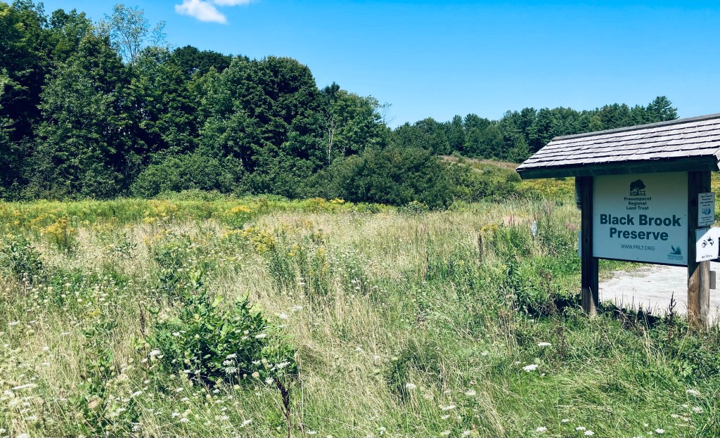
Black Brook Preserve is owned and maintained by the Presumpscot Regional Land Trust (PRLT). This 105-acre preserve in Windham is accessible through a small, clearly marked parking area just to the south side of Black Brook and Route 202 on Windham Center Road, with another small trailhead on Route 202. PRLT has the best map and description of the well-maintained hiking trails, accessible here. Dogs on leash are allowed, and as hunting is permitted, blaze orange is recommended for all in the fall.
Black Brook Preserve, Windham, ME
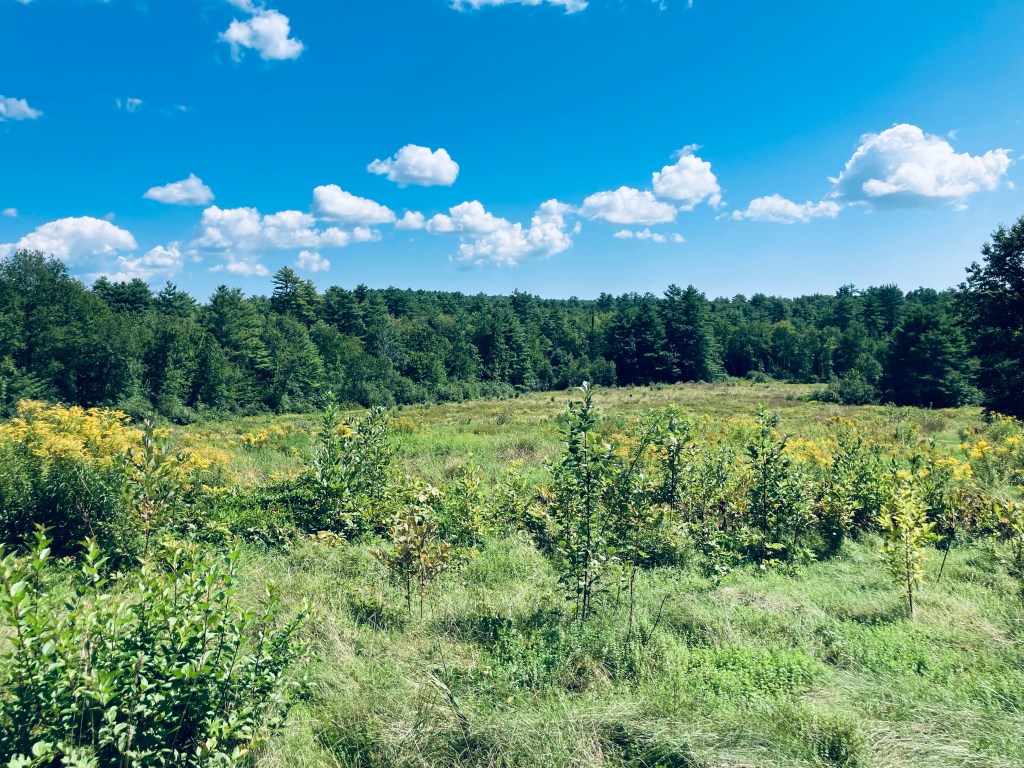
Pig and I took the Hawkes Trail to the Deer Trail and Diamond Trail to make an easy clockwise lollipop loop of about 2.1 miles that took just under an hour at a leisurely pace in late August. Plank bridges span muddy areas and small streams along the route, which is mostly shaded (a nice feature in the summertime, especially along the Family-Friendly Loop. Chipmunks, squirrels, and birds chattered in the surrounding forest. At about a half-mile, we switched over to the Deer Trail to continue the loop, and the trees opened up a little bit, letting in more sunlight.
The first time I chose to take the approximately six and-a-half mile Five Ponds Loop at Baxter State Park was the day after a strenuous Traveler Mountain hike, both for its relative ease and for early morning opportunities to see wildlife. I recently explored it again in mid-September as a last, long walk before sunset, after other more difficult hikes. A detailed description of the trail can be found in the AMC Maine Mountain Guide and Falcon Guides’ Hiking Maine’s Baxter State Park.
Colorful mushroom, Five Ponds LoopFern-covered Boulder, Five Ponds Loop, Baxter State ParkRed squirrel, Five Ponds Loop
In 2020, my hike was in a clockwise direction from the trailhead at the Trout Brook Farm Campground, familiar to me from my hike of Trout Brook Mountain two days prior (park in day-use parking near the sign that reads, “Park Orderly”). The ponds, in that east to west sequence, are Littlefield Pond, Billfish Pond, Round Pond, High Pond, and Long Pond, accessed through a series of side trails spanning the shoulders of Trout Brook Mountain. Billfish and Long each have canoe rentals (through the ranger at Trout Brook Farm campsite).
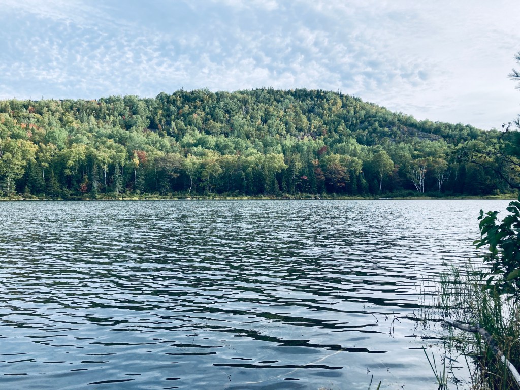
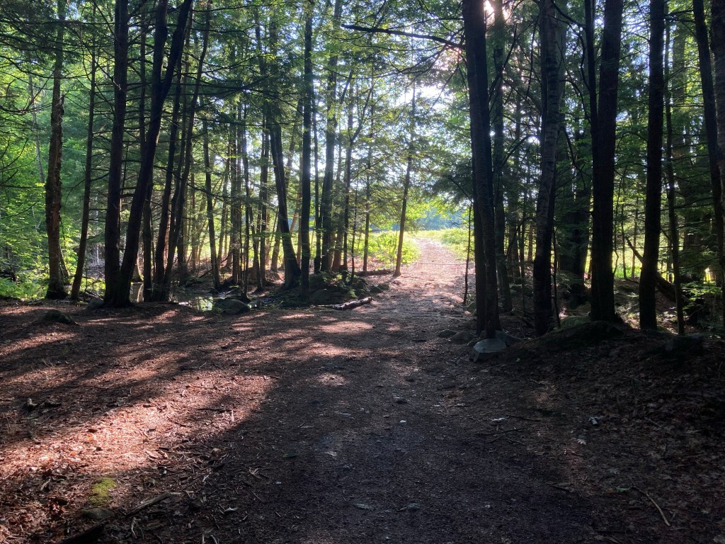
Sugarloaf Mountain (Mount Chase) from Seboeis River Trails, T6R7 WELS, ME
I first passed the sign for the Seboeis River Trails in 2020 on the way through northern Penobscot County to Baxter State Park’s north entrance, and made a mental note to check them out. Not much existed online at the time regarding this riverside hike from Grand Lake Road, part of the Seboeis River Gorge Preserve in T6R7 WELS, except the description of a 1.1 mile out-and-back trail along the Seboeis River, ending at the Grand Pitch. I had seen the sign, then saw that it was in the guide book Hiking Waterfalls Maine for the section of ledges at the Grand Pitch. Fast forward to 2024, and Penobscot River Trails has consistently improved this hike, which now extends 7.2 miles, crossing Shin Brook and following the Seboeis downstream to Grondin Road, with maps and descriptions at their site.
Seboeis River Trails, T6R7 WELS, ME
This is one of those secluded, beautiful hikes that I have to think twice before writing about, to see if I actually want to share it. One parking area, marked by a large wooden sign, is on the east bank of the Seboeis, shortly before the north entrance to Baxter State Park. A picnic table and a flat grassy area overlook a bend in the river, along with tent sites and a screened-in area, and an outhouse is available on a small hill above it in the woods. The trail itself begins across the street, from a larger parking area and kiosk on the south side of Grand Lake Road. Well-crafted wooden markers show the distances in kilometers along the path in both directions.
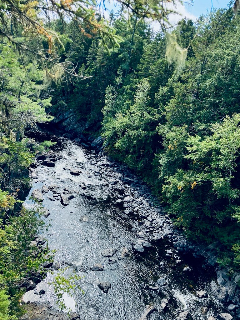
Seboeis River Trails, T6R7 WELS, ME
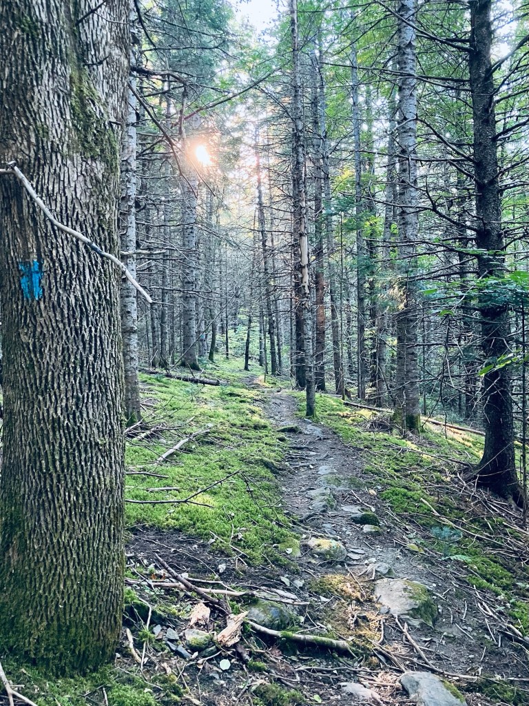
The trail starts as a flat gravel path, and then becomes a winding footpath, climbing above the riverbank on a small ridge, with a variety of frogs and toads hopping out of my way, and the continuous calls of woodpeckers and songbirds. The Seboeis becomes louder as it narrows and descends, and the scent of the bent and twisted riverside cedars wafts up through the river mist. A portage trail is marked by a sign in a tree for canoers to walk around the rapids. The trail turns inland next to a large rock outcropping and a bend in the river.
East Spur Overlook, Horse Mountain, Baxter State Park
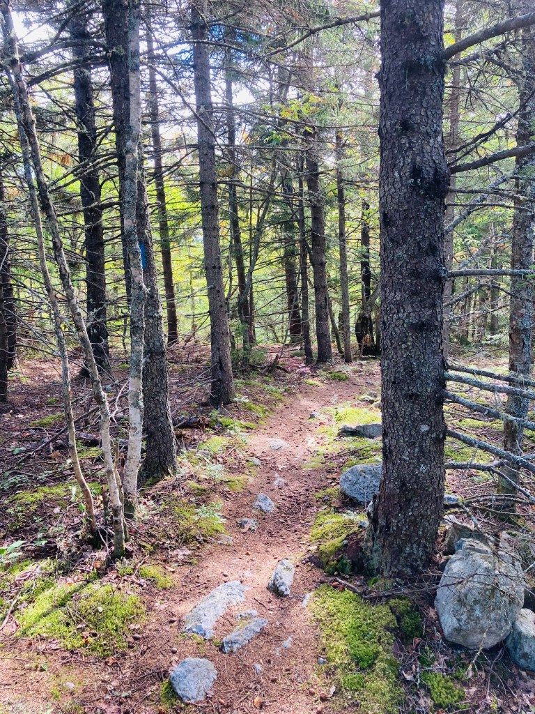
Horse Mountain (1,589 ft) is the first trail you will encounter through Baxter State Park’s Matagamon Gate, with high cliffs visible from the Grand Lake Road heading into the park. This hike, about 3.3 miles, taking about an hour and twenty minutes with the inclusion of the East Spur Overlook, starts uphill on a narrow track through a forest dominated by birch. Map and description are available from two indispensable books – the AMC Maine Mountain Guide and Falcon Guides’ Hiking Maine’s Baxter State Park by Greg Westrich. Throughout Baxter State Park, I used Map Adventures’ Katahdin Baxter State Park Waterproof Trail Map to navigate. Baxter’s great website also has downloadable/printable trail maps, and the Trout Brook Farm map covers this area.
Horse Mountain Trail near summit, Baxter State Park
The sparsely recorded trail log and spiderwebs across the trail attest to its lesser-used nature. In fact, as I was getting ready to hike it the first time in September 2020 at the tiny parking area, a man stopped his vehicle and told me that he had hiked every mountain in Baxter State Park except Horse Mountain. I don’t know why he stopped to tell me this, but it provided the proper motivation for me to do something that he had not. In September 2024, I hiked it in a steady rain, and did not see any other hikers.
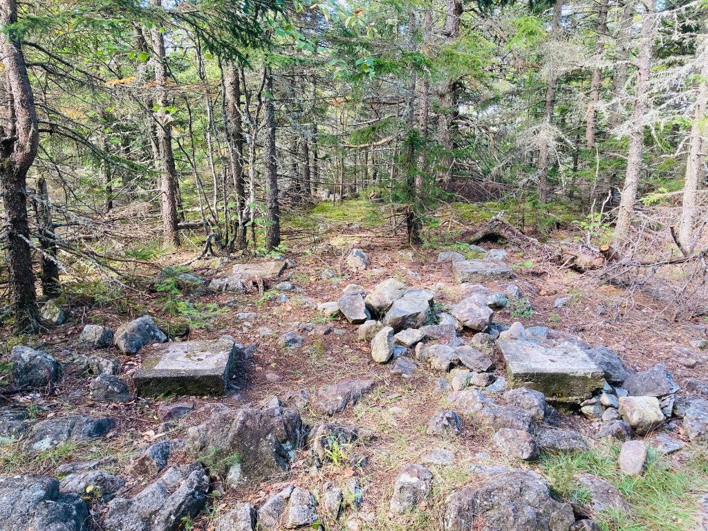
Footings of old fire tower at Horse Mountain summit, Baxter State Park
Maybe it’s too close to the Matagamon Gate, too low, no summit views (from Horse Mountain itself – views are from the East Spur), but I loved this hike. The beginning of the hike has a sort of a green tunnel aspect to it, but in the most positive way – there’s an artist’s palette of green with blueberries, princess pine, and hobblebush. This was a silver lining of the rain – I was able to notice the tones that sunlight would normally wash out. I bypassed the spur trail (1.2 miles in) on the way up, headed to the summit, planning to hit the views on the way back. At the peak, I found only the footings of what was once a fire tower, and scattered chunks of the rhyolite that comprises the volcanic mountains of the northern side of Baxter State Park.
View from East Spur Overlook, Horse Mountain, Baxter State Park
This wooded mausoleum was somber and peaceful, and I paused briefly to enjoy the silence. For those looking for a longer hike, the Horse Mountain Trail continues south to some backcountry campsites, the Billfish Pond and the Five Ponds Trail. The East Spur Overlook (.4 miles), which I took on the way back, provides an outstanding overlook of Grand Lake Matagamon and the East Branch of the Penobscot River. As an aside, this is one of the lowest mountains/easy hikes in Baxter that will give you sufficient elevation and line-of-sight to use cellular signal to send a proof-of-life text and maybe download an updated weather report.
Horse Mountain Trail, Baxter State Park
(Disclaimer: This post contains affiliate links, and as an Amazon Associate Hiking in Maine blog earns from qualifying purchases.)
Map kiosk and trailhead for Crooked River Forest, Harrison, Maine
The Crooked River Forest in Harrison is comprised of two forest parcels protected and maintained by the Loon Echo Land Trust (LELT). On a mild December day, I explored the 334 acre Intervale Preserve section, which is open year-round, with the parking area off Scribners Mills Road plowed in the winter. As of November 2023, it is only accessible from the Harrison side of the river (Maple Ridge Road), as the state of Maine permanently closed the Scribners Mill bridge over the Crooked River in Otisfield (“structurally unsound and unsafe for use”). The river and streams were still running high from the large winter storm a little over a week prior. I had the parking lot to myself, where there was a kiosk with a large trail map, and pamphlets with trail maps and info to carry along the hike. Maps and info are also available from LELT here.
Intervale Trail, Crooked River Forest, Harrison, Maine
I started on the Intervale Trail (.62 mile total length), and almost immediately heard the loud honking call of a great blue heron, with identity confirmed when it lumbered out of a tree into flight at my approach. Then along the short straightaway through the forest to an open area, I heard the chirping of a Red Crossbill. At this opening, the Evergreen Trail (1.1 mile total length) splits off to the right, and I continued left towards the Crooked River on the Intervale Trail. The trail is wide and flat, marked by red diamond-shaped placards with a black center, and moves slowly downhill toward the river. I passed over a brook flowing underneath the trail through a culvert ,with the banks covered in a recent overflow of mud and clay, yielding to a straight path through very evenly planted evergreens.
Crooked River from Intervale Trail, Harrison, Maine
Here, I disturbed some deer close to a pleasant curve in the Crooked River, which quickly became visible through a break in the trees. There were little, bubbling rapids and rocks, and trees spaced widely enough to allow for a good place for a picnic. After a short walk of about twenty minutes from the trailhead, the Intervale Trail dead-ends here, unless there’s snow. In the winter, the Winter Snowshoe Trail (.6 miles) would make a loop back to the Evergreen Trail, but without the snow, it’s too overgrown. I doubled back to the trail intersection at the open area, and then took the Evergreen Trail separately. On both trails, I saw ample signs of wildlife, with sounds in the woods, deer hoofprints in the mud, and scat and grey fur along the trail from animal usage, or some life or death struggles. Black-capped Chickadee and Dark-eyed Junco flitted across the path, and I heard Red-breasted Nuthatch and Northern Cardinal in the surrounding forest.
Crooked River from Intervale Trail, Harrison, Maine
The conifer-lined Evergreen Trail is true to its name, and crosses over several peaceful streams. In the wintertime, the trail is groomed for snowmobiles, so it might be a bit more difficult to share the road, depending on traffic. I reached the intersection with the Winter Snowshoe Trail and continued another .4 miles to where the Evergreen Trail ends abruptly in a clearing, with a wooden sign for notice. I turned around and heading back up this long, straight easy trail. My route was pleasant, a Y-shaped retracing of my steps totaling about 3.9 miles, and completed in a leisurely hour and 15 minutes or so. A more efficient snowshoe loop using the Evergreen, Intervale, and Winter Snowshoe Trails would be about 2 miles. In addition, a trail not listed on the map, marked with blue diamonds, is visible bisecting the Evergreen and Intervale Trails. According to the LELT land manager, this is another snowshoe/cross-country ski loop totaling about eight/tenths of a mile, and will be groomed (if there’s snow) by the snowmobile club. After the hike, the nearby Fluvial Brewing off Maple Ridge Road is a great place to grab a beer and snacks (check the hours first). Or, if heading towards Portland, The Good Life Market in Raymond is a perennial go-to for us.
Evergreen Trail, Crooked River Forest, Harrison, Maine
Viewpoint in summer, Bri-Mar Trail, Rattlesnake Mountain
Rattlesnake Mountain (1,035 ft) is an approximately 2.6 mile moderately difficult (but family-friendly) out-and-back hike in Raymond, Maine, with two good viewpoints overlooking the Lakes Region on the way to the summit. Allow about an hour or two for this adventure, depending upon the abilities of those in your group. The small, well-marked parking area for the Bri-Mar trailhead is off Webbs Mills Road (ME-85), and open from sunrise to sunset. No dogs are allowed on this trail. The trail is also closed during the month of April.
Wildflowers on Bri-Mar Trail, Rattlesnake Mountain, Raymond, Maine
We completed this hike several times, including as a family during the fall, a warm, early July solo hike, with the field at the beginning of the hike full of wildflowers and bees, and the most recent, a late-December trip about a week after a large storm, with the path mucky, and the field a blend of yellow, orange, and brown. The footpath across the field from the parking lot gives way to a wide, pine-covered road through a swampy area, then progresses upward on a more narrow path.
Bri-Mar Trail, Rattlesnake Mountain, Raymond, ME
The forest itself is typically alive with birdsong, from chickadees, woodpeckers, and mourning doves, as well as the chattering and rustling of squirrels and chipmunks. Deerflies were a problem at the beginning of the July hike, but thinned as I climbed. The trail was mostly empty in the morning, as in July I only saw two other trail users, both trail runners, but can be fairly busy on summer afternoons. Even on the winter weekday trip, the small lot was full, and hikers were spread across the trail in various phases.
Bri-Mar Trail, Rattlesnake Mountain
The Bri-Mar trail, named in memory of Brian and Marlene Huntress, is maintained by the Huntress family. This trail is easily followed in spring, summer, and fall, with red arrows spray-painted on rocks and trees in areas of uncertainty. On the recent December trip following the storm, this proved more difficult due to storm damage and leaves, and I found myself tracing a streambed away from the trail, before correcting myself. The trail is steep in places, but becomes more of a ridge hike at the two viewpoints and summit. Logs over the trail provide fun obstacles for kids to climb over, and several wild blueberry bushes cover the margins of the trail towards the summit.
Viewpoint in winter from Bri-Mar Trail on Rattlesnake Mountain, Raymond, Maine
Rattlesnake Mountain is a great Lakes Region hike for families. Enjoy the southern vistas provided by the two viewpoints on ledges, as the summit itself is wooded, and leads to other trails sloping downward. As a general rule, as you move toward the summit, veer left at trail intersections. The top is marked by a small wooden sign to the right of the trail, which is the turnaround point. After the hike, a great place to stop for lunch or a snack in Raymond is The Good Life Market, at the corner of ME-85 and 302, with all kinds of fresh options for every diet. In the fall, we have also picked apples down the road at Meadow Brook Farm.
Lakes Region in winter from 2nd viewpoint, Bri-Mar Trail, Rattlesnake Mountain, Raymond, Maine