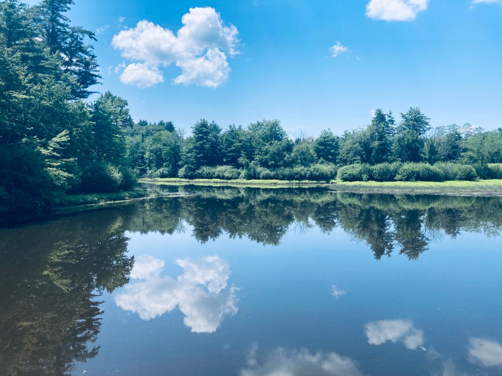
Morning light, Abol Stream Trail, Baxter State Park, ME
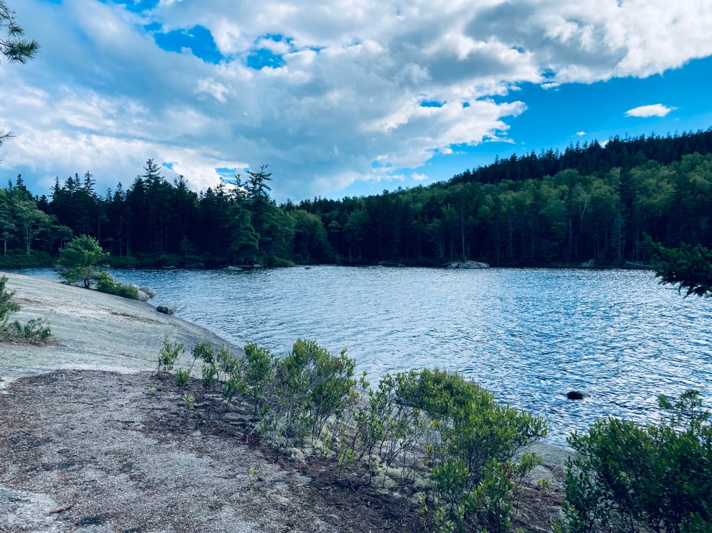
Some trails at Baxter State Park are quieter than others, and Blueberry Ledges, on the south side of the park, approximately midway between Katahdin Stream Campground and Abol Beach, is a beautiful spot you just might have all to yourself. Appalachian Trail (AT) thru-hikers this close to Katahdin are unlikely to take side trails, and day-hikers are often focused on the more robust peaks to the north and east. The lollipop loop trail to Blueberry Ledges from the trailhead at the end of Abol Beach Road is a 6.6 mile hike (if you take all the side trails like I did), using the Abol Stream Trail to briefly leave the Park, then pick up the Appalachian Trail (AT) northbound on the way out, and Abol Pond Trail on the return. I’ve done this twice, both on bright mid-September mornings, using the route recommended by the book Hiking Maine’s Baxter State Park. The Blueberry Ledges are also accessible from the north by using the AT southbound from the Park Tote Road near Katahdin Stream Campground, an out-and-back hike of about three miles each way. The trails are all on the downloadable Kidney-Daicey map from Baxter State Park, and in my pack, as usual, was the durable Map Adventures’ Katahdin Baxter State Park Waterproof Trail Map.
Mount Katahdin from Abol Stream Trail, Baxter State Park, ME
Abol Beach, which is a quiet, often-empty picnic area (with an outhouse) with a decent-sized parking lot. I began by crossing the small bridge at the outlet of Abol Pond, following the trail along a wide, wooded floor dotted with colorful late-season mushrooms. The path rises on an esker above Abol Stream. A little over a quarter mile in, there’s a short side path along the stream, which dead-ends at a robust beaver dam, and after about .4 miles, a small sign-in kiosk for hikers. At about .7 and 1.1 miles are more turnouts with excellent views of Katahdin’s bulk rising clear and crisp over multi-colored marsh grasses. The trail at this point is an old woods road bounded by sweet fern and pine, and serenaded by the chattering of red squirrels, jays, winter wrens, and white-throated sparrows.
Vaughan Woods, surprisingly close to downtown Augusta and the capitol complex, is part of a 197-acre nature preserve adjacent to the historic Vaughan Homestead in Hallowell, Maine, free to the public and open from dawn to dusk. Dogs are allowed, on-leash. The Vaughan Woods website has trail maps, a historical walking guide, and a list of programs. The Woods, comprising 150 acres, are protected through a conservation easement held by the Kennebec Land Trust. Trailhead parking is available in a small roadside lot at the corner of Litchfield Road and Middle Street. If this is full, alternate parking is available (during non-school hours, weekends and holidays) at Hall-Dale High School at 97 Maple St. in Farmingdale, with trailhead access by the tennis courts. This trail, and our photo, was featured in Portland’s monthly magazine in July/August 2024’s “Micro Hikes” article (pg 55).
Driving Bridge over Vaughan Brook, Vaughan Woods, Hallowell, ME
On a hot July day, and more recently on a cooler May day, I took the Corniche Trail Loop for a lollipop loop of about two miles, taking less than 45 minutes, a good lunchbreak hike. The trail, starting from an information kiosk, starts through an overgrown open field uphill of the homestead, then moves onto a wooded ridge, with Vaughan Brook flowing at the bottom. It can be very muddy in sections, with the biting insects present that one would expect from recent rains. The positive is that the walk is mostly shaded.
Vaughan Brook, Vaughan Woods, Hallowell, ME
A series of well-built stone bridges cross the streams which feed down to the brook, running quickly underneath the trail. The Brook Trail, a short (.4 mile) wooded path, runs along Vaughan Brook. According to the guided walking tour, along this trail is a pool known as Louis Philippe Pool, as the future king of France, then the Duke of Orleans, supposedly fell in here while fishing during a visit between 1795 and 1797.
Page & Stickney Dam, Vaughan Woods, Hallowell, ME
A series of pools, waterfalls, and cascades led up to the stone Driving Bridge, from which the tall Page & Stickney dam holding back Cascade Pond is visible. Shortly after the bridge, I veered to the right to take the Corniche Trail Loop counterclockwise. The trails throughout Vaughan Woods are unmarked, so I used AllTrails to navigate (the trail map bin at the kiosk was empty). Here on the Corniche Trail, you can still hear the sounds of I-95 off to your right. Otherwise, the trail is quiet and shady, surrounded by a mixed evergreen and deciduous forest, and much less trafficked than the Driving Bridge area. I heard the calls of red-eyed vireo, ovenbird, pine warbler, and hermit thrush.
Corniche Trail Loop, Vaughan Woods, Hallowell, ME
A turn-off to the right led to the high school, but I continued left/clockwise, reaching a high point on Perkins Hill, overlooking an old granite quarry. Here, I heard Eastern Woods Pee-wee, and saw a white-breasted nuthatch, robins, and a line of six squirrels crossing the trail together. As the trail loops back to complete the lollipop, it opens up on a large pasture, covered in wildflowers, milkweed, birds and butterflies. To the left, a maple and a hemlock appeared to have grown together over the years, and their mixed canopy sheltered a series of ferns. I rejoined the original trail, and took a quick detour at the Driving Bridge to climb the stone staircase next to the dam, which led up to views of Cascade Pond.
Light through the trees, Rines Forest, Cumberland, ME
Rines Forest is a 268-acre woodland owned by the Town of Cumberland, and preserved through a conservation easement with the Chebeague & Cumberland Land Trust (CCLT). I have hiked this in icy mid-March, using the Loop, Perimeter, and Waterfall Trails in Rines Forest in Cumberland, as a part of a longer loop including Hadlock Forest (Falmouth), connected through the Rines Trail, as well as more recently in sunny late May. Rines Forest has a network of about 3 miles of trails open for hiking, cross-country skiing, snowshoeing, fishing, hunting, picnicking, horseback riding, and snowmobiling as designated (some trails are winter-only). Dogs are allowed on-leash or under voice command at all times (Hadlock is different Apr – Oct, requiring leash due to sensitive habitats, so check before you do both). As hunting is allowed, blaze orange is recommended during hunting seasons.
Rines Forest, Cumberland, ME
Parking is available on Range Road, on the south side of the Forest, about 1.2 miles from the intersection with Winn Road. Next to the parking area is a Frog Pond & Salamander Swamp. CCLT’s website includes a trail map and a printable scavenger hunt for kids. The extended loop at Rines is about 2.77 mi, easily doable in an hour and change. In winter and early spring, micro spikes are probably advisable for the duration of the hike, and in the ice and snow, you can see the frozen tracks of deer and other animals. In warmer seasons, the green canopy provides great shade.
Waterfall Trail in early spring, Rines Forest, Cumberland, Maine
The trail traverses a high esker above a stream, and I took a right onto the red-blazed Perimeter Trail, then an immediate right onto the blue-blazed Waterfall Trail. This descends to a series of waterfalls, where in early summer, Pig the dog splashed around, and we avoided a larger concentration of biting insects. For a longer spur, the Waterfall Trail extends across Saw Mill Brook all the way to Blanchard Road. The loop described continues on the Perimeter Trail around the edges of Rines Forest.
Boardwalk, Rines Forest, Cumberland, ME
In spring, the margins of the trail are punctuated by wildflowers. The interior of the Forest has the Fox, Raccoon, and Fisher Trails, which I left for another visit. After completing the Perimeter Trail, if continuing the long loop, you can cross back over Range Road toward the Rines Trail and Hadlock Forest.
Late spring wildflowers in Rines Forest, Cumberland, ME
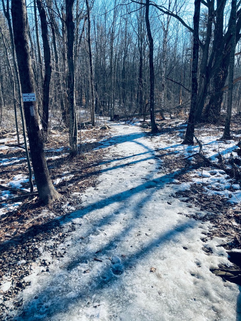
White Trail, Blackstrap Hill Preserve, Falmouth, Maine
The Blackstrap Hill Preserve, along with the Blackstrap Community Forest, is comprised of two separate properties totaling almost 600 acres and 11 miles of trails, owned by the Falmouth Land Trust (FLT) and the Town of Falmouth, and divided by north and south. We have hiked this several times, and the photos are from a mid-March day and a mid-November day, several years apart. Dogs are allowed, and must be on-leash within 300 ft of trailheads. Hunting is permitted, so blaze orange is highly suggested in-season. Parking is available at the Blackstrap Community Forest parking lot on Blackstrap Road, where there is a small lot and map kiosk (see the FLT website for a map). From there, we have completed a loop of about 4.2 miles in a little under two hours (White Trail, Waterfall Trail, Red Trail, Greenline Trail, Saw Whet Trail, and Cross-Cut Trail).
Pig in blaze orange on the River Trail, Blackstrap Hill Preserve, Falmouth, ME
The Preserve is also accessible from a trailhead further up Blackstrap Road (same as for North Falmouth Community Forest), just north of Babbidge Road, where we did a 4.8 mile hike in about 2 hours (River Trail, Hayfield Trail, River Trail, Updraft Trail, Bobcat Trail, Rocky Ridge Trail, Happy Cats Trail), as well as another small parking lot off Hurricane Road. A connector to the east (from the River Trail) extends to the Hadlock Community Forest, as well.
Waterfall Trail, Blackstrap Hill Preserve, Falmouth, Maine
In March, after a short walk across the grassy field to the White Loop Trail, I put on micro spikes to deal with the icy footing. The White Loop Trail led to the Waterfall spur trail, marked with purple blazes, which added about .7 miles out and back, with the pleasant sound of the creek leading downhill. The waterfall was not so much one massive torrent, but a pleasing series of cascades, and would be a nice, easy hike for young children in warmer months.
Piscataqua River in late fall, River Trail, Blackstrap Hill Preserve
I returned to the White Loop Trail, continuing a counter-clockwise loop to the Red Trail, which was wide and sunken, making it a sort of frozen river in the winter melt. At the Red Trail intersection with the Yellow Trail (which I bypassed), you can begin to hear the highway again. The trail network is mostly self-correcting, with maps at major intersections.
Blackstrap Hill Preserve, Falmouth, Maine
I turned left by a lazy bend in the West Branch of the Piscataqua River to take the Greenline Trail toward the Saw Whet Trail. The Saw Whet climbs a ridge next to a marshy area, and is not particularly well-marked, but I eventually re-acquired some white blazes, eventually returning to the Red Trail and then the White Trail, which widened out for the loop back to the parking lot. For the longer loop from further up Blackstrap, we used AllTrails to navigate clockwise, dodging a few mountain bikers here and there (all of whom were courteous and respectful).
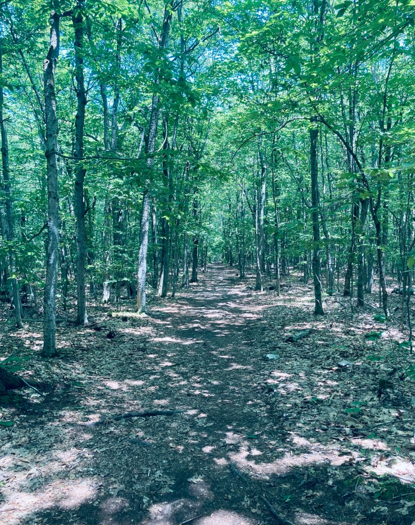
Great Back Lots and Valiant Loop Trail in Litchfield, Maine
The Great Back Lots and Valiant Trail Loop is part of the Small-Burnham Conservation Area in Litchfield, Maine, managed by the Kennebec Land Trust (KLT), who has a great website and map. The area itself is on a conservation easement by the landowners. I hiked this in late August 2024, navigating the 2.3 mile loop using AllTrails, easily completed in under an hour. The trails and parking area were very buggy, even on a dry sunny day. A small parking lot and kiosk are located off Pine Tree Road, with a sign-in station shortly down the trail.
Great Back Lots and Valiant Loop Trail in Litchfield, Maine
The Small-Burnham Conservation Area is open for hiking, nature observation, cross-country skiing, and snowshoeing. Contact the landowner for hunting permission, and snowmobiles are allowed on designated trails. Dogs are allowed on a leash or under voice command, as long as you clean up after them.
Great Back Lots and Valiant Loop Trail in Litchfield, Maine
The yellow-blazed Back Lots Trail follows the edge of a small ridge through deciduous trees overlooking a small, quiet stream. The slow flowage, bounded by ferns, looked fairly exotic by Maine standards in the late summer light. At a unique, twisted evergreen with five trunks, the trail turns hard left. At 1.4 miles I turned right on the main trail to do the loop counterclockwise.
Stone Bridge, Great Back Lots and Valiant Loop Trail in Litchfield, Maine
This trail was wide, open and shaded, a winding walk past a marsh and field of ferns. At a little over a mile, it opened up onto a wide meadow full of black-capped chickadee, cardinal and crows. On the opposite side of the loop, shortly before making the turn back towards the parking lot, I saw a large brown raptor by a low-lying marshy spot, but it flew away through the trees before I could identify it.
Great Back Lots and Valiant Loop Trail in Litchfield, Maine
Kenduskeag Stream from Kenduskeag Stream Parkway, Bangor, ME
The Kenduskeag Stream Parkway traces its namesake waterway upstream from downtown Bangor, and is an easy out-and-back lunchtime hike totaling about two miles. You can start the hike from Coe Park (as recommended in AllTrails) or from various entries on Harlow or Franklin Streets, all of which give you about a mile to the trail’s end by the Maxfield Mill Dam. The path, maintained by the City of Bangor, is featured on their website, including a printable map.
Kenduskeag Stream from Kenduskeag Stream Parkway, Bangor, ME
I have completed this hike from Coe Park in spring and from downtown in the early fall, and each time it took about 40-45 minutes. From Coe Park, cross Court Street, passing the playground, and going downhill, veer left. In the winter time, with the foliage bare, you can see down from the hillside to the other side of the river.
Morse Bridge from Kenduskeag Stream Parkway, Bangor, ME
The trail winds down, doubling back to Morse Bridge across the Kenduskeag. This steel footbridge was installed in 1985 after a wooden version was burned by an arsonist. A word of warning – this trail is a bit dodgy, emblematic of the less-savory substance use and economic underbelly of Bangor. It’s more reminiscent of Stephen King‘s “Derry” than the Bangor tourism brochures would have you believe. A needle receptacle is typically not a point of interest on a hike. But no interactions made me nervous or feel unsafe. I have politely declined an offer from a man to buy my shirt, and exchanged pleasantries with a few people passing the time on benches.
Downtown Bangor from Kenduskeag Stream Parkway, Bangor, ME
Prior to Morse Bridge and to the right, the parkway will take you along the west bank back towards downtown Bangor, where the Kenduskeag eventually meets the Penobscot. I haven’t seen much wildlife here, but there are fish and ducks, and I heard the calls of song sparrow, American goldfinch, and chickadee. When heading upstream, be careful crossing Harlow Street, as the trail crosses a busy section of road where the crosswalk has been exfoliated by sand and grit, and cars coming down the hill from 95 or heading out of downtown will be unlikely to stop.
Kenduskeag Stream and dam remains from Kenduskeag Stream Parkway, Bangor, ME
At Gateway Park, there is a covered picnic area and an interpretive panel listing Gateway Park as the halfway point, and describing the history of the Kenduskeag. Uphill, trails lead down to the Kenduskeag rapids, for views and fishing. The remains of an old dam also rest on the banks, and in the watercourse. The trail ends at Maxfield Mill Dam, with signs across Valley Avenue indicating the area is closed.
Kenduskeag Stream in early fall from Kenduskeag Stream Parkway, Bangor, ME
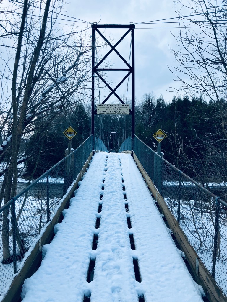
The Meduxnekeag River Trail, a lollipop loop in Houlton, is a stone’s throw from Maine’s border with Canada and starts from a variety of places. According to the brochure available at the trail kiosk, Meduxnekeag is Maliseet (one of the five tribes of the Wabanaki confederacy) for “rocky at its mouth.” On this first December day, I chose Riverfront Park, which has ample parking, and restroom facilities (May through October only) for a starting point. At about .6 miles on, the trail wound up the riverbank to the edge of an open field.
Meduxnekeag River Trail, Houlton, Maine
At this time of year, about four or five inches of snow covered the path, and I could read a mix of cross country ski tracks and footprints on the trail. In another week or two, I would need some traction devices or snowshoes, but for now, my body weight and good winter boots gave me the needed traction. I passed a double Adirondack chair, with views across the field, including a giraffe-like Irving sign on the horizon, which was less-than-scenic. The trail moved back into the woods about a mile in. This trail system has a couple loops built-in to make your own version of a hike, and even in December snow, I saw a couple people of various ages, including those with small kids, enjoying different levels of the trail.
Footbridge/ATV bridge on Meduxnekeag River Trail, Houlton, Maine
1.5 miles, the trail had a marker splitting “Easy” to the left, and “Moderate” to the right. I stuck to Moderate and started heading downhill towards a series of bridges. The trail crossed under the separate I-95 bridges- northbound (about to end) and southbound (just beginning) and reached the footbridge across at about 1.75 miles, a bridge shared by ATVs and people. This bridge definitely swayed with footfalls, and I trod down the snow and enjoyed the slow movement of the river. Across, the trail follows the bank under the two I-95 bridges and then goes back uphill along Cook Brook, which feeds the river, before tracing the brook briefly above some pleasant cascades and waterfalls and crossing back over it on a small wooden footbridge.
Meduxnekeag River Trail, Houlton, Maine
It was a quiet rolling walk along the riverbank until two small foot bridges across the creek led to a series of squiggles on the map at about 2.75 miles, which turned out to be switchbacks leading uphill. At about 3 miles, I passed the John H. Millar Civic Center, where the Community Park entrance of the trail comes in. Close to 3.5 miles, I emerged from the treeline, and saw the Highland Avenue bridge. Crossing the bridge was a little challenging, as the snow was piled high, and felt like walking across a series of Bosu Balls, but there was a great view at mid-span back along the slow river and then I took the long staircase back down to the riverside path and the parking lot. All told, about 4 miles in an hour and twenty minutes.
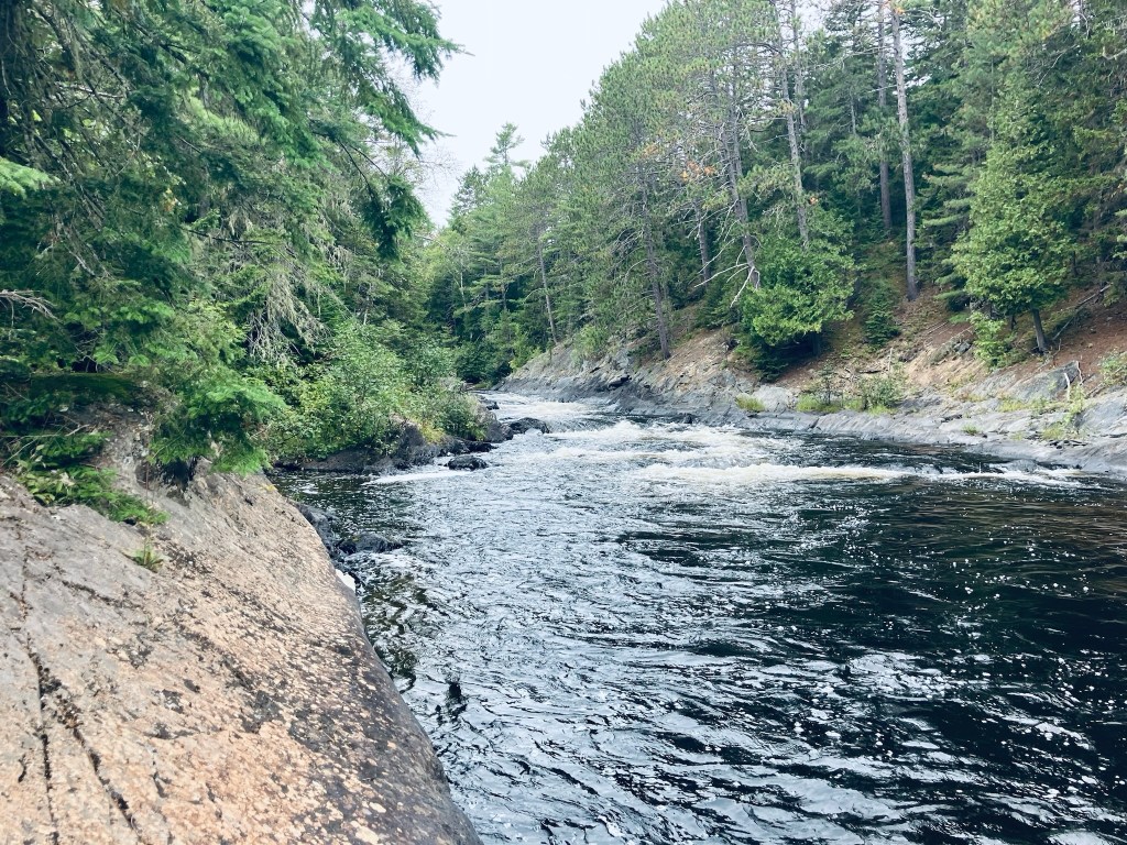
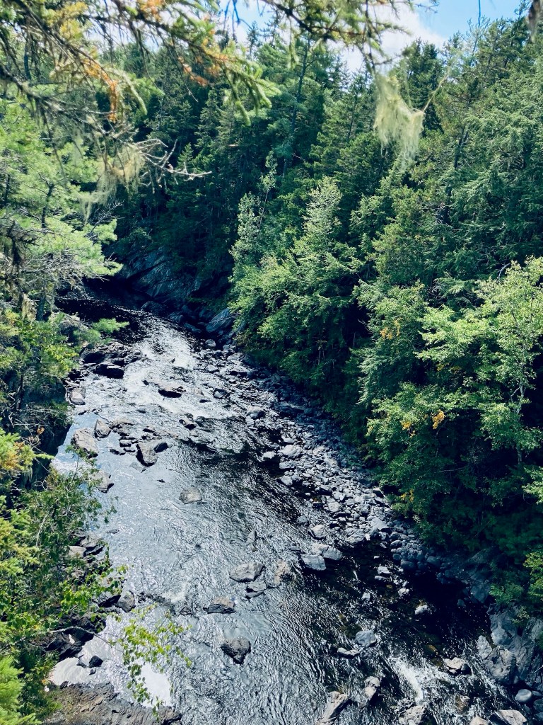
Falls at Grand Pitch of Webster Stream, Baxter State Park, ME
The Freezeout Trail at Baxter State Park (BSP) starts from the Day-Use Parking at Trout Brook Farm Campground, crossing a sturdy wooden bridge over the brook, which was mobbed by honking Canada geese when I hiked it in mid-September. The Freezeout Trail itself is a long one-way trail (14.4 miles) connecting Trout Brook Farm to the outlet of Webster Lake in Baxter’s Scientific Forest Management Area, and often included as a loop with the Wadleigh Brook and Frost Pond Trails, and/or as a backpacking trip utilizing the campsites along the way.
Freezeout Trail, Baxter State Park, ME
I navigated using AllTrails, on a route from Hiking Waterfalls Maine that took me to the Grand Pitch of Webster Stream, which the book accurately described as, “a long way from anywhere.” To the waterfalls and back was 12.86 miles, which I did in about four and-a-half hours, with a stop at the falls to cook a chili-mac meal on my JetBoil. The hike is usually described by guidebooks and BSP rangers as very buggy, but the chilly early fall morning made mosquitoes and flies a non-factor on this hike. After the third walk-in Trout Brook Farm tent site, there is a sign-in box for hikers.
Wildflowers on Freezeout Trail, Baxter State Park, ME
The trail was flat and fast, and a beautiful carpet of moss and princess pine lined the path. I had the trail to myself, with the pleasant chirping of birds throughout, and now and then the view of Grand Lake Matagamon to the right of me through the trees. At about one and-a-quarter miles I crossed a bridge over a small bog, passing aster and goldenrod flowers, and disturbed a small brown bird, a least flycatcher or pee-wee.
Beaver dam across large bog on Freezeout Trail, Baxter State Park, ME
At a little under 2.5 miles I crossed another bog over a large beaver dam, and saw one of the beavers working about 100 yards away, weaving its way in a slalom between the flooded tree trunks. A side trail at 3.2 miles led to a large pile of sawdust remaining from mill operations, springy underfoot on the shores of Grand Lake Matagamon. I stopped here for a snack on jerky and looked at the waters, while a solitary belted kingfisher plied the shoreline. A drifting loon joined the chorus of bird sound, and then dove under silently.
Sawdust pile on shore of Grand Lake Matagamon, Freezeout Trail, Baxter State Park, ME
As I turned up the shore to continue north on the Freezeout Trail, I noticed fairly clear, new bear tracks in the sawdust, and bear scat on the trail. At about 4.2 miles, the Frost Pond Trail came in from the left, and I continued to see the lake through the trees. The trail here was a little wider as I continued towards Webster Stream. At about 5.2 miles I stopped at the Northwest Cove tent site to take a look at the lake where a cormorant was drying its wings on a log extending from the water, then I continued up the Freezeout Trail.
At about 5.7 miles, I turned hard left towards Grand Pitch Falls, which I could already hear through the trees. The trail followed a worn path on the bank above Webster Stream, which moved quickly below. At about 6 miles I took advantage of an overlook to the right to watch the stream flow down towards me and downstream, around an island in the middle.
Webster Stream, Baxter State Park, ME
Shortly thereafter, I veered right on a small trail which rode the rock lip over the river, emerging to the Stream crashing through the canyon with a deafening roar, which was awesome to behold. Just above the wild falls, a large crayfish waited in a quiet pocket of rock.
Crayfish in pool above falls of Webster Stream, Baxter State Park, ME
I prepared myself a freeze-dried chili mac here and sat by the falls for quite awhile, then packed up everything and turned and walked the 6.4 miles back to the trailhead. On the way back across the beaver dam, I noticed a small ramp midway across, covered with mud, and clearly used by the beaver to slide back-and-forth between his properties. This is a truly remote hike – despite covering almost 13 miles, I didn’t see a single person until I got back to the parking area.
Grand Lake Matagamon from Freezeout Trail, Baxter State Park, ME
(Disclaimer: This post contains affiliate links, and as an Amazon Associate Hiking in Maine blog earns from qualifying purchases.)
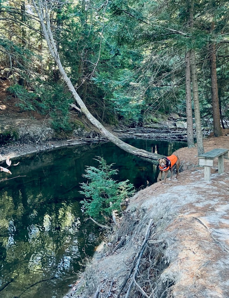
Pig wearing her blaze orange Carhartt, Partridge Pond in fall, Amherst Mountains Community Forest
The Amherst Mountains Community Forest are a Public Land reserve of almost 5,000 acres, located east of Bangor in rural Hancock County on the way to more famous Downeast destinations. On a quiet mid-August day after rains, I took Pig the dog for the Partridge Pond and Ducktail Pond Loop, which I clocked at about 3.4 miles, taking about an hour and a half. It is an out-and-back on Partridge Pond Trail to the Ducktail Pond Trail, and then back on the logging road. On a recent mid-October 2024 day, I also encountered a full lot at the Partridge Pond parking area, and just reversed the hike (as an out-and-back) from the Ducktail Pond parking area, which was just a little under 3 miles. Each time, I used AllTrails to navigate, and there is also a great description and map in Dog-Friendly Hikes in Maine (pets under control are allowed).
Partridge Pond Trail, Amherst, ME
The state of Maine has a comprehensive map and guide to the Amherst Mountains Community Forest, including campsites and the Bald Bluff Mountain hike, here. The turn off Route 9 onto Ducktail Pond Road (22-00-0 road), marked by a blue Amherst Public Lands sign, is a tricky hairpin off a busy road from either direction. The road is a typical logging road, dirt and gravel with some washouts and protruding rocks, but much better on the October 2024 visit than the previous one.
Pig exploring a stream next to plank bridge on Partridge Pond Trail, Amherst, ME
We went to the Partridge Pond Trailhead first, where the loud buzzing of mosquitoes and various assorted flies was ominous, but never quite materialized into a problem (and obviously not in October, either). The trail, well-marked with blue blazes, started with a section of slippery plank bridges, and a slight uphill into woods that were rocky and dark. The trail crossed a series of small brooks and wound over rolling terrain with low, wet spots mostly traversed by plank bridges. About 3/4 of a mile in, just before the trail split to the right towards Ducktail Pond, the forest opened up to a series of sunny, moss-filled glades. We continued straight to go to to Partridge Pond first.
Sugarloaf Mountain (Mount Chase) from Seboeis River Trails, T6R7 WELS, ME
I first passed the sign for the Seboeis River Trails in 2020 on the way through northern Penobscot County to Baxter State Park’s north entrance, and made a mental note to check them out. Not much existed online at the time regarding this riverside hike from Grand Lake Road, part of the Seboeis River Gorge Preserve in T6R7 WELS, except the description of a 1.1 mile out-and-back trail along the Seboeis River, ending at the Grand Pitch. I had seen the sign, then saw that it was in the guide book Hiking Waterfalls Maine for the section of ledges at the Grand Pitch. Fast forward to 2024, and Penobscot River Trails has consistently improved this hike, which now extends 7.2 miles, crossing Shin Brook and following the Seboeis downstream to Grondin Road, with maps and descriptions at their site.
Seboeis River Trails, T6R7 WELS, ME
This is one of those secluded, beautiful hikes that I have to think twice before writing about, to see if I actually want to share it. One parking area, marked by a large wooden sign, is on the east bank of the Seboeis, shortly before the north entrance to Baxter State Park. A picnic table and a flat grassy area overlook a bend in the river, along with tent sites and a screened-in area, and an outhouse is available on a small hill above it in the woods. The trail itself begins across the street, from a larger parking area and kiosk on the south side of Grand Lake Road. Well-crafted wooden markers show the distances in kilometers along the path in both directions.
Seboeis River Trails, T6R7 WELS, ME
The trail starts as a flat gravel path, and then becomes a winding footpath, climbing above the riverbank on a small ridge, with a variety of frogs and toads hopping out of my way, and the continuous calls of woodpeckers and songbirds. The Seboeis becomes louder as it narrows and descends, and the scent of the bent and twisted riverside cedars wafts up through the river mist. A portage trail is marked by a sign in a tree for canoers to walk around the rapids. The trail turns inland next to a large rock outcropping and a bend in the river.