Katahdin across River Pond, River Pond Nature Trail, Millinocket, Maine
River Pond Nature Trail is the outside loop of a trail system, all with logging names, dotted with interpretive displays, off the Golden Road in Millinocket between its namesake River Pond and the West Branch of the Penobscot River, not far at all from Baxter State Park’s Togue Pond gate. I took this trail loop, owned by Katahdin Forest Management, in mid-September as the last Sunday hike on the way out of the park on a weekend trip.
River Pond Nature Trail, Millinocket, Maine
Looking at reviews, it was uniformly described as buggy, but I didn’t have any problems with flies or mosquitoes in the cooler temperatures of early fall. The narrow Tenderfoot Trail through the forest started at a small kiosk by the large parking area, where there were two other vehicles. I moved counterclockwise, and at about .4 miles, just shy of a large boulder, I got my first view of Katahdin through a side trail that led down to River Pond.
River Pond Nature Trail, Millinocket, Maine
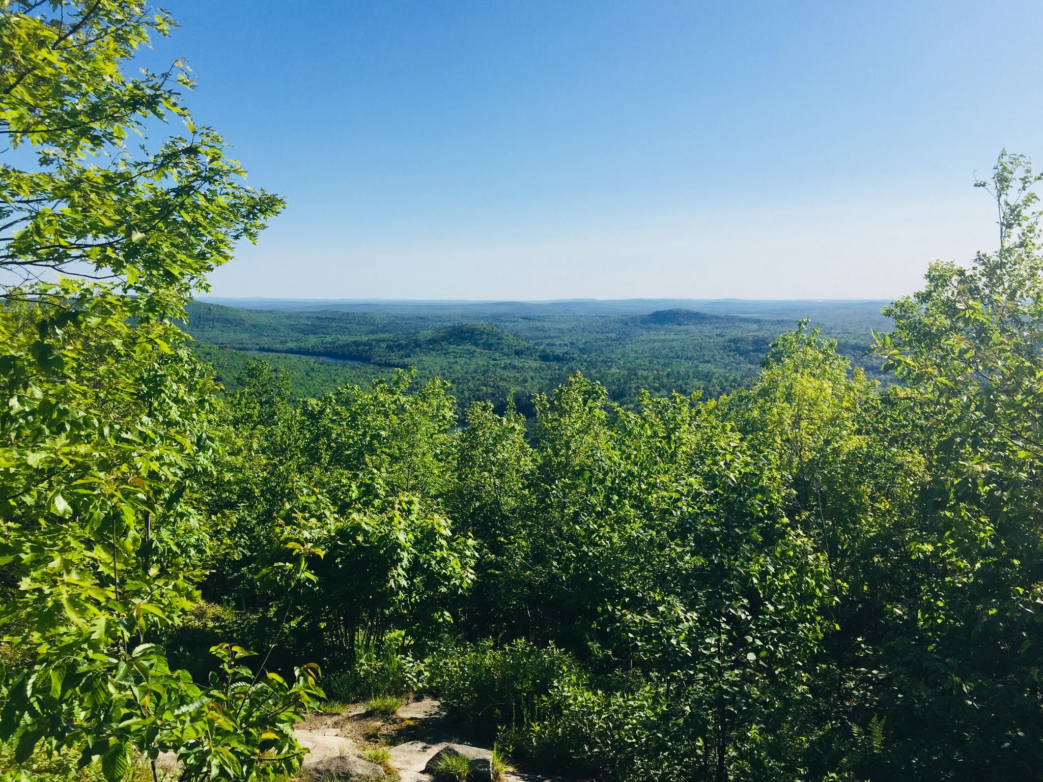
As I continued, two people coming towards me told me there were moose in the second clearing. I saw many clearings, no moose, but it’s always exciting to know they are out there. I reached Moose Point and the Timber Cruisers Trail and enjoyed the views across the pond of Katahdin, still nestled in clouds. The south side of the trail is more forested, with an occasional view of the West Branch of the Penobscot River below in the distance.
Katahdin across River Pond, River Pond Nature Trail, Millinocket, Maine
I did not take the River Driver’s Trail, which was a detour of a spur trail that would likely have culminated in better views, as I did not have the energy. Nevertheless, the rolling hills and springy pine-needle paths of the Forester’s Trail were a pleasant change from the rocky terrain of Baxter State Park. All told, the loop was about 4 miles, taking about an hour and 24 minutes.
Millinocket Lake from Observation Tower, Trout Mountain Preserve, T2 R9, Maine
Trout Mountain (1,409 ft) is the centerpiece of a 3,598 acre Preserve owned and managed by The Nature Conservancy (TNC), adjacent to the south side of Baxter State Park, and open from dusk to dawn (no overnight camping). Information and trail maps can be found on TNC’s Trout Mountain Preserve website. This hike is also fully described in The AMC Maine Mountain Guide. The relatively easy trail to the Trout Mountain summit, listed by TNC as 2.7 miles one-way, capped by an 80-foot observation tower, measured a total of 5.26 miles roundtrip by my AllTrails app, with only 827 feet elevation gain, the whole thing taking about an hour and 45 minutes.
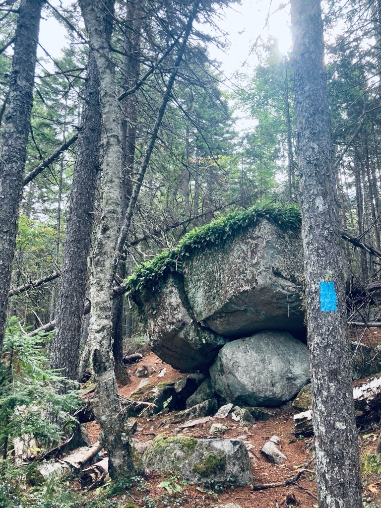
Fern-covered boulders, Trout Mountain Preserve, T2 R9, Maine
The trail starts from a small kiosk accessible from the same turn as the large emergency helicopter landing area, just short of Baxter State Park’s Togue Pond Gate, where a bald eagle circled when I drove through. The trail is a well-maintained single track that is fairly rocky. After the Nature Conservancy sign welcoming you to The Trout Mountain Preserve, the trail winds through a widely spaced young forest with knee-high ferns.
Trout Mountain Preserve, T2 R9, Maine
After 2 miles, the incline increases quickly, but it’s through such a beautiful green, moss-covered forest with hobblebush and bright red berries that the strain likely won’t hit you for a little bit. I reached the tower in a little less than an hour’s time. It looked incongruent on this quiet mountain, but I was grateful for its elevation in order to see the surrounding countryside.
Observation Tower, Trout Mountain Preserve, T2 R9, Maine
The tower, which a stamp shows was erected in 2020, seemed absurdly tall while climbing it, and even taller once I was at the top. I could see the surrounding north Maine woods, Millinocket Lake, and Katahdin shrouded with clouds, looking like the cloud would move away soon. There is also an outhouse near the summit. I had the tower to myself, and enjoyed the meager remains of my trail snacks from a weekend at Baxter State Park. The hike back was almost uniformly downhill, and I passed another solo hiker, then a small family, each headed up to the top.
Katahdin from Observation Tower, Trout Mountain Preserve, T2 R9, Maine
(Disclaimer: This post contains affiliate links, and as an Amazon Associate Hiking in Maine blog earns from qualifying purchases.)
Falls at Grand Pitch of Webster Stream, Baxter State Park, ME
The Freezeout Trail at Baxter State Park (BSP) starts from the Day-Use Parking at Trout Brook Farm Campground, crossing a sturdy wooden bridge over the brook, which was mobbed by honking Canada geese when I hiked it in mid-September. The Freezeout Trail itself is a long one-way trail (14.4 miles) connecting Trout Brook Farm to the outlet of Webster Lake in Baxter’s Scientific Forest Management Area, and often included as a loop with the Wadleigh Brook and Frost Pond Trails, and/or as a backpacking trip utilizing the campsites along the way.
Freezeout Trail, Baxter State Park, ME
I navigated using AllTrails, on a route from Hiking Waterfalls Maine that took me to the Grand Pitch of Webster Stream, which the book accurately described as, “a long way from anywhere.” To the waterfalls and back was 12.86 miles, which I did in about four and-a-half hours, with a stop at the falls to cook a chili-mac meal on my JetBoil. The hike is usually described by guidebooks and BSP rangers as very buggy, but the chilly early fall morning made mosquitoes and flies a non-factor on this hike. After the third walk-in Trout Brook Farm tent site, there is a sign-in box for hikers.
Wildflowers on Freezeout Trail, Baxter State Park, ME
The trail was flat and fast, and a beautiful carpet of moss and princess pine lined the path. I had the trail to myself, with the pleasant chirping of birds throughout, and now and then the view of Grand Lake Matagamon to the right of me through the trees. At about one and-a-quarter miles I crossed a bridge over a small bog, passing aster and goldenrod flowers, and disturbed a small brown bird, a least flycatcher or pee-wee.
Beaver dam across large bog on Freezeout Trail, Baxter State Park, ME
At a little under 2.5 miles I crossed another bog over a large beaver dam, and saw one of the beavers working about 100 yards away, weaving its way in a slalom between the flooded tree trunks. A side trail at 3.2 miles led to a large pile of sawdust remaining from mill operations, springy underfoot on the shores of Grand Lake Matagamon. I stopped here for a snack on jerky and looked at the waters, while a solitary belted kingfisher plied the shoreline. A drifting loon joined the chorus of bird sound, and then dove under silently.
Sawdust pile on shore of Grand Lake Matagamon, Freezeout Trail, Baxter State Park, ME
As I turned up the shore to continue north on the Freezeout Trail, I noticed fairly clear, new bear tracks in the sawdust, and bear scat on the trail. At about 4.2 miles, the Frost Pond Trail came in from the left, and I continued to see the lake through the trees. The trail here was a little wider as I continued towards Webster Stream. At about 5.2 miles I stopped at the Northwest Cove tent site to take a look at the lake where a cormorant was drying its wings on a log extending from the water, then I continued up the Freezeout Trail.
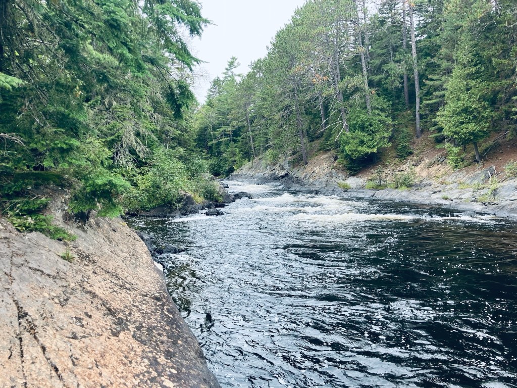
At about 5.7 miles, I turned hard left towards Grand Pitch Falls, which I could already hear through the trees. The trail followed a worn path on the bank above Webster Stream, which moved quickly below. At about 6 miles I took advantage of an overlook to the right to watch the stream flow down towards me and downstream, around an island in the middle.
Webster Stream, Baxter State Park, ME
Shortly thereafter, I veered right on a small trail which rode the rock lip over the river, emerging to the Stream crashing through the canyon with a deafening roar, which was awesome to behold. Just above the wild falls, a large crayfish waited in a quiet pocket of rock.
Crayfish in pool above falls of Webster Stream, Baxter State Park, ME
I prepared myself a freeze-dried chili mac here and sat by the falls for quite awhile, then packed up everything and turned and walked the 6.4 miles back to the trailhead. On the way back across the beaver dam, I noticed a small ramp midway across, covered with mud, and clearly used by the beaver to slide back-and-forth between his properties. This is a truly remote hike – despite covering almost 13 miles, I didn’t see a single person until I got back to the parking area.
Grand Lake Matagamon from Freezeout Trail, Baxter State Park, ME
(Disclaimer: This post contains affiliate links, and as an Amazon Associate Hiking in Maine blog earns from qualifying purchases.)
View from the Kennebec Highlands Trail, Round Top Mountain, Rome, Maine
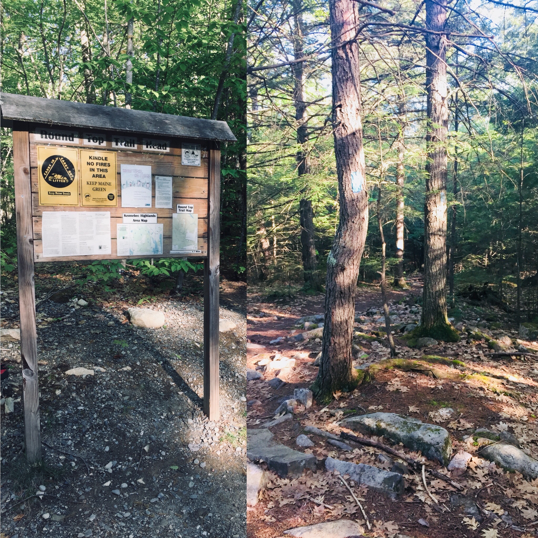
Round Top Mountain (1,133 ft) in Rome overlooks Belgrade Lakes and the Kennebec Highlands Public Reserved Lands. The route I chose on a sunny June day was an easy to moderate 4.7 mile counterclockwise loop using the Round Top Trail to the Kennebec Highlands Trail, the Round Top Spur, and then back down the Round Top Trail. I used the great guidebooks Maine Mountain Guide and Maine Hikes Off the Beaten Path for trail maps and hike descriptions. Visit the 7 Lakes Alliance website for a downloadable pdf map. This trailhead also allows access through the A Trail to McGaffey Mountain.
Trailhead and Round Top Trail in Rome, Maine
From the trailhead parking lot, this is a pleasant rolling path over a bristling cushion of oak and beech leaves and pine needles to the junction with the Kennebec Highlands Trail. On the early summer day I was there, the air was filled with aggressive mosquitoes, but a combination of Deet and constant movement neutralized their effect.
Morning light on the Round Top Trail, Rome, Maine
Wildflowers on Round Top Mountain in Rome, Maine
Thanks to recent rains, the open areas to the margins of the Round Top Trail and of the wider woods road of the Kennebec Highlands were full of a variety of Maine wildflowers, with lady slippers dotting the sides of the more wooded areas.
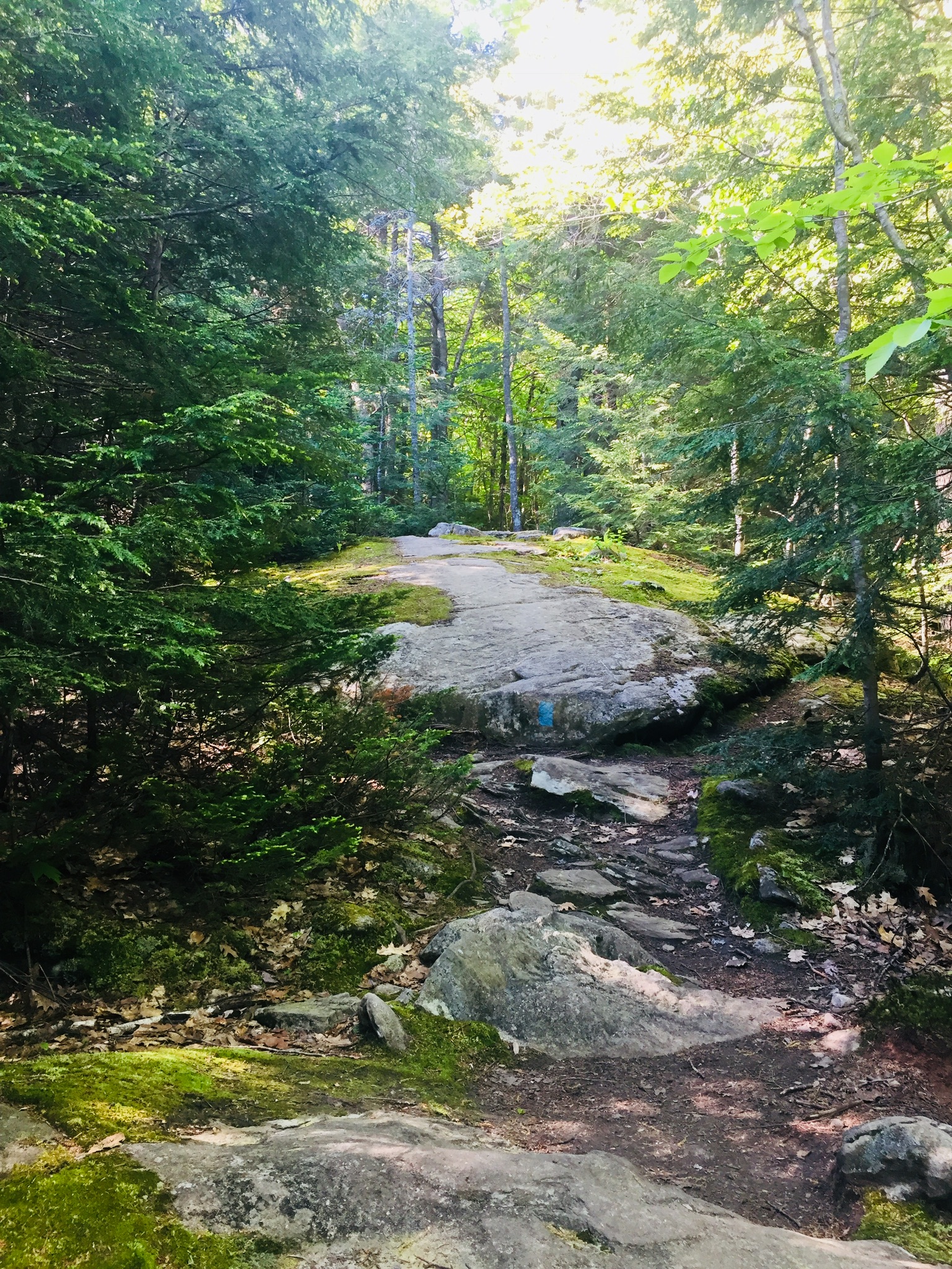
Rolling terrain on the Round Top Trail, Rome, Maine
From the left turn off the Kennebec Highlands Path, the ascent to the spur trail to the summit is a climb around switchbacks past blueberries and boulders, with views over the surrounding land.
View from summit spur trail, Round Top Mountain, Rome, Maine
The (counterclockwise loop) descent down the Round Top Trail is more gradual than that of the Kennebec Highlands Trail, with fewer overlooks. The wooded path winds through the mixed forest, with large boulders lining the hillside like the spine of a dinosaur. The total loop took me about an hour and fifty minutes at a steady but leisurely pace.
This well-maintained trail network creates a unique family-friendly climb in an area of central Maine that is rich in lakes, but lacks the higher elevations of the highlands to the west. This does, however, create many options for a post-hike swim to cool off. For insight regarding things to do and places to stay in the Belgrade Lakes area, check out this great Downeast magazine article.
(Disclaimer: This post contains affiliate links, and as an Amazon Associate Hiking in Maine blog earns from qualifying purchases.)