Suckfish Brook Conservation Area (Falmouth, ME)

Bench by beaver dam and pond, Suckfish Brook Conservation Area, Falmouth, ME

Suckfish Brook Conservation Area is a two-part preserve in Falmouth and Westbrook to the east of Highland Lake, a total of about 132 acres in size. On a mid-December day, I explored the 94-acre preserve in Falmouth by the Falmouth Land Trust, with a trail system maintained by the Town of Falmouth that begins in the Conservation Area and connects to trails made possible by neighboring landowners. The Conservation Area is named for the white sucker fish, which spawns in the eponymous brook. The small parking area is at the end of Upland Road, off Mast Road close to the Falmouth/Westbrook line. Navigation through Suckfish Brook Conservation Area can be difficult, as the maps are good, but some of the trails, particularly those through the Christmas tree farm owned by Skillins, are unsigned. I typically use the AllTrails application to navigate and track hikes, but in this case, the best way I found to navigate was using the QR code on the trail sign to access the Google Maps version of the trail map, showing my position relative to my anticipated route. In addition, the AllTrails trailhead directions tried to send me towards the wrong side of Falmouth.

Stone wall, Suckfish Brook Conservation Area, Falmouth, ME

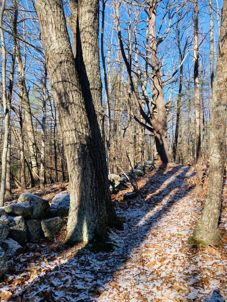
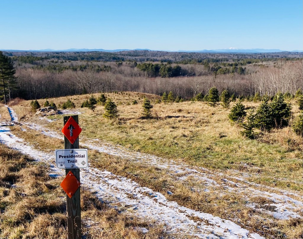
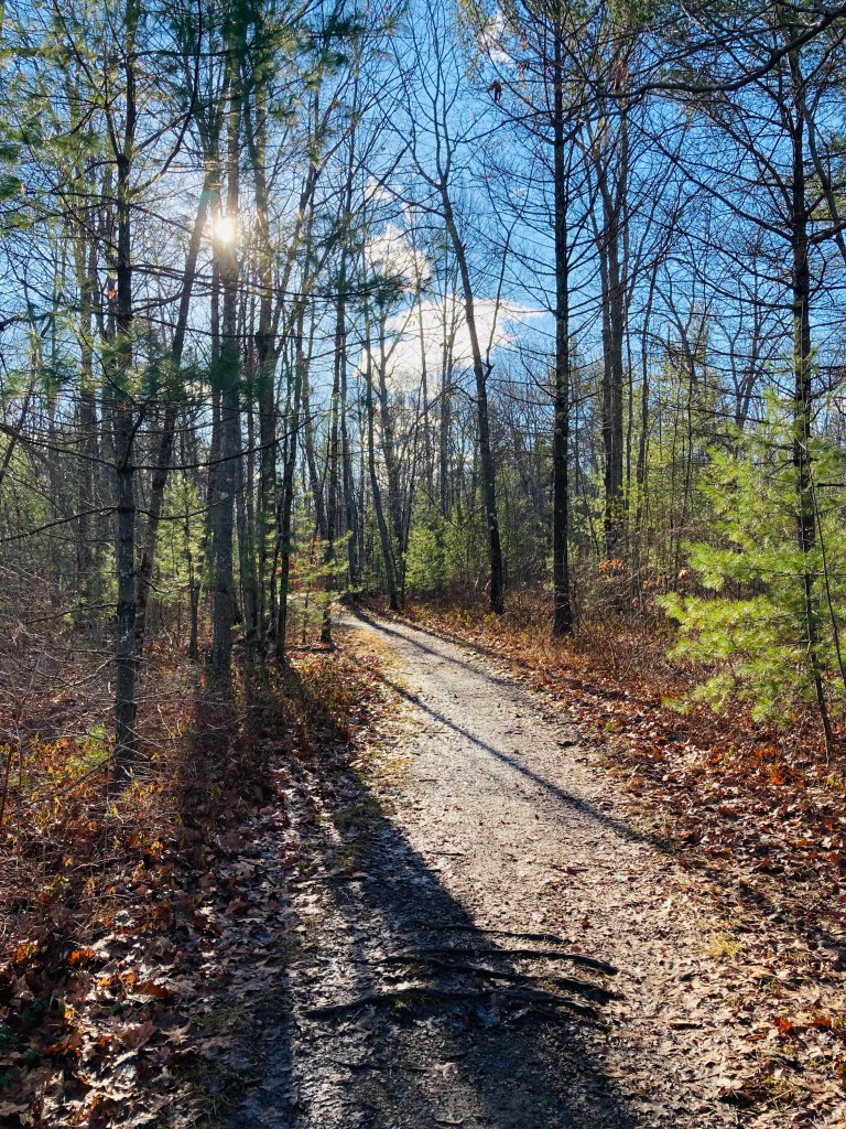
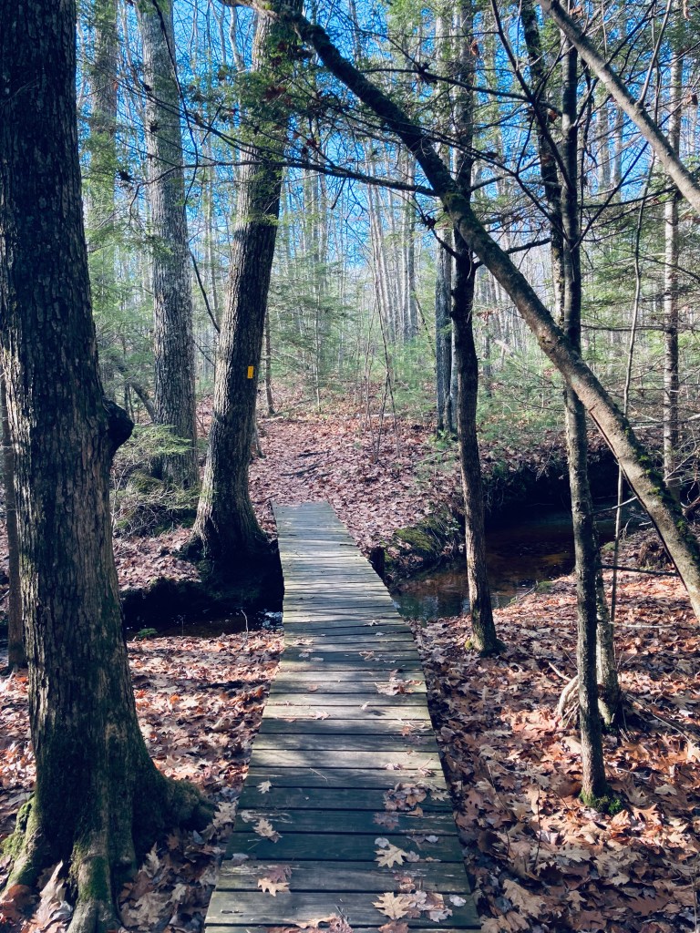
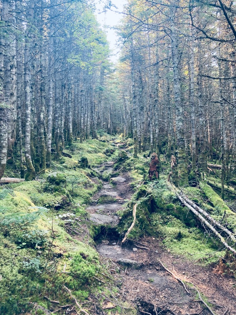
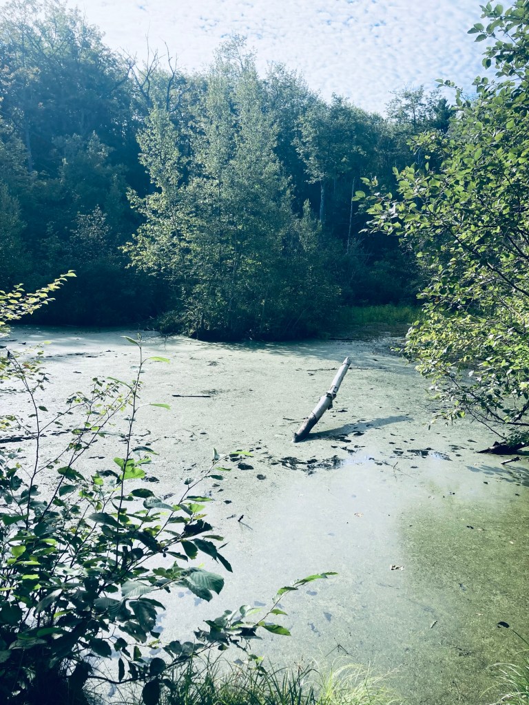
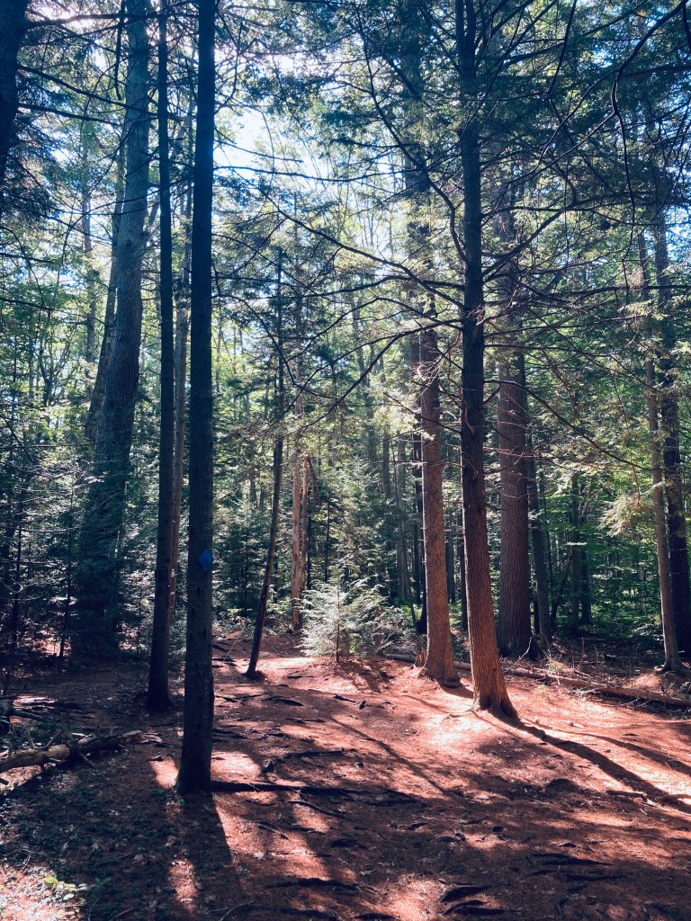
I made a loop by taking the Huston Trail clockwise to the Stone Ridge Trail, the Presidential Trail, the Red Tail Trail, and back north on the Presidential Trail to the Huston Trail, with a quick stop at the Beaver Trail. This route along the edges of the Conservation Area was about 2.6 miles, and easily completed in an hour. A sign and map kiosk mark the beginning of the trails, which are open sunrise to sunset. Shortly after the parking lot, a series of plank bridges led to the right, with a view over a small pond, a bench, and a beaver dam at the pond’s outlet. Returning to the main trail, white-blazed Huston Trail splits to the north and south, and I went left/north. Leaves rattled on the trees and crunched underfoot, frozen under a thin carpet of snow. There are periodic placards along the trail with notices and QR codes regarding the history of the area. The Huston Trail is named for William Huston and his family, the historical landowners. Huston was a forester working for the King of England’s mast agent for Maine, and white pines were harvested for Royal Navy masts here, hence the name of Mast Road, as well.

View of White Mountains from Presidential Trail, Suckfish Brook Conservation Area, Falmouth, ME
Continue reading

Edwin L. Smith Preserve (Kennebunkport, ME)

Morning light, Steele Trail, Edwin L. Smith Preserve, Kennebunkport, ME

The surprisingly big Edwin L. Smith Preserve in Kennebunk, Maine is the largest holding of the Kennebunkport Conservation Trust (KCT) and sits on over 1,100 acres. Smith Preserve, known for birding and biking, is part of an undeveloped 3,000-acre block of land which KCT’s web site describes as the largest such coastal block between Kittery and Brunswick. The provenance of this area is unique – a large 1947 fire destroyed multiple homes and farms, resulting in an eventual tax default. The land then reverted to the town of Kennebunkport as the town forest, but in 2002, Kennebunkport residents voted to transfer 741 of these acres to KCT. On the first weekend of December, I hiked a long counterclockwise lollipop loop through Smith Preserve, using the Steele Trail, Bobcat Ridge extension, Bobcat Ridge Trail, and the Trolley Trail to return to the Steele Trail. This easy 8-mile loop over rolling terrain took about two and a half hours. A printable map is available from the KCT site.

Batson River crossing, Steele Trail, Edwin L. Smith Preserve, Kennebunkport, ME

The trailhead is on Guinea Road in Kennebunkport, marked by a tasteful engraved stone with a parking area opposite. This lot has a capacity of about 15-20 cars, and on this early winter morning, most of the license plates were from New Hampshire. The well-signed trail begins in a marshy area paralleling the road. Up-to-date maps with “you are here” points are placed strategically at trail intersections, and there are small periodic alternate flourishes off the trail for mountain bikes. The yellow-blazed Steele Trail is the “main drag,” but longer or shorter loop hikes can be created by using the loop trails along the way, like the Brook Trail, Fox Den Trail, and Beacon Trail. A Forestry Management Project is underway in a 20-acre section of the trail, and placards educate visitors regarding its purpose.

Bobcat Ridge Extension Trail, Edwin L. Smith Preserve, Kennebunkport, ME
Continue reading

Cooley Preserve at Center Pond (Phippsburg, ME)

Tree overlooking Center Pond, Cooley Preserve at Center Pond, Phippsburg, ME

Cooley Preserve at Center Pond, also known as Center Pond Preserve, is located in Phippsburg and maintained by the Phippsburg Land Trust. Cooley Preserve, known for its bird habitat and wildflowers, contains 253 acres of woods, ledges, a beaver pond turned into a marsh, and the shoreline of Center Pond. A friend and I explored the trails on a cold but sunny late November day. The trailhead off Parker House Road is just south of a narrow neck between Center Pond and the Kennebec River, directly across the river from Squirrel Point light. The parking area has a sign-in notebook, with space for trail brochures (none when we visited), and a sign lists access to McKay Farm Preserve via the South Perimeter Trail. Online, the brochure notes that the Preserve is named for Mrs. Eleanor Cooley, from whom Phippsburg Land Trust acquired this, its first property, in 1995.

Trail map at Cooley Center Pond Preserve, Phippsburg, ME

Atop the trail guide box was a laminated version of the only map of the Preserve’s trails that I’ve seen, which is incomplete (no link to McKay Farm can be found off the South Perimeter Trail, and other new trails are not listed), and not aligned with north at the top like a traditional map. A sign encouraged hikers to wear blaze orange, which we took to heart on this late November day, the last day of deer hunting season. We navigated using the guide box map, as well as the AllTrails application and dead reckoning. Combining the Drummond Loop, Andy’s Way (signed, but not on the map), Schoolhouse Trail, Elbow Hill Trail, Perimeter Trail South, and Perimeter Trail North, we cobbled together a loop around the perimeter of the Preserve totaling about 5.5 miles.

AllTrails map of route taken through Center Pond Preserve, Phippsburg, ME

This easy hike took us a little over two hours, with plenty of time to stop and enjoy the various viewpoints. Near the trailhead, there are petroglyphs, or rock carvings, which you can find for yourself by following purple blazes or read about on Phippsburg Land Trust’s site (we are more aligned with a Leave No Trace philosophy, and these definitely aren’t our thing). The Drummond Loop led uphill from the parking area, then downhill to a left turn to pick up the loop. Shortly thereafter, we encountered a new sign for Andy’s Way, a blazed trail leading southeast, and followed this path over mixed forest, past tall ledges, until it reached the Schoolhouse Trail. There were vestiges of the farmland this used to be, with stone walls, and old barbed wire growing slowly back into the landscape.

View from Elbow Hill, Cooley Center Pond Preserve, Phippsburg, ME
Continue reading

Pineland Public Reserved Lands

North Loop, Pineland Public Reserved Lands, New Gloucester, ME

The Pineland Public Reserved Lands trailhead is located in New Gloucester, Maine, just south of the Pineland Farms complex on Depot Road, with year-round trails on either side of the road making a figure-eight loop, with Depot Road as the fulcrum at the center. The Lands themselves consist of over 600 acres of undeveloped forest in New Gloucester, Gray, and North Yarmouth. The best maps and descriptions can be found on Maine Trail Finder or Maine By Foot. The southern end of the trails connects to a much longer network of Pineland Corridor mixed use trails leading to Bradbury Mountain State Park, used primarily in the summer by mountain bikers.

Fall colors on North Loop, Pineland Public Reserved Lands, New Gloucester, ME

We completed this leisurely 3.2-mile loop in about an hour and twenty minutes in early October’s peak foliage, taking the northern (1.7 mi) and then southern (1.5 mi) loops each in a clockwise direction before returning to the trailhead. The trailhead is marked by a prominent brown sign on Depot Road with a pine tree on it, with a wide dirt/gravel parking area. A picnic area is adjacent to the trailhead. Plank walkways cover low or wet areas in the North Loop path, as the trail winds mostly downhill through mixed forest, with abundant ferns. Crows, black-capped chickadees, and blue jays called loudly through the widely-spaced trees.

Royal River rail bridge, North Loop, Pineland Public Reserved Lands, New Gloucester, ME
Continue reading

Orono Bog Boardwalk

Orono Bog Boardwalk, Orono, ME

The Orono Bog Boardwalk, adjacent to the Bangor City Forest, is located off Stillwater Avenue just north of the Bangor Mall area. The easy, flat 1-mile Boardwalk, celebrating its 20th year in 2022, is a joint venture of the University of Maine, the City of Bangor, and the Orono Land Trust. Updates on conditions and opening hours are available through the Boardwalk’s Facebook page. The Boardwalk is closed during the winter, and from the designated opening day in the spring through Labor Day, open from 7 am to 6:30 pm, with hours gradually getting shorter in September and October until closing for winter the Sunday after Thanksgiving, when it is 8 am to 3:30 pm. We had visited the Boardwalk before as a stopover to stretch our legs on the way back south from Katahdin.

Orono Bog Boardwalk, Orono, ME

On a rainy late September morning, I parked at the Bangor City Forest parking lot on Tripp Road and turned immediately right onto the wide flat East-West Loop Trail through the trees. It was quiet, except for red squirrels, and a little over a quarter mile to the Boardwalk, the entrance situated behind an information kiosk, a picnic table, and a bike rack. There are restroom facilities available, close by and clearly marked. The Boardwalk elevates over the bog, which is filled with large, lush ferns, wide leaves of skunk cabbage, and ash and maple trees perched on hummocks, with periodic benches to sit and watch the plants and wildlife. I heard but didn’t see a white-breasted nuthatch and a hairy woodpecker.

Pitcher plants, Orono Bog Boardwalk, Orono, ME
Continue reading

Barrell Ridge

View of North Traveler from Barrell Ridge Trail, Baxter State Park, ME

On the last day of a mid-September weekend hiking trip to Baxter State Park, I snuck in a morning hike before I packed up my South Branch Pond campsite, heading to Barrell Ridge (2085 ft) via Middle Fowler Pond Trail. I got the route for this moderate six mile out-and-back hike from Hiking Maine’s Baxter State Park and the suggestion of the South Branch Pond ranger. You can navigate using the South Branch Pond printable map from Baxter State Park. The trailhead is shared with the Ledges Trail and South Branch Nature Trail, a short walk north from South Branch Pond Campground, and branches off toward Middle Fowler Pond after about a third of a mile.

View northwest from ledges on Middle Fowler Pond Trail, Baxter State Park, ME
Continue reading

Machias River Preserve

Railroad Trestle Bridge, Machias River Preserve, ME

Machias River Preserve, located on the banks of its namesake, is a 917-acre area protected by the Downeast Coastal Conservancy (DCC), part of the Two Rivers Conservation Area (see description and map here). On a late September day, I used the parking area on 1A in Whitneyville to walk a lollipop-type loop using the Money Island, Homestead, and Hemlock Trails of about 3.3 miles, taking about an hour and twenty minutes. The Machias River Preserve can also be accessed from a small parking lot off 1A in the town of Machias. According to DCC’s site, “Machias” comes from a Passamaquoddy word meaning “bad little falls,” and I had taken this loop on before as part of the Bad Little Trail run sponsored by DCC and Bold Coast Runners.

Abandoned car on Money Island Trail, Machias River Preserve, Whitneyville, ME

Shortly after the entrance from the small parking area to the blue-blazed Money Island Trail, I saw the telltale signs of bushwhacking and circles in the grass indicating deer had slept here last night. I was almost immediately hit with the pleasant scent of wet pine and sweet fern. The trail narrowed, leading into a root-covered path along a healthy rust colored stream. At about a third of a mile in, just after the hulk of an old, abandoned car, a small side trail leads to the left to a series of pleasant moss-covered cascades where black-capped chickadees serenaded from the surrounding trees. Shortly after returning to the main trail, a small wooden bridge leads back over the stream, and a small spur trail can be taken to the right, for views of the Machias, flowing around Money Island in the middle of the river. The familiar clicking call of a belted kingfisher filled the cool river air.

Waterfall on Money Island Trail, Machias River Preserve, ME
Continue reading

Mount Coe, South Brother, and North Brother

Sun rising on the way up Mount Coe, Baxter State Park, ME

Having explored other difficult but rewarding long hikes in Baxter State Park, I decided to finally try a challenging early fall hike of Mount Coe (3,760 ft), South Brother (3,963 ft), and North Brother (4,052 ft), a 10.1 mi loop (extendable to about 12.5 mi if you include Fort Mountain in the spur hike from North Brother). This exhilarating trek begins with its most difficult ascent first, and hits peaks (including a 4,000 footer) that allow for views on a clear day in all directions of Baxter State Park and its surroundings. I started this hike based upon a route recommended by the book Hiking Maine’s Baxter State Park, a relatively new volume which I have dog-eared, bookmarked, and annotated in pen/pencil. As recommended in that book, every other guidebook, and the Baxter State Park ranger I consulted, I took the loop counterclockwise, in order to tackle the Mount Coe slides uphill, rather than trying to descend (more on that later). To navigate, you can use the free downloadable Kidney-Daicey map from Baxter State Park, or the more durable (my choice) Map Adventures’ Katahdin Baxter State Park Waterproof Trail Map.

Clear brook along Mount Coe Trail, Baxter State Park, ME

The parking area for Mount Coe and the Brothers is on the Park Tote Road just south of Slide Dam picnic area, on the east side of the road. I took a long, quiet morning drive south from South Branch Campground, with the windows down to breathe in the foggy morning dew and listen for about an hour. No moose crossed in front of me, but I saw several ruffed grouse scurrying into the undergrowth lining the Tote Road. At the parking lot, across from Nesowadnehunk Stream, a large hiking group was meeting and beginning to pack up breakfast and coffee in preparation for a hike in smaller pairs and trios. The hike started easily enough on a relatively flat grade, with the trail going across a couple low streambeds. The temperature began to increase as I climbed up and out of the valley, ascending a narrow staircase with the pretty runoff of the stream to my left. At about 1.2 miles, I reached the intersection of the Marston and Mount Coe trails and turned right towards Mount Coe. Almost immediately, I started seeing moose droppings. The trail was flat and mossy, almost downhill at the beginning, with quiet, green Eden-like surroundings of mossy hummocks and clear, cascading brooks.

View of Doubletop and beyond from Mount Coe slides, Baxter State Park, ME

I had arrived at the trailhead about an hour after sunrise, but the sun had still not summited the peaks to the east, so when it did, at around 8 AM, it peered over like a death ray. So, when the trail crisscrossed the cool stream and moved uphill, I missed the air conditioning that the cold running water had provided. Here, I passed a friendly group of three on my way to the final ascent of Mount Coe, then another, even more amiable group of three making their way up the slick, steep slides. It’s difficult to find grumpy people at Baxter State Park. Back to the slides – they were as advertised, difficult, slick with morning dew and runoff, and sharp (I left some blood there on a handhold). I had planned to only use my hiking poles, collapsed and stowed on my pack, on the descent, but thought twice about that plan while navigating the steep, slippery surface. I can’t imagine the difficulty of climbing down this stretch on coltish, tired legs on a clockwise hike. Thankfully, the slide gave way to a thin path through thin spruce with roots and trees for handholds, leading to the Mount Coe summit, with unbelievable views in all directions.

Trail up to South Brother summit, Baxter State Park, ME
Continue reading

Doubletop Mountain

View of Doubletop Mountain from Nesowadnehunk Stream bridge to the south near Kidney Pond Campground, Baxter State Park, ME

Doubletop Mountain (north peak 3,489 feet, south peak 3,455 ft) guards the western edge of Baxter State Park (BSP), its tufted, twin summit ridge looming like the profile of a slumped, pudgy Dark Knight. The views of this signature BSP mountain are impressive, as its unique profile and steep drops make for a formidable photo over Nesowadnehunk Stream or from the rugged peaks to its east. On a sunny mid-September afternoon, I ascended it for the first time, using a challenging 7 mile out-and-back route from the parking area at Nesowadnehunk Field Campground, which took me about three hours and forty minutes.

Nesowadnehunk Stream from bridge at Nesowadnehunk Field Campground by Doubletop Mountain Trail, Baxter State Park, ME
Continue reading

Winnick Woods Long Loop

Winnick Woods, Cape Elizabeth, ME

Winnick Woods is a 71 acre parcel of land owned by the Town of Cape Elizabeth, part of the Cape Elizabeth Greenbelt, which has a page with maps and a description. The trailhead is at a small gravel parking area with a map kiosk and space for eight vehicles off Sawyer Road. Be forewarned – the maps, including the ones posted along the trail, are not good ones. I used AllTrails to navigate an easy 3.8-mile Winnick Woods Long Loop that covered most of the preserve, and used the Cross Hill Trails to extend the hike, which took about an hour and forty minutes, with plenty of time to stop and examine the varied flora.

Stagnant pond, Winnick Woods, Cape Elizabeth, ME

This winds past some adjoining backyards, follows power lines in places, and crosses Cross Hill Road twice, but stays on established trails. Like many trails designed for mountain bikes, there are multiple twists and turns and intersections to maximize mileage and track length, which can be confusing for hikers and bikers alike. We encountered many mountain bikers and stepped briefly off the path to allow them to pass. The trail was also populated by trail runners and dog walkers.

Single-track through junipers on Winnick Woods Long Loop, Cape Elizabeth, ME

The trail begins with a wooded path (the White Trail), opening on a large meadow, where we saw (and heard) a large red-tailed hawk patrolling the skies above. We then turned left onto the Yellow Trail, which crosses the north side of a small, stagnant pond, and passes behind a neighborhood through a mixed forest. Throughout the early September hike, we saw a wide variety of berries, trees, shrubs, late summer flowers, colorful mushrooms, and birds. Regarding the fern family alone, we identified bracken fern, cinnamon fern, eastern hay-scented fern, Japanese painted fern, and Christmas fern. Nuthatches and brown creepers serenaded the woods and foraged along the tree trunks.

Winnick Woods Long Loop, Cape Elizabeth, ME

The marshy area to the east of the loop signals a move to higher ground along power lines, and the beginning of the Cross Hill Trails, lined with juniper and wildflowers. Here, a cacophony of catbird sounds greeted us in the lower-lying areas, before turning west and north to return to the Winnick Woods Trails, where the forest opens up to sunlight. A flat, easy walk brought us back to the start of the hike.

Winnick Woods Long Loop, Cape Elizabeth, ME