Dad and daughter atop Pleasant Mountain summit in 2017
Pleasant Mountain (2,006 ft) is a mountain in Bridgton right next to the former Shawnee Peak, now (since 2022) Pleasant Mountain ski area, with trails mostly on land owned by the Loon Echo Land Trust (see here for info and detailed maps). Dad and daughter hiked this first with our cousin in April 2017 as part of our preparation for our 100 Mile Wilderness trek via the (moderate) Southwest Ridge Trail (also known as the MacKay Pasture Trail), 5.8 miles up/back, but have done it since in February, August, and other months. Map and description are also available in the stellar Maine Mountain Guide. The preserve is open dawn to dusk, and dogs on-leash are allowed. Blaze orange is suggested during hunting season.
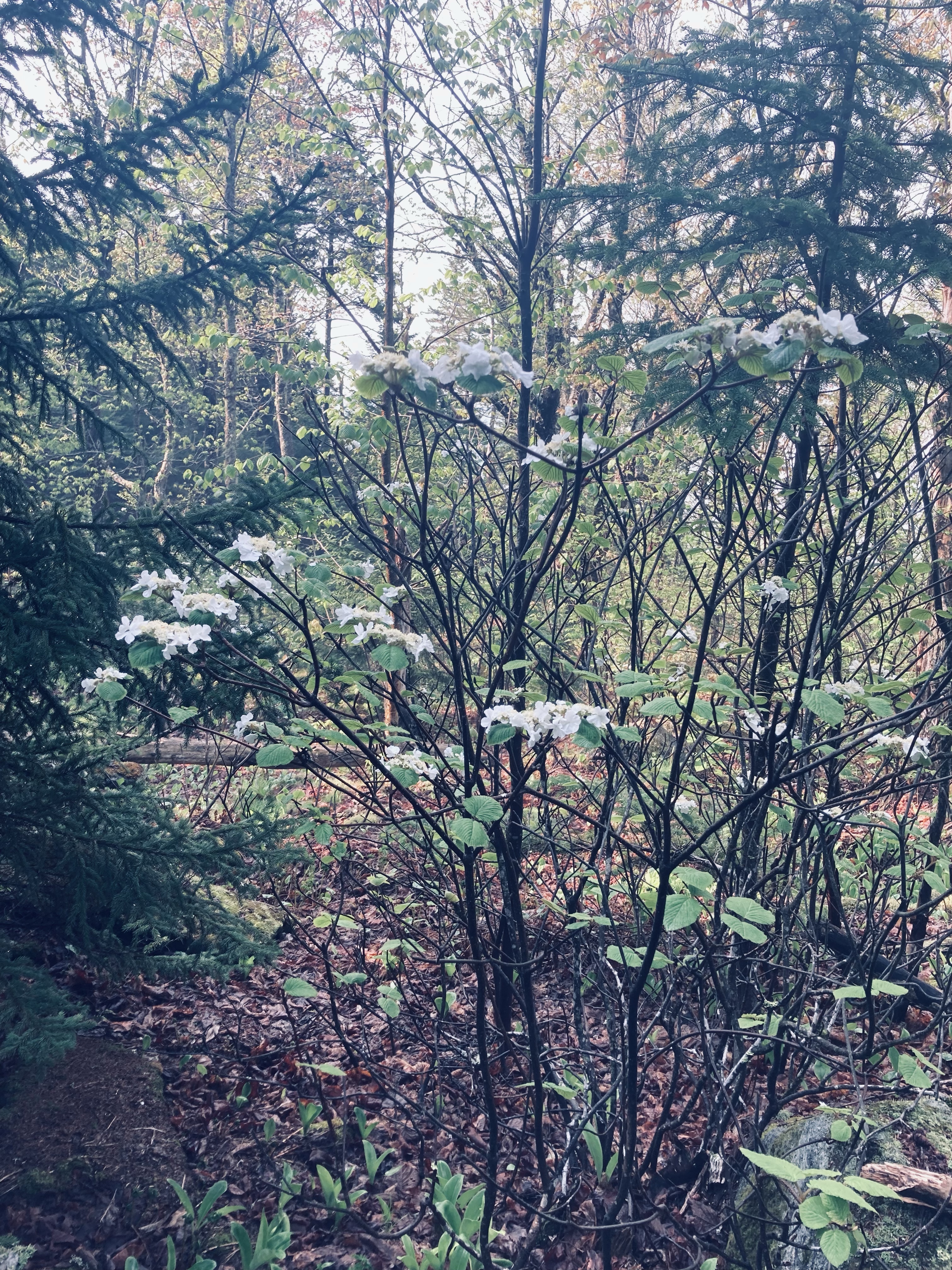
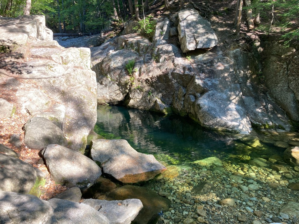
Morning light on Southwest Ridge Trail, Pleasant Mountain, Maine
This hike can be busy in summer, particular up the Ledges Trail, but an early start or a winter morning can provide solitude. There are always a few hikers, especially close to the summit, but I have also seen woodpeckers, crows, turkeys, and a winter herd of deer. The deer were using the same path, and bounded away from me, big white tails flashing, every time they heard my footsteps crunching in the snow, coming no closer than about fifty yards. In the summer, the call of loons carries up the mountain from Moose Pond.
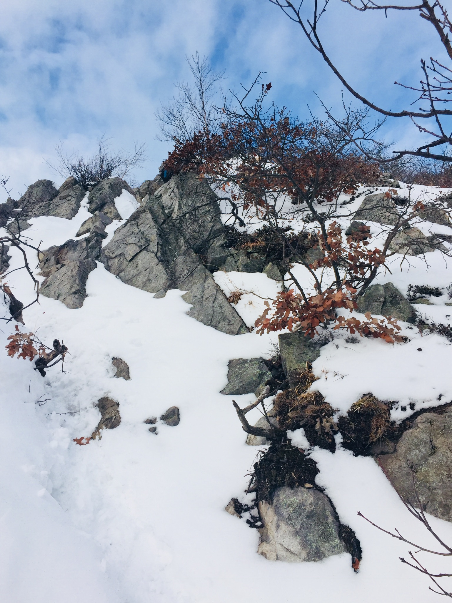
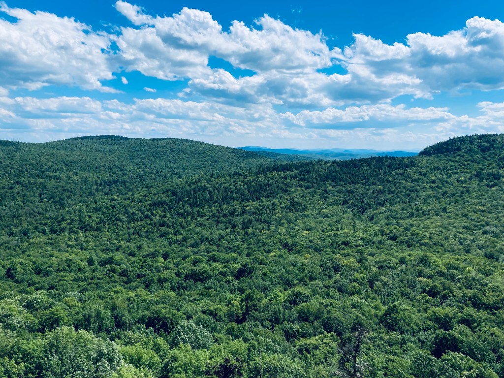
Winter morning view of Moose Pond from near Southwest Summit, Pleasant MountainContinue reading →
Descending from North Peak via the Twin Brook Trail, Burnt Meadow Mountain, Brownfield, Maine
Burnt Meadow Mountain (1,570 ft) in Brownfield, Maine, is a favorite hike of ours in all seasons, including when daughter was much younger. Brownfield, close to Fryeburg and the New Hampshire border, is still less than an hour from Portland, and during mid-late summer, the wild blueberries all the way to the summit make for a pleasant distraction and motivator for younger children, as this can be a challenging hike for little ones. In fall, the surrounding hills are alive with color, and in winter, the moderate climb through vanished deciduous foliage yields great views of the White Mountains, as well as the winding track of the Saco River.
Daughter watching three hawks (a pair and a loner) hunt in the valley below the Burnt Meadow Mountain Trail in summer.
Our preferred route is counterclockwise via the Burnt Meadow Mountain Trail (blue blazes) and Twin Brook Trail (yellow blazes), an approximately 3.7 mile lollipop loop, which took us about 2.5 hours at a relaxed pace in summer, and 2 hrs 10 mins in winter. The spur trail up to Stone Mountain (blue blazes) from the Twin Brook Trail adds about another 1.4 miles round-trip, which was about an hour added to the loop hike in the winter time. A map is available on an information sign at the parking area. These trails are usually well-marked and maintained by the Appalachian Mountain Club (AMC) and the Friends of Burnt Meadow Mountain. In October 2023, the sign in the parking lot had been knocked over, and the switchbacks on the way up had been modified with blue marking tape guiding a new path, and were a bit confusing. Additionally, the yellow blazes of the Twin Brook Trail can be hard to pick up in the fall amidst the reds, oranges, and yellows of the surrounding forest.
Lady slippers, Burnt Meadow Mountain, Brownfield, METoad on Burnt Meadow Mountain, Brownfield, ME
As usual, the best description of this hike is in the AMC Maine Mountain Guide. In the new 12th edition of this guide, Burnt Meadow again has its own map. In winter, the parking lot on Route 160 is small and icy, and hikers may have to find a parking spot at the town boat launch down the road. In the summer as well, it may help to have a backup plan for this popular hike. (try nearby Peary Mountain) For updated winter trail conditions, check the Burnt Meadow Mountain Trail page on All Trails. On winter days, the snow on the trail is usually hard-packed, and micro-spikes help with some of the resulting ice on rocks. The only deeper snow can lie on the lesser-used Stone Mountain trail.
Sunlit clearing on ascent of Burnt Meadow Mountain, Brownfield, ME
The Burnt Meadow Mountain Trail passes through shaded woods and over exposed rock faces up a relatively short, steep climb to the North Peak. On clear days, you will see hawks wheeling below, and the green, serrated sharks’ teeth rows of the surrounding hills and ridges. In winter, the climb has the effect of being a pleasantly continuous ridge hike without the leaves to obscure views. While the blueberries were still a bright, electric green in June, we have seen vultures, crows, many lady slippers in peak color, and also ran across a few toads. We used plenty of bug spray, but didn’t hit large clouds of black flies or mosquitoes, except in low-lying areas along the Twin Brook Trail (obviously, no bugs in the fall or wintertime). In fall, I’ve startled grouse along this path.
Winter ascent up to the North Peak, Burnt Meadow Mountain
The broad, open summit of Burnt Meadow is a great place for a picnic, and a rest after the last scramble upwards. We didn’t linger too long in summer, though, just enjoyed some jerky and proceeded across to the Twin Brook Trail. A large cairn marked the point to start our descent. The Twin Brook Trail sets a rolling course downward, with its own view of the White Mountains, then a wooded junction with the Stone Mountain Trail.
View from Burnt Meadow summit, Brownfield, ME
The Stone Mountain Trail is better in winter, as the surrounding area from the summit is easier to see without the leaves. This trail is substantially less traveled than the North Peak or Twin Brook Trails, and may require some travel through deeper snow, with snowshoes being possibly necessary. Following the Stone Mountain intersection, the Twin Brook Trail moves underneath the rock slides on the side of Burnt Meadow, and along the pleasant, cascading brooks for which the trail is named, back to its junction with the Burnt Meadow Mountain Trail, and from there back to the parking lot.
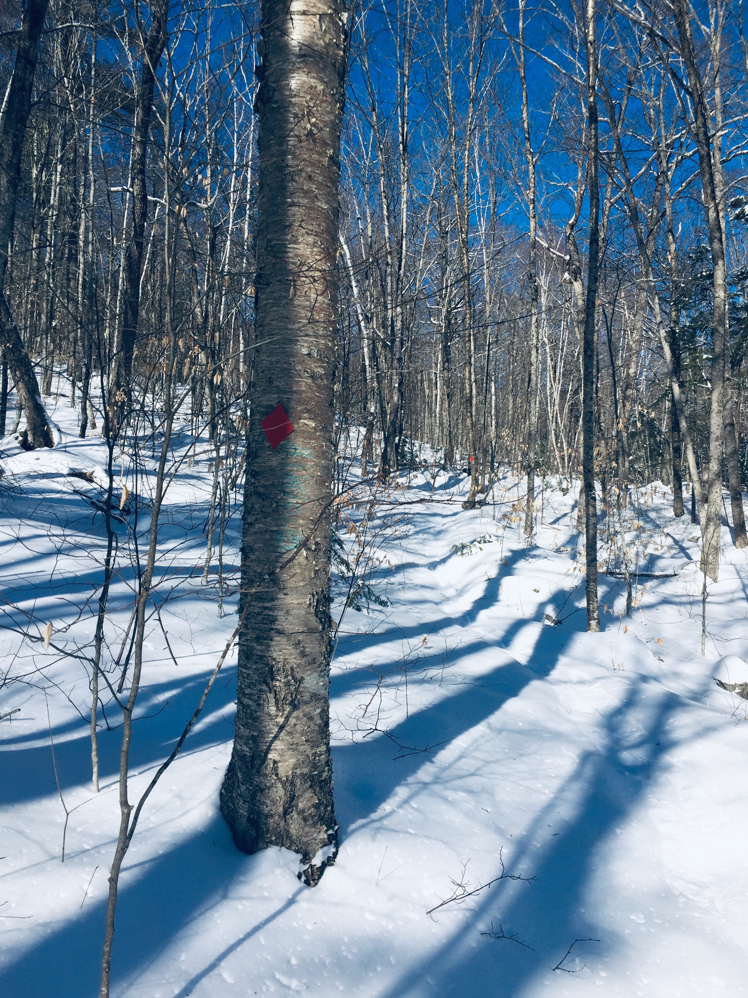
Follow blue blazes through a birch forest to the Stone Mountain summit.
Along the way in June, I saw two red-shouldered hawks patrolling the area recently harvested for lumber, looking for small mammals. These open cuts allowed for the growth of fragrant sweet fern, and blossoms promised blackberries later in the season. Shortly before returning to the trail junction, I spooked a herd of small deer, who disappeared into the thick forest. In October, a lone hermit thrush perched near the trail and listened skeptically to thrush calls played to it from my phone.
Fall foliage on Twin Brook Trail, Burnt Meadow Mountain, Brownfield, ME
One of the reasons we love this hike in the summertime is its proximity to the Brownfield Town Beach, which is a great place to cool off (Note: While dogs are plentiful on Burnt Meadow Mountain trails, they are not allowed at the beach after June 1st). Another interesting development is the effort to re-open the Burnt Meadow ski area, defunct since the early 1980’s, with initial plans to open the lodge as a winter warming hut in 2023/2024. The Whistle Stop General Store in Baldwin is a good place to grab food – open all winter for snowmobilers and other travelers. Alternately, according to a recent Press Herald article, Gneiss Brewing in Limerick has food truck options on summer days.
Brownfield Town Beach
(Disclaimer: This post contains affiliate links, and as an Amazon Associate Hiking in Maine blog earns from qualifying purchases.)
Bench by beaver dam and pond, Suckfish Brook Conservation Area, Falmouth, ME
Suckfish Brook Conservation Area is a two-part preserve in Falmouth and Westbrook to the east of Highland Lake, a total of about 132 acres in size. On a mid-December day, I explored the 94-acre preserve in Falmouth by the Falmouth Land Trust, with a trail system maintained by the Town of Falmouth that begins in the Conservation Area and connects to trails made possible by neighboring landowners. The Conservation Area is named for the white sucker fish, which spawns in the eponymous brook. The small parking area is at the end of Upland Road, off Mast Road close to the Falmouth/Westbrook line. Navigation through Suckfish Brook Conservation Area can be difficult, as the maps are good, but some of the trails, particularly those through the Christmas tree farm owned by Skillins, are unsigned. I typically use the AllTrails application to navigate and track hikes, but in this case, the best way I found to navigate was using the QR code on the trail sign to access the Google Maps version of the trail map, showing my position relative to my anticipated route. In addition, the AllTrails trailhead directions tried to send me towards the wrong side of Falmouth.
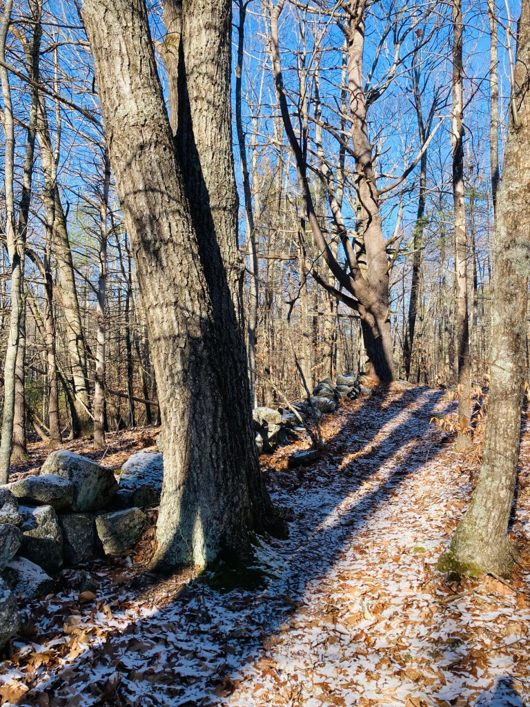
Stone wall, Suckfish Brook Conservation Area, Falmouth, ME
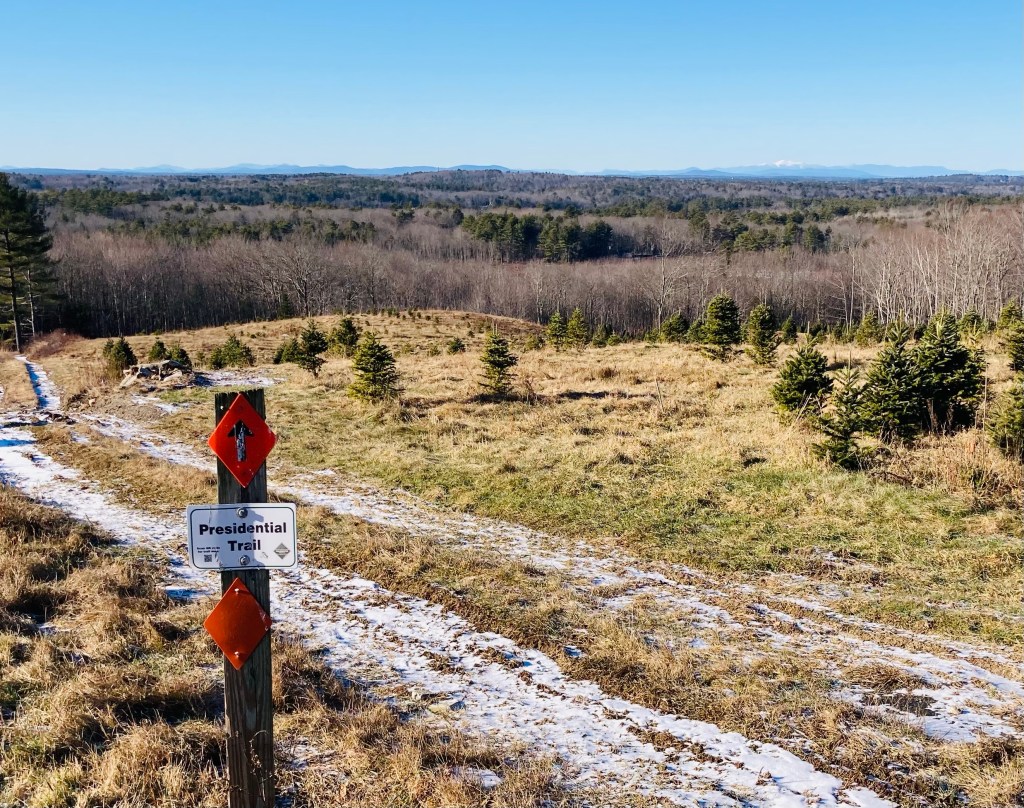
I made a loop by taking the Huston Trail clockwise to the Stone Ridge Trail, the Presidential Trail, the Red Tail Trail, and back north on the Presidential Trail to the Huston Trail, with a quick stop at the Beaver Trail. This route along the edges of the Conservation Area was about 2.6 miles, and easily completed in an hour. A sign and map kiosk mark the beginning of the trails, which are open sunrise to sunset. Shortly after the parking lot, a series of plank bridges led to the right, with a view over a small pond, a bench, and a beaver dam at the pond’s outlet. Returning to the main trail, white-blazed Huston Trail splits to the north and south, and I went left/north. Leaves rattled on the trees and crunched underfoot, frozen under a thin carpet of snow. There are periodic placards along the trail with notices and QR codes regarding the history of the area. The Huston Trail is named for William Huston and his family, the historical landowners. Huston was a forester working for the King of England’s mast agent for Maine, and white pines were harvested for Royal Navy masts here, hence the name of Mast Road, as well.
View of White Mountains from Presidential Trail, Suckfish Brook Conservation Area, Falmouth, MEContinue reading →
Long Mountain (1,828 ft), located in Greenwood Maine, partially within the 12,000-acre Crooked River Headwaters conservation land, is accessed by a relatively recently completed lollipop-type loop trail, opened in the fall of 2021. We hiked this loop, listed as 5.5 miles, in early July. Given the many spur trails to overlooks, my recorded mileage was a bit longer, about 5.8 miles, for a little over two and a half hours. The Long Mountain Trail is accessed from a trailhead with a relatively large parking area off Vernon Street in Bethel (GPS is 1268 Vernon Street, Bethel, ME) and diverges to the left from Bacon Hill single-track biking trails. The size of the parking lot owes to its former role as a log yard.
Board walkway, Long Mountain Trail, Greenwood, ME
A trail map is posted to the kiosk at the parking area, but difficult to find online. The trail itself is very well-marked and maintained, and I used the AllTrails app to navigate. As much of the summer of 2022 has been, it was a hot day, and the forested trail offered shade through much of the hike. The first part of the trail moves over a series of boardwalks through some marshy areas, then crosses a logging road by Mill Brook. Here at the edge of the road, we saw a large, tattered Luna moth near the end of its lifecycle.
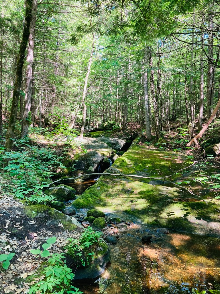
Mill Brook, Long Mountain Trail, Greenwood, ME
The trail then moves upstream past clear, cool Mill Brook, which is covered in moss and flows through large rock slabs. At about .9 miles, the trail splits into a lollipop loop, which we took clockwise, heading up first to the North Ledge. This is a challenging hike, heading steadily uphill until levelling out a bit, and becoming a ridge hike between the North and South Ledges. Long Mountain does not have a cleared summit with views, but the viewpoints from the ledges are outstanding.
Map kiosk, Puzzle Mountain parking area, Newry, Maine
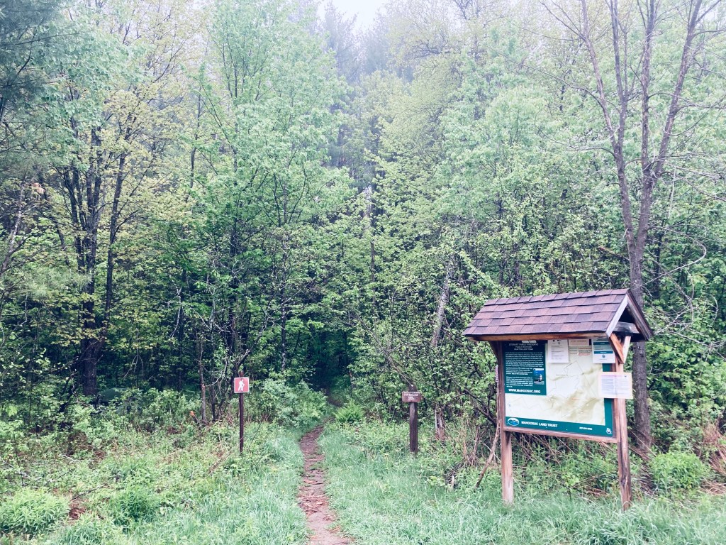
Puzzle Mountain (3,133 ft) in Newry, Maine, is a lollipop-style loop hike incorporating the Grafton Loop Trail and the Woodsum Trail, for an approximately 7.7 mile hike with expansive western Maine views, including Sunday River. The mountain is supposedly named after the discovery of a soft vein of rock on the mountain that was subsequently lost, making it a puzzle. Parking is available at a medium-sized parking area off Route 26, with a map kiosk. A map is available from the Mahoosuc Land Trust, which manages the 485 acres of Stewart Family Preserve land on which Puzzle Mountain sits. A detailed description is also available in the venerable Maine Mountain Guide.
Morning sun, Grafton Loop Trail, Puzzle Mountain
The blue-blazed trail crosses an ATV trail and then after about a quarter mile, a logging road, until beginning to climb by a small stream cascading down. Due to recent late May rains, the trail was slippery and the streams in the surrounding woods seemed to multiply. I knew this presaged a slippery trail with lots of bugs, and the clouds of mosquitoes were unrelenting. Clear spring streams criss-crossed the trail, which was a spooky green tunnel in the morning fog of beech leaves, birch, and hobblebush, with toads hopping out of the way.
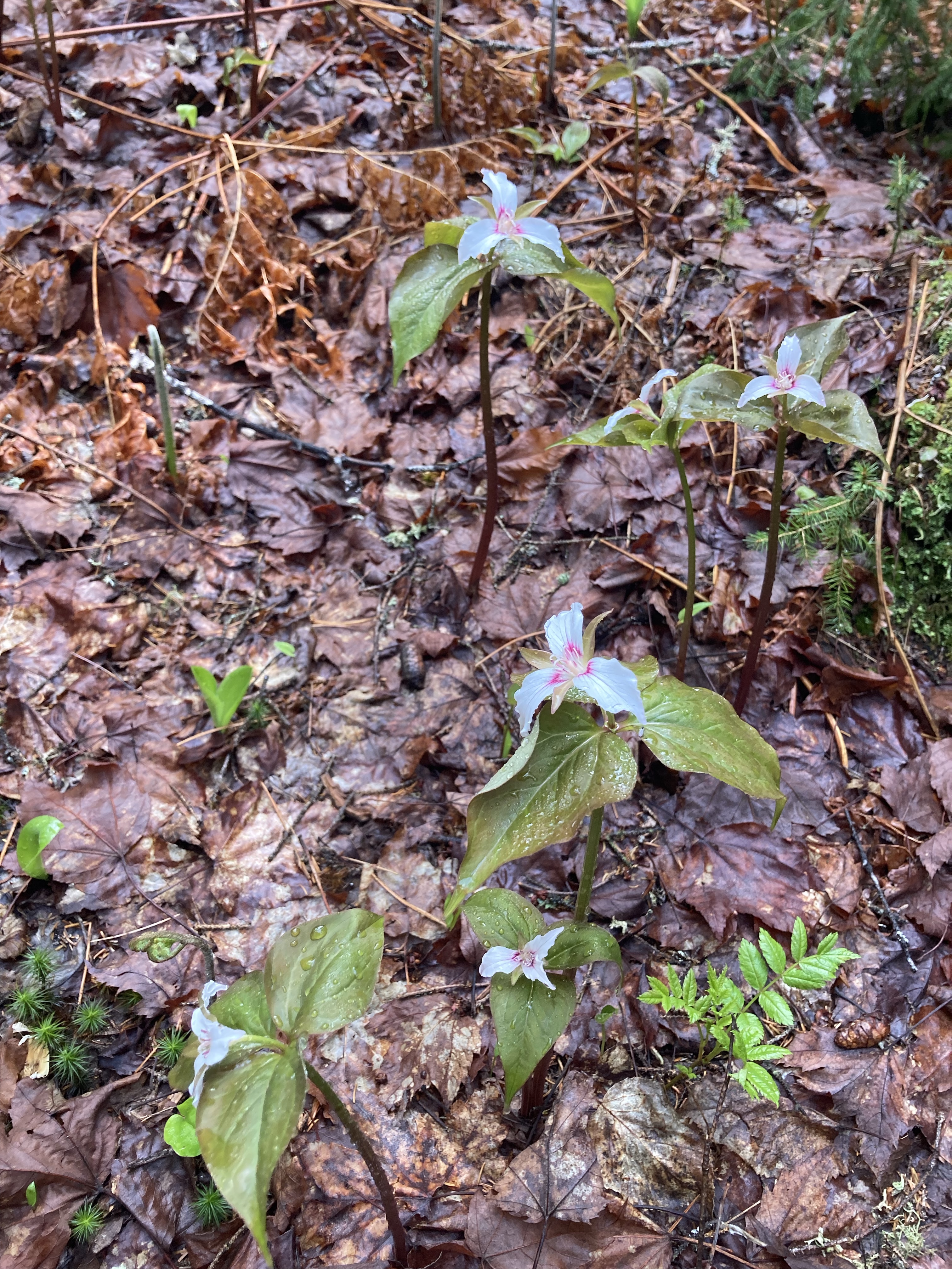
Spring Wildflowers, Puzzle Mountain, Newry, Maine
A Maine Appalachian Trail Club (MATC) register box was there to log the hike a little over 3/4 of a mile in. The sun began to light the way and changed the tunnel to an emerald forest, with trillium and other wildflowers dotting the sides of the trail, awaiting full bloom. This green deciduous forest ended abruptly as the trail circled a ridge with viewpoints over the valley surrounding the Bear River, switching to rocks, moss, and pine.
For the best foliage hikes, I often return to the White Mountain National Forest (WMNF), which has the perfect mix of pine and deciduous forest, displayed in sunny tiers, to boost the powerful colors of fall in New England. Albany Mountain (1,930 ft) in south Oxford county, near Bethel, on the eastern edge of WMNF, is a relatively easy climb for the quality of its views, which include a variety of fall colors spread across the forests, lakes, and hills leading to the White Mountains to the west. The hike is fully described in the Maine Mountain Guide, and downloadable maps are available from the site of the U.S. Forest Service, which manages the WMNF. A small parking area with a trail map and information kiosk is located off Crocker Pond Road in WMNF. From here, the yellow-blazed trail led through a yellow, green and orange October forest. Strategically placed rocks bridged small streams, and cut swaths on the margins let light into the surrounding forest.
Peary Mountain (958 ft) in Brownfield, Maine, is named for Arctic explorer Admiral Robert E. Peary, Sr., a resident of neighboring Fryeburg from 1878 to 1879. The trailhead for this easy to moderate hike is located in Brownfield, Maine, off Route 113. The Maine Mountain Guide has a full description of this hike – I used the AllTrails app to follow the path. Follow Farnsworth Road about 1.3 miles from Route 113 to a small dirt/grass parking area on the right side of the road, just before a one-lane bridge over the Little Saco River. In the summer, this can also be reached from the west (Fryeburg) side, but the road can be closed in winter months.
View of White Mountains from ledges, Peary Mountain, Brownfield, MEContinue reading →
Bicknell Ridge and beyond, from Baldface Circle Trail, Chatham, NH
The Baldfaces (North and South) are a difficult but rewarding hike just over the (Maine) border in Chatham, NH, part of the White Mountain National Forest (WMNF). I used the Baldface Circle Trail, with stops at the spur for Emerald Pool, and a short diversion through Chandler Gorge, for a challenging 10.1 mile clockwise “lollipop” loop that took a little under five hours, and hit the peaks of South Baldface (3,570 ft) and North Baldface (3,610 ft). To navigate, I used my well-worn AMC White Mountain Guide, with the Baldface Loop on Map 5. A digital map is also available on the WMNF U.S. Forest Service site. The well-maintained parking area (with toilets) is located on NH route 113 in Chatham, with parking for approximately fifteen cars, and is usually full on summer days and weekends.
Emerald Pool, Baldface Circle Trail, WMNF, Chatham, NHContinue reading →
The Heald and Bradley Ponds Reserve consists of over 800 acres in Lovell, Maine, preserved and maintained for public use by the Greater Lovell Land Trust (GLLT) – see GLLT map here. A detailed description of trails is also available in the AMC Maine Mountain Guide. While snowmobiles are allowed in winter on marked trails, I didn’t see any on the sunny February Sunday I visited. I followed an easy to moderate (double, triple?) lollipop loop for about 4.6 miles (appx 2 hours, 886 feet of elevation gain), summiting Amos Mountain (955 ft) and Whiting Hill (801 ft) via the Blue, Orange, Yellow and Red trails.
Icy mill dam outlet of Heald Pond, Lovell, ME
From the (well-plowed) parking lot on Slab City Road, it is a short downhill walk to the Blue Trail, past the southern outlet of Heald Pond. Informational kiosks are at the parking area and at the beginning of the Blue Trail, additionally, small placards at trail intersections, each with a laminated trail map, make navigation self-correcting (“You Are Here” is difficult to screw up).
I wore snowshoes the entire route, and once off the snowmobile trail, was breaking trail through the deep, crusty snow. While the snowshoes made for enhanced mobility, the rasp and stomp of my steps eliminated my chances of seeing much wildlife. I was lucky enough to see a large pileated woodpecker, and the signs in the snow of others – the soft tread of foxes, the larger, circling tread of coyotes, the bouncing tread of deer, and the deeper, larger crescents left by moose.
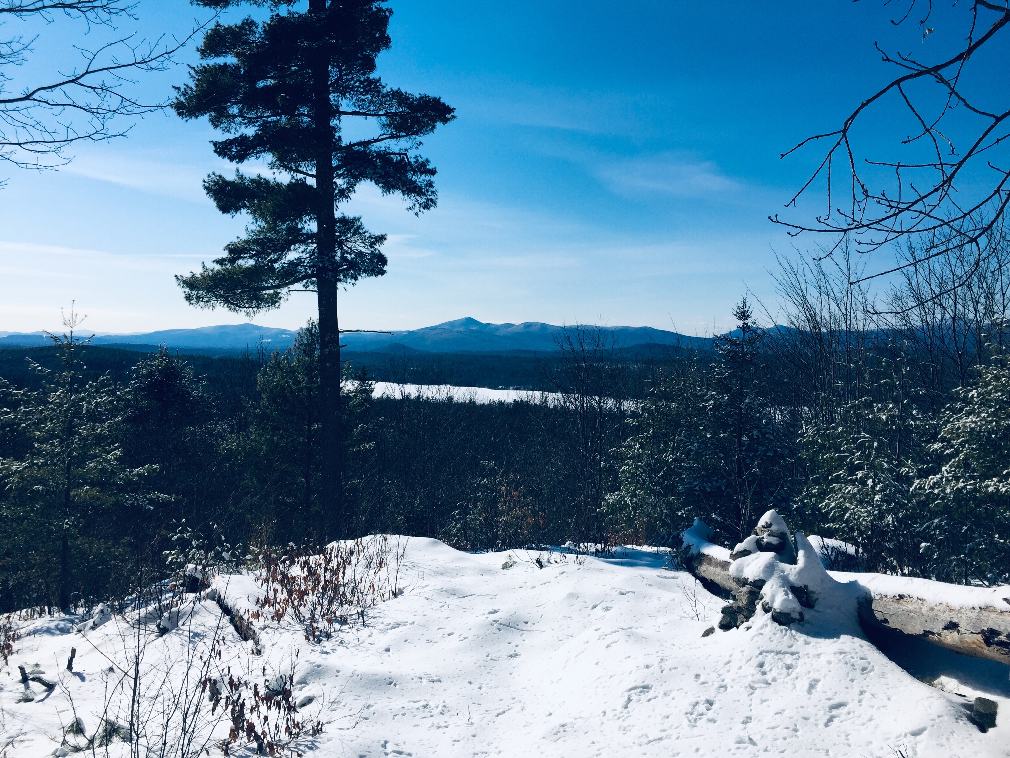
Mt Washington wreathed in clouds from Amos Mountain viewpoint, Lovell, ME
I bypassed Whiting Hill on the way out, sticking to the west shore of Heald Pond on the Red Dot Trail, and clambering down the Otter Rocks Spur briefly to look at the frozen lake, and the sole visible ice fishing shack. As I was solo, wearing snowshoes, and shoreline ice is often the most treacherous, I didn’t venture out on the frozen pond. Continuing gradually uphill, I reached the intersection with the Chestnut Trail (blue blazes), and turned left, towards the Heritage Loop Trail (orange blazes), and a broad circle of the summit of Amos Mountain.
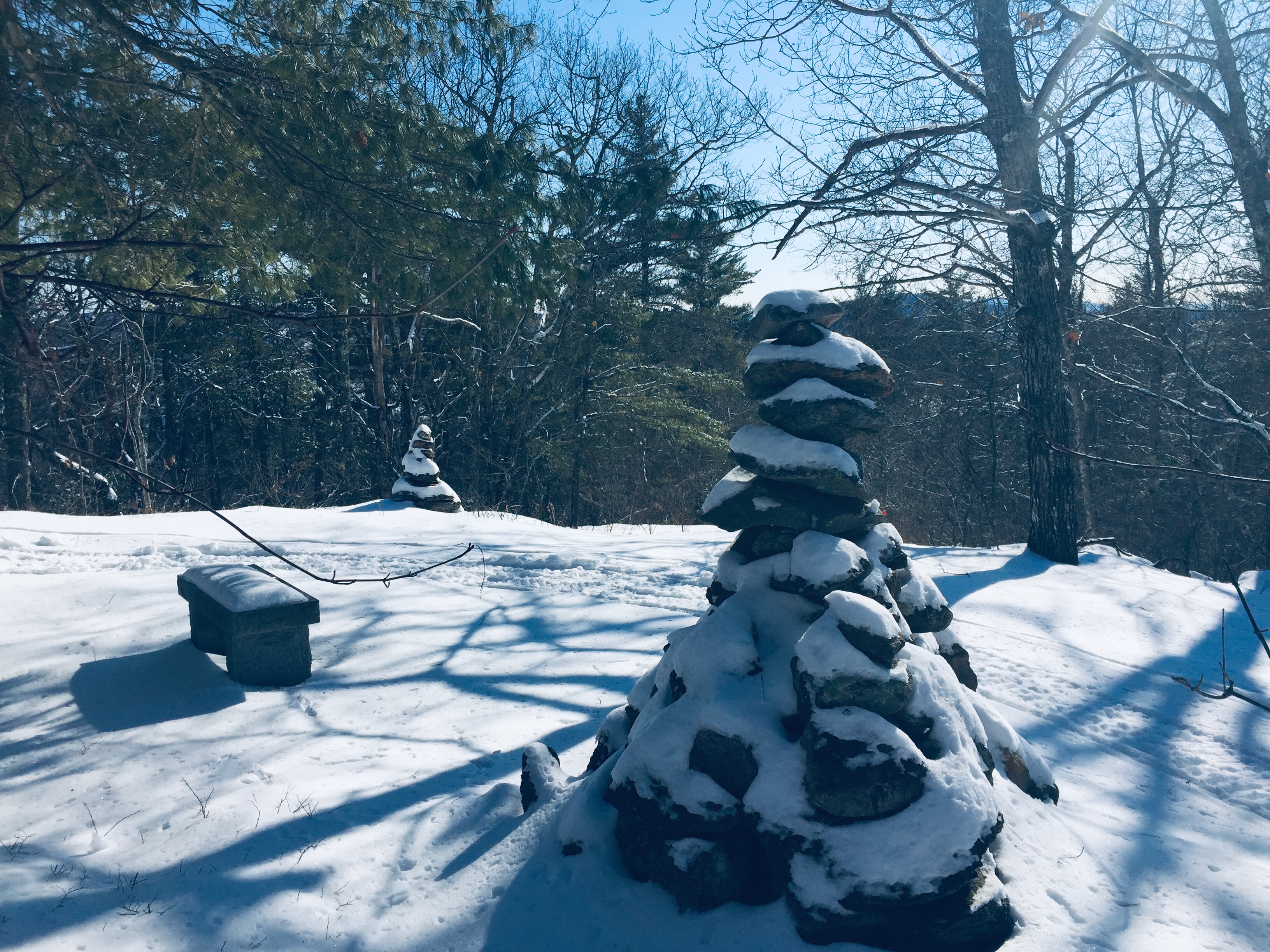
Summit cairns and bench, Amos Mountain, Lovell, ME
To the west of the summit is a viewpoint, just short of the Rogers Family Trail (blue blazes), with views of the Whites, with Mt. Washington as a centerpiece. The wooded summit of Amos Mountain contains rock cairns and a bench, with views to the southwest.
Kezar Lake and the Whites from Whiting Hill summit, Lovell, ME
I descended Amos Mountain to the Hemlock Loop Trail, and a small picnic area, then headed towards Whiting Hill and its loop back to the start of the trail and the parking area. Whiting Hall has a more open summit, with views to the West of Kezar Lake and the White Mountains beyond, and an easy downhill walk ended at Slab City Road.
This would also be a beautiful fall hike, but I enjoyed having the place mostly to myself in the snow. Parking areas on Route 5 and Heald Pond Road can also be used to shorten the hike for children or the less mobile – see the GLLT map for locations. This Reserve is not far from Sabattus Mountain, and the post-hike stops available in Lovell are the same – the Center Lovell Market, for picnic supplies and a restaurant, and (after checking seasonal hours) Ebenezer’s Pub for food and Belgian beer.
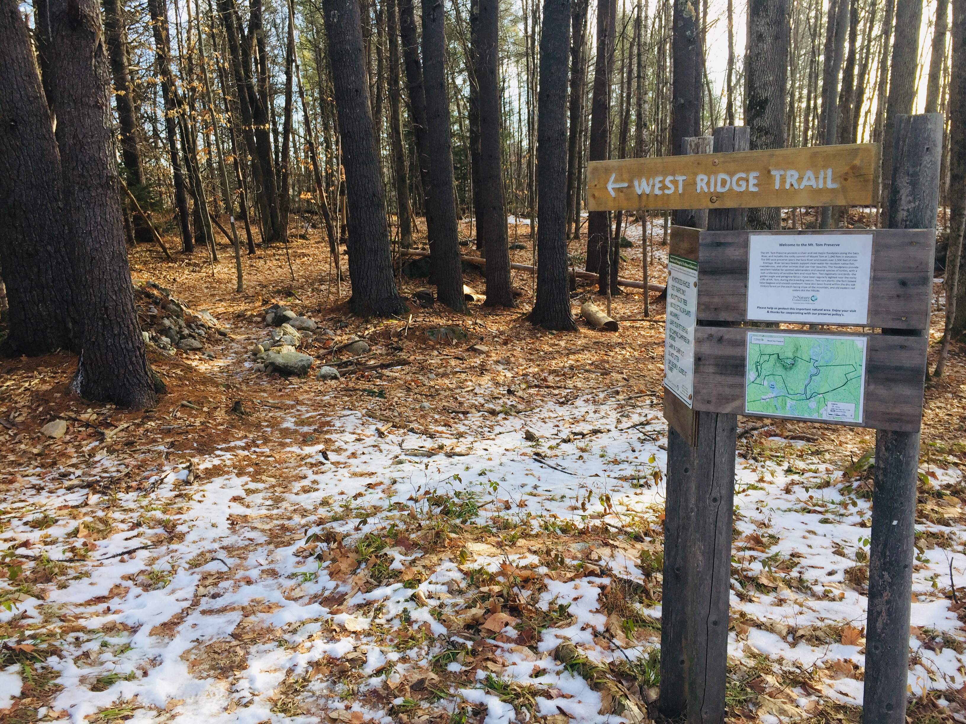
In January 2020, I hiked Mount Tom (1,073 ft) via the West Ridge Trail, an approximately 3.5 mile out-and-back from the parking lot for Mount Tom Preserve at Menotomy Road in Fryeburg, which took about an hour and fifteen minutes. Like Hawk Mountain and Mount Tire’m, which I did earlier the same day, this is a short but rewarding Oxford Hills hike. This can also be done as an approximately 4-mile loop hike by continuing after the summit to the Mount Tom Trail, then returning south on Menotomy Road, which is usually relatively quiet, to the start point.
Kiosk and start of West Ridge Trail from Nature Conservancy parking lot, Mount Tom Preserve, Fryeburg, Maine.
This parking lot, and the Preserve, which includes the summit, are maintained by The Nature Conservancy (TNC). TNC’s excellent description of the Preserve follows:
Mt. Tom Preserve protects a silver and red maple floodplain along the Saco River, and includes the rocky summit of Mount Tom at 1,040 feet in elevation. The 995-acre preserve spans the Saco River and boasts over 3,500 feet of river frontage. Several day-use hiking trails provide recreational opportunities, as does as a 1.14 mile seasonal snowmobile trail that is part of a larger network maintained by the Interstate Sno-goers. Visitors can summit Mt. Tom, canoe along the Saco River, or just walk through the beautiful forests!
River terrace forests support clean water for resident native fish, invertebrates, and other animals that use river beaches. The floodplains provide excellent habitat for spotted salamanders and several species of turtles, with a lush understory of sensitive fern and royal fern. Two regionally rare birds–the golden eagle and peregrine falcon–have been regularly sighted near the rocky cliffs of Mt. Tom, during the breeding season. Two rare plants–the fern-leaved false foxglove and smooth sandwort–have also been found within the dry oak-hickory forest on the south facing slope of the mountain, and old eastern red cedars dot the hillside.
View south from West Ridge Trail, Mount Tom, Fryeburg, Maine.
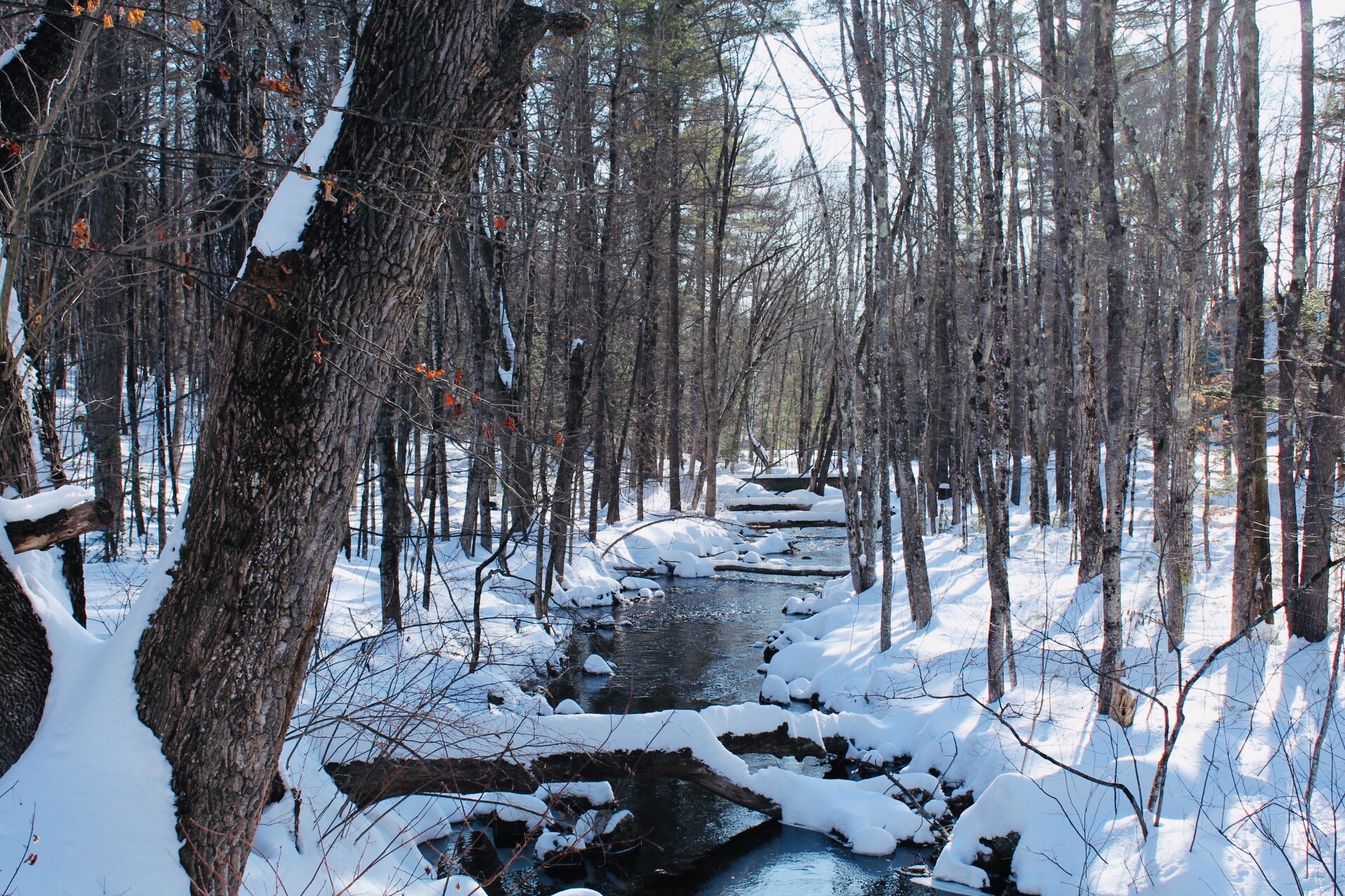
The West Ridge Trail, marked by white blazes and small TNC emblems, rolls across that floodplain, crossing small brooks, passing ghostly birches and large rock formations, until becoming steep about a mile in.
West Ridge Trail, Mount Tom Preserve, Fryeburg, Maine.
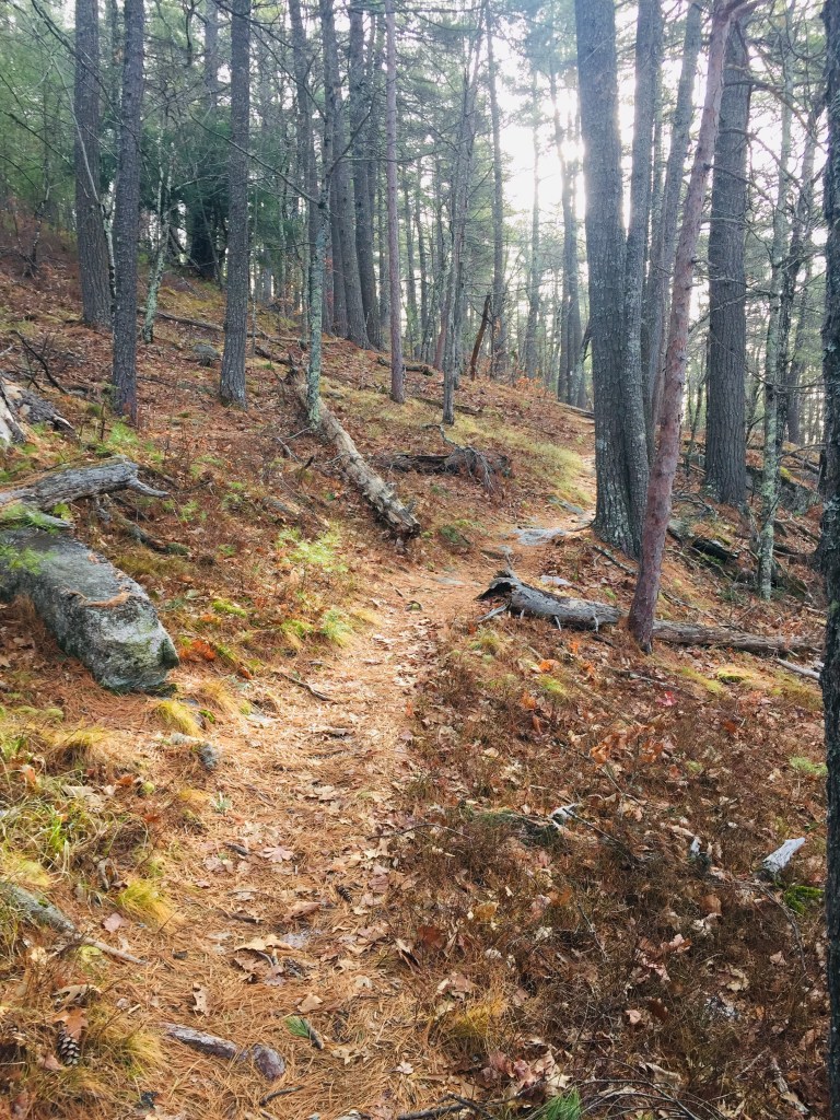
The trail ascends the ridge, with frequent views through clearings in the trees, to meet the Mount Tom Trail, at which point, it turns right, and shortly thereafter, reaches the summit and its rocky ledges and views.
Mount Tom summit, Fryeburg, Maine.
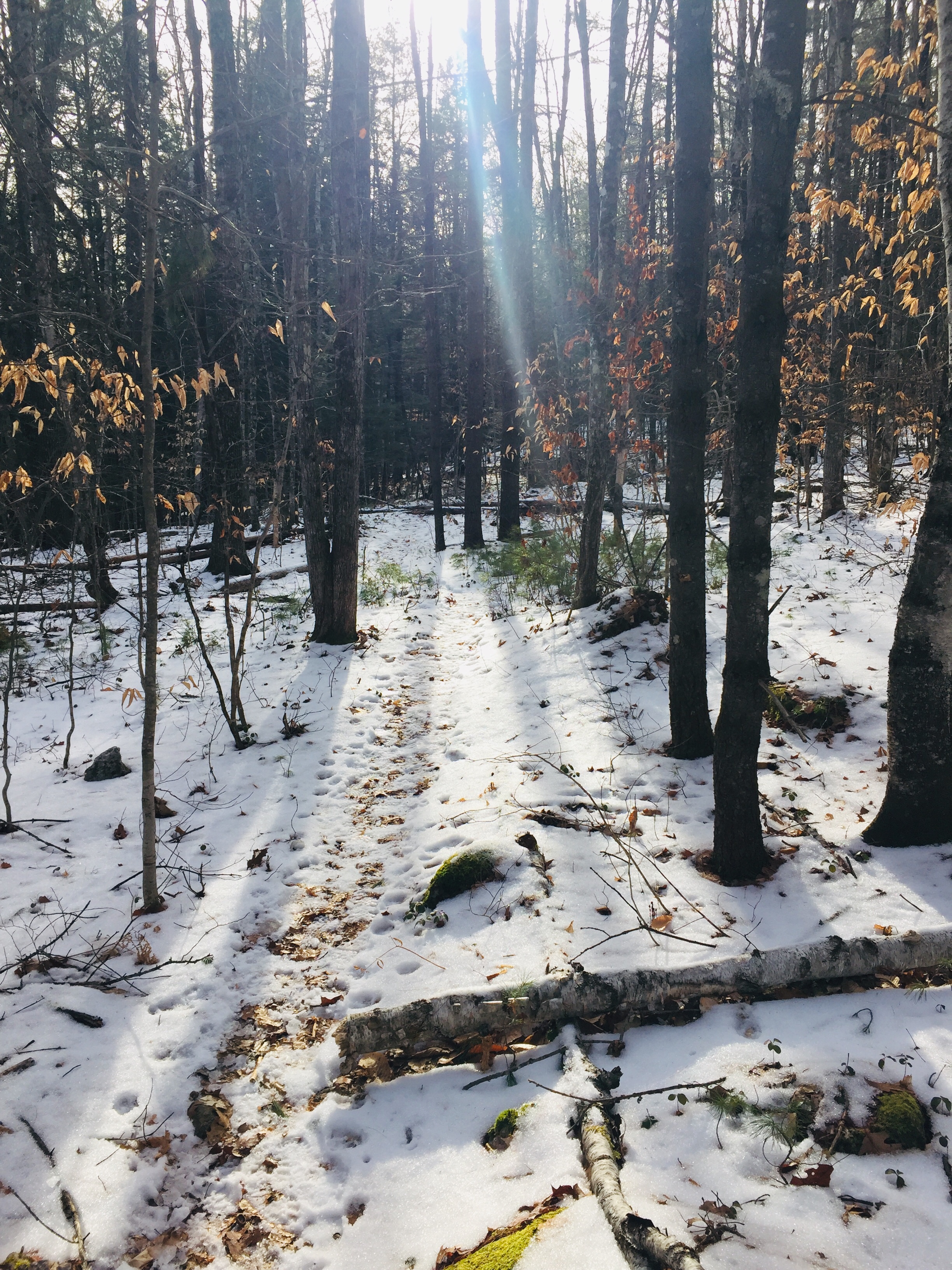
The descent in winter was easy, with microspikes, and I saw several other groups, all with dogs, ascending the trail on my way back. An added benefit in winter was the lack of bugs, which would be omnipresent in the late spring and early summer in the first portion of the trail. This hike may be challenging for very young or out-of-condition hikers, but presents an easy to moderate walk in the woods, with views to the south of the Saco River Valley.
West Ridge Trail in winter, Mount Tom Preserve, Fryeburg, Maine.