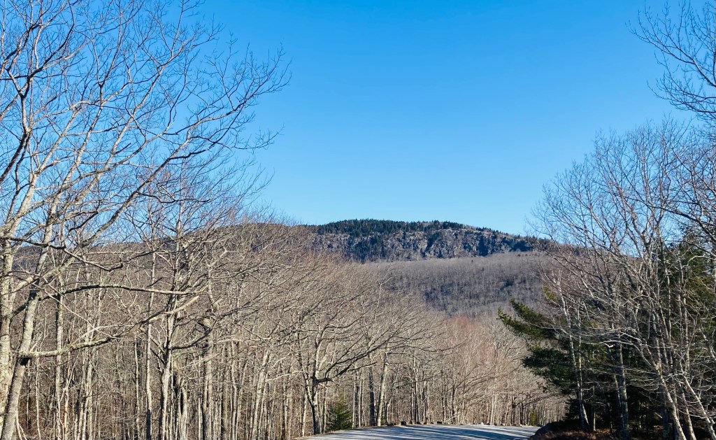
Bicknell Ridge and beyond, from Baldface Circle Trail, Chatham, NH
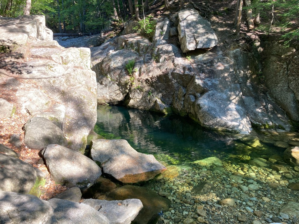
The Baldfaces (North and South) are a difficult but rewarding hike just over the (Maine) border in Chatham, NH, part of the White Mountain National Forest (WMNF). I used the Baldface Circle Trail, with stops at the spur for Emerald Pool, and a short diversion through Chandler Gorge, for a challenging 10.1 mile clockwise “lollipop” loop that took a little under five hours, and hit the peaks of South Baldface (3,570 ft) and North Baldface (3,610 ft). To navigate, I used my well-worn AMC White Mountain Guide, with the Baldface Loop on Map 5. A digital map is also available on the WMNF U.S. Forest Service site. The well-maintained parking area (with toilets) is located on NH route 113 in Chatham, with parking for approximately fifteen cars, and is usually full on summer days and weekends.
Emerald Pool, Baldface Circle Trail, WMNF, Chatham, NHContinue reading →
Evergreen Loop Trail, Evergreen Cemetery, Portland, Maine
Evergreen Cemetery in Portland is Maine’s second largest, checking in at 239 acres. The combination of green space habitat and (relative) solitude make it a popular birdwatching and walking area, located directly behind the University of New England (UNE) Portland Campus. The small ponds at the northwest edge of Evergreen are places to observe tadpoles, frogs, newts, turtles, snakes, large snapping turtles, and waterfowl throughout the warmer seasons. In addition to the paved, gravel, and dirt roads of the cemetery itself, Evergreen is traversed by Portland Trails’ extensive network, including the 10-mile Forest City Trail, which runs from the Presumpscot River to the Stroudwater.
Ledges in Evergreen Woods, Evergreen Cemetery, Portland, MaineContinue reading →
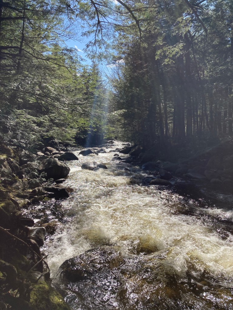
Afternoon sunlight on Wight Brook, Step Falls Preserve, Newry, Maine
Step Falls Preserve is a twenty-four acre parcel hugging the banks of Wight Brook in Newry, Maine. We visited at the beginning of May, during a road trip to see waterfalls during the spring melt. In the summer months, the shallow pools and falls are refreshing places to cool off with a dip, wade, or swim. Parking is available in a lot off Bear River Road/Route 26. The 3/4 mile trail to the top of the falls is fairly easy, with some roots and steep spots towards the end. Due to the popularity of this spot, it often fills up quickly on weekends and nice summer days.
The Cathance River Trails are a surprising green space, with a wild river ravine, in Topsham tucked next to the Highland Green development, within the sound of I-295. These are part of the Cathance River Nature Preserve, a 235 acre preserve composed of private land held in a conservation easement by the Brunswick-Topsham Land Trust. Closed due to COVID-19 restrictions for much of 2020, they are now partially re-opened, as of April 2021. Up-to-date information regarding the best places to park and map with trail closures can be found on the Cathance River Education Alliance webpage. The trails described in this post are mostly open. Dogs are not permitted in Cathance River Nature Preserve.
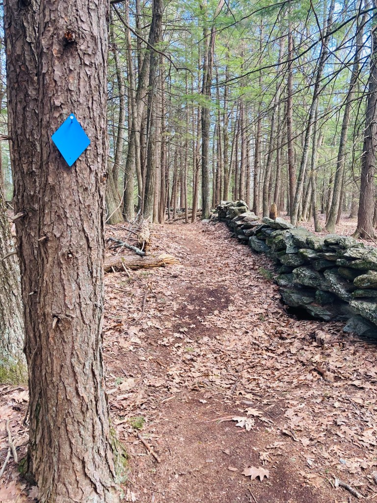
White Trail, Knight’s Pond Preserve, Cumberland, Maine
Knight’s Pond Preserve is a 334-acre preserve that straddles the town lines of Cumberland and North Yarmouth, with the 46-acre Knight’s Pond as the focal point. Parking is available in a small lot at 477 Greely Road Extension just short of Mill Brook, and on the street at the end of Greely Road Extension. The most current map is located on the Royal River Conservation Trust (RRCT) website, and includes more details and place names than the printed ones you will likely find in the kiosk at the parking lot. The property is managed by the Towns of Cumberland and North Yarmouth, the Chebeague & Cumberland Land Trust (CCLT), which has a printable scavenger hunt for kids, as well as the RRCT. The trails are well-marked and maintained, with trail map kiosks at most intersections.
Blue Trail leading to Bobcat Mountain, Knight’s Pond Preserve, Cumberland, MaineContinue reading →
Note from Town of Harpswell website: from May 1, 2021 to October 1, 2021, the first 1/2 mile of Cliff Trail will be closed to hikers due to a Maine Conservation Corps construction project to make it ADA accessible. The remainder of the trail is open. Park at the Town Office (263 Mountain Road) and walk up the path behind the building to access the trail entrance/exit on Community Drive. There will be temporary signs and maps installed to help hikers with the changes while the work is being completed.
The Cliff Trail in Harpswell is an approximately 2.3 mile loop, with expansive views of the Long Reach, a long finger of a bay extending from Casco Bay inland. The popular trail, with parking at the Harpswell Town Office on Mountain Road, is well-marked and maintained by the town of Harpswell (see printable map and description here at town website). I started the white-blazed trail clockwise at sunrise on a mid-January morning. It was dark and a little muddy, with plenty of roots to trip over, but no snow had accumulated, and no traction devices were necessary. Strawberry Creek, to the west of the trail, narrows to a quiet, scenic cascade, and the trail turns inland.
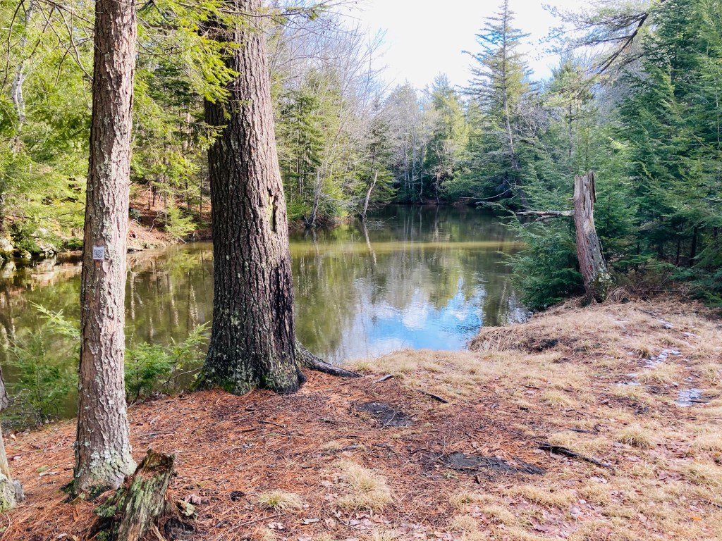
Hobb’s Brook Trail, Hadlock Community Forest, Falmouth, Maine
The Hadlock Community Forest in Falmouth, Maine, is accessible primarily from a small parking area near the end of Hadlock Road with a map and kiosk. Information regarding the almost 300 acre property, with a loop trail of about 2.9 miles, can be found on the Town of Falmouth’s website for the forest. Many activities are allowed in the Hadlock Community Forest, including hunting in-season, so wear blaze orange during those times. I visited on a mid-March day, needing microspikes for the entire trail. For me, this was part of a longer 6.7 mile loop through a connector to the Rines Forest.
Highland Trail, Hadlock Community Forest, Falmouth, MaineContinue reading →
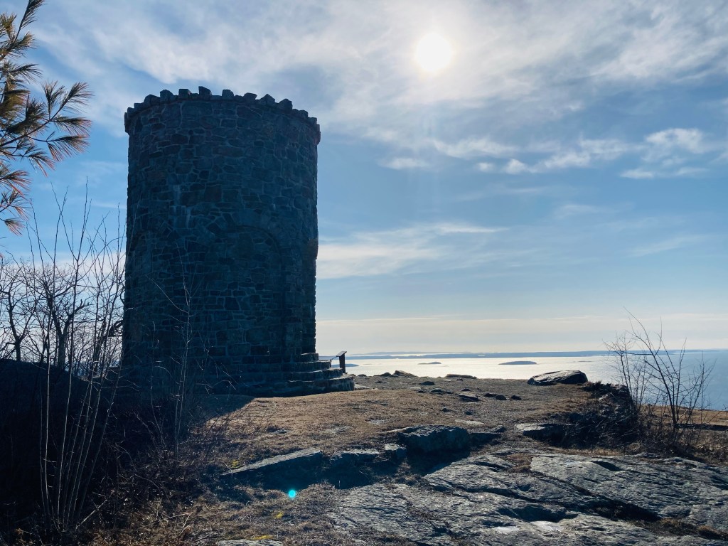
View of West Penobscot Bay from Mount Battie summit, Camden Hills State Park.
We first visited Camden Hills State Park in the spring of 2017, an unintentional winter hike of the Megunticook Loop. Better prepared, equipped, and with a full windy, cold March day to burn, I chose a longer, meandering route through the park. This ambitious path up Mount Battie (780 feet), over to the Maiden Cliff (800 feet), and up to the summit of Mount Megunticook (1385 feet) was close to 11 miles, and a little under five hours. You can find detailed descriptions of the trails in the AMC Maine Mountain Guide. As I arrived before the road to Mount Battie opened, I used the parking lot to the left of the main entrance, paid the $4 Maine resident fee, and walked the quarter mile or so from the gate to the parking lot for the trails (toilets are available in both places).
The blue-blazed trail Megunticook Trail headed up to the left, turning into the Nature Trail towards Mount Battie to begin the loop. I started to gain elevation at approximately a half-mile in, with views of the West Penobscot Bay through the bare winter trees. The Nature Trail parallels the road to Mount Battie before turning inland over ice-covered rocks. At a little over a mile, I turned left onto the Tablelands Trail, crossing the road towards Mount Battie. Near the summit, I saw a solo mourning dove and another small, puffy sparrow. The parking loop and area by the World War I memorial stone tower feature expansive views of the bay and Camden below.
Megunticook from the road to Mount Battie, Camden Hills State ParkContinue reading →
North Falmouth Community Forest at Blackstrap Road trailhead, Falmouth, ME
The North Falmouth Community Forest is over 400 acres of woodland reclaimed from pasture, with multi-purpose trails accessible from a small roadside parking area on Blackstrap Road (just south of the Happy Cats sign). Close to five miles of lightly-trafficked trails connect (across Blackstrap Road) with the Blackstrap Hill Preserve to the east and with Lowell Preserve in Windham to the west. This being Falmouth, the trails are well-marked, with map kiosks and QR codes (open your camera on your smartphone and scan the barcode to get maps/info). Downloadable or printable maps are harder to come by – try Maine by Foot’s post or the All Trails app. For true map nerds, you can explore using Falmouth’s ARCGIS map site.
Hurricane Valley Overlook, Poplar Ridge Trail, North Falmouth Community ForestContinue reading →
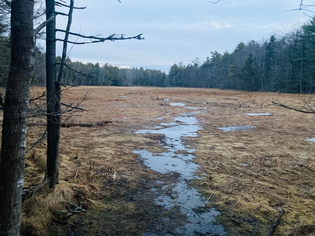
Mud flats of Back Cove from Red Trail, Hamilton Audobon Sanctuary, West Bath, Maine
The Hamilton Audobon Sanctuary, located near Foster Point in West Bath, Maine, contains about 93 acres of forest, marshes, and mud flats, with miles of looping trails surrounded by wide views of the New Meadows River and its Back Cove. Parking is located at 681 Fosters Point Road in West Bath, where there is a lot, map kiosk and composting toilet, open each day from dawn to dusk. Check out the map and guide at Audobon’s website (Note: dogs are not allowed at Hamilton Audobon). These trails are level, well-marked, and easy.
Light through the forest, Hamilton Audobon Sanctuary, West Bath, MaineContinue reading →